
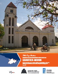
Urban Planning Sketch for the City of Quartier-Morin
- Quartier-Morin is strategically located within the Cap-Haïtien metropolitan influence area and along a major development axis.
- The city requires coordinated planning to become secure, dynamic and prosperous.
- A 20-year planning horizon with 5-year revision cycles is recommended.
- Priority interventions are needed to address urban development challenges.
- Comprehensive land use management tools are essential for sustainable development.
This urban planning document is part of a comprehensive support program for government and local authorities in planning and managing reconstruction or renovation works for 6 development poles. The sketch establishes development and planning orientations for the urban sector of Quartier-Morin commune within the Cap-Haïtien pole. The document aims to mobilize all stakeholders around common objectives, ensure coherence of measures to be implemented, and prioritize interventions to make Quartier-Morin a secure, dynamic and prosperous city. The planning framework includes diagnostic analysis, vision and orientations, implementation tools, and priority interventions. The document provides territorial diagnosis covering location, functions, occupations, character and identity of Quartier-Morin. It presents tools for managing land use including urbanization perimeter, land use sectors, constraint zones and protection zones. The planning horizon is 20 years with regular revisions recommended every five years to adapt to changing conditions and opportunities.
How to cite
United Nations Development Programme (UNDP); Ministry of Planning and External Cooperation (MPCE), 2013, Urban Planning Sketch for the City of Quartier-Morin, accessed via HaitiDocs, https://www.haitidocs.org/doc/undp-2013-urban-planning-sketch-city