
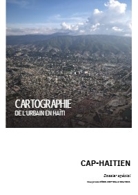
Cartography of Urban Areas in Haiti - Cap-Haitien Special Report
- Built-up land more than doubled, up 104.4 percent from 22.7 to 46.4 square kilometers between 2007 and 2019.
- The expansion rate rose from 1.79 to 2.23 square kilometers a year between the 2007 to 2014 and 2014 to 2019 periods.
- Quartier-Morin and Milot sped up by 114.3 and 95.2 percent, Cap-Haitien by 8.7 percent, and Plaine-du-Nord slowed by 31.8 percent.
- Cap-Haitien commune had 274,404 inhabitants in 2015, 98 percent urban, at 13,454 per square kilometer in the city.
- Urban population grew about 6 percent a year in Quartier-Morin, Plaine-du-Nord and Milot between 2009 and 2015.
- The pace is described as unmatched nationally except in the Port-au-Prince metropolitan area.
Produced with APRISMA, the interministerial land-use planning committee CIAT, Expertise France and the European Union, the file maps urban growth in the Cap-Haitien metropolitan area over two periods, 2007 to 2014 and 2014 to 2019. The study area includes parts of Cap-Haitien, Quartier-Morin, Plaine-du-Nord and Milot. Built-up land rose from 22.7 to 46.4 square kilometers, and the expansion rate went from 1.79 to 2.23 square kilometers a year between the two periods, up 24.6 percent. Quartier-Morin and Milot sped up by 114.3 and 95.2 percent, Cap-Haitien by 8.7 percent, while Plaine-du-Nord slowed by 31.8 percent. The text also gives 2015 population and density figures by commune and describes flood and landslide exposure along the Haut-du-Cap river, the Rodo basin and the Petite-Anse coast.
How to cite
APRISMA; Interministerial Committee for Territorial Planning (CIAT); Expertise France; European Union, 2019, Cartography of Urban Areas in Haiti - Cap-Haitien Special Report, accessed via HaitiDocs, https://www.haitidocs.org/doc/ciat-2019-cartography-urban-areas-haiti-cap