
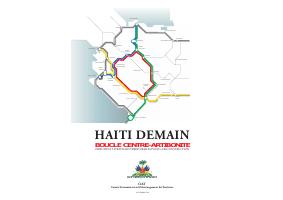
Centre-Artibonite Loop: Regional Territorial Plan (Haiti Tomorrow series)
- The plan is built around a road network standard: every settlement in the loop within half an hour of a service center.
- Fifteen communes receive individual project sheets, making this an operational document rather than a vision statement.
- It is the only regional-scale plan in this library covering the Centre and Artibonite departments.
- Land ownership and settlement patterns are treated as a planning constraint in their own right, not as a footnote to infrastructure.
This CIAT plan applies the Haiti Tomorrow territorial framework to the Centre-Artibonite Loop, the inland region running from Gonaïves and Saint-Marc through Mirebalais, Hinche and Pignon up to Cap-Haïtien and the Dominican border crossings at Belladère and Ouanaminthe. The plan is organized in four parts. THE ROAD treats the loop itself as the structuring investment: a network of towns in which no settlement is more than half an hour from a service center, with a typology of roads to build and a section on how the network would be managed and paid for.
THE TERRITORY covers environmental vulnerability, the organization of settlement, agricultural production structure, irrigation and drinking water, energy access, and the modernization of the farm economy alongside processing industry. THE PEOPLE covers settlement patterns and land ownership, hygiene and waste management, health networks, education and vocational training, and the exchange and social hubs that give a town its function. THE PROJECTS is the operational half: individual project sheets for Mirebalais, Thomonde, Hinche, Pignon, Maïssade, Saint-Raphaël, Saint-Michel de l'Attalaye, Marchand-Dessalines, Petite Rivière de l'Artibonite, Verrettes, La Chapelle, Boucan Carré, Lascahobas and Saut d'Eau, followed by an investment program and a governance section. It is one of the few Haitian planning documents that works at the regional scale rather than the commune or the country.
How to cite
Government of Haiti; Interministerial Committee for Territorial Planning (CIAT), 2010, Centre-Artibonite Loop: Regional Territorial Plan (Haiti Tomorrow series), http://ciat.gouv.ht/sites/default/files/docs/Boucle%20centre%20Artibonite.pdf