Full Document Text
Extracted text from the original document for search indexing.
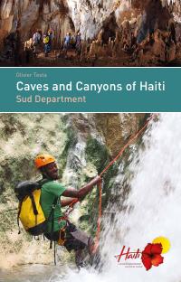
Olivier Testa
Caves and Canyons of Haiti
Sud Department
�Olivier Testa
Caves and Canyons of Haiti
Sud Department
Ministry of Tourism
English translation
by Carole Devillers
-1-
�Vers
Jérémie
Pic Macaya
2 347 m
Vers
Port-au-Prince
Vers
Tiburon
Main roads
Secondary trails
Canyon circuit
LES SITES
Access on foot
Stream, river
Waterfall, canyon, basin
Cave, chasm
Fort
Beach
Carte © http://www.thunderforest.com, Data © http://www.osm.org/copyright, NOT Engineers
-2-
1
Grotte Marie-Jeanne
p. 14
2
Grotte Goudron
p. 20
3
Grande Grotte
p. 22
4
Trou Zombi
p. 24
5
Canyon Casse-Cou
p. 28
6
Tête l’Acul
p. 32
7
Grotte Soulas
p. 34
8
Grotte Kounoubwa
p. 38
9
La Grotte Geffrard
p. 40
10 Le Canyon Ravine Blanche
-3-
p. 42
�Foreword
Preface
In Vodou, caves are of great importance because
of the ceremonial space they represent. Vodou
perpetuates the ancestors’ memory. Some
spirits live in caves and they are Taino, African
and even European. Their presence is recognized
and venerated by the vodouist who thus preserves their memory and ensures the transmission of sacred knowledge. A place of high
spirituality, of purification and enlightenment,
caves are a place that preserves part of the
Haitian identity.
May this document serve as a compass in your quest for novelty and
your thirst for adventure. It is meant for you, amateur and professional
cavers alike, or just simply for those who crave for something different
and feel the restlessness of their wandering soul.
This guidebook is a map to discover the treasures of Haiti. Plunge into
the bowels of the earth, you who are fond of explorations, of scuba diving,
of hiking or of simple strolls at sunset: you are here served. The caves
of Haiti are alive, invigorating even. More than a natural phenomenon,
the karst system of the South, already magnificent in itself, reveals a
whole culture, a protective matrix that silently accompanies the history
of the country, of this land where the Good God laughs, where the hooting
of the owl is a deciphered message for who has learned to hear, and
where Indians and Africans still dance to the rhythm of the same pain
and the same joy. Symbols of renewal, these hidden beauties wish to
be discovered - will you dare look for them?
Erol Josué
Executive Director of Bureau National d’Ethnologie
-4-
As you flip through the pages of this book, do
reconnect with the curious inner child, prompt
to wonder, that is dozing in you. From this paper
vantage point, wherever you are, dear lover of
exotic travel, dive into the heart of the Caribbean.
Don a pirate’s costume, make yourself up as a
buccaneer and open wide your eyes. Discover...
discover Haiti, “the best kept secret in the
Caribbean.”
With its gorges, its chasms, its waterfalls and
its subterranean rivers, the South of Haiti, also
dubbed the Caribbean Coast, is a heavenly gem for who loves to explore
caves and other mineral wonders. Slice through its warm waters populated with rainbow-colored creatures, towards the secrets of its deepest
origins. With your treasure map in hand and spurred by the mystery,
walk up these shaded and countless trails. Let yourself be caught up in
a veritable treasure hunt in the midst of numerous landscapes that take
your breath away. Immerse yourself in the underground mazes, mazes
adorned not only with majestic stalactites and stalagmites reflecting a
magical world, but also with the unavoidable aura attached to its myths.
Travel to a thousand places, gorges and rapids. Offered to you is an
unimaginable network of canyons and cavities, sculpturally shaped and
generating here and there waterfalls and basins of a striking blue color.
Captured by the natural charm of Southern Haiti and especially by its
smiling people and bewitching traditions, watch out that the child-pirate
wrapped in the liking of Marie-Jeanne’s experience, in the mystery of
Daredevil, does not carry forever in his heart this country and its people.
Because he will be doomed to return. And he will always be welcome...
at home, in the land of LIBERTY.
Marie-Christine Stephenson
Minister of Tourism
-5-
�The caves
Haitian caves are very warm, 20 to 28 degrees Celsius. Plan to take with you
enough drinking water to avoid dehydration.
Be aware that bat excrements often make cave floors very slippery.
Bring along self-rescue equipment (emergency ropes, spit kit, pulleys-blocks)
as well as a basic medical kit.
In canyons, the water-level rise can reach several meters. Above all, do not
penetrate when a thunderstorm is threatening.
Similarly, certain roads accessing the sites have to ford streams. In case of rain
these may be impossible to cross. If such is the case, be patient and wait for
the water level to drop. Be reminded that a 4 x 4 floats in water and can easily
be carried away by the current.
For caving novices
When the caves are easy and accessible to caving beginners, each of the group
members must have a headlamp of good quality. A headlamp allows you to
have your hands free. Don’t content yourself with one lamp for two people, and
two bad lamps will never replace one good lamp. A cell phone is not a lamp!
Bring with you brand-new spare batteries, in sufficient quantity for the group.
It is also recommended to have one spare lamp per person. Otherwise you
don’t split up!
Safety and Protection
Measures of the Sites
Recommendations, caution
This guide is intended in priority for autonomous cavers on rope. The caves and
chasms we are describing here present, for the most part, vertical sections.
Keep in mind there are no speleological rescue services in Haiti and we therefore
recommend the utmost caution. It is also recommended to have an insurance
policy covering this risky sport in the country where it will be practiced.
Always notify in advance several people of your itinerary, as well as what to do
in case of delay.
Before your departure, leave the following information with your entourage: the
name of the cave and its location, the names of the people accompanying you,
as well as the telephone number of a person or a service to be reached should
it be needed (this may be the number of your embassy if you are a foreigner.)
-6-
A mountain helmet, caving helmet, or failing that a construction helmet, is
indispensable.
Protection of caves
The following instructions are to be followed for any caving exploration:
• Do not smoke inside caves. Smoke affects wildlife and the ecosystem.
• Do not damage concretions (stalactites, stalagmites) and do not touch them.
• Respect all forms of animal life and never disturb bats.
• Keep and bring back all packaging and waste matter (bottles, food...).
• Make sure to relieve yourself before entering a cave. Urine affects the
ecosystem just as excrements do.
General Recommendations
It is always advisable to be guided to the caves entrances. Entering a cave without
a guide will indeed be particularly frowned upon by the locals. Communities
consider these sites as their natural heritage and they are particularly sensitive
to the respect of the premises. In addition, some cavities can be situated on
private lands or may be considered mystical places where religious ceremonies
are performed.
Gratuities for the accompanying persons vary according to the sites, duration
and level of difficulty.
-7-
�The Underground Fauna
Caves are a privileged location for certain animal
species that find in them the darkness, temperature or moisture that suit them. Bats for example
are a typical case. After spending the night in
flight to feed themselves, they rest in caves during
the day, and must not be disturbed by direct
lighting or noise. All Chiroptera are protected
species. They are indeed very useful to the ecosystem and humans. Insectivorous species can,
in fact, consume several thousands of insects
every night (including mosquitoes). The frugivorous bats, on the other hand, pollinate plants and
disperse the seeds of many useful plants (mango,
banana, ficus, avocado...).
Furthermore, another species that is regularly encountered in caves is the
Giant Tarantula of Hispaniola (Phormictopus cancerides), called Krab-anbara
in Creole. Contrary to popular belief, this spider is not deadly, however its long
hooks inject a venom that can be painful for a few days, similar to a bee sting.
Females distinguish themselves from males by their beautiful purplish colors
and their size. Males are thinner, and black.
The caves of the South are also the habitat of the cave-dwelling Yellow Frog
of Haiti (Eleutherodactylus Counouspeus). It is a small frog frequently seen that
produces an acute all-powerful sound - tweet, tweet, tweet. When all the frogs
respond to one another, their high pitch “tweets” sound like a real underground
concert. It is probable that in darkness this cry is used for echolocation.
This species is endemic to the Massif de la Hotte where it was first observed
in 1964 in Grotte Kounoubwa. Its scientific name stems from its place of
discovery.
These frogs distinguish themselves by the lack of tadpole stage in their development:
mini-frogs come straight out of the eggs.
Amblypygids are also arachnids. Although they are quite impressive with their
large size (40 cm sometimes) and their bristle-covered pedipalps, they are totally
harmless. They can be found on caves walls, on which they move about very fast.
With time, their first pair of legs lost its locomotor role, and serves to feel the
ground and vibrations. They are sensory legs.
-8-
-9-
�At 750 m above sea level, above Ducis, on the road leading to Massif Macaya, is
the Citadel of Platons. Built after the Haitian independence by General Geffrard
on the orders of Dessalines, this imposing fortification has several underground
chambers and powder magazines. The view over the plain of Les Cayes is
exceptional.
The Forts
The landscape of the South Department is punctuated by several forts. Consider
stopping there on your way to the caves. On an islet facing the town of SaintLouis-du-Sud is located the Fort des Anglais - the British Fort - (formerly known
as Fort Saint-Louis). It was built in 1702 by the French, to protect the town, then
the headquarters of the Company of Saint Domingue. It was the best anchorage
in the whole coast. Although defended by 338 men and 72 cannons, this fort did
not resist more than two hours to the assault of the British Navy commanded by
Vice Admiral Knowles in 1748. It was largely destroyed in the battle.
To erase their bitter defeat, the French built the Fort des Oliviers - Fort of Olives - in
1754. Of a more modest size, situated in an idyllic setting at the end of a peninsula
and facing the Fort des Anglais, it never served.
The visit of these two forts deserves a detour. The Fort des Anglais is the most
impressive. To get there it is necessary to take a fishing boat near the Fort des
Oliviers. Bring also a mask and a snorkel with you and go and admire the wrecks
in the shallow waters in their vicinity.
-10-
GPS Coordinates
Platons Fort: 18.27 ° N 73.97 ° W
Olives Fort: 18.557 ° N 73.558 ° W
British Fort: 18.2517 ° N 73.552 ° W
See map pages 2-3
-11-
�The History
Caves have always fascinated men. On the island of Hispaniola, traces of ancient
human occupation are legions. In the South, archaeologists have discovered in
numerous entrances of cavities, burial sites, shards of pottery and remnants of
occupation (shells, stone shards) characteristic of the island’s archaic peoples.
Before the arrival of Christopher Columbus, the island was populated by the Taino
Amerindians who used the caves for their ceremonies and covered the walls
with petroglyphs and expressive drawings. However no ornate site has yet been
discovered in the Southern Department.
More recently, starting with the colonial period, we find many descriptions of
caves in the whole country. In the South, Moreau de Saint Méry (1798) gives us
this description of a chasm in Platons that was descended before 1789. The
described abyss is 73-meter deep, and has not yet been located to date. Notice
to explorers...
-12-
-13-
�PORT-À-PIMENT
Grotte Marie-Jeanne
Crossing through Grotte Cactus
1
1
Carte © http://www.thunderforest.com, Data © http://www.osm.org/copyright, NOT Engineers
This full
crossing of Grotte
Marie-Jeanne,
down to its
deepest level
is an exceptional
adventure.
-14-
Grotte Marie-Jeanne is to date the longest known
cave in Haiti with a gallery length of 5,3 km. It was
completely explored by Belgian speleologists Mertens,
Soulas and Sprumont in the 1970’s and then mapped
under the direction of Lace and Kambesis from 2008
to 2010. A final exploration by Testa in 2017 brings
the total length to 5,3 km. It’s a dense network with nine
entrances over 4 hectares, and the entire galleries
of the cave are comprised in an area of 200 m in
diameter.
We propose to start the crossing through Grotte Cactus.
Located slightly above Grotte Marie-Jeanne, Grotte
Cactus is a fault of 12 meters deep, under a beautiful
clump of Kandelab. These plants resemble cacti but
are not. They are Dragon bones trees (Euphorbia
lactea) which produce a corrosive latex with medicinal
properties.
-15-
�Practical information
Type: Cave with rope
Duration: 6 to 8 hours
GPS coordinates
Grotte Cactus: 18.254543 ° N 74.094270 ° W
Access
1
DESCRIPTION OF THE ITINERARY
Go down the P12 from Grotte Cactus. Then a 4-meter step, then another and arrive
in Vertières chamber. Down below is the exit path towards Grotte Marie-Jeanne.
Proceed rather straight towards the Refuge (collapse), pass under a huge rock.
You get to the Lantern chamber, where tree roots hang from the ceiling. An opening at the top of the vault lets some light filter through. Continue, pass a narrow
passage between concretions that leads to a 1-meter step. Go down it. Past the
ledge, there is a pit to an underlying gallery. A 12-m rappel would allows to get
back into the Olympus chamber, but do remain on top. Turn around and underneath is a passage. It is necessary to crawl. Rappel down the P25 (inclined), and
arrive at the top of the Puits des Chauves-Souris (Bats Pit). This P30 gets rigged
on the right-hand side by a traverse line to access a chain that lead straight down.
At the foot of the P30 is the 4 level of Marie-Jeanne’s network. Leave a bag there.
Do not take the gallery that climbs up steeply in front but take the horizontal one,
just to the right, that leads to the Lair of the Blue Worm. You quickly find yourself feet
deep in guano and, just behind a wall of concretions that blocks almost the entire
gallery, you emerge into the first bat chamber. Thousands of these mammals
frolic about. In order to not disturb them, do not proceed any further into the
gallery, where all the bats have taken refuge.
th
Note: From this chamber, by the left wall, begins an ascending gallery that leads
into Grotte Belgique or to Doline Nord (Doline North).
Follow the trail for Grotte Marie-Jeanne. Before the
panoramic platform, mid-way, take the path that
goes up to the left, to the North. After 100 m, walk
along a large sinkhole (Doline Nord) and continue
100 m further. When the trail turns southeast, the
entrance opens up at 20 m on the right (fracture
2 m by 5 m).
Recommendations
This is a very hot cavity; bring sufficient drinking water.
Entrance often clogged with branches, cacti, roots
and vines. Even wasps.
Optional intermediate rappel.
Slippery floor at times.
Equipment
Puits Cactus (P12): (Cactus Pit) (P12): 30-m rope
(rappel), 2 slings, 3 carabiners
Access pit to the Olympus chamber (P12): 30-m
rope (rappel), NA, 2 bolts (one sling, 2 carabiners)
Access slope to Puits des Chauves-Souris (Bats Pit):
P25: NA + NA (30-m rope, 2 large slings, 2 carabiners)
P30 Bats Pit: Big NA + big NA + small NA + 1 bolt
+ chain (50-m rope, 2 small slings, 5 carabiners).
Go on visiting levels 4 and 5. It’s labyrinthic, but the presence of the bag left at the
bottom of the P30 is your landmark. Once you are finished, climb the P30 and the
P25 back up.
From there, either take the P12 which quickly leads to the exit, or set off again
towards the Refuge, climb down to level 3, on the main route, beautiful (and
obvious passage) up to the big hall of the Voûte Étoilée (Starry Vault). A gallery on
the north side spirals up to the Salle d’Attente (Waiting Room) at the entrance of
Grotte Marie-Jeanne, flooded by daylight.
Should you not be yet satiated, you can set off to other areas of the network, towards
the Jardins Suspendus (Hanging Gardens) and Doline Gèp (Wasp sinkhole), or to
the Salle du Cabri (Goat chamber) and the Salle des Racines (Roots chamber).
-16-
-17-
1
�Cactus
Cave
(Entrance)
P12
Cleft
Cave
Limit
Towards
Vertieres
1
Towards
Belgian Cave
Vertieres
Chamber
Fraternity
Beaded
Corner
Gothic
Chamber
Exit
MarieJeanne
1
Lair of the
Blue Worm
Towards the Refuge
The Refuge
Lantern
Chamber
P30
Olympus
Chamber
Hades
P25
Starry
Vault
The Abyss
P12
P30
Cactus Cave
Bats Pit
P12
The Abyss
Vertières
Grotte MarieJeanne
Lanterne
Starry
Vault
The Refuge
plane sketch
Adapted from Lace et al.
Towards
Belgian Cave
-18-
Fraternity
P12
Lair of the Blue
Worm
Bats Pit
-19-
The Abyss
�PORT-À-PIMENT
Grotte Goudron
Practical information
Type: Simple cave with rope
Duration: 1 to 3 hours
GPS coordinates
Grotte Goudron: 18.253332 ° N 74.095326 ° W
Access
Park in the parking lot of Grotte Marie-Jeanne in
Port-à-Piment.
2
Approach
Grotte Goudron is located on the access path to Grotte
Marie-Jeanne. At about 100 m before the latter,
branch off to the right, towards the sea side. The
pothole is about 30 m away from the path.
Equipment
Handline: natural anchors, then 2 bolts
Material
30-m rope, 3 carabiners, 1 sling
Fauna
Grotte Goudron is home to many tarantulas and a few
thousands bats.
Facing the access shaft, on the other side, begins
a gallery of 70 m. You have to progress below then
climb up a small ledge and explore a small network.
Initiation cave
particularly
adapted to learning
vertical caving,
with an entrance
pit of 20 m and a
concretioned hall.
The pothole is particularly attractive and opens with
a wide opening. A fracturing of the rock weakened
the limestone and is at the origin of the collapse
and the entrance. Access to the main hall is made
by a 20-m descent on a rope anchored on bolts in
place. Space is occupied by vines and lush vegetation.
Grotte Goudron
Profile sketch
Below, a first space, largely illuminated by the
pothole natural light, is richly decorated: stalagmites,
massive columns as well as many draperies abound.
Grotte Goudron (The Gum Drop) is connected to
the network of Grotte Marie-Jeanne. Between the
rocks, a narrow and descending passage allows
you to reach, after much crawling and through a
chaos of rocks, a balcony overlooking the lower level of
Grotte Marie-Jeanne. You stand at a depth of about
100 m.
-20-
Access to Grotte
Marie-Jeanne
Grotte Goudron’s name is associated with a species of trees growing at the entrance
of the cave, the Cirouelle or Mombin Tree (Spondias purpurea). A natural resin is
pulled from the trunk that can be used to seal canoes. But this tree is known mostly
for its small fruit (called siwèl) that are edible when perfectly red.
-21-
2
�PORT-À-PIMENT
Grande Grotte
3
Grande Grotte is a
practice cliff rigged
for vertical caving
training.
It overlooks the
entire town of
Port-à-Piment and
offers a panoramic
view on the coast.
A training site has been rigged for technical training.
It is located right next to town, and in case of rain it is
possible to get shelter under the porch.
At least 5 descent/ascent lines are available, secured
by a traverse line.
A passage through the chimney above is possible.
The equipment is modular to adapt to many exercises.
Behind the porch is a small cave (about 30 m away),
accessible after a 16-m pit. This cave houses a
large colony of bats, which are seldom disturbed
because of the difficulty of access. We do not recommend
going down, so as not to wake them up and disturb
them.
Practical information
Type: Cave with ropes
GPS coordinates
Grande Grotte: 18.252250° N 74.095383° W
Access
Fifteen minutes walk from Port-à-Piment.
Take Marie-Jeanne street (which runs along the EFACAP school) towards
the southeast. Walk along the large EFACAP building and take a nice trail
on the left, going straight up to the porch of the cave, which can be seen above.
Equipment
Taverse line: 2 bolts + 1 bolt + 1 bolt
Line heads: 2 bolts + 2 bolts + 2 bolts + 2 bolts + a few spits
Chimney rappel: 2 bolts
-22-
-23-
3
�CHANTAL
Trou Zombi
4
4
A 90-m deep
chasm worth
descending for
the adrenaline it
procures - and for
the somptuousness
of the surrounding
landscapes.
Located in the commune of Chantal and known for
a very long time, Trou Zombi is an impressive vertical
chasm of 90 meters. Its name speaks volumes on
the fear it might have aroused over the years in the
inhabitants. At the bottom, animal skeletons but also
human remains have been discovered.
The descent is carried out on the right bank, where the
different lengths of the 90-m pit succeed one another.
At the foot, a scree cone allows you to descend to the
very bottom of the cavity, to a depth of 110 meters.
At the deepest, it is possible to thread one’s way
between the rocks in an imposing rock collapse, and
try and find a passage that would extend this abyss.
No one has found it yet.
Beyond Trou Zombi, around Formon, speleologists
from the Anba Makaya expedition explored in 2013
a hundred chasms, of a depth of 20 to 80 m. All the
chasms of Formon end in collapses and none to date
shows access to any large underlying network that
collects karst waters.
-24-
-25-
�COMMUNE
Practical information
Type : cave with ropes
Coordonnées GPS
Trou Zombi: 18.315258 ° N 74.011298 ° W
Access
4
20 km/1:30 hour of good dirt road from Torbeck
(passing through Ducis) to Le Prêtre. Then go up
towards Formon (Pic Macaya), until after passing
the village of Sous-Bois. Plan for 15 km/1:15 hour
by 4x4. After the Citadel, the dirt road passes next to
several chasms.
See map pages 31 and 2-3
4
Approach
On foot, 2 minutes
Équipement
P90: 110-m rope, 10 carabiners, 2 slings
TL: NA, NA (optional), 2 bolts (pit head) - go down
15 m
(-5) 2 bolts - optional but available
(-15) 2 bolts - down 30 m
(-45) 2 bolts - down 18 m
(-63) 2 bolts - down 27 m
Beware of risks of falling stones, the walls being
unstable.
0m
The pit walls are plastered with a layer of calcite a
few centimeter-thick stuck to the rock underneath
with clay or moonmilk. It is very fragile and unstable:
a mere kick could dislodge plates weighing several
kilos. Be very careful during the descent not to
endanger the lives of your companions below.
- 60 m
- 90 m
- 109 m
Trou Zombi
Profile sketch
(adapted from Lips B. & J.)
-26-28-
Lovers of big verticals will also enjoy in the
Jacmel Valley (South-East) the Séjourné chasm
which opens with a 100-m deep pothole, and
extends for one kilometer underground with
a magnificent river.
-27-
�CHANTAL
Canyon Casse-cou
5
5
Descending Canyon
Casse-cou is
reserved for
athletes. It will
surely seduce with
its well-rounded
hollowings.
This canyon, very often dry, presents an impressive
encasement: the river that dug it in the course of
millennia sinks into a narrow corridor a few meters
wide by more than one hundred meter deep. Mother
Nature seems to have dug this canyon just for the
viewing pleasure!
The entrance to the canyon is shielded by a 25-m
high waterfall beyond which no return is possible.
The descent of the canyon is quite short, but the
approach walks, going and back, make this canyon
a strenuous affair.
Canyon to be practiced after a rainy period, if possible.
In fact, there is no perennial water supply, and the
basins are most often dry. But beware! During flash
flood, water can rise several meter high and no escape
is possible and once you are engaged in the canyon,
there is no safe place to rest.
-28-
-29-
�Practical information
Type: Canyon with ropes
Duration
A long day. Leave very early from Les Cayes (5 a.m. or 6 a.m.) and take along
lamps in case of nightly return.
GPS coordinates
5
Le Prêtre: 18.2687 ° N 73.9484 ° W - Parking: 18.274 ° N 73.9786 ° W
Beginning of the Canyon: 18.2980 ° N 73.9755 ° W
5
Access
20 km/1:15 hour of good dirt road to Le Prêtre from Torbeck and 7 km/30 min
by 4x4 up to Platons.
Shuttle: You have to either leave the car at Le Prêtre and hire motorcycle-taxis
to climb up to Platons, or go up with the car and have the chauffeur drive the
car back down while you descend the canyon. The driver can go for a ride to Tête
L’Acul and wait for the group there. See map pages 31
Approach
Going: 1:45 hour walk (easy) from Platons to the beginning of the canyon, through a
very diverse and most interesting karst landscape.
Return: two-hour walk down the ravine at the end of the canyon to Le Prêtre, via Tête
l’Acul where one can swim in the basin. See following page.
Equipment
Le Prêtre
One 50-m rope, 5 carabiners
Carte © http://www.thunderforest.com, Data © http://www.osm.org/copyright, NOT Engineers
DESCRIPTION OF THE PROGRESSION
List of obstacles
• C25: impressive 25-m waterfall. Traverse line at the beginning, on the left bank.
• C5: 5-m waterfall. Rappel on right bank.
• C7: 7-m slide, possible if water flows. Otherwise, handline and rappel on the left
bank (beware of the presence of trees in water).
• R3: 3-m Step with rappel on right bank, behind the rock, if there is no water.
Warning: plan for enough equipment to re-rig the obstacles. The floods are
colossal.
C25
C5
C7
-30-
R3
-31-
Vers
Ducis
�CHANTAL
Tête L’Acul resurgence
Tête L’Acul is a
beautiful basin
filled with fresh
blue water ideal for
swimming.
Tête L’Acul (Tèt Lakil, in Creole) literally means
“L’Acul River Spring”. It is a karst exsurgence, the
location where the rainwaters that fall on the
plateau of Platons, of Formon, and maybe of Gracia
and Gros Morne, come back out in the open. These
rainwaters had seeped into cracks, or had been
swallowed by chasms, and have circulated inside
the massif.
And it’s a real river that comes out of the mountain!
The water, clear and fresh (19 ° C), has a flow rate
of about 500 liters/second in dry season. During
floods, it exceeds 30,000 l/s.
6
The extent of the catchment
area is yet unknown, but in
2017, speleologists-divers
(Lehman, Testa) began the
exploration of the sump,
which goes under the
mountain for more than one
kilometer, without reaching
the end. In 2018 Widmann
went down to 100 meter
deep.
During the approach walk a superb hike along L’Acul
River – in a steep-sided
valley, one can admire the
trees and flowers, and
notice a diffuse exsurgence that forms nice little
waterfalls, on the bank opposite the trail. After 45
minutes, one arrives at the foot of a cliff and finally
the blue basin of the exsurgence presents itself.
The basin is especially suited for swimming and
picnics. Site shaded in the afternoon.
The basin has a depth of 25 meters!
Practical information
GPS coordinates: 18.2874 ° N 73.9560 ° W
Access
From the village of Le Prêtre, see page 31
Approach
The resurgence is reached after a 45-minute walk from Le Prêtre along L’Acul
River, on a very well-marked path: the village children are used to going there for
swimming!
-32-
-33-
6
�COMMUNE
TORBECK
Grotte Soulas
Camp-Perrin
Vers
Jérémie
7
7
Vers
Les Cayes
Carte © http://www.thunderforest.com, Data © http://www.osm.org/copyright, NOT Engineers
Located not far
from Camp Perrin,
this cavity opens
with an entrance
pit of 18 m
providing access to
several chambers
that will delight you
with their abundant
concretions.
-34-
The chasm is located on the path leading to Grotte
Kounoubwa, about 10 meters from the clearing, in
the thicket. You can get near the hole and discover a
wide and deep chasm of 18 m, surrounded by ficus
roots that go all the way to the bottom.
Below is a large collapsed chamber partially covered
with guano, that slopes down gently. From there, the
exploration of the different chambers can begin.
Starting from the bottom of the entrance scree, on
your left-hand side, you meander through several
chambers of significant proportions. At the northwestern end, take care not to proceed forward into
the two chambers whose ground is covered with
delicate, very fragile calcite speleothems: it is just
as well to observe them from a distance.
-35-
�Then you can climb back up a scree, and admire
from a balcony the large decorated hall.
7
At the end of the
visit, it is possible
to make a detour
by Source Moreau
(Moreau spring) (see
map page 35), a karst
exsurgence where
one can swim and
cool oneself, and
even cave dive. It is
located 3 km away;
or go and visit Grotte
Kounoubwa.
At the foot of the entrance scree, if you go to the
right, it is possible to climb back to the decorated
fossil areas.
A few bats are present in several areas of the cavity.
The cave, discovered at the end of the 1970s, was
named after its discoverer, Belgian agronomist Éric
Soulas. For its preservation, it had remained secret.
A team of youths rediscovered it by chance at the
beginning of the 2000s and went down the pit with
makeshift means. They wrote their names on the walls
of the cave, unaware that, by doing so, they were damaging
this little gem.
Practical information
Type: Cave with ropes
Duration: Half day
GPS coordinates: 18.303944 ° N 73.870121 ° W
Access
Park on the edge of the South Ravine, in Camp
Perrin, cross the South Ravine and climb the steep
slopes leading to Grotte Kounoubwa (30-minute
climb). See map page 35.
Approach
20-minute walk (80-m height difference)
Equipment
35-m rope, 6 carabiners
TL + P18: 2 bolts + 1 bolt + 1 bolt
+ 2 bolts (pit head) (to be adapted to cavers’ level)
Decorated
fossil areas
Grotte Soulas
Plan sketch
(Unpublished)
Balcony
Ascending scree
Chasm
entrance
Fragile area
-36-
-37-
7
�TORBECK
Grotte Kounoubwa
Practical information
Type: Cave with ropes
8
GPS coordinates
Chimney: 18.3063 ° N 73.870134 ° W
Municipality: Torbeck (access from Camp Perrin, by crossing the South Ravine)
Access
See Grotte Soulas. Joel Constant (Ph: 3810-5075), owner of the land and Grotte
Kounoubwa’s guide, will open the access gate. See map page 35.
Equipment
45-m rope, to descend all the way to the bottom of the cave.
Visit to be combined with Grotte Soulas
(see p. 36), or Saut Mathurine, in Camp
Perrin.
This unheard of
circuit is going
to start through
a 40-meter deep
pit in one of the
most-known caves
in Haiti.
Grotte Kounoubwa is one of Haiti’s most famous
caves, as per the thousands of graffiti covering its
walls and the narratives of Haitians having already
visited it in their childhood, proud to have written their
names in it and brought back a piece of stalactite (“No
more than 5 per person!” insisted the guide at the
time).
Grotte Kounoubwa
Plan sketch
(synthesis of Lips, Chaulet
and Testa)
Ascending
Pit
Writings
Chamber
For a visit of the cave without rope, just contact the
guide, Joel Constant.
But we suggest you descend through the 40-m pit
that opens up in the middle of a field. It is surrounded
by shrubs to prevent animals from falling in. The pit
is almost vertical and after anchoring the rope to the
tree, just rappel down.
40-m pit
Below, at the level of the end chamber, one can either
come out through the classic circuit, or comb all the
little galleries, pass through muddy squeezes, and
have fun for hours.
-38-
-39-
Entrance
8
�MANICHE
Grotte Geffrard
Practical information
Type: Cave without ropes
GPS coordinates
Parking: 18.3782 ° N 73.793 ° W - Cave: 18.394 ° N 73.80 ° W
Access
Take the road from Les Cayes towards Camp-Perrin, and branch off towards
Maniche (45 min). From there, go, in 4 x 4, up to Geffrard (40 min). Then it’s a
20-minute walk along the river. The cave is located at the edge of the water.
See map pages 2-3
9
DESCRIPTION OF THE PROGRESSION
Lower entrance
Just above the riverbed, a low entrance allows, not without several contortions and
climbing, to get to the entrance of the first chamber in the upper Grotte Geffrard.
Upper Entrance
By climbing the ladder up 20 meters, you can access the upper entrance and
enter the cavity from there. It’s a fossil resurgence. You can notice on the walls
scallop marks on limestone, evidence of a former water outlet. Decorated with a
few concretions, the entrance gallery leads you, at the end of 80 m, into the first
chamber of the cave. You will notice on the right a pretty steep ascending slope.
After going up the slope by trudging between a few old concretions, you emerge
into a nice chamber that includes several openings in the ceiling and the prettiest
of skylights. The farthest gallery is flanked by clay shoulders, while a slow stream
flows through it. After several low passages, a small chaos and a muddy slope,
you will be stopped by a very low passage, then a sump. It is necessary to turn
back. The cave shelters several colonies of bats, including the little Natalidae.
Mirror chamber
Chimney
?
Carte © http://www.thunderforest.com, Data © http://www.osm.org/copyright, NOT Engineers
Grotte Geffrard is a
cave offering
various modes of
exploration, that
will delight the
young and the
more experienced
alike, with narrow
passages, muddy
passages, climbs,
and belly crawl
passages.
The whole interest of this cave resides, for the
occasional caver, in the adventure of reaching the
cavity, and in searching for the underground route,
while having this sweet feeling of finding stillunexplored galleries.
The approach walk goes up the river and passes
by many basins. When given the opportunity by the
river bends, one notices, on the left bank, artisanal
ladders hooked on a sheer cliff that enable one to
climb up to two cave entrances. These are the two
entries leading to Grotte Geffrard.
?
Bats chamber
?
R3
Pit
?
Lower entrance
Siphon
-40-
Chimney
-41-
Upper entrance
9
�TORBECK/CHANTAL
Canyon Ravine Blanche
10
10
Vers
Camp Perrin
Les Cayes
Carte © http://www.thunderforest.com, Data © http://www.osm.org/copyright, NOT Engineers
Nice canyon
revealing a hidden
place of Southern
Haiti. Succession of
cascades in natural
basins and playful
short rappels are
on the program
with this refreshing
canyon.
The excursion begins with two small, very accessible,
waterfalls followed by a nice 7-m rappel.
The passage under a huge boulder suspended
between the canyon walls leads the traveler to
a 6-m waterfall. Here, the walls are very close to
each other and curiosity will prompt diving in under
the gaze of endemic frogs, and follow the stream.
This encasement sculpted by nature offers 4 steps
(R1 C4 C6 C7) interrupted by small basins occupied
by shrimp and fresh water crabs.
In the end, the ravine finally opens up to reveal the
magnificent waterfall of Saut Galant.
The canyon offers a few obstacles made up of
waterfalls and jumps (loopholes).
To fully appreciate this aquatic gem, it is best to
discover it during a wet period and not during the
dry season.
-42-
-43-
�COMMUNE
Practical information
Type: Canyon with ropes
Duration: 3-4 hours with support
GPS coordinates
Parking: 18.3139 ° N 73.9377 ° W - Canyon: 18.319 ° N 73.9466 ° W
End of Canyon: 18.3105 ° N 73.9429 ° W
10
Access
10
By car: 10 km/45 min from Camp Perrin to the village of Gros Morne.
See map pages 43
Approach
Walking approach: 30 min
After parking the vehicle, the approach is done on foot by the dirt road crossing
the village of Gros Morne, towards Gracia.
After the marketplace, go down the widest ravine and start the descent.
It is possible to find guides in the village, as youths there enjoy bathing in the first
basins.
Return
Return by foot: 45 min
The return is done from the left bank as soon as the waterfall of Saut Galant is
visible. Go up the ravine by a pretty vertical path that goes back up a hundred
meters to the plateau. Cross the fields and get back to the parking lot.
Equipment
20-m rope, 5 carabiners
Recommendations
Canyon to be practiced in the rainy season. During dry weather, the upper
cascades are no longer water-fed, and the basins may contain stagnant water.
These obstacles can be by-passed.
In floods, the practice is impossible. Shelter is available at almost all the obstacles.
-44-46-
-45-
�COMMUNE
10
DESCRIPTION OF PROGRESSION
List of obstacles
• C4: 4-m waterfall that falls in a shallow basin. Sometimes dry. A handline is
possible on the left bank to avoid passing through the water. It is not possible
to jump.
• C5: Small ledge of 5 m. The basin is deep (in places) and the jump is difficult.
Rappel descent.
• C7: 7-m waterfall between two rocks. The basin at the bottom is not deep. It
is not possible to jump. A handline must be rigged, that allows going down full
expanse.
Earthquakes and Caves
• C6: 6-m waterfall, to rappel down. Very difficult cascade for beginners because
of rock hidden in water.
What happens if you are inside a cave when an earthquake occurs? In a word:
often nothing!
• C1: Easy ledge.
• C5: 5-m waterfall with nice basin. Rappel descent and easy jump possible.
Ascent with rappel/knot rope possible.
An earthquake generates several types of waves: volume waves, which propagate
inside the earth, and surface waves. The latter are the most destructive.
• C7: 7-m waterfall rappel. Very difficult waterfall for beginners.
• C4: 4-m ledge. Possible jump.
A deep enough cave is a small hole inside a large mass of limestone. It will
only be traversed by volume waves, and the rock, being hard, will transmit the
wave without damage.
• Final basin: climbing without getting wet is very difficult and slippery. If the basin
is dry, possibility of going down.
There are two ways out: one at the big rock (left bank) and one after the C1 (left
bank). All obstacles (except the last three waterfalls) can be by-passed (with some
difficulty at times).
Rescue difficult in case of accident because a very steep slope makes exiting the
canyon uneasy (100 m in height elevation).
Way out
C4
C5
Exit
C7
Canyon Ravine Blanche
Sketch of obstacles
C6
C1
-46-
C5
C7
Most people who found themselves, by chance, in cavities at the time of an
earthquake were not aware of it. Others describe a dull, powerful rumble. Still
others speak of a breath of air, of water level variation. But no collapse, no
broken stalactites.
Saut
Galant
On the other hand, if you stay just at the entrance of the cave, the surface
waves may well bring down a few rocks.
Numerical modellings carried out by scientists show that only the longest and
extremely fine stalactites can be broken by seismic waves. The others, thanks
to their elasticity and the slowness of waves, are traversed by vibrations without
damage.
-47-
�Technical Terms
Pothole: Vertical opening of a cavity outward. Synonymous with chasm.
Calcite: mineral composed of calcium carbonate.
Concretion: Formation due to accumulation of mineral deposits, mostly calcite.
Ex: stalagmite, stalactite, rimstone pools, etc. Synonymous with speleothem.
Moonmilk: water-soaked calcite deposit with spongy or milky consistency.
NA: Natural Anchor
TL: traverse line
P30: 30-meter deep Pit
R5: 5-meter step (no rope required)
C7: 7-meter waterfall
E6: 6-meter Climb
The author and the publisher are only suggesting itineraries in caves and canyons.
They cannot accept any liability in the event of accident or incident. They are not responsible
of the condition of the sites, the equipment degradation whether natural or not, the weather
conditions, as well as the degree of civility, courtesy, and respect by all during practice. Nor
are they responsible for anyone’s ability to undertake these trips.
The author thanks all those who made possible the speleological explorations in the South,
without which this topoguide would not be: Carole, Stef, Mapi, Michaëlle, Jérémie, Jeff,
Pascal, Eliovil, Mousson, Fondation Odette Roy Fombrun, Fondation Françoise Canez
Auguste, Fondation Lucienne Deschamps, Fondation Petzl, UNESCO National commission,
Jean, Josiane et Bernard, Patricia, Brian, Fédération Française de Spéléologie, Bureau National d’Ethnologie, as well as Claire and Jocelyne, and those whom a sudden
failure of memory makes me forget.
Any reproduction, even partial, of texts, photographs and maps is prohibited on any support whatsoever without a formal agreement from the author and the publisher.
Publisher: Ministry of Tourism
All photographs are by Olivier Testa except: Serge Caillault (p 1, 4, 16, 17, 26, 27,
28 top, 39, 40, 41); Jean-François Fabriol (p 14, 28 bottom, back cover);
Philippe Stephenson (p 10, 48); Alexandre Vandekerkhove (p 22)
Engraving: Theodore Weber (p 12)
Cartographies: © http://www.thunderforest.com,
Data © http://www.osm.org/copyright, NOT Engineers
Cave sketches: Olivier Testa
Graphic design and layout: Jérôme Bédelet
English translation by Carole Devillers from the original French version “Grottes et
Canyons d’Haïti – département du Sud”
©2019 Ministry of Tourism
Champ de Mars - 8 rue Légitime - Port-au-Prince
Dépôt Légal n°1903092 Bibliothèque Nationale d’Haïti
-48-
�With its karst plateaus, its gorges and its valleys, its
chasms, its caves and its resurgences, the Southern
Department is a little paradise for cavers and
adventurous hikers.
Speleologist Olivier Testa has been exploring the caves of
Haiti for over 10 years. The canyons and cavities he has
selected for this guide are the best suited for the discovery
of this geological heritage diversity.
The proposed caves and canyons have progressive technical
levels starting with Grotte Geffrard accessible to all, up to
Trou Zombi and its 90-m vertical pit reserved to confirmed
cavers.
This guidebook is the culmination of a project of promotion
of the caves and canyons of Southern Haiti, implemented
by the Unité Technique d’Execution of the Ministry of
Economy and Finances and the Ministry of Tourism, with
funding from the Inter-American Development Bank.
www.grottesdhaiti.org
www.cavesofhaiti.org
ISBN: 978 – 99970- 53 – 33 - 6
This guide is free
and may not be sold
�