
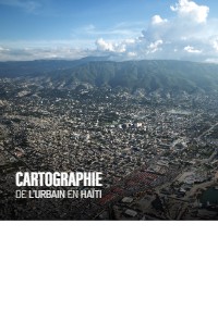
Urban Mapping in Haiti
- Haiti's urbanization rate reached 57.1% by 2020, with urban transition effective since 2014.
- 1% of urban population is concentrated along the coasts, with Port-au-Prince Metropolitan Area containing 59.4% of all urban dwellers.
- Urban expansion follows linear patterns along communication routes creating tentacular morphologies.
- Decades of uncontrolled urbanization have created highly vulnerable urban centers to natural hazards.
- Major disasters caused catastrophic economic losses: 2010 earthquake (120% of GDP), Hurricane Matthew (17.7% of GDP).
This comprehensive urban atlas of Haiti was produced as part of the URBAYITI program to strengthen governance and understanding of urban development. The document analyzes urbanization patterns across Haiti's territory, examining metropolitan areas like Port-au-Prince and Cap-Haïtien, intermediate cities, linear urban developments, and small towns. The study reveals that urbanization in Haiti is a particularly dynamic process, with 57.1% urbanization rate by 2020, concentrated primarily along the coasts where 90.1% of the urban population resides.
The atlas demonstrates that urban expansion follows linear patterns along communication routes rather than vertical densification, creating tentacular morphologies that complicate infrastructure provision. This uncontrolled urban sprawl has significantly increased vulnerabilities to natural hazards including floods, landslides, earthquakes, and hurricanes. The Port-au-Prince Metropolitan Area dominates with 59.4% of all urban dwellers, reflecting decades of centralization policies.
The research methodology combines very high-resolution satellite imagery analysis with field observations across different urban typologies. The study emphasizes that decades of spontaneous urbanization without public control have created urban centers that are particularly vulnerable to multiple natural hazards, with catastrophic consequences as seen in the 2010 earthquake (120% of GDP) and Hurricane Matthew (17.7% of GDP).
The document concludes that understanding and anticipating urban growth is critical for improving resilience and establishing sustainable urban policies. The lack of adequate tools and data to monitor urbanization processes has limited public authorities' ability to control and guide urban development, making this atlas a crucial contribution to urban planning knowledge in Haiti.
Full Document Text
Extracted text from the original document for search indexing.
How to cite
APRISMA; Comité Interministériel d'Aménagement du Territoire (CIAT); Expertise France; European Union, 2023, Urban Mapping in Haiti, accessed via HaitiDocs, https://www.haitidocs.org/doc/ciat-2023-urban-mapping-haiti