
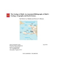
The Geology of Haiti: An Annotated Bibliography of Haiti’s Geology, Geography and Earth Science
- Compiled by Robert Lee Hadden and Steven G. Minson, Army Geospatial Center, with a report date of July 28, 2010 and coverage of 1900 to 2010.
- The preface cites a magnitude 7.0 earthquake in January 2010 with an epicenter about 15 km southwest of Port-au-Prince and about 2 million people in the zone of heavy to moderate damage.
- The introduction gives Haiti's area as about 28,000 square km, the eastern border as 388 km and the coastline as 1,771 km.
- It names the Morne de la Selle, at 2,715 meters, as the highest point.
- It records that the Miragoâne bauxite mine produced about 500,000 tons a year in the early 1980s and closed in 1982.
- Citations are listed alphabetically by author, many with abstracts, descriptors and OCLC accession numbers.
A 256-page bibliography compiled by Robert Lee Hadden and Steven G. Minson at the Army Geospatial Center of the US Army Corps of Engineers, with a report date of July 28, 2010 and a stated coverage of 1900 to 2010. The preface ties it to the magnitude 7.0 earthquake of January 2010, with an epicenter about 15 km southwest of Port-au-Prince. An introduction of about 20 pages describes Haiti's physical features: the five mountain ranges, the Plaine du Nord (2,000 square km), the Plateau Central, the Artibonite and Cul-de-Sac plains, the islands, caves, seismic history, climate, mining, agriculture, transportation and trafficability, water and sanitation, and rivers. A guide explains how to obtain cited items through services such as GeoRef, the Library of Congress, NTIS, OCLC and Selected Water Resources Abstracts. The rest is an alphabetical list of citations, many with descriptors, abstracts and library accession numbers.
How to cite
Army Geospatial Center; US Army Corps of Engineers, 2008, The Geology of Haiti: An Annotated Bibliography of Haiti’s Geology, Geography and Earth Science, accessed via HaitiDocs, https://www.haitidocs.org/doc/army-2008-geology-haiti