Texte Intégral du Document
Texte extrait du document original pour l'indexation.
[page 1]
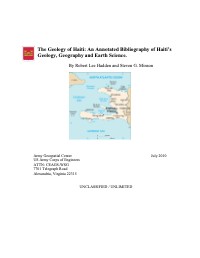
The Geology of Haiti: An Annotated Bibliography of Haitis
Geology, Geography and Earth Science.
By Robert Lee Hadden and Steven G. Minson
F LL] LL
NORTH ATLANTIC OCEAN
CUBA
“e
« Winamad = ap :
Passage 9 Port-dé- lañtien,
Paix
c Gonaives
"ou ER of
ho da le *verrettes
Navassa ee =: sur PINCE e—
Cd REP.
us) Miragoäne Chaine de (an
Lés Caves, ra Jacmel,_ 5%
LI —
Caribbean Sea |
© 50 km
74 Ô 60 me
Army Geospatial Center July 2010
US Army Corps of Engineers
ATTN: CEAGS-WSG
7701 Telegraph Road
Alexandria, Virginia 22315
UNCLASSIFIED / UNLIMITED
[page 2]
Bibliography of Haiïtian Earth Science
Form Approved
REPORT DOCUMENTATION PAGE OMB No. 0704-0188
PE
data needed, and completing and reviewing this collection of information. Send comments regarding this burden estimate or any other aspect of this collection of information, including suggestions for reducing
this burden to Department of Defense, Washington Headquarters Services, Directorate for Information Operations and Reports (0704-0188), 1215 Jefferson Davis Highway, Suite 1204, Arlington, VA 22202-
4302. Respondents should be aware that notwithstanding any other provision of law, no person shall be subject to any penalty for failing to comply with a collection of information if it does not display a currently
valid OMB control number. PLEASE DO NOT RETURN YOUR FORM TO THE ABOVE ADDRESS.
1. REPORT DATE (DD-MM-YYYY) 2. REPORT TYPE 3. DATES COVERED (From - To)
28-July-2010 Bibliography 1900 - 2010
4. TITLE AND SUBTITLE 5a. CONTRACT NUMBER
The Geology of Haiti: An Annotated Bibliography of Haiti's
Geology, Geography and Earth Science. 5b. GRANT NUMBER
5c. PROGRAM ELEMENT NUMBER
6. AUTHOR(S) 5d. PROJECT NUMBER
HADDEN, Robert Lee and MINSON, Steven George
5e. TASK NUMBER
PES AR QU LIANT AURA |
7. PERFORMING ORGANIZATION NAME(S) AND ADDRESS(ES) 8. PERFORMING ORGANIZATION REPORT
AND ADDRESS(ES) NUMBER
US Army Corps of Engineers
Army Geospatial Center
ATIN: CEAGS-WSG
7701 Telegraph Road
Alexandria, VA 22315
9. SPONSORING / MONITORING AGENCY NAME(S) AND ADDRESS(ES) 10. SPONSOR/MONITOR’S ACRONYM(S)
Geospatial Information
Library (GIL)
ATIN: CEAGS-WSG
7701 Telegraph Road
Alexandria, VA 22315
11. SPONSOR/MONITOR’S REPORT
12. DISTRIBUTION / AVAILABILITY STATEMENT
Unclassified/Unlimited
13. SUPPLEMENTARY NOTES
14. ABSTRACT
A bibliography on Haiti prepared by the Army Geospatial Center (AGC) to assist with
humanitarian efforts offered by the US Government and the Corps of Engineers after the
devastating earthquake hit Haiti on January, 2010. As such, this bibliography covers items of
interest to disaster engineers and emergency planners, including citations on geology and
geography, topography, transportation, water, medical concerns, and security.
15. SUBJECT TERMS
Earth Sciences. Forests. Geology. Geography. Groundwater. Haiti. Hydrology. Maps.
Meteorology. Mining. Soils. Surface-water. Trafficability. Transportation. Water.
16. SECURITY CLASSIFICATION OF: 17. LIMITATION 18. NUMBER | 19a. NAME OF RESPONSIBLE PERSON
Unclassified / Unlimited OF ABSTRACT OF PAGES R. Lee Hadden
a. REPORT b. ABSTRACT c. THIS PAGE UU 19b. TELEPHONE NUMBER (include area
UU UU UU 254 code)
(703) 428-9206
Standard Form 298 (Rev. 8-98)
Prescribed by ANSI Std. Z39.18
Army Geospatial Center June 2010 2
[page 3]
The Geology of Haïti:
An Annotated Bibliography of Haiti’s
Geology, Geography and Earth Science
By
Robert Lee Hadden and Steven G. Minson
Army Geospatial Center
7701 Telegraph Road
Alexandria, VA 22315
September 2008
Robert.L.Hadden@usace.army.mil
Preface
This bibliography was produced quickly by the Army Geospatial Center (See:
http://www.agc.army.mil/Haiti/index.html) in response to the humanitarian crisis caused
by the massive magnitude 7.0 earthquake which struck Haïti in January 2010 with an
epicenter about 15 km southwest of the capital, Port-au-Prince. An estimated 2 million
people live within the zone of heavy to moderate structural damage. The earthquake is
assessed as the worst in this region over the last 200 years.
In support of national response efforts led by the U.S. State Department, the U.S.
Agency for International Development, and U.S. Southern Command, and the U.S. Army
Corps of Engineers has deployed an initial team of four engineers in response to the
earthquake in Haiti. The team includes subject matter experts in civil, structural,
electrical, and hydrological engineering. Two additional eight-person Forward Engineer
Support Teams from USACE’s South Atlantic Division and two platoons of the 249th
Engineer Battalion, approximately 40 Soldiers, were placed on alert and ready to deploy.
The 249th Engineer Battalion, known as the “Army’s Power Company,” supplies
commercial grade power-related technical services to installations and disaster-relief
operations. USACE’s South Atlantic Division has identified and is preparing additional
structural engineers for deployment if called upon.
” P In support of this effort, the US Army Corps of
' TE N Engineers’ Army Geospatial Center (AGC) has
sn, 4 scanned a number of geological and hydrological maps
"SAS of Haïti to assist the disaster planners on this mission.
S"—, | This data is used to select locations for supply dumps,
SRE” emergency hospital locations, sanitation and clean
FLD © D rater supplies. Other data on trafficability,
En Eu à transportation and terrain helped with the airlifting of
Figure 1 U.S. Engineers, Haitians supplies, evacuating the injured, and the prevention of
Remove Debris in Turgeau. April2, bottlenecks in air, land and water traffic.
2010. By Chief Mass Communication The AGC web page has also helped civilian
Specialist James G. Pinsky, : Le : :
NAVFAC Public Affairs. Sec: relief agencies in their efforts. The data are available
http://www.dtic.mil/dtic/pdf/success/e around the world, and the US government, the United
leanup.pdf Nations and a number of non-governmental
organizations have made use of this data in their humanitarian relief efforts.
Some copyrighted and sensitive materials have been placed behind the PKI site,
and are available only to US government civilian and military personnel with CAC
[page 4]
Bibliography of Haiïtian Earth Science
access and for official use only. However, most of the information on the webpage is
from open sources, and thus is available to anyone.
Special thanks are given to all those people outside of the Army Geospatial
Center who helped in this emergency project. They include the Reference Staff of the US
Geological Survey Library who replied promptly to our requests and made their services
so accessible (http://library.usgs.gov/); the public services staff of the Defense Technical
Information Center (DTIC) who responded so quickly to our requests, and bent over
backwards to make their information available online to the public
(http://www.dtic.mil/dtic/index.html); and to the Reference Staff of the Geography and
Map Division, The Library of Congress (http://www.loc.gov/rr/geogmap/).
Army Geospatial Center June 2010 2
[page 5]
Bibliography of Haiïtian Earth Science
Introduction
The Physical Features of Haiti!
Haiti is a country of about 28,000 square kilometers, and is about the size of the
state of Maryland. It occupies the western third of the Caribbean island of Hispaniola (La
Isla Española); the Dominican Republic takes up the eastern two-thirds and borders Haiti
on the east. A series of treaties and protocols- the most recent of which was the Protocol
of Revision of 1936- set the 388 kilometer long eastern border, which is formed partly by
the Pedernales River in the south and the Massacre River in the north.
The Dominican Republic is Haiti’s only land border. To the south and west it is
bordered by the Caribbean and to the north by the Atlantic Ocean. Cuba lies some 50
miles (80 km) west of Haiti’s northern peninsula, across the Windward Passage, a strait
connecting the Atlantic to the Caribbean. Jamaica is some 120 miles (190 km) west of the
southern peninsula, across the Jamaica Channel, and Great Inagua Island (of The
Bahamas) lies roughly 70 miles (110 km) to the north. Haiti claims sovereignty over
Navassa (Navase) Island, an uninhabited U.S.-administered islet about 35 miles (55 km)
to the west in the Jamaica Channel.
Haïti is shaped like a horseshoe on its side with prominent peninsulas in both the
north and the south, and a coastline of 1,771 kilometers long. Its shores are generally
rocky, rimmed with cliffs, and indented by a number of excellent natural harbours. The
surrounding seas are renowned for their coral reefs. Located between the peninsulas is the
Ile de la Gonâve. Northwest of the northern peninsula is the Windward Passage, a strip of
water that separates Haiti from Cuba, which is about ninety kilometers away.
Haiti operates five hours behind Greenwich Mean Time (GMT).
Topography:
The generally rugged topography of central and western Hispaniola is reflected in
Haïiti’s name, which derives from the indigenous Arawak place-name Ayti
(‘Mountainous Land”). Five mountain ranges define Haïti’s topography, dividing the
country into three regions: the northern region, which includes the northern peninsula; the
central region; and the southern region, which includes the southern peninsula. The
backbone of the island of Hispaniola consists of four major mountain ranges that extend
from west to east.
Haïiti’s mountains are mainly limestone, although some volcanic formations can
be found, particularly in the Massif du Nord. Karstic features, such as limestone caves,
grottoes, and subterranean rivers, are present in many parts of the country.
Although Haïti is mostly mountainous, the mountain ranges alternate with fertile
but overpopulated lowlands. Haiti’s tropical climate is modified by the mountains and
subject to periodic droughts and hurricanes.
! The data in this introductory section are collected from a number of open literature and common
knowledge publications and resources, such as various almanacs, AG/’s “Glossary of Geology”, various
geographical dictionaries and gazetteers; encyclopedias such as the World Survey of Climatology, the
Encyclopedia Britannica, Encarta, Water Encyclopedia, etc.; open source government publications and
websites from the US Department of State, the Library of Congress, the Defense Technical Information
Center, the Food and Agriculture Organization of the UN and many others; the CIA Factbook, and several
different reports, articles and books on Haïti from federal government geological and geographical
resources.
Army Geospatial Center June 2010 3
[page 6]
Bibliography of Haiïtian Earth Science
The lowest point is the Caribbean Sea at 0 meters and the highest peak, the Morne
de la Selle, is located in the south, and reaches an altitude of 2,715 meters. Slopes of
mountains with more than a 20 percent grade cover nearly two-thirds of the country.
Haiti’s irregular coastline forms a long, slender peninsula in the south and a
shorter one in the north, separated by the triangular-shaped Gulf of Gonâve. Within the
gulf lies Gonâve Island which has an area of approximately 290 square miles (750 square
km). There are no navigable rivers in Haïti. The largest lake is Etang Saumâtre, a salt-
water body located in southern region.
Lowland plains, which are quite limited in extent, are the most productive
agricultural lands and the most densely populated areas. Plains constitute only about 20
percent of Haiti’s land, making cultivation difficult.
Northern Region:
The northern region has the country’s largest coastal plain, the Plaine du Nord
(Northern Plain), which covers an area of 2,000 square kilometers. The Plaine du Nord
lies along the northern border with the Dominican Republic, between the Massif du Nord
and the North Atlantic Ocean. This lowland area of 2,000 square kilometers is about 150
kilometers long and 30 kilometers wide.
The north’s major mountain range, the Massif du Nord (Northern Massif),
buttresses this plain. It is a series of parallel chains known in the Dominican Republic as
the Cordillera Central. This is an extension of the central mountain range in the
Dominican Republic, which begins at Haiti’s eastern border, north of the Guayamouc
River, and extends to the northwest through the northern peninsula. The Massif du Nord
ranges in elevation from 600 to 1,100 meters and has an average elevation of some 4,000
feet (1,200 metres). The Citadel (Citadelle Laferrière), a fortress built by Haitian ruler
Henry Christophe in the early 19th century, stands atop one of the peaks overlooking the
city of Cap-Haïtien and the narrow coastal plain.
Central Region:
The central region of Haïti consists of two plains and two sets of mountain ranges.
The Plateau Central (Central Plateau) extends along both sides of the Guayamouc
River, south of the Massif du Nord. It runs eighty-five kilometers from southeast to
northwest and is thirty kilometers wide. This interior basin is known as the San Juan
Valley in the Dominican Republic and covers an area of more than 2,500 square
kilometers. In Haïti it occupies about 150 square miles (390 square km) in the centre of
the country. The Guayamouc River splits the Central Plateau and provides some of the
country’s most fertile soil. The plateau has an average elevation of about 1,000 feet (300
metres), and access to it is difficult through winding roads. (See Transportation and
Trafficability.)
The Department du Centre, Haiti's Centre Department is one of the ten
Departments of Haiti, and is located in the center of the country, along the border with
the Dominican Republic. This Haiti Department is also known as “The Plateau Central”.
It has an area of 3,675 km? and a population of 564,200 (2002). Its capital is Hinche. It
borders the Dominican Republic to the east. The Centre department is divided into 4
arrondissements: Cerca la Source; Hinche; Lascahobas and Mirebalais.?
2 Taken from “Haiti Geo.com,” at: http://www.haitigeo.com/ accessed July 25, 2010.
Army Geospatial Center June 2010 4
[page 7]
Bibliography of Haiïtian Earth Science
To the southwest of the Plateau Central are the Montagnes Noires, with elevations
of up to approximately 600 meters. It is bounded by two minor mountain ranges on the
west and south—respectively, the Cahos Mountains and the Noires Mountains.
Southwest of the Montagnes Noires and oriented around the Artibonite River is
the Plaine de l’Artibonite, measuring about 800 square kilometers.
South of this plain lies the third major range, known as the Matheux Mountains
(Chaîne des Matheux) in west-central Haiti and the Trou d'Eau Mountains (Chaîne du
Trou d’Eau) farther east, corresponds to the Sierra de Neïba in the Dominican Republic.
The range forms the northern boundary to the narrow Cul-de-Sac Plain, which is
immediately adjacent to Port-au-Prince and includes the brackish Lake Saumâtre on the
Dominican border. (The Plaine du Cul-de-Sac is a natural depression, twelve kilometers
wide that extends thirty-two kilometers from the border with the Dominican Republic to
the coast of the Baie de Port-au-Prince.)
Southern Region:
Haiti’s southern region contains a series of small coastal plains as well as the
mountains of the Massif de la Selle. It encompasses both of Haiti’s highest point
Montagne Terrible, 2,684 meters, and the Plaine du Cul-de-Sac, which is a natural
depression 12 kilometers wide and 32 kilometers wide.
South of the Cul-de-Sac Plain is the fourth major range, called the Massif de la
Selle in Haiti and the Sierra de Baoruco in the Dominican Republic. It rises to 8,773 feet
(2,674 metres) at Mount Selle, the highest point in the country. The mountains of the
southern peninsula, an extension of the southern mountain chain of the Dominican
Republic (the Sierra de Baoruco), extend from the Massif de la Selle in the east to the
Massif de la Hotte in the west. The range’s highest peak, the Morne de la Selle, is the
highest point in Haïti, rising to an altitude of 2,715 meters. The Massif de la Hotte varies
in elevation from 1,270 to 2,255 meters.
The range’s western extension on the southern peninsula is called the Massif de la
Hotte (also known as Massif du Sud), which rises to 7,700 feet (2,345 metres) at Macaya
Peak. The Cayes Plain lies on the coast to the southeast of the peak.
Islands:
Haiti’s land area includes numerous small islands as well as four large islands: Île
de la Gonâve to the west, Île de la Tortue (Tortuga Island) off the north coast, and Île à
Vache and Grande Cayemite, are situated, respectively, south and north of the southern
peninsula.
Ile de la Gonâve is sixty kilometers long and fifteen kilometers wide with an area
of approximately 290 square miles (750 square km). The hills that cross the island rise to
heights of up to 760 meters.
Ile de la Tortue is located north of the northern peninsula, separated from the city
of Port-de-Paix by a twelve-kilometer channel. The most northerly mountain range,
known as the Cordillera Septentrional in the Dominican Republic, occurs in Haiti only on
Tortue Island, off the northern coast. Tortue Island has an area of about 70 square miles
(180 square km). In the 17th century it was a stronghold of privateers and pirates from
various countries.
Army Geospatial Center June 2010 5
[page 8]
Bibliography of Haiïtian Earth Science
Caves of Haïti:
Haïti has karst areas throughout most of its surface area, notably in the Hotte
range in the south. In fact, “haiti” is also the local term for cone karst. Although caves
have been long known in that country, and were often used for religious purposes, most
of the exploration and documentation of the caves of Haiti comes from the 1980
Expédition Spéléologique Française (E.S.F.), led by Alan Oddou (Bull. Centre
Mediterranéen de Spél., 1980, 2: “Contribution à la Connaissance Spéléologique de la
Republique d'Haïti.” 33 pages. Their work was facilitated by the previous geological
studies of J. Butterlin.
Short caves:
bim Séjourné (vallée de Jacmel) 167 meters deep, altitude 710 meters
trouin Sene (massif de la Selle, Seguin) 92 meters deep
trouin Seguin (massif de la Selle, Seguin) 72 meters deep
trou Maïo 1 oe Nan Cadet (massif de la Selle, Seguin) 65 meters deep
trouin de la Scierie (massif de la Selle, Seguin) 63 meters deep
Long Caves:
Trouin Sene (Massif de la Selle, Seguin) 1,668 meters deep
Grotte de Port à Piment (massif du Macaya, Port à Piment) 1,000 meters deep
Grotte de Conoubois (Camp Perrin) approx 900 meters deep.°
See also: Miller, Gerrit Smith. 1929. “A Second Collection of Mammals from
Caves near St. Michel, Haiti.” Washington, DC: Smithsonian Institution. Miscellaneous
Collections. Volume 81 (9). 30 pages, 10 plates. Publication 3012.
Seismic Activity:
A long fault line crosses the southern peninsula and passes just south of Port-au-
ge £ Rs + da Prince. Haïti is subject to
Ses TO E S # periodic seismic activity;
Æ LR RE À … end S carthquakes destroyed Cap-
Sie re Ÿ : DS Sn aïtien in 1842 and Port-au-
ZE + me ra, SE … Princein 1751 and 1770.
4 pr se Fe De. E ù Figure 2 Aerial view of
Le 1x 3 . s& si DE HE ere = buildings in Port-au-Prince damaged
æ PAT: fr Las ee ne SLT % bythe carthquake. Source: US.
À ec D ! en ET 00 © Navy/Mass Communication
« Xe f AU TRI { En D... | Specialist 2nd Class Chelsea Kennedy
DUO CCME KR HAUT A In January 2010 another
REA à “1 4 È SE . a Le +7 catastrophic earthquake and its
ÈS de > UE. A aftershocks resulted in severe
Esp” as Fe ES damage to Port-au-Prince.
Buildings collapsed throughout the capital and surrounding region, including many
homes as well as large public structures such as the National Palace, the city’s cathedral,
and hospitals. Estimates of the number of people killed ranged upwards of 200,000, and
several hundred thousand others were injured. More than a million people were made
3 Courbon, Paul, et al. 1989. Atlas of Great Caves of the World. St. Louis, MO: Cave Books. Cave
Research Foundation. Pages 59-60. ISBN: 0939748215.
Army Geospatial Center June 2010 6
[page 9]
Bibliography of Haiïtian Earth Science
homeless. To the west of the capital, near the quake’s epicentre, the city of Léogâne was
almost completely ruined.
Weather and Climate:
Haiti’s is a generally hot and humid tropical climate; semiarid where the
mountains in east cut off the trade winds. The north wind brings fog and drizzle, which
interrupt Haiti’s dry season from November to January. But during February through
May, the weather is very wet. Northeast trade winds bring rains during the wet season.
Haïti is characterized by diurnal temperature variations that are greater than the
annual variations and are modified by elevation. Average temperatures range from the
high 70s F (about 25°C) in January and February to the mid-80s F (about 30°C) in July
and August. The village of Kenscoff, at some 4,700 feet (1,430 metres), has an average
temperature of about 60°F (16°C), whereas Port-au-Prince, at sea level, has an average of
79°F (26°C). In winter, frost can occur at high elevations.
Because it is located on the leeward side of the island the influence of humid trade
winds is not as great as in the Dominican Republic. The more humid districts are found
on the northern and eastern slopes of the mountains. Some portions of the island receive
less than 28 inches (700 mm) of rainfall per year. The northwestern peninsula and
Gonâve Island are particularly dry. Some regions have two rainy seasons, lasting from
April to June and from August to October, whereas other regions experience rainfall from
May to November. Annual variations of precipitation can cause droughts, widespread
crop failures, and famine.
Haïti lies in the middle of the hurricane belt and is subject to severe storms from
June to October, occasional flooding and periodic droughts. The southern peninsula,
which is more vulnerable to hurricanes (tropical cyclones) than other parts of Haiti,
suffered heavy damage from Hurricanes Allen (1980), Gilbert (1988), and Georges
(1998). All parts of the country, however, can be hit by tropical storms and hurricanes.
During the 2008 hurricane season, the country was struck by three tropical storms and
one hurricane that resulted in torrential rains, extensive flooding and mudslides, and
hundreds of reported casualties. The lack of government infrastructure and rescue
services, combined with impassable roads and bridges, severely hindered rescue and
relief efforts. Casualties were estimated at some 800 lives.
Daily weather information in Haïti is available from national and international
media. The Haitian meteorological service provides hurricane warnings via national
radio. Most information local media broadcast only in Kreyol and/or French. Warnings
are also available on the Internet from many sources.
The average annual rainfall is 140 to 200 centimeters, but it is unevenly
distributed. Heavier rainfall occurs in the southern peninsula and in the northern plains
and mountains. Rainfall decreases from east to west across the northern peninsula. The
eastern central region receives a moderate amount of precipitation, while the western
coast from the northern peninsula to Port-au-Prince, the capital, is relatively dry.
Temperatures are almost always high in the lowland areas, ranging from 15° C to 25° C
in the winter and from 25° C to 35° C during the summer.
Army Geospatial Center June 2010 7
[page 10]
Bibliography of Haiïtian Earth Science
Mining and Economic Geology:
Endowed with few commercially valuable natural resources, Haïti maintained
only a small mining sector in the late 1980s; mining accounted for less than 1% of GDP,
and it employed less than 1% of the labor force. Mining activity in the late 1980s mostly
focused on raw materials for the construction industry.
Natural resources of Haiti include bauxite, copper, calcium carbonate, gold,
marble and hydropower. Haiti contains relatively small amounts of gold, silver,
antimony, tin, lignite, sulphur, coal, nickel, gypsum, limestone, manganese, marble, iron,
tungsten, salt, clay, and various building stones.
Gold and copper are found in small quantities in the north of the country. The
government announced the discovery of new gold deposits in the northern peninsula in
1985, but long-standing plans for gold production proceeded slowly. Copper also was
mined, beginning in the 19605, but production of the ore was sporadic.
There are bauxite (aluminum ore) deposits on the southern peninsula, but large-
scale mining there was discontinued in 1983. The country’s only bauxite mine, the
Miragoâne mine in the southern peninsula, produced an average of 500,000 tons of
bauxite a year in the early 1980s; however, in 1982 the declining metal content of the ore,
high production costs, and the oversupplied international bauxite market forced the mine
to close. Bauxite had at one time been the country’s second leading export.
Haiti apparently has no hydrocarbon resources on land or in the Gulf of Gonâve
and is therefore heavily dependent on energy imports (petroleum and petroleum
products).
Agriculture:
The poorest country in the Americas, Haïti has a developing market economy
based in large part on agriculture and light industries. Coffee is the main cash crop.
Agriculture dominates the economy, but the domestic food supply has not kept pace with
demand. As much as one-fifth of the food consumed in Haiti is imported or, sometimes,
smuggled from the Dominican Republic or the United States; the imports have lowered
overall food prices in Haiti, thereby further impoverishing the nation’s struggling farmers
and compelling more people to migrate to urban areas.
Agriculture employed 65 percent of labor force and accounted for 35 percent of
GDP and 24 percent of exports in late 1980s. Production suffered from severe
deforestation and erosion, primitive techniques, land fragmentation, and lack of public
and private investment. Coffee was the leading export (a mild Arabica), but production
consistently fell below country’s export quota as determined by International Coffee
Organization. Other cash crops included sugar, cocoa, sisal, and cotton. Real per capita
production of food crops declined during 19805, necessitating high levels of basic grains
imports.
Common agricultural products include coffee, mangoes, sugarcane, rice, corn,
sorghum, and wood. Many farmers concentrate on subsistence crops, including cassava
(manioc), plantains and bananas, corn (maize), yams and sweet potatoes, and rice. Some
foodstuffs are sold in rural markets and along roads. Haitian farmers sell it through a
system of intermediaries, speculators, and merchant houses. Sugarcane is the second
major cash crop, but since the late 1970s Haïti has been a net importer of sugar.
Army Geospatial Center June 2010 8
[page 11]
Bibliography of Haiïtian Earth Science
Goats and cattle are the most common livestock, with smaller numbers of pigs
and horses. There is some poultry production. Following a massive outbreak of African
swine fever in Haïti in the late 19705, the country’s entire Creole pig population was
exterminated by 1982. This deprived many peasants of their only asset, although other
pig breeds were subsequently imported as replacements.
Haiti’s soils and fishing zones are threatened. Only about 28.11% of the land is
arable, permanent crops cover 11.53% of the land, and 60.36% has other uses (2005).
Major problems include soil erosion (particularly on mountain slopes, which are seldom
terraced), recurrent drought, an absence of irrigation, extensive deforestation (much of
the remaining forested land is being cleared for agriculture and used as fuel), and
inadequate supplies of potable water.
The soils in the mountains are thin and lose fertility quickly when cultivated. The
lower hills are covered with red clays and loams. The alluvial soils of the plains and
valleys are fertile but overcultivated, owing to high population densities in those areas.
Deforestation has caused much soil erosion, and as much as one-third of Haïti’s land may
have eroded beyond recovery.
Traditionally, Haitians have not exploited their fishing resources; because of the
postindependence practice of living in the interior—away from the threat of a French
invasion—Haitians have depended on agriculture rather than fishing for subsistence.
There are some fisheries, however, in small ponds and various canals throughout Haïti.
Although most fishing boats are small and poorly equipped, the potential for a
commercial fishing industry does exist: the north-flowing currents off the coasts of Haiti
carry major migrations of such deep-sea fish as bonitos, marlins, sardines, and tuna.
Deforestation in Haiti is a serious problem that began with a high need for fuel for
processing sugarcane during the French colonial period and continues to the present day
With an intensified demand for charcoal for fuel in Port-au-Prince and other urban areas.
Political instability and poor funding have been serious obstacles to efforts to reduce
dependency on forests for fuel. À number of large-scale reforestation projects have been
planned, but they have been postponed because of social and political unrest and the
urgent need to fund other infrastructure projects. Today only a small fraction of Haiti’s
land is forested.
From the 17th to the 19th century, much of the natural vegetation was destroyed
through clearing for agriculture, grazing, and logging. Deforestation accelerated during
the 20th century as population increased, and the forests that once covered the country
have been reduced to a tiny proportion of the total land area. Patches of virgin forest
remain in the Massif de la Selle, which includes tall pines, and in the Massif de la Hotte,
where an evergreen forest with giant tree ferns and orchids stands on the slopes of
Macaya Peak. Bayahondes (a type of mesquite), cacti, and acacias form thorny woods on
the dry plains. The mangrove swamps on the coast have also declined rapidly, as their
trees have been overexploited for firewood and for the production of charcoal.
One writer said: “Today less than 4 percent of Haiti’s forests remain, and in many
places the soil has eroded right down to the bedrock. From 1991 to 2002, food production
per capita actually fell 30 percent.” Further on, he wrote: “Te a fatige,” said 70 percent of
Army Geospatial Center June 2010 9
[page 12]
Bibliography of Haiïtian Earth Science
Haïitian farmers in a recent survey when asked about the major agricultural problems they
faced. “The earth is tired.”*
With the retreat of natural vegetation, wildlife has lost its habitat and shelter. Wild
boars, guinea fowls, and wild ducks are no longer present, but caimans still inhabit rivers
of the southern peninsula, and some flamingos are found on Gonâve Island, where they
are often hunted. Little has been done to conserve Haiti’s flora and fauna, and few
national or regional parks have been established. The lack of conservation measures has
been particularly damaging for coral formations and the animal life associated with them.
Demographics and population:
The estimated population of Haïti is about 9,035,000 people, about 95 % of whom
are black and about 5 % of who are either mulatto or white. Estimates for this country
explicitly take into account the effects of excess mortality due to AIDS; this can result in
lower life expectancy, higher infant mortality, higher death rates, lower population
growth rates, and changes in the distribution of population by age and sex than would
otherwise be expected (July 2009 est.)
The life expectancy at birth for the total population is 60.78 years; 59.13 years for
males and 62.48 years for females (2009 est.). Haiti’s death rate is high, mainly because
of the prevalence of infectious and parasitic diseases, diseases of the circulatory system,
and conditions associated with malnutrition. Moreover, Haïti has a higher incidence of
HIV infection and AIDS and a higher infant mortality rate than any other country in the
Western Hemisphere.
Most people living in Haïti are at a high risk for major infectious diseases. Food
or waterborne diseases include bacterial and protozoal diarrhea, hepatitis A and E, and
typhoid fever; common vectorborne diseases are dengue fever and malaria; water contact
diseases include leptospirosis (2009).
Roughly three-fourths of Haitian households lack running water. Unsafe water —
along with inadequate housing and unsanitary living conditions —contributes to the high
incidence of infectious diseases. There is a chronic shortage of health care personnel, and
hospitals lack resources, a situation that became readily apparent after the January 2010
earthquake.
Languages:
Creole (official), Haitian Creole (Kweyol, or Kreyol), and French are Haïti’s
official languages. All Haitians speak Creole, but only about 10% of the people speak
French fluently. English and Spanish are increasingly used as second languages among
the young and in the business sector.
Creole is normally used in daily life, and French is used in more formal
circumstances. However, written Creole is not widely accepted, because the school
system retains French as the main language of instruction. Most of the vocabulary of
Haitian Creole is derived from French, but in its syntax it is similar to the Creole
languages of the Caribbean and the Indian Ocean.
* Bourne, Joel K. 2008. “Haiti Soil: Dirt Poor.” National Geographic. Accessed May 2010. See:
http:/ngm.nationalgeographic.com/2008/09/soil/bourne-text
Army Geospatial Center June 2010 10
[page 13]
Bibliography of Haiïtian Earth Science
Religions:
Haïti has no official religion, and the constitution allows for religious freedom.
However, Vodou (Voodoo, or Vodun), a religion whose gods (/wa) are derived from
West African religions, has been officially sanctioned by the government as of April
2003, and Roman Catholicism, the dominant sect of Christianity, has been given special
government recognition.
Most Haïitian Roman Catholics are also practitioners of Vodou. However, most of
the country’s Protestants consider Christianity to be incompatible with Vodou. In
addition to the older Protestant denominations established in the early 19th century
(Methodists, Episcopalians, and Presbyterians), Baptists, Seventh-day Adventists, and
Mormons came to Haiti during and after the period when the United States occupied the
country (1915-34).
About 80% of the population is Roman Catholic, 16% Protestant (Baptist 10%,
Pentecostal 4%, Adventist 1%, other 1%), 1% none, 3% other. Liberation theology
continues to have some influence in religious life, notably in the shantytown areas of
Port-au-Prince and other towns. Increasing numbers of Haitians have converted to
Protestantism through the work of missionaries active throughout the country.
Economy:
Haiti is the poorest country in the Western Hemisphere with 80% of the
population living under the poverty line and 54% in abject poverty. Two-thirds of all
Haïitians depend on the agricultural sector, mainly small-scale subsistence farming, and
remain vulnerable to damage from frequent natural disasters, exacerbated by the
country’s widespread deforestation.
While the economy has recovered in recent years, registering positive growth
since 2005, four tropical storms in 2008 severely damaged the transportation
infrastructure and agricultural sector. US economic engagement under the Haïtian
Hemispheric Opportunity through Partnership Encouragement (HOPE) Act, passed in
December 2006, has boosted apparel exports and investment by providing tariff-free
access to the US. A second version of the legislation, passed in October 2008 and dubbed
HOPE II, has further improved the export environment for the apparel sector by
extending preferences to 2018; the apparel sector accounts for two-thirds of Haitian
exports and nearly one-tenth of GDP. Remittances are the primary source of foreign
exchange, equaling nearly a quarter of GDP and more than twice the earnings from
exports.
Haïti suffers from a lack of investment because of financial insecurity and limited
infrastructure, and a severe trade deficit. In 2005, Haïti paid its arrears to the World
Bank, paving the way for reengagement with the Bank. Haiti received debt forgiveness
for about $525 million of its debt through the Highly-Indebted Poor Country (HIPC)
initiative in 2009. The government relies on formal international economic assistance for
fiscal sustainability.
Electricity production: 448 million kWh (2007 est.). Hydroelectricity provides
roughly half of the power generated in the country, the remainder coming from thermal
(mainly coal-fired) plants, especially in Port-au-Prince. However, the power supply is not
Army Geospatial Center June 2010 11
[page 14]
Bibliography of Haiïtian Earth Science
sufficient to satisfy current needs, and the main sources of energy for cooking are
firewood and charcoal.
The World Bank gave this estimation of Haiti’s electrical production in 2008: “In
Haïti, the production, transport and distribution of electricity is the responsibility of EDH
(Electricité d'Haïti), a public commercial company that is under the supervision of the
MTPTC. Currently, the company provides electricity to 184,000 customers- who
represent about 10 percent of the population. There has long been no maintenance. Thus,
from an installed productive capacity of 220 MWh, the company now produces 60 MWh.
EDH also faces a high number of illegal connections. The losses due to these illegal
connection are estimated to be about 30 to 40 percent of the output.”°
Oil consumption: 12,000 bbl/day (2008 estimate).
Telephone: There are roughly 108,000 main lines in use and 3.2 million
mobile/cellular lines (2008). Telecommunications infrastructure in Haïti is among the
least developed in Latin America and the Caribbean; domestic facilities are barely
adequate and international facilities are only slightly better. Mobile-cellular telephone
services are expanding rapidly due, in part, to the introduction of low-cost GSM phones,
and mobile-cellular teledensity exceeded 35 per 100 persons in 2008. Telephone
domestic: coaxial cable and microwave radio relay trunk service; international: country
code - 509; satellite earth station - 1 Intelsat (Atlantic Ocean). The website for the Consel
National des Télécommunications (CONATEL) is in French: http://www.conatel.gouv.ht/
The radio broadcast stations in Haïti are: 41 AM stations, 53 FM stations and 0
shortwave stations (2009).
The Internet country code: .ht; Internet hosts: 9 (2009); Internet users: 1 million
(2008).
Transportation and trafficability:
The roads from Port-au-Prince to Cap-Haïtien, Les Cayes, and Jacmel have been
paved but are not regularly repaired, and city streets are notorious for their many deep
potholes. Most inland transportation is hampered by rough roads that may become
impassable in inclement weather. Trucks and buses offer irregular and costly service
from Port-au-Prince to the provincial towns. There is no railway service. The primary
means by which the rural population travels are on foot, by bicycle, by public bus (known
as a “tap-tap” in Haiti), or by donkey. The latter mode is also commonly used to transport
goods.
Aüirports: 14 (2009). Airports with paved runways total 4; one that is between
2,438 to 3,047 m and three airports with runways between 914 and 1,523 m (2009).
Aüirports with unpaved runways total 10; two are between 914 and 1,523 m and eight are
under 914 m (2009). Haiti has two international airports, the principal one at Port-au-
Prince and another at Cap-Haïtien. Outside of Léogâne, a makeshift airstrip has been set
up on part of Route 9, a highway of the commune, able to handle small planes (2010).
The U.S. Federal Aviation Administration (FAA) has assessed the government of
Haiti’s Civil Aviation Authority as not being in compliance with International Civil
* World Bank. 2008. “Haiti: public expenditure management and financial accountability review.” World
Bank Publications. Page 82.
Army Geospatial Center June 2010 12
[page 15]
Bibliography of Haiïtian Earth Science
Aviation Organization (ICAO) aviation safety standards for oversight of Haïti’s air
carrier operations.
Raïlroads: N/A. There are currently no functioning railways in Haiti except for
transporting sugarcane. There are no rail connections with the neighbouring Dominican
Republic. In the past Haïti used railroads, but today they are no longer in use due to other
forms of transportation that have become available. In the past, horse tramways, steam
railways and industrial tracks were used. Their dates of closure are unknown.
Roads and highways: total: 4,160 km; paved: 1,011 km; unpaved: 3,149 km
(2000).
The World Bank gives this assesment of the roads in Haiti in 2008: “The road
network: The Haitian transport network is not only insufficiently developed but it
deteriorated significantly in the decade before 2004. That decade has seen the transport
network in constant - on
degradation. In 2004, . ile 7e: =
according to the MTPTC, the SUN à RE.
road network consisted of Re ee | L—
3,400km of roads, of which wr | AE cel | EE
ly 18 percent were paved. 1e à \ VE -
only 18 percent were pave CPC | Le 8
This network consists of 20.3 ù - RE ha À
percent of primary roads 2 Ÿ s AE En
1 a? RG b
(routes nationales), 44.4 di f al - 7 -A 1:
percent of secondary roads A ml PMR ES Re
(routes départmentales) and EE - — EPST ES es 7
35.4 percent of tertiary roads AT ER -
: > Æ x Et A SE
(routes communales) that link #4 RSS Rene. p«
the rural communities to the Figure 3 Haitian citizens walking down a debris-strewn |
secondary road network. street after the earthquake. Source: USAID/staff photo
Furthermore, only 20 percent of these roads are considered to be in acceptable condition.
To address the maintenance issue, an autonomous entity- the Fonds d’Entretien Routier
(FER)- has been progressively put in place from 2003 to ensure maintenance in this
sector. The FER benefits from earmarked funds (coming from taxes on gasoline, car
licenses, etc.) transferred directly by the MEF and act as a donor on issues regarding road
maintenance (MTPTC plans and contracts while the FER finances). But this executing
system has experienced some delays mainly due to a lack of planning and executing
capacity of the MTPTC.$
Haiti has two main highways that run from one end of the country to the other.
The northern highway, Route Nationale #1 (National Highway One), originates in Port-
au-Prince, winding through the coastal towns of Montrouis and Gonaïves, before
reaching its terminus at the northern port Cap-Haïtien. The southern highway, Route
Nationale #2, links Port-au-Prince with Les Cayes via Léogâne and Petit Goâve.
Maintenance for these roads lapsed after the 1991 coup, prompting the World Bank to
loan USD 50 million designated for road repairs. The project was canceled in January
$ World Bank. 2008. Haiti: Public Expenditure Management and Financial Accountability Review. Page
82.
Army Geospatial Center June 2010 13
[page 16]
Bibliography of Haiïtian Earth Science
1999, however, after auditors revealed corruption. Haïti also has a third major highway,
the Route Nationale #3, which connects Port-au-Prince to Cap-Haitien via the towns of
Mirebalais and Hinche. This route links the capital and Le Cap to the central plateau;
however, due to its poor condition, it sees limited use. The most common form of public
transportation in Haïti is the use of brightly painted pickup trucks as taxis called “tap-
taps.” They are named this because when a passenger needs to be let off they use their
coin money to tap the side of the vehicle and the driver usually stops. Most tap-taps are
fairly priced at around 10-15 gourdes per ride within a city. The catch to the price is that
the driver will often fill a truck to maximum capacity, which is nearly 20 to 30 people.
“Due to decades of deterioration of Haïiti’s road network, the 250-km drive from
Port-au-Prince to Cap Haitien, the largest city on the northern coast, can take up to seven
hours on RNI, the country’s main highway.””
TRAFFIC SAFETY AND ROAD CONDITIONS: While in a
foreign country, U.S. citizens may encounter road conditions that differ
significantly from those in the United States. The information below
concerning Haïti is provided for general reference only, and may not be
totally accurate in a particular location or circumstance.
Cars are supposed to be driven on the right side of the road in Haïti, but
few roads have lane indicators and drivers use whatever part of the road is
open to them, even if it is not the correct side of the road. Traffic is
extremely congested in urban areas, and hours-long traffic jams develop
throughout the country.
Driving in Haiti must be undertaken with extreme caution. The
situation on the roads can be described as chaotic at best, and it is
advisable for those with no knowledge of Haitian roads and traffic
customs to hire a driver through a local hotel. Roads are generally
unmarked, and detailed and accurate maps are not widely available. Lanes
are not marked and signs indicating the direction of traffic flow seldom
exist. This lack of organization, along with huge potholes that appear
without warning, may cause drivers to execute unpredictable and
dangerous maneuvers in heavy traffic. The Haitian government lacks
adequate resources to assist drivers in distress or to clear the road of
accidents or broken-down vehicles blocking the flow of traffic. While
drinking and driving is illegal in Haïti, people frequently drive after
drinking, especially at night.
Public transportation, as it is usually defined, does not exist in
Haiti. While Haitians use buses, “tap-taps,” and taxis, which may observe
regular routes, much like public transportation, none of these should be
considered reliable. The Embassy strongly discourages their use.
Those who drive in Haiti should do so defensively and
conservatively, avoid confrontations such as jockeying for position, and
T Inter-American Development Bank. 2009. “Haiti invests heavily in rebuilding roads: IDB helps finance
an unprecedented push to improve transportation.” Webpage accessed: Apr 13, 2009. See:
http://www.iadb.org/features-and-web-stories/2009-04/english/haiti-invests-heavily-in-rebuilding-roads-
35339.html
Army Geospatial Center June 2010 14
[page 17]
Bibliography of Haiïtian Earth Science
remain aware of the vehicles around them. Drivers should carry the phone
numbers of people to call for assistance in an emergency, as Haïitian
authorities are unlikely to respond to requests for assistance. When
traveling outside of Port-au-Prince, drivers should caravan with other
vehicles to avoid being stranded in the event of an accident or breakdown.
Although Haitian law requires that applicants pass both a written
and a driving test to qualify for a drivers license, many Haitian drivers
appear unaware of traffic laws. Signaling imminent actions is not widely
practiced and not all drivers use turn indicators or international hand
signals properly. For instance, many drivers use their left blinker for all
actions, including turning right and stopping in the road, and others flap
their left arm out the window to indicate that they will be taking an
unspecified action. Drivers do not always verify that the road is clear
before switching lanes, turning, or merging.
Speed limits are seldom posted and are generally ignored.
Speeding is the cause of many fatal traffic accidents in Haïti, as are
overloaded vehicles on winding, mountainous roads and vehicles without
brakes. Poor maintenance and mechanical failures often cause accidents as
well. Drivers should be particularly cautious at night, as unlighted vehicles
can appear without warning.
Right of way is not widely observed in Haïti, and there are few
operational traffic lights or traffic signs. It is advisable at most
intersections to stop and verify that there is no oncoming traffic even if it
appears that you have the right of way. Drivers can be quite aggressive
and will seldom yield. Walls built to the edge of roads frequently make it
impossible to see around corners, forcing drivers to edge their cars into the
road at intersections to check for oncoming traffic.
In addition to vehicles, a variety of other objects may appear on the
road in Haïti, such as wooden carts dragged by people or animals, small
ice cream carts, animals, mechanics working on vehicles parked on the
street, and vendors and their wares. Vehicles are often abandoned in the
road or by the side of the road. There are few marked crosswalks and
sidewalks, and pedestrians often wend their way through traffic in urban
areas.
According to the Washington Post, “Officials from the U.S. Army Corps of
Engineers said Saturday [January 23, 2010] that they assessed the damage from the Jan.
12 quake in Port-au-Prince, Haïti, and found that many of the roads aren’t any worse than
they were before because they”ve always been in poor condition.”
$ US Department of State. Bureau of Consular Affairs. “Haiti Country Specific Information.” See the
website at: http://travel.state.gov/travel/cis pa _tw/cis/cis 1134.html#traffic_ safety accessed July 26, 2010.
* Hedgpeth, Dana. 2010. “Haiti’s Bad Roads not Damaged by Quake, Army Engineers Say.” Washington
Pot. January 23, 2010. The website was accessed on May 5, 2010. See:
http://www.washingtonpost.com/wp-dyn/content/article/2010/01/23/AR2010012302113.html
Army Geospatial Center June 2010 15
[page 18]
Bibliography of Haiïtian Earth Science
Water and Sanitation:
Haiti has an estimated resource of 14 cubic kilometers of freshwater (2000).
Freshwater withdrawal for domestic (5%), industrial (1%) and agricultural (94%) use in
Haiti is 0.99 cubic kilometers/year; per capita water use is 116 cubic meters/year (2000).
Irrigated lands cover 920 square kilometers (2003).
A review of the earthquake’s effects on the water supplies is given in: “National
Ground Water Association Inc. Haïti earthquake: À Water Crisis.” Among the effects of
the Haïti earthquake is a severe disruption of water resources, including water provided
by wells. This Web page furthers the National Ground Water Association’s mission of
“advancing groundwater knowledge” by providing resources helpful to earthquake relief
agencies, affected government jurisdictions, groundwater professionals involved in the
relief effort, the news media, and the public.”1°
“The Haïitian water and sanitation sector is dominated by community-based water
committees, and two state-owned companies: The CAMEP (Centrale Autonome
Métropolitaine d’Eau Potable), which is in charge of the water supply in Port-au-Prince
and the SNEP (Service National pour l’Eau Potable), which is in charge of water supply
in secondary towns and rural areas. According to Haiti’s CEM 2006, in 2002, 88 percent
of the population had access to an improved water access in areas that are urban and 55
percent in areas that are rural. Service quality is poor with intermittent supply and
dubious water quality, forcing those who can afford it to rely on expensive bottled water
and water from tanker trucks. No real sewer network exists in Port-au-Prince or in the
secondary towns. Existing sanitation facilities are individual and consist of latrines, septic
systems and clandestine connections to the storm water drainage system. According to
Haiti’s CEM 2006, in 2002, 52 percent of the population had access to sanitation
facilities in urban areas and only 23 percent in rural areas of Haiti. The sector is currently
under a reform process through a Water and Sanitation Framework Law that is currently
being discussed in Parliament. According to the law, regional water and sanitation
companies would be created to replace CAMEO and SNEP. As part of the reform
process, a General Directorate for Drinking Water and Sanitation (DGEPA) is expected
to be created under MTPTC with the task of developing policies and regulate this
sector.”!!
“Too often, municipal water and sanitation services that can effectively reduce
microbial diseases have been operated on the assumption that the poor could not afford
water and sewer lines. In fact, these potential customers are already allocating a high
proportion of the household expenses- 20 percent in Port-au-Prince, Haïiti- for water
supplied from vendors. Many studies have found that such urban families will not only
pay the city to bring safe and reliable drinking water to them, but will pay for waste water
removal as well.” ?
“Collection of municipal solid waste (MSW) by contract is becoming increasingly
common in developing countries, including some of the poorest countries such as Haïti.
" Haiti Earthquake: A Water Crisis. 2010. National Ground Water Association. See:
http://www.ngwa.org/public/gwprotection/haiti.aspx
1 “Haiti: public expenditure management and financial accountability review.” 2008. World Bank. World
Bank Publications, 2008. ISBN: 0821375911. Page 82.
12 Livable cities for the 21st century.” 1996. World Bank. World Bank Publications, 1996. Length 47
pages. ISBN: 0821338129; 9780821338124. Page 33.
Army Geospatial Center June 2010 16
[page 19]
Bibliography of Haiïtian Earth Science
The impetus for seeking private sector involvement in this activity is obvious- the
expenditures on MSW service absorbs 20 to 50 percent of total municipal revenue in
developing countries, yet on average only 50 to70 percent of solid wastes are
collected.”!?
Waterways: Numerous rivers and streams, which slow to a trickle during the dry
season and which carry torrential flows during the wet season, cross Haiti’s plains and
mountainous areas. There are a number of rivers in Haiti, but few of them are
navigable. !* Many of the rivers of Haiti have not been investigated, nor have scientific
reports been made on their volume, resources or water quality.
Rivers that flow into the Atlantic Ocean are the:
Dajabén River (Massacre River): The Dajabôn River (also called the Massacre
River) is a river of the Dominican Republic. It forms the northernmost part of the
international border between the Dominican Republic and Haïti.
Grande Rivière du Nord: Grande-Rivière-du-Nord (Creole: Grann Rivyè dino) is a
municipality in the Grande-Rivière-du-Nord Arrondissement, in the Nord Department of
Haïti.
Rivière du Limbè
Les Trois Rivières: The most important river in the northern region is Les Trois
Rivières, or The Three Rivers. It is 150 kilometers long, has an average width of sixty
meters, and is three to four meters deep.
Rivers that flow into the Gulf of Gonâve:
La Quinte River
Rivière de l’Estère
Attibonite River: The largest drainage system in the country is that of the
Attibonite River. Rising as the Libôn River in the foothills of the Massif du Nord, the
river crosses the border into the Dominican Republic and then forms part of the border
before reentering Haiti as the Artibonite River. At the border, the river expands to form
the Lac de Péligre in the southern part of the Plateau Central. The 400-kilometer
Attibonite River is only one meter deep during the dry season, and it may even dry up
completely in certain spots. During the wet season, it is more than three meters deep and
subject to flooding. The US Marines crossed and re-crossed this river many times during
their long police action in the Dominican Republic in the 1900s.
The Artibonite River is a 320 km long river in Haïti. It is the longest as well as the
most important river in Haïti and the longest on the island of Hispaniola. Its sources are
in the Cordillera Central in the Dominican Republic, however most of its length lies in
Haiti. It empties into the Gulf of Gonâve. The river is used for irrigation and the Peligre
Hydroelectric Dam situated on it produces the country”’s supply of hydroelectricity. The
Attibonite forms part of the international border between Haiti and the Dominican
Republic.
1 Kessides, Christine. 1993. “Institutional options for the provision of infrastructure.” World Bank
Publications. Volume 212 of World Bank discussion papers., 1993. 81 pages. ISBN: 0821326279;
9780821326275. Page 24.
4° US Army Corps of Engineers. 1999. “L’Evaluation des Ressources d’Eau d’Haiti.”
L’Août 1999. United States Southern Command. See the website, accessed May 5, 2010:
http://www.sam.usace.army.mil/en/wra/Haiti/Combined®%20Final%20Haiti.pdf
Army Geospatial Center June 2010 17
[page 20]
Bibliography of Haiïtian Earth Science
French Rivière de l’Artibonite, Spanish Rio Artibonito river, the longest on the
island of Hispaniola. It rises in the Cordillera Central (Cibao Mountains) of the
Dominican Republic and flows southwest along the border with Haiti and then west and
northwest into Haiti and through the fertile Artibonite Plain to enter the Gulf of La
Gonâve after a course of 150 miles (240 km). It is navigable upstream for about 100
miles (160 km) by small craft. Large tracts of irrigated land were developed as part of the
Artibonite Valley Agricultural Project.
The Artibonite River is the island’s longest river, and is approximately 175 miles
(280 km) long. The Artibonite rises in the western Dominican Republic in the Cordillera
Central and follows a southwestward course along the border with Haïti. Its tributaries
flow eastward and southward through Haïti’s Central Plateau to a point near the
Dominican border, where they join the river proper as it turns westward. The Artibonite
then skirts the Noires Mountains as it flows to the Gulf of Gonâve. In eastern Haïti the
river was impounded as Lake Péligre in the mid-20th century; a hydroelectric complex
began operating at Péligre in 1971, but its power output has been unreliable during the
dry season. Just upstream from the Artibonite’s delta in the Gulf of Gonâve, some of its
waters are used to irrigate the triangular Artibonite Plain.
Rivière de Fer à Cheval
Macasia River: The Macasia River is a river mostly of the Dominican Republic. A
part of the river forms a small part of the international border between the Dominican
Republic and Haiti.
Guayamouc River: The ninety-five-kilometer Guayamouc River is one of the
principal tributaries of the Artibonite River. The Guayamouc River, or the Riviere
Guayamouc, is a river in central and eastern Haïti. It rises on the Massif du Nord and
flows generally southeast for 113 km into the Artibonite River at the border with the
Dominican Republic. It is notable for producing the fertile plain of central Haiti. Notable
cities on the Guayamouc include Hinche.
Rivière Bouyaha: Bouyaha River, in French, “Riviere Bouyaha”, is a river
flowing through the cities of Dondon, Saint Raphael and Pignon. It is said that the river
started in the mountain surrounding the municipalities of Dondon and Marmelade. The
Bouyaha river merges with the Guayamouc river in the nearby city of Hinche.
Rivière Canot
Rivière Locaine
Libôn River
Rivière de Saint-Marc
Rivière Montrouis
Rivière Blanche
Rivière Grise (Grande Riviere du Cul de Sac)
Momance River
Rivière de Grand Goâve: The Rivière de Grand Goâve is a river in Haïti. The
January 12, 2010, 7.0 tremblor created a landslide which formed a landslide dam
blocking the Grand Goâve river, that can potentially contain a large basin of water. With
the wet season approaching, there is a fear that a dam collapse would directly outflow the
contents behind the dam through the city of Grand-Goûâve. The dam is located about a
dozen kilometres from the city of Grand-Goâve.
Grand Rivière de Nippes
Army Geospatial Center June 2010 18
[page 21]
Bibliography of Haiïtian Earth Science
Grande-Anse River: The Grande-Anse River (French: Rivière de la Grande-Anse)
flows through western Haïti and empties into the Gulf of Gonâve at the city of Jérémie. It
is one of the largest rivers in Haïti.
Rivers that flow into the Caribbean Sea:
Acul River
Ravine River (Ravine du Sud)
Rivière de Cavaillon
Rivière des Côtes de Fer
Rivière de Bainet
Grand Rivière de Jacmel
Pedernales River: The Pedernales River (Hispaniola) is a river of the Dominican
Republic and Haiti. It forms the southernmost part of the international boundary between
the Dominican Republic and Haïti.
The most prominent body of water in the southern region is the salt-water Etang
Saumâtre, located at the eastern end of the Plaine du Cul-de-Sac. At an elevation of
sixteen meters above sea level, the lake is twenty kilometers long and six to fourteen
kilometers wide; it has a circumference of eighty-eight kilometers.
Ports and terminals in Haiti are: Cap-Haitien, Gonaïves, Jacmel, Jérémie, Les
Cayes, Miragoane, Port-au-Prince, Port-de-Paix, Saint-Marc, Fort Liberte. The two main
seaports are at Cap-Haïtien and Port-au-Prince. Container facilities at the Port-au-Prince
harbour handle most of Haiti’s foreign trade. There are several minor ports, but passenger
boat services are limited. Lesser ports include Miragoâne, Les Cayes, Fort Liberté,
Gonaïves, and Jérémie.
The port at Port-au-Prince, officially known as the “Port International de Port-au-
Prince,” has more registered shipping than any of the over dozen ports in the country.
The port’s facilities include cranes, large berths, and warehouses, but these facilities are
in universally poor shape. The port is underused, possibly due to the substantially high
port fees compared to ports in the Dominican Republic.
Port-au-Prince is the leading commercial port, followed by Cap-Haïtien, which
handled most cruise ship traffic. The port of Saint-Marc is currently the preferred port of
entry for consumer goods coming into Haiti. Reasons for this may include its location
away from volatile and congested Port-au-Prince, as well as its central location relative to
a large group of Haïtian cities including Cap-Haitien, Carrefour, Delmas, Desarmes,
Fond-Parisien, Fort-Liberté, Gonaives, Hinche, l’Artibonite, Limbe, Pétionville, Port-de-
Paix, and Verrettes. These cities, together with their surrounding areas, contain about six
million of Haïti‘s eight million people.
Economy:
Much of the research in the economy pre-dates the current government, and often
the most recent statistics of Haiti’s economy are twenty or more years old.
Services: Accounted for 42 percent of the gross domestic product (GDP) in 1987,
with 23 percent of labor force employed in the service economy in 1983. Banking and
financial services are a major sectoral contributor. Transportation and communications
systems are inadequate; tourism dropped off substantially during 1980s.
Army Geospatial Center June 2010 19
[page 22]
Bibliography of Haiïtian Earth Science
Currency: The Haïtian currency is the Gourde. The official exchange rate is
maintained at GS to US$1 since 1919. Black market trading began in early 1980s in
response to high inflation and fiscal shortfalls. The United States dollar is also accepted
as legal tender.
Imports: Approximately US$308 million in 1987. Foodstuffs are the leading
import item, followed by machinery and transport equipment, manufacturing inputs, and
petroleum.
Exports: Approximately US$198 million in 1987. Manufactured goods
accounted for more than 50 percent of total, followed by coffee and handicraft items.
Fiscal Year: October 1 through September 30.
Balance of Payments: Current account deficits throughout 19805, although
increased foreign aid flows compensated to some extent in FY 1986 and FY 1987.
Following renewed political instability after unsuccessful elections in November 1987,
capital flight and aid cutbacks exacerbated the balance of payments situation.
Fiscal Policy: Tradition of balanced budgets broken by expansion of public sector
under Jean-Claude Duvalier (1971-86). Public sector deficit reached 10.6 percent of GDP
in FY1985, reduced slightly to 7 percent of GDP in FY 1987.
Gross Domestic Product: Approximately US$1.95 billion in 1987, or about
US$330 per capita, lowest in Western Hemisphere. Economy contracted during most of
1980s.
Manufacturing and Industry:
Industry: Accounted for 23 percent of GDP in 1988, for 53 percent of exports,
and for 6 percent of labor force. The most dynamic subsector was assembly
manufacturing, mainly for United States market.
Manufacturing was the most dynamic sector of the economy in the 1980s. Growth
in this sector had averaged more than 10 percent a year during the 1970s; manufactures
replaced agricultural commodities as the country’s leading export goods during this
decade. In 1988 manufacturing accounted for 17 percent of GDP and for 53 percent of
exports; it employed about 6 percent of the labor force. In addition to the dynamic
assembly subsector, which experienced 22 percent real annual growth in the 1970s,
included small-scale local manufacturing enterprises and large-scale, state-owned
organizations.
Industry suffered in late 1980s because of political instability, country’s failure to
compete effectively with other Caribbean and Central American beneficiaries of
Caribbean Basin Initiative, high utility rates, infrastructure deficiencies, and shortage of
skilled labor.
The manufacturing sector in the late 1980s comprised 500 enterprises, most of
which were small or medium in size and family-owned. Their major products included
processed foods, electrical equipment, textiles, and clothing. Small enterprises,
employing up to 50 workers, represented 57 percent of all manufacturing firms, but they
employed only 10 percent of the industrial labor force. Medium enterprises, with 51 to
300 workers, accounted for 35 percent of the sector’s firms and employed 44 percent of
the industrial labor force. Large enterprises, those with more than 300 employees,
constituted only 8 percent of the companies, but they employed 43 percent of all
Army Geospatial Center June 2010 20
[page 23]
Bibliography of Haiïtian Earth Science
manufacturing workers, mostly in large assembly factories in the industrial parks of Port-
au-Prince.
Army Geospatial Center June 2010 21
[page 24]
Bibliography of Haiïtian Earth Science
Bibliography and Sources of Citations
This bibliography on the geology, geography and earth sciences of Haiti was
gathered from a variety of different abstracting, bibliographical and cartographical
resources. They include citations from agriculture, botany, engineering, geology,
geography, medical, military science, soils, transportation and other subject resources.
These citation resources are provided by a number of scientific societies, such as
the American Geographical Society; from government resources, such as the Defense
Technical Information Center; non-governmental organizations such as the United
Nation’s Food and Agricultural Organization (FAO); and from commercial databanks
such as GeoRef, WorldCat and GeoBase. Many unique citations were collected from the
catalogs and resources of major research libraries, such as the Library of Congress and
the US Geological Survey Library.
Within this bibliography, the article retrieval information is given as much as
possible. These include specific ISSN, ISBN, OCLC and Library of Congress numbers
that allow the electronic borrowing or copying of these items through library networks.
Alternately, the citations also include information on acquiring these items
through document delivery companies and commercial services. Very often, scientific
publications in less developed countries are not published in large numbers, and it is very
difficult to retrieve reports or maps more than even a few years old. This bibliography is
intended to be a resource for those scientific citations on Haïti that can still be retrieved.
Also included, when possible, are the addresses and contact information of the
journal authors. Many of these experts could be reached as needed during the crisis for
additional information and support.
Within these citations are many variations in spelling and place names. Many
scientific and cartographic investigations were done in various local languages, and the
languages of neighboring countries. Thus, the same name may be spelled differently
according to the language(s) used, especially in those languages with irregular spelling,
such as Kweyol. Variations on single and doubled consonants (geminated consonants)
and single and doubled vowels (diphthongs) are common.
Abbreviations and links to resources used:
(AI links and URLS in this bibliography are current as of July 2010)
AGI: American Geological Institute, Alexandria, VA. See: www.agiweb.org. The
AGI also has a document delivery service. They say, “When you see a document or map
cited in the GeoRef database you can simply order a copy from the GeoRef Document
Delivery Service. We provide copies of earth-science documents available in the U.S.
Geological Survey Library in Reston, VA, the Library of Congress, the AGI Library, and
through an international network of exchange partners including organizations in
Germany, China, and the Russian Federation.” The document delivery service is found
at: http//www.agiweb.org/georef/dds/index.html.
AGS: American Geographical Society Library, University of Wisconsin,
Milwaukee Campus. See: http://www.amergeog.org.
AS&T: Applied Science & Technology from H.W. Wilson is a bibliographic
database that indexes articles of at least one column in length. English-language
periodicals published in the United States and elsewhere are covered; non-English
language articles are included if English abstracts are provided. Periodical coverage
Army Geospatial Center June 2010 22
[page 25]
Bibliography of Haiïtian Earth Science
includes trade and industrial publications, journals issued by professional and technical
societies, and specialized subject periodicals, as well as special issues such as buyers’
guides, directories, and conference proceedings. See:
http://www.hwwilson.com/Databases/applieds.htm#Abstracts
ASFA: Aquatic Sciences and Fisheries Abstracts Input to ASFA is provided by a
growing international network of information centers monitoring more than 5,000 serial
publications, books, reports, conference proceedings, translations, and limited
distribution literature. ASFA is a component of the Aquatic Sciences and Fisheries
Information System (ASFIS), formed by four United Nations agency sponsors of ASFA
and a network of international and national partners. Aquatic Sciences and Fisheries
Abstracts are produced by CSA under contract to FAO. See: http://www.csa.com/
British Library: The British Library Document Supply Service can supply many
of the article citations and reports given in this bibliography, especially those maps and
other materials owned by the British Library. See:
http://www.bl.uk/services/document/dsc.html
CSA Technology Research Database: This comprehensive database provides a
single mega-file of all the unique records available through its 3 components: the CSA
Materials Research Database with METADEX, CSA High Technology Research
Database with Aerospace, and the CSA Engineering Research Database. The database
content represents the most comprehensive and current coverage of the relevant serial and
non-serial literature available. Sources covered include over 4,000 periodicals,
conference proceedings, technical reports, trade journal/newsletter items, patents, books,
and press releases. See: http://www.csa.com/
DTIC: Defense Technical Information Center, Alexandria, VA. “The Defense
Technical Information Center (DTIC”) serves the Department of Defense (DoD)
community as the largest central resource for DoD and government-funded scientific,
technical, engineering, and business related information available today. For more than
60 years DTIC has provided the warfighter and researchers, scientists, engineers,
laboratories, and universities timely access to over 2 million publications covering over
250 subject areas. Our mission supports the nation's warfighter.” See: www.dtic.mil
ESPM: The CSA Environmental Sciences and Pollution Management database
offers access to the international literature in the environmental sciences. Abstracts and
citations are drawn from over 6000 serials including scientific journals, conference
proceedings, reports, monographs, books and government publications. See:
http://www.csa.com/
FAO: Food and Agriculture Organization Library, United Nations, Rome, Italy.
See: www.fao.org
GeoBase: GEOBASE is a unique multidisciplinary database supplying
bibliographic information and abstracts for development studies, the Earth sciences,
ecology, geomechanics, human geography, and oceanography. The database provides
current coverage of almost 2,000 international journals, including both peer-reviewed
titles and trade publications, and provides archival coverage of several thousand
additional journal titles and books. GEOBASE is unequalled in its coverage of
international literature of the core scientific and technical periodicals. Papers are selected,
read, and classified using a unique classification scheme that is versatile and updated
annually to adapt coverage to current research trends. The material covered includes
Army Geospatial Center June 2010 23
[page 26]
Bibliography of Haiïtian Earth Science
refereed scientific papers; trade journal and magazine articles, product reviews,
directories and any other relevant material. GEOBASE has a unique coverage of non-
English language and less readily available publications including books, conference
proceedings and reports, making this the best resource available for multidisciplinary
searches of international literature. The content crosses over subject, language, and
cultural boundaries, providing a unique research tool to users. All material in GEOBASE
is also available as print in the following Elsevier/Geo Abstracts journals: Geographical
Abstracts, Physical Geography, Human Geography, Geological Abstracts, Ecological
Abstracts, International Development Abstracts and Oceanographic Literature Review,
Geomechanics Abstracts. See: www.elsevier.com
GeoRef: see: American Geological Institute, Alexandria, VA, listed above. The
American Geological Institute not only identified materials for the abstracting database,
GeoRef, but also locates and supplies materials as a document delivery service. See:
www.agiweb.org
ISBN: International Standard Book Number. This unique number can be used to
identify and locate library holdings of a particular book or report title. See:
http://www.isbn.org/standards/home/index.asp
ISSN: International Standard Serial Number. This unique number can be used to
locate libraries which have subscriptions to this journal, magazine or serial. See:
http://www.issn.org/
LCCN: Library of Congress Control Number. This is a unique number applied by
the Library of Congress to identify individual publications. This number can be used to
identify copies of this item in libraries held in the US and abroad. See:
http:/www.loc.gov/marc/Icen_structure.html
LC or LOC: Library of Congress, Geography and Map Division, Washington,
DC. The Geography and Map Division has the largest collection in the world, with 5.4
million maps, 75,000 atlases, 500 globes, 3,000 three-dimensional objects and thousands
of digital files. Recently, the Library of Congress has digitally scanned and mounted its
10,000 map online. See: http://www.loc.gov/rr/geogmap/
Northwestern University Transportation Library: The Transportation Library was
founded in 1958 to support the curricula and research programs of the Transportation
Center and the Center for Public Safety of Northwestern University, including the School
of Police Staff and Command. Containing over 400,000 items, the Transportation Library
of Northwestern University is one of the largest transportation information centers in the
world, encompassing information on all transportation modalities, including: air, rail,
highway, pipeline, water, urban transport and logistics. Its collection of environmental
impact statements is one of the most complete in the world. See:
http://www.library.northwestern.edu/transportation/
NTIS: National Technical Information Service, Alexandria, VA. See:
WWW.ntis.SOV
OCLC: Founded in 1967, OCLC Online Computer Library Center is a nonprofit,
membership, computer library service and research organization dedicated to the public
purposes of furthering access to the world’s information and reducing information costs.
More than 41,555 libraries in 112 countries and territories around the world use OCLC
services to locate, acquire, catalog, lend and preserve library materials. Researchers,
students, faculty, scholars, professional librarians and other information seekers use
Army Geospatial Center June 2010 24
[page 27]
Bibliography of Haiïtian Earth Science
OCLC services to obtain bibliographie, abstract and full-text information when and
where they need it. See: http://www.oclc.org/ or their free service at: www.worldcat.org
SWRA: Selected Water Resources Abstracts (1967-94). SWRA provides more
than 271,138 abstracts compiled by the Water Resources Scientific Information Center
(WRSIC) of the USGS. SWRA provides thorough coverage of worldwide technical
literature across the life, physical, and social-science aspects of water resources as well as
U.S. Government documents produced by the USGS’s many research facilities. Records
are drawn from journals, monographs, conference proceedings, reports, court cases, and
other federal and state publications. SWRA, and now Water Resources Abstracts, are your
best sources for issues pertaining to groundwater, water quality, water planning, and
water law and rights.
TRIS: TRIS is a bibliographic database funded by sponsors of the Transportation
Research Board (TRB), primarily the state departments of transportation and selected
federal transportation agencies. TRIS Online is hosted by the National Transportation
Library under a cooperative agreement between the Bureau of Transportation Statistics
and TRB. See: http://ntlsearch.bts.gov/tris/index.do
UN: United Nations Library, New York, NY. See: www.un.org
USGS: US Geological Survey Library, Reston, VA. The U.S. Geological Survey
Library system has become the largest earth science library in the world. Materials within
the library system include books and maps dating back to the 16th and 17th centuries.
Other materials include a nearly complete set of the various State Geological Survey
publications and a virtually complete set of USGS topographic maps. Today library users
have access to over 3 million items: books, periodicals and journals, maps (thematic,
topographic, raised relief), microfiche, microfilm, pamphlets, photographs (aerial as well
as landscape, in color and black and white), transparencies, field record notebooks,
videos and audio tapes, computer media, globes, foreign language materials and
electronic books. See: www.usgs.gov/library
University of Texas at Austin. Perry-Castañeda Library Map Collection: “Many
of these maps have been scanned and are available for downloading and other uses.” See:
http://www.lib.utexas.edu/maps/
WorldCat: Among other things, this a free database from OCLC showing local
library holdings of desired publications. See: http:/www.worldcat.org/
Army Geospatial Center June 2010 25
[page 28]
Bibliography of Haiïtian Earth Science
A
Adam, Pierre. 2006. Précis d’'Hydrogéologie et Forage d'Eau. Translated title :
Handbook of Hydrology and Drilling. Haïti: Presses Nationales d'Haïti. Descriptors:
Hydrogeology- Haiti; Water-supply- Haiti. Notes: v.: illustrations (some in color); 28 cm.
Note(s): Includes bbibliographical references. Responsibility: Pierre Adam. ISBN:
9993570354. OCLC Accession Number: 182727290.
Adams, Patrick. “Rainy Season could Hamper Haiti’s Recovery.” 2010. The
Lancet. 3/27. Volume 375, Issue 9720, Pages 1067-1069. ISSN: 0140-6736.
Adams, Patrick. 2010. “Relief Agencies Prepare for Long Haul in Haiti.” The
Lancet. 2/13. Volume 375, Issue 9714, Pages 539-539. ISSN: 0140-6736.
Adatte, Thierry and Keller, Gerta. 2006. “Stratigraphy, Age, Nature and Origin of
the KT Breccia from North America to Argentina; Geological Society of America, 2006
Annual Meeting.” Abstracts with Programs - Geological Society of America. Oct.
Volume 38, Issue 7, Pages 58. Descriptors: Antilles; Argentina; Belize; breccia;
Caribbean region; Cenozoic; Central America; Chicxulub Crater; clastic rocks; clasts;
conglomerate; Cretaceous; Danian; ejecta; Foraminifera; geochemical anomalies;
geochemistry; Greater Antilles, Guatemala; Haïti; Hispaniola; impact craters; impact
features; Invertebrata; iridium; K-T boundary; La Popa Basin; lower Danian; lower
Paleocene; Maestrichtian; marine sedimentation; matrix; Mesozoic; metals; Mexico;
microbreccia; microfossils; Neuquen Basin; North America; ocean floors; Paleocene;
Paleogene; planktonic taxa; platinum group; Protista; regression; reworking; sea-level
changes; sedimentary rocks; sedimentation; Senonian,; shallow-water environment; South
America; spherules; stratigraphic boundary; submarine canyons; Tertiary; Texas;
turbidite; United States; Upper Cretaceous; upper Maestrichtian; West Indies; Yucatan
Peninsula. Abstract: The stratigraphy and age of breccia containing Chicxulub impact
glass spherules is documented in late Maastrichtian-early Danian sequences from Texas,
northern and southern Mexico, Belize, Guatemala and Haiti. Reworked Chicxulub impact
glass spherules are known from all sequences spanning from the latest Maastrichtian to
early Danian. The oldest and original ejecta layer is found in the uppermost Maastrichtian
of Texas (Brazos), NE Mexico (Loma Cerca, El Penon) and the Chicxulub crater core
Yaxcopoil-1. The geochemistry of glass from this layer is identical in all sections and
consistent with Chicxulub impact ejecta documented from reworked spherule layers. The
K/T boundary, Ir anomaly and mass extinction are stratigraphically well above the oldest
ejecta layers, as well as most reworked layers. No Ir anomaly occurs at or near the
original Chicxulub spherule ejecta layer. The original spherule ejecta layer was deposited
during normal marine sedimentation in the upper Maastrichtian (base of CF1 Zone),
approximately 300’000 prior to the K/T boundary. All younger ejecta layers represent
repeated episodes of reworking of the original layer during a sea-level regression and are
part of siliciclastic deposition in submarine canyons via mass flows and turbidites (NE
Mexico), or incised valleys in shallow environments (e.g., Brazos, Texas, La Popa Basin
NE Mexico). The widespread thick microspherule and spheroid deposits in southern
Mexico, Belize, Guatemala and Haiti are interbedded with breccia, microbreccias and
conglomerates resulting from the erosion of shallow carbonate platform sediments. The
presence of Maastrichtian and early Danian planktic foraminifera in the matrix of the
breccia, as well as within spherule clasts, indicate that redeposition occurred during the
early Danian P. eugubina zone. In Brazil (Poty) and Argentina (Neuquen), early Danian
Army Geospatial Center June 2010 26
[page 29]
Bibliography of Haiïtian Earth Science
(Pla, Plc) microfossils mark the breccias as early Danian age. No evidence of impact
origin was detected (e.g., Ir, impact glass spherules, or trace element geochemistry).
Database: GeoRef. ISSN: 0016-7592.
Addiss, D. G., Dimock, K. A., Eberhard, M. L. and Lammie, P. J. 1995. “Clinical,
Parasitologic, and Immunologic Observations of Patients with Hydrocele and
Elephantiasis in an Area with Endemic Lymphatic Filariasis.” Journal of Infectious
Diseases. Volume 171, Issue 3, Pages 755-758. Descriptors: parasite antigen; adult; aged;
article; disease course; elephantiasis; filariasis; Haiti, human; hydrocele; Ilymphedema;
major clinical study; pathogenesis; priority journal; Adolescent; Antibodies, Helminth;
Child; Elephantiasis, Filarial; Female; Immunoglobulin G; Male; Middle Age; Support,
Non-U.S. Gov’t; Support, U.S. Gov’t, P.H.S. Abstract: Hydrocele and elephantiasis,
major clinical manifestations of bancroftian filariasis, are thought to share a common
pathogenesis. The characteristics of 121 patients with hydrocele or elephantiasis in
Leogane, Haiti, were compared: 39% of 57 men with hydrocele and 3% of 64 persons
with lymphedema of the leg were microfilaria-positive (P < .001). Circulating filarial
antigen, presumably from the adult worm, was detected in 15 (43%) microfilaria-negative
men with hydrocele and 9 (15%) microfilaria-negative persons with leg edema (P =
.004). Microfilaria-positive men had lower levels of filaria-specific IgG1 and hydroceles
of significantly smaller volume and shorter duration than did microfilaria-negative men;
hydrocele volume was inversely associated with microfilarial density (P = .001). In
contrast, filarial antigen but not microfilariae was associated with filaria-specific IgG4
and decreased lymphocyte proliferation. Antigen status was not associated with severity
of leg edema. In this filariasis-endemic area, men with hydrocele are more
immunologically and parasitologically heterogeneous than are persons with elephantiasis.
Database: SCOPUS. ISSN: 0022-1899.
Addiss, D. G., Louis-Charles, J., Roberts, J., et al. 2010. “Feasibility and
Effectiveness of Basic Lymphedema Management in Leogane, Haïti, an Area Endemic
for Bancroftian Filariasis.” PLoS Neglected Tropical Diseases. Volume 4, Issue 4,
Abstract: Background: Approximately 14 million persons living in areas endemic for
lymphatic filariasis have lymphedema of the leg. Clinical studies indicate that repeated
episodes of bacterial acute dermatolymphangioadenitis (ADLA) lead to progression of
lymphedema and that basic Ilymphedema management, which emphasizes hygiene, skin
care, exercise, and leg elevation, can reduce ADLA frequency. However, few studies
have prospectively evaluated the effectiveness of basic lymphedema management or
assessed the role of compressive bandaging for lymphedema in resource-poor settings.
Methodology/Principal Findings: Between 1995 and 1998, we prospectively monitored
ADLA incidence and leg volume in 175 persons with lymphedema of the leg who
enrolled in a lymphedema clinic in Leogane, Haiti, an area endemic for Wuchereria
bancrofti. During the first phase of the study, when a major focus of the program was to
reduce leg volume using compression bandages, ADLA incidence was 1.56 episodes per
person-year. After March 1997, when hygiene and skin care were systematically
emphasized and bandaging discouraged, ADLA incidence decreased to 0.48 episodes per
personyear (P<0.0001). ADLA incidence was significantly associated with leg volume,
stage of lymphedema, illiteracy, and use of compression bandages. Leg volume decreased
in 78% of patients; over the entire study period, this reduction was statistically significant
only for legs with stage 2 lymphedema (P=0.01). Conclusions/Significance: Basic
Army Geospatial Center June 2010 27
[page 30]
Bibliography of Haiïtian Earth Science
lymphedema management, which emphasized hygiene and self-care, was associated with
a 69% reduction in ADLA incidence. Use of compression bandages in this setting was
associated with an increased risk of ADLA. Basic lymphedema management is feasible
and effective in resource-limited areas that are endemic for lymphatic filariasis. Database:
SCOPUS.
"Agency Assistance should Aid Post-Quake Reconstruction." 2010. GeoWorld.
April. Volume 23, Issue 4, Pages 11. Descriptors: Port-au-Prince (Haïti) earthquake,
2010; Geological research; Geological Survey (U.S.); Applied Science & Technology.
Abstract: Scientists from the U.S. Geological Survey (USGS) are helping Haitians plan
reconstruction and long-term earthquake monitoring following the January 12, 2010,
earthquake that devastated the country. The USGS workers are providing geologic
research that will help establish new building codes for reconstruction in the country.
According to Walter Mooney, USGS research geophysicist, the agency's research will
contribute to explicit recommendations to the Haitian government and the international
community that is assisting the reconstruction efforts. ISSN: 1528-6274.
Agnant, Patrick. 1997. Planning for Water Resources Management in Haiti.
Descriptors: Water resources development- Haiti; Water-supply- Haiti; Water-power-
Haiti; Thesis/dissertation, Manuscript. Notes: 46 leaves: illustrations, 29 cm.
Dissertation: Thesis (M.S.)--New York Institute of Technology, 1997. Note(s): Includes
bibliographical references. OCLC Accession Number: 39336991.
Agricultural Development Support II Project. 1986. Initial Digital Resource Data
Base for Haiti. Descriptors: Hydrology- Haïiti- Maps; Digital mapping; Natural resources-
Haïiti- Maps. Notes: 216 p. in various pagings: map; 28 cm. Note(s): At head of title:
ADS-II, Agricultural Development Support II Project. “Report # 17, April, 1986.”
“USAID Contract # 521-0092 between the University of Arkansas, Fayetteville/Winrock
International and the Haitian Ministry of Agriculture (MARNDR).” “In cooperation with
the Comprehensive Resource Inventory and Evaluation System (CRIES) Project,
Michigan State University.” Data base prepared from thematic maps; these maps being
presented in digitized form. OCLC Accession Number: 18489446.
Ahmad, N. 1977. Erosion Hazard and Farming Systems in the Caribbean
Countries; Soil Conservation and Management in the Humid Tropics. Soil Conservation
and Management in the Humid Tropics, Ibadan. Nigeria Conference: June 1975.
Descriptors: Antigua; Antilles; Barbados; Barbuda; Barcelona Spain; Caribbean region;
Catalonia Spain; conservation; Dominica; Dominican Republic; erosion; erosion control;
Europe; Greater Antilles; Grenada; Haïti, Hispaniola; humid environment; Iberian
Peninsula; Jamaica; Lesser Antilles; Montserrat; Saint Kitts; Saint Lucia; Saint Vincent;
soil management; soil surveys; soils; Southern Europe; Spain; surveys; terrestrial
environment; Tobago; Trinidad; Trinidad and Tobago; tropical regions; water erosion;
West Indies. ISBN: 0471994731. GeoRef Accession Number: 1978-031977.
Alberti y Bosch, Narciso. 1912. Apuntes Para La Prehistoria De Quisqueya.
Tranlated title: Notes to the Prehistory of Quisqueya. La Vega: “El Progreso”.
Descriptors: Inscriptions- Haiti; Geology- Haïti; Inscriptions- Dominican Republic;
Geology- Dominican Republic; Haiti- Antiquities, Dominican Republic- Antiquities.
Abstract: v. 1 Geologiä y parte descriptiva. Notes: v.: ill., maps; 32 cm. Responsibility:
por Narciso Alberto y Bosch. OCLC Accession Number: 27111888.
Army Geospatial Center June 2010 28
[page 31]
Bibliography of Haiïtian Earth Science
Alexandre, Carolle. 1981. Ressources Hydrogeologiques des Plaines Alluviales
d’Haiti. Translated title: Hydrogeologic Resources of the Haitian Alluvial Plains; Premier
Colloque Sur La Geologie d'Haïti. First Symposium on the Geology of Haïti. Haiti:
Florentin J. M. R. Maurrasse, Port au Prince, Haïti. Premier Colloque Sur La Geologie
d’Haiti, Port-Au-Prince. Haiti Conference: March 27-29, 1980. Descriptors: Antilles;
aquifers; bibliography; Caribbean region; drainage basins; economic geology; Greater
Antilles, ground water; Haiti; Hispaniola; hydrogeology; hydrology; pluviometry;
surveys; water resources; West Indies. Notes: FE: Illus. incl. geol. sketch map. GeoRef
Accession Number: 1984-019538.
Alexis, S., Garcia-Montero, L. G., Hernändez, A. J., Garcia-Abril, A. and Pastor,
J. 2010. “Soil Fertility and GIS Raster Models for Tropical Agroforestry Planning in
Economically Depressed and Contaminated Caribbean Areas (Coffee and Kidney Bean
Plantations).” Agrofor. Syst. Volume 79, Issue 3, Pages 381-391. Abstract: In the
jaragua-bahoruco-enriquillo biosphere reserve, located on the southern border between
the Dominican Republic and Haïti, there are depressed rural areas with soils with high
content in Cadmium and other heavy metals which originate naturally in the geological
substrate. Data from 80 soils and an inventory of 76 plantations (coffee and kidney bean
were used) to design a GIS (geographic information systems) tool which integrated
statistical multivariate methods, soil parameters including heavy metal content into
models of land planning, agricultural development, forests and protection of the health of
the area’s inhabitants and the natural environment. This GIS tool is based on raster
models of an open source, which use combination and reclassification operations based
on the maps, geostatistical methods (Kriging), statistical analyses external to the GIS, and
cartography of limiting and excluding particular factors for crops (including heavy metal
soil content). The GIS tool developed discriminates extreme situations in sustainable
agroforestry planning in contaminated rural areas of the Caribbean, Central America and
other tropical regions. Database: SCOPUS. ISSN: 0167-4366.
Alward, R.; Lawand, T.A. 1981? “Solar distillation: how one village got involved
(in Haïti)” In: Ceres. FAO Review on Agriculture and Development (FAO). (no.78) p.
33-36. FAO, Rome (Italy). Lang.: English, Spanish, French. Notes: Photographs. Fiche
no: 8109111-121-EFS. Job no: N9435. Call no: P238 C33 A/E/F/S EDS (LIB). Doc.
Orig. Div: GIL. FAO-AN: 209117.
Amenagement hydro-agricole de l’Artibonite, Haiti. Mise en place d’un reseau
d’observations piezometriques. Rapport technique. Translated title: Hydro-agricultural
management of Artibonite, Haiti. Installation of a piezometric observation network.
Technical report). 1984. Departement de l’Agriculture, des Ressources Naturelles et du
Developpement Rural, Port-au-Prince (Haïti). Language: French. Imprint: Port-au-Prince
(Haïti). Jun 1984. v. 1-2. Fiche no: 86X00016. Doc. Orig. Div: AGL; AGO. Project:
Service Consultatif en Genie Rural et Cellule d’Evaluation Economique, Document 12,
HAI/81/005. Report umber(s): FAO-AGL--HAT/81/005. FAO-AN: 254729.
American Geographical Society of New York and A. Hoen & Co. 1940.
“Kingston - Port-Au-Prince: West Indies 1:1,000,000.” New York: American
Geographical Society of New York. Provisional. Descriptors: Geology- Haiti- Port-au-
Prince- Maps; Geology- Jamaica- Kingston- Maps; Port-au-Prince (Haïiti)- Maps,
Topographic; Kingston (Jamaica)- Maps, Topographic; West Indies- Maps, Topographic.
Notes: Description: 1 map: col.; 45 x 70 cm.; Map Info: Scale 1:1,000,000. Note(s):
Army Geospatial Center June 2010 29
[page 32]
Bibliography of Haiïtian Earth Science
Relief shown by contours, hypsometric tints and spot heights. Depth shown by soundings
and isolines. Includes synoptical index, relative reliability diagram, index to adjoining
sheets, note and legend. “N. E-18”; Other Titles: Port-au-Prince; West Indies
1:1,000,000; Map of Hispanic America. Responsibility: compiled and drawn by the
American Geographical Society of New York; photo-lithographed and printed by A.
Hoen and Company, Baltimore. OCLC Accession Number: 1931448009.
Amilcar, Helliot; Vila, Jean-Marie and Dir. 1997. Etude Géologique De l’Ouest
du Massif de la Hotte (Haïti, Grandes Antilles) Dans Son Cadre Terrestre Et Marin.
Implications Géodynamiques. Translated title: Geological Survey Of Western Massif de
la Hotte From (Haïti, Greater Antilles) in the Frame And Ground Marino. Geodynamic
implications. S.l: s.n. Descriptors: Biostratigraphie- Haïti- Thèses et écrits académiques;
Failles (géologie)- Haïti- Thèses et écrits académiques; Tectonique des plaques- Haïti-
Thèses et écrits académiques; Géodynamique- Haïti- Thèses et écrits académiques; Haïti-
Géographie- Thèses et écrits académiques; Terre; Ocean, Espace: Tectonique; Geologie
Structurale; Tectonique des Plaques-Stratigraphie; Biostratigraphie-Tectonique-Haiti-
Geodynamique-Nappe-Faille Decrochement-Tectogenese-Cretace Sup-Cenozoique-
Turbidites. Aerial Photography-Space Remote Sensing-Imagery-Landsat-Spot-
Geographic Information Systems-Tectonic Maps-Subduction; Thesis-dissertation.
Abstract: Ce memoire concerne la geologie de la partie occidentale du massif de la hotte
de la republique d’haïiti mais fait egalement la synthese des donnees recentes sur toute la
presqu’ile du sud et replace celle-ci dans son contexte geodynamique de bordure
decrochante du nord de la plaque caraïbe. L’etude stratigraphique (determinations
faunistiques d’environ quatre cents echantillons listes en annexe) distingue clairement
deux zones isopiques du cretace superieur actuellement superposees structuralement dans
le massif de la hotte. des considerations d’ordre structural, confirmees par des
observations recentes au niveau de la ride de beata au cours de la mission nautica,
permettent de penser que les roches formant la nappe de macaya auraient une origine
meridionale. L’etude stratigraphique de l’ensemble du cenozoique est reprise en integrant
le contexte tectonique de la region qui est domine par l’installation des decrochements e-
w. Les niveaux de turbidites dans la serie oligocene (formation de jeremie) prefigurent,
probablement, les premiers mouvements decrochants qui structureront la presqu’ile du
sud d’haïti a partir du miocene. du point de vue de la deformation, il est montre que la
presqu’ile du sud d’haïiti est une large structure en fleur batie autour du decrochement
senestre sud haïtien divise, dans la partie occidentale du massif de la hotte, en plusieurs
decrochements senestres actifs depuis le miocene inferieur. Au niveau du canal de la
jamaique, la plate-forme continentale de la presqu’ile est controlee par la structure en
fleur positive dont l’ilot de la navasse correspond a l’apex. Cette structure en fleur
positive prend le relais d’une structure en fleur negative localisee a l’est de la jamaique.
L’accent a ete mis dans ce travail sur l’anatomie de cette grande structure en fleur a l’aide
d’une integration de toutes les donnees topographiques, geophysiques (imageries landsat,
spot, radar, et photos aeriennes) et geologiques (issues des donnees de terrain) qui sont
numerisees dans un systeme d’information geographique. La carte structurale en couleur,
a l’echelle de 1/100.000, issue de ces donnees est evolutive et ces dernieres sont
maintenant integrables directement dans une base de donnees. La cartographie fine des
accidents permet de voir que les failles de fanchon et d’anse d’hainault semblent
contourner, pour les eviter, les structures anciennes dont celles de la nappe de macaya. La
Army Geospatial Center June 2010 30
[page 33]
Bibliography of Haiïtian Earth Science
connaissance du style tectonique de l’ouest de la presqu’ile du sud permet d’observer
l’evolution vers l’est de la structure en fleur dont le decrochement est repris en faille
normale dans un contexte de subduction de la presqu’ile du sud sous les ecailles du centre
d’hispaniola. Notes: 307 f.: ill.; 30 cm.; Dissertation: Thèse de doctorat: Sciences:
Toulouse 3: 1997; 2663.; Note(s): 1997TOU30095.; Other Titles: Geological Study of
the Western Part Of Massif de la Hotte (Haïti, Greater Antilles) Within His Terrestrial
And Marine Frame. Geodynamical Implications, Responsibility: par Helliot Amilcar.
OCLC Accession Number: 489818858.
Anderson, N. F. 2006. “Latin American Investment in Water Infrastructure must
Triple, Says CG/LA.” Water and Wastewater International. Volume 21, Issue 6, Pages
29-30. Descriptors: Investments; Productivity; Project management; Risk assessment;
Sanitation, Wastewater treatment; Clean water; Infant mortality rate; Water
infrastructure; Water loss; Water treatment plants. Abstract: A study conducted by
CG/LA Infrastructure reported that Latin American governments should invest more in
the water treatment sectors, so that they could progress and work more efficiently. The
study ranked Latin American countries by accessing a series of six indicators including,
coverage of clean water and sanitation, wastewater treated, unaccounted for water loss,
infant mortality rate, and investment in water-related infrastructure. The five lowest
ranked countries in the region included Haiti, Nicaragua, Venezuala, Paraguay, and
Bolivia. New and interesting projects are being developed by the Latin American
government with a focus on performance contracts in which the private sector takes the
risk of installing new metering system, take over the billing and collection systems.
Water systems are also beginning to measure important metric such as UFW, employees
per connection and revenue per connection to increase levels of productivity. Database:
SCOPUS. ISSN: 0891-5385.
Andreieff, P., Aubry, Marie-Pierre and Berggren, W. A. 1989. “Late Neogene
Foraminiferal and Calcareous Nannoplankton Biostratigraphy and Paleobathymetry of
Southern Haiti (Greater Antilles). International Geological Congress, Abstracts--
Congres Geologique Internationale, Resumes. [International Geological Congress],
[location varies]; Abstracts--Congres Geologique Internationale, Resumes. Volume 28,
Issue 1, Pages 45-46. Descriptors: Africa; algae; Antilles; benthic taxa; biostratigraphy;
biozones; Caribbean region; Cenozoic; Europe; Foraminifera; Greater Antilles;
Guadalquivir Basin; Haiti; Hispaniola; Iberian Peninsula; Invertebrata; lower Pliocene;
microfossils; Miocene; Morocco; nannofossils; nannoplankton; Neogene; North Africa;
paleobathymetry; paleosalinity; plankton; Plantae; Pliocene; Protista; shallow-water
environment, Southern Europe; southern Haïti; Spain; stratigraphic boundary;
stratigraphy; Tertiary; thallophytes; upper Miocene; West Indies. Notes: SP: IGC,
International Geological Congress. Database: GeoRef.
Andrianov, A. M. 2008. “Determining the Invariant Structure Elements of the
HIV-1 Variable V3 Loops: Insight into the HIV-MN and HIV-Haïiti Isolates.” Journal of
Biomolecular Structure and Dynamics. Volume 26, Issue 2, Pages 247-254. Descriptors:
hiv 1 v3 protein; trifluoroethanol; unclassified drug; virus protein; water; amino acid
sequence; article; comparative study; Human immunodeficiency virus; molecular
docking; nuclear magnetic resonance; priority journal; protein conformation; protein
motif, protein structure; virus isolation; HIV Envelope Protein gp120; HIV-1; Humans;
Mathematics; Models, Molecular; Molecular Structure; Nuclear Magnetic Resonance,
Army Geospatial Center June 2010 31
[page 34]
Bibliography of Haiïtian Earth Science
Biomolecular; Protein Structure, Secondary; Protein Structure, Tertiary; Human
immunodeficiency virus 1. Abstract: The computer approaches that combined the 3D
protein structure modeling with the mathematical statistics methods were used to
compute the NMR-based 3D structures of the HIV-1 gp120 V3 loop for the HIV-MN and
HIV-Haiti isolates in water as well as to compare their conformational characteristics
with the purpose of determining the structure elements common for the two virus
modifications. As a result, the variability of the amino acid sequence was found to
stimulate the considerable structural rearrangements of the V3 loop. However, despite
this fact, one functionally crucial stretch of V3 and a greater portion of its residues were
shown to preserve the conformations in the viral strains of interest. To reveal the
structural motifs and individual amino acids giving rise to the close conformations in the
HIV-MN and HIV-Haiti V3 loops regardless of the sequence and environment
variability, the simulated structures were collated with those deciphered previously in
terms of NMR data in a water/trifluoroethanol mixed solvent. The structure elements and
single residues of V3 residing in its biologically significant sites and keeping the
conformations in all of the cases at question are considered to be the promising targets for
anti-AIDS drugs studies. In this context, the structurally inflexible motifs of V3
presenting the weak units in the virus protection system may be utilized as the most
convenient landing-places for molecular docking of the V3 loop and ligand structures
followed by selecting chemical compounds suitable as a basis for the design of safe and
effective antiviral agents. Database: SCOPUS. ISSN: 0739-1102.
Andrukonis, M.; Foster, B.; Henriques, J. J. and Wildfire, L. 2010. Choosing
Sustainable Decentralized Water Supply Infrastructure: Selection and Design of a
Rainwater Harvesting System for Delmas 30, Port-Au-Prince, Haiti. 2010 IEEE Systems
and Information Engineering Design Symposium, SIEDS. 10 page(s): 124-129. Abstract:
884 million people lacking access to safe drinking water, which contributes to 1.6 million
deaths per year. This paper presents an application of Capacity Factor Analysis for the
design of a rainwater harvesting system for Delmas 30, a small community in Port-au-
Prince, Haiti. Capacity Factor. Analysis is a decision aid for the selection of sustainable
water supply infrastructure in developing communities. First, Capacity Factor Analysis
was used to asses the management capability of the community and identify sustainable
decentralized water supply technology options for increased access to drinking water.
Rainwater harvesting was selected from the set of viable technology options. Next, a
three part rainwater harvesting and treatment facility was designed for a centrally located
community center. This design was informed by the results of the decision model. The
designed rainwater catchment system is estimated to provide an additional 125,600
gallons of clean drinking water to the community of Delmas 30. The creation of an
implementation plan, training program, and educational curriculum, along with the
establishment of local supply chains, will serve to address areas low capacity identified
by the decision model. ISBN: 9781424475209. Database: SCOPUS. OCLC Accession
Number: 5469668.
Antilus, Loctamard. 1981. Les Sources Chaudes d'Haïti. Translated title: The Hot
Springs of Haiti; Premier Colloque Sur La Geologie d'Haïti. First Symposium on the
Geology of Haiti. Haiti: Florentin J. M. R. Maurrasse, Port au Prince, Haïti. Premier
Colloque Sur La Geologie d'Haïti, Port-Au-Prince. Haïti Conference: March 27-29,
1980. Descriptors: Antilles; Caribbean region; chemical composition; economic geology;
Army Geospatial Center June 2010 32
[page 35]
Bibliography of Haiïtian Earth Science
faults; geothermal energy; geothermie; Greater Antilles; Haiti; Hispaniola; hot springs;
hydrogeology; springs; thermal waters; West Indies. GeoRef Accession Number: 1984-
019531.
Aristide. 2000. “The Water of Life. (Cover Story).” Christian Century. Christian
Century Foundation: 03/01. Volume 117, Issue 7, Pages 236. Descriptors:
Discrimination; Prejudices; Haïti- Social conditions; Haiti. Notes: M3: Article; Accession
Number: 2936754; Aristide, Jean-Bertrand; Source Info: 03/01/2000, Vol. 117 Issue 7,
p236; Subject Term: Discrimination; Subject Term: Prejudices; Subject Term: Haïiti-
Social conditions; Subject Term: Haiti; Number of Pages: 3p; Illustrations: 1 bw;
Document Type: Article; Full Text Word Count: 2600. Abstract: Talks about the
prejudice and discrimination in Haïti. Why the rich people in Haiti hate the idea of poor
children being able to swim in a pool; Facilities of the Lafanmi Selavi center for street
children; Why the experience of swimming in a pool has tremendous ramifications;
Psychological and social repercussions of swimming in the same water. ISSN: 0009-
5281.
Arndt, Jeffrey S. 1996. Multi Spectral Imagery Processing Systems (Topographic
Support for Military). AIAA, Space Programs and Technologies Conference, Huntsville,
AL; United States; 24-26 Sept. 1996; AIAA, Space Programs and Technologies
Conference, Huntsville, AL. United States Conference: 24-26 Sept. 1996. Descriptors:
Image Processing; Multispectral Photography; Armed Forces (United States);
Photomapping; Terrain Analysis; Topography; Haiti; Yugoslavia; Earth Surface;
Planetary Mapping. Abstract: This paper discusses past, present, and future efforts to
support the Army with multispectral imagery (MSI) and terrain analysis. The strategic
level is embodied in the Defense Mapping Agency (DMA) and the Topographic
Engineering Center (TEC). Products produced here require high skill levels and relatively
long lead times. This level has and will have accesses to many national assets. Data and
products are focused on policy and national level concerns. Data and information is
general and used by the lower levels as a base to value add. The operational level is
embodied by the Topographic Engineer Battalions and Corps Topographic Engineer
Companies. This level has accesses to some national assets and relies on data and
information from the level above. Products are more developed and focused in area and
value adding has occurred. At the tactical level division terrain teams and individual S-2s
are responsible for geospatial data, MSI and terrain analysis. This level depends on
tactical data and information from the levels above. Products are quick, verbal and
focused on current events for the commander. Notes: AIAA paper 1996-4226. ISSN:
0146-3705. Database: CSA Technology Research Database. DTIC Accession Number:
A9641205.
Antoine, J.S. 2000. Analyse du systeme de collecte de donnees forestieres en
Haiti. Translated title: Analysis of the data collection system of forestry in Haïti. FAO,
Rome (Italy). Dept. des Forets, Commission Europeenne, Brussels (Belgium). Direction
Generale du Developpement. 12 web pages. LA: French. Forest Products; Data
Collection; Forestry Production; Fuelwood. Data Collection and Analysis for Sustainable
Forest Management in ACP Countries, INT/679/EC. URL:
http://www.fao.org/DOCREP/003/X6768F/X6768F00.HTM.
Army Geospatial Center June 2010 33
[page 36]
Bibliography of Haiïtian Earth Science
Arbon, Paul. “Applying Lessons Learned to the Haiti Earthquake Response.”
2010. Australasian Emergency Nursing Journal. 5. Volume 13, Issue 1-2, Pages 4-6.
ISSN: 1574-6267.
Army Command and General Staff Coll Fort Leavenworth KS School of
Advanced Military Studies and David, William E. 1996. “Environmental Scarcity as a
Cause of Violent Conflict. Fields and Groups- Sociology and Law- Government and
Political Science.” 01 Apr. Page(s): 73. Descriptors: National Security; Military Forces
Foreign, Conflict; Defense Planning; Weapons; Military Operations; Warfare; Gulfs;
Environments; Military Doctrine; Operational Readiness; Natural Resources; Signs And
Symptoms; Costs; Combustion; Fresh Water; Case Studies; Images; Casualties; Somalia;
Military Commanders; Birds; Forests; Haiti; Webs Sheets; Oil Wells. Abstract: Gulf War
images of oil soaked birds and burning oil wells continue to generate academic research
on the environment as both a victim and a weapon of war. The resulting literature has
sensitized policy makers and military leaders to the environmental costs of conflict and
military preparedness. Regrettably, this narrow focus obscures a potentially more
ominous role for the environment as a cause of conflict. Within the complex web of
causality, the increasing scarcity of renewable resources such as fresh water, forests, and
arable land portends to be the leading cause of conflict in the 21st century. This
monograph proves that environmental scarcity is a cause of violent conflict. Using the
Modified Conflict Causality Model and six case studies, the monograph shows that
scarcity generates adverse social effects which, in turn, cause violent conflict. After
proving causality, the monograph looks at three implications. First, recent Operations
Other Than War in Somalia, Rwanda, and Haïti treated the symptoms of scarcity without
solving the underlying environmental problems. Consequently, conflicts in those
countries are likely to recur, rendering the long-term outcomes of the operations as
failures. Second, conflicts arising from environmental scarcity will occur more frequently
in the future, threatening U.S. national security interests. Third, doctrine reveals that the
Army is unprepared intellectually to contend with scarcity as a cause of violent conflict.
Distribution Limitation(s): 01 - approved for public release. Notes: Full Text (pdf)
Availability: Size: 3 MB. Handle: http://handle.dtic.mil/100.2/ADA314878; DTIC
Accession Number: ADA314878.
“Aronson SM, Aronson BE: Clinical Neuropathological Conference.” 1967.
Diseases of the Nervous System. Volume 28, Issue 11, Pages 757-763. Descriptors: adult;
arachnoid; article; brain tumor; case report; cysticercosis; differential diagnosis;
granuloma; Haiti, hemianopia; human; hydrocephalus; male; occipital lobe; parasitosis;
pathology; pia mater; pons; vertigo; Brain Neoplasms; Diagnosis, Differential;
Hemianopsia; Parasitic Diseases. Database: SCOPUS. ISSN: 0012-3714.
Asch, R. G. and Turgeon, D. D. 2003. “Detection of Gaps in the Spatial Coverage
of Coral Reef Monitoring Projects in the US Caribbean and Gulf of Mexico.” Revista De
Biologia Tropical. Volume 51, Issue SUPPL. 4, Pages 127-140. Descriptors: Caribbean;
Coral reef, Gap analysis; Geographic information system; Gulf of Mexico; Monitoring;
animal, Anthozoa; Central America; conference paper; ecosystem; environmental
monitoring; methodology; Animals; Caribbean Region; Geographic Information
Systems; Halophila; Rhizophoraceae. Notes: Cited By (since 1996): 1. Abstract: As part
of the US Coral Reef Task Force’s National Program to Map, Assess, Inventory, and
Monitor US Coral Reef Ecosystems, a comprehensive survey of projects/programs
Army Geospatial Center June 2010 34
[page 37]
Bibliography of Haiïtian Earth Science
monitoring coral reef ecosystems and related habitats (i.e., seagrass beds and mangroves)
in the US Caribbean and Pacific was undertaken. Information was gathered on a total of
296 monitoring and assessment projects conducted since 1990 in the US Caribbean and
the Gulf of Mexico. Substantial gaps in monitoring coverage of US coral reef ecosystems
were revealed through geographic information system (GIS) analysis of survey metadata.
Although southern Florida contains approximately two-thirds of all marine monitoring
projects found in the US Caribbean and Gulf of Mexico, we were unable to identify any
ongoing projects that monitor coral reefs along Florida’s western coast and off of the
Florida Middle Grounds. Additionally, Florida is covered by approximately 1 900 km2 of
mangroves, yet there were only four ongoing projects that monitor this ecosystem,
leaving gaps in coverage in the Lower and Middle Keys and along the eastern and
western coasts. The Flower Garden Banks National Marine Sanctuary, located offshore
of the Texas/Louisiana border, has an integral long-term monitoring program, but lacks a
monitoring project that gathers long-term, quantitative data on reef fish abundance and
certain water quality parameters. Numerous coral reef monitoring projects in Puerto Rico
are concentrated on the island”’s southwestern coast surrounding La Parguera, while far
fewer monitoring projects are conducted along the northern and southeastern coasts and
around Vieques Island. In the US Virgin Islands, the paucity of monitoring projects in
large areas of St. Croix and St. Thomas contrasts with monitoring activity in three marine
protected areas (MPAs), where 66% of the US Virgin Islands” coral reef monitoring sites
were found. Only a series of assessments have been conducted at Navassa, a small,
uninhabited island located 55 km west of Haiti and 137 km northeast of Jamaica. In order
to better understand changes in coral reef communities and to produce a series of biennial
reports on the status of US coral reef ecosystems, the National Oceanic and Atmospheric
Administration (NOAA) is developing a national coral reef monitoring network. This
network has already begun to fill some of these gaps in monitoring coverage through
issuing cooperative grants to states and territories to build long-term monitoring capacity.
Database: SCOPUS. ISSN: 0034-7744.
Asker, James R. 1994. "U.S. Navy's Haïti Maps Merge Satellite Data." Aviation
Week & Space Technology. October 17. Volume 141, Pages 49. Descriptors: Satellite
imagery; Military reconnaissance; United States/Foreign relations/Haiti, United
States/Naval Space Command; Applied Science & Technology; Readers' Guide (Current
Events); Business; Communications equipment; Space research and technology. Notes:
Illustration. Abstract: Color pictures of Haïti produced by the Naval Space Command are
reproduced. The images were created by combining satellite data with elevation
information to offer U.S. forces three-dimensional pictures of the nation they were
preparing to invade. ISSN: 0005-2175.
Asker, James R. 1994. "U.S. Army Space Assets Get Workout in Haiti." Aviation
Week & Space Technology. September 26. Volume 141, Pages 20. Descriptors: Military
satellites; United States/Foreign relations/Haïiti; United States/Army/Space Command;
Applied Science & Technology; Readers' Guide (Current Events); Business; Radio & TV
communications equipment; National security. Notes: PD: Illustration. Abstract: U.S.
Army ground troops and aviators in Haiti are using space technologies in sophisticated
combinations for communications, mapping, mission visualization, weather forecasting,
and determinations of geographic location. These applications draw on a wide range of
satellites, including those of the U.S. Defense Department, U.S. and French civil
Army Geospatial Center June 2010 35
[page 38]
Bibliography of Haiïtian Earth Science
spacecraft, and the International Maritime Satellite Organization. This marks the first
time that the Army Space Command has deployed personnel and equipment in a scheme
designed to rapidly give war-fighting or peacekeeping forces a total package of advanced
space capabilities. The concept, which is called Cops (for Contingency Operations
Package Space), is discussed. ISSN: 0005-2175.
Assistance a l’Etude Hydrogeologique de la Plaine de Baconnois, Haiti. Compte
rendu final du projet. Translated title: Assiatance to the hydrogeological study of the
Baconnois Plain. 1982. FAO, Rome (Italy). Agriculture Dept. Language: French. Imprint:
Rome (Italy). 1982. 21 p. Fiche no: 8227681-F. Doc. Orig. Div: AG. Project: HAI/2201.
Report number(s): FAO-AG--TCP/HALI/2201. FAO-AN: 227681.
The Associated Press. 2008. “Aid Reaches Flooded Town in Haiti; Toll Rises.”
New York Times. Pages 8. Descriptors: peacekeeping forces; floods; public welfare;
United Nations; Haiti. Notes: Article; Accession Number: 34164738; The Associated
Press; Source Info: 09/06/2008, p8; Subject Term: peacekeeping forces; Subject Term:
floods; Subject Term: public welfare; Subject Term: United Nations; Subject Term:
Haiti; Company/Entity: United Nations. Number of Pages: Op; Document Type: Article;
Full Text Word Count: 296. Abstract: United Nations peacekeeping troops began handing
out food and water to famished Haïitians on Friday after the first shipload of aid sailed
into a crumbling port on the outskirts of this flooded city, where tens of thousands are
stranded in the wake of Tropical Storm Hanna. Receding floodwaters revealed more
bodies, bringing fears that the death toll of 163 will rise even higher. A news report that
hundreds of bodies have been found in Gonaives was incorrect, according to
peacekeepers, regional officials and Marie-Alta Jean Baptiste, director of Haiti’s civil
protection department. ISSN: 0362-4331.
Aubé, M. and Caron, L. 2001. “The Mangroves of the North Coast of Haiti.”
Wetlands Ecology and Management. Volume 9, Issue 3, Pages 271-278. Descriptors:
Caribbean mangroves; Forest structure; Human disturbances; Utilization; density;
mangrove; vegetation structure; Haiti; Rhizophoraceae. Notes: Cited By (since 1996): 2.
Abstract: The study of five mangrove forests was undertaken during the summer of 1998
on the north coast of Haiti. Photo-interpretation detected area changes between 1978 and
1989; the areas were reduced by an average of 43% each. Two of the sites, Salée River
mangrove and Haut-du-Cap River mangrove, were characterized by means of a
vegetation survey and water and soil analysis. Tree density averaged 58,750 stems/ha and
114,250 stems/ha respectively, while tree height averaged 2 m. Interviews with villagers
indicated that all the assessed mangroves are intensively harvested for charcoal and fuel
wood. This extraction seems to be the main human disturbance, resulting in changes in
forest structure, although heavy fishing and conversion to residential sites constitute
disturbances in some mangroves. The situation is critical but probably not irreversible.
However, the socio-economic and environmental conditions prevailing in the country and
the lack of basic information on Haïitian mangroves are major obstacles to their
preservation. Database: SCOPUS. ISSN/ISBN: 0923-4861.
Aube, Melanie. 1999. Evaluation Sommaire de la Situation des Mangroves de la
Cote Nord Haitienne. Translated title: Review Summary of the Status of Mangroves in
the North Haïtian Coast. Canada: Universite de Moncton (Canada). Descriptors: Forestry;
Aquaculture; Fish production; Environmental science; Geography. Abstract: An
assessment of five mangroves was undertaken during the summer of 1998 on the North
Army Geospatial Center June 2010 36
[page 39]
Bibliography of Haiïtian Earth Science
coast of Haiti. Interviews with villagers regarding their use of the mangroves for wood
extraction and fishing were conducted and the temporal changes in area, between 1978
and 1989, were estimated by photo-interpretation. The areas were reduced by an average
0f 43%. Two of the sites, Salée River and Haut-du-Cap River mangroves, were
characterized by means of a vegetation survey and water and soil analysis. Tree density
averaged 58 750 stems/ha and 114 250 stems/ha respectively, while tree height was 2 m.
All the assessed mangroves are intensively harvested for charcoal and fuel wood. This
extraction, and conversion to residential sites, are the main human disturbances resulting
in changes in forest structure and in mangrove area. Although, according to the fishermen
interviewed, heavy fishing seems also to constitute a disturbance. The situation is critical,
but probably not irreversible. However, the socio-economic conditions prevailing in the
country and the lack of basic information on Haïitian mangroves are major obstacles to
their preservation. Recommendations were made in order to improve the situation.
Accession Number: MQ47253. URL:
http://proquest.umi.com/pqdweb?did=732202721&Fmt-7&clienttd=45714&RQT-309&
VName=PQD.
Auerbach, P., Md, Norris, R., Md, Menon, A., Md, et al. 2010. "Civil-Military
Collaboration in the Initial Medical Response to the Earthquake in Haiti." N. Engl. J.
Med. Mar 11. Volume 362, Issue 10, Pages e32. Descriptors: Hospitals; Physicians;
Earthquakes,; Colleges & universities; Patients; Heatstroke. Abstract: Two days after
Haiti's devastating earthquake, a medical relief team made up in part of four emergency
physicians and four emergency nurses from Stanford University Hospital and three
emergency physicians from Columbia University Medical Center traveled under the
auspices of the International Medical Corps, a nonprofit organization based in Los
Angeles, to provide emergency medical support. Since there was no cold chain
(temperature-controlled supply chain), we could not store either tetanus toxoid or tetanus
immune globulin. ISSN: 00284793.
Army Geospatial Center June 2010 37
[page 40]
Bibliography of Haiïtian Earth Science
B
Baker, C. D., Rolling, L., Martinez, R., Baryar, A., Bulos, G. and Lipman, M.
2008. “The Power of Knowledge in Executing Household Water Treatment Programmes
Globally.” Waterlines. Volume 27, Issue 2, Pages 138-148. Descriptors: Household water
treatment; Technology transfer; Training; knowledge; technology adoption; water
treatment; Asia; Atlantic islands; Atlantic Ocean; Caribbean Islands; Central America; El
Salvador [Central America]; Eurasia; Greater Antilles; Haïti; India; Pakistan; Philippines;
South Asia; Southeast Asia. Abstract: This paper presents a case study of five
organizations from five countries: Haiti, El Salvador, India, the Philippines and Pakistan,
demonstrating that knowledge transfer can be a catalyst for locally driven water
programmes for the poor. Each organization received training and technical consulting
from the Centre for Affordable Water and Sanitation Technology on Project
Implementation for the biosand filter. Each then established an independent project
resulting in cleaner water for 156,000 people in six years, and widespread biosand filter
acceptance among users. Lessons learned are that knowledge transfer can result in
effective, sustainable and scaleable technology implementation; transfer takes place one
person at a time, making education at all levels crucial; pilots/demonstrations are
essential motivators to technology adoption; involvement of mainstream government can
result in faster implementation and widespread acceptance; and technology training is not
enough. Organizations need to learn how to plan, implement and monitor programmes.
Database: SCOPUS. ISSN: 0262-8104.
Bannister, Michael Eugene. 2001. Dynamics of Farmer Adoption, Adaptation,
and Management of Soil Conservation Hedgerows in Haiti. United States- Florida:
University of Florida. Descriptors: Forestry. Abstract: Understanding the conditions
under which hillside farmers in Haiti adopt soil conservation practices helps programs to
develop technologies that increase farmer revenue and stabilize or improve soil and water
resources. Three studies were done in Haïti that examined biophysical and socioeconomic
aspects of contour hedgerows, an agroforestry practice with the potential of stabilizing
soil, conserving water for crops, increasing soil fertility, and producing wood and fodder.
An on-station study of soil water competition between Leucaena leucocephala (Lan.) de
Wit hedgerows and adjacent maize (Zea mays L.) over three cropping cycles found that
substantial maize yield reduction was caused by the hedgerow trees because of soil water
competition. Polyethylene barriers between the hedges and the first row of maize
improved maize yield in two subsequent seasons by 18% and 77% over plots without
barriers. The percent increase in maize yield was highest during a season of very poor
rainfall; but it was lowest in a season of adequate rainfall. Barrier installation reduced
Leucaena biomass production by about 1,500 kg/ha over seven months, but this effect
was temporary. An examination of the distribution of Leucaena roots after the final maize
harvest showed that the hedgerow roots in the plots with barriers had grown under the
hedgerows and developed more fine roots at 200 cm from the hedges than plots without
barriers. An on-farm study comparing maize development in two kinds of hedgerows,
rock wall terraces, and an untreated control was unable to detect differences in the rate of
maize growth with respect to position within the alleys or with respect to position on the
overall slope. However, the maize in the hedgerows developed more slowly than in the
rock wall terraces or the control plot, indicating competitive interactions between maize
and hedgerow plants. There were no differences in maize grain yield among treatments.
Army Geospatial Center June 2010 38
[page 41]
Bibliography of Haiïtian Earth Science
An on-farm questionnaire-based survey of 1,540 Haïitian farmers showed that they
considered plot characteristics, including mode of tenure, soil fertility, distance from the
residence, and slope in their decisions to install different agroforestry practices. Tenure
security and soil fertility appeared to be the most important plot characteristics in the
decision to install, although it was not possible to separate them. Hedgerows were more
likely to be installed in plots having less secure tenure and less fertile soil; the opposite
was true for other agroforestry practices. Farmers’ qualitative assessments of soil fertility
were positively correlated with management quality of hedgerows. OCLC Accession
Number: 3009881; 47260193. URL:
http://proquest.umi.com/pqdweb?did=729038121&Fmt-7&clientld=45714&RQT-309&
VName=PQD.
Bannister, M. E. and Nair, P. K. R. 2003. "Agroforestry Adoption in Haiti: The
Importance of Household and Farm Characteristics." Agrofor. Syst. Volume 57, Issue 2,
Pages 149-157. Descriptors: Agroforestry/Haiti; Soil conservation/Haiti; Biological &
Agricultural. Notes: PD: Bibliography; Illustration; Map. Abstract: Most agroforestry-
adoption studies are based on surveys of non-adopters. An understanding of the
circumstances that have led to a change of attitude of the adopters will be valuable in our
efforts to enhance adoption rates. This study was undertaken to provide such knowledge
based on a large agroforestry extension project involving 200,000 farm families and
covering 25% of all rural households in Haïti. A questionnaire-based survey of the
project participants was conducted covering 1,540 households and 2,295 fields in four
regions of Haïti. Information was recorded about each farm and family member through
interviews with farmers and visits to their farms. The results confirmed that farmers make
decisions about tree culture based on household- and field characteristics. Different
farmers consider trees differently depending upon how they fit into their farm-family
strategy. In general, farmers installed tree hedgerows on fields of less secure tenure, of
lesser fertility, and steeper slope, while on closer, more fertile fields of greater tenure
security, tree seedlings and fruit trees were more common and there was a greater density
of mature trees (10 cm DBH). More money was realized from sale of tree products on
actively cropped fields in more secure tenure and having more fertile soil. Older farmers
managed a greater density of trees, especially when the land was in secure tenure status.
This broad-based study shows that agroforestry implementation strategies in poor
countries such as Haïti should be based on a thorough knowledge of how farmers use
household and field characteristics to make adoption decisions. It also suggests that
agroforestry-adoption studies should account for the dynamic changes occurring during
extended time periods. Reprinted by permission of the publisher. ISSN: 0167-4366.
Bannister, Michael E. and Naïr, P. K. R. 1990. "Alley Cropping as a Sustainable
Agricultural Technology for the Hillsides of Haiti: Experience of an Agroforestry
Outreach Project." Am. J. Alternative Agric. Volume 5, Issue 2, Pages 51-59.
Descriptors: Alley cropping; Sustainable agriculture; Agroforestry/Haiti; Biological &
Agricultural. Notes: PD: Bibliography; Illustration; Map. ISSN: 0889-1893.
Banque mondiale. 1987. Haiti: Examen des Depenses Publiques. Translated title :
Public Expenditures Review. Washington, Dc: Banque mondiale (World Bank).
Descriptors: Investissements publics- Aspect économique- Haïti; Agriculture;
Approvisionnement; Cee; Condition; Depense; Eau; Economie; Economique; Electricite;
Electrique; Energie; Enseignement; Entreprise; Haïti; Industriel; Investissement;
Army Geospatial Center June 2010 39
[page 42]
Bibliography of Haiïtian Earth Science
Politique; Programme; Public; Sante; Situation; Telecommunication; Transport;
Urbanisation. Notes: xxii, 273 p.; Note(s): Titre anglais: Haiti: public expenditure review.
Other Titles: Haiti: public expenditure review. ISBN: 0821308726; 9780821308721.
LCCN: 86-32599. OCLC Accession Number: 300927794.
Baranda, B. 2010. “Haiti, Land of Hope.” Boletin Latinoamericano y Del Caribe
De Plantas Medicinales y Aromaticas. Volume 9, Issue 2, Pages 84. Database: SCOPUS.
ISSN: 0717-7917.
Barragän, J. M. 2008. “Argentina, Peru Sign MoU to Form Joint Peacekeeping
Force.” Jane’s Defence Weekly. Issue OCT., Abstract: The Defense Ministries of
Argentina and Peru have signed a memorandum of understanding (MoU) in Buenos Aires
on 17 October, 2008 for creating a combined peacekeeping force. The unit will be called
José Martin bi-national company, which will initially comprise of a company of
engineers. The joint force is expected to be deployed to Haïti, as part of UN Stabilization
Mission in Haiti (MINUSTAH), assisting in the construction of roads, public schools,
and portable water infrastructure. This MoU has been signed to help both countries in
developing better military relationship. Peru has provided military aid and political
support to Argentina after Falklands/Malvinas conflict. Database: SCOPUS. ISSN: 0265-
3818.
Barthelemy, Y. 1991. “Evaluation of Water Resources for Port-Au-Prince District
- Haiti.” Hydrogeologie. Volume 4, Pages 335-346. Descriptors: water conservation;
water deficit; water legislation; water management; water resources; water resources
development; water use; Haiti, Port au Prince; Haïti, Port-au-Prince. Abstract: Actual
water deficit reached 83 Mm3/year, with an actual ground water production (wells and
catched springs) of 159 Mm3/year and surface water use, mainly for agricultural
purposes, of 101 Mm3/year. By 2015, water needs would induce a deficit of about 333
Mm3/year. Suggested solutions, including new agricultural practices and renewed
irrigation equipment, are oriented to tap new alluvial aquifers on the Leogane plain. An
important use of surface waters, including long distance water transfers and a new dam to
be built on Momance river, were also suggested. Water legislation would have to be
oriented to the program of water management. Database: SCOPUS.
Barthelemy, Y., Bobo, P., Chancy, B., et al. 1991. “Etude des Ressources En Eau
de la Region De Port-Au-Prince, Haïti. Translated title: Water Resources of the Port-Au-
Prince Area, Haiti.” Hydrogeologie (Orleans). Bureau de Recherches Geologiques et
Minieres, (BRGM), Orleans, France. Volume 1991, Issue 4, Pages 335-346. Descriptors:
Antilles, Caribbean region; Greater Antilles; Haiti, Hispaniola; Port-au-Prince Haïti;
possibilities, water management; water resources; water yield; West Indies. Database:
GeoRef. ISSN: 0246-1641.
Bayard, Budry, 19-. 2000. Adoption and Management of Soil Conservation
Practices in Haiti: The Case of Alley Cropping and Rock Walls. Descriptors: Soil
conservation- Haiti; Hedgerow intercropping- Haïti; Agroforestry- Haïti;
Thesis/dissertation (deg); Manuscript (mss). Notes: xv, 164 leaves: ill.; 28 cm.;
Dissertation: Thesis (M.S.)--Auburn University, 2000. Note(s): Abstract. Includes
bibliographical references (leaves 89-100). Other Titles: Case of alley cropping and rock
walls; Responsibility: Budry Bayard. OCLC Accession Number: 46873484.
Bayard, Budry; Jolly, Curtis M.; Shannon, Dennis Alan and Soil Management
Collaborative Research Support Program. 2004. Adoption of Rock Walls as a Soil
Army Geospatial Center June 2010 40
[page 43]
Bibliography of Haiïtian Earth Science
Conservation Structure in Haiti. Auburn University, Ala: United States Agency for
International Development, Soil Management Collaborative Research Support Program,
Auburn University. Page(s): 19. Descriptors: Soil conservation- Haïiti- Fort Jacques;
Terracing- Haïti- Fort Jacques; Retaining walls- Haïiti- Fort Jacques; Manuscript (mss).
Notes: ill; 28 cm. Note(s): Includes bibliographical references (p. 19). Department of
Agricultural Economics and Rural Sociology, Auburn University and The Center for
Agricultural Research and Development (CRDA) of the Ministry of Agriculture, Natural
Resources and Rural Development (MARNDR), Haiti. Funding: This work was made
possible through support provided by the Global Bureau, United States Agency for
International Development (USAID), under terms of Grant no. LAG-G-00-97-00002-00,
and by the USAID/Haiti Mission through contracts with the South-East Consortium for
International Development (SECID) in the Productive Land Use Systems (PLUS) Project
(Contract no. 521-0217-C-00-5031-00). OCLC Accession Number: 62149415.
Beatly, Timothy. 2010. "Ever Green." Planning. American Planning Association:
03. Volume 76, Issue 3, Pages 36-36. Descriptors: Soil erosion; Earthquake relief, House
construction; Haiti. Abstract: The article discusses the aspects to consider in rebuilding
Haïti after the earthquake in 2010. It entails the construction of homes and neighborhoods
to withstand disasters. It is considered that the country needs new approaches that
emphasize ecological restoration to feed and house its population. There is also a need to
help the country move away from reliance on soil-eroding annuals. ISSN: 0001-2610.
Beauboeuf, Yvon. 1981. Potentiels Geothermiques d'Haïti. Geothermal Potential
of Haïti, Premier Colloque Sur La Geologie d’Haïiti. Translated title: First Symposium on
the Geology of Haïti. Haiti: Florentin J. M. R. Maurrasse, Port au Prince, Haiti. Premier
Colloque Sur La Geologie d'Haïti, Port-Au-Prince. Haïti Conference: March 27-29,
1980. Descriptors: Antilles; Caribbean region; economic geology; exploration;
geochemical methods; geothermal energy; Greater Antilles; ground water; Haïti;
Hispaniola; hot springs; hydrogeology; springs; thermal waters; West Indies. Database:
GeoRef. Accession Number: 1984-019530.
Bedos, C. and Brodeur, J. M. 2000. “Determinants of Dental Caries in Haitian
Schoolchildren and Implications for Public Health.” Sante (Montrouge, France). Volume
10, Issue 3, Pages 161-168. Descriptors: adolescent; age; article; cariogenic diet; child;
comparative study; dental caries; female; Haiti; health survey; human; male; mouth
hygiene; prevalence; public health; risk factor; sex difference; statistical model; Age
Factors; Diet, Cariogenic; DMF Index; Humans; Logistic Models; Oral Hygiene; Risk
Factors; Sex Factors. Abstract: This work was carried out as part of a community
development project in North-West Haiti. The aim was to determine the prevalence of
dental caries among young Haitians and to identify the principal determinants and risk
factors. A total of 322 schoolchildren, all aged 12 years, participated in the study in
March and April 1996. Demographic characteristics, hygiene and dietary habits were
recorded. In parallel, a dentist assessed the amount of debris present on the teeth and
investigated the children’s history of caries. Almost two thirds of the children examined
were free of caries. The mean number of decayed missing and filled teeth (DMFT index)
was 0.93, which is low. However, a high-risk group was identified with a mean DMFT
index of 3.8. This group is a source of some concern, particularly as the region’s health
services are often inaccessible resulting in dental caries frequently remaining untreated
Army Geospatial Center June 2010 41
[page 44]
Bibliography of Haiïtian Earth Science
until tooth extraction is required. Logistic regression analysis showed that dental hygiene
and, to a lesser extent, sugar intake, were the principal risk factors for dental caries.
Adolescents who consume more than three meals per day and who, presumably, have a
higher intake of cariogenic food, present more caries than those who consume less. These
schoolchildren meet the objectives of the WHO for dental caries for 2000, but two
courses of action are nonetheless necessary: caries prevention and improved access to
dental health care. To prevent caries, techniques for increasing the resistance of teeth
could be recommended, as in industrialized countries. However, such strategies would be
difficult to implement in the rural context of a developing country. The addition of
fluoride to drinking water, for example, is not practical as most of the inhabitants of rural
areas do not have access to running water. The use of sealing agents, which protect
against decay affecting the occlusal surfaces of molars, is also impractical, for financial
reasons. Thus, basic measures involving the improvement of dental hygiene and reducing
the intake of cariogenic foods remain the principal means of preventing caries. Increasing
the accessibility of dental care, like prevention, involves a number of problems.
Increasing the number of health centers, or renovating existing clinics requires resources,
and possibly infrastructure, that the Haïtian state may not be in a position to provide. The
recently developed ART (Atraumatic Restoration Treatment) overcomes this problem.
This method involves manually cleaning cavities and sealing then with glass ionomer.
This product is highly adhesive, which frees dentists from the constraints of having to use
rotating electrical equipment. Caries can therefore now be treated in remote areas with a
minimum of dental equipment. However, although encouraging results were obtained in a
three-year trial in Thailand, the mechanical quality of glass ionomer and its ability to
block caries development are unclear. In conclusion, a lack of financial resources limits
the possibilities of intervention in developing countries, drawing attention to the
important question of the financing of health programs. Funding remains the key to any
program and has been shown to be an essential issue in epidemiological studies.
Database: SCOPUS. ISSN/ISBN: 11575999.
Ben-Ezra, M. Shrira, A. and Palgi, Y. 2010. “The Hidden Face of Haiti’s
Tragedy.” Science. Volume 327, Issue 5971, Page 1325. Abstract: In addition to the
destruction of major civil services, including hospitals and medical centers, there is a less-
attended but equally important effect of this disaster. This earthquake will probably lead
to an extreme rise in mental disorders —especially stress-related illnesses such as acute
stress disorder and posttraumatic stress disorder (PTSD)—in victims who have lost
family support systems and face economic instability and an uncertain future. The impact
of stress disorders is especially devastating in developing countries, where already
underdeveloped health services cannot cope with the flood oftraumatized people seeking
refuge and help. Database: SCOPUS. ISSN: 0036-8075.
Benedek, C. and Rivier, L. 1989. “Evidence for the Presence of Tetrodotoxin in a
Powder used in Haiti for Zombification.” Toxicon. Volume 27, Issue 4, Pages 473-480.
Descriptors: tetrodotoxin; gas chromatography; Haiti, liquid chromatography; mass
spectrometry; methodology; nonhuman; Chemistry, Physical; Culture; Mass
Fragmentography; Support, Non-U.S. Gov’t. Notes: Cited By (since 1996): 3. Abstract:
A powder prepared by Haitian voodoo sorcerers for the making of zombis was extracted
with acetic acid, the extract concentrated and applied to a small cation exchange column
followed by elution with water and then acetic acid. The water and acetic acid eluents
Army Geospatial Center June 2010 42
[page 45]
Bibliography of Haiïtian Earth Science
were analysed by gas chromatography-mass spectrometry and liquid chromatography-
mass spectrometry. The analyses indicated the presence of an alkaline degradation
product of tetrodotoxin, namely 2-amino-6-hydroxymethyl-8-hydroxyquinazoline, after
base treatment, and of tetrodotoxin and an isomer on direct thermospray mass spectral
activity. Database: SCOPUS. ISSN: 0041-0101.
Beno, S., Calello, D., Baluffi, A. and Henretig, F. M. 2005. “Pediatric Body
Packing: Drug Smuggling Reaches a New Low.” Pediatric Emergency Care. Volume 21,
Issue 11, Pages 744-746. Descriptors: Body packing; Opioids; Overdose; Poisoning;
opiate; anamnesis; article; case report; child; clinical feature; diagnostic approach route;
diagnostic imaging; diagnostic test; drug intoxication; drug traffic; human; laboratory
test; male; medical examination; neurologic examination; patient information;
prescription, urinalysis; Child Abuse; Coma; Crime; Diseases in Twins; False Negative
Reactions; Gastrointestinal Contents; Haiti; Humans; Hydrocodone; New York City;
Oxycodone; Substance Abuse Detection; Tablets; Travel. Notes: Cited By (since 1996):
1. Abstract: The case of a 6-year-old boy presenting with severe clinical manifestations of
an opioid intoxication and who is discovered to be an international “body packer” is
presented and discussed. This article is the first to report on the phenomenon of body
packing in young children. It also highlights the use of prescription opioids as cargo,
which has not previously been addressed in the literature. Database: SCOPUS. ISSN:
0749-5161.
Berdanier, B. 2006. Water Resources Evaluation Following Natural Disaster in
Haiti. ASEE Annual Conference and Exposition, Conference Proceedings113th Annual
ASEE Conference and Exposition, 2006. Chicago, IL Conference: 18 June 2006 through
21 June 2006. Descriptors: Disaster prevention; Floods; Gravitation; Hurricane effects;
Gravity feed water systems; Natural disaster; Water resources. Abstract: This paper will
present a case study of the impacts of a hurricane and the resultant flooding during June
2005 in Deschapelles, Haiti on spring box collection systems and gravity feed water
systems which serve Hospital Albert Schweitzer (HAS) and the surrounding
Deschapelles community. The paper will explore long and short term options for
replacement or rehabilitation of existing systems and discuss the field evaluation
performed and recommendations made by the author in cooperation with the directors of
the Grant Foundation. HAS is a private hospital which was founded in 1954 by Dr.
Larimer and Mrs. Gwen Grant Mellon. Currently HAS is funded and administered
through the Grant Foundation in Pittsburg and provides medical services, community
development, and community health services to the Artibonite Valley in Haïti in service
to well over 300,000 people. The paper presents the culmination of the project which has
evolved over the past five years involving the professor project leader, two graduate
students, and one senior level BSCE in developing field survey data, technical feasibility
studies and preliminary cost estimates. Database: SCOPUS.
Berdanier, Bruce W. 1999. Environmental Systems Construction in Deschapelles,
Haiti. WRPMD 1999- Preparing for the 21st Century. Proceedings of 29th Annual Water
Resources Planning and Management Conference. ASCE. Descriptors: Water treatment,
Sewage disposal, Environmental quality, Water distribution, Health care facilities .
Abstract: Hospital Albert Schweitzer (HAS) was established in Deschapelles, Haïti in
1954 by Dr. and Mrs. William Larimer Mellon. The hospital is currently administered
through the Grant Foundation Board of Directors. HAS was conceived, planned and built
Army Geospatial Center June 2010 43
[page 46]
Bibliography of Haiïtian Earth Science
as a state-of-the art hospital for a tropical region. The environmental support systems of
the hospital included: water collection, treatment, storage, and distribution; sanitary
sewerage collection system; wastewater treatment; and solid waste incineration. The
work planned for the subject project is for rehabilitating and replacing the HAS
environmental support systems. Although these systems were well conceived and built in
1954, their typical useful design life is approximately 30 years. The staff has kept the
systems operational with maintenance and design changes through the years, but major
rehabilitation and replacement is now required for continued support of HAS operations
and to protect the health of the staff and of the 600,000 residents of the region. Failing
systems (such as the sanitary sewerage and wastewater treatment) currently are adversely
affecting the health of the residents due to their impact on surface water sources. This
project was initiated in the fall of 1995 with HAS staff members defining the need for the
project. Permalink: http://dx.doi.org/10.1061/40430(1999)80
Berdanier, Bruce W. 1998. Environmental Systems Rehab in Deschapelles, Haiti.
Reston, VA, United States: ASCE. Proceedings of the Annual Water Resources Planning
and Management Conferencepage(s): 307-312. Proceedings of the 1998 25th Annual
Conference on Water Resources Planning and Management. Chicago, IL, USA
Conference: 7 June 1998 through 10 June 1998. Descriptors: Health care; Industrial
wastes; Sewage treatment; Waste incineration, Wastewater treatment; Water distribution
systems; Environmental support systems; Hospitals. Abstract: Hospital Albert Schweitzer
(HAS) was established in Deschapelles, Haïti in 1954 by Dr. and Mrs. William Larimer
Mellon. HAS was conceived, planned and built as a state-of-the art hospital for a tropical
region. The environmental support systems of the hospital included: water collection,
treatment, storage, and distribution; sanitary sewerage collection system; wastewater
treatment; and solid waste incineration. The work planned for the subject project is for
rehabilitating and replacing the HAS environmental support systems. Although these
systems were well conceived and built in 1954, their typical useful design life is
approximately 30 years. The staff has kept the systems operational with maintenance and
design changes through the years, but major rehabilitation and replacement is now
required for continued support of HAS operations and to protect the health of the staff
and of the residents of the region. Notes: ASCE. Database: SCOPUS.
Berger, C.; Lilin, C. 1987. Proposition pour un projet national de conservation des
sols et d’amenagement des bassins versants. Mission technique preparatoire PAM/FAO.
(Proposal for a national soil conservation and watershed management project. WFP/FAO
preparatory technical mission). Language: French. Imprint: Port-au-Prince (Haïti). Jan
1987. 52 p. Fiche no: 341553. FAO-AN: 341553.
Berkelman, Ruth, Cohen, Mitchell, Yashuk, , Barrett, , Wells, Joy and Blake,
Paul. 1983. “Traveler’s Diarrhea at Sea: Two Multi-Pathogen Outbreaks Caused by Food
Eaten on Shore Visits.” Am. J. Public Health. American Public Health Association: 07.
Volume 73, Issue 7, Pages 770. Descriptors: diarrhea; case studies; food poisoning;
seafood; passenger ships; cruise ships; shipyards; diseases; public health; Hait. Abstract:
In 1976 and 1981, two outbreaks of gastrointestinal illness aboard cruise ships occurred
within 24 hours following onshore visits to Haiti and Mexico, respectively. Three
hundred eighty-six of 600 (64 per cent) and 98 of 260 (38 per cent) passengers became ill
following luncheons in Port-an-Prince, Haïti, and Cozumel, Mexico. No increase in
illness was observed among those passengers who did not attend the onshore luncheons.
Army Geospatial Center June 2010 44
[page 47]
Bibliography of Haiïtian Earth Science
In both outbreaks, unrefrigerated seafood dishes served at outdoor buffets were
epidemiologically incriminated as the vehicles of transmission. Several species of
Vibrion, Salmonella, and toxigenic Escherichia coli were recovered from stool specimens
of ill passengers in both outbreaks. In addition, invasive Escherichia coli and Shigella
were isolated from stool specimens of ill passengers who ate at the Haitian buffet.
Previous investigations of outbreaks of gastrointestinal illness aboard cruise ships have
implicated exposures on board as the source and have involved only a single pathogen.
ISSN: 0090-0036.
Berney, C. 1985. Rehabilitation de trois petits perimetres irrigues: Laverdure,
Riviere Bois et Maury. Dossier de factibilite et avant project detaille des amenagements
hydrauliques. (Rehabilitation of three small irrigated areas: Laverdure, Riviere Bois and
Maury, Haïti. Feasibility study and detailed draft of water management works).
Language: French. Imprint: Port-au-Prince (Haïti). 1985. 86 p. Fiche no: 85X03072. Doc.
Orig. Div: AGO. Project: Service Consultatif en Genie Rural et Cellule d’Evaluation
Economique, HAI/84/011. Report number(s): FAO-AGO--HAÏT/84/011. FAO-AN:
254041.
Berry, M. J.; Spécialiste En Aménagement Forestier; Musgrave, K. D.; Haiti;
Food and Agriculture Organization of the United Nations and United Nations
Development Programme. 1978. Reboisement, Lutte Contre l’Érosion Et Mise En Valeur
des Forêts Naturelles, Haïti: Étude Qualitative Et Quantitative De l’Évolution du Couvert
Forestier Entre 1956-58 Et 1977: Rapport. Rome: Programme des Nations Unies pour le
développement: Organisation des Nations Unies pour l’alimentation et l’agriculture.
Page(s): 27. Descriptors: Forests and forestry- Haiti; Reforestation- Haïti; Soil erosion-
Haiti. Notes: vi; ill.; 28 cm. Note(s): Five folded maps in pocket. Bibliography: page 15.
Responsibility: préparé pour le Gouvernement d'Haïti par l'Organisation des Nations
Unies pour l’alimentation et l’agriculture agissant en qualité d’agence d’exécution du
Programme des Nations Unies pour le développement; sur la base des travaux de M.J.
Berry et K.D. Musgrave. LCCN: 81-213092. OCLC Accession Number: 12022683.
Bersch, C. 2010. “Disasters: Where they Find Us.” Clinical Chemistry and
Laboratory Medicine. Volume 48, Issue 5, Pages 599-602. Abstract: Preparing for a
natural disaster starts with a thorough understanding of the geography of your particular
location, as well as its weather patterns. Early planning must also look beyond the
disaster to examine the possible consequences of such a disaster. While no
disaster/emergency preparedness planners like to think of the bleakest outcome (ï.e., mass
fatalities), building in solutions at the outset of a plan alleviates having to figure them out
in the middle of an earthquake, a fire, or a hurricane. January’s earthquake in Haïti holds
lessons for anyone who is part of a first responder or healthcare profession, and those
lessons have been hard ones for the world to learn. Database: SCOPUS. ISSN: 1434-
6621.
Bildgen, Pierre. 1985. Etude de la Genese des Formations Bauxitiques de la
Presqu’ile du Sud D’haiti (Grandes-Antilles). Descriptors: Sciences Biologiques
Fondamentales Et Appliquees; Psychologie: Sciences Biologiques Fondamentales Et
Appliquees; Roche Volcanique-Roche Ignee-Roche Clastique-Roche Sedimentaire-
Antilles, These-Sol-Basalte-Tholeiite-Bauxite-Karst; Haiti- Amerique Centrale Amerique-
Sol Ferrallitique; Volcanic Rocks-Igneous Rocks-Clastic Rocks-Sedimentary Rocks-
West Indies-Theses-Soils-Basalts-Tholeïite-Bauxite-Karst-Haiti-Central America-
Army Geospatial Center June 2010 45
[page 48]
Bibliography of Haiïtian Earth Science
America-Thesis-Soil-Ferrallitic Soil, Thesis-dissertation. Abstract: ces produits
ferrallitiques et bauxitiques se sont formes en plusieurs etapes: 1) formation de profils
lateritiques primaires sur roche-mere tholeitique oceanique; 2) demantelement et
transport des produits formes au sein de ces profils qui constituent un melange
kaolinique, alumineux et siliceux; 3) depot de ce melange sur les surfaces carbonatees et
transformations mineralogiques secondaires des produits en fonction du modele karstique
affectant ces surfaces. Notes: 44 p.; 30 cm. OCLC Accession Number: 490504156.
Bildgen, P. and Boulegue, J. 1988. “Analyse, Par Teledetection Spatiale, de la
Charge Solide Transportee Par Les Rivieres; Exemple du Bilan Erosion-Transport dans 1
a Vallee de la Grande Riviere De Jacmel (Presqu’Ile du Sud d'Haïti, WI). Space Remote
Sensing Analysis of Solid Load Transported by Rivers; Example of Erosion-Transport
Balance in the Grande Riviere De Jacmel, Peninsula in Southern Haiti, West Indies;
Teledetection; Actes du 113eme Congres National des Societes Savantes; Section des
Sciences, Section De Geographie Physique Et Humaine. Remote Sensing; Proceedings of
the 113th Congres National des Societes Savantes, Section des Sciences, Section De
Geographie Physique Et Humaine.” Actes du Congres National des Societes Savantes,
Section des Sciences. Gauthier-Villars, Paris, France: France. Volume 113, Pages 75-87.
Descriptors: Antilles; basalts; bedload; Caribbean region; drainage basins; erosion;
fluvial features; geomorphology; Greater Antilles; Haiti; Hispaniola; hydrology; igneous
rocks; Jacmel; laterites; remote sensing; rivers and streams; soils; southern Haïti; stream
transport; volcanic rocks; water erosion, West Indies. Notes: FE: References: 4; illus.
incl. sects., geol. sketch maps. Database: GeoRef. ISSN/ISBN: 0996-357X.
Bildgen, P.; Boulegue, J. And Simonin, A. 1985. Characterization of Spectral
Signatures of Aluminous Formations (Laterites and Bauxites) - Possibilities of using
Satellite Remote Sensing for Prospecting for Aluminous Minerals. MI, Environmental
Research Institute of Michigan: Ann Arbor. page(s): 1383-1392. International
Symposium on Remote Sensing of Environment, 18th, Paris, France; United States; 1-5
Oct. 1984; International Symposium on Remote Sensing of Environment, 18th, Paris,
France. United States Conference: 1-5 Oct. 1984. Descriptors: Aluminum; Bauxite;
Laterites; Mineral Exploration; Remote Sensing; Satellite Imagery; France; Haiti;
Infrared Spectra; Landsat Satellites; Spectral Reflectance; Thematic Mappers (Landsat);
Visible Spectrum. Abstract: The present paper is concerned with the problem of spectral
characterization of aluminous lateritic rocks and bauxites, taking into account
possibilities for the utilization of satellite data in prospecting for aluminous minerals.
Previous studies are discussed, and the geological data of selected test-sites are
considered. Attention is given to Haïitian test-sites, test-sites in the southeast of France,
and the conduction of laboratory and field studies. The analysis of spectrophotographic
data and in situ field data shows clearly that in the spectral regions presently used by
satellite sensors of the type employed by Landsat, only the occurrence of iron can be
detected. A differentiation between aluminous kaolinic rocks and red sediments with a
high content of aluminum hydroxides (bauxites) cannot be achieved on the basis of data
obtained in this spectral region. However, the employment of new sensors, such as the
Thematic Mapper, will improve possibilities for the differentiation. Notes: NU: A86-
21101 08-43; proceedings. volume 3; NR: 12. Database: CSA Technology Research
Database. DTIC Accession Number: A8621213.
Army Geospatial Center June 2010 46
[page 49]
Bibliography of Haiïtian Earth Science
Bildgen, P. and Hieronymus, B. 1982. “Nature Mineralogique des Premiers
Stades De l’Alteration Bauxitique En Haïti. Mineralogic Nature of the First Stages of the
Bauxitic Alteration in Haiti; Comptes Rendus du 106eme Congres National des Societes
Savantes, Sciences de la Terre. the Proceedings of the 106th National Congress of
Learned Societies; Earth Sciences.” Comptes Rendus du Congres National des Societes
Savantes.Sciences de la Terre. Bibliotheque Nationale, Paris, France: France. Volume
106, Issue 3, Pages 401-411. Descriptors: altitude; aluminum; Antilles; areal studies;
basalts; bauxitization; Caribbean region; clay mineralogy; clay minerals; geochemistry;
gibbsite; Greater Antilles; Haiti; Hispaniola; hydration; hydrolysis; hydroxides; igneous
rocks; iron, kaolinite; metals; oxides; SEM data; sheet silicates; silicates; soil profiles;
soils; surveys; volcanic rocks; weathering; West Indies.. Database: GeoRef.
Bilger, Burkhard. 2010. “Towheads.” New Yorker. April 19, 2010. Pages 84-97.
Abstract: This article describes the dangerous but lucrative work of tugboating. A brief
history of tugboats from the steam age to the present is given, and the role tugboats play
in towing barges and guiding larger ships into ports is discussed. The activities of one
tugboating family in southern Louisiana are highlighted. The family specializes in
salvage and ocean towing, and has towed all over the world. Even though the younger
generation is estranged from their father, they sometimes bid for the same jobs. The
complicated preparations for a contract to transport relief supplies to Haïti are described.
Datatabase: TRIS. ISSN: 0028-792X.
Bilham, R. “Lessons from the Haiti Earthquake.” 2010. Nature. Volume 463,
Issue 7283, Pages 878-879. Abstract: With an official death toll of 230,000 and thousands
still buried beneath collapsed structures, the Haïti earthquake of 12 January was more
than twice as lethal as any previous magnitude-7.0 event. In my visit to the region in the
weeks after the earthquake, the reason for the disaster was clear in the mangled ruins- the
buildings had been doomed during their construction. Every possible mistake was
evident: brittle steel, coarse non-angular aggregate, weak cement mixed with dirty or
salty sand, and the widespread termination of steel reinforcement rods at the joints
between columns and floors of buildings where earthquake stresses are highest. Database:
SCOPUS. ISSN: 0028-0836.
Bird, M. I, Longstaffe, F. J., Fyfe, W.S. and Bildgen, P. 1992. “Oxygen-Isotope
Systematics in a Multiphase Weathering System in Haïti.” Geochimica Et Cosmochimica
Acta. Volume 56, Issue 7, Pages 2831-2838. Descriptors: bauxite; isotope study; oxygen
isotope value; partial dissolution technique; regolith; weathering; Haiti. Notes: Cited By
(since 1996): 25. Abstract: Physical and chemical (partial dissolution) techniques have
been applied to a suite of young karst bauxite and laterite samples from the southern
peninsula of Haiti. The 180 values have been obtained for nine mineral species and
range from + 1.0%0 for anatase/rutile to +33.4% for authigenic quartz. On one hand,
results for quartz, calcite, kaolinite, gibbsite and boehmite compare favourably with 8180
values predicted from accepted mineral-water fractionation factors, assuming modern
temperatures (25 + 2°C) and water 8180 values (-3.1 + 0.5%o). On the other hand, the
8180 values measured for anatase, illite/smectite, chlorite/smectite, and some iron oxide
samples do not compare favourably with predicted values. Departures from expected
values for these minerals may be related to crystallization from water with a different
8180 value than modern water, an imprecise knowledge of some mineralwater
fractionation factors under surficial conditions, or nonattainment of isotopic equilibrium
Army Geospatial Center June 2010 47
[page 50]
Bibliography of Haiïtian Earth Science
between mineral and water during formation. Partial dissolution techniques hold
considerable promise for obtaining quantitative 8180 values of individual minerals in
single samples of complex, fine-grained regolith material. Database: SCOPUS. ISSN:
0016-7037.
Blanquet, Lucienne and Morette, Andre. 1957. “Sur La Composition des Eaux Et
des Gaz Spontanes De Quelques Sources Thermominerales De Haiti.” Vol.18. Oct.
Volume 18, Pages 1556-1559. Descriptors: Antilles; Caribbean region; composition of
water and gas; Greater Antilles; ground water; Haiti; Hispaniola; Hot mineral springs;
mineral springs; springs; thermal mineral; thermal waters; West Indies. Notes: Acad. Sci.
Comptes rendus, tome 245; FE: tables, Paris. Database: GeoRef.
Blum, Joel D. and Chamberlain, C. Page. 1992. "Oxygen Isotope Constraints on
the Origin of Impact Glasses from the Cretaceous-Tertiary Boundary." Science. August
21. Volume 257, Pages 1104-1107. Descriptors: Glass beads; Isotope geology;
Cretaceous-Tertiary boundary; General Science; Readers' Guide (Current Events);
Applied Science & Technology. Notes: Bibliography; Illustration. Abstract: Laser-
extraction oxygen isotope and major element analyses of individual glass spherules from
Haitian Cretaceous-Tertiary boundary sediments demonstrate that the glasses fall on a
mixing line between an isotopically heavy (180 = 14 per mil) high-calcium composition
and an isotopically light (180 = 6 per mil) high-silicon composition. This trend can be
explained by melting of heterogeneous source rocks during the impact of an asteroid (or
comet) approximately 65 million years ago. The data indicate that the glasses are a
mixture of carbonate and silicate rocks and exclude derivation of the glasses either by
volcanic processes or as mixtures of sulfate-rich evaporate and silicate rocks. Copyright
1992 by the AAAS. ISSN: 0036-8075.
Bohnker, Bruce K., Bowman, Wendi, Dell, Danielle and Gutermuth, Fred. 2005.
"Disease Nonbattle Injury Surveillance for Commander, Joint Task Force Haiti, 2004."
Mil. Med. Dec. Volume 170, Issue 12, Pages 1032. Abstract: We analyzed weekly
disease nonbattle injury data from the Joint Task Force in Haïti during 2004. Surveillance
found 908 initial visits during 17,938 person-weeks, for an overall rate of 5.1% (95%
confidence interval, 4.7-5.4%), above the reference rate of 4% suggested by the
Chairman of the Joint Chiefs of Staff. Rates of dermatological (1%), respiratory (0.8%),
and other medical/surgical (0.9%) conditions were above suggested rates, whereas rates
of work injuries (0.6%) and recreational injuries (0.8%) were below suggested rates.
Leading causes of light duty (n = 1,079; 6.01 days per 100 person-weeks) were
recreational injuries (39%) and work-related injuries (36%), followed by other
medical/surgical conditions (12%). One case of malaria was reported during the
deployment. These rates are lower than disease nonbattle injury rates of 9.2% to 13%
reported for multinational forces from previous operations in Haïti. They are also lower
than rates of 7.1% to 8.1% reported from Bosnia and Kosovo in the late 1990s. ISSN:
0026-4075.
Bohor, B. F.; Glass, B. P. and Betterton, W. J. 1993. "K/T Spherules from Haïti
and Wyoming: Origin, Diagenesis, and Similarity to some Microtektites." Denver, CO.
Sponsor: National Aeronautics and Space Administration, Washington, DC; United
States: Geological Survey. Volume: N94120854, page(s): 2. Descriptors: Cretaceous-
tertiary boundary; Micrometeorites; Spherules; Tektites; Ejecta; Glass; Andesite; Haiti;
Meteoritic composition, Scalloping; Wyoming. Abstract: Spherules with relict glass cores
Army Geospatial Center June 2010 48
[page 51]
Bibliography of Haiïtian Earth Science
in the K/T boundary bed of Haiti allow for a comparison of these bodies with hollow
goyazite shells in the K/T boundary claystone of Wyoming and with younger
microtektites of the [Ivory Coast strewn field. Samples of the Haïitian beds from
undisturbed sections at Beloc, as determined by Jehanno et al., contain both hollow shells
and relict glass cores rimmed by palagonite that has been partially converted to smectite.
These palagonite rims developed from hydration zones formed when hot, splash-form
droplets of andesitic impact glass were deposited into water. Mutual collisions between
these droplets in the ejecta curtain may have formed point-source stresses on their
surfaces. Initiation of hydration would be facilitated at these surface stress points and
propagated radially into the glass. The inner surface of these merged hemispherical fronts
appears mammillary, which is reflected as scalloping in Haïitian relict glass cores. Notes:
In Lunar and Planetary Inst., Twenty-Fourth Lunar and Planetary Science Conference.
Part 1: A-F p 145-146. Database: NTIS. NTIS Accession Number: N94120854.
Boisson, Dominique; Aubouin, Jean and Dir. 1987. Etude Geologique du Massif
du Nord D’haiti (Hispaniola - Grandes Antilles). Descriptors: Terre; Ocean, Espace:
Geologie Regionale; Cartes; Secondaire-Antilles-These-Cretace Sup-Cenozoique-Roche
Ignee-Composition Calcoalcaline-Arc Insulaire-Deformation Polyphasee-Haiti-Amerique
Centrale-Amerique; Mesozoic-West Indies-Theses-Upper Cretaceous-Cenozoic-[gneous
Rocks-Calc-Alkalic Composition-Island Arcs-Polyphase Processes-Haiti-Central
America-America-Thesis-Island Arc; Espace: Terre; Espace; Thesis/dissertation (deg).
Abstract: le massif du nord est un edifice cretace et tertiaire polyphase appartenant a la
bordure nord de l’orogene caraibe. Son etude stratigraphique et petrographique permet
d’y distinguer: une logique de depot post-danienne caracterisee par: une sedimentation
neogene essentiellement detritique: deux cycles de plate-forme carbonatee (l’un a
l’eocene et l’autre au miocene inferieur) separes par une discordance fini-eocene et une
lacune locale de sedimentation oligocene. Tous ces terrains sont supportes par l’ensemble
volcano-sedimentaire de l’arc cretace recoupe par plusieurs generations d’intrusifs; le
chimisme de cet ensemble indique clairement son appartenance a une lignee calco-
alcaline d’arc insulaire. Le substratum de cet ensemble affleure tres peu et est constitue
de roches basiques et ultrabasiques d’age inconnu.l’inventaire des differentes structures
qui affectent les terrains du massif du nord combine aux contraintes stratigraphiques
conduit a y retenir six episodes de deformation. Notes: XII-256 P.; 30 cm.; Dissertation:
Doctorat D’etat: Terre, Ocean, Espace: Paris 6: 1987.; Note(s): 1987PA066771. 12 P.;
Other Titles: Geological Study of the Haitian Massif du Nord (Hispaniola, Greater
Antilles); Responsibility: Dominique Boisson. OCLC Accession Number: 490207210.
Bonhomme, G. C. 1995. Rapport no. 1 sur la construction de retenues collinaires
a Pandiassou. (Report no. 1 on building small dams in Pandiassou). FAO, Rome (Italy).
Dept. des Forets. Language: French. Imprint: (np). Jun 1995. FAO, Rome (Italy). Dept.
des Forets. Jun 1995. 5 p. Fiche no: 371003. Project: Mise en Place d’une Cellule
d’Appui au Projet PAM/HA1I/2820, Haiti, Document de travail 5, HAI/89/024. Report
number(s): FAO-FO--HAÏ/89/024. FAO- AN: 371003.
Bohor, Bruce F. 1996. “A Sediment Gravity Flow Hypothesis for Siliciclastic
Units at the K/T Boundary, Northeastern Mexico; the Cretaceous-Tertiary Event and
Other Catastrophes in Earth History.” Special Paper - Geological Society of America.
Geological Society of America (GSA), Boulder, CO, United States: United States.
Volume 307, Pages 183-195. Descriptors: Antilles; Arroyo el Mimbral; Beloc Haïti;
Army Geospatial Center June 2010 49
[page 52]
Bibliography of Haiïtian Earth Science
Bouma sequence; Caribbean region; Cenozoic; clastic rocks; clastic sediments;
Cretaceous; deep-water environment; deposition; depositional environment; Greater
Antilles, Haïti; Hispaniola; impacts; K-T boundary; La Lajilla Mexico; lower Paleocene;
marine environment; marl; Mesozoic; Mexico; mineral composition; northeastern
Mexico; Paleocene; Paleogene; provenance; sand; sedimentary rocks; sedimentary
structures; sediments; SEM data; shallow-water environment; shelf environment;
siliciclastics; spherules; stratigraphic boundary; Tertiary; tsunamis; turbidite; turbidity
current structures; Upper Cretaceous; West Indies; Yucatan Peninsula. Notes: SP:
USGSOP, Non-USGsS publications with USGS authors; CD: GSAPAZ; FE: References:
52; illus. incl. block diag., sect., strat. cols., 1 table, sketch map. Database: GeoRef.
ISBN: 0813723078.
Bonnlander, Heinke P. 1994. Two Epidemiological Studies in Central Haïti.
United States- Oregon: Oregon State University. Descriptors: Public health. Abstract:
Two epidemiological studies, designed to expand our knowledge of morbidity and
mortality indicators concerning malaria and Bacillus Calmette-Guerin vaccination in the
Hospital Albert Schweitzer health district located in Central Haiti’s Artibonite Valley, are
presented. The hospital serves a rural population of 190,000 in its 610 square mile
district. A large proportion of the rural population still relies on traditional healers in
times of illness. Consequently, accurate morbidity and mortality data from individuals
and communities in the district are scarce. The first study investigated an outbreak of
axillary lymphadenitis and abscesses after Bacillus Calmette-Guerin vaccination among
rural Haïitian children treated at Hospital Albert Schweitzer from January 1986 through
March 1991. Seventy-seven cases of vaccine-related complications were identified, all
among children immunized before the age of 1 year. The proportions of children with
complications were 0.017% for 1986 through 1989, 0.91% for 1990, and 2.2% for
January through March 1991. The probable explanation for the increase is a change in the
BCG strain or in the reactogenicity of the Pasteur strain. The second study, also
conducted at Haiti’s Hospital Albert Schweitzer, sought to assess the numbers of malaria
cases seen at the hospital in 1982-1991, the distribution of cases by age and sex in the
1989-1991 period, and the validity of official reports indicating an overall decline in
malaria cases. Review of the hospital’s laboratory records (1982-1986, 1988-1991),
patient medical records (1989-1991), and patient discharge summary cards (1989-1991)
revealed 5,251 malaria cases identified through examination of approximately 65,000
blood smears. The largest numbers of cases were diagnosed in 1982 (1,150 cases) and
1988 (980 cases), the smallest numbers in 1990 (120) and 1991 (317). Peak malaria
incidence occurred yearly in the November through January period, a few months after
the rainy season. of the 838 malaria cases found in the 1989-1991 period, 53% occurred
in females and 47% in males. Relatively high numbers of cases (41.1 cases per year of
age) were found among children aged, 0-6 years, with the largest number of cases in any
one-year age group (54) occurring among children 1 year old. (In general, the numbers of
cases declined with increasing age.) Eight cases among hospital inpatients ended in
malaria-related death; five of these deaths occurred among children aged 0-6 years, and
six involved cerebral malaria (a common complication of P. falciparum infection).
Overall, the results of this study supported official reports showing a general decline in
the number of malaria cases in this region of Haïti between 1982 and 1991. Primary
health care may have contributed to the decline in malaria in addition to a 1990 drought
Army Geospatial Center June 2010 50
[page 53]
Bibliography of Haiïtian Earth Science
in the Dominican Republic, whose mountains supply the district’s Artibonite River with
its water. Finally, a brief overview of Haiti’s history and its political economy is given
because, ultimately, health care is closely related to development and resource
distribution. OCLC Accession Number: 9434249. URL:
http://proquest.umi.com/pqdweb"?did=741138531&Fmt-7&clientld=45714&RQT-309&
VName=PQD.
Botton, Sarah; Braïlowsky, Alexandra; Matthieussent, Sarah and Water,
Engineering, and Development Centre. 2005. The Real Obstacles to Universal Access to
Drinking Water in Developing Countries: Thoughts Stemming from how Poor
Neighbourhood Populations Living in Port-Au-Prince (Haïti) and Bueno Aires
(Argentina) Experience Access to Drinking Water. Loughborough: Water, Engineering
and Development Centre, Loughborough University. Page(s): 36. Descriptors: Drinking
water- Argentina- Buenos Aires; Drinking water- Haïiti- Port-au-Prince; Water-supply-
Rates- Developing countries. Notes: x; illustrations30 cm. Note(s): Includes
bibliographical references. Responsibility: Sarah Botton, Alexandra Braïlowsky and
Sarah Matthieussent. ISSN/ISBN: 1843800896 (pbk.); 9781843800897 (pbk.). OCLC
Accession Number: 78202308.
Boulègue, Jacques, Benedetti, Marc and Bildgen, Pierre. 1989. “Geochemistry of
Waters Associated with Current Karst Bauxite Formation, Southern Peninsula of Haiti.”
Applied Geochemistry. Volume 4, Issue 1, Pages 37-47. Abstract: Geological and
petrographical observations have led to the hypothesis that there is current formation of
bauxitic deposits in the southern peninsula of Haïti. The kaolinitic products of the lateritic
alteration of the basalts are trapped in karst. It is then proposed that they are transformed
into gibbsite by the flushing out of dissolved silica. The study of waters percolating the
different outcrops show that the formation of gibbsite takes place during the rainy season;
during the dry season kailinite is not significantly altered. The geochemistry of Al, Si, Ca
and ZCO2 is in agreement with the reaction: kaolinite — gibbsite + dissolved silica. The
resulting gibbsite remains trapped in karst. Geochemical budgets show that the formation
of such bauxitic deposits of 1.3 m thick can take place in only 100,000 a. ISSN: 0883-
2927.
Boulos, Antoine. 1995. Haïti: Ressources Physiques Informatisées et Vocation
des Terres. Berkeley: University of California. Page(s): 143. Descriptors: Natural
resources- Haiti- Maps; Agriculture- Haiti- Maps; Soils- Haiti- Maps; Cartography-
Haiti- Data processing; Digital mapping; Haiti- Maps. Notes: maps; 22 x 28 cm. Note(s):
Recherche réalisée à l’Université de Californie du sud (U.S.C) en collaboration avec
l’architecte Ngok Lung Ha et le professeur Charles Steve Dwyer. Responsibility: Antoine
Boulos. OCLC Accession Number: 52346193.
Bourée, P., Joseph, P. -F, Joseph, P. -F and Morell Gil, R. -E. 2001. “Haïti: La
diarrhée Aigue Est La première Cause De Mortalité Infantile.” Revue Internationale De
Pediatrie. Issue 313, Pages 9-12. Descriptors: Acute diarrhea; Fecal hazards; Haiti; Infant
mortality. Abstract: Haiti: Acute diarrhea is the first cause of infant mortality. The acute
diarrhea, infectious disease transmitted by fecal-oral route, remains a major public health
problem in countries with precarious hygiene conditions. Worldwide spread, it affects
more than 300 million of infantile population, and is responsible for nearly 1.5 million
deaths each year, including 200 000 in America’s countries. This affection occurs in
Haiti, because of the importance of fecal hazards, with a high incidence during the
Army Geospatial Center June 2010 51
[page 54]
Bibliography of Haiïtian Earth Science
weanning. Among Haitian population, only 1/3 in rural zone and 1/2 in urban zone have
access to safe water. Similarly, 43% of urban population have access to latrines against
only 16% of rural population. A study carried out at Community hospital of Mirebalais,
in Center of Haïti, between July 1994 and December 1995, showed that on 1 000 live
births, the incidence of infant mortality was 45.6 in children aged more than one month.
The causes of death were primarily gastro-intestinal disturbances (60%). The infant
mortality rate in Haïti has decreased from 124 per 1 000 in 1978 to 106.7 per 1 000 in
1984 and to 57.2 per 1 000 in1995. In spite of this reduction observed in the country, the
incidence of mortality remains high, compared to others countries in the same area, as the
Dominican republic where the rate is 42 per 1 000 live births. In a country with strong
endemicity like Haïti, in the absence of improvement of the socio-economic situation and
the environment, the oral rehydration remains an effective means of treatment of
dehydration and serious malnutrition, responsible for the infant mortality. Database:
SCOPUS. ISSN/ISBN: 00488135.
Bouvier, A. 1986. “Methodes Geophysiques Appliquees a l’Hydraulique
Villageoise. Geophysical Methods Applied to Village Hydraulics.” Geologues. [publisher
unknown], Paris, France: France. Volume 78-79, Pages 43-52. Descriptors: Africa;
Antilles, Australasia; Australia; Caribbean region; exploration, geophysical surveys;
Greater Antilles; Haiti; Hispaniola; surveys; water resources; West Africa; West Indies;
Western Australia. Notes: GEOLBU; References: 6; illus. Database: GeoRef. ISSN:
0016-7916.
Bower, Kathleen M., Brown, Mary L., Burnitz, Kimberly, Nance, Kyla and
Schiaretti, Kimberly. 2007. “Increased Drinking Water Supply through Improved Cistern
Design in Rural Haïti; Geological Society of America, South-Central Section, 41st
Annual Meeting; Geological Society of America, North-Central Section, 41st Annual
Meeting.” Abstracts with Programs - Geological Society of America. April. Volume 39,
Issue 3, Pages 58. Descriptors: Antilles; Barasa Haïti; Caribbean region, design; drinking
water; economics; Greater Antilles; Haïti; Hispaniola; hydrology; rural environment;
water resources; water supply; water wells; West Indies. Abstract: Barasa, Haiti is an
extremely poor, isolated rural community located on a mountain. Cisterns in Barasa,
Haïti are the preferred method to collect and store water for household use. Local masons
build the cisterns which provides jobs for local people. The local construction may be
funded through charitable organizations, such as the Haïti Connection of Charleston,
Illinois. Stone and concrete aggregate found in Barasa are used for local cistern
construction but are of calcite which weakens the mortar between limestone blocks.
Some locally built cisterns crack and water escapes. While this is a problem over the
entire developing world, cistern crack formation seems to occur often in Haïti. When
cisterns crack, people no longer have easy year-round access to water. Development of
simple and economical solutions to help prevent cistern cracking or repair cisterns so
water is retained after cracking, would benefit many organizations, communities, and
those who are water-poor in Haïti and other developing countries. In order to be
sustainable, methods chosen for constructing cisterns must be economically feasible for
Haitians, be easy to apply by uneducated and untrained masons, use material readily
available and economical in Haïti, be safe, and be culturally acceptable to Haitians. The
solution to cracking cisterns in Haiti involves improvement of construction methods and
materials used for cisterns in Haiti. It was determined in this project that addition of
Army Geospatial Center June 2010 52
[page 55]
Bibliography of Haiïtian Earth Science
inexpensive dried fibers from sisal, a native plant in Haïti, increased compressive strength
in concrete. Longer curing times under moist conditions also increased mortar strength in
cisterns. These methods are both inexpensive, easy to use, and utilize readily available
materials in Barasa, Haïti. The Eastern Illinois University students tested these methods
for effectiveness and ease of application. The most promising methods will be
communicated to Haitian masons via interaction with members of the Haiti Connection.
If feasible, Haitian masons will field test the most promising methods in Barasa, Haïti.
Sustainable new methods of cistern construction should increase the drinking water
supply of rural Haïti, improving health and economic productivity of the residents.
Database: GeoRef. ISSN: 0016-7592.
Bracey, Dewey R. and Peter R. Vogt. 1970. “Plate Tectonics in the Hispaniola
Area.” Geological Society of America Bulletin. September 1970 v. 81 no. 9 p. 2855-
2860. URL: http://gsabulletin.gsapubs.org/content/81/9/2855.abstract
Bracey, Dewey R. and Peter R. Vogt. 1971. “Plate Tectonics in the Hispaniola
Area: Reply.” Geological Society of America Bulletin. April 1971 v. 82 no. 4 p. 1127-
1128. URL: http://gsabulletin.gsapubs.org/content/82/4/1127.abstract
Brandimarte, L., Brath, A., Castellarin, A. and Baldassarre, G. D. “Isla
Hispaniola: A Trans-Boundary Flood Risk Mitigation Plan.” Physics and Chemistry of
the Earth. Descriptors: Dominican Republic; Flood risk mitigation plan; Haïti;
Institutional capacity building; River Soliette. Notes: Article in Press. Abstract: It is sadly
known that over the past decades Isla Hispaniola (Haïti and the Dominican Republic) has
been exposed to the devastating passage of several hurricanes and tropical storms.
Territories that are economically weak and extremely poor in terms of natural resources
have been shaken by severe flood events that caused the loss of thousands of human
lives, displacement of people and damage to the environment. On May 24th 2004, the
flooding of the trans-boundary river Soliette killed over 1000 Haïtian and Dominican
people, wiping out villages and leaving behind desolation and poverty. After this
catastrophic flood event, the General Direction for Development and Cooperation of the
Italian Department of Foreign Affairs funded through the Istituto Italo-Latino Americano
(LA, www.iila.org) an international cooperation initiative (ICT), coordinated and
directed by the University of Bologna. The ICI involved Haïtian and Dominican
institutions and was twofold: (a) institutional capacity building on flood risk management
and mitigation measures and policies; (b) hydrological and hydraulic analysis of the May
2004 flood event aimed at formulating a suitable and affordable flood risk mitigation
plan, consisting of structural and non-structural measures. Database: SCOPUS.
ISSN/ISBN: 14747065.
Bras, A., Berdier, C., Emmanuel, E. and Zimmerman, M. 2009. "Problems and
Current Practices of Solid Waste Management in Port-Au-Prince (Haïiti)."” Waste
Manage. Nov. Volume 29, Issue 11, Pages 2907-2909. Descriptors: Environmental
Engineering: ASW, Caribbean Sea, Greater Antilles, Haiti; Solid waste management.
Abstract: Abstract not available. Database: CSA Technology Research Database. ISSN:
0956-053X.
Bras, A., Emmanuel, E., Obicson, L., Brasseur, P., Pape, J. W. and Raccurt, C. P.
2007. “Assessment of the Risks of Cryptosporidium Oocysts in Drinking Water in Port-
Au-Prince (Haïiti).” Environnement, Risques Et Sante. Volume 6, Issue 5, Pages 355-364.
Descriptors: Cryptosporidium; Drinking water, Environmental exposure; Haiti; Risk
Army Geospatial Center June 2010 53
[page 56]
Bibliography of Haiïtian Earth Science
assessment, article; cryptosporidiosis; groups by age; human; immune deficiency;
immunocompetence; oocyte; pathogenesis; population research; United States. Abstract:
Cryptosporidiosis is one of the most frequent causes of diarrhoea in Haïti. Its
transmission to humans, and in particular the groups at highest risk - children younger
than five, people with HIV infection, and the undernourished - occurs through food and
water containing Cryptosporidium oocysts. Recent studies demonstrate that the
concentration of oocysts in 100 litres of the drinking water used by the population in
Port-au-Prince (Haïti) ranges from 4 to 1,274 oocysts in 16 of the 18 water points
sampled (89%). The aim of this study was to evaluate the risks associated with this
parasite in the drinking water of the Port-au-Prince metropolitan area. An exponential
model was used to mark on the probability of an increasing infection. Four populations
were considered: immunocompetent and immunodeficient children younger than five
years, and immunocompetent and immunodeficient people five years or older. The risk of
infestation in the immunocompetent portion of the population was 1% to 5%, and in the
immunodeficient portion, 1% to 97%, according to the Cryptosporidium oocyst
concentration. It is necessary to monitor and improve the microbiologic quality of
drinking water to reduce the risk of human infections with pathogenic microorganisms
related to biological pollution in Haiti. Database: SCOPUS. ISSN/ISBN: 16350421.
Bredl, Sebastian. “Migration, Remittances and Educational Outcomes: The Case
of Haiti.” International Journal of Educational Development. Volume In Press.
Descriptors: Haiti; International education; Development; Remittances; Migration.
Abstract: This paper empirically investigates how migration and the receipt of
remittances affect educational outcomes in Haïti. Based on a theoretical approach it tries
to disentangle the effects of both phenomena that have mostly been jointly modeled in
previous literature. The results suggest that remittances play an important role for poor
households in alleviating budget constraints. Household wealth, captured via an asset
index, is found to have a significant impact on education as well, supporting the idea that
budget constraints play a crucial role in schooling decisions in Haïti. ISSN: 0738-0593.
Brenner, M. and Binford, M. W. 1988. “A Sedimentary Record of Human
Disturbance from Lake Miragoane, Haiti.” Journal of Paleolimnology. Kluwer Academic
Publishers: Volume 1, Issue 2, Pages 85-97. Descriptors: 210Pb; land-water interactions;
limnology; paleolimnology; sediment geochemistry; West Indies; carbonate; carbonates;
deforestation; organic matter; palaeolimnology; sedimentation rate; sedimentation rates;
soil erosion; Haïti, Lake Miragoane. Notes: Cited By (since 1996): 10. Abstract: Lake
Miragoane, Haïti is one of the largest, natural freshwater lakes in the Caribbean (A=7.06
km?2, zmax=41.0 m, conductivity = 350 LS cm-1). Lake waters are dominated by calcium
and bicarbonate ions. The lake was thermally stratified, and oxygen profiles were
clinograde during summer visits in 1983 and 1985. A 72-cm mud-water interface core
was taken near the center of the lake and dated with 210Pb. The local 210Pb fallout rate
is low (0.09 pCi cm-2 yr-1), about 20% of the global average. Bulk sedimentation rates
ranged from 0.008 to 0.030 g cm-2 yr-1 during the past 130 years (0-8 cm depth).
Sediment geochemistry and pollen have been analyzed in the topmost 58 cm of the
section. Tentative ages were assigned to the core by extrapolation of 210Pb dates.
According to this preliminary chronology, the bottom part of the core (58-30 cm) records
pre-Columbian sedimentation (1000-500 B.P.) and contains pollen evidence of intact, dry
and mesic forest. Pre-Columbian deposits are rich in organic matter (x = 30%) and
Army Geospatial Center June 2010 54
[page 57]
Bibliography of Haiïtian Earth Science
relatively poor in carbonates (x = 15% as CO2). The top 30 cm of the core preserve the
record since European contact (500 B.P. to present). Pollen data reveal two episodes of
deforestation following European arrival. Consequent soil erosion is documented by a
decrease in organic matter content (x = 15%) and an increase in carbonates (x = 27% as
CO2). Surficial sediments reflect the widespread deforestation and soil loss that
characterize the watershed today. © 1988 Kluwer Academic Publishers. Database:
SCOPUS. ISSN/ISBN: 09212728.
Brenner, M. Curtis, J. H. Higuera-Gundy, A., et al. 1994. “Lake Miragoane, Haïti
(Caribbean).” United Kingdom (GBR): Cambridge University Press, Cambridge, United
Kingdom (GBR). Volume: 4, Descriptors: absolute age; Antilles; Arthropoda;
biostratigraphy; C-14; carbon; Caribbean region; Cenozoic; climate; Crustacea; dates;
ecology; fresh water; Greater Antilles; Haiti; Hispaniola; Holocene; IGCP; Invertebrata;
isotopes; lacustrine environment; Lake Miragoane; lakes; levels; lithostratigraphy;
Mandibulata; miospores; O-18/0-16; Ostracoda; oxygen; palynomorphs; pollen;
Quaternary; radioactive isotopes; rift zones; stable isotopes; West Indies. Notes: SP:
IGCP, International Geological Correlation Programme; IGCP Project No. 324. ISBN:
0521414520. Database: GeoRef. OCLC Accession Number: 1995-037250.
Breton, Anne-Marie R. Gorena, Temistocles and Organization of American
States. Office of Regional Development. 1972. “Données Hydrologiques Et Utilisation
des Eaux, République d'Haïti.” Washington, D.C: Organisation des États Américains.
Descriptors: Hydrology- Haiti- Maps; Water use- Haiti- Maps; Government publication;
International government publication. Notes: Description: 1 map: col. 94 x 126 cm. Map
Info: Scale 1:250,000; Note(s): Relief shown by shading. Includes indexed inset of
“Bassins et zones hydrographiques” and numerous graphs. Responsibility: cette carte fait
partie des travaux réalisés en 1968-70 par la Mission d’assistance technique intégrée du
Secrétariat général de l’OEA en Haïti et a été préparée par le Bureau de développement
régional de l’OEA; préparée et dessinée par la Bureau de développement régional du
Secrétariat général de l’Organisation des états américains; cartographes, Anne-Marie
Breton [et] Temistocles Gorena. National Library Cataloging: Program for Cooperative
Cataloging (PCC). LCCN: 2003-623258. OCLC Accession Number: 52108652;
51276447.
Breusers, H. N. C. 1991. “Scour Below Low Head Structures.” Scouring.
Balkema, for IAHR, Hydraulic Structures Design Manual, 2: Pages 123-142. Descriptors:
accretionary prism,; cohesive strength; dam; frictional resistance; oblique convergence;
scour; seafloor declivity; water level; weir; Dominican Republic; Germany; Haïti;
Netherlands. Abstract: Considers flows over and under gates, weirs and low dams.
Describes extensive work done in connection with the Netherlands Delta Project and
parallel work in Germany. These include studies of the time dependence of the rates of
scour which are characteristic of the fine sediments found in deltas. -from Author.
Database: SCOPUS.
Brody, S. A. and Loriaux, D. L. 2003. “Epidemic of Gynecomastia among Haïitian
Refugees: Exposure to an Environmental Antiandrogen.” Endocrine Practice: Official
Journal of the American College of Endocrinology and the American Association of
Clinical Endocrinologists. Volume 9, Issue 5, Pages 370-375. Descriptors: androgen
receptor; antiandrogen; insecticide; phenothrin; pyrethroid; adolescent; adult; animal;
article; environmental exposure; epidemic; ethnology; fibroblast; gynecomastia; Haïti;
Army Geospatial Center June 2010 55
[page 58]
Bibliography of Haiïtian Earth Science
human; male; metabolism; middle aged; rat; refugee; United States; Androgen
Antagonists; Animals; Disease Outbreaks; Fibroblasts; Humans; Insecticides; Pyrethrins;
Rats; Receptors, Androgen; Refugees. Notes: Cited By (since 1996): 6. Abstract:
Objective: To investigate an observed epidemic of gynecomastia among Haïtian refugees
in US detention centers in 1981 and 1982. Methods: All identifiable environmental
exposures were investigated for estrogenic and antiandrogenic activity. Results: A high
incidence of gynecomastia was observed among Haitian refugees in five detention
centers in the United States. Of 284 men screened, 20 (from 18 to 53 years old)
demonstrated new-onset gynecomastia (Tanner stages 2 to 5) in June 1982. The mean
onset of gynecomastia was 130 +/- 12 days after arrival in the United States. Other
symptoms included loss of libido (in all 20 patients) and decreased beard growth (in 10).
Plasma concentrations of luteinizing hormone, follicle-stimulating hormone, prolactin,
testosterone, and estradiol were not significantly different from those in 20 age-matched
control subjects. Environmental substances, including tap water and the delousing agents
Kwell shampoo and R&C Spray (applied to bedding and clothing), were tested for
estrogenicity and androgenicity. None of these substances bound to cytosol estrogen
receptors. The delousing agents were assayed for androgen binding by using genital skin
fibroblasts. R&C Spray competed equally with testosterone for androgen-binding sites.
Phenothrin, the ‘“multi-cide” component of R&C Spray, reproduced this competitive
binding result. When tested for antiandrogenic effects on prostate growth by using
immature male rats treated with testosterone-filled Silastic capsules, phenothrin
antagonized androgen action, as demonstrated by decreased prostate weights.
Conclusion: The antiandrogenic activity of phenothrin may explain this unusual epidemic
of gynecomastia. Database: SCOPUS. ISSN: 1530-891X.
Brown, David. 2010. “Haiti Indicators Studied; Geohazards Lurk in Familiar
Places.” AAPG Explorer. American Association of Petroleum Geologists, Tulsa, OK,
United. March. Volume 31, Issue 3, Pages 6, 8. Descriptors: Africa; Antilles; Caribbean
region; earthquakes; Enriquillo-Plantain Garden Fault; epicenters; faults; geologic
hazards; Global Seismic Network; Greater Antilles; Haiti, Hispaniola; landslides;
magnitude; mass movements; measurement; seismic intensity; seismotectonics; South
Africa; Southern Africa; stress; tectonics; volcanoes; West Indies. Notes: FE: illus. incl.
ports. Database: GeoRef. ISSN: 0195-2986. URL:
http://www.aapg.org/explorer/index.cfm.
Brown, John Stafford. 1948. “Underground Water in Haïti.” 2 Pp. Descriptors:
Antilles, Caribbean region; Greater Antilles; ground water; Haïti; Hispaniola; West
Indies. Notes: Assoc. Internat. Hydrol. Sci., Reunion, Washington, 1939, C. R., tome 2,
Comm. des Eaux Souterraines, Enquete, Rpt. 9. Database: GeoRef.
Brown, John Stafford. 1924. “The Hot Springs of the Republic of Haiti.” J. Geol.
University of Chicago Press, Chicago, IL, United States: United States. Jul. Volume 32,
Issue 5, Pages 384-399. Descriptors: Antilles; Caribbean region; Greater Antilles; ground
water; Haiti; Hispaniola; hot springs; springs; thermal waters; West Indies. Database:
GeoRef. ISSN: 0022-1376.
Bufe, Mary. "Restoring Lifelines in Haiti." 2010. Water Environ. Technol. 06.
Volume 22, Issue 6, Pages 14-20. Descriptors: Sanitation, Water-supply; Disaster relief;
Haiti, Catholic Relief Services (Company); World Health Organization; Mercy Corps
(Organization). Abstract: The article offers information on the relief agencies that provide
Army Geospatial Center June 2010 56
[page 59]
Bibliography of Haiïtian Earth Science
relief and rebuilding efforts to Haïti. It details the problems these agencies such as
Catholic Relief Services, World Health Organization, and Mercy Corps, encounter. The
services they provide to the disaster area which include water and sanitation needs,
disposal of household trash and building debris, and improvements to living conditions,
are discussed. It also mentions the long term solutions for water and sanitation. ISSN:
1044-9493.
Burbank, Wilbur Swett; Loughlin, G. F. and Papers. 1905-1974. Papers, 1865-
1974 (Bulk 1905-1974). Descriptors: Geology- Research- United States; Geology-
Research- West (U.S.); Geology- Research- Colorado; Geology- Research- Montana;
Geology- Research- Haiti; Minerals- Classification. Abstract: The collection is chiefly
papers of Wilbur S. Burbank, with some materials from Gerald F. Loughlin. There are ten
boxes of Burbank’s research notes and files; field notebooks through 1962;
correspondence from 1929-1974; photographic negatives and glass plate negatives;
photographs; maps; charts and diagrams. Notes: 10 cubic ft; Genre/Form: Photographs.
Negatives. Maps. Cross sections. Note(s): Bio/History: Wilbur Swett Burbank (1898-
1975) was a field geologist for the United States Geological Survey for 35 years. After
earning a Master’s degree from MIT in 1920, he did a geological survey of Haïti before
joining the USGS in 1922. Before and during World War IT he was involved in searching
for strategic minerals in the United States and abroad. Gerald Francis Loughlin (1880-
1946) was Burbank’s father-in-law. He held a Ph. D. in Geology from Yale (1906) and
taught at MIT from 1906-1912, when he joined the United States Geological Survey
where he remained until his death in 1946. He did field work in the mining districts of
Utah and Leadville, Colorado, before moving on to administrative positions at USGS
headquarters in Washington, D.C., where he was Chief Geologist from 1935-1944;
General Info: Organization: Topical. Occupation: Geologists. OCLC Accession Number:
27765266.
Burns, LV. 1955. Haiti - La politique forestiere et sa mise en oeuvre - Rapport au
gouvernement. (Haiti - Forest policy and its implementation - Report to the
government.). Language: French. Imprint: 1955. FAO 1955 - EPTA report no 349 - 125
pages, 1 tab. 5 annexes with 1 tab. 6 photos, 1 map. Fiche no: 50349. Report number(s):
FO-EPTA 349 TA 57/S/4. FAO-AN: 050349.
Butterlin, Jacques. 1960. Géologie Générale Et Régionale de la République
d'Haïti. Paris: Institut des hautes études de l’ Amérique latine. Descriptors: Geology-
Haiti, Paleontology- Haiti; Géologie- Haïti; Paléontologie- Haïti. Notes: 194 p. illus.,
maps (1 fold. col. in portfolio) profiles, tables. 29 cm. Note(s): Bibliography: p. [179]-
186. Also issued online. LCCN: 63-27264. OCLC Accession Number: 2473824.
Butterlin, Jacques. 1960. Geologie Generale Et Regionale de la Republique
d'Haïti. Paris: Institut des Hautes Etudes de l’ Amerique Latine. Descriptors: Géologie-
Haïti (île); Haïti- Géographie; Amérique latine- Histoire; Antilles; Caraïbe; Fossile;
Geologie; Haïti; Lithologie; Mine; Paleontologie; Petrographie; Petrologie; Region;
Republique; Resource; Ressource. Notes: 194 pages. Note(s): Illus., planches, carte (en
pochette). Other Titles: Universite de paris. Institut des hautes etudes de l’amerique
latine. OCLC Accession Number: 3016133109.
Butterlin, Jacques. 1960. “Carte Géologique de la République d'Haïti. Par J.
Butterlin. 1958. Echelle 1: 250,000.” Paris: Institut des Hautes Études de l’ Amérique
Latine. Descriptors: HAITI (Republic).- Geology -- Maps and charts- 1960. Notes:
Army Geospatial Center June 2010 57
[page 60]
Bibliography of Haiïtian Earth Science
Description: 1207 x 945 mm.; Map Info: Scale 1: 250 000. General Info: In: Butterlin (J.)
Géologie générale et régionale de la République d'Haïti. 1960. 8°. [Travaux et Mémoires
de l’Institut des Hautes Études de l’Amerique Latine. No. 6]. National Library:
004855312. OCLC Accession Number: 557641850.
Butterlin, Jacques. 1958. Géologie générale et régionale de la Republique d'Haïti;
Université de Paris III and Institut des hautes études de l’ Amérique latine. 1958. “Carte
Géologique de la République d'Haïti.” Paris, France: Institut des hautes études de
l’Amérique latine. Descriptors: Geology- Haiti- Maps; Maps- Haïiti- 1958; Géologie-
République d’Haïti- Cartes; Haiti- Maps; République d’Haïti- Cartes. Notes: Description:
1 map: col.; 95 x 120 cm. folded to 24 x 15 cm. Scale 1:250,000; (W 74030°--W
71052°’/N 20005°--N 18000”). West longitude: W0743000 East longitude: W0715200
North latitude: N0200500 South latitude: N0180000; Note(s): Relief shown by contours.
Accompanies: Géologique générale et régionale de la République d'Haïti par Jacques
Butterlin. 194 p.; 29 cm. OCLC Accession Number: 13464081.
Butterlin, Jacques A. 1954. “La Geologie de la Republique d'Haïti; Et Ses
Rapports Avec Celle des Regions Voisines.” (The Geology of the Republic of Haïti, with
reports of neighboring regions.) Volume 1, Issue 42, Pages 446. Paris: Imprimerie Jouve.
Publications du Comité du cent-cinquantième anniversaire de l’indépendence de la
République d'Haïti. Descriptors: Anthozoa; Antilles; areas described; Caribbean region;
Cenozoic; Coelenterata; Cretaceous; Cretaceous-Recent; crystalline; Crystalline rocks
thin-section descriptions; distribution lists; economic geology; Foraminifera; General and
areas; Geologic formations, Lists, sections, Tables; geologic history; geologic maps;
Greater Antilles; ground water; Haiti; Hispaniola; historical geology; igneous rocks;
Individual areas; Invertebrata; maps; Mesozoic; microfossils; mineral resources;
Mollusca; paleontology; petrology; physical geology; physiographic geology; pre-
Cretaceous()-Pleistocene(); pre-Cretaceous()-Recent; Protista; Quaternary; rock
descriptions; sedimentary rocks; structure and tectonics; studies; tectonic; tectonics;
Tertiary; thin sections; West Indies. Notes: Inst. Francais d’Haiti Mem. summary, Soc.
Geol. France Bull., ser. 6 (super e) , tome 3, fasc. 4-6, p. 283-291, illus., Paris, 1953 [Feb.
1954]; Rev. Geog. 1955, tomo 16, p. 151-157, Rio de Janeiro, 1955; discussion of
summary by R. C. Mitchell, Soc. Geol. France Compte rendu Sommaire, p. 284-286,
Paris, Nov. 8, 1954. Illus. incl. geol. Maps. Database: GeoRef. OCLC Accession
Number: 1877094.
Butterlin, Jacques. 1952. “Carte Géologique de la République d'Haïti.” Paris:
SCIP. Descriptors: Geology- Haiti- Maps; Haiti- Maps. Notes: Description: 1 map: col.;
95 x 121 cm.; Map Info: Scale 1:250,000. Note(s): “Marius Cagnion, Cartographe, Vitry
s/Seine.” OCLC Accession Number: 20347860.
Butterlin, Jacques. 1952. La Géologie de la République d'Haïti Et Ses Rapports
Avec Celle des Régions Voisines: Les Grandes Lignes De l’Hydrogéologie d'Haïti. Paris:
Univ. de Paris. Descriptors: Géologie- Haïti. Notes: 446, 22p.; Note(s): Microfiches. 19
fiches; 11x12.5 cm. Other Titles: Les grandes lignes de l’hydrogéologie d'Haïti. OCLC
Accession Number: 421455129.
Butterman, Heidi Carol. 1997. Raïnfall Variability in Haïti and its Relation to
Global and Regional-Scale Climate Indices. United States- New York: Columbia
University Teachers College. Descriptors: Atmosphere; Oceanography. Abstract: This
study investigated relationships between rainfall in Haiti over the past century, and five
Army Geospatial Center June 2010 58
[page 61]
Bibliography of Haiïtian Earth Science
meteorological indices: El Nino and the Southern Oscillation (ENSO), the North Atlantic
Oscillation (NAO), the Stratospheric Quasi-Biennial Oscillation (QBO), the Subtropical
North Atlantic Sea Surface Temperature (SST) and Sea Surface Winds (SSWS). These
correlations were used to formulate multiple regression relations to aid in precipitation
forecasting. Four distinct regions were identified for rainfall classification purposes:
North, South, Central and Artibonite (West Central). The North, South, and Central
regions all exhibited bimodal precipitation profiles having Spring and Fall maxima.
Attibonite, experienced its single rainfall maximum in the Summer. A strong positive
correlation between the North Region Raiïnfall and the Subtropical Atlantic Sea Surface
Temperature indices showed that during the Spring when ocean water around Haïti is
warmer than usual, the North region experiences greater than normal precipitation. NAO
correlations were stratified by the phase of the Spring QBO index. When the Summer
NAO and the Spring QBO indices were positive a wetter than normal Fall was observed
in the North, South, and Central regions. When the Fall NAO index was positive and the
Spring QBO index was negative, a drier than normal Northern Fall season was observed.
Lag time plots of correlation coefficients for the NAO with several site indices showed
that a strong negative correlation emerged approximately every five years. Comparison of
Haiti precipitation anomalies for easterly phase Fall QBO during El Nino years versus
westerly phase Fall QBO during non-El Nino years demonstrated, through lower
precipitation anomalies, that Tropical Atlantic storm activity in the Caribbean Basin is
suppressed during El Nino years in which the Fall QBO is in its easterly phase. All four
regions in Haïti uniformly experience a drier than normal summer during an El Nino
(warm event) year. Correlations of summer rainfall indices with El Nino were further
verified by ranking Haïti rainfall anomalies. The driest years were found to be associated
with warm ENSO events, though no generalization could be made about the wettest
years. OCLC Accession Number: 9909409. URL:
http://proquest.umi.com/pqdweb?did=732786411&Fmt-7&clientld=45714&RQT-309&
VName=PQD.
Buzzard, Shirley. 1983. The PLAN/Haiti Water Projects in Croix-Des-Bouquets
and Jacmel: An Evaluation Report. Warwick, R.I: Foster Parents Plan International.
Descriptors: Water-supply- Haiti- Croix des Bouquets; Water-supply- Haïiti- Jacmel;
Developing countries- Water-supply. Notes: viii, 142 leaves: ill., maps; 28 cm. Note(s):
Includes bibliographical references (leaf 101). Responsibility: by Shirley Buzzard. OCLC
Accession Number: 14347422.
Army Geospatial Center June 2010 59
[page 62]
Bibliography of Haiïtian Earth Science
C
Caillouët, K. A., Keating, J. and Eisele, T. P. 2008. “Characterization of Aquatic
Mosquito Habitat, Natural Enemies, and Immature Mosquitoes in the Artibonite Valley,
Haiti.” Journal of Vector Ecology. Volume 33, Issue 1, Pages 191-197. Descriptors:
Aedes; Anopheles albimanus; Culex; Haïti; Larval habitat; Predators. Abstract: This
paper characterizes water body types harboring immature mosquitoes in a low-lying area
of Haïti and investigates the relationship between immature Anopheles albimanus
abundance and aquatic predator presence. Larval An. albimanus were found in permanent
and semi-permanent groundwater habitats including (in order of greatest abundance)
hoof/ footprints, ditches, rice fields, and ground pools. High levels of species co-
occurrence were observed in habitats. Among water bodies positive for immature
Anopheles, 42.9% also contained immature Culex species. Significant association
between An. albimanus abundance and the absence of fish predators was detected.
Results from the multivariate negative binomial regression suggest that the interactive
effect of increasing distance from the Artibonite River and elevation are positively
associated with the abundance of immature An. albimanus. The presence of fish predators
was not associated with the abundance of An. albimanus larvae in habitats while
controlling for habitat distance and elevation. The results of this study provide baseline
entomological information to inform vector control programs in the country. Database:
SCOPUS. ISSN: 1081-1710.
Calais, E; Perrot, J and B. Mercier de Lépinay. 1998. “Strike-slip tectonics and
seismicity along the northern Caribbean plate boundary from Cuba to Hispaniola.” GSA
Special Papers 1998, v. 326, p. 125-169. URL:
http://specialpapers.gsapubs.org/content/326/125.abstract
Calder, and Kaimowitz. 2004. “A Flood of Evidence.” Economist. Economist
Newspaper Limited: 10/09. Volume 372, Issue 8396, Pages 16-16. Descriptors:
LETTERS to the editor, NATURAL disasters; POOR; Haiti. Notes: M3: Letter;
Accession Number: 14677198; Calder, Ian 1 Kaimowitz, David 2; Affiliation: 1: Centre
for Land Use and Water Resources Research, University of Newcastle, Newcastle-upon-
Tyne 2: Centre for International Forestry Research, Bogor, Indonesia; Source Info:
10/9/2004, Vol. 372 Issue 8396, p16; Subject Term: LETTERS to the editor; Subject
Term: NATURAL disasters; Subject Term: POOR,; Subject Term: Haiti; Number of
Pages: 1/4p; Document Type: Letter; Full Text Word Count: 206. Abstract: Presents a
letter to the editor of “The Economist” relating to the claim that Haiti’s natural disasters
are both a cause and consequence of the misery of the country”’s poor. ISSN/ISBN:
00130613.
Caldwell, James D. 1929-1964. Papers, 1929-1964. Descriptors: Environmental
engineering; Sanitary engineering; Technical assistance- Caribbean Area; Technical
assistance- South America; Water-supply engineering. Abstract: Scrapbooks (1942-1964)
from Caldwell’s foreign service with memorabilia, photos and clippings, some in
Spanish; vitae, transcripts, reference letters and other personal documents; photographs
(1942-1960); reports and pamphlets, some in Spanish; certificates; medals and
engineering tools. Notes: 8 cu. ft; Named Corp: Auburn University- Alumni and
alumnae. Geographic: Brazil- Description and travel. Dominican Republic- Description
and travel. Ecuador- Description and travel. Haïiti- Description and travel. Jamaica-
Description and travel. Panama- Description and travel. Venezuela- Description and
Army Geospatial Center June 2010 60
[page 63]
Bibliography of Haiïtian Earth Science
travel. Note(s): Bio/History: B.S., Alabama Polytechnic Institute, now Auburn
University, 1929; M.S., Harvard, 1938; sanitation officer in state and municipal
government, 1929-1942; civil engineer, U.S. Army, served in Central America, 1942-
1946; sanitary engineer with various federal and foreign service programs in Central and
South America, the Caribbean, and in Washington, D.C. retired, 1963. OCLC Accession
Number: 33314546.
Capo, E. 1967. A rural sociologist s function and role in an FAO project /undp-sf,
land and water surveys in the Gonaives plain and the nort-West department, Haïiti/.
Lang.:EN. Imprint: 1967. FAO 1967 - Panel on Rural Sociology /First Session/ - Rome,
Italy, 27 Nov - 1 Dec 1967 - 9 P. - Cf/02041/. Fiche no: 02048. Job no: 66087. Report
number(s): RU-RS/5. FAO-AN: 102048.
Caractéristiques Et Nature de la Fraction Argileuse De Quelques Sols Rouges
d'Haïti Situés Sur Calcaires Durs. 1969. s.1.: Descriptors: Sols- Haïti- Cartographie.
Soils- Haiti- Cartography. Notes: pp. 345-415: ill.; 30 cm.; Note(s): In revue “Cahier
ORSTOM, série Pédol., vol. VII, n3, 1969. OCLC Accession Number: 495544960.
Carey, S.; Sigurdsson, H.; Dhondt, S.; Espindola, J. M. and Rhode Island Univ.,
Narragansett. Graduate School of Oceanography. 1993. Stratigraphy and Sedimentology
of the K/T Boundary Deposit in Haïti (Abstract Only). Lunar and Planetary Inst.,
Twenty-Fourth Lunar and Planetary Science Conference. Part 1: A-F p 251-252 (SEE
N94-12015 01-91); United States; Lunar and Planetary Inst, Twenty-Fourth Lunar and
Planetary Science Conference. Part 1: A-F p 251-252 (See N94-12015 01-91); United
States. Descriptors: Cretaceous-Tertiary Boundary; Earth Planetary Structure;
Sedimentary Rocks; Stratigraphy; Tectonics; Boundary Layers; Carbonates; Deposits;
Haiti, Sediments; Tektites. Abstract: The K/T boundary sequence is exposed in uplifted
carbonate sediments of the southwest peninsula of Haïti. It is found at 15 localities within
the Beloc formation, a sequence of limestone and marls interpreted as a monoclinal nappe
structure thrust to the north. This tectonic deformation has affected the K/T boundary
deposit to varying degrees. In some cases the less competent K/T deposit has acted as a
slip plane leading to extensive shearing of the boundary layer, as well as duplication of
the section. The presence of glassy tektites, shocked quartz, and an Ir anomaly directly
link the deposit to a bolide impact. Stratigraphic and sedimentological features of the
tripartite sequence indicate that it was formed by deposition from ballistic fallout of
coarse tektites, emplacement of particle gravity flows and fine grained fallout of widely
dispersed impact ejecta. (Author (revised)). Notes: Available from CASI HC A01/MF
A06. Database: CSA Technology Research Database. Accession Number: N94-12138.
Carmichael, G. T. 1972. “Anopheline Control through Water Management.”
American Journal of Tropical Medicine and Hygiene. Volume 21, Issue 5, Pages 782-
786. Descriptors: water; animal; Anopheles; article; disease carrier; ecology; El Salvador;
Haïti; India; malaria; mosquito; Pakistan; water supply; Insect Vectors; Mosquito
Control. Notes: Cited By (since 1996): 2. Database: SCOPUS. ISSN/ISBN: 00029637.
Carrasco, Domingo A. and Witter, Scott G. 1993. “Constraints to Sustainable Soil
and Water Conservation: À Dominican Republic Example.” Ambio. Allen Press on
behalf of Royal Swedish Academy of Sciences: Oct. Volume 22, Issue 6, Pages 347-350.
Abstract: In an attempt to limit erosion, to stabilize hillside farming practices, and to
increase farm income, the United States Agency for International Development (USAID)
along with the Dominican Secretary of Agriculture implemented the Natural Resource
Army Geospatial Center June 2010 61
[page 64]
Bibliography of Haiïtian Earth Science
Management Project (NARMA) in 1982. In 1985, over 90% of the farmers in the
watershed were participating in NARMASs programs, greatly reducing hillside erosion
rates. During the summer of 1990, 150 hillside farmers from 22 communities within the
Ocoa watershed were surveyed and 20 officials from the Dominican government and
local funding agencies were interviewed. This study documents the outcomes of
NARMASs key programs and identifies major constraints to sustainable conservation
projects. ISSN: 0044-7447.
“Caribbean at Risk of More Large Earthquakes.” 2010. The New Scientist. 1/20.
Volume 205, Issue 2744, Pages 4-4. Abstract: Historical records suggest the tragedy in
Haïti did not release all the energy that has built up in the faults that run through the
Caribbean. ISSN: 0262-4079.
Carroll, Chris. 2010. "Safe Houses." National Geographic. Volume 217, Issue 6,
Pages 30-33. Descriptors: Earthquakes; Structural design; Earthquake resistant design.
Abstract: The article presents an overview of inexpensive construction methods,
including the use of smaller windows and reinforced walls, which can be used to help
build homes that can withstand the effects of earthquakes. A discussion of construction
flaws that allowed several earthquakes, including a 2010 earthquake in Haïti and a 1970
earthquake in Peru, destroy many homes, is presented. ISSN: 0027-9358.
Castor, L. L., Mirocha, C. J. and Chang, H. L. 1987. "Aflatoxin Occurrence in
Maize Samples Collected in Haitian Markets." Plant Dis. November. Volume 71, Pages
969-971. Descriptors: Aflatoxins; Corn/Microbiology; Plant disease surveys/Haiti; Grain
contamination, Biological & Agricultural. Notes: Bibliography; Illustration. ISSN: 0191-
2917.
Catastit, P., Bradbury, E. M. and Gupta, G. 1996. “Structure and Polymorphism
of HIV-1 Third Variable Loops.” Journal of Biological Chemistry. Volume 271, Issue 14,
Pages 8236-8242. Descriptors: glycoprotein gp 120; human immunodeficiency virus
vaccine; virus glycoprotein; amino acid sequence; article; carboxy terminal sequence;
conformational transition; human immunodeficiency virus 1; human immunodeficiency
virus infection; nonhuman; priority journal; protein domain; protein isolation; protein
polymorphism; protein secondary structure; sequence analysis; HIV Envelope Protein
gp120; HIV-1;, Hydrogen Bonding; Magnetic Resonance Spectroscopy; Models,
Molecular; Molecular Sequence Data; Protein Folding; Protein Structure, Secondary;
Protein Structure, Tertiary; Solvents; Trifluoroethanol; Water; Human immunodeficiency
virus. Notes: Cited By (since 1996): 57. Abstract: The third variable (V3) loop of HIV-1
surface glycoprotein, gp120, has been the target of neutralizing antibodies. However,
sequence variation inside the V3 loop diminishes its effectiveness as a potential vaccine
against HIV-1. The elusive nature of the V3 loop structure prompted us to carry out a
systematic study on different isolates in an attempt to identify a common structural motif
in the V3 loop regardless of the amino acid sequence variability. We have previously
determined the structural features of two V3 loops: V3 Thailand and V3 MN. In this
paper, we present the structure of two other variants: V3 Haiti and V3 RF. Our results
show that similar secondary structures are observed in all the four V3 loops: a
GPG(R/K/Q) crest in the center of the neutralizing domain, two extended regions
flanking the central crest, and a helical region in the C-terminal domain. For the Haïitian
V3 loop, we also show how the conserved structural features are masked through a
Army Geospatial Center June 2010 62
[page 65]
Bibliography of Haiïtian Earth Science
conformational switch encoded in the amino acid sequences on the C-terminal side of the
GPGK crest. Database: SCOPUS. ISSN/ISBN: 00219258.
Celestin, W.; Giordano, G. C. No date given. Les retenues collinaires, une
alternative pour le developpement agricole integre des zones seches; cas de Pandiassou,
Hinche. (Small dams as an alternative for the integrated agricultural development of
drylands: the case of Pandiassou, Hinche). FAO, Rome (Italy). Dept. des Forets. ang.:Fr.
Imprint: (np). (No date given).Notes: Summary (Fr). FAO, Rome (Italy). Dept. des
Forets. (No date given).11 p. Fiche no: 370999. Doc. Orig. Div: FO. Project: Mise en
Place d’une Cellule d’Appui au Projet PAM/HALI/2820, Haïti, Document de travail 3,
HAI/89/024. Report number(s): FAO-FO--HAI/89/024. FAO-AN: 370999.
Cellule d’Appui a la Gestion de Plans d’Eau, Haiti. Conclusions et
recommandations du projet. Rapport terminal. 1999. FAO, Rome (Italy). Dept. de
l’Agriculture. Lang: French. 43 p. Job no: X2055. Project: 024; Mise en Place d’une
Cellule d’Appui a la Gestion des Plans d'Eau, Haiti, HAI/89/024. Report number(s):
FAO-AG--DP/HAÏT/89/024. FAO-AN: 391669.
Cenatus Amilcar, Hildegonde; Purser, Bruce Harold. 1997. Etude des terrasses
marines plio-quaternaires et de leur substratum eocene a miocene dans la presqu’ile du
nord-ouest et l’ile de la tortue, Haïti, grandes antilles. Descriptors: Terre; Ocean; Espace:
Stratigraphie-Tectonique; Geologie Structurale; Tectonique des Plaques; Grandes
Antilles-Haiti-Paleocene-Quaternaire-Terrasse Marine-Substrat-Eocene-Miocene-
Sedimentation Marine-Controle Tectonique-Cretace-Arc Insulaire-Soulevement-Plaque
Caraibes-Plaque Nord Americaine-Lithosphere; Greater Antilles-Ng-Haiti-Ng-Paleocene-
Nx-Quaternary-Nx-Marine Terraces-Substrates-Eocene-Nx-Miocene-Nx-Marine
Sedimentation-Tectonic Controls-Cretaceous-Nx-Island Arcs-Uplifts-Caribbean Plate-
North American Plate-Lithosphere; Thesis/dissertation. Abstract: ce memoire concerne la
sedimentation et la tectonique cretacees, tertiaires et quaternaires dans la presqu’ile du
nord-ouest d’haiti et dans l’ile de la tortue. Chacune de ces deux regions presente une
structure en forme de bombement dont le coeur est constitue de formations magmatiques
(presqu’ile du nord-ouest) ou metamorphiques (ile de la tortue) appartenant a l’ancien arc
insulaire cretace des grandes antilles. La couverture sedimentaire tertiaire de la presqu’ile
du nord-ouest est formee, au-dessus d’une epaisse serie volcanique paleocene, d’une serie
calcaire (neritique et pelagique) eocene-oligocene suivie d’une serie marno-greseuse
turbiditique miocene. Ces formations tertiaires montrent d’importantes variations
laterales de facies qui expriment une instabilite tectonique liee au systeme d’arc insulaire.
Les formations tertiaires sont recouvertes en discordance par une serie calcaire plio-
quaternaire constituee de formations recifales et perirecifales, agencees en une vingtaine
de terrasses d’une nettete exceptionnelle, etagees et soulevees jusqu’a pres de 700 m
d’altitude. Cette serie n’est pas uniquement formee de facies construits; en effet, d’apres
l’etude des coupes de rivieres et de falaises, elle se caracterise par des formations
detritiques de talus importantes (a stratifications obliques) surmontees de dalles massives
subhorizontales plus ou moins construites, de deux a trois metres d’epaisseur, montrant
l’importance de l’erosion marine par rapport a la contribution organique, dans la
formation des terrasses. L’ile de la tortue presente aussi des terrasses bien developpees
sur sa bordure nord mais leur style est different. Les etudes photogeologiques, de terrain
et biostratigraphiques de ces series ont par ailleurs permis de realiser une carte
geologique au 1/50 000#e de la partie occidentale de la presqu’ile du nord-ouest et de
Army Geospatial Center June 2010 63
[page 66]
Bibliography of Haiïtian Earth Science
l’ile de la tortue. des datations radiometriques (u/th), realisees sur les plus basses terrasses
(entre 3 et 50 m), ont permis de les rattacher au dernier interglaciaire, c’est-a-dire entre
80 000 et 125 000 ans b.p (stades 5a a 5e). L’etude geomorphologique et sedimentaire
des terrasses de la presqu’ile du nord-ouest a permis de preciser l’anciennete et
l’evolution du bombement lithospherique vraisemblablement associe a l’existence de la
zone de convergence entre les plaques nord-americaine et caraibe au debut du
quaternaire. Les terrasses ont subi un soulevement et un basculement, aussi bien dans la
presqu’ile du nord-ouest que dans l’ile de la tortue, c’est-a-dire de chaque cote de la
fracture qui constitue la limite transpressive senestre de ces plaques. Ce bombement,
depuis le pleistocene, serait attenue avec l’evolution de la limite convergente qui devient
decrochante transpressive en raison du changement de direction de la plaque caraibe dont
le sens du deplacement est passe du nord-est a l’est. Notes: 260 P.; Dissertation: Thèse de
doctorat: Terre, Ocean, Espace: Paris 11: 1997. Note(s): 1997PA112150. 104 REF;
Other Titles: Study of the presqu’ile du nord-ouest and ile de la tortue plio-quaternary
marine terraces and their eocene-miocene substratum, haïti, greater antilles;
Responsibility: OCLC Accession Number: 490164973.
Center for Disease Control and Prevention (US). 2010. Launching a National
Surveillance System after an Earthquake- Haïti, 2010. Morbidity and Mortality Weekly
Report Vol. 59 No. 30. 2010-08-06. Abstract: "Haiti government officials estimated that
230,000 persons died and 300,000 were injured during a 7.0-magnitude earthquake in
Haiti on January 12, 2010. At the time, Haïti had no system capable of providing timely
surveillance on a wide range of health conditions. Within 2 weeks, Haiti's Ministry of
Public Health and Population, the Pan-American Health Organization, CDC, and other
national and international agencies launched the National Sentinel Site Surveillance
System." Databse: HSDL. URL: https:/www.hsdl.org/?view&doc=127016&coll=limited
Centre on Transnational Corporations (United Nations). 1981. Transnational
Corporations in the bauxite/aluminum Industry. New York: United Nations. Page(s): 88.
Descriptors: Aluminum industry and trade; International business enterprises;
Internationale ondernemingen; Aluminiumindustrie; Aluminium Industry; Transnational
Corporations; Australia; Brazil; Dominican Republic; France; Ghana; Greece; Guinea;
Guyana; Haïti; India; Indonesia; Jamaica; Malaysia; Mining; Sierra Leone; Suriname;
United States; Bauxite; Government publication; International government publication.
Notes: ix; 29 cm. Note(s): “ST/CTC/20.” Includes bibliographical references.
Responsibility: United Nations, Centre on Transnational Corporations. LCCN: 81-
186123. OCLC Accession Number: 7816549.
Cercle des Philadelphes. 1788. “Mémoires du Cercle des Philadelphes.” de
l’imprimerie de Mozard, Associé du Cercle des Philadelphes & Rédacteur de la Gazette
de Saint-Domingue: Au Port-au-Prince. Descriptors: Natural history- Haiti- Periodicals;
Mineral waters- Haiti- Periodicals; Hydrotherapy- Haiti- Periodicals; Blacks- Diseases-
Haiti. Notes: Tome premier. 1 v. ([4], 5-264, [8] p.); 20 cm; References: Lib. Company.
Afro-Americana,; 6620; Note(s): Largely observations on mineral waters. No more
published. Signatures: [A]-R&.
Charles, Christophe. 2006. Légendes De l’Eau Et de la Pluie: Contes. Port-au-
Prince: Editions Choucoune. Descriptors: Tales- Haiti; Water- Legends; Legends- Haiti.
Notes: 96 p. 21 cm. Responsibility: textes choisis, édités par Christophe Philippe Charles.
ISBN: 9993530573; 9789993530572. OCLC Accession Number: 124504353.
Army Geospatial Center June 2010 64
[page 67]
Bibliography of Haiïtian Earth Science
Chas. T. Main, Inc and USAID/Haiti. 1978. Proposal for Water Resources Study:
Haiti. Boston, Mass: Chas. T. Main International. Descriptors: Water resources
development- Haiti; Chas. T. Main, Inc. Abstract: Proposal from the Chas. T. Main
International, Inc. to USAID for a water resources study in Haiti. Notes: 1 v. (unpaged):
illustrations, 28 cm. Note(s): “U.S. Agency for International Development.” “901-01-80-
29235”--Leaf [1]. Includes bibliographical references. OCLC Accession Number:
1873122609.
Cheilletz, A., Kachrillo, J. J., Sonet, J. and Zimmermann, J. L. 1978.
“Petrographie Et Geochronologie De Deux Complexes Intrusifs a Porphyres Cupriferes
d'Haïti; Contribution a La Connaissance de la Province Cuprifere Laramienne De l’Arc
Insulaire des Grandes Antilles. Petrography and Geochronology of Two Intrusive
Complexes of Copper Porphyry in Haïti; the Laramian Copper Province of the Island
Arcs of the Greater Antilles.” Bull. Soc. Geol. Fr. Societe Geologique de France, Paris,
France: France. Volume 20, Issue 6, Pages 907-914. Descriptors: absolute age; andesites;
Antilles, Caribbean region; copper ores; Cretaceous; crust; dates; diorites; economic
geology; geochronology; Greater Antilles; Haiti; Hispaniola; hydrothermal alteration;
igneous rocks; intrusions; island arcs; K/Ar; Laramide Orogeny; Mesozoic; metal ores;
metasomatism; mineral deposits, genesis; molybdenum ores; oceanic crust; ore deposits;
petrography; plate tectonics; plutonic rocks; porphyry; porphyry copper; quartz diorites;
Rb/Sr; rhyodacites; Upper Cretaceous; volcanic rocks; West Indies. Database: GeoRef.
ISSN: 0037-9409.
Cheilletz, Alain; Le Mailloux, Yannick and Samama, Jean Claude. 1973.
Inventaire Et Carte des Gîtes Minéraux d'Haïti. Nancy, France: Descriptors: Geology,
Economic- Haïiti- Maps; Minerals- Haiti- Maps; Government publication; National
government publication. Notes: p. 381-407: ill., map; 27 cm. Note(s): In: Sciences de la
terre, t. 18, no. 4 (1973). Accompanied by folded col. map (scale 1:350,000). Other
Titles: Sciences de la terre. OCLC Accession Number: 70485338.
Choulot, J. -J and Carbonnier, H. 2007. “Adoption from Haïti and lead
Poisoning.” Archives De Pediatrie. Volume 14, Issue 11, Pages 1372-1373. Descriptors:
lead; water; blood; computer program; consultation; France; Haïti; human; laboratory;
lead poisoning; letter; pathology; pediatrician; pregnancy; serology; thorax radiography:;
adoption; child; ethnology; Humans. Database: SCOPUS. ISSN: 0929-693X.
Clermont-Dauphin, C., Cabidoche, Y. -M and Meynard, J. -M. 2005. "Diagnosis
on the Sustainability of an Upland Cropping System of Southern Haïti." Agric., Ecosyst.
Environ. January. Volume 105, Issue 1/2, Pages 221-234. Descriptors: Sustainable
agriculture; Agriculture/Haiti; Biological & Agricultural. Notes: Bibliography;
Illustration. ISSN: 0167-8809.
Cohen, J. 2010. “Haiti’s Quake Shifts Clinic’s Focus from AIDS to Aid.”
Science. Volume 327, Issue 5965, Pages 509. Abstract: The AIDS clinic called
GHESKIO in downtown Port-au-Prince has developed a reputation over the past 25 years
as a place that, improbably, provides thousands of Haitians with free care and conducts
world-class clinical research. Led by Jean “Bill” Pape, GHESKIO (the Haitian Group for
the Study of Kaposi's Sarcoma and Opportunistic Infections) has continued to function
since the 12 January earthquake. The clinic has now become one of the few places where
locals can receive emergency care in that part of the devastated city and has converted
Army Geospatial Center June 2010 65
[page 68]
Bibliography of Haiïtian Earth Science
itself into a hospital with a surgical unit and a makeshift outdoor home for thousands of
refugees. Database: SCOPUS. ISSN: 0036-8075.
Colburn, Tracy W. and Air Univ Maxwell AFB AL. 1997. Running on Empty:
The Development of Helicopter Aerial Refueling and Implications for Future USAF
Combat Rescue Capabilities. Ft. Belvoir Defense Technical Information Center. Page(s):
47. Descriptors: Military Aircraft Operations; Attack and Fighter Aircraft; Helicopters;
Refueling in flight; Fuel systems; Flight testing; Military personnel; Combat
effectiveness; Flight crews; Long range(time); Flow rate; Long range(distance);, Somalia;
Altitude; Psychology; Air transportation; Military budgets; Search and rescue;
Airworthiness; Bosnia Herzegovina; Downed aircraft; Haïti; Prisoners of war; Liberia;
Life saving; Vietnam war; HC-130 AIRCRFT. Abstract: By 1999 the total active United
States Air Force fighter wing equivalents will have shrunk from 24 to 13 in only ten
years. The declining defense budget means painful force structure decisions lie ahead.
Even as funds are drying up, the armed forces are being called upon to execute
contingencies in places such as Haiti, Somalia, Liberia, and Bosnia. The future appears
very busy for Air Force rescue units as well. According to Strategic Assessment 1996
Instruments of U.S. Power by the National Defense University and the Institute for
National Strategic Studies, U.S. armed forces will most likely be called upon to engage in
numerous evacuation and rescue missions for Westerners over the next quarter of a
century. It goes on to predict, The rescue of U.S. military personnel under combat
conditions, particularly downed flight crews, will also continue to be carried out on a
fairly frequent basis. Ultimately it concludes, The practice by certain societies of abusing
US. military prisoners to put psychological pressure on the U.S. government and public
will only make such rescue operations more imperative. To accomplish these long-range
operations USAF rescue helicopters rely greatly on aerial refueling from HC-130 tanker
aircraft. Unfortunately, the current fleet of HC-130s has many deficiencies that degrade
mission performance. Worse yet, based upon current operations tempo these tankers will
begin to lose airworthiness in 2005. Despite the budget crunch the time has come to
modernize the HC-130 fleet. By tracing helicopter aerial refueling from its inception
during the Vietnam War to the present, this paper will demonstrate the need to purchase
new HC-130J aircraft. This should occur even if it means delaying other programs or
further cutting active duty personnel. Notes: Report: AU/ACSC/0412/97-03; General
Info: APPROVED FOR PUBLIC RELEASE. OCLC Accession Number: 227987492.
DTIC purl: http://handle.dtic.mil/100.2/ADA398604.
Colindres, R. E., Jain, S., Bowen, A., Domond, P. and Mintz, E. 2007. “After the
Flood: An Evaluation of in-Home Drinking Water Treatment with Combined Flocculent-
Disinfectant Following Tropical Storm Jeanne- Gonaives, Haiti, 2004.” J. Water Health.
Sep. Volume 5, Issue 3, Pages 367-374. Descriptors: Chlorination; Diseases; Drinking
Water; Education; Fecal coliforms; Filtration; Floods; Residual Chlorine; Rivers; Rural
areas; Storms; Testing Procedures; Turbidity; Water Treatment; Water purification;
Water wells; households; water pollution; Article Geographic Terms: ASW, Caribbean
Sea, Greater Antilles, Haïti. Abstract: Tropical Storm Jeanne struck Haiti in September
2004, causing widespread flooding which contaminated water sources, displaced
thousands of families and killed approximately 2,800 people. Local leaders distributed
PuR registered, a flocculent-disinfectant product for household water treatment, to
affected populations. We evaluated knowledge, attitudes, practices, and drinking water
Army Geospatial Center June 2010 66
[page 69]
Bibliography of Haiïtian Earth Science
quality among a sample of PuR registered recipients. We interviewed representatives of
100 households in three rural communities who received PuR registered and PuR
registered -related education. Water sources were tested for fecal contamination and
turbidity; stored household water was tested for residual chlorine. All households relied
on untreated water sources (springs [66%], wells [15%], community taps [13%], and
rivers [6%]). After distribution, PuR registered was the most common in-home treatment
method (58%) followed by chlorination (30%), plant-based flocculation (6%), boiling
(5%), and filtration (1%). Seventy-eight percent of respondents correctly answered five
questions about how to use PuR registered; 81% reported PuR registered easy to use; and
97% reported that PuR registered -treated water appears, tastes, and smells better than
untreated water. Although water sources tested appeared clear, fecal coliform bacteria
were detected in all sources (range 1 - >200 cfu/100m1l). Chlorine was present in 10
(45%) of 22 stored drinking water samples in households using PuR registered . PuR
registered was well-accepted and properly used in remote communities where local
leaders helped with distribution and education. This highly effective water purification
method can help protect disaster-affected communities from waterborne disease.
Database: Aqualine. ISSN: 1477-8920.
Collard III, Sneed B. 1991. "Hope in Hispaniola." Earth Island Journal. Earth
Island Institute; Earth Island Institute: Spring91. Volume 6, Issue 2, Pages 26.
Descriptors: Agroforestry; Haiti; Hunsberger, Arlin. Abstract: Features the agroforestry
project named Pwoje Pyebwa in Haiti under the direction of Arlin Hunsberger. Funding
of the project by the United States AID; Operation of the project by the Pan American
Development Foundation; Cooperation of about 80 churches and community groups;
Aïm of training farmers to establish their own nurseries. ISSN: 1041-0406.
Colloque d'Haïti; Université d’état d'Haïti, Faculté des sciences and Ed. 1982.
Colloque Sur La Géologie D’Haïiti. Translated title: Colloquium on the Geology of Haïti.
Port-au-Prince: F.J.-M. Maurasse. Page(s): 286. Descriptors: Géologie- Haïti. Notes: ill.;
28 cm.; Note(s): bibliography, index. Responsibility: 1er colloque sur la géologie d'Haïti:
ler colloque sur la géologie d'Haïti; organisé par la faculté des sciences de l’université
d’état d’haïti à l’auditorium Maurice la Tortue du 27 au 29 mars 1980, Port au Prince.
OCLC Accession Number: 495553606.
Columbus, Christopher and Bourne, Edward Gaylord ). 2003. Journal of the First
Voyage of Columbus. Wisconsin Historical Society Charles Scribner’s Sons. Descriptors:
Columbus Expedition; 1492-1493; Spanish; Cuba; Haiti; Santo Domingo; Martin Alonzo
Pinzon; de Triana; Gutierrez; Vincente Vanez; San Salvador; Santa Maria; Diego Arana;
Pedro Gutierrez; Rodrigo Escovedo; Pedro Alonzo; Madeira; Azores; Castile; Seville;
San Miguel; Lisbon; contact / meeting; sighting; white attitudes; communication;
language; Indian-white relations; Indian attitudes; clothing; customs; jewelry &
adornment; housing & furnishings; food & water; Catholic; Indian beliefs; conversion;
legends; captivity; intertribal relations; warfare & battles; governance & laws; trade &
barter; agriculture; cartography; navigation; rocks; islands; harbors; lakes; mountains;
winds; storms; rain; trees; vegetables; fruits; flowers; herbs; grasses; fish & marine life;
birds; mammals. Notes: Note(s): Journal; travel narrative; translation. West Indies, Gulf
& Caribbean. 1492-1493. General Info: Source of Data: Olson, Julius E. and Edward
Gaylord Bourne (editors). The Northmen, Columbus and Cabot, 985-1503: The Voyages
Army Geospatial Center June 2010 67
[page 70]
Bibliography of Haiïtian Earth Science
of the Northmen and The Voyages of Columbus and of John Cabot. (New York: Charles
Scribner’s Sons, 1906). Pages 87-258. I OCLC Accession Number: 56637520.
Compte rendu du seminaire organise a l’occasion du dixieme anniversaire du
C.F.A.I M. (Centre de Formation en Amenagement Integre des Mornes), Limbe. (Report
of the workshop to mark the tenth anniversary of the C.F.A.IM. (Training Centre for the
Integrated Development of Hill Areas), Limbe). Ministere de l’Agriculture, des
Ressources Naturelles et du Developpement Rural, Port-au-Prince (Haiti). Language:
French. Imprint: Port-au-Prince (Haiti). No date given. Ministere de l’Agriculture, des
Ressources Naturelles et du Developpement Rural, Port-au-Prince (Haiti). (No date
given).146 p. Fiche no: 331149-159. Project: Centre de Formation en Amenagement
Integre des Mornes, Haiti, HAI/011/SWI. Report number(s): FAO-FO--
GCP/HATI/011/SWI. FAO-AN: 331149.
Conseil national de développement et de planification (Haiti). 1969-. “Centrale
Hydro-Electrique François Duvalier à Péligre: Avancement des Travaux: Bulletin.”
Translated title : Central Hydro-electrical Poer Plant, “François Duvalier” at Peligre-
Progress of Work. Conseil national de développement et de planification: Port-au-Prince.
Descriptors: Hydroelectric power plants- Haïiti- Periodicals; LC: TK1433.H2. Notes: No.
1 (15 mars, 1969)-; v. 27 cm; Geographic: Haiti- Economic policy- Periodicals. Note(s):
Title from cover.
Constance, P. 1999. “What Price Water?” IDB America. Jul. Pages 2-5.
Descriptors: Charges; Costs (see also Economics; Low cost); Covering; Finance;
Generation; Growth; Inflation; Maintenance; Metering (see also Meters);
Neighbourhoods; Network; Payment; Personnel; Preventive maintenance; Salaries;
Services; Tanks; Taxation; Water supply systems; Article Geographic Terms: Caribbean
Sea; Haiti; USA; Discussed; Groupe; Inspired; Pipes (see also conduits, drains,
pipelines,sewers); Providers; Recherche; Revenues; World health organization.
Publication focus: General. Abstract: Water services in Latin America and the Caribbean
are discussed and a community-based project in Port-au-Prince, Haiti, which seeks to
provide an affordable water service to the poorest people is described. Tax revenues are
insufficient for state spending on extending service provision resulting in a growth of
private providers who sell water to the poorest people at inflated prices. In Port-au-
Prince, aided by external funding, the Groupe de Recherche et d’Echange
Technologiques (GRET) is working with the service provider CAMEP and community
groups in 14 districts. CAMEP supplies a single metered access pipe to the entrance to
each district and community-elected committees are responsible for installing distribution
pipelines, holding tanks and standpoints, maintaining the network and collecting
payments. The 1 U.S. dollar per m3 water charge covers CAMEP s bulk water charge,
network administration and maintenance, workers wages, reinvestment in expanded
services and the financing of other community needs. The success of the scheme, which
has inspired CAMEP to plan services for 60 more neighbourhoods, is attributed to the
financial support which was received for capital costs and the work of the local NGO and
GRET in generating consensus among local interest groups. Database: Aqualine.
Cox, Craig A. 2004. "Conservation Can Mean Life Or Death." Journal of Soil &
Water Conservation. November/December. Volume 59, Issue 6, Pages 118A-9A.
Descriptors: Natural resource management; Biological & Agricultural; General Science.
Notes: Illustration. Abstract: Ecological and social collapses in Haïti highlight how the
Army Geospatial Center June 2010 68
[page 71]
Bibliography of Haiïtian Earth Science
benefits of resource conservation remain out of reach in many of the poorer parts of the
world. In Haiti, 90 percent of the forest cover has been destroyed, which has led to
extreme soil erosion. As a result, two-thirds of the country's productive farmland has
been destroyed, silting has caused the hydrological system to collapse, and floods cause
considerable damage during the rainy season. In Haïti, 2,000 people died during
catastrophic hurricanes due to recent hurricanes; in contrast, across the border in the
Dominican Republic, where forests are largely intact, watersheds are functioning, and
soils are productive, less than 10 people died in the hurricanes. ISSN: 0022-4561.
Crane, Pamela Ellen, Williams, Molly E. and Silliman, Stephen E. 2002. “Oral
Survey as a Tool to Determine Health and Willingness to Pay in Southern Haïti;
Geological Society of America, 2002 Annual Meeting.” Abstracts with Programs -
Geological Society of America. Oct. Volume 34, Issue 6, Pages 244. Descriptors:
Antilles, Caribbean region; Greater Antilles; ground water; Haïti; Hispaniola; Leogane
Haïti, levels; public health; southern Haiti; West Indies. Abstract: Two questions are
being addressed in the region of Leogane, Haïti. The first involves the willingness of the
local population to pay for water derived from hand-pumps (for the primary purpose of
providing funding for hand-pump repair). The second involves the possible correlation
between groundwater level and the incidence of vector-born disease. These two questions
are addressed through an oral survey conducted during the summer of 2002. Observations
are discussed regarding the development of the survey, the strengths and weaknesses of
the oral survey approach, and initial analysis of the survey results relative to the two
central questions. Database: GeoRef. ISSN: 0016-7592.
Crews, Patricia Ann. 1978. Petrology and Stratigraphic Relations of a Mafic
Volcanic Complex and Associated Sediments of an Ophiolite in Southern Haïti.
Descriptors: Ophiolites- Haiti; Geology- Haïti; Thesis/dissertation; Manuscript. Notes: ix,
82 leaves: illustrations(some col.); 28 cm. Dissertation: Thesis (M.S.)--University of
Florida.; Note(s): Typescript. Vita. Includes bibliographical references (leaves 78-81).
OCLC Accession Number: 4868708.
“Crit: A Plan for Haiti.” 2010. Architect. Volume 99, Issue 3, Pages 38-39.
Abstract: Architecture for Humanity Lays Out a Reconstruction Roadmap. Database:
SCOPUS. ISSN: 1935-7001.
Cummings, George Howard. 1973. Reefs and Related Sediments of the Cap
Haitien Area, Haiti. Descriptors: Reefs- Haiti; Coral reefs and islands; Sediments
(Geology); Thesis/dissertation; Manuscript. Notes: viii, 93 leaves. illus. 28 cm.
Dissertation: Thesis (M.S.)--University of Florida. Note(s): Typescript. Vita.
Bibliography: leaves 91-92. OCLC Accession Number: 14101090.
Curran, M., Md. 2010. "Haïti -- A View from the Ship." N. Engl. J. Med. Mar 18.
Volume 362, Issue 11, Pages e41. Descriptors: Mortality; Earthquakes; Medical
treatment. Abstract: Over the coming months, a concerted effort must be made to develop
safe housing and food and water supplies as well as to ensure adequate orthopedic
follow-up and access to prosthetics for the thousands of amputees. ISSN: 0028-4793.
Curtis, Jason Hilleary. 1997. Climatic Variation in the Circum-Caribbean during
the Holocene. United States- Florida: University of Florida. Descriptors: Geology.
Abstract: Climate variability has been reconstructed in the circum-Caribbean region on
the basis of oxygen isotopic ratios in fossil shells of ostracods and gastropods from six
lakes including Lakes Punta Laguna, Chichancanab, and Coba, Yucatan Peninsula,
Army Geospatial Center June 2010 69
[page 72]
Bibliography of Haiïtian Earth Science
Mexico; Lake Peten-Itza, Peten, Guatemala; Lake Valencia, Venezuela; and Lake
Miragoane, Haiti. By using these records, changes in evaporation to precipitation ratios
for the region during the Holocene were reconstructed. Following arid conditions during
the last Ice Age, climate in the Neotropics became wetter and lake basins filled between
$\sim$10,500 and $\sim$7,600 $\sp{14}$C years BP. Holocene oxygen isotopic records
for the six lakes, interpreted as a record of evaporation to precipitation changes, are
broadly similar but regional differences do exist. In the majority of the lakes, the overall
climatic pattern indicates that conditions were dry but becoming wetter during the earliest
Holocene, followed by maximum moisture availability during the early to middle
Holocene, and a return to drier conditions during the latest Holocene. This pattem may be
explained by precessionally driven changes in the seasonal distribution of solar energy
that controls the intensity of the annual cycle and rainfall abundances. Differences
between records include variability in the timing and rates of initial lake filling and the
occurrence of centurial to decadal climatic events (wet and dry periods). For example, the
late Holocene history of the Yucatan Peninsula was marked by several periods of drought
(centered on 585, 862, and 1391 AD) that coincided with major cultural discontinuities in
the Classic Maya civilization. Some of the decadal- to centurial-scale differences in
isotopic records are probably the result of local differences in a lake”’s response to climate
forcing, such as lake volume, altitude, orography, basin morphology, and rates of filling.
Abrupt climatic changes observed in the isotopic records can not be explained by
orbitally driven forcing and must have roots in other mechanisms, such as solar
variability, volcanism, ocean-atmosphere interactions, and natural unforced variability.
OCLC Accession Number: 9802289. URL:
http://proquest.umi.com/pqdweb?did=736552191&Fmt-7&clientld=45714&RQT-309&
VName=PQD.
Army Geospatial Center June 2010 70
[page 73]
Bibliography of Haiïtian Earth Science
D
Dalton, Rex. 2010. “Geologists to Evaluate Future Haïti Risks.” Nature. Volume
463, Issue 7279, Pages 276-277. Abstract: US geologists hope to arrive in Haïti next
week to pick through the rubble of the earthquake that struck on 12 January, killing tens
of thousands of people. The scientists will hunt for survey markers that could help them
better understand the geology of what happened- and perhaps determine where future risk
lies. The stainless-steel pins, usually set in concrete bases, are crucial landmarks for
measuring earth movements as small as 1 millimetre. To date, the array of 30 devices in
Haïti, and 40 in the Dominican Republic- which shares the island of Hispaniola with
Haïiti- has yielded the best analysis yet of the local earthquake risk. Finding them could
allow researchers to better estimate the likelihood of future fault movements. Database:
SCOPUS. ISSN: 0028-0836. doi:10.1038/463276b.
David, Pierre. 1984. A Pedological Study of Clayey Soils of Savane Diane,
Central Plateau, Haïti. Descriptors: Clay soils; Soils- Haiti; Soils- Analysis;
Thesis/dissertation; Manuscript. Notes: xi, 169 leaves: illustrations(some col.), maps; 29
cm. Dissertation: Thesis (Ph. D.)--Rutgers University, 1984. Note(s): Typescript
(photocopy). “Graduate Program in Soils and Crops.” Folded maps in pocket. Col.
illustrations are mounted. Vita. Includes bibliographical references (leaves 163-169).
Responsibility: by Pierre David. OCLC Accession Number: 15383032; 17881367.
David, William E. and Army Command and General Staff College, Fort
Leavenworth, Ks, School of Advanced Military Studies. 1996. Environmental Scarcity as
a Cause of Violent Conflict. Ft. Belvoir Defense Technical Information Center. Page(s):
73. Descriptors: Government and Political Science; Sociology and Law; National
security; Military forces(foreign); Conflict; Defense planning; Weapons; Military
operations; Warfare; Gulfs; Environments; Military doctrine; Operational readiness;
Natural resources; Signs and symptoms; Costs; Combustion; Fresh water; Case studies;
Images; Casualties; Somalia; Military commanders; Birds; Forests; Haiti; Webs(sheets);
Oil wells. Abstract: Gulf War images of oil soaked birds and burning oil wells continue
to generate academic research on the environment as both a victim and a weapon of war.
The resulting literature has sensitized policy makers and military leaders to the
environmental costs of conflict and military preparedness. Regrettably, this narrow focus
obscures a potentially more ominous role for the environment as a cause of conflict.
Within the complex web of causality, the increasing scarcity of renewable resources such
as fresh water, forests, and arable land portends to be the leading cause of conflict in the
21st century. This monograph proves that environmental scarcity is a cause of violent
conflict. Using the Modified Conflict Causality Model and six case studies, the
monograph shows that scarcity generates adverse social effects which, in turn, cause
violent conflict. After proving causality, the monograph looks at three implications. First,
recent Operations Other Than War in Somalia, Rwanda, and Haïti treated the symptoms
of scarcity without solving the underlying environmental problems. Consequently,
conflicts in those countries are likely to recur, rendering the long-term outcomes of the
operations as failures. Second, conflicts arising from environmental scarcity will occur
more frequently in the future, threatening U.S. national security interests. Third, doctrine
reveals that the Army is unprepared intellectually to contend with scarcity as a cause of
violent conflict. Notes: General Info: approved for public release. OCLC Accession
Number: 227832037. DTIC PURL: http://handle.dtic.mil/100.2/ADA314878.
Army Geospatial Center June 2010 71
[page 74]
Bibliography of Haiïtian Earth Science
Davis, Brett and Lucey, Danielle. 2010. “Unmanned Systems in Haiti: What’s
There, What Isn’t, and What it Means for the Future of Disaster Relief.” Unmanned
Systems. Association for Unmanned Vehicle Systems International. March 2010, pages
36-37.
Davis, Dawne M. and Naval War College, Newport, RI. 1997. Operational
Logistics in MOOTW: What Your CINC Needs to Know. Ft. Belvoir Defense Technical
Information Center. Page(s): 17. Descriptors: Military Operations, Strategy and Tactics;
Military operations; Military planning; Logistics planning; Ussr; Military reserves;
Warfare; Iraq; Nations; Lessons learned; Government(foreign); Tools; Water; Operation;
Wake; Logistics; California; Somalia; North(direction); Feeding; Communism;
Democracy; Haïti; Elections; MOOTW (MILITARY OPERATIONS OTHER THAN
WAR). Abstract: Much has been made of the changing role of the military since the
threat from communism has all but been eliminated with the fall of the Soviet Union. In
fact, without an ‘evil empire’ to provide a focus for our military plans the military has
been forced to redefine itself in the wake of these startling changes. We must do more
with less, downsize our forces, shift many logistical assets to the reserve components to
save money, reduce our forward presence while at the same time maintaining capabilities
to fight two major regional contingencies and to conduct military operations other than
war (MOOTW). MOOTW have become increasingly predominant in the roles and
missions of our armed forces. Since the fall of the iron curtain United States armed forces
have been involved in Operation Provide Comfort to feed the Kurds in Northern Iraq,
Operation Restore Hope to feed the starving masses in Somalia, Operation Uphold
Democracy to restore a democratic government in Haïti, Joint Task Force Los Angeles
during the riots in California and Operation Support Hope to stop the dying in Rwanda.
These military operations demonstrate a gradual shift in the use of military forces from
simply winning our nation’s wars to providing the tools to feed the hungry, provide water
to the thirsty and uphold foreign government elections all in support of our national
interests. Notes: General Info: approved for public release. OCLC Accession Number:
227845828. DTIC PURL: http://handle.dtic.mil/100.2/ADA325110.
De Andrade-Lima, J. R. P. and Batista, R. B. 2010. “Health Surveillance of
Brazilian Military Peacekeepers Deployed in the United Nations Stabilization Mission in
Haiti (MINUSTAH), 2007 - 2009.” International Journal of Infectious Diseases. 3.
Volume 14, Issue Supplement 1, Pages e145-e146. ISSN: 1201-9712.
Delamare Deboutteville, C. and Juberthie, C. 1975. “Mission En Republique De
Saint-Domingue et Au Guatemala (8 Avril Au 29 Avril 1975). The Mission in the
Dominican Republic and Guatemala, 8-29 April, 1975.” Annales De Speleologie. Centre
National de la Recherche Scientifique, Paris, France: France. Volume 30, Issue 4, Pages
767-771. Descriptors: 1975; analysis; Antilles; Caribbean region; caves; Central
America; composition, dolines; Dominican Republic; geomorphology; Greater Antilles;
ground water; Guatemala; Haiti; Hispaniola; karst; solution features; West Indies.
Database: GeoRef. ISSN: 0003-4215.
Dempsey, Paul. 2010. "How Comms Teams are Helping Haïti." Engineering &
Technology. February 6-19. Volume 5, Issue 2, Pages 14-15. Descriptors: Port-au-Prince
(Haïti) earthquake, 2010/Rescue work; Emergency communication systems; World Food
Programme; Applied Science & Technology. Notes: Illustration. Abstract: The writer
discusses how the UN's emergency telecoms cluster led by the World Food Program set
Army Geospatial Center June 2010 72
[page 75]
Bibliography of Haiïtian Earth Science
up vital communications services in the days after the devastating earthquake in Haïti.
The first stage is to arrive in a disaster zone with a flyaway kit that will be used for data
connectivity and Internet resources for aid agencies involved. It is also a basic strategy to
be in the zone with a small, flexible team that can quickly meet immediate needs and then
iteratively improve and extend the reach and quality of the networks as the relief effort
builds up. The cluster aims to build voice and data networks for use by official aid
organizations and provide free-of-charge communications for local people who need to
contact friends and families. ISSN: 1750-9637.
DeMets, Charles; Mattioli, Glen; Jansma, Pamela;Rogers, Robert D.; Tenorio,
Carlos and Henry L. Turner. 2007. “Present motion and deformation of the Caribbean
plate: Constraints from new GPS geodetic measurements from Honduras and Nicaragua.”
GSA Special Papers 2007, v. 428, p. 21-36. Abstract: Velocities from six continuous and
14 campaign sites within the boundaries of the Caribbean plate, including eight new sites
from previously unsampled areas of Honduras and Nicaragua at the western edge of the
Caribbean plate, are described and tested for their consistency with Caribbean-North
America plate motion and a rigid Caribbean plate model. Sites in central Honduras and
Guatemala move 3-8 mm yr westward with respect to the Caribbean plate interior,
consistent with distributed east-to-west extension in Guatemala and the western two-
thirds of Honduras. A site in southern Jamaica moves 8+ 1 mm yr | westward relative to
the Caribbean plate interior, indicating that most or all of Jamaica is unsuitable for
estimating Caribbean plate motion. Two sites in southern Hispaniola also exhibit
anomalous motions relative to the plate interior, consistent with a tectonic bias at those
sites. An inversion of the velocities for 15 sites nominally located in the plate interior
yields a well-constrained Caribbean plate angular velocity vector that predicts motion
similar to previously published models. Data bootstrapping indicates that the solution is
robust to better than 1 mm yr! with respect to both the site velocities that are used to
estimate the plate angular velocity and the site velocity uncertainties. That velocities at
seven of eight GPS sites in eastern Honduras and Nicaragua are consistent with the
motions of sites elsewhere in the plate interior indicates that much or all of eastern
Honduras and Nicaragua move with the plate interior within the 1-2 mm yr! resolution
of our data. It further suggests that the morphologically prominent, but aseismic Guayape
fault of eastern Honduras is inactive. Tests for possible east-to-west deformation across
the Beata Ridge and Lower Nicaraguan Rise in the plate interior establish a 95% upper
bound of -2 mm yr ! for any deformation across the two features, significantly slower
than a published estimate of 9.0 £ 1.5 mm yr | during the past 23 Ma for deformation
across the Beata Ridge. URL: http://specialpapers.gsapubs.org/content/428/21 abstract
"Dengue Fever among U.S. Military personnel- Haïti, September-November,
1994." 1995. JAMA. January 4. Volume 273, Pages 14-15. Descriptors: Dengue fever;
Military medicine; Public health/Haiti; General Science. Notes: Bibliography. Abstract:
To monitor the occurrence of mosquito-borne illnesses among U.S. military personnel
deployed to Haïti, the U.S. Army established a surveillance system for febrile illness on
September 19. As of November 10, preliminary laboratory results for 48 febrile patients
had revealed the presence of antiflavivirus IgM in 11 and dengue virus in 3 of these
patients. The occurrence of dengue fever among troops deployed to Haïti highlights the
increasing impact of this disease in the Americas, the need for an effective vaccine, and
Army Geospatial Center June 2010 73
[page 76]
Bibliography of Haiïtian Earth Science
the necessity for increased efforts to control the mosquito vector of dengue virus. ISSN:
0098-7484.
Denizé, Robert. 1984. Transportation and Energy use in the Port-Au-Prince
Metropolitan Area. Descriptors: Energy consumption- Haiti- Port-au-Prince; Urban
transportation- Haïti- Port-au-Prince; Motor vehicles- Energy consumption- Haïiti- Port-
au-Prince; Thesis/dissertation; Manuscript. Notes: 93 leaves (some folded), bound: maps;
29 cm. Dissertation: Thesis (M.S.)--Columbia University, 1984. Note(s): Typescript.
Bibliography: leaves [91]-93. OCLC Accession Number: 78907300.
Desreumaux, Christian. 1994. “Haiti; Sciences de la Terre Et Developpement,
Mythes Et Realites. Translated Title: Haiti; Earth Sciences and Development, Myths and
Facts.”’ PANGEA. Centre International pour la Formation et les Echanges Geologiques
(CIFEG), Paris, France: France. Dec. Volume 22, Pages 37-48. Descriptors: Antilles;
areal geology; Caribbean region; clays; coal; coal seams; construction materials;
economics; environment; erosion; exploration; geologic hazards; Greater Antilles; Haïti;
Hispaniola; igneous activity; lignite; lithofacies; marble deposits; mineral exploration;
organic residues; planning; potential deposits; risk assessment; sedimentary rocks;
tectonics; water resources; West Indies. Database: GeoRef. ISSN: 0760-1751.
Desreumaux, Christian; Vigneaux, Michel and Dir. 1987. Contribution à l’Étude
De l'Histoire Géologique des Régions Centrale Et Méridionale d’Haïti (Grandes Antilles)
du Crétacé à l’Actuel. Translated Title: Contribution to the Studies of the geological
history of the central and southern regions of Haïti (Grandes Antilles), From the
Cretaceous to Present. s.1.: page(s): 507. Descriptors: Géologie- Haïti; Terre; Ocean;
Espace: Geologie Regionale; Cartes; Antilles-Secondaire-Haiti-Cretace-Cenozoique-
Croute Continentale-Croute Oceanique-Paleoenvironnement-Accretion-Collision Plaque-
Flysch-Recif-Geodynamique-Amerique Centrale-Amerique-Prisme Accretion; West
Indies-Mesozoic-Haiti-Cretaceous-Cenozoic-Continental Crust-Oceanic Crust-
Paleoenvironment-Accretion-Plate Collision-Flysch-Reefs-Geodynamics-Central
America-America-Reef, Thesis/dissertation. Abstract: haiti se compose de deux
domaines geotectoniques au cretace: le premier, dans le nord est constitue d’une croute
oceanique. Durant l’eocene, les differences entre les deux domaines diminuent
progressivement et un environnement de plateforme s’installe. A partir du miocene
inferieur, les regions septentrionale et centrale evoluent en prisme d’accretion tandis que
la region meridionale s’enfonce. La collision debute vers la fin du miocene. La
cinematique de la croute est decrite a partir de l’analyse des formations sedimentaires
syntectoniques diachrones. Notes: illustrations 30 cm. Dissertation: Th. Etat: Sciences:
Bordeaux 1: 1987; 904. Note(s): 1987BOR10639. Other Titles: contribution to the study
of the geological history of the central and southern regions of Haiti, Greater Antilles,
from Cretaceous to the present. OCLC Accession Number: 489899282.
Desreumaux, Christian. 1983. “L’Eocene Moyen Et Superieur d'Haïti
(Hispaniola, Grandes Antilles), Un Repere Dans l’Evolution Tectonique De Cette Region
du Cretace a Nos Jours. Translated Title: Middle and Upper Eocene of Haiti (Hispaniola,
Greater Antilles); a Marker in the Tectonics of this Region from the Cretaceous to Today;
Earth Science; Volume 1.” Comptes Rendus du Congres National des Societes Savantes.
Sciences de la Terre. Bibliotheque Nationale, Paris, France: France. Volume 108, Pages
351-359. Descriptors: Antilles; carbonate rocks; Caribbean region; Cenozoic;
compression tectonics; environment; Eocene; evolution; Greater Antilles; Haiti;
Army Geospatial Center June 2010 74
[page 77]
Bibliography of Haiïtian Earth Science
Hispaniola; Laramide Orogeny; limestone; orogeny; Paleogene; sedimentary rocks;
sedimentation, shallow-water environment; stratigraphy; tectonics; Tertiary; West Indies.
References: 1 p. illus. incl. sketch map; Database: GeoRef.
Desroches, Reginald; Swann, Julie and Ergun, Ozlem. 2010. Haiti’s Eternal
Weight. New York: New York Times. July 8, 2010. Page(s): A25. Abstract: IT has been
six months since the earthquake in Haiti left more than 300,000 people dead and
destroyed 280,000 homes and businesses. Haïti still faces a long road to recovery, but one
of the biggest things literally standing in its way is earthquake debris. The quake left an
astonishing amount of debris, including concrete and rebar from collapsed buildings,
destroyed belongings and human remains. Twenty million to 25 million cubic yards of
debris fill the streets, yards, sidewalks and canals of Port-au-Prince- enough to fill five
Louisiana Superdomes. According to our research and conversations with aid groups in
Haiti, less than 5 percent of this has been removed since January, and even less has been
properly disposed of. A draft of the United States Army Corps of Engineers’ debris
management plan says it would take a dump truck with a 20-cubic-yard bed 1,000 days to
clear the debris, if it carried 1,000 loads a day- or about three years. But the current rate
of removal is much lower. Based on our calculations, partially from the United States
Agency for International Development’s reports on debris removal programs, we
estimate that it could take 20 years or more. URL:
http://www.nytimes.com/2010/07/08/opinion/08desroches.html?_r=1&scp=-2&sq=haiti&
st=cse.
“Developpement Local et Amenagement des Terres Pour un Programme National
De Securite Alimentaire et De Gestion des Ressources Naturelles, Haiti. Compte Rendu
Final du Projet.” Translated title: Local Development and Land Development Program
for a National Food Safety and Management of Natural Resources, Haiti. 2005. Rome
(Italy): FAO, Div. de la Mise en Valeur des Terres et des Eaux. Volume: FAO-AG--
TCP/HAI/2904, page(s): 14. Notes: Project: Developpement Local et Amenagement des
Terres pour un Programme National de Securite Alimentaire et de Gestion des
Ressources Naturelles - (Recoded to TCP/HAI/2804 - Return Flow), Haïti, HAI/2904.
OCLC Accession Number: 422323.
Devi, Sharmila. 2010. “Helping Earthquake-Hit Haiti.” The Lancet. 1/23. Volume
375, Issue 9711, Pages 267-268. ISSN: 0140-6736.
Di Blasi, F. 1992. “What Hope for Haiti?” People & the Planet / IPPF, UNFPA,
IUCN. Volume 1, Issue 4, Descriptors: environmental degradation; spatial distribution;
article; Central America; Critique; deforestation, Demographic Factors; demography;
developing country; economic development; Economic Factors; economics;
environment, environmental protection; family planning; Family Planning Programs;
fertility;, Financial Activities; financial management; Foreign Aid; Geographic Factors;
geography; Haïti; health care planning; High Fertility Population; international
cooperation; migration; Natural Resources; North America; political system; pollution;
population; population dynamics; population growth; poverty; Rural-urban Migration;
Slums; socioeconomics; soil degradation; South and Central America; urban population;
Urban Spatial Distribution; urbanization; water supply; Western Hemisphere; Americas;
Caribbean; Colonialism; Developing Countries; Environmental Pollution; Latin America;
Political Systems; Socioeconomic Factors; Caribbean Region; Conservation of Natural
Resources; Emigration and Immigration; Evaluation Studies; Health Planning; Poverty
Army Geospatial Center June 2010 75
[page 78]
Bibliography of Haiïtian Earth Science
Areas; Residential Mobility. Abstract: The population, environmental, and economic
problems of Haiti must be solved through a national change in attitude, an emphasis on
the individual value of children, a social concern for urgent action on sustainable
development, and shared responsibility in the international community. The impact of
colonialism was to lay waste to subsistence practices which were ecologically balanced.
This first nation of self-liberated slaves has problems deeply rooted in the past, which
have been worsened by the ruling elite’s exploitation. There is extreme poverty, boat
people, deforestation, environmental degradation, civil liberty abuses, and a struggle for
democracy. Population growth as well as, indirectly, death, hunger, and disease, have
contributed to the immigration of Haïitians to the US, Canada, France, and neighboring
islands. Fertility has been high for the past 20 years. The family planning challenges are
discussed in light of the 10% acceptance rate and met demand. The host country’s ability
to cope with the burden of supplying employment, social services, and legal protection
accounts for the reluctance to accept greater numbers of Haitians. Rural-to-urban
migration has created nightmares within Haiti. Cite Soleil has a population density of
25,000 people/sq. kilometer, and more than 33% of rural areas is unfit for habitation. The
urban slums offer a substandard quality of life due to infiltration of sea water into the soil
which prohibits vegetative growth, due to sanitation deficits, and due to inadequate clean
water supplies. The example of a small sugar merchant with an income of $40/month
reflects the ability to survive but with no provision for empowerment or betterment for
the future for the grandchildren in her care. Captain Jacques-Y ves Cousteau attests to the
difficulties and, maybe, impossibilities of turning around the process of environmental
devastation and overpopulation. The ecological problems are primarily due to salinization
and deforestation; the pressure for fuelwood has increased since the trade embargo,
which prevents importation of butane and propane. Tree planting of 20 million/year
yields 2-3 million actually surviving. Destructive fishing, quarrying, and agricultural
techniques continue to waste resources. Database: SCOPUS. ISSN: 0968-1655.
“Dire Straits in Haiti.” 1992. World Press Review. 09. Volume 39, Issue 9, Pages
37. Descriptors: Haiti- Social conditions. Notes: M3: Article; Accession Number:
9209213510; Source Info: Sep92, Vol. 39 Issue 9, p37; Subject Term: Haiti- Social
conditions, Number of Pages: 1/5p; Document Type: Article; Full Text Word Count: 187.
Abstract: Reports Haïiti’s deteriorating economic and environmental situation has spurred
fresh pleas for international assistance, carried in recent press reports. All but the rich
drinking contaminated water; Diarrhea the leading cause of death in children younger
than five; Infant mortality rate 13 percent; Life expectancy only 54 years; Conditions are
worst in northwest Haiti; Reported by Jose Maria Mayrink in ‘Jornal do Brasil.” ISSN:
0195-8895.
Dix, Linda. 2005. “The Triad of Ethics, Science and Technology: A Threefold
Literacy Venture in Haïti.” Delta Kappa Gamma Bulletin. Delta Kappa Gamma Society
International: Volume 71, Issue 3, Pages 37-42. Descriptors: Literacy programs; Hearing
impaired children; Intercultural communication; Activity programs in education;
Educational programs; Haïti; New Jersey. Subject Term: Literacy programs; Hearing
impaired children; Intercultural communication; Activity programs in education;
Educational programs; Haïti; New Jersey; Exam Preparation and Tutoring; Number of
Pages: 6p,; Illustrations: 2 bw. Abstract: This article describes how a bond between
hearing-impaired Haitian children and students in Moorestown, New Jersey, formed
Army Geospatial Center June 2010 76
[page 79]
Bibliography of Haiïtian Earth Science
when the author traveled to Haïti in February 1999 as a member of a parish school
literacy team to install solar panels to provide water and electricity to the Aisle
Communal and Institute of Marie-Louise. This venture made possible a twinning
relationship between two schools at a crucial time of conflict in Haïti. ISSN: 0011-8044.
Dixon, Martin. 2010. “From Havoc to Hope.” Containerisation International.
Volume 43, pages 45-46. Abstract: Rescue work on the earthquake-hit island of Haïti was
initially hampered by the damage suffered to its main port, Port-au-Prince. But as Martin
Dixon reports, cargo is now being handled at the port, with a range of shipping and
freight logistics services assisting the island's rebuilding efforts. Database: TRIS. ISSN:
0010-7379.
Dixon, T., Ameluimg, F., Harrison, C., Wdowinksi, S. and Lin, G. 2010.
“Rebuilding Haiti Smarter.” Science. Volume 327, Issue 5971, Pages 1325. Abstract: R.
Kerr's recent News of the Week story “Foreshadowing Haiti's catastrophe” (22 January)
nicely summarized the geological and seismological knowledge behind the earthquake
that struck Port-au-Prince on 12 January this year. However, he failed to draw an obvious
conclusion. Why not take this opportunity to move the capital's critical infrastructure to
safer ground? A large part of central Haïti is roughly equidistant from the two major plate
boundary faults (Enriquillo in the south, Septentrional in the north), far enough from each
to be much safer than the current location. Even relocating 10 to 20 km north of the
current airport would be a big improvement because it would be outside ofthe region of
thickest sedimentary fill in Port-au-Prince's alluvial valley. We can't predict the timing of
the next big earthquake, but most Earth scientists agree that another major event in Haïti
is inevitable. Comparison of satellite imagery and aftershock patterns to historical
descriptions of past ruptures suggests that the recent 12 January event ruptured only part
‘te segment that last ruptured in 1751; if so, the likelihood of another major event close
to Port-au-Prince in the next few decades is quite high. It is usually not feasible to
relocate urban infrastructure, but one exception is immediately after a major disaster,
when damaged infrastructure has to be rebuilt anyway, and there is heightened awareness
among the public and government officials. Database: SCOPUS. ISSN: 0036-8075. DOI:
10.1126/science.327.5971.1325-a
Dolan, James F., Mullins, Henry T. and David J. Wald. 1998. “Active tectonics of
the north-central Caribbean: Oblique collision, strain partitioning, and opposing
subducted slabs.” GSA Special Papers 1998, v. 326, p. 1-61. URL:
http://specialpapers.gsapubs.org/content/326/1.abstract
Dolan, James F. and Mann, Paul. 1998. Active Strike-Slip and Collisional
Tectonics of the Northern Caribbean Plate Boundary Zone. Boulder, Colo: Geological
Society of America. Page(s): 174. Descriptors: Plate tectonics- Caribbean Area; Plate
tectonics- South America; Plate tectonics- Hispaniola; Geology- Caribbean Area;
Geology- South America; Geology- Hispaniola; Tectonique des plaques- Région caraïbe;
Tectonique des plaques- Amérique du Sud; Tectonique des plaques- Haïti (île). Abstract:
Active tectonics of the north-central Caribbean: oblique collision, strain partitioning, and
opposing subducted slabs. James F. Dolan, Henry T. Mullins, and David J. Wald-
Tectonic geomorphology and paleoseismology of the Septentrional fault system,
Dominican Republic. Paul Mann .. [et al.]- Strike-slip tectonics and seismicity along the
northern Caribbean plate boundary from Cuba to Hispaniola. E. Calais, J. Perrot, and B.
Mercier de Lépinay- 1943-1953 north-central Caribbean earthquakes: active tectonic
Army Geospatial Center June 2010 77
[page 80]
Bibliography of Haiïtian Earth Science
setting, seismic hazards, and implications for Caribbean-North America plate motions.
James F. Dolan and David J. Wald. Notes: xvi; ill., maps; 28 cm. Note(s): Includes
bibliographical references and index. ISBN: 0813723264. LCCN: 98-28431. OCLC
Accession Number: 39269657.
Dolisca, Frito. 2005. Population Pressure, Land Tenure, Deforestation, and
Farming Systems in Haiti: The Case of Foret Des Pins Reserve. United States --
Alabama: Auburn University. Page(s): 213. Descriptors: Forestry; Agricultural
economics; Population; Landowners; Deforestation; Farms; Perceptions; Socioeconomic
factors; Cluster analysis; Environmental conditions; Studies. Abstract: Forêt des Pins
Reserve, a state-owned natural forest in Haïti, has suffered severe degradation due to a
land tenure system that does not guarantee security for farmers, illegal harvesting of trees
for the production of firewood and charcoal, and an ongoing influx of people with
varying backgrounds and different socioeconomic context seeking fertile land. This
situation has resulted in environmental damage and posed a threat to the welfare of the
inhabitants of this Reserve. Various approaches, essentially based on "participatory" and
"command and control" regulations, have been unsuccessfully tried to persuade farm
households to adopt conservation measures. Negative impacts on the welfare of farmers
limit the efficiency of these approaches for forest conservation. The heterogeneity of
conditions faced by farmers has also amplified the challenge for conceiving and
implementing development strategies. This study addresses the effects of socioeconomic
and institutional dynamics of land use change, and assesses the role of different policy
instruments for forest conservation in the Forêt des Pins Reserve. First, this study
investigates farmers' perceptions on the impact of the Forêt des Pins Reserve on the
socioeconomic and environmental status of local people. Structural equation procedures
reveal that farmers grant considerable importance to economic and environmental
objectives, such as tourism and tree planting activities. Second, this study focuses on the
causes of deforestation in Forêt des Pins Reserve. À Tobit model was used to test the
hypotheses about the effects of household variables (socioeconomic and institutional) on
deforestation. The results show that: (a) larger household size, insecure land tenure, and
farm labor increase deforestation; (b) length of residency and higher education of the
head of the household reduce clearance. However, the effects of land efficiency and age
show no influence on land clearing. Third, cluster analysis was used to classify farm
households in Forêt des Pins Reserve, based on socioeconomic and demographic
variables. The results show that three types of farm households may be identified,
namely, low-income, middle-income , and large-income farm households. Household
size, forest dependency, and total family labor are the dominant factors in differentiating
the groups. Finally, a linear programming model (LP) was built to evaluate the role of
various policy instruments (land tax, cost sharing, input price, and cross compliance
policies) for forest conservation on two groups of farm households in Forêt des Pins
Reserve. This chapter investigates the social efficiency of such policies for forest
conservation in Haïti. Results suggest that subsidies tied to environmental benefits seem
to be promising for sustainable resource use in Forêt des Pins Reserve. OCLC Accession
Number: 3201441.
Dolisca, Frito, Carter, Douglas R. and McDaniel, Joshua M. 2006. "Factors
Influencing Farmers' Participation in Forestry Management Programs: A Case Study
from Haïti." For. Ecol. Manage. December 1. Volume 236, Issue 2/3, Pages 324-331.
Army Geospatial Center June 2010 78
[page 81]
Bibliography of Haiïtian Earth Science
Descriptors: Forest management/Haiti, Farmers/Haïiti; Forests and forestry/Social
aspects; Biological & Agricultural. Notes: Bibliography; Table. ISSN: 0378-1127.
Dorea, C. C. and Clarke, B. A. 2006. “Performance of a Water Clarifier in
Gonaives, Haiti.” Waterlines. Volume 24, Issue 3, Pages 22-24. Descriptors: equipment;
water treatment; Atlantic islands; Atlantic Ocean; Caribbean Islands; Gonaives; Greater
Antilles, Haiti. Notes: Cited By (since 1996): 1. Database: SCOPUS. ISSN: 0262-8104.
"Draft Environmental Report on Haïti." 1979. Washington, DC. Science and
Technology Project; United States: Library of Congress. Jan. Volume: AIDPNAAG980;
PB82131046, page(s): 70. Descriptors: Natural resources; Haiti; Environmental surveys;
Water resources; Wildlife; Forestry; Agriculture; Mineral deposits; Economic factors;
Soil erosion; Population growth; Pollution; Legislation, Developing country application.
Abstract: Haiti's current, almost unparalleled environmental degradation is due to
interrelated problems of overpopulation, deforestation, and soil erosion. This draft
environmental report assesses Haiti's environmental problems, natural resources,
economy, and the Government of Haiti's environmental agencies and legislation. Notes:
Sponsored in part by National Committee for Man and the Biosphere, Washington, DC.
Database: NTIS. NTIS Accession Number: PB82131046.
“Drilling in Haiti: One Woman’s Story.” 1997. Water Well Journal. Volume 51,
Issue 4, Pages 58. Notes: Additional Info: Water Well Journal Pub. Co. Alt Journal: Key
Title: Water well journal Preceding Title: Illinois well driller. ISSN: 0043-1443.
"Dry Toilets and Soil Health in Haïti." 2009. Biocycle. 07. Volume 50, Issue 7,
Pages 12-14. Descriptors: Organic fertilizers; Recycling (Waste, etc.); Feces; Toilets;
Haiti; Larsen, William. Notes: M3: Article. Abstract: The article relates the resource
recovery programs which William Larsen, a professor at Rochester Institute of
Technology (RIT) in New York, is assisting with in Haiti. It highlights the dry
composting of toilets in communities in Northern Haïti, which segregate feces and urine
for plant growth. It mentions the Sustainable Organic Integrated Livelihoods (SOIL) and
the trends of using human was as fertilizer in Haiti. ISSN/ISBN: 0276-5055.
Duke, W. F., Nordin, R. N., Baker, D. and Mazumder, A. 2006. “The use and
Performance of BioSand Filters in the Artibonite Valley of Haiti: A Field Study of 107
Households.” Rural and Remote Health [Electronic Resource]. Volume 6, Issue 3, Pages
570. Descriptors: silicon dioxide; article; developing country; Escherichia coli; filtration;
Haïti, housing; human; hygiene; isolation and purification; methodology; microbiology;
questionnaire; rural population; water supply; Developing Countries; Humans;
Questionnaires; Water Microbiology. Notes: Cited By (since 1996): 4. Abstract:
Introduction: Approximately one billion people world-wide lack access to adequate
amounts of safe water. Most are in developing countries, especially in rapidly expanding
urban fringes, poor rural areas, and indigenous communities. Methods: In February and
March 2005, a field study of 107 households was conducted to evaluate the use and
performance of the Manz BioSand filter in the Artibonite Valley of Haïti. Approximately
2000 filters had been installed in this area over the preceding 5 years by the staff in
Community Development at Hospital Albert Schweitzer, Deschappelle, Haïti. Interviews,
observations, and water samplings were carried-out by two teams of Haitian enumerators,
each consisting of a nurse and a filter technician. Water analyses were performed by
Haitian lab technicians using the membrane filtration method to determine Escherichia
coli counts. The enumerators and the lab technicians completed a 2 week training
Army Geospatial Center June 2010 79
[page 82]
Bibliography of Haiïtian Earth Science
program before beginning the study; they worked under the direct supervision of the
primary investigator. Laboratory quality was monitored by running 10% blank and 10%
duplicate samples. Results: The households contained an average of 5.4 persons. Filters
had been in use for an average of 2.5 years, and participants were generally satisfied with
their filter’s performance. Shallow, hand-dug wells provided the only source of water for
61% of the households, with 26% using water piped from springs or deep wells, and 13%
having access to both. Only 3% had plumbing in their homes. Source water from shallow
wells contained an average of 234 E. coli cfu/100 mL. Piped sources averaged 195 E. coli
cfu/100 mL. of the source water samples 26% contained 0-10 E. coli cfu/100 mL. of the
filtered water samples 97% contained 0-10 E. coli cfu/100 mL (80% with 0 cfu/100 mL,
and 17% with 1-10 cfu/100 mL). Overall bacterial removal efficiency for the filters was
calculated to be 98.5%. Turbidity decreased from an average of 6.2 NTU in source water
samples to 0.9 NTU in the filtered water. None of the households treated the water after
filtering; 91% used the filtered water only for drinking. No problems related to filter
construction were observed; 13% were found to have significantly decreased flow rates
(all restored by cleaning the filter). Recontamination was found to occur, with only 3% of
the samples from the filters’ spouts containing >10 E. coli cfu/100 mL and 22% of the
stored filtered water samples at point-of-use containing >10 cfu/100 mL. Conclusion: The
Marz BioSand filters are an attractive option for supplying water treatment to family
units in rural areas of poorly developed countries. Database: SCOPUS. ISSN: 1445-6354.
Durso, Fred, Jr. 2010. "From the Rubble." NFPA Journal. March/April. Volume
104, Issue 2, Pages 17. Descriptors: Port-au-Prince (Haïti) earthquake, 2010;
Building/Standards; Building/Repair and reconstruction; United States/National Institute
of Building Sciences/Conferences; Applied Science & Technology. Abstract: The
rebuilding of Haïti after the January 12, 2010, earthquake was discussed at the February
17 Haïti Toolkit Meeting in Washington, D.C. The meeting was organized by the
National Institute of Building Sciences and was attended by representatives of more than
30 organizations, including the National Fire Protection Association. Participants
discussed the reconnaissance of Haïiti's construction materials, project oversight, design
criteria, construction training, quality control, and feedback from the Haitian community
regarding residential, commercial, and critical buildings. ISSN: 1054-8793.
“Dutch Companies Ship Water Treatment Systems to Haïti.” 2010. Filtration
Industry Analyst. 2. Volume 2010, Issue 2, Pages 4-4. Abstract: Dutch water company
PWN and Norit X-Flow are supplying seven advanced Perfector-E compact water
treatment systems to Haïti, following the recent earthquake. ISSN: 1365-6937.
Army Geospatial Center June 2010 80
[page 83]
Bibliography of Haiïtian Earth Science
E
Earl, D.E. 1976. Reboisement et lutte contre l’erosion, Haïti. Le charbon de bois,
combustible renouvelable - Rapport technique 1. Translated title: Reforestation and
erosion control, Haiti. Charcoal, renewable fuel - (Technical report 1). FAO, Rome
(Italy). Forestry Dept. 30 p. Languages: Chinese, English, Spanish, French, Arabic. 9
tables; Summary: French. Forests; Charcoal. Report Number: FAO-FO--DP/HAI/72/012-
TR-1.
Earsom, S. D., Lombard, C., Schwagerl, J., Oland, J. P. and Miranda-Castro, L.
2008. “Avifauna and Human Disturbance Observations on Navassa Island.” Caribbean
Journal of Science. Volume 44, Issue 2, Pages 246-251. Descriptors: Ashy-face owl;
Brown booby; Disturbance; Haiti; Magnificent frigatebird;, Navassa; Red-footed booby;
White-necked crew; avifauna; dominance; invasive species; native species; new species;
seabird; Atlantic islands; Atlantic Ocean; Caribbean Islands; Greater Antilles; Aves;
Fregata magnificens; Strigiformes; Sula leucogaster; Sula sula. Abstract: Navassa Island
and waters surrounding it were designated a National Wildlife Refuge (NWR) in 1999,
becoming the eighth unit of the Caribbean Islands NWR Complex. Five expeditions to
the island between July 1998 and October 2006 yielded 18 new records of birds, bringing
the species list to 58. Winter mist netting allowed for the banding of several new species.
Five seabird species roost and nest on Navassa Island including hundreds and thousands
of magnificent frigate birds, Fregata magnificens, and red-footed boobies, Sula sula,
respectively. Several grassland-associated bird species are now common, suggesting that
this habitat has become more dominant during the last century. Habitat disturbance
appears to primarily be the result of human caused fires. Future management efforts will
focus on regulation of unauthorized hunting, fishing, and other public use, as well as
control of non-native invasive species and restoration of subtropical dry forest. Database:
SCOPUS. ISSN: 0008-6452.
"Earthquake Assistance." 2010. PE&RS: Photogrammetric Engineering &
Remote Sensing. Volume 76, Issue 3, Pages 245-245. Descriptors: HAITI Earthquake,
Haiti, 2010; MERRICK & Co. Abstract: The article reports that GeoSpatial Solutions
(GSS) division of Merrick & Co. will provide proprietary software for the lidar data
acquisition for the relief and recovery efforts in Haiti. ISSN: 0099-1112.
Easley, Dale H. and Vaughn, Robert L. 2002. “Maintenance; a Challenge to
Supplying Water in the Developing World; Geological Society of America, 2002 Annual
Meeting.” Abstracts with Programs - Geological Society of America. Oct., 2002. Volume
34, Issue 6, Pages 244. Descriptors: Antilles; Caribbean region; developing countries;
Greater Antilles; ground water; Haiti, Hispaniola; policy; public health; rural
environment; water supply; water wells; West Indies. Abstract: One of the biggest
challenges to supplying safe water in developing countries is maintenance, particularly in
rural areas. Funds are available for installation of new systems from a variety of donors,
including governments, NGOSs, and religious groups. However, once the system is
installed, usually with expertise from outside the local community, maintenance is turned
over to locals who have little funding, expertise, or sense of ownership. Many wells and
water delivery systems stand abandoned, long forgotten by those who installed them and
long unused by those who need them. To improve the situation, maintenance must be
supported at the individual, community, national, and international levels through
education and empowerment, policy changes in funding and democratization, and
Army Geospatial Center June 2010 81
[page 84]
Bibliography of Haiïtian Earth Science
increased international awareness. In addition, the politics that play havoc with human
health must be reduced. Specific examples from Haiti will be given. Database: GeoRef.
ISSN: 0016-7592.
Eau potable, assainissement at sante en milieu rural. Rapport. Translated Title:
Water, Sanitation at rural health. Report. 1991. OMS, Geneva (Switzerland). Conf:
Groupe de Travail OMS: Eau, Assainissement, Sante. Consultation. 2. Geneva
(Switzerland), 9-11 Apr 1991. Language: French. Imprint: Geneve (Switzerland).
OMS/CWS. 1991. Groupe de Travail OMS: Eau, Assainissement, Sante. Consultation. 2.
Geneva (Switzerland). 9-11 Apr 1991. OMS, Geneva (Switzerland). 1991. 43 p. Report
number(s): WHO--CWS/91.5. FAO-AN: 315324.
Eberhard, M. L., Walker, E. M., Addiss, D. G. and Lammie, P. J. 1996. “A
Survey of Knowledge, Attitudes, and Perceptions (KAPSs) of Lymphatic Filariasis,
Elephantiasis, and Hydrocele among Residents in an Endemic Area in Haïti.” American
Journal of Tropical Medicine and Hygiene. Volume 54, Issue 3, Pages 299-303.
Descriptors: diethylcarbamazine; ivermectin; adolescent; adult; aged; article; attitude;
disease severity; disease transmission; elephantiasis; endemic disease; female; filariasis;
Haïti; health survey; human; hydrocele; infection control; major clinical study; male;
Aged, 80 and over; Elephantiasis, Filarial; Health Knowledge, Attitudes, Practice;
Humans; Middle Aged; Prevalence; Questionnaires; Testicular Hydrocele; Water. Notes:
Cited By (since 1996): 18. Abstract: To assess knowledge, attitudes, and perceptions
about bancroftian filariasis, 104 residents of an endemic area in Haïti were interviewed.
Questions focused on 1) whether people understood the relationship between infection
and disease, 2) recognition of the role that mosquitoes play in transmission, 3) perceived
importance of hydrocele and elephantiasis in relation to other recognized diseases, and 4)
the willingness of the community to participate in a control program. Fewer than 50% of
residents had heard of filariasis and only 6% of those surveyed knew that it was
transmitted by mosquitoes. In contrast, all persons knew of the clinical conditions of
hydrocele and elephantiasis. Hydrocele was thought to be caused by trauma (60%) or
trapped gas (30%); elephantiasis by walking bare foot on soil or water (37%) or by use of
ceremonial powder that had been sprinkled on the ground (23%). Of 76 respondents, 53%
and 38% thought that hydrocele could be treated through surgery or a drug, respectively,
whereas of 86 respondents, 85% and 15% believed that either surgery or a drug could be
used to treat elephantiasis. In this context, persons were not referring to a specific drug;
rather, they believed a drug existed (possibly in some other country) that could cure these
conditions. Hydrocele and elephantiasis ranked second to acquired immunodeficiency
syndrome as perceived health problems, most likely because residents believed treatment
for conditions such as malaria, intestinal worms, anemia, and diarrhea was easily
obtained. Responses were influenced by age, sex, and symptoms, but none of these
effects were statistically significant except that persons with hydrocele or elephantiasis
were more likely to have sought treatment than persons without these conditions (P =
0.0006). The survey results indicate that awareness of the causes of disease, the
relationship between infection and disease, and goals of treatment must be heightened
through community-based education campaigns to increase the possibility of acceptance
and support of control programs. Database: SCOPUS. ISSN: 0002-9637.
Effros, Michelle, Goldsmith, Andrea and Médard, Muriel. 2010. "The Rise of
Instant Wireless Networks." Sci. Am. Scientific American: 04. Volume 302, Issue 4,
Army Geospatial Center June 2010 82
[page 85]
Bibliography of Haiïtian Earth Science
Pages 72-77. Descriptors: AD hoc networks (Computer networks); Wireless
communication systems; Communication infrastructure; Emergency medical services --
Communication systems; Telecommunication systems -- Economic aspects; Haiti
Earthquake, Haïti, 2010; Haiti. Notes: M3: Article. Abstract: The article discusses ad-hoc
wireless networks, which are networks that do not require a fixed infrastructure and
through which information passes from one device to another to form a web of
connections. Topics include an overview of the strategies needed to avoid data loss and
mitigate interference because of the fluctuating behavior of ad-hoc networks, an example
of the importance of communication infrastructure during the relief effort in Haïti, as a
result of the 2010 earthquake in which rescue and relief workers relied heavily on
satellites phones as a primary method of communication, and the economic benefits of
replacing traditional mobile telephone infrastructure with ad-hoc networks in remote
areas. INSETS: Using Smart Redundancy to Send Messages; Vary the Volume to Avoid
Interference. ISSN: 0036-8733.
Eisele, Thomas P., Keating, Joseph and Bennett, Adam. 2007. "Prevalence of
Plasmodium Falciparum Infection in Rainy Season, Artibonite Valley, Haïti, 2006."
Emerging Infectious Diseases. October. Volume 13, Issue 10, Pages 1494-1496.
Descriptors: Epidemiology/Haiti; Plasmodium falciparum; Malaria; General Science.
Notes: Bibliographic footnotes; Graph; Map; Table. Abstract: We conducted a
population-based survey to estimate the prevalence of Plasmodium falciparum infection
among persons older than 1 month in the Attibonite Valley of Haïti during the high
malaria transmission season in 2006. Results from PCR for 714 persons showed a
prevalence of 3.1% for P. falciparum infection. Reprinted by permission of the publisher.
ISSN: 1080-6040. URL: Full Text PDF HTML:
http://vnweb.hwwilsonweb.com/hww/jumpstart.jhtml?recid=0bc05f7a67b1790e9775431
596744c6d71a36fc7493fdd003fea90aSf7affffe0dc3 1a5eS0bal16f&fmt-HPDF:
http://vnweb.hwwilsonweb.com/hww/jumpstart.jhtml?recid=0bc05f7a67b1790e9775431
596744c6d71a36fc7493fdd003fea90a5f7affff0e0dc3 1aSeS0bal6f&fimt-P.
Ellis, Gerald, M. 1987-1992. The Hispaniola Report. Gold in the Dominican
Republic and Haïti: The Island of Hispaniola, Emerging Gold District in the Americas.
Editora Amigo del Hogar). Page(s): 12. Descriptors: Gold mines and mining- Dominican
Republic; Gold mines and mining- Hispaniola; Gold mines and mining- Haiti; Mines and
mineral resources- Dominican Republic; Mines and mineral resources- Hispaniola; Mines
and mineral resources- Haiti. Notes: ill., maps; 28 cm. Note(s): Cover title. “Author,
Gerald M. Ellis”--P. 12. Other Titles: Hispaniola report, Gold in the Dominican Republic
and Haïti. Gold in the Dominican Republic and Haïti. Island of Hispaniola, emerging
gold district in the Americas. OCLC Accession Number: 26344868.
Ellis, Gerald M. 1986. "Dominican Republic and Haïti Continue to Explore their
Alluvial Gold Deposits." Mining Eng. August. Volume 38, Pages 818-820. Descriptors:
Gold ores/Hispaniola; Placer deposits; Applied Science & Technology. Notes: Map.
ISSN: 0026-5187.
“Emergency Aid Approved, Water, Road, School Improvement is Main Target.”
1991. United Nations Chronicle. United Nations Publications: 09. Volume 28, Issue 3,
Pages 24. Descriptors: Haiti- Social conditions. Notes: M3: Article; Accession Number:
9202032546; Source Info: Sep91, Vol. 28 Issue 3, p24; Subject Term: Haiti- Social
conditions, Number of Pages: 1p; Illustrations: 1 bw; Document Type: Article; Full Text
Army Geospatial Center June 2010 83
[page 86]
Bibliography of Haiïtian Earth Science
Word Count: 507. Abstract: Discusses the United Nations’ plans to launch a 1991 crash
emergency aid program to help the new democratically-elected Government of Haïti
improve roads and water supply, and rehabilitate school facilities and buildings. Role of
UN Observer Group for the Verification of the Elections in Haïti (ONUVEH) in
December 1990 elections. ISSN: 0251-7329.
Emery, Kenneth Orris and Cox, Doak Carey. 1956. “Beachrock in the Hawaïian
Islands.” Pac. Sci. University Press of Hawaïi, Honolulu, HI, United States: United
States. Oct. Volume 10, Issue 4, Pages 382-402. Descriptors: Antilles; beaches;
beachrock; beachrock composition and characteristics; beachrock erosion; carbonate
rocks; Caribbean region; East Pacific Ocean Islands; erosion; geomorphology; Greater
Antilles, ground water; Haiti; Hawaii; Hispaniola; Oceania; origin; petrology;
physiographic geology; Polynesia; sedimentary rocks; shorelines; United States; West
Indies. Database: GeoRef. ISSN: 0030-8870.
Emmanuel, E., Angerville, R., Joseph, ©. and Perrodin, Y. 2007. “Human Health
Risk Assessment of Lead in Drinking Water: A Case Study from Port-Au-Prince, Haïti.”
International Journal of Environment and Pollution. Volume 31, Issue 3-4, Pages 280-
291. Descriptors: Drinking water; Human health; Lead; Risk; Groundwater; Human
engineering; Lead compounds; Potable water; Sampling; Water supply; Human health
risk assessment; Public health; Public water supply; Health risks; ground water;
concentration (composition); health risk; measurement method; pollution exposure; risk
assessment; article; controlled study; Haïti; health hazard; human; infant; lead blood
level; lead poisoning; water analysis; water quality; water sampling; Atlantic islands;
Atlantic Ocean; Caribbean Islands; Greater Antilles; Port au Prince. Abstract: In Latin
America and the Caribbean (LAC), human intoxication to lead is considered as an
important public health issue. In Port-au-Prince, concentrations of lead ranging from 40
ug/L to 90 ug/L, greater than the threshold value (10 ug/L) for drinking water, were
measured in groundwater and drinking water. This study aims to assess human health
risks generated by exposure to lead in the Port-au-Prince water supply. Two sampling
campaigns were performed between April 2004 and December 2004 on different
structures of the public water supply. A significant lead concentration of 250 ug/L,
greater than the threshold value, had been detected in a water tank. Risk of deterioration
of the psychological development of children exposed to these waters was calculated.
These results require monitoring in order to control the human health risk by lead in Port-
au-Prince’s drinking water. Database: SCOPUS. ISSN: 0957-4352.
Emmanuel, E., Fanfan, P. N., Louis, R. and Michel, G. -A. 2002. “Determining
the Optimal Flourine Dose in the Drinking Water of the South Center Hydrological
Region of Haiti.” Cahiers Sante. Volume 12, Issue 2, Pages 241-245. Descriptors:
drinking water; fluorine; article; dose calculation; drug determination; Haiti; hydrology;
temperature measurement; water analysis; water sampling; Fluoridation;, Humans;
Reference Values; Seasons; Temperature; Tropical Climate. Abstract: This study aims at
determining the optimal dose of fluorine in the drinking water in the South Center region
of Haïti. This region has an average daily temperature ranging from 17 to 33°C. Water
samples were collected from November 15th to December 20th 2000 on the water
resource of some of the counties of the hydrological South Center region of Haïti. The
results show that the concentration of fluorine in this region varies between 0 and 0.83
mg/litre. However, the calculated optimal dose based on the temperature measured show
Army Geospatial Center June 2010 84
[page 87]
Bibliography of Haiïtian Earth Science
that fluorine concentration of water should be between 0.7 and 1 mg/litre. Database:
SCOPUS. ISSN: 1157-5999.
Enilorac, M.P. 1988. L’erosion par ravinement en Haiti. (Gully erosion in Haïti).
FAO, Rome (Italy). Dept. des Forets; Ministere de l’Agriculture, Port-au Prince (Haïti).
Language: French. Imprint: (np). (1988). FAO, Rome (Italy). Dept. des Forets; Ministere
de l’Agriculture, Port-au Prince (Haïti). (1988). 94 p. Fiche no: 354733. Doc. Orig. Div:
FO. Project: Centre de Formation en Amenagement Integre des Mornes, Haïti,
HAI/011/SWI. Report number(s): FAO-FO--GCP/HAI/011/SWI. FAO-AN: 354733.
Esler, David. 2010. «Offering Relief: Business Aviation’s Response to Disaster.”
Business and Commercial Avaiation. Volume 105 (5), pages 38-50. Abstract: How a
handful of business aviation professionals armed with BlackBerries, iPhones and laptops
organized one of the largest private airlifts in history. Database: TRIS. OCLC: 2615823.
Etienne, Mill; Powell, Clydette and Faux, Brian. 2010. “Disaster Relief in Haïti:
A Perspective from the Neurologists on the USNS COMFORT.” The Lancet Neurology.
5. Volume 9, Issue 5, Pages 461-463. ISSN: 1474-4422.
Etude des possibilites de la mise en place de citernes pour l’approvisionnement en
eau potable des villages Paulette et Phaeton (Departement du Nord-Est). Translated Title:
Feasibility of installing tanks for the supply of safe water in the villages of Paulette and
Phaeton (Department of the North-East). 1993. Association Haitienne pour la Maitrise
des Eaux et des Sols (Haïti). Language: French. Imprint: (np). Jan 1993. Notes: Summary
(Fr). Association Haitienne pour la Maitrise des Eaux et des Sols (Haïti). Jan 1993. 51 p.
Fiche no: 342181. Project: Creation de Fermes Energetiques et Reboisement Sylvo-
Pastoral dans une Region Marginale de la Plantation Dauphin, Haiti, Document de travail
3, HAI/89/017. Report number(s): FAO-FO--HAI/89/017. FAO-AN: 342181.
Ewald, Steve. 2010. "Why I Got into Ham Radio: Hurricane Ike." QST. May.
Volume 94, Issue 5, Pages 75-76. Descriptors: Radio communication/Emergency use;
Amateur radio operators/Licenses; Applied Science & Technology. Notes: Illustration.
Abstract: The writer explains how he became interested in ham radio. After experiencing
Hurricane Ike, he wanted to have backup communications in the event of another natural
disaster. Hams he met on the Internet suggested that the best solution was to get a ham
license and a two-meter transceiver, which would provide access to numerous area
repeaters. His ham radio friends also encouraged him to assemble a go-box, a grab-and-
go radio station that can be deployed on short notice to provide emergency
communications for others. Being a licensed ham has enabled him to help others at a
regional emergency center during a storm alert in Houston, Texas, and after an
earthquake in Haiti. ISSN: 0033-4812. URL: Full Text PDF HTML:
http://vnweb.hwwilsonweb.com/hww/jumpstart.jhtml?recid=c84804dfd2d2953e072d4ba
4b5550ae1b6d6a49e4ea6211f6759a3adcaf4b3e6&fmt-HPDF:
http://vnweb.hwwilsonweb.com/hww/jumpstart.jhtml?recid=c84804dfd2d2953e072d4ba
4b5550ael1b6d6a49edea6211f6759a3adcaf4b3e6&fmt=P.
"Export and Import Clinker Terminals." World Cement. Palladian Publications
Ltd: 15 South St, Farnham, Surrey, UK. June 2000. Volume 31, Issue 6, Pages 66, 69-70.
Descriptors: Terminals; Clinker; Dominican Republic; International trade; Saudi Arabia;
Supply and demand; Materials handling; Ships; Additives; Slags; Balancing; Haïti;
Cements; Storage; Exports; Imports. Abstract: Increasing volumes of clinker, slag and
Army Geospatial Center June 2010 85
[page 88]
Bibliography of Haiïtian Earth Science
additives are being distributed by ship in an attempt to balance supply and demand on
both a regional and global level. The Aumund Group has produced 3 terminals recently,
in the Dominican Republic, Saudi Arabia and Haiti. Details of the terminals and their
equipment, including handling and storage plant, are described. Database: CSA
Technology Research Database. ISSN: 0263-6050.
Army Geospatial Center June 2010 86
[page 89]
Bibliography of Haiïtian Earth Science
F
FAO and UN. Department of Technical Cooperation for Development. 1986.
Water Resources Legislation and Administration in Selected Caribbean Countries. New
York: UN: FAO. Descriptors: Water Resources; Laws And Regulations; Water
Management; Antigua and Barbuda; Cayman Islands; Dominican Republic; Haïti;
Jamaica; Montserrat; Saint Kitts And Nevis; Saint Vincent And The Grenadines. Notes:
iv, 171 pages. Note(s): UN sales no.: 86.IL.H.2. Distribution: General. ISBN:
9211231051; UN Stock no: 86.IL.H.2. OCLC Accession Number: 79307235.
Farmer, P. 2007. “Whither Equity in Health? The State of the Poor in Latin
America.” Cadernos De Saude Publica. Volume 23, Issue SUPPL. 1, Descriptors:
Delivery of health care; Equity; Privatization, article; Haïti; health care delivery; health
status; human; organization and management; policy; poverty; rural population; social
justice; South and Central America; Humans; Latin America; Public Policy. Notes: Cited
By (since 1996): 2. Abstract: As Latin American nation states define their public health
agendas, the notion of public responsibility for health has slowly dissipated, and
inclinations towards neoliberalism have led to an increasing privatization of health care.
When it comes to the privatization of health, Haïti has many similarities to other parts of
Latin America, from the Guatemalan highlands to the urban slums of Lima. Even in
Chile, where health indicators rank amongst the best in Latin America, there is a growing
equity gap in health outcomes. Although in health care the application of market forces
cannot yield optimal results, health professionals have to increasingly work within the
paradigm of market forces and defensively prove that their interventions are effective and
inexpensive. Unless the poor are accorded some right to health care, water, food, and
education, their lives will inevitably be short, desperate and unfree; these are not
indicators by which we will want to be judged. Database: SCOPUS. ISSN: 0102-311X.
Fass, S. 1982. “Water and Politics: The Process of Meeting a Basic Need in
Haiti.” Development and Change. Volume 13, Issue 3, Pages 347-364. Abstract: Provides
a brief description of the organization of urban water distribution in Port-au-Prince, Haïti,
in 1976, of the response of the population to the system, and of the efforts of several
international assistance organizations to help the government improve supply in the
decade 1971-1981. Although financial resources have been more than adequate, the
government remains unwilling to use them to assist the poor. In addition, technical
assistance provided by international assistance organizations has often been
inappropriate. The information presented here is based on a 1974-75 city-wide survey of
2600 water consumers and sellers, on a 1976 household income-expenditure survey of 90
families in a downtown area of Port-au-Prince, and on the experience of working with
each government and international agency. Database: SCOPUS.
Fass, S. M. 1993. “Water and Poverty: Implications for Water Planning.” Water
Resources Research. Volume 29, Issue 7, Pages 1975-1981. Descriptors: cost/benefit
analysis; distribution system; poverty; returns to clean water; urban water supply; water
planning; water pricing; water supply; water supply system; Haïti, Port-au-Prince;
Benefits, Developing Countries; Planning. Notes: Cited By (since 1996): 7. Abstract:
Planning for improvements of urban water systems in developing countries has
overlooked ways in which water may influence health and income among the poor. In
these populations the price of water may further affect health and labor productivity, both
directly through its impact on nutrition and indirectly through its impact on housing size
Army Geospatial Center June 2010 87
[page 90]
Bibliography of Haiïtian Earth Science
and quality and on residential density. What at first might seem a straightforward equity
issue in planning may thus be an issue of economic efficiency as well. Failure to account
for the fuller range of tangible benefits associated with improvements in water supply
may lead to underestimation of returns to investment and therefore to economically
inefficient investment. Database: SCOPUS.
Fass, Simon M. 1981. The Political Economics of Drinking Water: Port-Au-
Prince. Minneapolis, Minn: Descriptors: Drinking water- Contamination- Haiti, Haïiti-
Economic policy; Haiti- Economic conditions- 1971-. Notes: 39, [8] leaves; 28 cm.
Note(s): Includes bibliographical references. OCLC Accession Number: 20577004.
Felker, P., Russell, E. J., Benge, M. D. and Wojtusik, T. 1993. "Cloning of Erect,
Thornless, Non-Browsed Nitrogen Fixing Trees of Haiti's Principal Fuelwood Species
(Prosopis Juliflora)." Agrofor. Syst. 03. Volume 21, Issue 3, Pages 293. Descriptors:
Nitrogen -- Fixation; Prosopis juliflora; Trees; Cloning; Haiti, Fuelwood species;
Nitrogen fixation; Tree. ISSN: 0167-4366.
Fenyvesi. 1994. “Oil and Troubled Waters.” U. S. News & World Report. US
News & World Report: 08/29. Volume 117, Issue 9, Pages 25. Descriptors: United
States- Foreign economic relations; United States. Dept. of the Treasury; Haiti; Texaco
Inc. Fenyvesi, Charles; Source Info: 8/29/94-9/5/94, Vol. 117 Issue 9, page 25; Subject
Term: United States- Foreign economic relations; Subject Term: United States. Dept. of
the Treasury; Subject Term: Haiti; Company/Entity: Texaco Inc. Full Text Word Count:
171. Abstract: Reports that Treasury’s Office of Foreign Assets Control is poised to slap
Texaco Inc. with a $1.6 million penalty for allegedly violating the United States oil
embargo against Haiti. How Texaco circumvented sanctions; Why embargo was
imposed. ISSN: 0041-5537.
Ferguson, James. 1988. "Desert in the Making." New Scientist. May 19. Volume
118, Pages 68. Descriptors: Deforestation, Agriculture/Haiti; General Science; Applied
Science & Technology. Notes: Illustration. ISSN: 0262-4079.
Fett, J. D., Carraway, R. D., Perry, H. and Dowell, D. L. 2003. “Emerging
Insights into Peripartum Cardiomyopathy.” Journal of Health Population and Nutrition.
Volume 21, Issue 1, Pages 1-7. Descriptors: Autoimmunity; Case-control studies; Haiti;
Heart failure; Microchimerism; Peripartum cardiomyopathy; Pregnacy; Selenium;
drinking water; adolescent; adult; article; blood sampling; cardiomyopathy; case control
study; controlled study; echocardiography; female; human, incidence; informed consent;
interview; major clinical study; parity; population research; prenatal care; questionnaire;
risk assessment; risk factor; statistical analysis; Heart Failure, Congestive; Hospitals;
Humans; Middle Aged; Pregnancy; Pregnancy Complications, Cardiovascular;
Prospective Studies; Puerperal Disorders; Questionnaires; Retrospective Studies; Risk
Factors. Notes: Cited By (since 1996): 7. Abstract: Peripartum cardiomyopathy (PPCM)
is relatively common in the Hospital Albert Schweitzer (HAS) district of Haiti. This
investigation was carried out to expand epidemiologic data aiming at identifying risk
factors for PPCM in this population. The HAS District PPCM Registry with 74 PPCM
patients, enrolled from 1 February 2000 to 1 September 2002, served to identify the
PPCM patients involved in this study. Thirty-seven non-PPCM Haïtian mothers from the
HAS district served as controls in the case-control study I and 32 non-PPCM Haitian
mothers from the HAS district served as controls for the case-control study IL. Following
informed consent, patients and controls participated in clinical examination,
Army Geospatial Center June 2010 88
[page 91]
Bibliography of Haiïtian Earth Science
echocardiography, epidemiologic questionnaire interviews, and immunohaematologic
testing. Findings revealed: increased parity in PPCM vs control mothers (4.6 vs 3.3,
p=0.0252); 47% of the PPCM mothers had their initial diagnosis with the 5th or more
pregnancy; increased number of patients with some hospital prenatal care in PPCM vs
control mothers (42% vs 0%, p=—0.00001); and increased valley unit PPCM vs control
mothers with no formal schooling (54% vs 24%, p=0.0054). However, when hill-unit
controls were included, there was no statistical difference in this category. Taking
drinking-water from the river was found in 11% of the valley PPCM mothers vs 0% of
the valley control mothers (p=0.0509). Although the first 59 PPCM cases identified came
from the valley units, recent identification of PPCM mothers in the hill unit indicates
similar incidence of PPCM in mothers of remote hill area compared to the valley
mothers-approximately 1 per 350 to 400 livebirths. Although the cause of PPCM and
reasons for increased incidence in the HAS district of Haiti remain unknown, initial data
present emerging insights and avenues to pursue in subsequent studies. Database:
SCOPUS. ISSN/ISBN: 16060997.
Finger, W. R. 1992. “Should the Threat of HIV Affect Breastfeeding?” Network.
Volume 13, Issue 2, Pages 12-14. Descriptors: immunologic factor, Africa; Africa south
of the Sahara; apparatus, equipment and supplies; article; biology; bottle feeding; breast
feeding; breast milk; Clinic Activities; counseling; Critique; developed country;
developing country; Diseases; Eastern Africa; environment; environmental protection;
Europe; French Speaking Africa; general aspects of disease; health; health care planning;
Hiv Infections--transmission; Human immunodeficiency virus infection; immunity;
infant nutrition; interpersonal communication; lactation; mass medium; Maternal
Physiology; Natural Resources; North America; Northern America; Northern Europe;
nutrition, organization and management; outpatient department; physiology; policy;
Postpartum Women; pregnancy; Program Activities, Programs; public health;
puerperium; reproduction; risk factor; Rwanda; sanitation; United Kingdom; United
States; vascularization; Viral Diseases; virus infection; water supply; Western
Hemisphere; Americas; Blood Supply; Communication; Developed Countries;
Developing Countries; Equipment And Supplies, Human Milk; Immunologic Factors;
Mass Media; Organization And Administration; Risk Factors; Social Policy; Africa,
Eastern; Africa, Northern; Ambulatory Care Facilities, Conservation of Natural
Resources; Disease; Evaluation Studies; Great Britain; Health Planning; HIV Infections;
Milk, Human, Public Policy; Virus Diseases. Abstract: About 33% of infants born to HIV
positive women acquire HIV. Since breast milk has disease-protecting antibodies and
diluting infant formula with unsafe water poses sizable health hazards, it is difficult for
countries to set sound policy on breast feeding and for health workers to counsel HIV
infected mothers and those at high risk of HIV infection. In 1985, US and UK public
health officials advised HIV infected mothers to bottle feed. They eventually amended
their position by claiming the guidelines only applied to the US and the UK where safe
water is exists. WHO recommends that the only HIV infected women who should use a
breast milk substitute are those in countries where infectious diseases are not the leading
causes of infant death or those in countries with widespread malnutrition and infectious
diseases which do cause infant death, but whose conditions would allow an appropriate
alternative. In Rwanda, a study on HIV transmission via breast milk shows infants
seroconvert during the same month as do the mothers. So the researchers advise mothers
Army Geospatial Center June 2010 89
[page 92]
Bibliography of Haiïtian Earth Science
at high risk for seroconversion to not breast feed; yet all women in Rwanda are at high
risk. In Haïti, where all women are also at such risk and have no breast milk substitutes,
the HIV transmission rate among breast fed infants is 25%, equalling that of non breast
fed infants in the US and Europe. A European and Australian study also reveals a higher
risk of HIV transmission via breast milk in mothers who acquired HIV postpartum than
in those who acquired it prenatally. Some research shows that 24% of the colostrum of
HIV infected mothers has P24 antigen, while there is no P24 antigen in 4-day postpartum
breast milk. Policymakers should develop an algorithm for health providers to use to
advise mothers about the relative benefits and risks of breast feeding concerning HIV
transmission. Database: SCOPUS. ISSN/ISBN: 00933341.
Fitzgerald, Daniel W. and Behets, Frieda M. T. F. 2002. "Beyond Folklore."
JAMA. December 11. Volume 288, Issue 22, Pages 2791-2792. Descriptors: Syphilis;
Public health/Developing countries; Haiti/Social life and customs; Folklore; General
Science. Notes: Bibliographic footnotes. Abstract: More needs to be done to wipe out
congenital syphilis in the developing world. In Haïti, the high rates of peri-natal and
newborn mortality and the inadequate means available to the poor to combat the causes
of these deaths have led to the emergence of folklore to explain the loss of a new child.
Beliefs such as the loup garou, or werewolf, can help explain the unexplainable and deal
with the fear, guilt, and helplessness. However, it is time to move beyond folklore: it is
over 50 years since public health experts spoke of wiping out congenital syphilis. Only
very slowly are diagnostic tests, treatments, and prevention strategies being retooled to
improve access for the poor of countries like Haïti. ISSN: 0098-7484.
Fitzgerald, Daniel W., Behets, Frieda and Preval, Johanne. 2003. "Decreased
Congenital Syphilis Incidence in Haiti's Rural Artibonite Region Following
Decentralized Prenatal Screening." Am. J. Public Health. March. Volume 93, Issue 3,
Pages 444-446. Descriptors: Familial diseases; Syphilis; Prenatal diagnosis; Public
health/Haiti, Education; Social Science; General Science. Notes: Bibliographic footnotes;
Graph. Abstract: The effect of decentralization of prenatal screening for congenital
syphilis in Haiti's Artibonite region was investigated. Before 1996, syphilis screening for
pregnant women in the Artibonite region was centralized, but this strategy failed, as rates
of congenital syphilis in 1995 were 550 cases per 100,000 live births. In 1996, a
decentralized syphilis screening approach was implemented, and between 1996 and 1999,
laboratories were installed and personnel trained in 12 of the 14 Hospital Albert
Schweitzer dispensaries. On average, the rate of congenital syphilis in the 3 years after
the implementation was 137 cases per 100,000 live births, a 75 percent reduction from
1995 rates. ISSN: 0090-0036. URL: Full Text PDF HTML:
http://vnweb.hwwilsonweb.com/hww/jumpstart.jhtml?recid=c84804dfd2d2953e3765877
2a009443bda8a9617a3feba9558983aa8eeSe6418&fmt-HPDF:
http://vnweb.hwwilsonweb.com/hww/jumpstart.jhtml?recid=c84804dfd2d2953e3765877
2a009443bda8a9617a3feba9558983aa8eeSe6418&fmt-P.
Fleurantin, Gardy. 1989. Response of Corn Grown on Haitian High Lime Soils to
Zinc Fertilization. Descriptors: Corn- Fertilizers; Zinc fertilizers; Corn- Soils- Haïti;
Soils- Haiti; Thesis/dissertation;, Manuscript. Notes: ix, 85 leaves: illustrations 28 cm.
Dissertation: Thesis (M.S.)--University of Arkansas, Fayetteville, 1989. Note(s):
“January 1989.” Includes bibliographical references (leaves 74-78). OCLC Accession
Number: 20966373.
Army Geospatial Center June 2010 90
[page 93]
Bibliography of Haiïtian Earth Science
Florvil, A. 1992. Etude comparee de l’effet de differents niveaux d’eau sur le taux
de reprise des propagules du manglier rouge (Rhizophora mangle) et la croissance en
hauteur des plantules a “etang saumatre”. Translated Title: Comparative study of the
effect of different water levels on the rate of recovery of propagules of red mangrove
(Rhizophora mangle) and height growth of seedlings in a “brackish pond ». Language:
French. Imprint: (np). (npub). 1992. Notes: Memoire (Ingenieur - Agronome) -
Universite d’Etat d’Haiti, Faculte d’ Agronomie et de Medecine Veterinaire, Port-au-
Prince (Haïti). (np). (npub). 1992. 87 p. FAO-AN: 329722.
Food and Agriculture Organization of the United Nations. 1968. Enquêtes Sur Les
Terres Et Les Eaux dans 1 a Plaine des Gonaïves Et Le Département du Nord-Ouest;
Haiti: Rapport Final. Translated Title: Investigations on The Land and in the Waters of
the Gonaives Plain and the Department of Northwest Haiti: Final Report. Rome: FAO.
Descriptors: Land use- Haiti; Water resources development- Haiti. Notes: v.: ill., maps
(part. folded); 28 cm. OCLC Accession Number: 19245172.
Food and Agriculture Organization of the United Nations and United Nations
Development Programme. 1968. Enquetes Sur Les Terres Et Les Eaux dans 1 a Plaine des
Gonaives Et Le Departement du Nord-Ouest, Haiti; Rapport Final. Rome: Programme
des Nations Unies pour le developpement. Descriptors: Natural resources- Nord, Haïti
(Dept.); Water resources development- Nord, Haiti (Dept.); Regional planning- Nord,
Haiti (Dept.). Abstract: v. 1. General.- v. 2. Pedologie. - v. 3. Eaux. - v. 4. Genie rural. -
v. 5. Socio-economie. Notes: 5 v. illus., maps (part fold. rt col.); 28 cm. Note(s): Part of
illustrative matter in pockets. “FAO/SF: 45/HAI-3.” Notes: 5 v. in 6. illus., maps (part
fold. rt col.); “Rapport prepare pour le gouvernement de la Republique d'Haïti par
l’Organisation des Nations Unies pour l’alimentation et l’argriculture en qualite d’agent
d’execution du Programme des Nations Unies pour le developpement.” Includes
bibliographies. OCLC Accession Number: 270623476; 41195050.
Fox, Marisa. 1987. "Haitian Heat Wave: Driven to Dance." Health (New York,
N.Y.). July. Volume 19, Pages 48-50. Descriptors: Dancers; Haïiti/Social life and
customs; Physical fitness; General Science. Notes: Illustration. ISSN: 0279-3547.
Fox, Marisa. 1987. "Haitian Rhythm and Roots." Health (New York, N.Y.). July.
Volume 19, Pages 51. Descriptors: Dance; Haiti/Social life and customs; General
Science. ISSN: 0279-3547.
French, Jonathan. 2001. Managing Fatigue in Long Duration Airlift Operations
1994. Descriptors: Circadian Rhythms; Jet Lag; Position (Location); Sensory Feedback;
Sleep; Rwanda; Haiti; Somalia; Air To Air Refueling; Analogies; Gulfs; Safety;
Schedules; Warfare. Abstract: During September, 1994 the operational tempo for US Air
Force C-S transport crews was at a record high. Support flights were routinely sent to
assist international efforts to bring peace to warring factions in Rwanda, Somalia and, in
addition to their normal full time responsibilities, there were additional flights needed to
reinstate the elected government in Haïti. I interviewed crews at Dover AFB to learn their
perspectives of the sources and the extent of fatigue on these sustained missions. Many of
these crews had participated in Operation Restore Hope II to Somalia which involved
multiple 25 + hour flights from the US to Somalia before crew resting in Cairo. I learned
the pace of C-5 operations has remained at record levels since the Gulf War. Important
issues identified by the crews were cumulative sleep debt, circadian disruption and their
impact on mission safety. I was able to accompany a crew throughout a planned 10 day
Army Geospatial Center June 2010 91
[page 94]
Bibliography of Haiïtian Earth Science
support mission. This report is based on my conversations with about 35 officers and
enlisted transport crews. I was impressed with the similarity of the comments for the
primary sources of frustration and fatigue in the conduct of C-5 missions. These are
described more fully in the report but some deserve highlighting here. Many felt that
once they did something demanding, like 20-hour plus missions or the then
unprecedented three aerial refueling needed in Somalia, it becomes expected, not the
"one time only effort" they were told. There is a strong feeling that there are too many
crews on BRAVO alerts, perhaps unnecessarily and BRAVO alerts were too long. Many
were convinced that better collaboration with schedulers and the Wing would provide
more realistic mission schedules. Based on some objective data I collected, in-flight sleep
on the C-5 may be less restful than previously thought. Analysis of the nutritional content
available in the box meal were conducted and suggests good food is available but not
often selected by crews. A decibel meter was used to sample sound frequencies at 6
locations on the C-5 and while louder than published in the C-S operations manual, the
Dash-1, is still within limits. Given that longer missions may be more frequent, noise
limits may need to be reconsidered. It is my hope that this report will stimulate interest in
a larger study of C-5 crew fatigue issues. Coping strategies for management of fatigue
that are simple to follow and can be implemented in current operations are provided at
the end of the report and were derived, in large part, from the experiences gained during
this investigation. Dr French has left the USAF and is now a fatigue consultant for shift-
work, jet lag and sustained duration operations. Notes: RP: RECON no. 20010032436;
available from aerospace dispatch. Database: CSA Technology Research Database.
Frendak-Blume, Allison M. 2004. United States Military Chaplains on the
Ground in Today's Peace Operations: Somalia, Haïti, and Bosnia. United States-
Virginia: George Mason University. Page(s): 622. Descriptors: International law;
International relations. Abstract: This research set out to explore the role peacekeepers
might play in post-Cold War peace operations and focused on the religious figures who
accompanied national contingents into a mission area. Sixty-eight US military chaplains
who had deployed with US peacekeepers to Somalia, Haïti, and Bosnia were interviewed.
A first-level analysis focused on the activities chaplains' performed during these
operations, the intent behind performance if an activity involved the local population,
how chaplains felt their involvement addressed the conflict in the particular country, and
whether the chaplains believed there was potential for greater involvement in future
peace operations due to their standing as religious figures. À second level of analysis was
conducted by matching up roles depicted in the transcripts with those detailed in
peacekeeper, third-party, and religious figure literature. Both analyses were carried out on
an individual case basis. A third level of analysis was achieved through comparison
across cases. OCLC Accession Number: 3123117.
Frenette, M., Nzakimuena, J. T. and Journier, P. J. 1982. “Cas Historique De
Sedimentation du Barrage Peligre, Haïti. Translated Title: Case History of Sedimentation
- the Peligre Dam, Haïti.” Can. J. Civ. Engng. Volume 9, Issue 2 , Jun. 1982, Pages 206-
223. Abstract: The Peligre Dam in Haïti, on the Artibonite River, was built in 1956 for an
expected life of about 180 years. Based on sedimentation data collected in 1925 and
1926, the average rate of silting in the reservoir was estimated at 3.45 x 10 SUP 6 m SUP
3/year. In 1979, however, an average sedimentation rate of 9.6 x 10 SUP 6 m SUP 3/year
was established. Systematic observations were undertaken in 1961, 1977, and 1979 to
Army Geospatial Center June 2010 92
[page 95]
Bibliography of Haiïtian Earth Science
explain the phenomenon and to predict the future rate of silting in the reservoir. The
studies led to simulation, by means of a mathematical model, of the processes and have
permitted reconstruction of the hydro-sedimentological events since 1956 as well as
prediction of the future rate of sedimentation. In order to develop a methodology that has
widespread applicability for predicting the rate of sedimentation, the main physical
processes responsible for the patterns of deposition were used as common denominators:
degradation of watershed and rivers, efects of deforestation, urbanisation, and agriculture,
effects of flocculation and consolidation, effect of the reservoir geometry, expected
sediment inflow, water inflow versus outflow, etc. On the whole, the model indicated
very well the acceleration of the silting rate with an average increase of about 18% per
year. The study thus shows that the sediment inflow took the form of a quadratic or
exponential growth curve instead of a straight line. After 23 years the average silting is
three times that of the design. The results show in conclusion how we must be careful in
predicting long-term sedimentation rates in a reservoir since the lifetime of the dam is
notably reduced. Database: SCOPUS. ISSN: 0315-1468.
Frenette, M. Souriac, J. C. Tournier, J. P. and International Commission on Large
Dams, Paris, France. 1982. Modelisation De l’Alluvionnement de la Retenue De Peligre,
Haiti. Modelling of Siltation of the Peligre Dam, Haiti, Transactions of the Fourteenth
International Congress on Large Dams; III, Reservoir Sedimentation and Slope Stability;
Technical and Environmental Effects. France: Comm. Int. des Grands Barrages, Paris,
France. 14th International Congress on Large Dams, Rio De Janeiro. Brazil Conference:
May 3-7, 1982. Descriptors: alluvium; Antilles; Artibonite River; Caribbean region;
clastic sediments; dams; engineering geology; erosion; Greater Antilles; Haiti;
Hispaniola; hydrogeology; hydrology; mathematical models; runoff, sediments; siltation;
water erosion; West Indies. Notes: FE: References: 6; illus. incl. sketch map. GeoRef
Accession Number: 1983-044598.
Frenette, M., Tournier, J. P. and Nzakimuena, T. J. 1982. “(Case History of the
Sedimentation of the Peligre Dam, Haïiti).” Canadian Journal of Civil Engineering.
Volume 9, Issue 2, Pages 206-223. Descriptors: degradation; erosion; lifetime; reservoir;
sedimentation, simulation, watershed. Abstract: The Peligre Dam in Haïti, on the
Artibonite River, was built in 1956 for an expected life of about 180 years. Based on
sedimentation data collected in 1925 and 1926, the average rate of silting in the reservoir
was estimated but in 1979 the rate was nearly 3 times as high. Systematic observations
were undertaken to explain the phenomenon and to predict the future rate of silting in the
reservoir. The studies led to simulation, by means of a mathematical model, of the
processes involved and have permitted reconstruction of the hydro-sedimentological
events since 1956 as well as prediction of the future rate of sedimentation. The study thus
shows that the sediment inflow took the form of a quadratic or exponential growth curve
instead of a straight line. Database: SCOPUS. ISSN: 0315-1468.
Frick, German. 1970. “Wassererschliessung in Haiti.” Translated Title:
“Development of Water Supplies in Haiti.” Wasser Boden. Paul Parey, Hamburg, Federal
Republic of Germany: Federal Republic of Germany. Volume 22, Pages 226-228.
Descriptors: Antilles; Arcahaie plain, Caribbean region; Cul-de-Sac plain; Greater
Antilles, ground water; Haiti; Hispaniola; hydrogeology; resources; West Indies.
Abstract: Geologic setting, Cretaceous-Tertiary volcanic and marine sedimentary rocks,
Army Geospatial Center June 2010 93
[page 96]
Bibliography of Haiïtian Earth Science
borings in Cul-de-Sac and Arcahaie plains, hydrogeologic data, fresh-salt-water interface.
Database: GeoRef. ISSN: 0043-0951.
Fulghum, David A. 1994. "Massed Airborne Forces Aimed at Heart of Haiti."
Aviation Week & Space Technology. October 10. Volume 141, Pages 71-2+.
Descriptors: United States/Foreign relations/Haiti; Applied Science & Technology;
Readers' Guide (Current Events), Business. Notes: Illustration. Abstract: The canceled
armed invasion of Haiti was to have been the U.S.'s largest and most intricate airborne
assault since operation Market Garden at Nijmegan, Holland, 50 years ago. Air Force and
Army officers say that approximately 3,900 soldiers of the 82nd Airborne Div. were to
land, depending on conditions, by parachute or in some of the 60 C-130s and 53 C-141s
assembled for the initial airborne assault. The paratroopers would have been followed by
60 helicopters and 600 soldiers of the division's aviation brigade. The attack was
canceled after Haiti's leaders agreed to relinquish power. ISSN: 0005-2175.
Fulghum, David A. 1994. "Controllers Over Haiti Ease Occupation Chaos."
Aviation Week & Space Technology. September 26. Volume 141, Pages 18-19.
Descriptors: United States/Foreign relations/Haiti; Applied Science & Technology;
Readers' Guide (Current Events), Business; Search and navigation equipment (3812).
Notes: PD: Illustration. Abstract: The agreement by Haiti's military rulers to voluntarily
relinquish power left U.S. military commanders scrambling to improvise and implement
new plans for the changed US. role in the troubled Caribbean nation. Over a 9-hour
period on the night of September 18-19, the 18,000-man U.S. Joint Task Force-Haiti was
transformed from an assault group to a peaceful entry and occupation force. A key in
sorting out the confusion was a handful of U.S. Air Force aircraft in the air over Haïti:
EC-130 Airborne Battlefield Command and Control Centers, E-3 AWACSs, AC-130
Specter gunships, refueling tankers, and RC-135 Rivet Joint aircraft. The efforts of these
aircraft in facilitating the occupation are discussed. ISSN: 0005-2175.
Army Geospatial Center June 2010 94
[page 97]
Bibliography of Haiïtian Earth Science
G
Gallagher, John. 2010. “From the Ground Up.” Fairplay International Shipping
Weekly. Volume 368, issue 6568. Pages 4-5. Descriptors: Disaster relief, Haïti; marine
transportation; shipping. Abstract: Haiti's enormous rebuilding effort is slowly beginning.
Long shunned by carriers, the island could now see new shipping markets open up. John
Gallagher reports. Database: TRIS. ISSN: 0307-0220.
Gambel, J. M., Drabick, J. J. and Martinez-Lopez, L. 1999. “Medical Surveillance
of Multinational Peacekeepers Deployed in Support of the United Nations Mission in
Haiti, June-October 1995.” International Journal of Epidemiology. Volume 28, Issue 2,
Pages 312-318. Descriptors: Haiti; International health; Medical surveillance; Military
medicine; United Nations’ peacekeepers; drinking water; army; article; dengue; follow
up; food processing; gastroenteritis, human; incidence; infection; language; major clinical
study; normal human; periodic medical examination; priority journal; public health;
sanitation; united nations; vector control; Female; Health Status; Humans; International
Cooperation; Male; Military Personnel; Missions and Missionaries; Morbidity;
Population Surveillance. Notes: Cited By (since 1996): 12. Abstract: Background.
Multinational peacekeepers, both military and civilian, often deploy to areas of the world
where significant health threats are endemic and host country public health systems are
inadequate. Medical surveillance of deployed personnel enables leaders to better direct
health care resources to prevent and treat casualties. Over a 5-month period, June to
October 1995, a medical surveillance system was implemented in support of the United
Nations Mission in Haiti (UNMIH). Information obtained from this system as well as
lessons learned from its implementation and management may help decrease casualty
rates during future multinational missions. Methods. Over 90% of UNMIH personnel
(80% military from over 11 countries and 20% civilian from over 70 countries) stationed
throughout Haïti participated in the MSS. A weekly standardized reporting form included
the number of new outpatient visits by disease and non-battle injury (DNBJT) category and
number of personnel supported by each participating UN medical treatment facility
(MTF). Previously, medical reporting consisted of simple counts of patient visits without
distinguishing between new and follow-up visits. Weekly incidence rates were
determined and trends compared within and among reporting sites. The diagnoses and
numbers of inpatient cases per week were only monitored at the 86th Combat Support
Hospital, the facility with the most sophisticated level of health care available to UN
personnel. Results. The overall outpatient DNBI incidence rate ranged from 9.2% to 13%
of supported UN personnel/week. of the 14 outpatient diagnostic categories, the three
categories consistently with the highest rates included orthopaedic/injury (1.6-2.5%),
dermatology (1.3-2.2%), and respiratory (0.9-2.2%) of supported UN personnel/week.
The most common inpatient discharge diagnoses included suspected dengue fever
(22.3%), gastro-enteritis (15%), and other febrile illness (13.5%). of the 249 patients who
presented with a febrile illness, 79 (32%) had serological evidence of recent dengue
infection. Surveillance results helped lead to interventions that addressed issues related to
field sanitation, potable water, food preparation and vector control. Conclusions. Despite
hurdles associated with distance, language, and communications, the MSS was a practical
and effective tool for UNMIH force protection. UN requirements for standardized
medical surveillance during deployments should be developed and implemented.
Furthermore, planners should recognize that if ongoing medical surveillance and related
Army Geospatial Center June 2010 95
[page 98]
Bibliography of Haiïtian Earth Science
responses are to be effective, personnel should be trained prior to deployment and
resources dedicated to a sustained effort in theatre. Database: SCOPUS. ISSN: 0300-
5771.
Gambel, J. M., Drabick, J. J., Seriwatana, J. and Innis, B. L. 1997.
“Seroprevalence of Hepatitis E Virus (HEV) among United Nations Mission in Haïti
(UNMIH) Peacekeepers, 1995.” Clinical Infectious Diseases. Volume 25, Issue 2, Pages
374. Abstract: Information about the prevalence of HEV infection is sparse in many
countries. Following the identification of four cases of acute HEV infection with jaundice
among Bangladeshi soldiers whose battalion had recently deployed to Haïti as
peacekeepers, a cross-sectional survey to determine the level of Ig to HEV was conducted
to assess the prevalence of past infection with HEV among other UNMIH personnel and
Haitian civilians. The ELISA antigen was HEV (Burma) capsid protein expressed in the
baculovirus system. of the 981 participants in the survey, 876 were soldiers from 8
UNMIH-participating countries representing Asia, Africa, and the Americas. The
remaining 105 participants were Haïitian civilians who had applied for local hire by the
United Nations. The prevalence of HEV infection by country ( from highest to lowest)
included Pakistan (66%), India (39%), Nepal (39%), Bangladesh (30%), Djibouti (16%),
Guatemala (8%), Honduras (8%), Haiti (6%), and the United States (3%). The wide range
of prevalences of HEV infection that we observed were remarkably consistent with those
published from those countries in which HEV has been studied. Safe water and sanitation
practices will help prevent HEV transmission among military and civilian travelers, and
local populations alike as other countermeasures are being developed. Future
multinational missions like the UNMIH present unique opportunities to study health
threats of widespread interest. Database: SCOPUS. ISSN: 1058-4838.
Gao, J., Ge, W., Hu, G. and Li, J. 2005. “From Homogeneous Dispersion to
Micelles - A Molecular Dynamics Simulation on the Compromise of the Hydrophilic and
Hydrophobic Effects of Sodium Dodecyl Sulfate in Aqueous Solution.” Langmuir.
Volume 21, Issue 11, Pages 5223-5229. Descriptors: Computer simulation; Dispersions;
Interfaces (materials); Molecular dynamics; Molecular structure; Sodium compounds;
Surface active agents; Atomistic models; Functional diversity; Microscopic simulation;
Spatio-temporal scales; Micelles. Notes: Cited By (since 1996): 11. Abstract: The
structural and functional diversity of surfactant systems has attracted simulation works in
atomistic, coarse grain, and mesoscopic models (Bandyopadhyay, S. et al. Langmuir
2000, 16, 942; Senapati, S. et al. J. Phys. Chem. B 2003, 107, 12906; Haiti, P. K. et al.
Langmuir 2002, 18, 1908; Srinivas, G. et al. J. Phys. Chem. B 2004, 108, 8153; Groot, R.
D. et al. J. Chem. Phys. 1999, 110, 9739; Rekvig, L. et al. Langmuir 2003, 19, 8195).
However, atomistic models have suffered from their tremendous computational cost and
are, so far, not able to simulate the structural behaviors in sufficient spatio-temporal
scales (Shelley, J. C. Shelley, M. Y. Curr. Opin. Colloid Interface Sci. 2000, 5, 101). The
other two approaches are not microscopic enough to describe the configurations of the
surfactants that determine their behaviors (Shelley and Shelley). In this study, we propose
to simplify atomistic models based on the observation that the compromise of the
hydrophilic and hydrophobic effects (Li, J. Kwauk, M. Chem. Eng. Sci. 2003, 58, 521-
535) and molecular structures of surfactants are the dominant factors shaping their
structures in the systems. With this simplification, we are able to simulate with moderate
computing cost the whole process of micelle formation from an initially uniform
Army Geospatial Center June 2010 9%6
[page 99]
Bibliography of Haiïtian Earth Science
dispersion of sodium dodecyl sulfate (SDS) in aqueous solution. The resulting micelle
structures are different from those predicted by atomistic simulations that started with a
predefined micelle configuration at the same surfactant concentrations. However, if we
use their initial micelle configuration, micelle structures the same as theirs are obtained.
Analyses show that our results are more realistic and that the results of the atomistic
simulations suffer from artificial initial conditions. Therefore, our model may serve as a
reasonable simplification of atomistic models in terms of the general structure of
micelles. Database: SCOPUS. ISSN: 0743-7463.
Garcia, Rebecca A. 2010. “Snapshot over Haïti: Air Force asset used to assess
damage, needs.” Air Force Print News Today. January 19, 2010. Abstract: After a
devastating 7.0-magnitude earthquake rocked the capitol of Haïti, Port-au-Prince, last
week leaving severe structural damage and an unknown death toll, the Air Force was
tasked to provide imagery through the use of an observation aircraft. The OC-135B
“Open Skies” aircraft, belonging to Air Combat Command's 55th Wing and stationed at
Offutt Air Force Base, Neb., is specifically tailored for the enforcement of the “Open
Skies” treaty of 1992, which allows unarmed flights over the territory of “Open Skies”?
signatories for observation of military forces and activities. Jan. 16, the aircraft was used
for a different type of observation mission: to gather imagery over Haiti for a damage and
resource requirement assessment. The aircraft left Joint Base Andrews to fly over Haïti,
gathering images for approximately 3.5 hours on wet film before flying to Wright-
Patterson Air Force Base, Ohio, where the film was processed, digitized and made
available to the public. See: http://www.acc.af mil/news/story_print.asp?id=123186247
Galand, A. 1981. Perimetre irrigue des Gonaives, Haiti. Conception et gestion du
reseau de distribution; propositions. (Translated Title: Irrigation scheme in Gonaives,
Haiti. Design and management of distribution network; proposals). Language: French.
Imprint: (np). Jul 1981. 33 p. Fiche no: 323831. Doc. Orig. Div: AGO. Project: Service
Consultatif en Genie Rural, Gestion et Organisation de l'ODPG et de l’ODVA, Haïti,
HAI/78/013. Report number(s): FAO-AGO--HAT/87/013. FAO-AN: 323831.
Garcia, Tony. 2010. "Recognizing and Treating Crush Syndrome." Fire Eng.
May. Volume 163, Issue 5, Pages 26, 28, 31. Descriptors: Wounds and injuries;
Emergency medical care; Port-au-Prince (Haïti) earthquake, 2010; Applied Science &
Technology. Notes: Table. Abstract: The writer discusses the crush injury syndrome, a
systemic manifestation of muscle cell damage resulting from pressure or crushing or a
condition in which the pressure within the muscle compartment rises to critically high
levels resulting in severe ischemia. It is frequently observed because of prolonged
entrapment. Building collapses due to earthquakes have the highest incidence of crush
syndrome. Early recognition of the possibility for this rare condition and aggressive
management will reduce morbidity and mortality from crush syndrome. ISSN: 0015-
2587.
Gaspard, S. A plan to quench Haït’s thirst. In: World Health (WHO). p. 10-12.
Language: English. FAO-AN: 264419.
Geological Survey (U.S.). 1949. Geologic Investigations in the American
Republics, 1945. Washington D.C.: U.S. Govt. Print. Office. Page(s): 84. Descriptors:
Geology- Latin America; Mines and mineral resources- Latin America; Antimony-
Mexico; Manganese- Haiti; Aluminum- Dominican Republic. Abstract: (A) Antimony
deposits of the Tejocotes region, state of Oaxaca, Mexico- (B) Manganese deposits of the
Army Geospatial Center June 2010 97
[page 100]
Bibliography of Haiïtian Earth Science
Republic of Haiti- (C) Aluminous lateritic soil of the Sierra de Bahoruco area, Dominican
Republic, W.I. Notes: iv; ill., maps; 24 cm. + 9 maps (some col.); Note(s): Includes
bibliographical references. Accompanying maps (folded) in back pocket. Includes
bulletins 953 A-C. OCLC Accession Number: 48035990.
Geological Survey (U.S.). 1948. “Index Map of the Republic of Haïti Showing
Areas Prospected and Known Occurrences of Aluminous Lateritic Soil.” Washington,
D.C.: Geological Survey. Bulletin, 954Descriptors: Soils- Aluminum content- Haiti-
Maps; Aluminum- Haiti- Maps; Haïiti- Maps; Government publication; National
government publication. Notes: Description: 1 map; 18 x 24 cm. Map Info: Scale [ca.
1:1,330,560]. OCLC Accession Number: 17913433.
“Geologische Karte der Gegend Zwischen Gros Morne und Borgne und
Umgebung (Insel Haïiti).” Translated Title: “Geological map of the area between Gros
Morne and Borgne and the surrounding area.” 1899. Gotha: Justus Perthes. Descriptors:
Geology- Haiti- Maps; Haiti- Geology- Maps. Notes: Description: 1 map: color; Map
Info: Scale 1:200 000. Note(s): Petermann’s Geogr. Mitteilungen. Jahrang 1899, Tafel
10. Responsibility: gezeichnet von L. Gentil Tippenhauer, ingenieur. Oktober 1896.
National Library: 014769381. OCLC Accession Number: 5006464017.
Georges, Gaston. 1981. Impact du Developpement Sur l'Environnement En
Rapport Avec Le Contexte Geologique. Translated Title: Impact of Development on the
Environment in a Geologic Context; Premier Colloque Sur La Geologie d'Haïti. First
Symposium on the Geology of Haiti. Haiti: Florentin J. M. R. Maurrasse, Port au Prince,
Haiti. Premier Colloque Sur La Geologie d'Haïti, Port-Au-Prince. Haiti Conference:
March 27-29, 1980. Descriptors: Antilles; beaches; Caribbean region; engineering
geology; environmental geology; erosion; geomorphology; Greater Antilles; Haiti;
highways; Hispaniola; human activity; littoral erosion; pollution; water erosion;, West
Indies. GeoRef Accession Number: 1984-019536.
"Geospatial Companies Support Haiti Earthquake Recovery Efforts." 2010.
GeoWorld. March. Volume 23, Issue 3, Pages 6-7. Descriptors: Port-au-Prince (Haïti)
earthquake, 2010/Rescue work; Disaster relief, GIS industry; Applied Science &
Technology. Notes: Map. Abstract: Several geospatial companies have played an
important role in assessing priorities to get resources and people to the most critical areas
in Haïti, as a response to the aftermath of the Haïti earthquake that occurred on January
12, 2010. Commercial imagery providers DigitalGlobe and GeoEye offered commercial
satellite imagery of post-earthquake Haïti to the National Geospatial Intelligence Agency.
Also involved in the relief efforts were ESRI, GeoSpatial's Merrick & Co., DigitalGlobe's
WorldView-1, QuickBird, Japan's ALOS, European Space Agency's ERS-2, Envisat,
Canada's RadarSat-2, NVision Solutions, and LeadDog Consulting. ISSN: 1528-6274.
Gibbons, Ann. 2010. “Greening Haïti, Tree by Tree.” Science. February 5.
Volume 327, Issue 5966, Pages 640-641. Abstract: As the focus of relief efforts after
Haïiti’s devastating earthquake begins to shift from immediate rescue to long-term
rebuilding, the use of agro-forestry to boost Haiti’s natural resources has taken on a new
urgency. Many Haitians are leaving Port-au-Prince and pouring into rural areas such as
the Artibonite valley, and the buzzword in the foreign aid community is to “decentralize”
services from the capital. The Haïti Timber Re-Introduction Project aims to teach people
in the Artibonite valley how to plant and nurture trees on their own small plots. The trees
will provide wood to sell for lumber and charcoal, fruit to eat, and nitrogen to improve
Army Geospatial Center June 2010 98
[page 101]
Bibliography of Haiïtian Earth Science
the soil so they can grow crops for food. If they’re lucky, enough trees will last long
enough to improve the watershed for rivers and prevent erosion and flash floods. ISSN:
0036-8075.
Gillis, Chris. 2009. “Haiti Bound: Former Miami Port Director Starts Liner
Service with Initial Focus on Island Market.” American Shipper. Volume 51 (12), pages
34-35. December 2009. Database: TRIS. ISSN: 1074-8350.
Ginzburg, E., Md, O'neill, W., Md, Goldschmidt-clermont, P., Md, De Marchena,
E., Md, Pust, D., Md and Green, B., Md. 2010. "Rapid Medical Relief -- Project
Medishare and the Haïitian Earthquake." N. Engl. J. Med. Mar 11. Volume 362, Issue 10,
Pages e31. Descriptors: Earthquakes; Emergency medical care; Medical supplies;
Antibiotics; Colleges & universities; Sepsis; Tents. Abstract: On day 4, new antibiotics
arrived from Miami. Because the teams were working without a microbiology laboratory
and believed that wider-spectrum antibacterial coverage was required to treat highly
contaminated open wounds, many patients with impending sepsis were switched
empirically to piperacillin and tazobactam. ISSN: 0028-4793.
Giordano, G. 1994. Cellule d’Appui a la Gestion de Plans d’Eau. Rapport de
Mission, nov - dec 1994. (Support unit for the management of water bodies. Mission
report, Nov - Dec 1994). FAO, Rome (Italy). Dept. des Forets. Language: French.
Imprint: (np). (No date given).FAO, Rome (Italy). Dept. des Forets. (No date given). vp.
Doc. Orig. Div: FO. Project: Mise en Place d’une Cellule d’Appui au Projet PAM/2820,
Haiti, HAI/89/024. Report number(s): FAO-FO--EQG/92/001. FAO-AN: 373857.
Girard, Philippe R. 2002. The Eagle and the Rooster: The 1994 United States
Invasion of Haiti. Ohio: Ohio University. Page(s): 333. Descriptors: History; Latin
American history; American history; International law; International relations. Abstract:
This dissertation studies the 1994 US. intervention in Haïti, focusing on causation (why
did Bill Clinton decide to intervene in Haiti?) and consequences (what did the United
States and the United Nations achieve from 1994 to 20017). Regarding U.S. motives, the
dissertation argues that economics and ideology played secondary roles in convincing the
Clinton administration to intervene in Haiti. Restoring U.S. and presidential credibility;
stopping the flow of Haitian refugees; securing the political support of the Congressional
Black Caucus; and responding to demands by Haïitian President Jean-Bertrand Aristide
were the decisive factors. Regarding consequences, the dissertation views the U.S./U.N.
occupation as a political and economic failure. U.S. occupation forces, particularly during
the first few months following the 1994 intervention, limited themselves to basic law and
order, often with the help of former Haïitian soldiers. Political strife soon resumed. A
politically divided Haitian government refused to approve economic reforms requested
by foreign donors and thus failed to seize this opportunity to better the economic lot of
most Haïitians. Sources for the dissertation are: World Bank, IMF, UN, OAS, US., and
Haïtian internal government documents; documents obtained under the Freedom of
Information Act; interviews with participants; published government documents; U.S.,
Haitian, French, Canadian, and Venezuelan newspapers and magazines; and secondary
literature. OCLC Accession Number: 3086331.
Giüuli, Gabriele, Eeckhout, Sigrid Griet, Koeberl, Christian, Pratesi, Giovani and
Paris, Elenora. 2008. “Yellow Impact Glass from the K/T Boundary at Beloc (Haïti);
XANES Determination of the Fe Oxidation State and Implications for Formation
Conditions.” Meteoritics & Planetary Science. Meteoritical Society, Fayetteville, AR,
Army Geospatial Center June 2010 99
[page 102]
Bibliography of Haiïtian Earth Science
United States. May. Volume 43, Issue 5, Pages 981-986. Descriptors: alkaline earth
metals; Antilles; Beloc Haiti; Calcium; Caribbean region; Cenozoic; Cretaceous; data
processing; electron probe data; ferric iron; ferrous iron; Greater Antilles; Haïti;
Hispaniola; imactites; iron, K-T boundary; lower Paleocene; major elements; Mesozoic;
metals; metamorphic rocks; oxidation; oxygen fugacity; Paleocene; Paleogene; spectra;
strigraphic boundary; Tertiary; Upper Cretaceous; West Indies; X-ray spectra; Xanes
spectra. Notes: GeoRef in Progress. ISSN 1086-9379.
Glass, B. P.; Bohor, Bruce F.; Betterton, William J. and Delaware Univ., Newark.
Dept. of Geology. 1993. Cretaceous-Tertiary Boundary Spherules and Cenozoic
Microtektites: Similarities and Differences (Abstract Only). Lunar and Planetary Inst.
Twenty-Fourth Lunar and Planetary Science Conference. Part 2: G-M p 539-540 (SEE
N94-16173 03-91); United States; Lunar and Planetary Inst, Twenty-Fourth Lunar and
Planetary Science Conference. Part 2: G-M p 539-540 (SEE N94-16173 03-91); United
States. Descriptors: Anomalies; Cretaceous-Tertiary Boundary; Iridium; Meteoritic
Composition; Planetary Geology; Spherules; Tektites; Analogies; Clays; Glass; Haiti;
Mexico. Abstract: Bohor and Betterton pointed out that the K-T spherules can be divided
into three groups. Their Type 1 spherules appear to be found in or adjacent to North
America, particularly the Western Interior and in Haïti and Mexico. The Type 1 spherules
occur in the lower part of the K-T boundary clay below an Ir anomaly. It is the Type 1
spherules which are most similar to microtektites. The discovery of K-T boundary
spherules in Beloc, Haïti, and Mimbral, Mexico, with residual tektite-like glass cores
supports the hypothesis that the Type 1 spherules are diagenetically altered microtektites.
The similarities and differences of the Type 1 K-T boundary spherules to previously
described Cenozoic microtektites are discussed. (Author). Notes: Available from CASI
HC AO01/MF A06. Database: CSA Technology Research Database.
Godron, M. 1987. Mission en Haiti (Centre de Formation du Limbe). Rapport.
(Mission to Haiti (Limbe Training Centre). Report). Language: French. Imprint: (np).
Nov 1987. 21 p. Fiche no: 293833. Doc. Orig. Div: FO. Project: Centre de Formation,
Haiti, HAT/011. Report number(s): FAO-FO--GCP/HALI/011/SWI. FAO-AN: 293833.
Godron, M. 1987. Zones ecologiques en Haiti. Rapport du consultant. (Ecological
zones in Haiti. Consultant report). Language: French. IMprint: (np). 1987. 19 p. Fiche no:
312553. Doc. Orig. Div: FO. Project: Centre de Formation en Amenagement Integre des
Mornes, Haiti, HAI/011/SWI. Report number(s): FAO-FO--GCP/HAI/011/SWI. FAO-
AN: 312553.
Goldich, Samuel S. Bergqiost, Harlan R. and Joint Author. 1948. Aluminous
Lateritic Soil of the Republic of Haiti, W.[L. Washington: G.P.O. Descriptors: Soils- Haïti.
Notes: v; 63-112: pls., tables, folded map in pocket; 23 cm. Responsibility: Samuel S.
Goldich and Harlan R. Bergquist. OCLC Accession Number: 6110641.
Goldich, Samuel S. Bergquist, Harlan R. and Geological Survey (U.S.). 1948.
“Isopach Map of Aluminous Lateritic Soil Deposits of the Rochelois Plateau Region:
Haiti.” Washington, D.C.: Geological Survey. Bulletin; 954. Descriptors: Soils-
Aluminum content- Haiti- Rochelois Plateau- Maps; Aluminum- Haiti- Rochelois
Plateau- Maps; Rochelois Plateau (Haïiti)- Maps; Government publication; National
government publication. Notes: Description: 1 map; 34 x 76 cm. Map Info: Scale [ca.
1:9,600]. Note(s): Relief indicated by spot heights and contours. Includes 4 cross-
Army Geospatial Center June 2010 100
[page 103]
Bibliography of Haiïtian Earth Science
sections. Inset: Areas represented by composite samples. Responsibility: by S.S. Goldrich
and HR. Bergquist. OCLC Accession Number: 17250133.
Goldstein, Harry. 2010. "Satellite Internet Access Withstands Haiti Quake." IEEE
Spectrum. March. Volume 47, Issue 3, Pages 11-12. Descriptors: VSAT networks; Port-
au-Prince (Haiti) earthquake, 2010/Rescue work; Nongovernmental organizations;
Applied Science & Technology. Notes: Illustration. Abstract: Although
telecommunications were damaged due to the 7.0-magnitude earthquake that struck Haïti,
the country's satellite Internet access has remained functional, helping nongovernmental
organizations (NGOSs) to coordinate rescue and recovery missions. NetHope, one of the
NGOs utilizing satellite technology called very small aperture terminal (VSAT),
collaborated with California-based Inveneo to bridge the proverbial last mile by
establishing Internet connectivity in Haiti's capital and surrounding areas via VSAT links
with long-range Wi-Fi. The Inveneo network supports Internet access in and out of the
country, carries voice communications, and enables the collaboration and sharing of
resources among up to 20 NGOs. ISSN: 0018-9235.
Gonfiantini, R. and Simonot, M. 1987. “Isotopic Investigation of Groundwater in
the Cul-De-Sac Plain, Haiti.” Isotope Techniques in Water Resources Development.
Proc. IAEA Symposium, Vienna, 1987, (IAEA,; Proceedings Series, STI/PUB/757).
Pages 483-504. Notes: Cited By (since 1996): 1. Abstract: The major aquifer of the Cul-
de-Sac plain consists of a Quaternary multilayer alluvial formation occupying a graben
between two Eocene karst anticlinoria. Environmental isotopes clearly delineate the
origin and major flow patterns of groundwater in this aquifer and its relationship with the
karst systems. The major source of recharge is the Riviere Grise, but other sources from
the SE karst are also important. The N karst does not contribute significantly. The origin
of groundwater salinization in the northern part of the plain and in the zone of Port-au-
Prince is also being investigated with isotopes. It appears that this is derived from mixing
with a saline water which is slightly enriched in heavy isotopes with respect to fresh
groundwater but obeys the same delta 180-delta D relationship. Possible mechanisms of
saline water formation are discussed which could account for the isotopic enrichment
observed. Saline groundwater may derive from water submitted to evaporation in
conditions of high relative humidity or it may have formed during a period when the
isotopic composition of precipitation was slightly enriched in heavy isotopes in
comparison to the present. Sea-water intrusion induced by exploitation is responsible for
water salinization in wells close to the coast in the area of Port-au-Prince. Database:
SCOPUS.
Graham, Alan. 1990. "Late Tertiary Microfossil Flora from the Republic of
Haiti." Am. J. Bot. July. Volume 77, Pages 911-926. Descriptors: Paleobotany/Tertiary;
Paleobotany/Haïiti; Biological & Agricultural; General Science. Notes: Bibliography;
Illustration, Map. ISSN: 0002-9122.
Gramling, Carolyn. 2010. “Rebuilding Haiti; what Geoscientists Plan to do After
the Earthquake.” Earth. American Geological Institute, Alexandria, VA, United States
(USA): United States. Apr. Volume 55, Issue 4, Pages 28-29. Descriptors: Antilles;
Caribbean region; construction; damage; earthquakes; geologic hazards; Greater Antilles;
Haiti; Hispaniola; risk assessment; seismic risk; West Indies. Database: GeoRef. ISSN:
1943-345X. URL: http://www.earthmagazine.org/.
Army Geospatial Center June 2010 101
[page 104]
Bibliography of Haiïtian Earth Science
"GreenCOM Sustainable Cities: Initiative for Sustainable Development Haitian
Urban Sanitation Project." 1996. Washington, DC. Environmental Education and
Communication Project; United States: Agency for International Development. Volume:
PB2001101983, page(s): 38. Descriptors: Sustainable development; Haïti; Sanitation;
Urban areas; Waste water; Potable water; Water supply; Environmental sanitation;
Community planning; Communications; Lessons learned; Water treatment; Waste
disposal; GreenCOM; Sustainable cities. Abstract: The objectives of the study are to
help: (1) identify sanitation technologies to propose to the population, derived in part
from the description of current practices, particularly those regarding the disposal of used
water and human waste; and (2) understand the roles played by men and women in these
activities. It also helps to design the educational messages to include in the education
/communication strategy, taking into account the differences that may exist between the
attitudes and beliefs of men and women. Special attention will be given to purchased
water, and to the interest the population may have in guaranteeing the quality /safety of
the treated water in the pipes and at home, and the practices adopted in this regard.
Attitudes with respect to the use of collective/public installations will also be examined.
It helps to design mechanisms that will enable residents to participate in the design and
implementation of the potable water system; helps determine communication channels to
use; and extracts lessons for completing similar studies in the poor neighborhoods of
urban dwellers in the Third World. Contracts USAID-PCE-C-00-93-00068-00, USAID-
PCE-Q-00-93-00069-00. Database: NTIS. NTIS Accession Number: PB2001101983.
Greene IV, G. 2004. “GPS Helps Speed Survey Work in Haitian Water Projects.”
Water and Wastewater International. Volume 19, Issue 2, Pages 20-21. Descriptors:
Computer software; Cost effectiveness; Error analysis; Pressure drop; Signal receivers;
Surveying; Wastewater treatment; Water resources; Global positioning survey (GPS);
Survey accuracy; Survey training; Water problems; Global positioning system. Abstract:
The use of global positioning survey (GPS) equipment by the non-profit organization
Water Missions International (WMI) has resulted in time and money savings in Haïti.
ProMark2 GPS unit has helped WMI by eliminating the need for second trips for projects
by incorporating the entire survey into the initial visit. The ProMark2 includes two
receivers that can be set up quickly and operated by a single person. ProMark2 is small,
lightweight and affordable for a professional system, offering high quality results at the
lowest cost under US$4,000 for a two receiver configuration with software. Database:
SCOPUS. ISSN: 0891-5385.
Griscom, D. L., Belträn-Lépez, V., Merzbacher, C. I. and Bolden, E. 1999.
“Electron Spin Resonance of 65-Million-Year-Old Glasses and Rocks from the
Cretaceous-Tertiary Boundary.” Journal of Non-Crystalline Solids. Elsevier Science
Publishers B.V.: Amsterdam, Netherlands. 5 July 1998 through 10 July 1998. Volume
253, Issue 1-3, Pages 1-22. Descriptors: Agglomeration; Calcite; Electron spin resonance
spectroscopy; Ferrimagnetic materials; Limestone; Magnetite; Particle size analysis;
Polycrystalline materials; Precipitation (meteorology); Quartz; Rocks; Weathering;
Asteroids; Comets; Dolomite; Photomicroscopy; Single-domain titanomagnetite;
Spherules; Meteoritic glass. Cited By (since 1996): 8. Abstract: Glasses and rocks
produced or altered by the colossal impact of an asteroid or comet with the earth 65
million years ago have been studied by electron spin resonance (ESR) and thin-section
photomicroscopy. The ESR spectra reveal the presence of 1.9+0.5 wt% single-domain
Army Geospatial Center June 2010 102
[page 105]
Bibliography of Haiïtian Earth Science
(SD) titanomagnetite particles (sizes in the range approximately 10-60 nm) in shock-
melted rocks drilled from the floor of the giant Chicxulub crater (>180 km diameter)
buried approximately 1 km below the surface of Mexico’s Yucatan peninsula. These
ferrimagnetic (ferrite) particles account for 37+9% of the total iron in the once-vitreous
crater-floor rocks. Similar ferrites in particle sizes approximately 3 nm and amounts
0.13+0.03 wt% are found in coeval tektite glasses from Haïti. Additional SD
titanomagnetite phases in particle sizes ranging from approximately 3 to approximately
4.5 nm and amounts 0.045+0.020 wt% are identified by ESR as markers of the
Cretaceous-Tertiary (K/T) boundary in limestones from two sites in Spain, where their
ESR intensities rise above background by factors approximately 14. The latter K/T-
boundary ‘marker’ ferrites are hypothesized to have precipitated in vitreous materials
ejected from the Chicxulub crater and to have survived aqueous weathering which
converted their original glassy matrices to clays. Spherules from K/T-boundary beds in
Mexico and New Jersey were found to contain amounts of ferrites not exceeding
background levels; rather, their ESR spectra exhibit spectral components characteristic of
Fe3+ in glasses and of previously reported radiation-induced paramagnetic species in
crystalline quartz and calcite (CaCO3). Thin-section studies, including energy-dispersive
spectroscopy, show the Mexican spherules to be fine-particle agglomerates (component
grain sizes approximately 1-100 um) of calcite, dolomite (MgCa(CO3)2), and glass, with
interstitial flint (a polycrystalline form of quartz assumed to have been deposited
hydrolytically after the spherules fell to earth). It is argued that the carbonate-containing
spherules originally condensed within a ‘warm fireball’ composed of water vapor and
approximately 2000 km3 of shock-vaporized limestone proposed by others to have been
generated by the Chicxulub impact. Database: SCOPUS. ISSN: 0022-3093.
Guides panorama Haïti s.a and Société Haïtienne d’aménagements Concertés.
2005. “2006 Haïti, Port-Au-Prince, Carte Routière.” Pétionville, Haïti: Guides Panorama
Haïti. Descriptors: Roads- Haïiti- Maps; Port-au-Prince (Haiti)- Maps. Notes: Description:
2 maps on 1 sheet: both sides, col. sheet 56 x 86 cm., folded to 19 x 11 cm. Map Info:
Scale 1:500,000. Scale [ca. 1:18,000]. Note(s): “Imprimé .. juin 2005.” Relief shown by
shading, gradient tints, and spot heights. Title from panel. Includes index to Port-au-
Prince, location map, 3 insets, and advertisements. Other Titles: 2006 Haïti, Port-au-
Prince, road map; Haïti, Port-au-Prince, carte routière; Haïti, Port-au-Prince, road map;
Responsibility: réalisation, Guides panorama Haïti s.a. Société haïtienne d’aménagements
concertés s.a. (SHAC)/Patrick Sardin = 2006 Haïti, Port-au-Prince, road map production,
Guides panorama Haïti s.a. Société haïtienne d’aménagements concertés s.a.
(SHAC)Patrick Sardin. Abstract: Haïti- Port-au-Prince, zone métropolitaine. ISBN:
9993528455; LCCN: 2008-621227. OCLC Accession Number: 191051707.
Guindo, Ousmane. 1989. "The Role of Adaptive Research in Increasing
Agricultural Productivity: The Experience from Haiti." Can. J. Agric. Econ. Descriptors:
Agricultural production/Haiti; Farm practice adoption research/Haiti; Biological &
Agricultural. Canadian Journal of Agricultural Economics v. 37 (December 1989 pt2) p.
887-97; Bibliography; Illustration. ISSN: 0008-3976.
Guthrie, Richard L. Shannon, Dennis Alan; Auburn University and Soil
Management Collaborative Research Support Program. 1995. Soil Profile Descriptions
for Steeplands Research Sites in Haiti. Auburn, Ala.: United States Agency for
International Development, Soil Management Collaborative Research Support Program,
Army Geospatial Center June 2010 103
[page 106]
Bibliography of Haiïtian Earth Science
Auburn University. Page(s): 24. Descriptors: Soil profiles- Haiti; Soil surveys- Haïti;
Soils- Haïiti- Composition- Research; Soils- Haïiti- Classification; Soils- Haiti- Analysis;
Soils- Haïiti- Testing; Soils- Haiti- Sampling; Soils- Research- Haiti; Soils- Haiti; Soil
mineralogy- Research- Haiti. Notes: illustrations (some col.); 28 cm. Note(s): “March
2004.” Includes bibliographical references (p. 22). Funding: Work performed under
USAID (United States Agency for International Development) Grant no. LAG-G-00-97-
00002-00 and the Productive Land Use Systems (PLUS) Project contract no. 521-0217-
C-00-5031-00. OCLC Accession Number: 55485385.
Guthrie, Richard L. South-East Consortium for International Development and
Auburn University; Haiti Productive Land Use Systems Project; Auburn University;
United States and Agency for International Development. 1995. Soil Profile Descriptions
for Agroforestry Research Sites in Haïti. Auburn, Ala.: Haïti Productive Land Use
Systems Project, South-East Consortium for International Development and Auburn
University. Descriptors: Soil profiles- Haïti; Soil surveys- Haiti; Soils- Haïiti-
Composition- Research; Soils- Haïiti- Classification; Soils- Haiti- Analysis; Soils- Haiti-
Testing, Soils- Haiti- Sampling; Soils- Research- Haïti; Soils- Haïti; Soil mineralogy-
Research- Haiti; Agroforestry- Research- Haiti, Agroforestry projects- Haiti, Forest site
quality- Research- Haiti; Site index (Forestry)- Haiti; South-East Consortium for
International Development and Auburn University. Haiti Productive Land Use Systems
Project. Notes: iv, 23, [4] L.: illustrations (some col.); 28 cm. Note(s): “December, 1995.”
Includes bibliographical references (1. 22). Funding: Work performed under USAID
(United States Agency for International Development). Contract No: Contract. no. 521-
0217-C-00-5031-00. Other Titles: Productive land use systems, Haiti; SECID/Auburn
PLUS report, USAID/Haïiti Economic Growth Office; Responsibility: by Richard L.
Guthrie. OCLC Accession Number: 41673427.
Gutiérrez Domech, M. R. 1998. “El Karst En El archipiélago Cubano y La regién
Caribe-Antillana.” Translated Title: Karst in the Cuban archipelago and the Caribbean-
Antillean region.” Mineria y Geologia. Volume 15, Issue 3, Pages 39-52. Abstract: The
ensemble phenomena and processes produced under the water action distinguished by the
dissolution and corrosion, principally on carbonates rocks, at the Caribbean-Antillean
region, particularly at the Cuban Archipelago, has a not calculate importance for live and
economic development for this area’s nations. The geological history of the Greater
Islands and the continental areas, principally, the paleogeographic characteristics of the
region, together with the relatively paleoclimatic stability to the Pleistocene, where the
strong insolation - consequently with high temperatures - with heavy rainfalls, are
combine, during this geological period with drought stages; the strong sea level
movements and therefore the changing of the underground waters level, on the lands as a
consequence of the glacioeustatic fluctuations, determinated the development and
existence of karstic landscapes with a richness and a variety of forms quiet important,
much more aggressive and of faster evolution than those of the classic Dinaric Alps area.
The main karstic areas of the Cuban Archipelago, the Yucatan peninsula, and other
Mexican areas; from Jamaica, Puerto Rico, Dominican Republic, Haiti, Venezuela,
Guatemala, Belize and others are described. So are described those more typical karstic
mesoforms, such as the Cuban mogotes and the similar Jamaica and Puerto Rico’s karstic
hills; the so called “cayos” from the flooded areas of Los Haitises, Dominican Republic;
and San Juan “morros”, from Venezuela, where the Precambrian quarcites “tepuis”?
Army Geospatial Center June 2010 104
[page 107]
Bibliography of Haiïtian Earth Science
towers can be found; such as the Yucatan cenotes, also presents at Guatemala and Belize
and their Cuban and Dominican equivalents the “casimbas”. Poljes and others karstics
valleys from Cuba, and others Greates Antilles and Mexico, are described, and also these
countries and others ‘“karrenfelds”. In addition to the importance of the karstic areas for
the region nations economy, because of the possibilities of operation of the underground
aquifer, the necessity of karstic terrains for engineering works, prospecting of minerals
deposits, etc., the interest for fossils deposits, mainly from Quaternary, and the ancient
inhabitants remains are unquestionable, together with the fact of having ecosystems of
great biodeiversity and richness. Database: SCOPUS. ISSN: 0258-5979.
Army Geospatial Center June 2010 105
[page 108]
Bibliography of Haiïtian Earth Science
H
Hafner, Edzard. 1997. “Vermeidung Von Sedimentationszonen Bei Seitlicher
Flusswasserentnahme. Translated Title: Avoiding Sedimentation Zones in Front of
Lateral River Water Intakes.” Wasserwirtschaft. Franckh, Stuttgart, Federal Republic of
Germany: Federal Republic of Germany. Volume 87, Issue 6, Pages 290-294.
Descriptors: Antilles; Caribbean region; currents; fluvial features; Greater Antilles; Haïti;
Hispaniola; hydraulics; hydroelectric energy; optimization; planning; power plants;
purification; rivers; scale models; sedimentation; structures; West Indies. Notes: illus.
incl. sketch maps. Database: GeoRef In Process. ISSN: 0043-0978.
Haiti 2010 Earthquake Response: Seismic, Geological and Building Hazards,
Interim Risk Management Plan. 2010. United Nations and Republic of Haiti. March 4,
2010. Abstract: "This interim risk management plan has been produced by a joint United
Nations, government and international academic team for use by all stakeholders present
in Haïti and those outside of Haiti and engaged in the relief effort and recovery planning
processes. In the context of the January 12th 2010 earthquake and relief programme, its
purpose is to launch a programme of action to directly protect the population of Haiti and
international visitors, the economy and the relief effort from ongoing major and life
threatening seismic, geological and building hazards. It is also designed to inform
decision makers engaged in the recovery and reconstruction process." 53 pages. URL:
http://web.ics.purdue.edu/-ecalais/haiti/documents/Haïiti_Interim_Seismic Risk Plan.pdf
Haiti. 1978. Development Credit Agreement (Provincial Towns Water Supply
Project) between Republic of Haïti and International Development Association. Uniform
Title: Treaties, etc. International Development Association, 1978 Jan. 23. Washington,
D.C: International Development Association. Descriptors: Loans, Foreign- Haiti; Debts,
External- Haiti; Economic assistance- Haiti; Water-supply- Finance- Haiti, International
Development Association- Finance. Notes: 12 p. 28 cm. Note(s): “Conformed copy”’--
Cover. Cover title. Other Titles: Provincial towns water supply. OCLC Accession
Number: 52732950.
Haiti. Département de l’agriculture et de l’enseignement professionel. Service
technique. 1926. Translated Title: Report on the Soil Survey of the Artibonite Plain: An
Investigation of the Physical and Chemical Properties of the Soils, the Occurrence and
Composition of Alkali, of the Climate, and of the Native Vegetation, Crops, and
Agricultural Practices of the Region: With Maps of the Distribution of the Soils and of
the Alkali Salts in the Soils. Port-au-Prince: The Service. Page(s): 210. Descriptors:
Soils- Haiti. Notes: illustrations 23 cm. + 2 folded maps. OCLC Accession Number:
13639839.
Haiti. Département de l’agriculture et de l’enseignement professionel. Service
technique. 1926. Rapport Sur Le Relevé du Sol de la Plaine De L’Artibonite; Recherches
Sur Les Propriétés Physiques Et Chimiques des Terrains, Sur La Determination de la
Présence De l’Alcali Et Sur Sa Composition, Sur Les Conditions Climatologiques Et Sur
La Végétation Indigène du Lieu, y Compris Les Cultures Et Les Pratiques Agricoles En
Cours dans 1 a Région, Avec des Cartes Indiquant La Distribution des Terrains Et Les
Parties Qui En Sont Alcalines. Port-au-Prince: Impr. du S.T.A. Descriptors: Soils- Haïti;
Government publication; National government publication. Notes: 245 p. illus. 23 cm.
Note(s): Imperfect copy: title-page wanting. Two fold. maps in pocket. Other Titles:
Attibonite, Rapport sur le relevé du sol de la plaine. OCLC Accession Number: 1899303.
Army Geospatial Center June 2010 106
[page 109]
Bibliography of Haiïtian Earth Science
Haiti. Direction générale des travaux publics. 1927. Report on Irrigation
Possibilities in the Republic of Haiti, from the Engineer in Chief, to the Secretary of State
for Public Works; a Summary Report on various Irrigation and Hydroelectric
Investigations Throughout the Republic. Port-au-Prince: Cie Lithographique d’Haite.
Descriptors: Irrigation- Haïti; Water-power- Haiti. Notes: 61 p. incl. tables; 19 plates
(incl. maps; folded, diagrams) tables (part fold.) 23 cm. Note(s): At head of title:
Republic of Haïti. Bureau of Public Works. LCCN: gs 28-404. OCLC Accession
Number: 8926240.
Haiti. Direction générale des travaux publics. 1927. Possibilités d’Irrigation de la
République d'Haïti. Translated Title: Possibilities of irrigation in the Republic of Haïti.
Port-au-Prince: Cie lithographique d'Haïti. Page(s): 19. Descriptors: Irrigation- Haïti;
Water-power- Haiti. Notes: 63 p. ates: ill., maps; 22 cm. Note(s): Includes tables. At head
of title: République d’Haiti. Departement des travaux publics. Responsibility: lettre de
l'ingénieur en chef au secrétaire d’État des travaux publics transmettant un rapport
sommaire sur les diverses investigations relatives à l’irrigation et à l’energie hydro-
électrique à travers la république. OCLC Accession Number: 29104360.
Haiti. Direction générale des travaux publics. 1924-. Bulletin Hydrographique .
Port-au-Prince. Descriptors: Hydrography- Haïti. Notes: v. tables, fold. maps. 23 cm. no.
1-; Note(s): Also issued in print. Reproduction: Electronic reproduction. Mountain View,
Calif. Google Book Search Library Project, 2009. General Info: Access to some volumes
or items may be restricted. Restrictions unspecified. Other format available: Original.
OCLC Accession Number: 297343362.
Haiti and Départment des travaux publics. 1941. Les Eaux De Surface de la
République d'Haïti: 1938-1939. Translated title: Surface Water of Haïti. Port-au-Prince:
Impr. de l’Etat. Page(s): 94. Descriptors: Water-supply- Haiti. Notes: folded maps; 23
cm. Note(s): Includes index. National Library Cataloging: Program for Cooperative
Cataloging (PCC). OCLC Accession Number: 45416177.
Haiti: enquetes sur les terres et les eaux dans la plaine des Gonaives et le
Departement du Nordouest. Rapport interimaire. (Haiti: land and water survey in the
Gonaives plain and the North-West Department. Interim report). Land and Water
Development Div. Language: French. Coll.: 37 p. Imprint: 1971. Notes: Land and Water
Survey in the Gonaives Plain and the North-West Department. 5 tab., 1 graph, 3 annexes.
Land and Water Development Div. 1971. HAI/3. Land and Water Survey in the
Gonaives Plain and the North-West Department. Interim report no 1.37 p.. 5 tab., 1
graph, 3 annexes. Fiche no: 14541. Job no: B5250. Doc. Orig. Div: AGL. Report
number(s): AGL-UNDP/SF HAI/3. FAO-AN: 114541.
Haiti - Enquetes Sur les terres et les eaux dans la plaine des Gonaives et le
departement du Nord-ovest - Vol 5, socio-economie - Partie 2, economie rurale, etude des
phenomenes des interrelations essentielles et des possibilites reelles de developpement
economique et social du pays. (Haïti - Land and water survey in the Gonaives plain and
the North-West department, final report - Vol 5, social and economic aspects - Part 2,
rural economy, study of the phenomena of essential interrelationships and of concrete
possibilities for the social and economic development of the country.). Land and Water
Development Div. Language: French. Imprint: 1969. Land and Water Development Div.
1969. FAO 1969 - UNDP/SF Report 45/Hai/3 - in Vol 5 of 5 - P. 125-220, 19 Tab., 2
Army Geospatial Center June 2010 107
[page 110]
Bibliography of Haiïtian Earth Science
Graphs - Cf/09693/. Fiche no: 09695. Job no: 74374. Report number(s): LA-UNDP/SF
45/HAI/3. FAO-AN: 109695.
Haiti - Enquetes Sur les terres et les eaux dans la plaine des Gonaives et le
departement du Nord-ovest - Vol 5, socio-economie. (Haïti - Land and water survey in
the Gonaives plain and the North-West department, final report - Vol 5, social and
economic aspects.). Land and Water Development Div. Language: French. Imprint: 1969.
Land and Water Development Div. 1969. FAO 1969 - UNDP/SF Report 45/Hai/3 - Vol
5 of 5-292 P., 60 Tab., 2 Graphs, 3 Plans, 2 Maps, 3 Annexes With 22 Tab. For Det.
Index. See /09694/ & /09695/ - Cf/09682/. Fiche no: 09693. Job no: 74374. Report
number(s): LA-UNDP/SF 45/HAI/3. FAO-AN: 109693.
Haiti - Enquetes Sur les terres et les eaux dans la plaine des Gonaives et le
departement du Nord-ovest, rapport final - Vol 4, genie rural. (Haiti - Land and water
survey in the Gonaives plain and the North-West department, final report - Vol 4,
agricultural engineering.). Land and Water Development Div. Language: French.
Imprint: 1969. Land and Water Development Div. 1969. FAO 1969 - UNDP/SF Report
45/Hai/3 - Vol 4 of 5 - 169 P., 30 Tab., 5 Graphs, 4 Maps, 1 Plan, 9 Ref. & 1 Large Map
Attached & 6 Plans in Folder - Cf/09682/. Fiche no: 09692. Job no: 74374. Report
number(s): LA-UNDP/SF 45/HAI/3. FAO-AN: 109692.
Haiti - Enquetes Sur les terres et les eaux dans la plaine des Gonaives et le
departement du Nord-ovest - Vol 5, socio-economie - Partie 1, les communautes rurales
face au developpement socio-economique. (Haiti - Land and water survey in the
Gonaives plain and the North-West department, final report - Vol 5, social and economic
aspects - Part 1, rural communities confronted by socio-economic development.). Land
and Water Development Div. Language: French. Imprint: 1969. Land and Water
Development Div. 1969. FAO 1969 - UNDP/SF Report 45/Hai/3 - in Vol 5 of 5 - P. 1-
124, 41 Tab., 3 Plans, 2 Maps - Cf/09693/. Fiche no: 09694. Job no: 74374. Report
number(s): LA-UNDP/SF 45/HAI/3. FAO-AN: 109694.
Haiti - Enquetes Sur les terres et les eaux dans la plaine des Gonaives et le
departement du Nord-ovest, rapport final - Vol 3, eaux - Partie 3, etudes des eaux
souterraines. (Haïti - Land and water survey in the godaives plain and the North-West
department, final report - Vol 3, water resources - Part 3, groundwater studies.). Land and
Water Development Div. Language: French. Imprint: 1969. Land and Water
Development Div. 1969. FAO 1969 - UNDP/SF Report 45/Hai/3 - in Vol 3 of 5 - P. 73-
174, 4 Tab., 3 Graphs, 7 Plans, 7 Maps & 5 Large Maps Attached - Cf/09688/. Fiche no:
09691. Job no: 74374. Report number(s): LA-UNDP/SF 45/HAI/3. FAO-AN: 109691.
Haiti - Enquetes Sur les terres et les eaux dans la plaine des Gonaives et le
departement du Nord-ovest, rapport final - Vol 3, eaux - Partie 2, inventaire des eaux de
surface. (Haiti - Land and water survey in the godaives plain and the North-West
department, final report - Vol 3, water resources - Part 2, surface water inventory.). Land
and Water Development Div. Language: French. Imprint: 1969. Land and Water
Development Div. 1969. FAO 1969 - UNDP/SF Report 45/Hai/3 - in Vol 3 of 5 - P. 35-
72, 15 Tab. - Cf/09688/. Fiche no: 09690. Job no: 74374. Report number(s): LA-
UNDP/SF 45/HA1I/3. FAO-AN: 109690.
Haiti - Enquetes Sur les terres et les eaux dans la plaine des Gonaives et le
departement du Nord-ovest, rapport final - Vol 3, eaux - Partie 1, etudes Climatiques et
hydroclimatiques. (Haïti - Land and water survey in the godaives plain and the North-
Army Geospatial Center June 2010 108
[page 111]
Bibliography of Haiïtian Earth Science
West department, final report - Vol 3, water resources - Part 1, Climatic and
hydroclimatic studies.). Land and Water Development Div. Language: French. Imprint:
1969. Land and Water Development Div. 1969. FAO 1969 - UNDP/SF Report 45/Hai/3
- in Vol 3 of 5 -P. 1-33, 4 Tab., 2 Graphs, 4 Maps - Cf/09688/. Fiche no: 09689. Job no:
74374. Report number(s): LA-UNDP/SF 45/HAI/3. FAO-AN: 109689.
Haiti - Enquetes Sur les terres et les eaux dans la plaine des Gonaives et le
departement du Nord-ovest, rapport final - Vol 3, eaux. (Haïti - Land and water survey in
the godaives plain and the North-West department, final report - Vol 3, water resources.).
Land and Water Development Div. Language: French. Imprint: 1969. Land and Water
Development Div. 1969. FAO 1969 - UNDP/SF Report 45/Hai/3 - Vol 3 of 5 - 223 P.,
48 Tab., 14 Ref. & 5 Large Maps Attached & 1 Large Tab., 1 Large Map in Folder - For
Det. Index. See /09689/ To /09691/ - Cf/09682/. Fiche no: 09688. Job no: 74374. Report
number(s): LA-UNDP/SF 45/HAI/3. FAO-AN: 109688.
Haiti - Enquetes Sur les terres et les eaux dans la plaine des Gonaives et le
departement du Nord-ovest, rapport final - Vol 2, pedologie - Chap. 2, Analyses de
laboratoire. (Haiti - Land and water survey in the Gonaives plain and the North-West
department, final report - Vol 2, soil science chap. 2, Laboratory analyses.). Land and
Water Development Div. Language: French. Imprint: 1969. Land and Water
Development Div. 1969. FAO 1969 - UNDP/SF Report 45/Hai/3 - in Vol 2 of 5 - P. 85-
115, 13 Tab., 2 Graphs - Cf/09685/. Fiche no: 09687. Job no: 74374. Report number(s):
LA-UNDP/SF 45/HAI/3. FAO-AN: 109687.
Haiti - Enquetes Sur les terres et les eaux dans la plaine des Gonaives et le
departement du Nord-ovest, rapport final - Vol 2, pedologie - Chap. 1, Prospection
pedologique. (Haïti - Land and water survey in the Gonaives plain and the North-West
department, final report - Vol 2, soil science chap. 1, Soil survey.). Land and Water
Development Div. Language: French. Imprint: 1969. Land and Water Development Div.
1969. FAO 1969 - UNDP/SF Report 45/Hai/3 - in Vol 2 of 5 - P. 3-84, 7 Tab., 1 Drwg, 9
Graphs, 3 Plans, 7 Maps - Cf/09685/. Fiche no: 09686. Job no: 74374. Report number(s):
LA-UNDP/SF 45/HAI/3. FAO-AN: 109686.
Haiti - Enquetes Sur les terres et les eaux dans la plaine des Gonaives et le
departement du Nord-Ouest, rapport final - Vol 2, pedologie. (Haiti - Land and water
survey in the Gonaives plain and the North-West department, final report - Vol 2, soil
science.). Land and Water Development Div. Language: French. Imprint: 1969. Land and
Water Development Div. 1969. FAO 1969 - UNDP/SF Report 45/Hai/3 - Vol 2 of5 -
165 P., 21 Tab., 1 Drweg, 11 Graphs, 3 Plans, 9 Maps, 2 Annexes With 10 Forms & 4
Large Maps In Folder - For Det. Index. See /09686/ & /09687/ - Cf/09682/. Fiche no:
09685. Job no: 74374. Report number(s): LA-UNDP/SF 45/HAI/3. FAO-AN: 109685.
Haiti - Enquetes Sur les terres et les eaux dans la plaine des Gonaives et le
departement du Nord-Ouest, rapport final - Vol 1, general - Carte. (Haïti - Land and
water survey in the Gonaives plain and the North-West department, final report - Vol 1,
general - Maps.). Land and Water Development Div. Language: French. Imprint: 1969.
Land and Water Development Div. 1969. FAO 1969 - UNDP/SF Report 45/Hai/3 - Vol
1 of 5 -2 Large Maps - Cf/09682/. Fiche no: 09684. Job no: 74374. Report number(s):
LA-UNDP/SF 45/HAI/3. FAO-AN: 109684.
Haiti - Enquetes Sur les terres et les eaux dans la plaine des Gonaives et le
departement du Nord-Ouest, rapport final - Vol 3, eaux. (Haiti - Land and water survey in
Army Geospatial Center June 2010 109
[page 112]
Bibliography of Haiïtian Earth Science
the Gonaives plain and the North-West department, final report - Vol 3, water resources.
Provisional indexing pending issuance of all vols.). Land and Water Development Div.
Language: French. Imprint: 1969. Land and Water Development Div. 1969. Fao 1969 -
UNDP/SF Report 45/Hai/3 - Vol 3 of 5 - 223 P., 23 Tab., 6 Graphs, 6 Plans, 13 Maps, 6
Annexes With 48 Tab 14 Ref. & 5 Large Maps Attached and 1 Large Tab., 1 Large Map
in Folder. Fiche no: 07780. Job no: 74374. Report number(s): LA-UNDP/SF 45/HAÏI/3.
FAO-AN: 107780.
Haiti - Enquetes Sur les terres et les eaux dans la plaine des Gonaives et le
departement du Nord-Ouest, rapport final. (Haiti - Land and water survey in the Gonaives
plain and the North-West department, final report.). Land and Water Development Div.
Language: French. Imprint: 1969. FAO 1968/69 - UNDP/SF Report 45/Hai/3 - 5 Vols /6
Separates/ For Det. Index. See /09683/ To /09695/. Fiche no: 09682. Job no: 74374.
Report number(s): LA-UNDP/SF 45/HAI/3. FAO-AN: 109682.
Haiti - Enquetes Sur les terres et les eaux dans la plaine des Gonaives et le
department du Nord-Ouest, rapport final - Vol 5, socio-economie. (Haiti - Land and water
survey in the Gonaives plain and the North-West department, final report - Vol 5, social
and economic aspects. Provisional indexing pending issuance of all vols.). Land and
Water Development Div. Language: French. Imprint: 1969. Land and Water
Development Div. 1969. FAO 1969 - UNDP/SF Report 45/Hai/3 - Vol 5 of 5 - 292 P.,
60 Tab., 2 Graphs, 1 Plan, 4 Maps, 3 Annexes With 22 Tab. Fiche no: 07782. Job no:
74374. Report number(s): LA-UNDP/SF 45/HAI/3. FAO-AN: 107782.
Haiti - Enquetes Sur les terres et les eaux dans la plaine des Gonaives et le
departement du Nord-ovest, rapport final - Vol 1, general - Carte. (Haïti - Land and water
survey in the Gonaives plain and the North-West department, final report - Vol 1, general
- Maps. Provisional indexing pending issuance of all vols.). Land and Water
Development Div. Language: French. Imprint: 1969. Land and Water Development Div.
1969. FAO 1969 - UNDP/SF Report 45/Hai/3 - Vol 1 of 5 - 2 Large Maps. Fiche no:
07720. Job no: 74374. Report number(s): LA-UNDP/SF 45/HAI/3. FAO-AN: 107720.
Haiti - Enquetes Sur les terres et les eaux dans la plaine des Gonaives et le
department du Nord-Ouest, rapport final - Vol 4, genie rural. (Haïti - Land and water
survey in the Gonaives plain and the North-West department, final report - Vol 4,
agricultural engineering. Provisional indexing pending issuance of all vols.). Land and
Water Development Div. Language: French. Imprint: 1969. Land and Water
Development Div. 1969. FAO 1969 - UNDP/SF Report 45/Hai/3 - Vol 4 of 5 - 169 P.,
30 Tab., 5 Graphs, 4 Maps, 1 Plan, 9 Ref. & 1 Large Map Attached & 6 Plans in Folder.
Fiche no: 07781. Job no: 74374. Report number(s): LA-UNDP/SF 45/HAI/3. FAO-AN:
107781.
Haiti - Enquetes Sur les terres et les eaux dans la plaine des Gonaives et le
departement du Nord-Ouest, rapport final - Vol 1, general. (Haïti - Land and water survey
in the Gonaives plain and the North-West department, final report - Vol 1, general.).
Land and Water Development Div. Language: French. Imprint: 1968. Land and Water
Development Div. 1968. FAO 1968 - UNDP/SF Report 45/Hai/3 - Vol 1 Of 5 - 175 P.,
41 Tab., 6 Graphs, 4 Maps, 3 Annexes With 15 Ref. - Cf/09682/. Fiche no: 09683. Job
no: 74374. Report number(s): LA-UNDP/SF 45/HAI/3. FAO-AN: 109683.
Haiti - Enquetes Sur les terres et les eaux dans la plaine des Gonaives et le
departement du Nord- Ouest - Vol 1, rapport final provisoire. (Haïti - Land and water
Army Geospatial Center June 2010 110
[page 113]
Bibliography of Haiïtian Earth Science
survey in the Gonaives palin and the North West department - Vol 1, draft of final
report.). Land and Water Development Div. Language: French. Imprint: 1968. Fao 1968 -
UNDP/SF Hai/3, Land and Water Survey in the Gonaives Plain and the North West
Department - 194 P., 41 Tab., 3 Annexes With 15 Ref. - For Final See /04893/. Fiche no:
02792. Job no: 73912. Report number(s): LA-UNDP/SF HAI/3. FAO-AN: 102792.
Haiti - Enquetes Sur les terres et les eaux dans la plaine des Gonaives et le
departement du Nord-Ouest, rapport final - Vol 1, general. (Haïti - Land and water survey
in the Gonaives plain and the North-West department, final report - Vol 1, general.).
Land and Water Development Div. Language: French. Imprint: 1968. Land and Water
Development Div. 1968. FAO 1968 - UNDP/SF Report 45/Hai/3 - Vol 1 of 5 - 175 P.,
41 Tab., 6 Graphs, 4 Maps, 3 Annexes With 15 Ref. - For Final Index. of All Vols See
/09682/ To /09695/. Fiche no: 04893. Job no: 74374. Report number(s): LA-UNDP/SF
45/HAI/3. FAO- AN: 104893.
Haiti - Enquetes Sur les terres et les eaux dans la plaine des Gonaives et le
departement du Nord-Ouest - Rapport ad hoc - Projet de mise en valeur agricole de la
vallee des trois rivieres, la rive droite de l’Estere et de la plaine des Gonaives. (Haïti -
Land and water survey in the Gonaives plain and the North-West department - Ad hoc
report - Project for the reclamation of the trois rivieres valley, the right bank of the Estere
and of the Gonaives plain.). Personal Author: Bulle, E.; Da Cunha, AJ. Language:
French. Imprint: 1968. FAO 1968 - UNDP/SF Report Hai/3 - 121 P., 23 Tab., 2 Maps, 12
Annexes With 50 Tab., 1 Form, 8 Ref. & 2 Large Maps in Folder. Fiche no: 04295. Job
no: 76513. Report number(s): LA-FAO/SF HAI/3. FAO-AN: 104295.
Haiti - Enquetes Sur les terres et les eaux - Projet de mise en valeur agricole de la
vallee des trois-rivieres, la rive droite de la vallee de l’Estere, la plaine des Gonaives.
(Haiti - Land and water surveys - Project of land reclamation of the three river valley, the
right bank of the Estere valley and the Gonaives plain.). Personal Author: BULLE E; DA
CUNHA, AJ. Language: French. Imprint: 1967. FAO 1967 - UNDP/SF Project Hai/3,
Land and Water Survey in the Gonaives Plain and the North West Department - 131 P.,
22 Tab., 1 Graph, 13 Annexes With 51 Tab., 4 Graphs, 1 Form - For Final See /04295/.
Fiche no: 02106. Job no: 67454. Report number(s): LA-UNDP/SF HAI/3 DRAFT. FAO-
AN: 102106.
Haiti. Ministère de la planification et de la coopération externe. Unité de
télédétection et de systèmes d’information géographique; Haïti; Ministère des travaux
publics, transports et communications; Haiti and Bureau de l’ordonnateur national
(Convention de Lomé). 2001. “Risque d’Erosion du Sol: [Haiti].” Port-au-Prince, Haïti:
UTSIG/MPCE. Descriptors: Soil erosion- Haiti- Maps; Government publication;
National government publication. Notes: Description: 1 map: photocopy, col. 79 x 104
cm. Map Info: Scale 1:300,000. 1 cm. = 3 km.; universal transverse Mercator proj. (W
74030°--W 71034’/N 20007°--N 18000’). Note(s): At head of title: République d'Haïti,
Union eruopéenne, Projet utilisation de l’imagerie satellitaire pour l’aménagement du
territoire. Includes inset of Île de la Navase, col. coat of arms, and col. illustrations of
flag. Responsibility: maître d’oeuvre, Ministère de la planification et de la coopération
externe, Unité de télédétection et de systèmes d’information géographique, collaboration
du Ministère des travaux publics, transportes et communications; maître d’ouvrage,
Bureau de l’ordonnateur national (Convention de Lomé). LCCN: 2007-633636. OCLC
Accession Number: 182764806.
Army Geospatial Center June 2010 111
[page 114]
Bibliography of Haiïtian Earth Science
Haiti. Service Geologique. 1923. “Esquisse Geologique de la Republique
D'’Haiti.” Haiti: Republique D’Haïti Service Geologique. Descriptors: Geology- Haïti-
Maps; Government publication; National government publication. Notes: Description: 1
map: col. 52 x 64 cm. Map Info: Scale 1:500,000. Note(s): Relief shown by contours,
layer color, and shaded relief. OCLC Accession Number: 341989305.
Haiti, Départment des travaux publics, tranports et communications and Tippetts-
Abbett-McCarthy-Stratton. 1980. Training Manual: Labor Intensive Operations. New
York: TAMS. Descriptors: Roads- Haiti- Design and construction Handbooks, manuals,
etc; Roads- Haïti- Maintenance and repair- Handbooks, manuals, etc; Road materials-
Haïiti- Handbooks, manuals, etc. Notes: 1 v. (various pagings): illustrations 29 cm.
Note(s): At head of title: The Agricultural Feeder Roads Project, Grant no. 521-0074;
Loan no. 521-T-007. “July 1980.” Other Titles: Labor intensive operations.
Responsibility: Government of the Republic of Haïti, Public Works, Transport and
Communications Department. OCLC Accession Number: 15208683.
Haiti and Ministère des mines et des ressources énergétiques. 1987-1989. “Carte
Geologique de la Republique d'Haïti.” Paris, France: Imagéo. Descriptors: Geology-
Haiti- Maps; Government publication; International government publication (igp). Notes:
Description: 1 map on 4 sheets: col. 94 x 124 cm., sheets 52 x 65 cm. or smaller. Map
Info: Scale 1:250,000. (W 73°30°--W 71°37°/N 20°06°--N 18°01°). Note(s): Relief
shown by contours. Includes 1 index map and 1 inset map. Other Titles: Margin title:;
Carte geologique d’Haiti; Responsibility: par le Ministère des Mines et des ressources
énergétiques .. [et al.]. Abstract: feuille nord-ouest. Mole Saint Nicolas- feuuille nord-est.
Cap Haïtien- feuille sud-ouest. Les Cayes- feuille sud-est. Port-au-Prince. OCLC
Accession Number: 162127727.
"Haiti: In Need of Trees." 2004. American Forests. Summer/Autumn. Volume
110, Issue 2, Pages 12. Descriptors: Floods/Haiti; Forests and forestry/Haiti;
Environmental management/Haiti; Deforestation; Biological & Agricultural; General
Science; Readers' Guide (Current Events). Abstract: The Associated Press (AP) reports
that the lack of trees on Haiti's hilltops and valleys contributed significantly to destruction
caused by floods in late May. AP estimates that over 90 percent of Haïti is deforested,
and David Adams, director of the U.S. Agency for International Development in Haïti,
told the wire service that approximately 10 to 20 million trees are cut down annually.
Without trees to hinder their progress, the May floodwaters ripped through villages such
as Mapou and Fond Verettes, causing incalculable damage and claiming the lives of over
2,600 Haitians and Dominicans who share the tiny island. According to AP, the Haitian
government is now considering the importation of either propane or wood in an effort to
prevent further environmental destruction. ISSN: 0002-8541.
Haiti, perimetre irrigue des Gonaives. Projet detaille des prises en riviere Alectine
et Georges; etude et plans d’execution. (Haïti, Gonaives irrigated area. Detailed water
outlet project on Alectine and Georges Rivers; implementation study and plans).
Departement de l’Agriculture, des Ressources Naturelles et du Developpement Rural,
Port-au-Prince (Haiti). Language: French. Imprint: Port-au-Prince (Haiti). 1984. 39 p.
Fiche no: 85X00875. Doc. Orig. Div: AGL; AGO. Project: Service Consultatif en Genie
Rural et Cellule d’Evaluation Economique, Document 11, HAI/81/005. Report
number(s): FAO-AGL--HAI/81/005. FAO-AN: 247237.
Army Geospatial Center June 2010 112
[page 115]
Bibliography of Haiïtian Earth Science
"Haiti Rebuilds on Agriculture." 2010. Farm Chemicals International. 04. Volume
24, Issue 4, Pages 7-7. Descriptors: Agricultural development; Port-au-Prince (Haïti);
Haiti. Abstract: The article reports that the rural migration issues in Port-au-Prince, Haïti
arose several innovative programs for the improvement of the country's agricultural
policies including their farm needs distribution and reforestation. ISSN: 1043-8858.
“Haiti Relies on Water Purification Systems from the USA and Europe.” 2010.
Membrane Technology. 3. Volume 2010, Issue 3, Pages 5-5. Abstract: The City of
Rahway, New Jersey, USA, and United Water, one of the USAs largest water services
companies, are jointly supplying a solar water purification system to the people of Haiti
to support aid efforts following the earthquake in January. The country also received
water-treatment systems from Dutch firms PWN Waterleidingbedrijf Noord-Holland
(PWN) and Norit X-Flow. ISSN: 0958-2118.
Haiti, UNDP and FAO. 2000. Haiti: Cellule d’Appui 4 La Gestionde Plans d'Eau:
Conclusions Et Recommandations du Projet. Rome: UNDP: FAO. Descriptors: Water
Resources Development; Rainwater; Water Management; Haiti; Aquaculture;
Agricultural Development; Project Activities; UNDP- Programme management. Notes:
vii, 39 p. Note(s): AG:DP/HAI/89/024. Rapport préparé pour le Gouvenement d'Haïti par
l’Organisation des Nations Unies pour l’alimentation et l’agriculture agissant en qualité
d’agence d’exécution du Programme des Nations Unies pour le développement. Rapport
terminal. Material type: Development projects. Govt. documents. Specialized agencies
(incl. GATT and IAEA) material. OCLC Accession Number: 81811659.
"Haitian Tektites Date the Demise of the Dinosaurs." 1991. New Scientist.
September 28. Volume 131, Pages 38. Descriptors: Mass extinction of species; Tektites;
Geology/Haiti, General Science. Notes: Illustration. ISSN: 0262-4070.
Hall, P. L. and Doyle, F. L. 1975. “Ground Water Exploration in the Cul-De-Sac
Plain, Republic of Haiti--Une Exploration a La Plaine Cul De Sac, Republique d'Haïti.”
United States: Geol. Surv. Ala., Univ., Ala., United States. Descriptors: Antilles;
aquifers; Caribbean region; composition; Cul de Sac Plain; development; economics;
exploration, Greater Antilles; ground water; Haiti; Hispaniola; hydrogeology; water
resources; water supply; wells; West Indies. GeoRef Accession Number: 1976-030207.
Hargreaves, G. H. 2003. “Lessons from Success and/or Faïilure of Irrigation
Development.” Irrigation and Drainage. Volume 52, Issue 1, Pages 31-38. Notes: Cited
By (since 1996): 3. Abstract: World population is increasing, particularly in the
developing countries. Groundwater reserves are being depleted; lands are being degraded.
The required increase in food production must come principally from new supplies of
water for irrigated lands. If irrigated lands fail to produce the required food, increased
destruction of resources and degradation of the environment from increasing slash and
burn agriculture is anticipated. Various countries and international agencies have
recognized the possibility of future food shortage. This paper presents case studies and
includes technical and scientific considerations. In Greece, important considerations were
land consolidation, and the incentives provided encouraged private initiative. The
construction of large dams facilitated reforestation. In Haïti, flooding and erosion
resulting from slash and burn agriculture, and land fragmentation were serious problems.
Land redistribution and failure of maintenance resulted in the rapid deterioration and
failure of the once prosperous colonial irrigation systems. Agrarian reform and/or the
establishment of cooperatives with government landownership produced a rapid decline
Army Geospatial Center June 2010 113
[page 116]
Bibliography of Haiïtian Earth Science
in irrigated production in various countries. In Honduras, little use has been made of 20
cooperatives financed by the government of Japan and the FAO. Various countries and
international agencies have financed resource inventories and project studies and have
provided funds for development. However, World Bank experience indicates that
favorable laws and policies frequently have more influence on development than the
availability of financial assistance. Strength in the rule of law, a free market economy,
local and user participation in planning and management, and encouragement of private
enterprise are frequently more important than the amount of money available from loans.
Some successful training courses are described. A World Water and Climate Atlas is now
available and can be used for many planning and risk evaluation purposes. Database:
SCOPUS. ISSN: 1531-0353.
Hargreaves, George H. Samani, Zohrab A. and International Irrigation Center.
1983. Rainfed Agriculture in Haïti: A Practical Manual. Logan, Utah: International
Irrigation Center, Dept. of Agricultural and Irrigation Engineering. Descriptors: Crops
and climate- Haiti; Rain and rainfall- Haiti, Water in agriculture- Haïti. Notes: 1 v.
(various pagings): illustrations 28 cm. Note(s): “April, 1983.” Includes bibliographical
references (p. 26). Responsibility: by George H. Hargreaves and Zohrab A. Samani.
National Agricultural Library. OCLC Accession Number: 30317145.
Harnish, David E. and Brown, Philip E. 1986. “Petrogenesis of the Casseus Cu-Fe
Skarn, Terre Neuve District, Haiti; Mineral Deposits in Northern Alaska.” Econ. Geol.
Bull. Soc. Econ. Geol. Economic Geology Publishing Company, Lancaster, PA, United
States: United States. Nov. Volume 81, Issue 7, Pages 1801-1807. Descriptors: affinities;
Antilles; Caribbean region; Casseus Deposit; copper ores; Cretaceous; economic
geology; granites; granodiorites; Greater Antilles, Haiti; Hispaniola; hydrothermal
alteration; hydrothermal processes; igneous rocks; interpretation; intrusions; iron, island
arcs; Mesozoic; metal ores; metals; metamorphic rocks; metasomatic rocks;
metasomatism; mineral deposits, genesis; mineralization; northern Haïti; paragenesis;
phase equilibria; plate tectonics; plutonic rocks; plutons; porphyry copper; skarn; Terre
Neuve District; West Indies. Database: GeoRef. ISSN: 0361-0128.
Harza Engineering Company. 1979. “Water Resources Study for Haiti: Final
Report: Submitted to Agency for International Development.” Published by Harza
Engineering Co.: 450 pages. Notes: United States Agency for International Development,
Harza Engineering Company, United States.
Harza Engineering Company; United States; Agency for International
Development; Harza Engineering Company and Water resources study for Haïti. 1980.
Addendum to Final Report, Water Resources Study for Haiti: Submitted to Agency for
International Development. Chicago: Harza Engineering Co. Descriptors: Water
resources development- Haiti. Notes: 21, 5, [71] leaves: illustrations 28 cm. Note(s):
Includes bibliographical references. LCCN: 80-137866. OCLC Accession Number:
8307238.
Haspil, Arnaud and Butterlin, Jacques. 1955. Les Principaux Types De Sols de la
République d'Haïti Et Leur Répartition Géographique. Port-au-Prince: Imprimerie de
l'Etat. Page(s): 15. Descriptors: Haïti. Sols. 1955. Notes: 1 carte h.t. dépl. in-8°; Note(s):
Bulletin agricole, vol. IV, n° 1. Responsibility: par Arnaud Haspil, Jacques Butterlin, .
OCLC Accession Number: 492595138.
Army Geospatial Center June 2010 114
[page 117]
Bibliography of Haiïtian Earth Science
Hauserman, W. B. and Johnson, M. D. 1986. "Production of Cooking Briquettes
from Maissade (Haiti) Lignite. Feasibility Study and Preliminary Plant Design." Grand
Forks. Energy Research Center; United States: North Dakota Univ. 20 Mar. Volume:
DOEFE60181198; DE86008701, page(s): 45. Descriptors: Ashes; Briquetting;
Equipment; Lignite; Ash Content; Bagasse; Binders; Calcium Hydroxides; Calorific
Value; Chars; Chemical Composition; Coal Deposits; Economics; Experimental Data;
Feasibility Studies; Flowsheets; Food Processing; Fuels; Haiti; Manufacturers; Molasses;
Pyrolysis; Sulfur Content; Thermal Gravimetric Analysis; X-Ray Diffraction, X-Ray
Fluorescence Analysis; ERDA/010401. Abstract: A laboratory study was done to
establish the technical feasibility of producing domestic cooking briquettes to be
marketed in Haiti, from the Maissade lignite reserves of that country, which are high in
both ash and sulfur and not yet mined. It was found that acceptable briquettes could be
made from Maissade char, pyrolized and compacted with a molasses-lime binder and the
addition of bagasse to improve strength and burning rate. Molasses, lime and bagasse are
all produced in Haïti. Sodium nitrate was added to enhance ignition, and borax as a
wetting and release agent. Standard, "pillow-shaped" briquettes were successfully
produced on a standard, double roll briquetting machine. The recommended process
sequence and equipment selection are virtually identical to that used to produce standard
US barbecue briquettes from North Dakota lignite. The heating value of the Maissade
briquettes is lower due to their high ash level, which may be acceptable if they can be
produced at a cost per heating value comparable to wood charcoal, currently used in
Haiti. The high sulfur content, mostly in organic form, presents no problem, since it is
tied up after combustion as CaSO sub 4 by the unusually high calcium content of this
lignite. Detailed analyses of Maissade lignite and its mineral components are included, as
well as a preliminary plant design and capital cost estimate, for capacities of 10,000 and
50,000 metric tons per year, and for a smaller pilot plant. Database: NTIS. NTIS
Accession Number: DE86008701.
Hedges, S. Blair and Woods, Charles A. 1993. "Caribbean Hot Spot." Nature.
July 29. Volume 364, Pages 375. Descriptors: Nature conservation; Environmental
policy/Haiti; General Science. Notes: Bibliography; Illustration. Abstract: Two U.S.
biologists call for international intervention to counter the imminent mass extinctions of
plant and animal species in Haïti. Haïti's ecosystem is among the most severely depleted
in the world, with the total forest cover being less than 1 percent. Many Haitian species
are only found in Haïti, and international environmental support is desperately needed to
help prevent their extinction. ISSN: 0028-0836.
Henriquez, L. 1998. “Les Effets Negatifs de la Degradation Acceleree d'un Milieu
Urbain: Le Cas de Port-Au-Prince.” Translated Title: “The Negative Effects of the
Accelerated Degradation Upon an Urban Area: Port-Au-Prince Case Study.” Pages 199-
209. Urban Transport Policy: À Sustainable Development Tool. Location: Cape Town,
South Africa. Date: 1998-9-21 to 1998-9-25. Sponsors: CODATU VII International
Scientific Committee. References (4); Tables (3). Abstract: The urban area of the
metropolitan Haitian capital, Port-au-Prince, has reached such a degree of poverty and
disorganization that classic methods are no longer practical. This paper looks at the
transportation sector and its lack of public power, lack of regulations and lack of traffic
management that have greatly contributed to the present situation. The paper argues that
the atypical situation in Port-au-Prince should motivate responsible authorities to seek
Army Geospatial Center June 2010 115
[page 118]
Bibliography of Haiïtian Earth Science
simple, innovative and realistic solutions to help improve the transportation sector
stagnation in the rapidly growing urban area. Database: TRIS. ISBN: 9054109890.
Herlant, P.; Koohafkan, A.P.; Pasket, C. 1987. Synthese de la situation actuelle et
propositions d’amenagement pour l’agriculture des mornes. (Summary of current
situation and management proposals for knoll agriculture). Language: French. Imprint:
Port-au-Prince (Haiti). 1987. 53 p. Fiche no: 293835. Doc. Orig. Div: FO. Project: Centre
de Formation, Haiti, HAI/011. Report number(s): FAO-FO--GCP/HAI/011/SWI. FAO-
AN: 293835.
Heusch, B. 1986. Traitement des ravines en amont du perimetre irrigue des
Gonaives. 2eme partie: Les ravines du bassin versant de la plaine des Gonaives. (Gully
stabilization upstream from the Gonaives irrigated perimeter. Part 2: The gullies of the
Gonaives plain’s watershed). Language: French. Imprint: Port-au-Prince (Haiti). Dec
1986. Notes: Summary (Fr). 77 p. Fiche no: 323829. Doc. Orig. Div: AGO. Project:
Service Consultatif en Genie Rural et Cellule d’Evaluation Economique, Haïti,
HAI/81/005. Report number(s): FAO-AGO--HAT/81/005. FAO-AN: 323829.
Heusch, B. 1985. Perimetre irrigue des Gonaives, Haiti. Traitement des ravines en
amont du perimetre irrigue des Gonaives. lere partie: La ravine Duree. Rapport de
consultant. (The Gonaives irrigated perimeter, Haiti. Gully stabilization upstream from
the Gonaives irrigated perimeter. Part 1: The Duree gully. Consultant’s report).
Departement de l’Agriculture, des Ressources Naturelles et du Developpement Rural,
Port-au-Prince (Haiti). Language: French. Imprint: Port-au-Prince (Haiti). Dec 1985. 45
p. Fiche no: 323839. Doc. Orig. Div: AGL. Project: Service Consultatif en Genie Rural et
Cellule d’Evaluation Economique, Haïti, HAI/84/011. Report number(s): FAO-AGL--
HAI/84/011. FAO-AN: 323830.
Higuera-Gundy, A., Brenner, M., Hodell, D. A., Curtis, J. H., Leyden, B. W. and
Binford, M. W. 1999. “A 10,300 14C Yr Record of Climate and Vegetation Change from
Haiti.” Quaternary Research. Volume 52, Issue 2, Pages 159-170. Descriptors:
Caribbean; Deforestation; Geochemistry; Haïti; Lake sediment; Paleoclimate;
Paleoecology; Pollen, Stable isotopes; Taino; Vegetation dynamics; climate change;
Holocene; palynology; Pleistocene; proxy climate record. Notes: Cited By (since 1996):
22. Abstract: Pleistocene and Holocene vegetation dynamics in the American tropics are
inferred largely from pollen in continental lake sediments. Maritime influences may have
moderated climate and vegetation changes on Caribbean islands. Stable isotope (8180)
study of a 7.6-m core from Lake Miragoane, Haïti, provided a high-resolution record of
changing evaporation/precipitation (E/P) since -10,300 14C yr B.P. The Miragoane
pollen record documents climate influences and human impacts on vegetation in
Hispaniola. The 8180 and pollen data near the base of the core indicate cool, dry
conditions before -10,000 14C yr B.P. Lake Miragoane filled with water in the early
Holocene as E/P declined and the freshwater aquifer rose. Despite increasing early
Holocene moisture, shrubby, xeric vegetation persisted. Forest expanded —-7000 14C yr
B.P. in response to greater effective moisture and warming. The middle Holocene
(7000-3200 14C yr B.P.) was characterized by high lake levels and greatest relative
abundance of pollen from moist forest taxa. Climatic drying that began -3200 14C vr
B.P. may have driven some mesophilic animal species to extinction. The pollen record of
the last millennium reflects pre-Columbian (Taino) and European deforestation. Long-
term, Holocene vegetation trends in southern Haïti are comparable to trends from
Army Geospatial Center June 2010 116
[page 119]
Bibliography of Haiïtian Earth Science
continental, lowland circum-Caribbean sites, suggesting a common response to regional
climate change. Database: SCOPUS. ISSN: 0033-5894.
Higuera-Gundy, Antonia. 1991. Antillean Vegetational History and Paleoclimate
Reconstructed from the Paleolimnological Record of Lake Miragoane, Haiti. United
States- Florida: University of Florida. Descriptors: Ecology; Botany; Freshwater ecology;
Paleoecology. Abstract: Palynological analyses of sediments from Lake Miragoane,
Haïti, provide a continuous record of the vegetational and climatic history of Hispaniola
from the late Pleistocene to present. The demonstrated high sensitivity of Antillean plant
communities to long-term climatic fluctuations has profound implications for West
Indian biogeography. Available isotopic and geochemical records from Lake Miragoane
were used in combination with the pollen results for reconstructing the ecological history
of the lake and its watershed. Extremely dry conditions characterized Hispaniola during
the late Pleistocene, 10,230-9,700 B.P., and early Holocene, 9,700-7,000 B.P., with
temperatures cooler than today persisting until 8,600 B.P. During these dry phases, local
and regional forest fires were rare. The vegetation around Miragoane, and possibly
throughout Hispaniola, consisted of xeric and shrubby communities and small,
fragmented forests. Lake Miragoane, with permanent fresh water standing 10 m below
present as the Pleistocene ended, filled when the Holocene began. Deep-water conditions
and a large littoral zone occupied by Chenopodiaceae/Amaranthaceae persisted until
2,800 B.P. Hispaniola’s most mesic vegetation flourished in the mid Holocene (7,000-
2,800 B.P.) under a wet, warm, seasonal climate. Successional mesic forests
predominated until 4,800 B.P. and later co-existed with mature forests until 2,800 B.P.
Forest fires became common in Hispaniola by 7,000 B.P. Climatically dry conditions
returned around 2,800 B.P. Since then, the watershed’s vegetation has consisted of dry
communities and relict moist forests. Agricultural activity at Miragoane dates from 1,100
B.P., but the greatest deforestation took place during the last five centuries. Lake water
levels, though fluctuating, have drastically declined since 3,700 B.P. Lacustrine
sedimentation patterns in the past millennium have been strongly controlled by declining
water levels, establishment of macrophyte beds, and human disturbance. A large marsh
on the basin’s east side has probably functioned as a sink for incoming clastics and as a
net source of organic matter to the lake. Consequently, slow deposition of organic-rich
sediments has coincided with severe human-induced disturbance of the watershed. OCLC
Accession Number: 9209022. URL:
http://proquest.umi.com/pqdweb?did=745172861&Fmt-7&clienttd=45714&RQT-309&
VName=PQD.
Hildebrand, Alan Russell. 1992. Geochemistry and Stratigraphy of the
Cretaceous/Tertiary Boundary Impact Ejecta. United States- Arizona: The University of
Arizona. Descriptors: Geology; Geophysics; Astronomy; Astrophysics. Abstract: An
array of stratigraphic, chemical, isotopic, and mineralogical evidence indicates that an
impact terminated the Cretaceous Period. The 180-km-diameter Chicxulub crater, which
now lies buried on the Yucatan peninsula of Mexico, was probably formed by the impact.
The impactor was probably a long-period comet. Shock devolatization of the thick
carbonate/evaporite sequence impacted at Chicxulub probably led to a severe and long-
lasting greenhouse warming and a prompt pulse of sulfuric acid rain. The fallout of crater
ejecta formed two layers: a lower layer which varies in thickness following a power-law
relation based on distance from the Chicxulub crater and an upper, globally-distributed,
Army Geospatial Center June 2010 117
[page 120]
Bibliography of Haiïtian Earth Science
uniformly $\sim$3-mm-thick layer. The upper layer probably represents the fallout of
condensates and entrained solid and liquid particles which were distributed globally by
the impact fireball. The lower layer consists of brecciated rock and impact melt near the
crater and largely altered tektites far from the crater. The clasts of this layer were
probably ballistically transported. The Raton, New Mexico K/T boundary section
preserves the fireball and ejecta layers in a coal-free nonmarine environment.
Siderophile, chalcophile, and lithophile trace element anomalies occur similar to those
found at marine K/T boundary localities. Soot occurs peaking in the 3-mm-thick fireball
layer and the immediately overlying 3 mm of sediment, implying prompt burning of the
Cretaceous forests. The Brazos River, Texas continental-shelf K/T sections preserve
coarse boundary sediments which were probably produced by impact waves. Siderophile
and chalcophile trace-element anomalies occur suggesting that the fireball layer and
possibly part of the ejecta layer are interbedded with the coarse boundary sediments. The
Beloc, Haiti deep-sea K/T sections preserve a thick ejecta sequence including altered and
unaltered tektites and shocked minerals capped by the fireball layer. The thick K/T ejecta
preserved at this and other nearby K/T localities require a source crater of Chicxulub’s
size and location. The composition of the tektites and shocked grains require an impact
into recently extracted continental crust with a carbonate/evaporite component as found
at the Chicxulub crater. OCLC Accession Number: 9313009. URL:
http://proquest.umi.com/pqdweb?did=746501991&Fmt-7&clienttd=45714&RQT-309&
VName=PQD.
Hildebrand, Alan R. and Boynton, William V. 1990. "Proximal Cretaceous-
Tertiary Boundary Impact Deposits in the Caribbean." Science. May 18. Volume 248,
Pages 843-847. Descriptors: Meteorite craters; Catastrophes (Geology); Paleopedology;
Cretaceous-Tertiary boundary; General Science; Readers' Guide (Current Events);
Applied Science & Technology. Notes: Bibliography; Illustration; Map. Abstract: Trace
element, isotopic, and mineralogic studies suggest that the proposed asteroid or comet
impact at the Cretaceous-Tertiary (K-T) boundary, which is believed to have caused a
mass extinction of species, occurred in an ocean basin. The thickness of the K-T
boundary ejecta layer in southern Haïti indicates an impact site within about 1,000 km.
Boundary sediments in the Colombian Basin and Cuba may be deposits of a giant wave
produced by the impact, and a buried structure that is visible in seismic reflection profiles
of the Colombian Basin may be the impact crater. ISSN: 0036-8075.
Hodell, D. A., Curtis, J. H., Jones, G. A., et al. 1991. “Reconstruction of
Caribbean Climate Change Over the Past 10,500 Years.” Nature. Volume 352, Issue
6338, Pages 790-793. Descriptors: climate change; lake sediment; low latitude; low
latitude lake; Milankovitch variation; ostracod; ostracod shell; sediment core; tropical
climate; Younger Dryas; Haiti, Lake Miragoane. Notes: Cited By (since 1996): 113.
Abstract: Sediment cores from low-latitude lakes provide some of the best records of
tropical climate change since the late Pleistocene. Here we report a high-resolution
reconstruction of Caribbean climate based on 180/160 ratios in ostracod shells from
Lake Miragoane, Haïti. Our results show that the climate was dry and the lake level low
during the latter part of the Younger Dryas chronozone (10.5-10 kyr BP), but that water
level in the lake rose at the end of the last deglaciation (-10-7 kyr BP), reflecting the
wetter conditions of the early Holocene which persisted for nearly 4,000 years. Lake
level declined at -3.2 kyr BP with the onset of a drier climate which generally prevailed
Army Geospatial Center June 2010 118
[page 121]
Bibliography of Haiïtian Earth Science
throughout the late Holocene. These long-term changes in Caribbean climate are
generally similar to those found for Africa over the same period, and can be largely
explained by orbitally induced (Milankovitch) variations in seasonal insolation which
modified the intensity of the annual cycle. Superimposed on the orbitally forced climate
trends are more abrupt climate events that result from complex, nonlinear interactions in
the ocean - atmosphere system. The interpretation of Antillean biogeography and the
development of Caribbean and Mesoamerican culture must be considered in the context
of such shifts in climate. Database: SCOPUS. ISSN: 0028-0836.
Hodges, Carl N., Thompson, T. Lewis, Riley, James J. and Glenn, Edward P.
1993. “Reversing the Flow: Water and Nutrients from the Sea to the Land.” Ambio.
Allen Press on behalf of Royal Swedish Academy of Sciences: Nov. Volume 22, Issue 7,
The Royal Colloquium, Pages 483-490. Abstract: One area of immediate planetary-scale
concern is the increasing carbon level of the atmosphere. Another is the decreasing
carbon level of the world’s soils. These two phenomena are part of a single problem. We
must increase the flow of carbon from the atmosphere into the soil. One technology to
contribute to this is seawater-based agriculture whereby seawater and nutrients from the
sea are brought onto the land for aquatic animal and halophyte farms. Further, these
farms can be constructed as integral parts of new seawater-based communities which can
be developed in many locations along the coastal regions of the earth. If the world
population expands at projected rates before stabilizing, and if half of that increased
population continues to live within 50 km of the world’s seacoasts (as half of the present
population does), seawater-based communities may be one of the best alternatives for
developing new forms of environmentally-enhancing communities with the associated
critically-needed wealth generation. ISSN: 0044-7447.
Hough, R. M., Wright, IL. P., Sigurdsson, H., Pillinger, C. T. and Gilmour, I. 1998.
"Carbon Content and Isotopic Composition of K/T Impact Glasses from Haiti.” Geochim.
Cosmochim. Acta. Apr. Volume 62, Issue 7, Pages 1285-1291. Descriptors: Cretaceous-
Tertiary Boundary; Carbon Isotopes; Isotope Composition; Glass; Hypervelocity Impact;
Meteoritic Composition; Haiti; Carbon Dioxide; Calcium Compounds; Spherules. Notes:
NR: 31. Abstract: Bubbles in a dark impact glass from Haïti are studied to ascertain
whether they represent entrapped gases from the Cretaceous /Tertiary impact 65 years
ago. The CO2 in the bubbles was probably produced by the thermal dissociation of the
thick sequences of the carbonate-rich sediments at the Chicxulub impact site, which
subsequently became entrapped within the impact melt droplet. (AIAA). Database: CSA
Technology Research Database. ISSN: 0016-7037.
Houlberg, Marilyn. 1996. “Sirens and Snakes: Water Spirits in the Arts of Haitian
Vodou.” African Arts. UCLA James S. Coleman African Studies Center: Spring. Volume
29, Issue 2, Special Issue: Arts of Vodou, Pages 30-101. ISSN: 0001-9933.
Huber, B. A., Fischer, N. and Astrin, J. J. 2010. “High Level of Endemism in
Haiti’s Last Remaining Forests: À Revision of Modisimus (Araneae: Pholcidae) on
Hispaniola, using Morphology and Molecules.” Zool. J. Linn. Soc. Volume 158, Issue 2,
Pages 244-299, Abstract: This study describes the remarkable radiation of Modisimus on
Hispaniola. During two short trips to the island, more species have been collected than
are known from any comparable area on the mainland. We redescribe three of the four
previously known Hispaniolan species, and describe 22 new species. Most Haitian
species are local endemics, either of the severely threatened forests in one of the two
Army Geospatial Center June 2010 119
[page 122]
Bibliography of Haiïtian Earth Science
national parks (La Visite National Park and Macaya Biosphere Reserve) or of their
surrounding areas. Phylogenetic analysis indicates that most of these species together
represent a species group that is restricted to the paleogeographically distinct southern
‘paleoisland”, and that is otherwise known neither from Hispaniola nor from any other
island. Two mitochondrial markers, 16$ and cytochrome oxidase I (COD), were
sequenced in 21 species to test for their performance as barcoding genes within this group
of partly closely related species. Both markers unambiguously corroborated the
morphospecies, with small but distinct gaps between the intra- and interspecific genetic
distances. The absence of Modisimus in South America argues against colonization of the
West Indies over a ‘landspan’ connecting South America to the Greater Antilles.
Overwater dispersal is supported by two lines of evidence (unusual radiation and reduced
higher-level diversity), but further data (especially time estimates for the separation of
mainland and island taxa) are needed to evaluate the third major model, continent-island
vicariance as a result of plate tectonics. The species diversity of the genus, combined with
the presence of habitat specialists, suggests that this system may have the potential to
complement the classic studies on adaptive radiation in Caribbean Anolis lizards.
Database: SCOPUS. ISSN: 0024-4082.
Hughes, C. J. 2010. “Architects Eagerly Awaït Opportunities to Help Haïti.”
Archit. Rec. Volume 198, Issue 3, Pages 33. Database: SCOPUS. ISSN: 0003-858X.
“Human Suffering.” 1992. People Count. Volume 2, Issue 11, Pages 1-4.
Descriptors: article; comparative study; Economic Factors; economics; health; Health
Status Indexes; health survey; human rights; methodology; poverty; quality of life;
research; social welfare; socioeconomics; Standard Of Living; Studies; World;
Comparative Studies; Research Methodology; Socioeconomic Factors; Health Status
Indicators. Abstract: 10 measures of quality of life are used to rank 141 countries in the
International Human Suffering Index (HST). The Index differentiates between extreme,
high, moderate, and minimal levels of human suffering. Social welfare is the sum of 10
measures: life expectancy, daily caloric intake, clean drinking water, infant
immunization, secondary school enrollment, gross national product per capita, the rate of
inflation, communication technology (1.e., telephones), political freedom, and civil rights.
Each measure is ranked between 0 and 10. The highest score indicates the greatest
country stress, with the worst possible score being 100. About 1 billion people live in
desperate poverty. Living conditions are the worst in Mozambique (93), followed by
Somalia, Afghanistan, Haïti, and Sudan. Most of these countries also have high
population growth. The most comfortable countries are Denmark (1), the Netherlands,
Belgium, Switzerland, and Canada, which have low population growth. Total scores of
75 or greater (extreme human suffering) occur in 27 countries (20 in Africa, 16 in Asia,
and Haïti) with 8% of the world’s population (432 million people). High human suffering
scores range between 50 and 74 and include 56 countries (24 in Africa, 16 in Asia, 15 in
the Western Hemisphere, and 1 in Oceania) with 3.5 billion people. The number of
countries in this grouping increased from 44 countries with 58% of world population in
1987. Moderate suffering scores range from 25-49. Countries with moderate suffering
number 34 countries (9 in Europe, 13 in Asia, 8 in the Western Hemisphere, and 2 in
Oceania and 2 in Africa) with 11.8% of world population (636 million). Over the
preceding 5-year period the number of countries increased from 29 countries with 10% of
world population. Minimal human suffering occurs in 24 countries (17 in Europe, Israel
Army Geospatial Center June 2010 120
[page 123]
Bibliography of Haiïtian Earth Science
and Japan in Asia; Canada, the US, and Barbados in the Western Hemisphere; and
Australia and New Zealand in Oceania) with 14.8% of world population (797 million).
Five years ago 27 countries with 21% of world population were in the minimal suffering
group. Database: SCOPUS. ISSN: 0117-5602.
Hunter, Danita L. and Transportation Command Scott AFB IL. 1997. United
States Transportation Command: 10 Years of Excellence, 1987-1997. Ft. Belvoir Defense
Technical Information Center. Page(s): 47. Descriptors: Military Forces and
Organizations; Logistics, Military Facilities and Supplies; Military Operations, Strategy
and Tactics; Military forces (United States); Military operations; Military exercises;
Military transportation, Organizational realignment; History; Iraq; Air transportation;
Panama; Sealift operations; Persian gulf war; Haïti; Bosnia herzegovina; Airlift
operations; Somalia; Russia; Land transportation; Raïl transportation; Ustranscom(United
States Transportation Command), Mac(Military Airlift Command); Amc(Air Mobility
Command); Mtmc(Military Traffic Management Command), Msc(Military Sealift
Command); Organizational Change; Desert Storm Operation; Desert Shield Operation;
Disaster Relief, Humanitarian Assistance. Abstract: Throughout the history of the United
States, when the need arose for the nation to move its military forces from point A to
point B, the Army, Navy, Marines and Air Force deployed unilaterally. There was no
single point of contact for transportation. If an Army unit had to move from Fort Bragg,
NC, to Stuttgart, Germany, for example, their equipment might go by rail to Charleston,
SC, where it would be taken by sea to Antwerp, Belgium. There, it would be unloaded
from the ship and placed on a train and taken by rail to Stuttgart. From there it would be
again unloaded and reloaded on a truck to be taken to the final destination. The people in
the unit would travel by bus to the airport, fly to Frankfurt, get bussed to Stuttgart, and
wait for their equipment to arrive. For many, many years a move such as this, which
happens routinely, required the unit transportation officer to coordinate with people in the
other services and civilian transportation companies to route the passengers and
equipment from the origin through many transportation systems to arrive at the final
destination. Whether or not it would all arrive safely could not readily be determined
while the cargo was in transit. Today, that whole scenario is taken care of with one phone
call. The transportation officer simply picks up the phone and dials 1-800-
USTRANSCOM to arrange for all of the people and cargo to be transported from Fort
Bragg to Stuttgart. All of the coordination still must be accomplished for the equipment
and people to reach their final destination, but now the professionals at U.S.
Transportation Command (USTRANSCOM) and its Transportation Component
Commands- the Air Force’s Air Mobility Command, the Army’s Military Traffic
Management Command, and the Navy’s Military Sealift Command- take care of the
details. This monograph chronicles the creation of USTRANSCOM and its involvement
in military operations, military exercises, and humanitarian and relief efforts from 1987
to 1997. Notes: Note(s): The original document contains color images. General Info:
APPROVED FOR PUBLIC RELEASE. OCLC Accession Number: 2279329027.
Huppert, W. and Urban, K. 1994. “Service Analyses in Irrigation Development.”
Quarterly Journal of International Agriculture. Volume 33, Issue 3, Pages 260-275.
Descriptors: infrastructure development; irrigation; irrigation sector; methodological
approach; service interaction analysis; service management; water management.
Abstract: In infrastructure development the construction of the infrastructure itself tends
Army Geospatial Center June 2010 121
[page 124]
Bibliography of Haiïtian Earth Science
to be considered the core activity. The services to be provided by the infrastructure were
largely regarded as a natural output, that came by itself after construction. In reality
however, infrastructure is developed in a complex multiorganisation network, irrigation
development in particular. The article presents an analytical instrument, the service
interaction analysis (SIA) that helps to identify role players, services and the interaction
between service providers and their clients in a multiorganisational network. It also
allows the analysis of problems that occur in the provision if individual services. The
instrument has been applied throughout the years 1992-94 in ten different project settings
in countries as different as Bolivia, Haïti, Germany, South Africa, Tanzania, and Mali;
two of the cases (Bolivia and Germany) are presented in the text. -from Authors.
Database: SCOPUS.
Army Geospatial Center June 2010 122
[page 125]
Bibliography of Haiïtian Earth Science
I
"Impacts, Tsunamis, and the Haitian Cretaceous-Tertiary Boundary Layer." 1991.
Science. June 21, 1991. Volume 252, Pages 1690-1693. Descriptors: Geology/Haiti;
Tsunamis; Catastrophes (Geology); Cretaceous-Tertiary boundary; General Science;
Readers' Guide (Current Events), Applied Science & Technology. Notes: Bibliography;
Illustration. Abstract: Studies of the marker bed at the Cretaceous-Tertiary boundary of
the Beloc Formation in southern Haïti and of the distribution of planktonic foraminifera
suggest that the bed formed from a complex sequence of events that could have involved
a catastrophic extraterrestrial meteor or meteorite impact. The Beloc bed, which contains
the thickest ejecta layer and has the largest micro-tektites known to date, became sparsely
consolidated when vaporized materials with anomalously high extraterrestrial
components settled along with carbonate sediments. The initial deposit was partly
reworked by another major disruptive event, possibly a giant tsunami. The lithology,
sedimentary structures, and faunal content of the Beloc marker bed are discussed. ISSN:
0036-8075.
"In Brief." 2010. Water. Magazine of the International Water Association. 04.
Pages 5-9. Descriptors: Water -- Management; Water quality management; Energy
consumption; Sewage disposal plants; Earthquake relief, Haïti Earthquake, Haiti, 2010.
Abstract: This section offers world news briefs related to water management. A grant
worth 19 million U.S. dollars has been awarded by USAID to World Vision to help
victims of the January 2010 earthquake in Haïti. ISSN: 1561-9508.
“Inundated.” 2004. Economist. Economist Newspaper Limited: 09/25. Volume
372, Issue 8394, Pages 48-48. Descriptors: disaster relief, natural disasters; flood;
hurricanes; storms; poor; peacekeeping forces; United Nations; Haiti; United Nations-
Peacekeeping forces. Notes: M3: Article; Accession Number: 14530185; Source Info:
9/25/2004, Vol. 372 Issue 8394, p48; Subject Term: Disaster relief, Natrual disasters;
floods; hurricanes; storms; poor; peacekeeping forces; United Nations; Haiti;
Company/Entity: United Nations- Peacekeeping forces; NAICS/Industry Codes: 624230
Emergency and Other Relief Services; NAICS/Industry Codes: 922190 Other Justice,
Public Order, and Safety Activities; Number of Pages: 7/9p; Illustrations: 1 map, 1 color;
Document Type: Article; Full Text Word Count: 671. Abstract: The article looks at
conditions in Haïti as of September 2004. Though tropical storm Jeanne was less fierce
than the preceding Atlantic hurricanes, it killed far more people: in hapless Haïti, more
than 1,000 died and another 1,000 were missing after heavy rains triggered mudslides and
flash floods. In Haïti, natural disasters are both cause and consequence of the
indescribable misery of the country’s poor majority. On September 22, 2004, half the city
of Gonaives was under fetid water and a thick layer of mud. The United Nations, which
has a peacekeeping force in the country, began to deliver food and drinking water to
Gonaives. The latest disaster adds to the difficulty of reconstructing Haiti’s economy and
government. ISSN: 0013-0613.
Institut Géographique National (France); Haiti; Ministère des travaux publics,
transports et communications, Haiti and Service de Géodésie et de Cartographie. 1999.
“Haïti 1:300 000 Échelle: 1:300 000, 1 Cm.” Paris: I.G.N. Ed. 1. Pays et villes du monde;
Les spéciales de l’IGN. Descriptors: Haiti- Remote-sensing images; Haiti- Maps, Tourist;
Haiti- Road maps; Remote-sensing image. Notes: Description: 1 map: col. 78 x 103 cm.
folded to 23 x 12 cm. Map Info: Scale 1:300 000. 1 cm. = 3 km. Note(s): Panel title. At
Army Geospatial Center June 2010 123
[page 126]
Bibliography of Haiïtian Earth Science
foot of title: Coopération Française; Institut Géographique National; République d'Haïti.
Ministère des Travaux Publics, Transports et Communications. Relief shown by shading
and spot heights. Includes ancillary map showing departments and inset map of Ile de la
Navasse. “Fond mosaïque de 16 scènes SPOT XS sur Haïti de 1990 réalisé par ERIM
(US).” “3615 IGN”--Back panel. Responsibility: [réalisé et édité par l’Institut
Géographique National pour le compte du Service de Géodésie et de Cartographie de la
République d'Haïti]. OCLC Accession Number: 223009510.
Institut Géographique National (France); Haiti and Service de Géodésie et de
Cartographie. 1999. “Les Spéciales De l’IGN, Pays Et Villes du Monde. Haïti, Échelle
1:300 000, 1 Cm.” Paris: IGN. Ed. 1. Descriptors: Roads- Haiti- Maps; Haïti- Maps;
Haiti- Maps, Tourist; Haiti- Remote-sensing maps. Notes: Description: 1 map: col. 78 x
104 cm., folded to 22 x 12 cm. Map Info: Scale 1:300,000. 1 cm. = 3 km. Note(s): Relief
shown by satellite imagery and spot heights. Panel title: “Fond mosaïque de 16 scènes
SPOT XS sur Haïti de 1990 réalisé par ERIM (US) et édité avec l’aimable autorisation du
PNUD en Haïti-Projet ECMU-et de la société SPOT Image.” “3615 IGN.” Includes
ancillary map of Haiti showing administrative and political divisions and inset of Navasse
Island. Other Titles: Haïti, échelle 1:300 000, 1 cm=3 km. Responsibility: réalisé et édité
par l’Institut géographique national pour le compte du Service de géodésie et de
cartographie de la République d'Haïti. ISBN: 2118505019; 9782118505011. LCCN:
2003-626132. OCLC Accession Number: 51494997; 43347475.
Institut géographique national (France); Haiti and Service de Géodésie et de
Cartographie. 1990. “Carte Touristique, Haïti, 1:300 000-1 Cm.” Paris: IGN. Ed. 1.
Descriptors: Roads- Haiti- Maps; Haiti- Maps, Tourist. Notes: Description: 1 remote-
sensing image: col. on sheet 96 x 110 cm., folded to 24 x 11 cm. Map Info: Scale
1:300,000; universal transverse Mercator proj. Note(s): “Fond mosaïque de 16 scènes
SPOT XS sur Haïti de 1990 réalisé par ERIM (US) et édité avec l’aimable autorisation du
PNUD en Haïti - et de la société SPOT image.” Relief shown by spot heights. Title from
panel. Includes col. ill., location map, and ancillary maps of administrative divisions and
Ile de la Navasse. On spine of panel: 85050 Haïti (1). Responsibility: réalisé et édité par
l’Institut géographique national; pour le compte du Service de Géodésie et de
Cartographie de la République d'Haïti. OCLC Accession Number: 231749180.
Institut Interaméricain des Sciences Agricoles de l’OEA. 1974. Contrôle De
l’Érosion au Morne l'Hôpital, Pour la Protection de la Ville de Port au Prince. Port au
Prince: Institut Interaméricain des Sciences Agricoles. Descriptors: Sols- Érosion- Haïti.
Notes: 100 p. + annexes. 27 cm. Institut interaméricain des sciences agricoles de l'OEA.
OCLC Accession Number: 495544862.
Inter-American Development Bank. 1980. Inter-American Bank Approves
$1,560,000 in Technical Cooperation to Finance Road Studies in Haiti. Washington, D.C:
Inter-American Development Bank. Descriptors: Roads- Haïiti- Finance; Feasibility
studies- Haïti; Transportation and state- Haiti; Technical assistance- Haiti. Notes: 2 p. 28
cm. Note(s): Caption title. “October 31, 1980.” “News release. NR-68/80.” OCLC
Accession Number: 53229348.
Inter-American Development Bank and Pan American Health Organization.
1990s. Informe de la Conferencia: San Pedro De Sula, Honduras, 29 De Septiembre Al
10 De Octubre De 1996. Washington, D.C.: Banco Interamericano de Desarrollo;
Organizaciôn Panamericana de la Salud. Page(s): 289. Descriptors: Water-supply-
Army Geospatial Center June 2010 124
[page 127]
Bibliography of Haiïtian Earth Science
Central America- Congresses; Water-supply- Haiti- Congresses; Water-supply- Mexico-
Congresses;, Water-supply- Dominican Republic- Congresses; Sanitation- Central
America- Congresses; Sanitation- Haiti- Congresses; Sanitation- Mexico- Congresses;
Sanitation- Dominican Republic- Congresses; Conference; International government
publication (igp). Notes: illustrations 28 cm. Note(s): Conference co-sponsored by Inter-
American Development Bank and Pan American Health Organization. OCLC Accession
Number: 39454971.
International Crisis Group. 2010. Haïti: Stabilization and Reconstruction after the
Quake. Port-au-Prince/Bogotä/Brussels, 31 March 2010. Abstract: This report, published
by the International Crisis Group, provides recommendations for the stabilization and
reconstruction of Haiti after its 2010 earthquake. "Haiti's earthquake produced enormous
devastation that threatens political and socio-economic stability and poses huge recovery
and reconstruction challenges. Historical institutional and governance weaknesses and
deep poverty compound a major humanitarian crisis that could become very difficult to
control if the security environment deteriorates further with the approaching rainy and
hurricane seasons. The disaster prompted postponement of legislative elections and casts
uncertainty over whether presidential elections can be held at year's end as planned. After
mid-May, the legislature will have left office, and the country will be missing critical
parts of its institutional anatomy. The government must thus reach out now to civil,
political and economic society to forge a robust consensus on how democracy can be
upheld until elections without sacrificing the incumbent's ability to take tough and urgent
decisions on reconstruction. These need to be based on a Haitian-led long-term strategy
supported by all sectors of society and the international community and pay due attention
to restoring security and rule of law." Latin America/Caribbean Report No. 32. Database:
HDSL. URL: https://www.hsdl.org/?view&doc=-121377&coll=documents
International Development Association. 1978. Project Agreement (Provincial
Towns Water Supply Project) between International Development Association and
Service National d'Eau Potable. Washington, D.C: International Development
Association. Descriptors: Loans, Foreign- Haiti; Water-supply- Haïiti- Finance;
International Development Association- Finance; Government publication (gpb);
International government publication. Notes: 15 p. 28 cm. Note(s): Title from cover.
“Credit number 757 HA.” “Dated January 23, 1978.” “Conformed copy.” OCLC
Accession Number: 70868720.
International Travel Maps and ITMB Publishing Ltd. 2007. “Dominican
Republic; Haiti.” Vancouver: International Travel Maps, a division of ITMB Publishing.
Ath. International Travel Maps. Descriptors: Roads- Dominican Republic- Maps; Roads-
Haïiti- Maps; Dominican Republic- Maps; Haiti- Maps. Notes: Description: 1 map: both
sides, col. on sheet 68 x 99 cm. Map Info: Scale 1:350,000. Note(s): Map of Dominican
Republic and Haiti showing roads, cities and towns, railways, ferries, distances and
tourist information. Relief shown by gradient tints and sport heights. Panel title. Other
Titles: Haiti. Inset; Port-au-Prince; Santo Domingo. ISBN: 1553411919;
9781553411918. OCLC Accession Number: 225401106.
Isaac, Lionel; South-East Consortium for International Development and Auburn
University; Haiti Productive Land Use Systems Project; Auburn University; United
States and Agency for International Development. 1996. The Effects of Alley Cropping
and Other Soil Conservation Practices on Maïze (Zea Mays) Yields Over Two Years of
Army Geospatial Center June 2010 125
[page 128]
Bibliography of Haiïtian Earth Science
Cropping. Auburn, Ala.: Haiti Productive Land Use Systems Project, South-East
Consortium for International Development and Auburn University. Descriptors: Corn-
Yields- Haïti; Crop yields- Haïti, Hedgerow intercropping- Haïti; Intercropping- Haïti;
Cropping systems- Haïti; Soil conservation projects- Haiti; Soil conservation- Research-
Haiti, Soil productivity- Haiti, Soil productivity- Research- Haiti. Notes: illustrations 28
cm. Note(s): “September 1996.” Includes bibliographical references (p. 34-37). Funding:
Work performed under USAID (United States Agency for International Development).
Contract No: Contract. no. 521-0217-C-0004-00. Other Titles: Productive land use
systems, Haïti; Responsibility: by Lionel Isaac [et al.]. OCLC Accession Number:
41627723.
Isaac, Lionel; South-East Consortium for International Development and Auburn
University; Haiti Productive Land Use Systems Project; Auburn University; United
States and Agency for International Development. 1995. The Effects of Leucaena
Hedgerow Management on Maize and Hedgerow Biomass Yields Over Two Years of
Cropping. Auburn, Ala.: Haiti Productive Land Use Systems Project, South-East
Consortium for International Development and Auburn University. Descriptors:
Leucaena- Control- Environmental aspects- Haiti; Corn- Yields- Haiti; Crop yields-
Haiti, Hedgerow intercropping- Haiti; Intercropping- Haiti; Cropping systems- Haïti; Soil
conservation projects- Haiti; Energy crops- Yields- Haïti; Energy crops- Environmental
aspects- Haiti, Integrated agricultural systems- Haiti. Notes: illustrations 28 cm. Note(s):
“September 1995.” Includes bibliographical references (p. 39-42). Funding: Work
performed under USAID (United States Agency for International Development). Contract
No: Contract. no. 521-0217-C-5031-00. Other Titles: SECID/Auburn PLUS report,
USAID/Economic Growth Office; Productive land use systems, Haiti, Responsibility: by
Lionel Isaac [et al.]. OCLC Accession Number: 41658288.
“ITT, Mercy Corps Provide Safe Water and Sanitation to Haiti.” 2010. Filtration
Industry Analyst. 3. Volume 2010, Issue 3, Pages 3-4. Abstract: ITT Corp has donated
five portable water treatment systems to Haïti, providing enough potable water each day
for up to 200 000 victims of the January earthquake. ISSN: 1365-6937.
"IWA Delivers WASH Coordinator for Emergency Response in Haiti." 2010.
Water. Magazine of the International Water Association. 04. Pages 64-64. Descriptors:
Sanitary engineering; Water-supply; Haïti Earthquake, Haïti, 2010. Notes: M3: Article.
Abstract: The article reports that International Water Association (IWA) has delivered a
suitable water and sanitation engineer for emergency response in Haiti following a
devastating earthquake in January 2010. ISSN: 1561-9508.
Izett, G. A. 1991. "Tektites in Cretaceous-Tertiary Boundary Rocks on Haïti and
their Bearing on the Alvarez Impact Extinction Hypothesis." Journal of Geophysical
Research. American Geophysical Union, Washington, DC, 20009-1277. Volume 96,
Pages 20, 879-20, 905. Descriptors: Cretaceous-Tertiary Boundary; Extinction; Impact
Melts; Rare Earth Elements; Tektites; Geochemistry; Haïti; Platinum; Rocks; Spherules.
Abstract: Observational and geochemical data for glass objects recently discovered, by
Izett et al. (1990), in K-T boundary rocks on the island of Haïti are presented. The
presence of tektites, which are of terrestrial impact origin, in the same bed with a Pt-
metal abundance anomaly and shocked mineral grains enormously strengthens the impact
component of the Alvarez K-T impact extinction hypothesis. Shocked quartz grains in
samples of the Haitian K-T boundary marker bed are about the same size as those at the
Army Geospatial Center June 2010 126
[page 129]
Bibliography of Haiïtian Earth Science
K-T boundary sites in western North America. Petrographic observations indicate that the
K-T marker bed on Haiti is not a primary air fall unit composed entirely of impact ejecta.
It contains a small volcanogenic component of locally derived material admixed with the
impact ejecta during deposition on the seafloor. The major and trace element composition
of the Haïitian tektites, in particular, the high Rb and REE content, suggests that the target
material melted during the K-T impact was sedimentary with an average composition of
andesite, not mafic or ultramafic oceanic crust. ISSN: 0148-0227.
Izett, G. A., Snee, L. W. and Dalrymple, G. B. 1991. "AR-40/AR-39 Age of
Cretaceous-Tertiary Boundary Tektites from Haiti." Science. American Association for
the Advancement of Science, Washington, DC, 20005. 14 June. Volume 252, Pages
1539-1542. Descriptors: Geochronology; Haiti; Sedimentary Rocks; Tektites; Coal;
Isotopic Labeling; Marine Environments; Montana; Spectral Methods. Abstract: AR-
40/AR-39 dating of tektites discovered recently in Cretaceous-Tertiary (K-T) boundary
marine sedimentary rocks on Haiti indicates that the K-T boundary and impact event are
coeval at 64.5 + or - 0.1 million years ago. Sanidine from a bentonite that lies directly
above the K-T boundary in continental, coal-bearing, sedimentary rocks of Montana was
also dated and has an AR-40/AR-39 age of 64.6 + or - 0.2 million years ago, which is
statistically indistinguishable from the age of the tektites. (Author). Database: CSA
Technology Research Database. ISSN: 0036-8075.
Izett, Glen Arthur. 1990. Tektites in Cretaceous-Tertiary boundary rocks on Haïti.
Denver, Colo.: U.S. Geological Survey, 1990? U.S. Geological Survey open-file report,
90-635. Cover title. Distributed to depository libraries in microfiche. 31 pages: ill.; 28
cm. Descriptors: Tektite- Haiti; Geology, Stratigraphic- Cretaceous; Geology,
Stratigraphic- Tertiary. OCLC: 28266412.
Army Geospatial Center June 2010 127
[page 130]
Bibliography of Haiïtian Earth Science
J
Jacinthe, P.A. 1989. Relations eau, sol, plante. Translated title: “Relationships of
water, soils and plants.” Language: French. Imprint: Limbe, Haïti. Feb 1989. Limbe
(Haïti). Feb 1989. 22 p. Fiche no: 332613. Doc. Orig. Div: FO. Project: Centre de
Formation en Amenagement Integre des Mornes, Haïti, HAI/011/SWI. Report number(s):
FAO-FO--GCP/HAT/011/SWI. FAO-AN: 332613.
James, Erica Caple. 2010. “Ruptures, Rights, and Repair: The Political Economy
of Trauma in Haïti.” Soc. Sci. Med. 1. Volume 70, Issue 1, Pages 106-113. Descriptors:
Haiti; Human rights; Humanitarian intervention; Gender; Trauma; Security; Insecurity;
Rape. Abstract: This article analyzes the unintended consequences of humanitarian and
development interventions in Haïti implemented to facilitate its postconflict transition
following the period of military rule between 1991 and 1994. International and national
governmental and nongovernmental initiatives to provide redress and healing to victims
of human rights abuses from this period inadvertently contributed to the growth of a
political economy of trauma. I argue that state-sponsored and non-state interventions
aimed at truth seeking, acknowledging past ruptures, and reparations have intersected
with the politics of local communities in ways that contribute to the commoditization of
suffering in the political economy of trauma. The experience of a woman whose bodily
integrity and personal sovereignty were violated by members of Haiti’s terror apparatus
demonstrates the presence of a terror economy. My witnessing of her interactions with
the international and national humanitarian and development aid organizations that
assisted her in the aftermath of violation revealed the contours of the compassion
economy. ISSN: 0277-9536.
Jansme, Pamela E and Glen S. Mattioli. 2005. “GPS results from Puerto Rico and
the Virgin Islands: Constraints on tectonic setting and rates of active faulting.” GSA
Special Papers 2005, v. 385, p. 13-30. Abstract: Puerto Rico and the northern Virgin
Islands define the eastern terminus of the Greater Antilles, which extend eastward from
offshore eastern Central America to the Lesser Antilles volcanic arc and mark the
boundary between the Caribbean and North America plates. In Hispaniola, Puerto Rico,
and the northern Virgin Islands, the Puerto Rico trench and the Muertos trough define the
northern and southern limits of the plate boundary zone, respectively. Three microplates
lie within the boundary zone: (1) the Gonave in the west; (2) the Hispaniola in the center;
and (3) the Puerto Rico-northern Virgin Islands in the east. Results from Global
Positioning System (GPS) geodesy conducted in the region since 1994 confirm the
presence of an independently translating Puerto Rico-northern Virgin Islands microplate
whose motion is 2.6 + 2.0 mm/yr toward N82.5°W + 34° (95%) with respect to the
Caribbean. Geodetic data are consistent with east-west extension of several mm/yr from
eastern Hispaniola to the eastern Virgin Islands. Extension increases westward with the
most, 5 +3 mm/yr, accommodated in the Mona rift, confirming earlier GPS geodetic
results. East-west extension of 3 + 2 mm/yr also is observed across the island of Puerto
Rico, consistent with composite focal mechanisms and regional epicentral distributions.
Although the loci of extension are not known, similarity of GPS-derived velocities
among sites in eastern Puerto Rico suggests the active structures lie west of the San Juan
metropolitan area. Reactivation of the Great Northern and Southern Puerto Rico fault
zones as oblique normal faults with right-lateral slip is a possibility. East-west extension
of 2 + 1 mm/yr also must exist between eastern Puerto Rico and Virgin Gorda, which
Army Geospatial Center June 2010 128
[page 131]
Bibliography of Haiïtian Earth Science
likely is attached to the Caribbean plate. These extensional belts allow eastward transfer
of slip between North America and the Caribbean from the southern part of the plate
boundary zone in the west to the northern segment in the east. Motions along or across
any of the individual subaerial structures of Puerto Rico are <2 mm/yr. The Lajas Valley
in the southwest, where microseismicity is greatest, is the locus of highest permissible
on-land deformation. Northwest-southeast to east-west extension of 2 + 1 mm/yr is also
observed across the Anegada Passage. doi: 10.1130/0-8137-2385-X.13.
Jean-Louis, Martin. 2001. Demande En Eau Et Evaluation du Modele d’Analyse
d'Utilisation De l’Eau: Avenues d’Amelioration. Translated title: Application and
Evaluation of the Water Model for Analysis of Water Use: Avenues for Improvement.
Canada: Ecole Polytechnique, Montreal (Canada). Descriptors: Civil engineering.
Abstract: This study mainly concerns the water demand and the Water Use Analysis
Model (WUAM). In the first section, the principal components, the forecast methods and
the management modes of the water demand were presented and analyzed. An illustration
of the various components of the WUAM and two of its applications (the cases of the
Yamaska and Saskatchewan-South rivers) are the focus of the second section. The third
section of this paper relates to the water pricing of the Yamaska river basin. Having
discussed the strengths and weaknesses of the WUAM in section four, two approaches
are proposed for the design of a new water demand model. In the last section, dedicated
to the examination of the WUAM potential to be applied to Haïti basins, it reveals that its
application could be very useful in economic planning and in water resources
management of watersheds but the model limits, the Haitian climatic context as well as
the lack of socio-economic and climatic data could constitute a major handicap to the
application of model. URL:
http://proquest.umi.com/pqdweb"?did=766164741&Fmt-7&clientld=45714&RQT-309&
VName=PQD.
Jean-Pierre, Joël Desrosiers. 1984. L’Aménagement De Bassins Versants Face
Aux Contraintes Économiques Paysannes: Une Analyse Empirique de la Problématique
de la Lutte Anti-Érosive en Haïti. Translated title: The Watershed Planning in response to
the economic Peasant: An Empirical Analysis of the Problem of the erosion control in
Haiti. Descriptors: Bassins hydrographiques- Haïti; Sols- Conservation- Haïti;
Paysannerie- Haïti; Travailleurs agricoles- Haïti- Conditions économiques;
Thesis/dissertation, Manuscript. Notes: x, [4], 162 f. 29 cm. Dissertation: Thèse (M.Sc.) -
Université Laval, 1984. Note(s): Bibliogr.: f. [121]-125. Other Titles: Thèse. Agriculture.
Reproduction: Microfiche du ms dactylographié. Ottawa: Bibliothèque nationale du
Canada, Service des thèses canadiennes, 1986. 2 fiches; 11 x 15 cm. (Thèses
canadiennes). Responsibility: Joël Desrosiers Jean-Pierre. ISBN: 0315226188. OCLC
Accession Number: 77447162.
Jehanno, C., Boclet, D., Froget, L., et al. 1992. "The Cretaceous-Tertiary
Boundary at Beloc, Haïti - no Evidence for an Impact in the Caribbean Area." Earth
Planet. Sci. Lett. Mar. Volume 109, Issue 1-2, Pages 229-241. Descriptors: Caribbean
Region; Cretaceous-Tertiary Boundary; Meteorite Collisions; Sedimentary Rocks; Haiti;
Obsidian Glass; Stratigraphy; Tektites. Database: CSA Technology Research Database.
ISSN: 0012-821X.
Jerome, G. and Ivers, L. C. 2010. “Community Health Workers in Health Systems
Strengthening: À Qualitative Evaluation from Rural Haïti” AIDS. Volume 24, Issue
Army Geospatial Center June 2010 129
[page 132]
Bibliography of Haiïtian Earth Science
SUPPL. 1, Abstract: background: Haïti is among the countries facing serious shortages in
human resources for healthcare. In rural Haïti, the need for daily, long-term adherence to
medication for HIV and TB was initially the driving factor for recruitment of community
health workers (CHW) during scale-up of HIV services. Their role became broader over
time. This qualitative study evaluated the role of CHW in the health system as a whole in
both HIV and non-HIV-related services in rural Haïti and investigated the challenges and
facilitating factors for their work. Methods: We used qualitative methods including focus
group discussions and group interviews in four sites in rural Haïti. Data from 462 CHW
were analysed for themes and content according to standard ethnographic methods.
Results: CHW contributed to a wide range of primary health services and non-HIV-
related activities. Recognition from the community, status, satisfaction of contributing to
the well-being of others and remuneration were facilitating factors to performing their
work. Challenges included insufficient materials to cope with the obstacles on the
ground, lack of diagnostic and treatment roles in their activities, high work load, and
desire for ongoing training and a higher salary. Conclusion: CHW initially hired for HIV
care represent an important part of the health system in rural Haïti in both HIV-related
and primary healthcare services. CHW programmes have important potential for building
capacity in the health workforce and thereby contributing to strengthening of the health
system as a whole. Attention must be paid to adequate remuneration, training and
provision of materials. Database: SCOPUS. ISSN: 0269-9370.
Joachim, G. and Loaurissaint, Y. 2005. “TROPS Application De l’echographie
dans 1 e Domaine de la Filariose Lymphatique Scrotale a l’hopital Ste Croix De Leogane
(Haïiti).” Translated title : TROPS8 Application of ultrasound for Scrotal Lymphatic
Filariasis at the hospital Ste Croix de Leogane. Journal De Radiologie. 10. Volume 86,
Issue 10, Pages 1587-1587. Descriptors: Lymphatiques, parasitose; Tropical. Abstract:
Objectifs L’hôpital Ste Croix de Léogane, centre national de référence pour le
programme d’élimination de la filiariose d’ici à 2020, dénombre plus d’un million de
personnes infectées par le parasite filarien Wuchereria bancrofti. Pour au moins un quart
de la population vivant dans les régions hyperendémiques, les manifestations de cette
maladie, comme le lymphœdème, l’éléphantiasis et l’hydrocèle scrotale, entraînent
souvent un grave stigmate social parce qu’invalidantes.Matériels et méthodes
L’échographie utilisée comme méthode de diagnostic pour l’identification directe in vivo
des filaires adultes dans le scrotum qui montrent “un signe de danse filariale », complète
le diagnostic sérologique et clinique.Résultats L'importance de l’ultrason permet
également de distinguer une variété de manifestation de pathologie scrotale, d’aider les
chirurgiens dans la planification pré-opératoire pour la réparation de l’hydrocèle, de
localiser les parasites adultes chez les enfants et surtout de mieux comprendre la
pathogenèse. La résistance des vers adultes à la masse de médicaments antifilariens
administrée à la population infectée exige une surveillance facilitée par les ultrasons pour
son élimination définitive et rompre la chaîne de transmission.Conclusion Les ultrasons
sont également appréciés pour mesurer la valeur thérapeutique des candidats
macrofilaricides par l’observation directe des nids de vers à la suite du traitement
médicamenteux. ISSN/ISBN: 0221-0363.
Joinet, Louis and UN. Commission on Human Rights. Independent Expert on the
Situation of Human Rights in Haiti. 2006. Situation of Human Rights in Haiti: Report.
Geneva: UN. Descriptors: Human Rights; Fact-Finding Missions; Administration Of
Army Geospatial Center June 2010 130
[page 133]
Bibliography of Haiïtian Earth Science
Justice; Technical Cooperation; Haïti; Human Rights Violations; Internal Security; Right
To Security Of Person; Rights of the Child; Women’s Rights; Gender-Based Violence;
Involuntary Repatriation; Dominican Republic; Deportation; Police; Detained Persons;
Arbitrary Detention; Economic, Social And Cultural Rights; Land Administration; Water
Supply; UN. Commission on Human Rights. Independent Expert on the Situation of
Human Rights in Haiti- Recommendations. Notes: 22 p. Provides an account of the
Independent Expert’s 6th, 7th and 8th visits to Haiti in 2005. UN Job no.: G0610454 E.
Material type: Reports/studies. Issued under agenda item 19, agenda document
E/CN.4/2006/1. General Info: Distribution: General. Responsibility: prepared by the
Independent Expert, Louis Joinet. OCLC Accession Number: 153317135. URL:
http://daccess-ods.un.org/access.nsf/Get?Open&DS=E/CN.4/2006/115&Lang=A
Jolibois, Sylvan Clement; University of California, Berkeley and Institute of
Transportation Studies. 1993. State Versus Nongovernmental Organization Management
of Transportation Resources: À Comparison of Rural Development Projects in Haïti.
Berkeley: Institute of Transportation Studies, University of California. Page(s): 143.
Descriptors: Transportation- Haïti- Planning; Transportation- Developing countries-
Planning; Non-governmental organizations- Haïti; Non-governmental organizations-
Developing countries; Rural development- Haiti; Thesis/dissertation. xii; ill.; 28 cm.
Dissertation: Thesis (Ph. D.)--University of California, Berkeley, 1993. Note(s): “May
1993.” Includes bibliographical references. Series 0192-4109. OCLC Accession Number:
28444408.
Jones, D. 2002. “Community-Managed Standpipes in Port-Au-Prince, Haïti.”
Waterlines. Volume 21, Issue 2, Pages 12-14. Descriptors: partnership approach; pipe;
service provision; water supply; Haïti. Abstract: Through a partnership between the
French NGO GRET, the public water utility and local community-based organizations,
water services have been brought to over 500 000 people in 35 previously unserved
shanty towns in Port-au-Prince. Database: SCOPUS. ISSN: 0262-8104.
Jones, Geoffrey P. 2007. “DC-3s and Decay at Cap-Haïtien.” Airways: a Global
Review of Commercial Flight, v. 14, no. 7 (Sept. 2007), p. 8-10: ill., map. Subject
headings: Airports- Haiti- Cap Haïitien. Database: TRIS.
Joseph, G., Chokmani, K., Ouarda, T. B. M. J. and Saint-Hilaire, A. 2007. “An
Evaluation of the Robustness of Canonical Kriging for Regional Analysis of
Streamflows.” Revue des Sciences De l’Eau. Volume 20, Issue 4, Pages 367-380.
Descriptors: Canonical kriging; Hydrology; Linear regression; Mean annual streamflow;
Regional estimation; Catchments; Estimation; Watersheds; Stream flow; canonical
analysis; error analysis; estimation method; hydrological modeling; kriging; regression
analysis; streamflow; watershed. Notes: Cited By (since 1996): 1. Abstract: The objective
of this study was to test the general application and the robustness of canonical kriging, a
new approach regional hydrological estimation. The evaluation of the robustness was
carried out for the estimation of mean annual streamflow over the continental territory of
Haïti, under a tropical climate and under non-optimal conditions of data quality and
availability. The performances of canonical kriging were studied using cross validation.
The results were compared to those of the linear regression between the mean annual
streamflow and the watershed area applied for the same conditions. In general, canonical
kriging vields slightly higher performances. It produces less biased estimates (mean
relative bias of - 13% against - 20% for regression) with slightly less significant relative
Army Geospatial Center June 2010 131
[page 134]
Bibliography of Haiïtian Earth Science
errors (54.4% against 59.6% for regression). However, the linear regression produced
better estimates for the largest basins although the global performances of canonical
krigeage remained acceptable. In addition, considering the very unfavourable conditions
in which the method was applied, it was not possible to connect the decrease in the
performances of canonical krigeage to a lack in the general application of the approach
and/or its robustness. Database: SCOPUS. ISSN: 0992-7158.
Joseph, Myrtho and Wang, Fahui. 2010. “Population Density Patterns in Port-Au-
Prince, Haiti: A Model of Latin American City?” Cities. Volume 27, Issue 3, Pages 127-
136. Descriptors: Port-au-Prince; Population density functions; Monocentric model;
Polycentric model; Latin American city model. Abstract: This paper examines the
population density patterns in Port-au-Prince, Haiti, by both the monocentric and
polycentric models, based on the 2003 census data at the SDE (Section d’énumération)
and district levels. The regression results show a poor fitting power of monocentric
functions, and improved but less than satisfactory R2 by the polycentric functions. Port-
au-Prince bears some resemblance to the Griffin-Ford (1980) model for Latin American
cities with its own identity. The city has five zones: (1) a commercial quarter around the
city center, (2) a transitional zone with mixed land uses, (3) a high-income residential
zone with the best amenities in the southeastern area, (4) a disamenity (squatters) zone
with the highest population density in the north area, and (5) another disamenity
(squatters) zone with the second highest population density in the south and southwest
areas. À regression model validates the five-zone model for Port-au-Prince. This structure
is mainly shaped by the absence or lack of institutional enforcement of land use
regulations and urban planning. ISSN: 0264-2751.
Juhl, Jorgen; Sasso, R. Harvey; Blankenship, Timothy; Joyner, Brian and Bjorn
Johansen. 2001. “Mooring Buoys for the Largest Cruise Ship in the World.” Ports ‘01:
America’s Ports- Gateways to the Global Economy. ASCE. Proceedings of Ports
Conference 2001. Abstract: À mooring system consisting of two catenary type opposing
mooring buoys has been designed and installed in Labadee Bay, Haiti. The mooring
system was designed to accommodate Royal Caribbean International’s first Voyager
Class cruise ship, Voyager of the Seas, which is the largest cruise ship in the world. The
paper describes the field investigations, the analyses and numerical modeling performed
for establishing the design loads, the engineering design, and finally the installation of the
two mooring systems by a specialized anchor-handling vessel. The focus is on the
specific challenges encountered in mooring a ship of this size in a very confined area,
with soft soil conditions and sudden locally generated winds. Permalink:
http://dx.doi.org/10.1061/40555(2001)46
Army Geospatial Center June 2010 132
[page 135]
Bibliography of Haiïtian Earth Science
K
Kachrillo, Jean-Jacques; Samama, Jean-Claude; Dir; Institut National
Polytechnique de Lorraine and Université de Soutenance. 1976. Etude Géologique des
Indices De Type Porphyre Cuprifère des Montagnes De Port Margot (Massif du Nord-
Haïti). Translated title: Geological Survey of Indices porphyry copper Margot From Port
Of Mountains (Massif du Nord-Haiti). Descriptors: Géologie- Haïti (île)- Thèses et écrits
académiques; Métallogénie- Haïti (île)- Thèses et écrits académiques; Porphyre
(pétrologie)- Haïti (fle)- Thèses et écrits académiques; Thesis/dissertation. Notes: 141 -
[6] p.-XIV pl.; 30 cm. Dissertation: Thèse de 3e cycle: Géologie: Vandoeuvre-les-Nancy,
INPL: 1976. Note(s): Bibliogr. pages 138-141. Responsibility: Jean-Jacques Kachrillo;
[sous la dir. de J.-C. Samama]. OCLC Accession Number: 492162210.
Kaimowitz, David. 2004. "The Great Flood Myth." New Sci. Reed Business
Information Limited (New Scientist); Reed Business Information Limited (New
Scientist): 06/19. Volume 182, Issue 2452, Pages 18-18. Descriptors: Deforestation;
Floods; Soil erosion; Homelessness; Dominican Republic; Haiti. Abstract: Cutting down
trees contributes to local flooding and soil erosion. But the claim that deforestation leads
to big floods is bad science, and it is ruining the lives of poor farmers. When massive
flooding in Haïti and the Dominican Republic killed 3000 people and left tens of
thousands homeless, everyone seemed sure who was to blame. Haïiti's deforestation
allows flood water to run unchecked. Haïiti's prime minister pointed the finger at poor
farmers for cutting down trees for fuel and to make charcoal. ISSN: 0262-4079.
"K-T Wallop: Through the Looking Glass." 1991. Science News. February 23.
Volume 139, Pages 125. Descriptors: Glass; Catastrophes (Geology); Geology/Haiti;
General Science; Readers' Guide (Current Events). Abstract: In the February 7, 1991,
issue of Nature, Haraldur Sigurdsson of the University of Rhode Island in Narragansett
and colleagues provide evidence to support the theory that a catastrophic impact, rather
than intense volcanic eruptions, played a role in mass extinctions 66 million years ago at
the end of the Cretaceous period. The geologists found rounded pieces of glass in a
Haitian rock layer dating to the time of the Cretaceous-Tertiary (K-T) boundary, which
was when dinosaurs and many other life forms were killed off. The structures of the glass
spherules are almost entirely free of crystals. Sigurdsson notes that glass drops created
when meteorites strike Earth usually do not develop crystals, but drops formed during
volcanic eruptions always contain some crystals. The Haïitian findings, which contain
clues to where the meteorite or comet crashed, also support theories on the K-T impact
site. ISSN/ISBN: 0036-8423.
Kalantri, M. 2010. “Lessons Learned from Haiti [1]. Archit. Rec. Volume 198,
Issue 4, Pages 16. Database: SCOPUS. ISSN: 0003-858X.
Kambesis, Patricia. 2008. “Reconnaissance of Southwest Coast of Haïti; Selected
Abstracts from the 2008 National Speleological Society Convention, Lake City, Florida.”
J. Cave Karst Stud. National Speleological Society, Huntsville, AL, United States. Dec.
Volume 70, issue 3, Pages 183. Descriptors: Antilles; Caribbean region; caves; coastal
environment, ecosystems; exploration; geomorphology; Greater Antilles; Grotte Marie-
Jeanne Cave; Haiti; Hispaniola; Karst; Masssif de la Hotte; Solution features;
Southwestern Haiti, West Indies. Notes: GeoRef in Process. After editing and indexing,
the record will be added to GeoRef. ISSN: 1090-6924.
Army Geospatial Center June 2010 133
[page 136]
Bibliography of Haiïtian Earth Science
Kamo, Sandra L. and Krogh, Thomas E. 1995. "Chicxulub Crater Source for
Shocked Zircon Crystals from the Cretaceous-Tertiary Boundary Layer, Saskatchewan:
Evidence from New U-Pb Data." Geology. March. Volume 23, Pages 281-284.
Descriptors: Zircon; Radioactive dating; Meteorite craters; Cretaceous-Tertiary
boundary; General Science; Applied Science & Technology. Notes: Bibliography;
Illustration, Map. Abstract: The authors extend the geographic coverage of previous U-Pb
zircon studies on the Chicxulub crater in Mexico to a new sample site of the Cretaceous-
Tertiary (K-T) boundary fireball layer in Saskatchewan. New U-Pb data for 5 of 6
individual shocked zircon grains from this site yielded a source age of 548 6 Ma.
Collinear data points were found to be variably discordant in proportion to the intensity
of shock metamorphism exhibited by each zircon. A strong temporal and genetic link
with K-T distal ejecta from the fireball layer at the Berwind canyon site in the Raton
Basin, Colorado, was indicated by the age and zircon shock features. At that site,
texturally similar zircons from a previous study provided an indistinguishable source age
of 544 5 Ma. These ages agree with independent ages obtained from a previous study for
single-shocked zircons from the Chicxulub crater and from Beloc, Haïti. The data
unequivocally support a meteorite impact origin for the global K-T boundary layer and
indicate that the Chicxulub crater is the sole North American target source. ISSN: 0091-
7613.
Karto + Grafik Verlagsgesellschaft. 1985. “Hispaniola (Haiti, Dominikanische
Republik).” Frankfurt/Main: Karto + Grafik Verlagsgesellschaft mbH. Hildebrand’s
Urlaubskarte; 1-34-1.Descriptors: Hispaniola- Road maps; Dominican Republic- Road
maps; Haïiti- Road Maps; Microfilm. Notes: Description: 1 map: col.; 38 x 84 cm. +1
cover. --;, Map Info: Scale 1:816,000. Note(s): Cover title. Relief shown by shading and
spot heights. 6 classes of roads with distances; cultural detail; insets: [Gross-Antillen]-
Port-au-Prince- Cap Haitien- Santo Domingo, text. OCLC Accession Number:
2254397109.
Karto und Grafik Verlagsgesellschaft (Frankfurt am Main, Federal Republic of
Germany). 1985. “Hispaniola.” Frankfurt am Main, Federal Republic of Germany: Karto
& Grafik. Hildebrand’s travel map; no. 34; Variation: Hildebrand’s travel map; no. 34.
Descriptors: Maps; Road Maps; Dominican Republic; Haiti. Notes: Description: 1 map:
col.; 39 x 84 cm. Map Info: Scale 1:816,000.; Note(s): Some geographical place names in
German, English and French. - Inset: Location map. - Includes tourist information in
English and street maps of Port-au-Prince, Cap-Haïtien and Santo Domingo. - Series title
from folder cover. OCLC Accession Number: 80192182.
Kean, S. 2010. “From the Bottom Up.” Science. Volume 327, Issue 5966, Pages
638-639. Abstract: Rebuilding the cities of Haiti to withstand natural disasters seems both
simple and impossible. Engineers in the United States, Europe, and Japan have known for
decades how to buttress buildings against earthquakes. The 1989 quake near San
Francisco, California, for example- although it had the same magnitude as the Haïti
tremor (7.0)- killed only 63 people. But Haiti simply doesn't have the money to adopt
first-class solutions. Although various governments pledged to support Haïti over the
next decade at a meeting in Montreal, Canada, in late January (Haiti is seeking $3
billion), Haiti has very little time to develop a rebuilding plan. With perhaps 170,000
dead and most survivors living outdoors and scared to enter standing structures, Port-au-
Prince cannot wait. Nevertheless, scientists do see quick and cheap ways to rebuild—if
Army Geospatial Center June 2010 134
[page 137]
Bibliography of Haiïtian Earth Science
Haiti is willing and able to accept foreign ideas. Database: SCOPUS. ISSN: 0036-8075.
DOI: 10.1126/science.327.5966.638.
Keller, G., Macleod, N., Lyons, J. B. and Officer, C. B. 1993. “Ts there Evidence
for Cretaceous-Tertiary Boundary-Age Deep-Water Deposits in the Caribbean and Gulf
of Mexico.” Geology. Volume 21, Issue 9, Pages 776-780. Descriptors:
Cretaceous/Tertiary boundary; deep water deposit; gravity-flow deposits; hiatus;
reworking,; stratigraphy; turbidite; turbidites; Caribbean Sea; Gulf of Mexico. Notes:
Cited By (since 1996): 26. Abstract: Over most of the Gulf of Mexico and Caribbean a
hiatus is present between the lower upper Maastrichtian and lowermost Tertiary deposits.
Current-bedded volcaniclastic sedimentary rocks at DSDP Sites 536 and 540, which were
previously interpreted as impact-generated megawave deposits of K-T boundary age, are
biostratigraphically of pre-K-T boundary age and probably represent turbidite or gravity-
flow deposits. Absence of continuous sediment accumulation across the K-T boundary in
the 16 Gulf of Mexico and Caribbean sections examined prevents their providing
evidence of impact-generated megawave deposits in this region. The most complete
trans-K-T stratigraphic records may be found in onshore marine sections of Mexico,
Cuba, and Haïti. The stratigraphic records of these areas should be investigated further
for evidence of impact deposits. Database: SCOPUS. ISSN: 0091-7613.
Keller, Gerta. 2008. “Impact Stratigraphy; Old Prinicple, New Reality; the
Sedimentary Record of Meteorite Impacts.” Special Paper — Geological Society of
America. Volume 437, Pages 147-178. Descriptors: Antilles; Atlantic Ocean; Bass River;
Belize; Belic Haïti; biostratigraphy; Blake Nose; Blake Plateau; Brazos River; Cribbean
region; Cenozoic; Central America; Chicxulub Crater; cores; correlation; Creataceous;
Cuba; Danian; Drosion; Foraminifera; Greater Antilles; Guatemala; Haïti; Hispaniola;
impact stratigraphy; impacts; Invertebrata; iridium; K-T Boundary; Lower Paleocene;
mass extinctions; Mesozoic; Metals; Mexico; Microfossils; New jersey; North Atlantic;
Paleocene; Paleogene; platinum group; Protista; reworking; spherules; strtigraphic
boundary; Tertiary; Texas; United States; Upper Cretaceous; West Indies. Abstract:
Impact strigraphy is an estremely useful correlation tool that makes use of unique events
in Earth’s history and places them within spacial and temporal contexts. The K-T
boundary is a particularly apt example to test the limits of this method to resolve ongoing
controversies over the age of the Chicxulub impact and whether this impact is indeed
respoinsible for the K-T boundary mass extinction. Two impact markers, the Ir anomaly
and the Chicxulub impact pherule deposits, are deal because of their widespread
presence. Evaluation of the stratigraphic occurrences reveals the potential and the
complexities inherent in using these impact signals. For example, in the most expanded
sedimentary sequences; (1) The K-T Ir anomaly never contains Chicxulub impact
sphereules, whereas the Chicxulub impact pherule layer never contains an Ir anomaly. (2)
The separation of up to 9 m between the IR anomally and pherule layer annot be
explained by differential settling, tsunamis, or slumps. (3) The presence of multiple
spherule layers with the same glass geochemistry as melt rock in the impact breccia of
the Chicxulub crater indicates erosion and redeposition of the original pherule ejecta
layer. (4) The stratigraphically oldest pherule layer is in undisturbed upper Maastrichtian
sediments (zone CF1) in NE Mexico and Texas. (5) From central Mexico to Guatemala,
Belize, Haïti, and Cuba, a major K-T hiatus is present and spherule deposits are reworked
and redposited in dearly Danian (zone P1a) sediments. (6) A second Ir anomaly of
Army Geospatial Center June 2010 135
[page 138]
Bibliography of Haiïtian Earth Science
cosmic origin is present in the early Danian. This shows that although impact markers
represent and instant in time, they are subject to the same geological forces as any other
marker horizons—erosion, reworking, and redeposition—and must be used with caution
and applied on a regional scale to avoid artifacts of redeposition. For the K-T transition,
impact stratigraphy unequivocally indicates that the Chicxulub impact predates the K-T
boundary, that the Ir anomaly at the K-T boundary is not related to the Chicxulub impact,
and that environmental uphealval continued during the early danian with possibly another
smaller impact and volcanism. Database: GeoRef. ISBN: 9780813424379.
Keller, G., Adatte, T., Berner, Z., et al. 2007. "Chicxulub Impact Predates K-T
Boundary: New Evidence from Brazos, Texas." Earth Planet. Sci. Lett. 30 Mar. Volume
255, Issue 3-4, Pages 339-356. Descriptors: Article Subject Terms: Storms; Marine
sediment cores; Foraminifera; Stratigraphy; Erosion; Ocean floors; Meteorite impact
effects; Geochemistry; Tsunamis; Carbon isotopes; Cosmic spherules; Cretaceous; Fossil
Foraminifera; Zoobenthos; Ocean floor, Mass extinctions; Burrowing organisms; Article
Taxonomic Terms: Foraminifera; Ophiomorpha; Thalassinoides; Article Geographic
Terms: Mexico; Texas, Brazos R.; Caribbean Sea, Greater Antilles, Haiti; Mexico Gulf,
Chicxulub Crater. Object Subject Terms: Basal conglomerate; Bedded mudstones; Brazos
spherule samples; Burrowed sandstone units; CMA-B new core; CMA-B outcrops;
Calcareous claystone; Cheto smectite clay; Chicxulub ejecta fallout; Chicxulub impact
glass spherules; Chicxulub impact spherules; Event deposit; Granulometric data;
Lithology of event deposit; Low oxygen environment; Maastrichtian marine
sedimentation; Maastrichtian sea level fall; Normal marine deposition; Outcrop
sequences; Outcrops CMA-B across event deposit; River bed section; Sand deposition;
Sandstone of event deposit; Smectite altered spherules; Smectite spherules; Storm
deposition; Tocheto smectite; Yellow clay. Abstract: Multidisciplinary studies, including
stratigraphy, sedimentology, mineralogy and geochemistry, of the new core Mullinax-1
and outcrops along the Brazos River and Cottonmouth Creek, Falls County, Texas, reveal
the complex history of the Chicxulub impact, the event deposit and the K-T boundary
event. The K-T boundary, as identified by the negative delta super(1) super(3)C shift,
first occurrence of Danian planktic foraminifera and palynomorphs occurs 80 cm above
the event deposit in core Mullinax-1. The underlying 80 cm interval was deposited in a
shallow low oxygen environment during the latest Maastrichtian, as indicated by high
stress microfossil assemblages, small shells and burrows infilled with framboidal pyrite.
The underlying event deposit, commonly interpreted as K-T impact tsunami, consists of a
basal conglomerate with clasts containing Chicxulub impact spherules, repeated upward
fining units of spherule-rich sands, followed by hummocky cross-bedded and laminated
sands, which are burrowed by Thalassinoides, Planolites and Ophiomorpha and truncated
by erosion. This suggests a series of temporally separated storm events with re-
colonization of the ocean floor by invertebrates between storms, rather than a series of
waning tsunami-generated waves. The lithified clasts with impact spherules at the base of
the event deposit provide strong evidence that the Chicxulub impact ejecta layer predates
the event deposit, but was eroded and re-deposited during the latest Maastrichtian sea
level lowstand. The original Chicxulub ejecta layer was discovered in a 3 em thick
yellow clay layer interbedded in undisturbed late Maastrichtian clay- and mudstones 40
cm below the base of the event deposit and near the base of planktic foraminiferal zone
CF1, which spans the last 300 kyr of the Maastrichtian. The yellow clay consists of cheto
Army Geospatial Center June 2010 136
[page 139]
Bibliography of Haiïtian Earth Science
smectite derived from alteration of impact glass, as indicated by rare altered glass
spherules with similar chemical compositions as reworked spherules from the event
deposit and Chicxulub impact spherules from NE Mexico and Haiti. The Brazos sections
thus provide strong evidence that the Chicxulub impact predates the K-T boundary by
about 300 kyr, consistent with earlier observations in NE Mexico and the Chicxulub
crater core Yaxcopoil-1. Database: Illustrata: Technology. ISSN: 0012-821X.
Keller, G., Stinnesbeck, W., Adatte, T. and Stuben, D. 2003. “Multiple Impacts
Across the Cretaceous-Tertiary Boundary.” Earth-Science Reviews. Volume 62, Issue 3-
4, Pages 327-363. Descriptors: Ir, Maastrichtian-Danian; Microkrystites, Microtektites;
Multiple impacts; PGE anomalies; Cretaceous-Tertiary boundary; Deccan Traps; ejecta;
impact; mass extinction; primary production; tektite. Notes: Cited By (since 1996): 32.
Abstract: The stratigraphy and age of altered impact glass (microtektites, microkrystites)
ejecta layers from the Chicxulub crater are documented in Late Maastrichtian and Early
Danian sediments in Mexico, Guatemala, Belize and Haiti. In northeastern Mexico, two
to four ejecta layers are present in zone CF1, which spans the last 300 ky of the
Maastrichtian. The oldest ejecta layer is dated at 65.27+0.03 Ma based on sediment
accumulation rates and extrapolated magnetostratigraphy. All younger ejecta layers from
the Maastrichtian and Early Danian Parvularugoglobigerina eugubina zone Pla(l) may
represent repeated episodes of reworking of the oldest layer at times of sea level changes
and tectonic activity. The K/T boundary impact event (65.0 Ma) is not well represented in
this area due to widespread erosion. An Early Danian Pla(l) Ir anomaly is present in five
localities (Bochil, Actela, Coxquihui, Trinitaria and Haïti) and is tentatively identified as
a third impact event at about 64.9 Ma. À multiimpact scenario is most consistent with the
impact ejecta evidence. The first impact is associated with major Deccan volcanism and
likely contributed to the rapid global warming of 3-4 °C in intermediate waters between
65.4 and 65.2 Ma, decrease in primary productivity and onset of terminal decline in
planktic foraminiferal populations. The K/T boundary impact marks a major drop in
primary productivity and the extinction of all tropical and subtropical species. The Early
Danian impact may have contributed to the delayed recovery in productivity and
evolutionary diversity. Database: SCOPUS. ISSN: 0012-8252.
Kerr, Richard A. 2010. “Foreshadowing Haïiti’s Catastrophe.” Science. January
22. Volume 327, Issue 5964, Pages 398. Abstract: Before last week, it had been 240 years
since the last major earthquake on the fault that ruptured in Haïti. Stress had been
building, but no big quakes had relieved it. When a section of the plate boundary finally
did rupture, it did so with devastating fury. When the east-west, San Andreas-like fault
ruptured, tens of thousands likely perished in what may be the Western Hemisphere’s
worst disaster in a century. But the devastation was more the result of lack of
infrastructure than the strength of the quake itself, which barely qualified as major. ISSN:
0036-8075.
Kerr, Richard A. 1992. "Huge Impact Tied to Mass Extinction." Science. August
14. Volume 257, Pages 878-880. Descriptors: Meteorite craters; Radioactive dating;
Mass extinction of species; General Science; Readers' Guide (Current Events); Applied
Science & Technology. Notes: Illustration. Abstract: New radioisotope data strongly
support the theory that an asteroid impact caused the extinction of the dinosaurs and
many other groups of organisms at the end of the Cretaceous period. Carl Swisher of the
Institute of Human Origins in Berkeley and coworkers used the argon-argon method to
Army Geospatial Center June 2010 137
[page 140]
Bibliography of Haiïtian Earth Science
obtain an age of 64.98 million years, 0.06 million years, for rock samples from the
Chicxulub crater on Mexico's Yucatan peninsula. Using the same method, Glen Izett of
the U.S. Geological Survey has determined that the age of impact debris from Haïti is
65.06 million years, 0.18 million years. The 2 ages are close enough to convince some
former skeptics that the Chicxulub structure is the impact crater that scientists have been
seeking. The next step will be to demonstrate that the impact's environmental effects
were lethal to many forms of life throughout the world. ISSN: 0036-8075.
Kerr, Richard A. 1990. "Dinosaurs' Death Blow in the Caribbean Sea?" Science.
May 18. Volume 248, Pages 815. Descriptors: Catastrophes (Geology); Paleontology;
Haiti, General Science; Readers' Guide (Current Events); Applied Science &
Technology. Notes: Map. Abstract: Two cosmochemists have found evidence that the
Caribbean region is the site of the comet or asteroid impact that is believed to have
caused the mass extinction of species at the end of the Cretaceous period. A thin,
worldwide layer of iridium-rich material has convinced most scientists that such an
impact took place. Now Alan Hildebrand and William Boynton of the University of
Arizona have found a second, thicker layer of debris in the upper Cretaceous deposits of
Haiti. The debris contains shocked quartz grains and altered tektites, both indicative of a
large impact. They have also found that uppermost Cretaceous marine deposits between
North and South America contain evidence of a gigantic tsunami, which could have been
triggered by an impact. Furthermore, seismic surveys of the Colombia Basin indicate the
presence of a 300-km depression that Hildebrand and Boynton believe may be the impact
crater. Some other researchers think the impact site may lie near Cuba. ISSN: 0036-8075
Kesler, Stephen Edward. 1966. The Geology and Ore Deposits of the Meme-
Casseus District, Haiti; Mines and mineral resources- Haïiti- Meme-Casseus District;
Biography. United States- California: Stanford University. Descriptors: Geology. OCLC
Accession Number: 6704380. URL:
http://proquest.umi.com/pqdweb?did=756051771&Fmt-7&clientld=45714&RQT-309&
VName=PQD.
Ketchie, Karen and Breuilly, Elizabeth. 2010. “Our Experience in Earthquake-
Ravaged Haiti: Two Nurses Deployed with a DMAT Team.” Journal of Emergency
Nursing. Volume In Press, Corrected Proof, ISSN: 0099-1767.
Kettrup, B., Deutsch, A., Ostermann, M. and Agrinier, P. 2000. “Chicxulub
Impactites: Geochemical Clues to the Precursor Rocks.” Meteoritics and Planetary
Science. Volume 35, Issue 6, Pages 1229-1238. Descriptors: Cretaceous-Tertiary
boundary; geochemistry; impact structure; impactite; Mexico. Notes: Cited By (since
1996): 25. Abstract: The 65 Ma Chicxulub impact structure, Mexico, with a diameter of
—180 km is the focus of geoscientific research because of its link to the mass extinction
event at the Cretaceous-Tertiary (K/T) boundary. Chicxulub, now buried beneath thick
post-impact sediments, is probably one of the best-preserved terrestrial impact structures
known. Because of its inaccessibility, only limited samples on the impact lithologies from
a few drill cores are available. We report major element and Sr-, Nd-, O-, and C-isotopic
data for Chicxulub impact-melt lithologies and basement clasts in impact breccias of drill
cores C-1 and YŸ-6, and for melt particles in the Chicxulub ejecta horizon at the K/T
boundary in Beloc, Haiti. The melt lithologies with SiO2 ranging from 58 to -63 wt%
show significant variations in the content of AL, Ca, and the alkalies. In the melt matrix
samples, 813C of the calcite is about -3%o. The 8180 values for the siliceous melt
Army Geospatial Center June 2010 138
[page 141]
Bibliography of Haiïtian Earth Science
matrices of Ÿ-6 samples range from 9.9 to 12.4%0. Melt lithologies and the black Haïtian
glass have rather uniform 87Sr/86$r ratios (0.7079 to 0.7094); only one lithic fragment
displays 87Sr/86Sr of 0.7141. The Sr model ages TSrUR or most lithologies range from
830 to 1833 Ma; unrealistic negative model ages point to an open Rb-Sr system with loss
of Rb in a hydrothermal process. The 143Nd/144Nd ratios for all samples, except one
basement clast with 143Nd/144Nd of 0.5121, cluster at 0.5123 to 0.5124. In an eNd-eSr
diagram, impactites plot in a field delimited by eNd of -2 to -6, and eSr of 55 to 69. This
field is not defined by the basement lithologies described to occur as lithic clasts in
impact breccias and Cretaceous sediments. At least one additional intermediate to mafic
precursor component is required to explain the data. Database: SCOPUS. ISSN: 1086-
9379.
Kientz, B., Tyler, W. A. and Rivard, L. A. 1984. "Biophysical Mapping of the
Republic of Haïti through the use of Enhanced Landsat Imagery." (Environmental
Research Institute of Michigan, NOAA, NASA, Et AL, International Symposium on
Remote Sensing of Environment, 17th, Ann Arbor, MI, may 9-13. 1983) IN: Papers
selected for presentation at the Sixteenth International Symposium on Remote Sensing of
Environment. Volume 1 (A84-40151 19-43). Ann Arbor, MI. Volume Environmental
Research Institute of Michigan, Pages 393-405. Descriptors: Biomass; Geomorphology;
Landsat Satellites; Satellite Imagery; Thematic Mapping; Classifications; Erosion; Haiti;
Image Processing; Photo-interpretation. Notes: 24 ref. Database: CSA Technology
Research Database.
Kinley, D. 1986. “Haiti Adopts Low-Cost Solutions to its Water Problems.”
Waterlines. Volume 4, Issue 3, Pages 21-23. Abstract: Describes two programmes which
have had unusual success in meeting the drinking water needs of Haïiti’s rural poor, by
using low cost appropriate technologies and achieving genuine community participation
in programme planning and implementation.-from Author. Database: SCOPUS. ISSN:
0262-8104.
Kirkpatrick, S. M. and Cobb, A. K. 1990. “Health Beliefs Related to Diarrhea in
Haitian Children: Building Transcultural Nursing Knowledge.” Journal of Transcultural
Nursing: Official Journal of the Transcultural Nursing Society and the Transcultural
Nursing Society. Volume 1, Issue 2, Pages 2-12. Descriptors: treatment; adult;
Agricultural Workers--women; article; attitude; Beliefs; breast feeding; Central America;
Child Mortality--prevention and control; Child Survival; cultural anthropology; cultural
factor, Demographic Factors; developing country; diarrhea; Diarrhea, Infantile--
prevention and control; Diseases; Dominican Republic; Economic Factors; epidemiology;
ethnic group; ethnology; Family And Household; Family Relationships; family size;
female; fluid therapy; Haïti; health; health care delivery; health service; human; Human
Resources; incidence; infant nutrition; Labor Force; Length Of Life; measurement;
medicine; mortality; mother; North America; nursing; nutrition; oral rehydration therapy;
parent; population; population dynamics; psychological aspect; Research Methodology;
self care; South and Central America; Studies; Surveys; Survivorship; traditional
medicine; Western Hemisphere; Americas; Caribbean; Culture; Delivery Of Health Care;
Developing Countries; Family Characteristics; Folklore; Health Services; Latin America;
Medicine, Traditional; Mothers; Oral Rehydration; Parents; Sampling Studies; Attitude to
Health; Cultural Characteristics. Notes: Cited By (since 1996): 3. Abstract: Regardless of
where they live or under what circumstances, mothers throughout the world seem to have
Army Geospatial Center June 2010 139
[page 142]
Bibliography of Haiïtian Earth Science
a compelling desire to provide the best possible health care for their children (Huston,
1979). Haitian mothers living in the Dominican Republic were no exception. The health
beliefs and practices of these mothers related primarily to diarrhea among their children
which demonstrated a concern and resourcefulness that is commendable. The results of
this study clearly indicate the importance of transcultural nurses conducting culturally
relevant research as a basis to develop sound health programs in developing countries.
Diarrhea was identified as the single most important threat to a child’s health in these
communities. That mothers did not know about the correct ingredients and/or proportions
for oral rehydration solutions (Western views) was of interest. Although the Dominican
government makes some commercial packets of ORS, most of the women interviewed
did not have ready access to this product. This finding reflected the need for transcultural
nurses to offer to teach mothers how to make ORS using the sugar, salt, and water they
had available. Since the mothers” perception that diarrhea was a dangerous threat to their
children’s health, was verified by childhood mortality statistics in the bateys, it would
seem that ORS could make a significant impact on the health status of the children.
Breastfeeding also was a major health belief factor associated with the treatment of
diarrhea. Even though the majority of mothers believed breast feeding should be
continued if a child had diarrhea, a number believed it should be discontinued. Nurses
working with CHWs will need to emphasize the importance of breastfeeding and help
them to develop creative ways of communicating this information to the mothers. The
second most dangerous threat to the child identified by the mothers was respiratory
ailments. This suggests a new area of concentration for future research and training of
CHWSs. A host of new questions related to respiratory problems such as health beliefs,
causative factors, course of disease, traditional treatments, mortality rate, etc. need to be
investigated. When transcultural nurses plan health care programs for women and
children in other cultures, it is important to recognize the concerns mothers have for their
children, and their intense desire to nature and care for them. In this study, mothers
willingly participated and demonstrated active interest in learning to use methods to
improve the health and well being of their children. It is well documented (Lieban, 1977)
that established health beliefs are not automatically discarded when new knowledge is
made available, but that exploration and incorporation of new information when
presented in a culturally relevant framework does occur. An understanding of local
beliefs surrounding health is fundamental to the development of appropriate transcultural
nursing interventions. Database: SCOPUS. ISSN/ISBN: 10436596.
Knowles, Robert B. Buckalew, James O. Markley, Bruce and Waite, Laura. 1999.
“Water Resources Assessment of Haiti.” United States: Descriptors: Antilles; aquifers;
Caribbean region; developing countries; drinking water; Greater Antilles; ground water;
Haiti, Hispaniola; hydrogeologic maps; hydrology; maps; pollution; rainfall; surface
water; waste water; water management; water quality; water resources; water supply;
watersheds; West Indies. Abstract: Haïti is one of the most densely populated countries in
the world and one of the poorest in the Western Hemisphere. The population has already
outstripped domestic food production, and it is estimated that the population will be 8
million by the year 2000. One-third of the population lives in the Departement de l’Ouest
where Port-au-Prince is located. Heavy migration from rural areas to towns and cities
occurring over the past decade has adversely affected the distribution of the water supply.
Access to water and sanitation facilities is inadequate, contributing to poor living
Army Geospatial Center June 2010 140
[page 143]
Bibliography of Haiïtian Earth Science
conditions, disease, and a high mortality rate. In 1990 only 39 percent of the 5.9 million
residents had adequate access to water and only 24 percent to sanitation. The lack of
potable water for basic human needs is one of the most critical problems in the country.
Given the rainfall and abundant water resources, there is adequate water to meet the
water demands, but proper management to develop and maintain the water supply
requirements is lacking. However, the water supply sector is undergoing complete
transformation. Although currently there is no comprehensive water policy, progress is
being made towards establishing a national water resources management policy.
Numerous agencies and non-government organizations (NGO’s) are working to provide
water, many of which conduct their missions with little or no coordination with other
agencies, which creates duplication of work and inefficient use of resources. The Reform
Unit for Potable Water (URSEP) is a special agency created recently to help organize the
efforts of the various agencies in the water sector. Pollution of the water resources is a
significant problem. Contamination of surface water and shallow ground water aquifers
are prevalent throughout the country. Domestic wastewater and agricultural runoff causes
biological contamination of water near and downstream of populated places. Currently
there is no public system for the collection and treatment of wastewater. Indications are
that contamination is increasing rapidly, especially for surface water. The amount of
water pollution is important because much of the population still uses surface water and
ground water from shallow aquifers for their water supply. Deforestation, with its
devastating environmental consequences, is a serious problem in Haïti. Lac de Peligre,
the only major reservoir in the country, has lost 30 percent of its storage capacity due to
sedimentation caused by deforestation. Deforestation accelerates soil erosion, decreases
the amount of recharge to aquifers by increasing surface runoff, damages barrier reefs
and ecosystems, increases turbidity which affects mangroves, decreases agricultural
production, and causes problems and increased maintenance of water systems and
impoundments. Hydrologic data is lacking also. As of April 1998, only 3 of the 35 gaging
stations and 25 percent of the hydrometeorological gages were functional. The technical
information obtained from such a network is critical for effective water resources
management. If the recommendations for watershed management are adopted, if progress
is made toward reducing the untreated waste entering the nation’s waterways, and if a
national water resources management policy is implemented, positive, immediate, and
long-term benefits could be realized. Notes: Includes appendices; References: 71; illus.
incl. 7 tables; colored hydrogeologic maps. Database: GeoRef. U. S. Army Corps of
Engineers, Mobile, AL, United States. GeoRef Accession Number: 2005-008377.
Koeberl, C. and Sigurdsson, H. 1992. “Geochemistry of Impact Glasses from the
K/T Boundary in Haiti: Relation to Smectites and a New Type of Glass.” Geochimica Et
Cosmochimica Acta. Volume 56, Issue 5, Pages 2113-2129. Descriptors:
Cretaceous/Tertiary boundary; geochemistry; impact glass; smectite; Haiti, Beloc. Notes:
Cited By (since 1996): 35. Abstract: We have individually analyzed twelve black and
seven yellow glasses from the K/T boundary section at Beloc, Haïti, plus three smectite
mantles around black glasses. The main chemical differences between black and yellow
glasses are higher S, Ca, Mg, Zn, As, Br, Sb, and Au, but lower K, Na, and Si abundances
in the yellow glasses. We have found high-CaO yellow glasses with low S contents (0.08,
0.17 wt%), which may be explained by fusion of carbonate-rich sediments. Microprobe
studies of individual glasses show that the black glasses are very homogeneous in their
Army Geospatial Center June 2010 141
[page 144]
Bibliography of Haiïtian Earth Science
composition at the 10-100 pm level, while yellow glasses show much more variability
and different intra-sample elemental correlations. One of the black glasses has higher
Si02 and K20 abundances, but lower concentrations of all other major elements. This
suggests the existence of a third glass type, which we have named the high Si-K variety
(HSi,K glass). The glass shows areas consisting of pure SiO2 (maybe lechatelierite) and
some schlieren with lower SiO2 content. The chemical composition indicates that the
HSi,K glass may have originated from melting of a sedimentary source rock, such as
shale or argillite. Severe changes in major and trace element composition occur during
alteration of the glass, as documented by analyses of adhering smectites. The REE
patterns in the glass are similar to average upper crust, but the smectites exhibit much
lower abundances and flat patterns, not unlike the patterns observed in claystones at
numerous K/T boundary sites. The suggestion that the Chicxulub structure in Yucatan
may be the source crater for the K/T impact glasses is not fully supported by the currently
available data. Impact glasses and tektites are produced from the surface layers of their
targets. At Chicxulub, the target stratigraphy comprised mainly carbonates and
evaporites. Although we cannot exclude Chicxulub as a source, the present data do not
provide any firm chemical evidence for a connection. We conclude, however, that the
Haïti glasses have formed by impact and have later undergone alteration by low-
temperature hydrothermal processes to produce clays. The boundary claystones at K/T
boundary sites may very well be alteration products of these impact glasses. © 1992.
Database: SCOPUS. ISSN: 0016-7037.
Koeberl, Christian. 1992. “Water Content of Glasses from the K/T Boundary,
Haiti: An Indication of Impact Origin.” Geochimica et Cosmochimica Acta. 12. Volume
56, Issue 12, Pages 4329-4332. Abstract: The water content in seven glass samples from
the K/T boundary on Haiti was determined by micro-infrared spectrometry. These glasses
are thought to result from impact melting associated with the K/T boundary impact,
although this interpretation is not unanimous. The results of the water determinations,
0.013-0.021 wt% H20, show that the Haïti glasses are water-poor. This is a common
characteristic of impact glasses and tektites, which usually have water contents below
0.05 wt%, and is not in agreement with interpretations that the Haitian glasses are of
volcanic origin. ISSN/ISBN: 0016-7037.
Koelling, Martin, Webster, Jody Michael, Camoin, Gilbert, Iryu, Yasufumi, Bard,
Edouard and Seard, Claire. “SEALEX — Internal Reef Chronology and Virtual Drill
Logs from a Spreadsheet-Based Reef Growth Model.” Global and Planetary Change.
Volume In Press, Corrected Proof, Descriptors: model; reef, coral; sea level; Tahiti; Huon
Peninsula; Haiti; Hawaii, spreadsheet; forward model; reef growth. Abstract: A reef
growth model has been developed using an Excel spreadsheet. The 1D forward model is
driven by a user definable sea-level curve. Other adjustable model parameters include
maximum coral growth rate, coral growth rate depth dependence and light attenuation,
subaerial erosion and subsidence. A time lag for the establishment of significant reef
accretion may also be set. During the model run, both, the external shape and the internal
chronologic structure of the growing reef as well as the paleo-water-depths are
continuously displayed and recorded. ISSN: 0921-8181.
Koohafkan, A. P.; Lilin, Ch and F.A.O. Centre de formation et aménagement des
bassins versants. 1989. Arbres Et Arbustes De Haiti: Utilisation des Espéces Ligneuses
En Conservation des Sols Et En Aménagement des Bassins Versants. Translated title :
Army Geospatial Center June 2010 142
[page 145]
Bibliography of Haiïtian Earth Science
Trees and Shrubs in Haiti: Use of woody species in soil conservation and Development in
the Watershed. Port-au-Prince, Haiti: F.A.O. Centre de formation en aménagement des
bassins versants. Page(s): 133. Descriptors: Trees- Haïti; Shrubs- Haïti; Soil
conservation- Haïti. Notes: ill.; 30 cm. Note(s): “Décembre 1989.” “GCP/HAI/011/SWI.”°
Includes bibliographical references (p. 133) and index. Responsibility: A.P. Koohafkan et
Ch. Lilin. French National Library: FRBNF399855460000002. OCLC Accession
Number: 25044566; 470333452. Notice et cote du catalogue de la Bibliothèque nationale
de France. URL: http://catalogue.bnf.fr/ark:/12148/cb39985546q.
Konyukhov, AI. 2008. "Geological Structure, Evolution Stages, and Petroliferous
Complexes of the Gulf of Mexico Basin." Lithol. Miner. Resour. Jul. Volume 43, Issue 4,
Pages 380-393. Descriptors: Article Subject Terms: Continental slope; Lithology;
Mineral resources; Bottom topography; Oceanic crust; Permian; Escarpments; Geological
structures; Palaeo studies; Article Geographic Terms: Caribbean Sea, Greater Antilles,
Cuba; Caribbean Sea, Greater Antilles, Haiti; Mexico, Yucatan Peninsula; Mexico,
Campeche; Mexico Gulf, Mississippi Fan; Caribbean Sea, Greater Antilles; USA,
Mississippi, Marine. Notes: Object Subject Terms: Basic; Basins; Coastal; Continental
Margin; Diapirs; Endothelin; Heterogeneous; Indexing in process; Mesozoic; Miocene;
Pliocene; Salt; Sheets; Structure; deep-sea; TR: CS1015170. Abstract: The Gulf of
Mexico basin occupies a vast region encompassing the southern continental margin of
North America, a considerable part of the Greater Antilles, and the intervening Sigsbee
Deep with the oceanic crust. In the north, the basin is contiguous with spurs of the
Hercynian Appalachians, the Mississippi Interior and Permian basins. The Mississippi
Fan, one of the largest in the world, governs the bottom topography and structure in the
eastern Gulf of Mexico. The abyssal basin is surrounded in many areas by steep
continental slopes passing in places into escarpments: Sigsbee, Campeche, and others. It
is only in the Yucatan Peninsula region that the continental slope merges with a wide
shelf. The Cuban-North Haïti meganticlinorium frames the basin on the Cuba Island side.
Database: Illustrata: Technology. ISSN: 1608-3229.
Koshel, P.; Allen, E. L.; Cecelski, E.; Dougher, R. and Ring, L. 1981.
"Opportunities for Energy Conservation in the Developing Countries." TN. Sponsor:
Department of Energy, Washington, DC; United States: Oak Ridge Associated
Universities, Inc. Mar. Volume: ORAUIEAS8I11(M), page(s): 230. Descriptors:
Developing countries; Haiti; Sri lanka; Commercial sector; Cost; Data compilation;
Domestic supplies; Energy conservation; Energy consumption; Energy demand; Energy
policy; Financial data; Fuel substitution, Government policies; Industry; Power
generation; Renewable energy sources; Reserves; Residential sector; Transportation
sector. Abstract: Energy problems faced by developing countries are explored and
opportunities for saving energy and for using fuels other than petroleum in the modern
sector are assessed. Specific resources assessed include oil and gas, coal, hydropower,
and traditional fuels. Trends in commercial energy consumption by the developing
countries are assessed and the domestic fuel resources of these countries are examined.
Patterns of commercial energy use in several LDCSs including Sri Lanka, Haïti, India,
Kenya, Egypt, the Phillippines, the Republic of Korea, and Brazil are examined. Sri
Lanka and Haïti are the subjects for case studies reported in the appendixes.
Opportunities for conservation in the modern sector, which include most industrial
activities, transportation, and electric power generation as well as some agricultural
Army Geospatial Center June 2010 143
[page 146]
Bibliography of Haiïtian Earth Science
activities and large residential and commercial buildings, are discussed. The concluding
section explores policies which might be initiated by LDC governments to encourage
energy conservation. NTIS Accession Number: ORAUIEAS11(M).
Kremery, V. and Philippe, M. 2010. “Disaster Relief in Haiti.” International
Journal of Infectious Diseases. 3. Volume 14, Issue Supplement 1, Pages e17-e17. ISSN:
1201-9712.
Kring, Davida and Boynton, William V. 1992. "Petrogenesis of an Augite-Bearing Melt
Rock in the Chicxulub Structure and its Relationship to K/T Impact Spherules in Haïti."
Nature. Macmillan Magazines Ltd: Brunel Rd , Houndsmills, Basingstoke, Hants, RG21
2XS, UK. 9 July. Volume 358, Issue 6382, Pages 141-144. Descriptors: Cretaceous-
Tertiary Boundary; Metamorphic Rocks; Meteorite Craters; Petrology; Spherules;
Breccia; Haiti; Meteorites; Meteoritic Damage; Stratigraphy; Tektites. Abstract: The link
between the Chicxulub structure and the K/T impact is strengthened here by a showing
that a simple chemical relationship exists between glassy tektitelike relics and an augite-
bearing melt rock found within the structure. It is argued that the composition of this melt
rock could not easily have been produced by volcanic processes. Database: CSA
Technology Research Database. ISSN: 0028-0836. Kring, Davida, Boynton, William V
1991. and Arizona Univ., Tucson. "Altered Spherules of Impact Melt and Associated
Relic Glass from the K/T Boundary Sediments in Haiti." Geochim. Cosmochim. Acta.
June. Volume 55, Pages 1737-1742. Descriptors: Cretaceous-Tertiary Boundary; Glass;
Impact Melts; Sediments; Spherules; Chemical Composition; Haiti; Photomicrographs.
Contract: NAG9-37; NR: 42. Abstract: Partially to wholly altered glass spherules
produced by impact-induced shock melting have been found in the K/T boundary
sediments of Haiti which also contain grains of shocked quartz. The relic glass has an
approximately dacitic composition, and although grossly similar in composition to most
previously described tektite glasses, it is slightly enriched in Ca and slightly depleted in
Si, suggesting the Haitian glass was produced either from a target with a greater fraction
of carbonate and anhydrite lithologies and fewer silicate units than the targets from which
most other tektites were produced, and/or from one with a significant mafic component.
The composition of the glass can best be reconciled with a continental margin terrane,
consistent with studies of shocked mineral phases reported elsewhere. The thickness of
the deposit in which the impact spherules occur indicates the source of the ejecta was in
the proto- Caribbean region. Database: CSA Technology Research Database. ISSN:
0016-7037. Kunert, N. and Greminger, M. 1986. “Untersuchungsmethodik Und
Baudurchfuehrung Bei Kleinwasserkraftwerken in Laendern Der Dritten Welt.
Investigation Methods and Applications to Small Water Power Plants in the Third World;
Bedeutung Geologisch-Geotechnischer Aspekte Bei Untergrundabdichtungen.”
Translated title: “Significant Geological-Geotechnical Aspects of Underground
Disposal.” Mitteilungen Zur Ingenieurgeologie Und Hydrogeologie. Lehrstuhl fuer
Ingenieurgeologie und Hydrologie der RWTH Aachen, Aachen, Federal Republic of
Germany: Federal Republic of Germany. Volume 24, Pages 137-173. Descriptors:
Africa; Antilles; Burundi; Caribbean region; Central Africa; Central America; dams;
developing countries; economic geology; economics; engineering geology;
environmental geology; foundations; fractures; geology; global; Greater Antilles;
Guatemala; Haïti; Hispaniola; hydrogeology; hydrology; injection; joints; mine drainage;
Army Geospatial Center June 2010 144
[page 147]
Bibliography of Haiïtian Earth Science
Peru; power plants; production, Rio Grande de Zacapa; sealing; seepage; South America;
water resources; West Indies. References: 8; illus. incl. geol. sketch maps, sects., chart.
ISSN: 0341-3853.
Kurlansky. 1995. “On Haitian Soil.” Audubon. Jan/Feb 95. Volume 97, Issue 1,
Pages 50. Descriptors: Logging- Environmental aspects; Environmental policy; Haïti.
Notes: M3: Article; Accession Number: 9501202925; Kurlansky, Mark; Source Info:
Jan/Feb95, Vol. 97 Issue 1, p50; Subject Term: Logging- Environmental aspects; Subject
Term: environmental policy; Subject Term: Haiti; Administration of Air and Water
Resource and Solid Waste Management Programs; 8p; 11 color. Abstract: Analyzes the
vicious cycle effect of indiscriminate cutting of trees in Haïti. Short supply of human and
material resources; Government’s prioritizing of environmental problems; Effect of
American policies on Haitian ecological problems. ISSN: 0097-7136.
Kurlansky, Mark. 1988. "Haiti's Environment Teeters on the Edge; Deforestation
has Plunged the Island Nation Perilously Close to Ecological Collapse." Int. Wildl.
March/April. Volume 18, Pages 34-38. Descriptors: Deforestation; Agriculture/Haiti;
Erosion; Forest planting; General Science. Notes: Illustration. ISSN: 0020-9112.
Army Geospatial Center June 2010 145
[page 148]
Bibliography of Haiïtian Earth Science
L
Lafortune, R.; Seme, F. and Laurin, R. 1979. Landsat Applications to Land use
Mapping of the Cul De Sac Plain of Haiti. Mich , Environmental Research Institute of
Michigan: Ann Arbor. page(s): 1465-1477. International Symposium on Remote Sensing
of Environment, 13th, Ann Arbor, Mich., Proceedings., Volume 3.; United States; 23-27
Apr. 1979; International Symposium on Remote Sensing of Environment, 13th, Ann
Arbor, Mich , Proceedings , Volume 3. United States Conference: 23-27 Apr. 1979.
Descriptors: Land use; Land; Automation; Haïti; Classification, Digital mapping;
Optimization; Digital imaging; Ecology; Maps; Remote sensing; Mapping; Color;
Satellites (artificial); Coastal Plains; Photointerpretation; Photomapping. Abstract:
Satellite data collected in February 1975 were used to prepare a land use/land cover map
of the Cul-de-Sac Plain in central Haïti - a 480 square kilometer area characterized by a
wide range of ecological and cultural conditions. Manual interpretation of the tones and
patterns of digitally-enhanced false color imagery resulted in a twenty category
generalized land use map. Automatic scene classification of the Landsat data yielded
seventeen detailed terrain/land cover categories. In this area of mixed environments, the
combination of manual interpretation and automatic classification was found to be
optimal for preparation of land use/land cover maps. Manual interpretation allowed
delineation of broad areas of similar land use, while automatic processing was required
for precise definition of detailed land cover boundaries and areal tabulation of the many
small spatial units. Notes: A80-22376 07-43; A80-22376 07-43; proceedings. volume 3.
Database: CSA Technology Research Database.
Lalonde, Girouard, Letendre & Associés. 1977. Documentaire Hydrologique.
Montréal: Lalonde, Girouard, Letendre & Associés. Page(s): 200. Descriptors:
Hydrology- Haiti. Notes: illustrations (some col.); 29 cm. LCCN: 79-122303. OCLC
Accession Number: 6486447.
Lalonde, Girouard, Letendre & Associés. 1977. Annuaire Hydrologique.
Montréal, Canada: Lalonde, Girouard, Letendre & Associés. Descriptors: Hydrology-
Haiti. Notes: 641 p. in various pagings: 8 maps (some col.); 29 cm. LCCN: 79-1223109.
OCLC Accession Number: 6890532.
Lalonde, Girouard, Letendre & Associés. 1977. Hydrogéologie Préliminaire de la
Plaine du Cul de Sac. Montréal, Canada: Lalonde, Girouard, Letendre & Associés.
Descriptors: Groundwater- Haiti- Cul de Sac; Water-supply- Haiti- Cul de Sac. Notes:
[73] leaves: illustrations 29 cm. Note(s): Includes bibliography. LCCN: 79-122309.
OCLC Accession Number: 6304782.
Lalonde, Girouard, Letendre & Associés. 1977. Rapport d'Études
Sédimentologiques. Montréal, Canada: Lalonde, Girouard, Letendre & Associés.
Descriptors: Sediments (Geology)- Haiti, Sedimentation and deposition- Haïti;
Hydrology- Haiti. Notes: ca. 250 leaves: illustrations (some col.), maps (2 fold. in
pocket); 29 cm. LCCN: 79-122312. OCLC Accession Number: 6530547.
Lalonde, Girouard, Letendre & Associés. 1976. Potentiel Hydro-Électrique de la
Rivière La Thème. Montréal: Lalonde, Girouard, Letendre & Associés. Descriptors:
Hydroelectric power plants- Haiti- Lathème River; Lathème River (Haïti)- Power
utilization. Notes: [51] leaves: illustrations (some col.); 29 cm. LCCN: 79-122304.
OCLC Accession Number: 8132296.
Army Geospatial Center June 2010 146
[page 149]
Bibliography of Haiïtian Earth Science
Lalonde, Girouard, Letendre & Associés. 1976. Potentiel Hydro-Électrique De
Sites Marginaux. Montréal, Canada: Lalonde, Girouard, Letendre & Associés.
Descriptors: Water-power- Haiti; Hydroelectric power plants- Haïti; Rivers- Haïti. Notes:
92 p. in various pagings: illustrations (some col.); 29 cm. LCCN: 80-123867. OCLC
Accession Number: 7275752.
Lalonde, Girouard, Letendre & Associés; Haïti and Canadian International
Development Agency. 1977. Rapport Synthèse du Potentiel Hydro-Électrique d'Haïti.
Montréal: Lalonde, Girouard, Letendre & Associés Ltée. Descriptors: Water-power-
Haiti; Hydroelectric power plants- Haiti; Rivers- Haiti. Notes: 1, 16 leaves: maps; 29 cm.
Note(s): At head of title: République d’Haïti. Agence canadienne de développement
international. Responsibility: Lalonde, Girouard, Letendre & Associés, ltée. LCCN: 80-
123860. OCLC Accession Number: 7740885.
Lalonde, Girouard, Letendre & Associés; Haïti and Canadian International
Development Agency. 1976. Potentiel Hydro-Électrique des Micro-Centrales. Montréal:
Lalonde, Girouard, Letendre & Associés Limitée. Descriptors: Water-power- Haiti;
Hydroelectric power plants- Haiti; Rivers- Haiti. Notes: 139 leaves in various pagings:
maps; 29 cm. Note(s): At head of title: République d'Haïti. Agence Canadienne de
Développement International. Responsibility: Lalonde, Girouard, Letendre & Associés
Itée. LCCN: 80-123870. OCLC Accession Number: 7461040.
Langston, Charles A. and Pennsylvania State Univ University Park. 1987.
Calculation of Source and Strucutral Parameters at Regional and Teleseismic Distances.
Ft. Belvoir Defense Technical Information Center: Descriptors: Seismology; Seismic
Detection and Detectors; Seismic data; Earth crust; Earthquakes; Earth mantle; Seismic
waves; Australia; Computations; Synthesis; Waveguides; Discrimination; Explosives;
Depth; Emplacement; Sources; Determination; Explosions; Haïti; Dominican Republic;
Africa; India; Phase; Theory; Wave propagation; Distribution; Seismological stations;
Discontinuities; Models; Velocity; Waveforms; Primary waves(seismic waves); Long
range(distance); Regions; Amplitude; Waves; Structural geology; Frequency; Integration;
Seismic velocity; Upper mantle; Synthetic seismograms. Abstract: Wave number
integration and generalized ray theory methods for computation of synthetic seismograms
have been used to model short-period local and near regional seismograms from small
(M1 2.5 - 4.0) earthquakes located in Australia and India. When the effect of crustal
structure is adequately known, source depth can be determined with an accuracy of 1 km
or less from sP and Rg wave arrivals within the observed wave forms. The determination
of source depth directly from the wave form data offers a method of discrimination of
explosives from earthquakes using sparse station distribution since it is unlikely that
explosions will be emplaced below depths of a few kilometers. À method for computing
the wavefield for SH and P-SV line sources in an elastic layer-over-halfspace model with
corrugated boundaries has been developed to study the effect of imperfections in a crustal
waveguide. The formulation allows the computation of the wave field at any point within
the model. The formulation is appropriate for the study of scattered high frequency
crustal phases such as Pg and Lg and mantle phases such as Pn and Sn. Source
parameters of selected earthquakes have been obtained from inversion of teleseismic
body wave data for use in regional wave propagation studies. Upper mantle structure was
examined using P waves from an intermediate depth earthquake under Hispaniola. The
relative amplitude and timing of triplicated phases from the 670 km discontinuity
Army Geospatial Center June 2010 147
[page 150]
Bibliography of Haiïtian Earth Science
observed in the data was used to refine existing velocity models for the area. The results
of this study suggest that the locations of this upper discontinuity is 670 km rather than
650 km as published in a previous study. Notes: 325 pages. General Info: APPROVED
FOR PUBLIC RELEASE. DTIC: ADA183008. OCLC Accession Number: 227703129.
Lapierre, Henriette, Dupuis, Vincent and de Lpinay, Bernard Mercier. 1997. "Is
the Lower Duarte Igneous Complex (Hispaniola) a Remnant of the Caribbean Plume-
Generated Oceanic Plateau?" J. Geol. January. Volume 105, Pages 111-120. Descriptors:
Geology/Hispaniola; Igneous rocks/Analysis; General Science; Applied Science &
Technology. Notes: Bibliography; Illustration; Map. Abstract: Eleven samples of
metapicrites, metaankaramites, diabases, and cumulates of the lower Duarte Complex in
central Hispaniola were analyzed for major, trace element, and Nd-Sr isotopic
compositions. The picrites are plagioclase-free and rich in phenocrysts of clinopyroxene
and olivine pseudomorphs. The ankaramites differ from the picrites by the presence of
abundant and large clinopyroxene phenocrysts. The diabases consist of plagioclase laths
embedded with clinopyroxene. These rocks show E-MORB affinities. Relative to N-
MORB, they exhibit high concentrations in Nb, Ta, Th, Ti, light and medium rare earth
elements, and low Y contents. They are associated with olivine-clinopyroxeue cumulates
and gabbros. The olivine-clinopyroxene cumulates differ from the lavas by lower trace
element contents and a lesser LREE enrichment. The gabbros exhibit flat REE patterns.
All these clinopyroxene-rich rocks show homogeneous Nd(T = 150 Ma) ratios (+5.3 to +
7.1), which plot within the range of Ocean Island basalts. Their Nd(T = 150 Ma) ratios
are less homogeneous (-16.7 Sr -3.7; 0.70315 (87/86Sr)i 0.70406) but fall within the
Mantle Array, with the exception of the gabbro and a picrite, which show the highest
(87Sr/86Sr)i ratios (0.70374, 0.70406). The picrites are geochemically similar to the
Enriched Basalts from Gorgona and southern Haiti. These data lead us to develop the
hypothesis that the lower Duarte complex likely represents the remnants of an oceanic
plateau generated by a Galapagos-type hotspot that collided with the proto-Caribbean arc
during the Late Cretaceous. Reprinted by permission of the publisher. ISSN: 0022-1376.
Lauria, Donald T. 1983. “Water Supply Program of Foster Parents Plan in Haïti.”
Published by Water and Sanitation for Health Project, Coordination and Information
Center. Page(s): 51 pages. Notes: By Agency for International Development, Water and
Sanitation for Health Project (U.S.), Office of Health, United States Agency for
International Development. Bureau for Science and Technology. Office of Health,
Bureau for Science and Technology, United States, Water and Sanitation for Health
Project. “Prepared for the U.S. Mission to the Republic of Haiti under order of Technical
Direction No. 140.” Contract no. AID/DSPE-C-0080, project no. 931-1176. Descriptors:
Water-supply- Haiti. OCLC Accession Number: 11156509.
Lauruol, Pierre. 1981. “Aéroport de Cap Haïtien: renforcement de la piste et étude
d’extension de l’aéroport.” Translated title: “Cap Haïtien airport: reinforcement of
runway and study of airport extension.” Revue générale des routes et des aérodromes.
Volume 55, no. 575 (May 1981), pages 117-120: ill., map. French; English summary.
Database: TRIS.
Lauwerysen, Herman Johannes. 1998. Irrigation and Vodou: A Study of Change
in the Artibonite Valley, Haiti. United States -- New York: Columbia University. page(s):
279. Descriptors: Cultural anthropology; Social structure; Religion; Latin American
history. Abstract: This thesis is an attempt to link up (basic notions of) an abstract theory-
Army Geospatial Center June 2010 148
[page 151]
Bibliography of Haiïtian Earth Science
-Giddens' theory of structuration--with a very concrete historical situation: a rural village
in a changing context caused by the introduction of irrigation. The research focuses on
central Haiti's Artibonite Valley extending between Saint Marc and Gonaives. The study
looks into the affects, of an externally introduced transformation in the mode of
production, on one of the villages in the Valley. In the research proposal, the original key
questions were formulated as follows: (a) How does the local population in economically
less-developed countries react to a major technological innovation brought about by
government or foreign agencies? I expected to find variation in such factors as class, age,
sex, political or ritual power, access to scarce land, and education. (b) Does a changing
environment and a change in mode and relations of production determine a radical
change in ideology and religious forms? I expected to find empirical data to move this
theoretical debate one step closer to resolution. This study then includes a short
interpretation of Haitian history, a description of a village in the Artibonite Valley, with
demographic data, detailed land tenure data, and data on religion. Then follows a
description of the observed changes on several levels: economic, religious, community,
family, individual. Special attention was paid to the power relations connecting all those
levels. A separate chapter on Vodou contains a detailed description of the Leaves Ritual.
The conclusion represents a final interpretation of the findings and refers to the key
importance of the shifting power position of individuals, families and groups, affecting
ideational patterns as well as patterns at the economic level. OCLC Accession Number:
9838967.
Lawand, T. A. and Alward, R. 1986. Community Solar Still in Haiti. New York,
NY, USA: Pergamon Press. Volume: 2, page(s): 1346-1350. INTERSOL 85: Proceedings
of the Ninth Biennial Congress of the International Solar Energy Society. Montreal, Que,
CanDescriptors: Desalination - Process Heating; Distillation Equipment - Process
Heating; Seawater - Distillation; Solar Energy - Haiti; Water Heaters - Solar; Potable
Water; Solar Distillation; Solar Stills; Solar Radiation. Abstract: A solar distillation
system has been built at the coastal village of Grande Saline in Haïti, to provide potable
water from sea water. The system consists of 32 individual basins and is designed to
produce a total of 400 litres of water per sunny day. This paper describes the system,
discusses the technical and organizational difficulties encountered, and demonstrates that
continuous supervision by someone experienced in solar distillation is essential during
construction. It proved very difficult to transfer such expertise to the local community by
a short-term apprenticeship beforehand. The large energy consumption implies a
relatively high capital investment due to the large area of solar collector required. Thus,
solar stills have been typically installed where the daily per capita demand for potable
water is relatively low, in the order of 3 to 10 1/person/day. Notes: Sponsors: Int Solar
Energy Soc, Parkville, Aust. ISBN: 0080331777. Database: SCOPUS.
Lazard, J. C. 1997. Compte-rendu de mission d’assistance technique au project:
Cellule d’Appui a la Gestion de Plans d'Eau. Translated title: Report of technical
assistance mission to project: Support Unit to the Management of Water Bodies. Haiti (23
Novembre - 8 Decembre 1997). FAO, Rome (Italy). Dept. des Forets. Lang: French.
Imprint: Francia. 1997. FAO, Rome (Italy). Dept. des Forets. 1997. vp. Project: Mise en
Place d’une Cellule d’Appui a la Gestion des Plans d'Eau, Haiti, HAI/89/024. FAO-AN:
766286.
Army Geospatial Center June 2010 149
[page 152]
Bibliography of Haiïtian Earth Science
Lea, John Dale; South-East Consortium for International Development and
Auburn University; Haiti Productive Land Use Systems Project; Auburn University;
United States and Agency for International Development. 1993. Initial Financial
Evaluation of Hedgerows. Auburn, Ala.: Haiti Productive Land Use Systems Project,
South-East Consortium for International Development and Auburn University. Page(s):
26. Descriptors: Leucaena- Economic aspects- Haiti- Evaluation; Corn- Vields-
Economic aspects- Haiti- Evaluation, Crop yields- Economic aspects- Haiti- Evaluation;
Hedgerow intercropping- Economic aspects- Haiti- Evaluation; Intercropping- Economic
aspects- Haiti- Evaluation; Cropping systems- Economic aspects- Haiti- Evaluation; Soil
conservation projects- Haiti- Evaluation. Notes: ï; illustrations 28 cm. Note(s): “June
1993.” Includes bibliographical references (p. 19). Funding: Work performed under
USAID (United States Agency for International Development). Contract No: 521-0217-
C-0004-00. Other Titles: Productive land use systems, Haiti. OCLC Accession Number:
41638807.
“Least developed” countries report on road needs and programs. 1981. World
Highways, v. 32, no. 7 (Aug./Sept. 1981), p. Let seq. Abstract: Information presented at
United Nations Conference on the Least Developed Countries, Paris, September 1-14,
1981. Descriptors: Roads- Haiti. Database: TRIS.
Lee, Scott Gardner. 1988. Water/heat Stress on Flowering and Fruiting of
Mesquite (Prosopis Glandulosa Var. Glandulosa) in South Texas and Progeny Testing
Prosopis for Biomass Production in Haïti. United States- Texas: Texas A&I University.
Descriptors: Forestry; Botany. Abstract: Five sites along an ecological gradient in south
Texas were selected to study physiological and environmental variables affecting
flowering and fruiting of mesquite (Prosopis glandulosa var. glandulosa). Flower length
(p =.0002) and total nectar sugar per flower (p =.0049) were significantly greater in the
surplus rainfall year of 1987 than in the drought year of 1988. Flower production in 1988
was significantly (p =.0001) higher than 1987. Pod production in 1988 was 3.3 times
higher than in 1987. Negative correlations (p $<$.05) were found between maximum
temperatures and flower length (May, 1987: r = $-.54$; June, 1988: r = $-.57$), and
maximum temperatures and nectar sugar per flower (May, 1987: r = $-.34$; June, 1988: r
= $-.49$) during both years. Study suggests that in addition to affecting flowering and
fruiting intensity, environmental factors also influence total nectar sugar content and
flower length. OCLC Accession Number: 1335456. URL:
http://proquest.umi.com/pqdweb"?did=747548741&Fmt-7&clientld=45714&RQT-309&
VName=PQD.
Lespinasse, Raymonde. 1978. Bibliographie Agricole Haïtienne, 1950-77. [Port-
au-Prince]: Institut interaméricain des sciences agricoles de l'OEA, Représentation en
Haïti, [1978]. 127; 29 cm.
Library of Congress Washington DC Congressional Research Service and Taft-
Morales, Maureen. 2010. Haiti Earthquake: Crisis and Response. March 8, 2010.
Abstract: "The largest earthquake ever recorded in Haïti devastated parts of the country,
including the capital, on January 12, 2010. The quake, centered about 15 miles southwest
of Port-au-Prince, had a magnitude of 7.0. A series of strong aftershocks have followed.
Experts estimate the earthquake caused $8 to $14 billion in damage. [...] On January 12,
President Barack Obama assembled heads of U.S. agencies to begin working
immediately on a coordinated response to the disaster. The U.S. Agency for International
Army Geospatial Center June 2010 150
[page 153]
Bibliography of Haiïtian Earth Science
Development (USAID) through the Office of Foreign Disaster Assistance (OFDA) is the
lead agency within the U.S. government responding to this disaster. On January 14, the
Administration announced $100 million in humanitarian assistance to Haiti to meet the
immediate needs on the ground. As of March 4, 2010, total humanitarian funding
provided to Haïti for the earthquake was $712.9 million. Currently, there is no funding
specifically for Haiti earthquake relief in the FY2011 budget or supplemental requests.
Reportedly, the Administration is putting together details of a proposed assistance
package to Haiti. The Department of Homeland Security has temporarily halted the
deportation of Haitians and granted Temporary Protected Status for 18 months to Haitian
nationals who were in the United States as of January 12, 2010. Congressional concerns
include budget priorities and oversight, burden-sharing, immigration, tax incentives for
charitable donations, trade preferences for Haïti, and helping constituents find missing
persons, speed pending adoptions, and contribute to relief efforts. Several congressional
committees held hearings on Haïti in January and February. The focus of this report is on
the immediate crisis in Haiti as a result of the earthquake, the U.S. and international
response to date, and long-term implications of the earthquake. Related legislation
includes P.L. 111-117, P.L. 111-126, HR. 144, H.R. 264, HR. 417. H.R. 1567, HR.
3077, H.R. 4206, H.R. 4577, H.R. 4616, S. 2949, $. 2961, and S. 2978." Report number:
CRS Report for Congress, R41023. Database: HDSL. URL:
https://www.hsdl.org/?view&doc=119980&coll=limited
Library of Congress Washington DC Congressional Research Service and Taft-
Morales, Maureen. 2005. “Haiti: Developments and U.S.Policy since 1991 and Current
Congressional Concerns.” 02 June. Page(s): 28 Report Number: CRS-RL32294 XJ-
CRS/DC. Descriptors: foreign policy; government (foreign); foreign aid; Haiti; United
States; security; migration; elections; United Nations; instability; legislation; democracy;
drug smuggling. Abstract: President Jean-Bertrand Aristide first assumed office in
February 1991, following elections that were wildly heralded as the first free and fair
elections in Haïiti’s then-186-year history. He was overthrown by a military coup in
September 1991. For over three years, the military regime resisted international demands
that Aristide be restored to office. U.S. policy under the administrations of presidents
George H. W. Bush and William J. Clinton consisted of pressuring the de factor Haitian
military regime to restore constitutional democracy. On September 18, 1994, when it
learned that a U.S. military intervention had been launched, the military regime agreed to
Aristide’s return, the immediate, unopposed entry of U.S. troops, and the resignation of
the military leadership. Following his return, Aristide, with U.S. assistance, disbanded the
army and began to train a professional, civilian Haitian National Police force. Elections
held under Aristide and his successor, Rene Preval (1996-2000), Including the one in
which Aristide was reelected in 2000, were marred by alleged irregularities, low voter
turnout, and opposition boycotts. Efforts to resolve the electoral dispute frustrated the
international community for years. The OAS tried to mediate negotiations between the
Aristide government and the civic opposition, and set up a mission in Haïti. Tension and
violence in Haiti continued throughout Aristide’s second term, culmination in his
departure from office on February 29, 2004. Since February 2004, Haïti faced a series of
crises. Congressional concerns relation to Haiti include support for fostering stability and
democratic development, the cost and effectiveness of U.S. assistance, protection of
human rights, and improvement of security conditions, combating narcotics trafficking,
Army Geospatial Center June 2010 151
[page 154]
Bibliography of Haiïtian Earth Science
addressing Haïitian migration, and alleviating poverty. Citation Status: Active. DTIC
Accession Number: ADA461383. PURL: http://handle.dtic.mil/100.2/ADA461383.
Library of Congress Washington DC Ferederal Research Div and Haggerty,
Richard a. 1991. “Area Handbook Series: Dominican Republic and Haïti: Country
Studies.” Jan. Page(s): 476 Report Number: DA-PAM-550-36 XA-APM-550-36
Descriptors: Dominican Republic; Haïti; economics; military forces (foreign);
demography; history; handbooks; geography; religion; sociology; national security;
political science; ethnic groups. Notes: Full Text (pdf) Availability, View Full Text (pdf).
Size 24 MB; Citation Status: Active. DTIC Accession Number: ADA424550.
http://Ieweb2.loc.gov/frd/cs/httoc.html.
Lilin, Charles; Koohafkan, A. P.; Food and Agriculture Organization of the
United Nations; Haïti and Ministère de l’agriculture, des ressources naturelles et du
développement rural. 1987. Techniques Biologiques De Conservation des Sols en Haïti.
Translated title: Biological Techniques for the Conservation of Soils in Haïti. Port-au-
Prince: Organisation des nations unies pour l’alimentation et l’agriculture: Ministère de
l’agriculutre des ressources naturelles et du développement rural. Page(s): 36.
Descriptors: Soil conservation- Haiti, Government publication; International government
publication. Notes: ill., map; 30 cm. Note(s): “Juin 1987.” Includes bibliographical
references (p. 36). OCLC Accession Number: 30998056.
Lilin, M.O. 1988. Typologie des Ravines en Haïti. Rapport du consultant. (Ravine
typology in Haïti. Consultant’s report). Language: French. Imprint: (np). 1988. (np).
1988. 27 p. Fiche no: 293839. Doc. Orig. Div: FO. Project: Centre de Formation, Haïti,
HAI/011/SWI. Report number(s): FAO-FO--GCP/HAI/011/SWI. FAO-AN: 293839.
Limousin, E., Fennerty, H. and Ludwig, R. G. 1969. “Water Supply for Port-Au-
Prince.” Water and Sewage Works. Vol. 116, NO 7. July. Volume P 272-275, Pages 1
Photo. Descriptors: water supply; water sources; water management (applied); municipal
water; water consumption, water conveyance; scalding water distribution (applied); water
policy; Port-Au-Prince (Haiti). Abstract: Port-au-Prince, Haiti, Currently obtains its water
supply from springs which issue from the slopes of the Morne L’Hopital mountain ridge.
The Morne L’Hopital is a limestone massive of the Oligocene period. Its geologic
structure includes faults and fractures and it is along these faults that the springs appear.
The yield of these springs has been increased by the construction of sub-surface
collection pipe systems in the alluvial material and by tunnels (infiltration galleries)
driven horizontally into the slopes of the Morne L’Hopital. The water supply sources
serving the metropolitan area are characterized by their relatively high calcium hardness,
alkalinity and carbon dioxide. In addition they are in a state of supersaturation in varying
degrees with respect to calcium carbonate. The present criteria for operation of the
distribution system is that all consumers receive water for at least one hour per day. The
average daily per capita requirement for the study area is estimated at 46 GPD. For fire,
an allowance of 500 GPM was adopted for all areas except the main downtown district of
the city, where an allowance of 1,000 GPM was adopted. The problem of supersaturation
should be amenable to conventional treatment methods. First phase improvements are
designed to supply the source and transmission needs through the year 1978. Database:
Water Resources Abstracts.
Lin, Jian. 2010. “Lessons from the Haïti Earthquake: Knowing How and Where to
Rebuild Can Save Lives.” Woods Hole Oceanographic Institution. Abstract: "When I was
Army Geospatial Center June 2010 152
[page 155]
Bibliography of Haiïtian Earth Science
a boy growing up in China, a 7.8-magnitude earthquake near the city of Tangshan killed
more than 242,000 people and severely injured 170,000 more. More than 7,000 families
perished entirely. It was the deadliest quake of the 20th century. The quake left an
imprint on me and my generation that is perhaps as profound and indelible as Sept. 11 is
on today's generation. It encouraged me to become a geophysicist and to seek to
understand the fundamental physics of earthquakes. My research has focused on many
seismically vulnerable areas of the world, most recently including Haïti and Chile, and
we have come to learn some simple lessons: 1. Poorly constructed buildings are the
primary cause of deaths from earthquakes, and 2. People who live in areas of high
seismic hazard must be educated about earthquake preparedness. While the earthquake in
Chile on Feb. 27, 2010, released 500 times more energy than the previous month's quake
near Port-au-Prince, the death toll and devastation in Haïti was 200 times worse because
as a very poor nation, Haiti does not mandate building codes, and its structures are
inadequately built. Furthermore, unlike in Chile, which has frequently felt earthquakes,
Haïti experienced its last major quake 240 years ago. It affected long-gone ancestors but
had dimmed in the memory of their descendants." URL:
http://www.whoi.edu/oceanus/viewArticle.do?id=74566§ionid=1021
Lin, Jian; Stein, Ross S.; Sevilgen, Volkan and Toda, Shinji. 2010. “USGS-
WHOI-DPRI Coulomb Stress-Transfer Model for the January 12, 2010, M (Sub w) =7.0
Haiti Earthquake.” United States (USA): U. S. Geological Survey, Reston, VA, United
States (USA). Open-File Report - U.S.Geological Survey. 2010. Volume: OF 2010-1019,
page(s): 7. Descriptors: active faults; Coulomb stress; earthquakes; Enriquillo Fault;
faults; geologic hazards; Haiti earthquake 2010; magnitude; models; probability; risk
assessment; rupture; seismic risk; statistical analysis; stress; thrust faults; USGS.
Abstract: Using calculated stress changes to faults surrounding the January 12, 2010,
rupture on the Enriquillo Fault, and the current (January 12 to 26, 2010) aftershock
productivity, scientists from the U.S. Geological Survey (USGS), Woods Hole
Oceanographic Institution (WHOT), and Disaster Prevention Research Institute, Kyoto
University (DPRI) have made rough estimates of the chance of a magnitude (Mw)> or =7
earthquake occurring during January 27 to February 22, 2010, in Haïti. The probability of
such a quake on the Port-au-Prince section of the Enriquillo Fault is about 2 percent, and
the probability for the section to the west of the January 12, 2010, rupture is about 1
percent. The stress changes on the Septentrional Fault in northern Haïti are much smaller,
although positive. Notes: USGS, Publications of the U. S. Geological Survey. ISSN:
0196-1497. Database: GeoRef. OCLC Accession Number: 2010-053878. URL:
http://pubs.usgs.gov/of/2009/1019/.
Longstaffe, Fred J. 2000. “An Introduction to Stable Oxygen and Hydrogen
Isotopes and their use as Fluid Tracers in Sedimentary Systems; Fluids and Basin
Evolution.” Short Course Handbook. Mineralogical Association of Canada, Ottawa, ON,
Canada (CAN): Canada (CAN). Volume 28, Pages 115-159. Descriptors: Alberta;
Antilles, Appalachian Basin; Ariake Bay; Asia; basins; C-13/C-12; Canada, carbon;
Caribbean region; chemical fractionation; chlorite; chlorite group; clay mineralogy;
Clearwater Formation; Cretaceous; D/H; deuterium; Eastern Canada; Far East; fluid
dynamics; geochemistry; Greater Antilles; Haïti; Hispaniola; hydrochemistry; hydrogen;
illite; isotope ratios; isotopes; Iwaizumi Deposit; Japan; Kyushu; Lower Cretaceous;
Mesozoic; meteoric water; North America; O-18/0-16; Ontario; oxygen; pore water; S-
Army Geospatial Center June 2010 153
[page 156]
Bibliography of Haiïtian Earth Science
34/S-32; sea water; sedimentary basins; sedimentary rocks; sheet silicates; silicates;
stable isotopes; sulfur; tracers; West Indies; Western Canada. Database: GeoRef. ISSN:
0381-1743.
Lopez, A.S., Bendik, J. M., Alliance, J. Y., et al. 2003. “Epidemiology of
Cyclospora Cayetanensis and Other Intestinal Parasites in a Community in Haïti.” Journal
of Clinical Microbiology. Volume 41, Issue 5, Pages 2047-2054. Descriptors: well water;
adolescent; adult; age distribution; aged; article; Ascaris lumbricoides; case control study;
child; controlled study; Cryptosporidium parvum; Cyclospora cayetanensis; developing
country; epidemiological data; feces analysis; female; follow up; Giardia lamblia; Haiti;
health survey; hookworm; human; infection risk; intestine parasite; major clinical study;
male; multivariate analysis; parasitemia; prevalence; priority journal; Trichuris; water
sampling; Animals; Case-Control Studies; Child, Preschool; Cross-Sectional Studies;
Cyclospora; Cyclosporiasis; Feces; Humans; Infant; Infant, Newborn; Middle Aged;
Polymerase Chain Reaction; Risk Factors; Water; Water Supply; Ancylostomatoidea;
Ascaris; Cryptosporidium; Giardia; Giardia intestinalis; Protozoa. Notes: Cited By (since
1996): 7. Abstract: We conducted an exploratory investigation in a community in Haïti to
determine the prevalence of Cyclospora cayetanensis infection and to identify potential
risk factors for C. cayetanensis infection. In 2001, two cross-sectional stool surveys and a
nested case-control study were conducted. In 2002, a follow-up cross-sectional stool
survey was conducted among children <510 years of age. Stool specimens from study
participants and water samples from their wells were examined for Cyclospora and other
intestinal parasites. In stools, the prevalence of infection with Cyclospora in persons of
all ages decreased from 12% (20 of 167 persons) in February 2001 to 1.1% (4 of 352
persons) in April 2001, a 90.8% decrease. For children <10 years of age, the prevalence
rates were 22.5% (16 of 71 children) in February 2001, 3.0% (4 of 135 children) in April
2001, and 2.5% (2 of 81 children) in January 2002. Use of the water from the artesian
well in the northern region of the community versus the one in the south was the only risk
factor associated with Cyclospora infection in multivariate analyses (odds ratio, 18.5;
95% confidence interval, 2.4 to 143.1). The water sample from one of the nine wells or
water sources tested (one sample per source) in January 2001, shortly before the
investigation began, was positive for Cyclospora by UV fluorescence microscopy and
PCR. None of the water samples from the 46 wells or water sources tested during the
investigation (one sample per source per testing period, including the artesian wells) were
positive for Cyclospora. Further studies are needed to assess the role of water as a
possible risk factor for Cyclospora infection in Haïti and other developing countries.
Database: SCOPUS. ISSN: 0095-1137.
Lôpez, Victor M. 1945. Informe Geolôgico-Econémico Preliminar Sobre Las
Posibilidades De Instalacién De Una Planta De Cemento En La Repüblica De Haïti.
Translated title: Economic Preliminary Geological Report on the possibilities of installing
a cement plant in the Republic of Haïti. Caracas: Tipografia americana. Descriptors:
Geology- Haiti; Cement industries- Haiti. Notes: 77 p., [11] leaves of plates: maps,
diagrs. 23 cm. Language: Spanish. Note(s): “Trabajo publicado en la Revista de fomento,
nümero 60, julio a setiembre 1945, año vii.” Bibliography: p. 77. Responsibility: por
Victor M. Lôpez. LCCN: as 46-213. OCLC Accession Number: 15092744.
Louca, Kyriacos. 1990. “Geological Setting and Base and Precious Metal
Deposits of Northern Haiti, Transactions of the 12th Caribbean Geological Conference.”
Army Geospatial Center June 2010 154
[page 157]
Bibliography of Haiïtian Earth Science
Transactions of the Caribbean Geological Conference = Memorias - Conferencia
Geologica Del Caribe. [publisher varies], [location varies], United States. Dec. Volume
12, Pages 200-216. Descriptors: Antilles; base metals; carbonate rocks; Caribbean region;
copper ores; Cretaceous; economic geology; exploration; gold ores; Greater Antilles;
Haïti; Hispaniola; hydrothermal alteration; limestone; Loma de Cabrera Batholith; Massif
du Nord; Mesozoic; metal ores; metallogeny; metals; metasomatism; mineral deposits,
genesis; mineralization; models; northern Haïti; occurrence; ophiolite; porphyry copper;
precious metals; production; resources; sedimentary rocks; silver ores; stockwork
deposits; stratabound deposits; Tennier Rouge Series; Upper Cretaceous; volcanism;
West Indies. Database: GeoRef. ISSN: 0576-758X.
Louis, Pierre Antoine. 1985. Properties of Soils in a Toposequence on Cap Rouge
Plateau, Haiti. Descriptors: Soils- Haiti; Thesis/dissertation; Manuscript. Notes: ix, 91
leaves: illustrations 29 cm. Dissertation: Thesis (M.S.)--Texas À & M University, 1985.
Note(s): Typescript (photocopy). Vita. Includes bibliographical references (leaves 69-74).
“Major subject: Soil Science.” OCLC Accession Number: 15182046.
Lovell, Leonard A. 1935-1976. Papers, 1935-1976. Descriptors: Dams; Irrigation;
Soils- Composition; Water resources development- Nebraska; Water resources
development- Haiti, Water resources development- Pakistan; Water resources
development- Philippines. Abstract: Collection contains correspondence (1939-1976);
subject files on dams, irrigation and soil composition; blueprints of the Artibonite Valley
Development Peligre Dam Project in Haïti and the Elkhorn Water Power Project in
Nebraska (1930, 1953); reports (some in Spanish) on the Tarbela Dam in Pakistan and
the Philippines, (1935-1955); and newspaper clippings (1945-1948). Notes: 1.8 cubic ft.
(4 boxes); Named Corp: Artibonite Valley Development Peligre Dam Project. Elkhorn
Water Power Project. Genre/Form: Blueprints. Geographic: Philippines- History- 1946-
1986. Pakistan- History. Nebraska- History. Haiti- History- 1934-1986. Tarbela Dam
(Pakistan) Peligre Dam (Haiti); Note(s): Bio/History: Leonard A. Lovell (1907-1977), an
engineer, graduated from the University of Nebraska in 1930 and was an assistant city
engineer for Grand Island, Nebraska, from 1930-1934. From 1934-1939 he was an
engineer for the Platte Valley Public Power and Irrigation District in North Platte,
Nebraska. Lovell worked as a consulting engineer for the firm of Parsons, Brickerhoff,
Logan and MacDonald from 1939-1945, and from 1945-1972 he was a partner with the
consulting engineering firm of Tippetts-Abbett-McCarthy-Stratton of New York City,
directing their hydraulic and hydroelectric projects in Haïti, the Philippines, Taiwan, and
Pakistan. General Info: Occupation: Engineers. OCLC Accession Number: 28289111.
Lucchi, Elena. 2010. “Between War and Peace: Humanitarian Assistance in
Violent Urban Settings.” Disasters. Abstract: Cities are fast becoming new territories of
violence.l The humanitarian consequences of many criminally violent urban settings are
comparable to those of more traditional wars, yet despite the intensity of the needs,
humanitarian aid to such settings is limited. The way in which humanitarian needs are
typically defined, fails to address the problems of these contexts, the suffering they
produce and the populations affected. Distinctions between formal armed conflicts,
regulated by international humanitarian law, and other violent settings, as well as those
between emergency and developmental assistance, can lead to the neglect of populations
in distress. It can take a lot of time and effort to access vulnerable communities and
implement programmes in urban settings, but experience shows that it is possible to
Army Geospatial Center June 2010 155
[page 158]
Bibliography of Haiïtian Earth Science
provide humanitarian assistance with a significant focus on the direct and indirect health
consequences of violence outside a traditional conflict setting. This paper considers the
situation of Port-au-Prince (Haiti), Rio de Janeiro (Brazil) and Guatemala City
(Guatemala). ISSN: 1467-7717. URL: http://dx.doi.org/10.1111/j.1467-
7717.2010.01178.x.
Lyons, John B. And Officer, Charles B. 1992. "Mineralogy and Petrology of the
Haïti Cretaceous/Tertiary Section." Earth Planet. Sci. Lett. Mar. Volume 109, Issue 1-2,
Pages 205-224. Descriptors: Cretaceous-Tertiary Boundary; Haiti; Mineralogy;
Petrology; Sedimentary Rocks; Igneous Rocks; Obsidian Glass; Stratigraphy; Tektites.
Notes: NR: 80. Abstract: The mineralogy and petrology of the Haiti Cretaceous/Tertiary
section are studied in detail in order to elucidate the origin of the Haïti layer. The five
major constituents of each section are characterized. On the basis of various mineralogic,
petrologic, and sedimentologic factors it is concluded that the layers were of an original
volcanic origin. Database: CSA Technology Research Database. ISSN: 0012-821X.
Army Geospatial Center June 2010 156
[page 159]
Bibliography of Haiïtian Earth Science
M
MacPhee, R. D. E. and Woods, C. A. 1982. “A New Fossil Cebine from
Hispaniola.” American Journal of Physical Anthropology. Volume 58, Issue 4, Pages
419-436. Descriptors: bone; fossil; Haïti; monkey; nonhuman; Animal; Cebidae; Cebus;
Evolution; Fossils; Jamaica; Paleontology; Saimiri; Support, U.S. Gov’t, Non-P.H.S.
Notes: Cited By (since 1996): 4. Abstract: An incomplete mandibular fragment of a
cebine monkey from an early Holocene Haïitian cave deposit adds to the small but
growing list of fossil Antillean primates. The jaw is of the correct size to belong to the
same taxon as the partial maxilla of ‘Saimiri” bernensis from the Dominican Republic.
Both finds probably represent a single species whose proximate ancestry lay closer to
Cebus than to Saimiri, although more evidence will be required to substantiate this. No
close relationship of the Hispaniolan fossils to the Jamaican platyrrhine Xenothrix is
indicate. How monkeys managed to penetrate the West Indies is a biogeographical puzzle
of the first order. Geographical vicariance events, island-hopping, and purposeful or
inadvertent introduction by humans seem rather implausible devices. On the whole, long-
distance, over-water rafting from the Americas remains the most likely mechanism for
past land vertebrate immigration into the Caribean. Database: SCOPUS. ISSN: 0002-
9483.
MacRae, Duncan; Whittington, Dale; University of North Carolina at Chapel Hill
and Curriculum in Public Policy Analysis. 1987. Assessing Preferences in Cost-Benefit
Analysis: Reflections on Rural Water Supply Evaluation in Haiti. Chapel Hill, N.C:
Public Policy Analysis Program, University of North Carolina at Chapel Hill.
Descriptors: Water-supply, Rural- Haïti- Cost effectiveness; Water-supply, Rural- Cost
effectiveness- Case studies; Cost effectiveness- Case studies. Notes: 33 leaves; 28 cm.
Note(s): Includes bibliographical references. Responsibility: by Duncan MacRae, Jr. and
Dale Whittington. OCLC Accession Number: 28920206.
Madfis, Josh, Martyris, Daryl and Triplehorn, Carl. 2010. “Emergency Safe
Spaces in Haiti and the Solomon Islands.” Disasters. Volume 34, Issue 3, Pages 845-864.
Abstract: This paper provides background information on emergency Safe Spaces for
children and specific information for responses in Haïti and the Solomon Islands. In
2007, both countries experienced natural disasters that resulted in internal displacement
of thousands of people. The Save the Children Alliance created Safe Spaces for children
living in camps for internally displaced persons. The project sought to accomplish ‘B-
SAFE’ strategies through emergency education, psychosocial, and protection
interventions. The B-SAFE strategies are to (Build relationships, cooperation, and
respect among peers; to (Screen for high-risk children and youth; (A)ctive, structured
learning and life saving information; to (F)acilitate children’s natural resilience and a
return to normalcy; and to (E}stablish a sense of security and self-esteem. The project
made use of child and parent surveys and observation tools that measured B-SAFE
indicators. Analysed data demonstrated an improvement in children’s behavior
participating in the programme. ISSN: 1467-7717. URL:
http://dx.doi.org/10.1111/j.1467-7717.2010.01172.x.
“Malaria Acquired in Haiti - 2010.” 2010. Morbity & Mortality Weekly Report.
Volume 59, Issue 8, Pages 217-219. Database: SCOPUS. ISSN: 0149-2195.
Malone, David Henry. 1990. Precious Metal Mineralization of the Meme Deposit,
Southeast Terre Neuve District, Haiti. United States: University of Wisconsin at
Army Geospatial Center June 2010 157
[page 160]
Bibliography of Haiïtian Earth Science
Madison, Madison, WI, United States. Descriptors: Antilles; Caribbean region;
chalcopyrite; copper ores; disseminated deposits; geologic maps; gold ores; Greater
Antilles; Haïti; haloes; Hispaniola; hydrothermal alteration; hydrothermal processes;
inclusions; iron oxides; maps; massive deposits; Meme Deposit; metal ores; metals;
metamorphic rocks; metasomatic rocks; metasomatism; mineral deposits, genesis;
mineral exploration; ore grade; oxides; paragenesis; polymetallic ores; porphyry copper;
precious metals; pyrite; reserves; silver ores; skarn; sulfides; Terre Neuve mining district;
Terre Neuve Stock; veins; West Indies; xenoliths. Abstract: The Terre Neuve Cu-Au-Ag
district is the largest ore district in Haïti and one of the largest in the Caribbean. Ore is
localized in a series of mineralized contact skarns that developed within xenoliths of
Cretaceous limestone that were stoped into the 66.2 m.y. Terre Neuve stock. The Meme
skarn is the largest and most productive deposit in the district; over 2 million tons of ore
were produced from 1975-1971. The deposit historically has been an important source of
copper. Small amounts of gold and silver were recovered as by-products of copper
mining. The Meme skarn is a porphyry-related copper skarn that contains both
vein/veinlet and disseminated/replacement copper mineralization. Chalcopyrite is the
most abundant ore mineral, averaging 13% of skarn by volume, and is the principal phase
that is extracted. Pyrite to chalcopyrite ratios are low compared with ether porphyry-
related copper skarns, averaging from 2:1 to 1:10 for individual samples. Precious metal
concentrations of samples collected from the underground workings average 3,9 ppm and
21.7 ppm (N = 48) for gold and silver, respectively. The Meme skarn has suffered a
lengthy mineral paragenesis. Main stage skarn formation of hydrograndite garnet+ or -
tremolite and diopside was followed by skarn retrogradation and destruction as the
eperating hydrothermal system cooled and chemically evolved. Early retrograde epidote
and chlorite were followed by calcite and quartz. Skarn metallization accompanied
retrogradation, and included early deposition of massive iron oxides followed by vein and
disseminated copper and iron sulfides. Precious metals were introduced late in the
lifetime of the hydrothermal system, and they occur as microscopic veinlets and
disseminations within chalcopyrite as alloys with base metals. Gold and silver
concentrations are positively correlated with modal chalcopyrite, but are not evenly
distributed throughout the body. Gold and silver vary according to the style of
occurrence. The highest precious metal concentrations are associated with
chalcopyrite+pyrite-+quartz veins and veinlets. The veins/veinlets average 15.4 ppm gold
and 64.1 ppm silver. Although volumetrically the most significant, massive replacement
and disseminated ore have relatively low precious metal concentrations, averaging 1.8
ppm and 14.2 ppm for gold and silver, respectively. There is a minimum of 6.5 million
tons (1000 kg/ton) of probable reserves at Meme, which includes 25,350 kg of gold,
141,050 kg of silver and 130,000 tens of copper. At today’s commodity prices of $380/oz
for gold and $1/1b for copper, both gold and copper can be economically recovered. The
Terre Neuve stock adjacent to the Meme skarn is composite in nature, containing both
quartz monzonite and porphyry phases. The intrusive rocks apparently lack the low grade
copper mineralization that is commonly associated with porphyry systems. Alteration and
field studies indicate that only the uppermost portions of the porphyry system are
currently exposed by erosion, and a potentially mineralized core is yet unroofed. Notes:
References: 32; illus. incl. 6 plates; Map Scale: 1:5000. Type: geologic map. GeoRef
Accession Number: 1994-056593.
Army Geospatial Center June 2010 158
[page 161]
Bibliography of Haiïtian Earth Science
Malow, Robert, Rosenberg, Rhonda, Lichtenstein, Bronwen and Dévieux, Jessy
G. 2010. “The Impact of Disaster on HIV in Haïti and Priority Areas Related to the
Haitian Crisis.” Journal of the Association of Nurses in AIDS Care. 6. Volume 21, Issue
3, Pages 283-288. Descriptors: disaster; earthquake; HIV infection; Haïti; priorities.
ISSN: 1055-3290.
Manaker, D. M.; Calais, E.; Freed, A. M; Ali, S. T. et al. 2007. "Interseismic
Plate coupling and strain partitioning in the Northeastern Caribbean." Geophys. J. Int.
(2008) 174, 889-903. Summary: The northeastern Caribbean provides a natural
laboratory to investigate strain partitioning, its causes and its consequences on the stress
regime and tectonic evolution of a subduction plate boundary. Here, we use GPS and
earthquake slip vector data to produce a present-day kinematic model that accounts for
secular block rotation and elastic strain accumulation, with variable interplate coupling,
on active faults. We confirm that the oblique convergence between Caribbean and North
America in Hispaniola is partitioned between plate boundary parallel motion on the
Septentrional and Enriquillo faults in the overriding plate and plateboundary normal
motion at the plate interface on the Northern Hispaniola Fault. To the east, the
Caribbean/North America plate motion is accommodated by oblique slip on the faults
bounding the Puerto Rico block to the north (Puerto Rico subduction) and to the south
(Muertos thrust), with no evidence for partitioning. The spatial correlation between
interplate coupling, strain partitioning and the subduction of buoyant oceanic asperities
suggests that the latter enhance the transfer of interplate shear stresses to the overriding
plate, facilitating strike-slip faulting in the overriding plate. The model slip rate deficit,
together with the dates of large historical earthquakes, indicates the potential for a large
(Mw7.5 or greater) earthquake on the Septentrional fault in the Dominican Republic.
Similarly, the Enriquillo fault in Haiti is currently capable of a Mw7.2 earthquake if the
entire elastic strain accumulated since the last major earthquake was released in a single
event today. The model results show that the Puerto Rico/Lesser Antilles subduction
thrust is only partially coupled, meaning that the plate interface is accumulating elastic
strain at rates slower than the total plate motion. This does not preclude the existence of
isolated locked patches accumulating elastic strain to be released in future earthquakes,
but whose location and geometry are not resolvable with the present data distribution.
Slip deficit on faults from this study are used in a companion paper to calculate
interseismic stress loading and, together with stress changes due to historical earthquakes,
derive the recent stress evolution in the NE Caribbean. doi: 10.1111/.1365-
246X.2008.03819.x.
Manbeck, D. M. and Chitty, J. P. 1982. Water Resources Study for Haiti; Water
for Human Consumption, Man and His Environment; a Selection of Papers Prepared for
the IVth World Congress of the International Water Resources Association (IWRA).
Ireland (IRL): Tycooly Int. Publ., Dublin, Ireland. Volume: 2, Water for Human
Consumption, Man and His Environment, Fourth World Congress of the International
Water Resources Association, Buenos Aires. Argentina Conference: Sept. 3-12, 1982.
Descriptors: Antilles; Caribbean region; economic geology; Greater Antilles; Haiti;
Hispaniola; hydrogeology; hydrology; water resources; water supply; West Indies. ISBN:
0907567606. GeoRef Accession Number: 1986-018868.
Army Geospatial Center June 2010 159
[page 162]
Bibliography of Haïtian Earth Science
Mann, Paul. 2005. “Introduction to Active Tectonics and Seismic Hazards of
Puerto Rico, the Virgin Islands, and Offshore Areas.” Geological Society of America
Special Paper 385, p. 1-12. doi: 10.1130/0-8137-2385-X.1.
Mann, Paul, et al. 2005. “Reconnaissance study of Late Quaternary faulting along
Cerro Goden fault zone, western Puerto Rico.” GSA Special Papers 2005, v. 385, p. 115-
137. Abstract: The Cerro Goden fault zone is associated with a curvilinear, continuous,
and prominent topographic lineament in western Puerto Rico. The fault varies in strike
from northwest to west. In its westernmost section, the fault is — 500 m south of an
abrupt, curvilinear mountain front separating the 270- to 361-m-high La Cadena de San
Francisco range from the Rio Añasco alluvial valley. The Quaternary fault of the Añasco
Valley is in alignment with the bedrock fault mapped by D. Mclntyre (1971) in the
Central La Plata quadrangle sheet east of Añasco Valley. Previous workers have
postulated that the Cerro Goden fault zone continues southeast from the Añasco Valley
and merges with the Great Southern Puerto Rico fault zone of south-central Puerto Rico.
West of the Añasco Valley, the fault continues offshore into the Mona Passage
(Caribbean Sea) where it is characterized by offsets of seafloor sediments estimated to be
of late Quaternary age. Using both 1:18,500 scale air photographs taken in 1936 and
1:40,000 scale photographs taken by the U.S. Department of Agriculture in 1986, we
identified geomorphic features suggestive of Quaternary fault movement in the Añasco
Valley, including aligned and deflected drainages, apparently offset terrace risers, and
mountain-facing scarps. Many of these features suggest right-lateral displacement.
Mapping of Paleogene bedrock units in the uplifted La Cadena range adjacent to the
Cerro Goden fault zone reveals the main tectonic events that have culminated in late
Quaternary normal-oblique displacement across the Cerro Goden fault. Cretaceous to
Eocene rocks of the La Cadena range exhibit large folds with wavelengths of several
kms. The orientation of folds and analysis of fault striations within the folds indicate that
the folds formed by northeast-southwest shortening in present-day geographic
coordinates. The age of deformation is well constrained as late Eocene-early Oligocene
by an angular unconformity separating folded, deep-marine middle Eocene rocks from
transgressive, shallow-marine rocks of middle-upper Oligocene age. Rocks of middle
Oligocene-early Pliocene age above unconformity are gently folded about the roughly
east-west-trending Puerto Rico—Virgin Islands arch, which is well expressed in the
geomorphology of western Puerto Rico. Arching appears ongoing because onshore and
offshore late Quaternary oblique-slip faults closely parallel the complexly deformed crest
of the arch and appear to be related to extensional strains focused in the crest of the arch.
We estimate —4 km of vertical throw on the Cerro Goden fault based on the position of
the carbonate cap north of the fault in the La Cadena de San Francisco and its position
south of the fault inferred from seismic reflection data in Mayaguez Bay. Based on these
Army Geospatial Center June 2010 160
[page 163]
Bibliography of Haiïtian Earth Science
observations, our interpretation of the kinematics and history of the Cerro Goden fault
zone includes two major phases of motion: (1) Eocene northeast-southwest shortening
possibly accompanied by left-lateral shearing as determined by previous workers on the
Great Southern Puerto Rico fault zone; and (2) post-early Pliocene regional arching of
Puerto Rico accompanied by normal offset and right-lateral shear along faults flanking
the crest of the arch. The second phase of deformation accompanied east-west opening of
the Mona rift and is inferred to continue to the present day. doi: 10.1130/0-8137-2385-
X.115. URL: http://specialpapers.gsapubs.org/content/385/115.abstract
Mann, Paul, et al. 1998. “Tectonic geomorphology and paleoseismology of the
Septentrional fault system, Dominican Republic.” GSA Special Papers 1998, v. 326, p.
63-123. URL: http://specialpapers.gsapubs.org/content/326/63.abstract
Mann, P. and Lawrence, S. R. 1991. “Petroleum Potential of Southern
Hispaniola.” Journal of Petroleum Geology. Volume 14, Issue 3, Pages 291-308.
Descriptors: geological history; hydrocarbon generation; maturity modelling; petroleum
potential; seismic stratigraphic mapping; Haiti, West Indies, Greater Antilles, Hispaniola,
Dominican Republic; Petroleum Geology - Stratigraphy; Petroleum Prospecting;
Carribean Region, Dominican Republic; Location Maps; Southern Hispanoala; Petroleum
Geology. Notes: Cited By (since 1996): 4. Abstract: Recent surface and seismic
stratigraphic mapping has elucidated the geologic history of Southern Hispaniola. Oil-
prone source rocks are predicted in deep-water carbonate rocks of the Sombrerito
Formation (Early Miocene) and hemi-pelagic mudstones of the Trinchera Formation
(Middle to Late Miocene). Reservoirs occur in carbonates of the Sombrerito Formation
and sandstones of the Trinchera and Arroyo Blanco Formations. Maturity modelling
shows that hydrocarbon generation largely pre-dates Plio-Pleistocene folding and uplift.
Shallow, late-formed structural traps in the Azua Basin have been charged by remigrated
hydrocarbons. Unrecognised and undrilled deeper parent structures are predicted at depth
in the Azua Basin, but require modern seismic data to confirm their existance. Existing
seismic data identify undrilled prospects in the Enriquillo and San Juan Basins. Database:
SCOPUS. ISSN: 0141-6421.
Mann, Paul; Draper, Grenville and Lewis, John F. 1991. Geologic and Tectonic
Development of the North America-Caribbean Plate Boundary in Hispaniola. Boulder,
Colo: Geological Society of America. Page(s): 401. Descriptors: Island arcs- Hispaniola;
Plate tectonics- Hispaniola; Geology- Hispaniola; Tectônica de placas- Caribe; Geologia-
Caribe; Géologie- Haïti (île); Tectonique des plaques- Haïti (île); Arcs insulaires- Haïti
(île). Abstract: An overview of the geologic and tectonic development of Hispaniola /
Paul Mann, Grenville Draper, John F. Lewis- Metamorphic belts in central Hispaniola /
Grenville Draper, John F. Lewis- Blueschist metamorphism and deformation on the
Samana Peninsula: a record of subduction and collision in the Greater Antilles / James
Joyce- Geology, structure, and tectonic development of the Rio San Juan Complex,
notrthern Dominican Republic / Grenville Draper, Frederick Nagle- Stratigraphy and
geological history of the Puerto Plata area, northern Dominican Republic / James L.
Pindell, Grenville Draper- Duarte complex in the La Vega-Jarabacoa-Janico area, central
Hispaniola: geologic and geochemical features of the sea floor during the early stages of
arc evolution / John F. Lewis, Jorge G. Jiménez G.- Lithology and stratigraphy of upper
Army Geospatial Center June 2010 161
[page 164]
Bibliography of Haiïtian Earth Science
Cretaceous volcanic and volcaniclastic rocks of the Tireo Group, Dominican Republic,
and correlations with the Massif du Nord in Haïti / John F. Lewis .. [et al.]. (cont.) Age of
intrusive rocks in northern Hispaniola / Stephen E. Kesler .. [et al.]- Geology of the
Maiïmon Formation, Dominican Republic / Stephen E. Kesler .. [et al.]- Geology and
geochemistry of the early Cretaceous Los Ranchos Formation, central Dominican
Republic / Stephen E. Kesler .. [et al.]- Geology of the maar-diatreme complex hosting
precious metal mineralization at Pueblo Viejo, Dominican Republic / Norman Russell,
Stephen E. Kesler- Sedimentologic, stratigraphic, and tectonic synthesis of Eocene-
Miocene sedimentary basins, Hispaniola and Puerto Rico / James Dolan .. [et al.]-
Structural geology and Cenozoic tectonic history of the central Cordillera Septentrional,
Dominican Republic / Ruurdjan de Zoeten, Paul Mann- Structure and geologic
development of the Cibao Valley, northern Hispaniola / N. Terence Edgar- Tectonic
evolution of the San Francisco Ridge of the eastern Cibao basin, northeastern Hispaniola
/ Margaret A. Winslow .. [et al.]. (cont.) Structural geology and Cenozoic tectonic history
of the southeastern termination of the Cordillera Central, Dominican Republic / Christoph
Heubeck, Paul Mann- Geology of the Azua and Enriquillo basins, Dominican Republic:
1, Neogene lithofacies, biostratigraphy, biofacies, and paleogeography / P.P. McLaughlin
and W.A. van den Bold, Paul Mann- Geology of the Azua and Enriquillo basins,
Dominican Republic: 2, structure and tectonics / Paul Mann, P.P. McLaughlin, Calvin
Cooper. Notes: xx; ill., maps; 27 cm. Note(s): Issued in box with 5 maps on 8 folded
leaves. Includes bibliographical references and index. ISBN: 0813722624;
9780813722627. LCCN: 91-38100. OCLC Accession Number: 24670505; 468404030.
URL: http://catalogue.bnf.fr/ark:/12148/cb37396738s
Mann, P., Matumoto, T., Burke, K. and Texas Univ., Austin. 1984. "Neotectonics
of Hispaniola - Plate Motion, Sedimentation, and Seismicity at a Restraining Bend."
Earth Planet. Sci. Lett. Elsevier Science BV: P.O. Box 211, Amsterdam, 1000 AE,
Netherlands, [mailto:w.tukker(@elsevier.nl], [URL:http://www.elsevier.com]. Oct.
Volume 70, Issue 2, Pages 311-324. Descriptors: Dominican Republic; Geological
Surveys; Haïti; Plates (Tectonics); Tectonics; Bending; Geological Faults; Sediments;
Seismology; Vertical Distribution. Contract: NAGS5-155; NR: 49. Abstract: The question
as to the extent to which earthquake mechanisms define plate motion is addressed in view
of the pattern of Neogene faulting, volcanism, and sedimentation in Hispaniola. The
structure of two fault systems that approximately define the northern and southern coasts
of the island suggest an east-west trend in relative plate motion, which is consistent with
previous findings. The intervening area consists of en echelon mountain ranges thrust up
at the restraining bend from the early Miocene. A Pleistocene volcanic province within
this area is interpreted as defining a diffuse extensional fault termination of the southern
strike-slip fault zone. Database: CSA Technology Research Database. ISSN: 0012-821X.
Mann, William Paul. 1983. Cenozoic Tectonics of the Caribbean: Structural and
Stratigraphic Studies in Jamaica and Hispaniola (Haïti, Dominican Republic). United
States- New York: State University of New York at Albany. Descriptors: Geology;
Remote sensing. Abstract: Structural and stratigraphic field studies in Jamaica and
Hispaniola (Dominican Republic and Haiti) and synthesis of published data from
surrounding areas refine previously proposed models for convergent and strike-slip plate
interactions in the northern Caribbean. Specifically: (1) new data and regional
Army Geospatial Center June 2010 162
[page 165]
Bibliography of Haiïtian Earth Science
stratigraphic analysis of major unconformities in the Greater Antilles supports the idea of
two distinct arcs that terminated by collision at slightly different times in the latest
Cretaceous and Paleogene; unconformities and sedimentation associated with both
collisions are used to constrain a prestrike-slip, early Oligocene reconstruction of the
northern Caribbean, (2) field studies in the Port Maria area of northeastern Jamaica
essentially complete mapping of the Wagwater Belt, a reactivated Paleogene graben and
overlying sedimentary basin, that records approximately east-west extension normal to
the trend of the latest Cretaceous Jamaican island arc; the relatively narrow Wagwater
Graben contains at least 5.6 km of coarse clastic terrestrial sediments and is overlain by
the much larger, saucer-shaped basin filled with a fining-upward section of 1.2 km of
marine sediments; consideration of the orientation, distribution, and ages of other
Cenozoic graben in Jamaica, the Nicaragua Rise and Central America suggests that all of
the graben, including the Wagwater, may have formed by internal deformation of the
northern Caribbean plate as it moved eastward during the Cenozoic around a promotory
in the North America plate in southern Mexico; and (3) the interpretation of satellite
imagery and aerial photographs and field studies in the Enriquillo Valley and Sierra el
Numero, Dominican Republic; the Cul-de-Sac Valley and southern peninsula of Haïti;
and the Clydesdale area of eastern Jamaica indicate the presence of a 700 km long,
approximately east-west trending throughgoing left-lateral strike-slip fault zone--named
here, the Enriquillo-Plantain Garden Fault Zone; field studies in the Clydesdale area and
the overall fault pattern of Jamaica suggest that the island constitutes a large restraining
bend or compressional segment in the Enriquillo-Plantain Garden Fault Zone; the overall
structure of the Enriquillo-Plantain Garden Fault Zone is remarkably consistent with the
east-west direction of Caribbean-North America relative plate motion which has been
previously determined from earthquake slip vectors and fault-strikes mostly from the
Cayman Trough. Although many problems remain in the late Cretaceous and Cenozoic
geology of the Caribbean, a plate tectonic framework into which many of them can be
accommodated is beginning to emerge. OCLC Accession Number: 8401427. URL:
http://proquest.umi.com/pqdweb?did=750221361&Fmt-7&clientld=45714&RQT-309&
VName=PQD.
"Mapping Agencies Offer Aid After Haiti Quake." 2010. GeoWorld. March.
Volume 23, Issue 3, Pages 10. Descriptors: Port-au-Prince (Haïti) earthquake,
2010/Rescue work; GIS industry; Aerial mapping; Applied Science & Technology.
Notes: PD: Illustration. Abstract: Two federal agencies, the National Geospatial
Intelligence Agency and the National Oceanic and Atmospheric Administration (NOAA),
offered assistance in the wake of the January 2010 Haiti earthquake. NOAA deployed a
specially equipped jet for aerial surveys on January 1718, 2010. The jet was equipped
With high-resolution digital cameras and other sensors to collect data for disaster
response, scientific research, and environmental resource management. ISSN: 1528-6274.
Mar, E. 2010. “Lessons Learned from Haïti [2].” Archit. Rec. Volume 198, Issue
4, Pages 16. Database: SCOPUS. ISSN: 0003-858X.
Marcelin, Fritz Sauveur. 1985. Predicting Soil Erosion from Cap Rouge Plateau,
Haiti. Descriptors: Soil erosion- Haïti; Thesis/dissertation, Manuscript. Notes: x, 89
leaves: illustrations 29 cm. Dissertation: Thesis (M.S.)--Texas À & M University, 1985.
Note(s): Typescript (photocopy). Vita. Includes bibliographical references (leaves 76-86).
“Major subject: Range Science.” OCLC Accession Number: 15161200.
Army Geospatial Center June 2010 163
[page 166]
Bibliography of Haiïtian Earth Science
Martinez, Juan Carlos, Sain, Gustavo and Yates, Michael. 1991. "Toward Farm-
Based Policy Analysis: Concepts Applied in Haïti." Agricultural Economics. July.
Volume 5, Pages 223-235. Descriptors: Agricultural administration/Haiti; Biological &
Agricultural. Notes: Bibliography; Illustration. ISSN: 0169-5150.
Mathews, J. T. 1989. “Redefining Security.” Foreign Affairs. Volume 68, Issue 2,
Pages 162-177. Descriptors: environmental degradation; article; deforestation;
Demographic Factors; demography; developed country; environment; environmental
protection; Estimation Technics; forecasting; Natural Resources; North America;
Northern America; Political Factors; politics; pollution; population; population dynamics;
Population Forecast; population growth; research; Research Methodology; soil
degradation; United States, Western Hemisphere; World; Americas; Developed
Countries; Environmental Pollution; Conservation of Natural Resources; Statistics.
Notes: Cited By (since 1996): 103. Abstract: The concept of US national security was
redefined in the 1970s to include international economics, and lately environmental
degradation has also become a factor, as pollution transcends boundaries. By 2100
another 5-6 billion people may be added to the world’s population requiring dramatic
production and technology transformation with the resultant expanded energy use,
emissions, and waste impacting the ecosystem. Climate change through global warming
is in the offing. The exponential growth of the population in the developing world poses a
crucial challenge for food production, housing, and employment. At a 1% growth rate
population doubles in 72 years, while at 3% it doubles in 24 years. Africa’s growth rate is
almost 3%, it is close to 2% in Latin America, and it is somewhat less in Asia. Renewable
resources such as overfished fishing grounds can become nonrenewable, and vanished
species can never be resurrected. Deforestation leads to soil erosion, damage to water
resources through floods and silting of irrigation networks, and accelerated loss of
species. 20% of species could disappear by 2000 thereby losing genetic resources for
chemicals, drugs, and food sources. Overcultivation has caused major erosion and decline
of agricultural productivity in Haiti, Guatemala, Turkey, and India. Lopsided land
ownership in Latin America requires land reform for sustainable agricultural production
in the face of the majority of people cultivating plots for bare subsistence. Human
practices that have caused environmental damage include concessions granted to logging
companies in the Philippines, mismanagement of natural resources in sub-Saharan Africa,
the ozone hole, and the greenhouse effect with potential climate changes. Solutions
include family planning, efficient energy use, sustainable agroforestry techniques, and
environmental accounting of goods and services. Database: SCOPUS. ISSN: 0015-7120.
Maurrasse, Florentin J-M. and Sen, Gautam. 1991. "Impacts, Tsunamis, and the
Haitian Cretaceous-Tertiary Boundary Layer." Science. 21 June 1991. Volume 252,
Pages 1690-1693. Descriptors: Cretaceous-Tertiary Boundary; Petrography; Quartz;
Tektites; Tsunami Waves; Basalt; Bolides; Haiti; Photomicrographs; Spherules. Contract:
NSF EAR-76-22620; NSF EAR-88-15858; NSF EAR-89-03879; Research supported by
Florida International University; NR: 35. Abstract: The marker bed at the Cretaceous-
Tertiary boundary of the Beloc Formation (Haïti) contains abundant coarse-grained
microtektites and minor amounts of shocked quartz grains in the basal part. The upper
part is composed of medium-grained marl with amalgamated microtektite lenses and
finer-grained marl lenses disseminated throughout. Field and petrographic observations,
and the distribution of planktonic foraminifera suggest that the bed formed from a
Army Geospatial Center June 2010 164
[page 167]
Bibliography of Haiïtian Earth Science
complex sequence of events. A bolide impact nearby produced microtektites that settled
to form a nearly pure layer at the base. Vaporized materials with anomalously high
extraterrestrial components settled last, along with carbonate sediments. The entire bed
became sparsely consolidated. Subsequently, another major disruptive event, perhaps a
giant tsunami, partly reworked the inital deposit. Cohesive fragments of the original
marker bed mixed with exotic materials were re-deposited as lenticular bodies. Database:
CSA Technology Research Database. ISSN: 0036-8075.
Maurasse, Florentin J. M. 1988. Presentations, Transactions du 1er Colloque sur
la Géologie d'Haïti: Port-Au-Prince, 27-29 Mars 1980. Port-au-Prince: Imp. Le Natal.
Page(s): 286. Descriptors: Geology- Haiti- Congresses. Notes: ill., maps (7 folded); 28
cm. Note(s): French or English. 2 pages of errata bound in at end of book. Includes
bibliographical references (p. 271-281) and index. Reproduction: Photocopy. [Berkeley,
CA: University of California Library Photographic Service, 19887]. 285 leaves.
Responsibility: editeur, Florentin J.-M.R. Maurasse. OCLC Accession Number:
18122705 ; 490130092.
Maurrasse, Florentin J-M R. 1982. Présentations, Transactions du ler Colloque
Sur La Géologie d'Haïti, Port-Au-Prince, 27-29 Mars 1980. Impr. Le Natal). Descriptors:
Geology- Haiti- Congresses; Conference publication (cnp). Notes: 286, [4] p., [8] folded
leaves of plates: ill., maps; 28 cm. Note(s): One map on folded leaf laid in. “Achevé
d’imprimer janvier 1982”--P. [287]. Includes bibliographical references (p. 271-281
and [289-290]) and index. Responsibility: éditeur, Florentin J-M.R. Maurrasse. OCLC
Accession Number: 8711566.
Maurrasse, Florentin J. M. R. 1981. New Data on the Stratigraphy of the Southern
Peninsula of Haïti, Premier Colloque Sur La Geologie d'Haïti. First Symposium on the
Geology of Haiti. Haiti: Florentin J. M. R. Maurrasse, Port au Prince, Haiti. Premier
Colloque Sur La Geologie d'Haïti, Port-Au-Prince. Haïti Conference: March 27-29,
1980. Descriptors: Antilles; Atlantic Ocean, biostratigraphy; carbonate rocks; Caribbean
region; Caribbean Sea; Cenozoic; clastic rocks; conglomerate; Cretaceous; environment;
Foraminifera; Greater Antilles; Haiti, Hispaniola; Invertebrata; limestone; Mesozoic;
microfossils; micropaleontology; North Atlantic; paleoecology; Protista; sedimentary
petrology; sedimentary rocks; sedimentation; shallow-water environment; stratigraphy;
Tertiary; turbidite; West Indies. Notes: FE: Illus. incl. geol. sketch map, strat. GeoRef
Accession Number: 1984-019540.
Maurrasse, Florentin J-M R. 1981. Présentations, Transactions du ler Colloque
Sur La Géologie d'Haïti, Port-Au-Prince, 27-29 Mars 1980. ], Impr. Le Natal).
Descriptors: Geology- Haiti- Congresses; Conference publication (cnp). Notes: 286 p.,
[8] folded leaves of plates: ill., maps; 28 cm. Note(s): One map on folded leaf in pocket.
English and French, with summaries in English. Includes bibliographical references (p.
271-281) and index. Responsibility: éditeur, Florentin J-M.R. Maurrasse. LCCN: 82-
147912. OCLC Accession Number: 9153759.
Maurrasse, Florentin J-M R. 1980. Resumés des Présentations, 1er Colloque Sur
La Géologie d'Haïti. Descriptors: Geology- Haiti- Congresses; Conference publication.
Notes: 34 p. 28 cm. Responsibility: éditeur, Florentin J-M.R. Maurrasse. OCLC
Accession Number: 20655672.
Maurrasse, Florentin J-M R. and Miami Geological Society. 1982. Survey of the
Geology of Haiti: Guide to the Field Excursions in Haïti of the Miami Geological
Army Geospatial Center June 2010 165
[page 168]
Bibliography of Haiïtian Earth Science
Society, March 3-8, 1982. Miami, Fla: Miami Geological Society. Page(s): 103.
Descriptors: Geology- Haiti. Notes: ii; illustrations 28 cm. Note(s): Includes
bibliographical references (p. 98-103). Responsibility: by Florentin J-M.R. Maurrasse.
OCLC Accession Number: 10755738.
Maurrasse, Florentin J-M R. Sen, Gautam and Colorado Geological Survey. 1996.
The Cretacious-Tertiary Boundary in the Beloc Formation, Southern Peninsula of Haïti,
West Indies. Denver, Colo: Colorado Geological Survey, Dept. of Natural Resources.
Descriptors: Geology- Haiti- Guidebooks; Haiti- Guidebooks; Government publication;
State or province government publication. Notes: 1 v. (unpaged): illustrations 28 cm.
Note(s): Cover title. Includes bibliographical references. Responsibility: by Florentin J-
MR. Maurrasse and Gautam Sen. OCLC Accession Number: 37750793.
Max, Michael D., Johnson, Arthur H., Dillon, William P., Max, Michael D.,
Johnson, Arthur H. and Dillon, William P. 2006. “Oceanic Gas Hydrate Character,
Distribution, and Potential for Concentration; Economic Geology of Natural Gas
Hydrate.” Coastal Systems and Continental Margins. Springer, Dordrecht, Netherlands.
Volume 9, Pages 105-130. Descriptors: aliphatic hydrocarbons; alkanes; Antilles;
Atlantic Ocean; Blake-Bahama Outer Ridge; Bryant Canyon; Caribbean region;
clathrates; continental shelf, continental slope; gas hydrates; geophysical methods;
geophysical profiles; geophysical surveys; Greater Antilles; Haiti; Hispaniola;
hydrocarbons; localization; methane; natural gas; North Atlantic; ocean floors; organic
compounds; petroleum; petroleum accumulation; reflection methods; remote sensing;
seismic methods; seismic profiles; spatial distribution; stability; surveys; tectonics;
uplifts, West Indies. Notes: FE: illus. incl. table. Database: GeoRef. ISBN: 1402039719.
Mbanya, Jean Claude. 2010. “Global Solidarity in a Time of Crisis: How IDF
Responded to the Disaster in Haiti.” Diabetes Res. Clin. Pract. 3. Volume 87, Issue 3,
Pages 423-425. ISSN: 0168-8227.
McClenny, Bernie. 2006. "Haïti Operations." QST. September 2006. Volume 90,
Issue 9, Pages 74-75. Descriptors: DXpeditions; Amateur radio stations/Haïiti; Applied
Science & Technology. Notes: Illustration. Abstract: Amateur Radio operations from
Northwest Haiti Christian Mission at St. Louis du Nord are discussed. The mission is
located in a remote part of Haïti and has had an Amateur Radio presence for over 10
years. Operators such as Jan Heise have traveled to the mission to participate in contests
because Amateur Radio activity in the country has declined and QSOs from Haïti are in
demand. Some of the trips to the mission are described. ISSN: 0033-4812.
McCluney, Christen N. 2010. Commander Discusses Brigade’s Role in Haiti.”
Armed Forces Press Service. Emerging Media, Defense Media Activity. March 25, 2010.
Abstract: The brigade”’s soldiers have been working in phased operations with Joint Task
Force Haiti, initially providing immediate assistance and disaster relief, along with
security and humanitarian aid. They transitioned to helping the World Food Program’s
surge, providing security and assistance to nongovernmental organizations and the United
Nations as they provided food and water to displaced Haïitians. “This had a huge effect on
the population,” McAteer said. Immediately after the Jan. 12 earthquake, he explained,
the government and security in Haïti experienced major setbacks. “We were able to fill
that void and serve as a supporting element,” the colonel said. McAteer added that the
brigade’s paratroopers broke down many barriers and changed misconceptions about the
US. military as they quickly ascertained the needs of the Haitian people. For example, he
Army Geospatial Center June 2010 166
[page 169]
Bibliography of Haiïtian Earth Science
said, a university hospital in the Haïtian capital of Port-au-Prince was inundated with
patients, and help from the brigade’s soldiers allowed the hospital staff to turn things
around. The airport and naval ports now are operating at pre-earthquake capacity,
McAteer said, and the security environment is vastly improved. “When you look at the
trends in security, it has been very calm throughout our stay here,” he said. “There have
been no acts of violence against American soldiers.” See:
http://www.defense.gov/news/newsarticle.aspx?id=58466
McGahey, Christopher. 1998. Community-Managed Water and Sanitation Utility
for the Urban Poor: Cite Soleil, Port-Au-Prince, Haiti. Reston, VA, United States: ASCE.
Proceedings of the Annual Water Resources Planning and Management Conference.
Page(s): 313-318. Proceedings of the 1998 25th Annual Conference on Water Resources
Planning and Management. Chicago, IL, USA Conference: 7 June 1998 through 10 June
1998. Descriptors: Economic and social effects; Environmental protection; Public policy;
Sanitation; Urban planning; Waste disposal; Environmental sanitation services; Water
supply systems. Abstract: The U.S. Agency for International Development’s (USAID)
Environmental Health Project, worked with a non-governmental organization, the
Centres pour le Developpment et la Sante (CDS), to plan and implement a water and
sanitation district in Cite Soleil, an informal settlement of 200,000 inhabitants in Port-au-
Prince, Haiti. The USAID activity enhanced a United Nations-funded project to construct
an independent water supply system for Cite Soleil. The USAID project supported CDS
in establishing and operating an autonomous organization, or district, capable of
managing the water supply system and providing environmental sanitation services with
revenues from the sale of water. Design of the activity began in October 1995 and
inauguration of the district, under Haitian supervision, began in April 1997. After six
months of operation, the district was successfully covering its operating costs with
revenue generated for the retail sale of water. At that time, the district had not yet
generated sufficient monthly income to completely implement its environmental
sanitation mandate, but it was scaling up its services from a targeted focus to broader
community coverage. Community ownership of the operation and maintenance of the
system was strong and clearly visible, and no significant illegal tapping of the system was
evident which could not be addressed by the community. Notes: Sponsors: ASCE;
conference code: 48659. Database: SCOPUS.
McLean, R. G., Spillane, J. T. and Miles, J. W. 1975. “A Prospective Study of the
Effects of Ultralow Volume (ULV) Aerial Application of Malathion on Epidemic
Plasmodium Falciparum Malaria. III. Ecologic Aspects.” American Journal of Tropical
Medicine and Hygiene. Volume 24, Issue 2, Pages 193-198. Descriptors:
acetylcholinesterase; insecticide; malathion; anopheles; anopheles albimanus; arthropod;
epidemiology; malaria; plasmodium falciparum; prevention; vector; Aircraft; Animal;
Birds; Brain; Chiroptera; Disease Outbreaks; Ecology; Environmental Exposure;
Evaluation Studies; Fishes; Haiti; Human; Insects; Lizards; Mosquito Control; Population
Density; Prospective Studies; Support, U.S. Gov’t, Non-P.H.S. Notes: Cited By (since
1996): 1. Abstract: The effects of aerial ultralow volume (ULV) malathion on selected
species of nontarget animals in Haïti are reported. Mortality of certain groups of insects
such as bees, flies, beetles, and butterflies was observed immediately following spray
application. Minor fish mortality occurred only in shallow water exposed to direct spray.
The brain acetylcholine esterase levels of living fish, tree lizards, birds and bats collected
Army Geospatial Center June 2010 167
[page 170]
Bibliography of Haiïtian Earth Science
from treated areas were not significantly reduced. No ill or dead animals, besides the few
fish, were seen even when maximum exposure occurred. Only minor changes in the
feeding behavior of some insectivorous birds were observed. The relative bird density
decreased substantially for only one species during the study, and other factors besides
the treatment were considered to be the reasons for the decline. Aerial applications of
ULV malathion at dosages sufficient to dramatically reduce anopheline populations did
not significantly affect nontarget vertebrates in this tropical environment. Database:
SCOPUS. ISSN: 0002-9637.
Meggiolaro, V., Niccolini, G., Miniussi, G., et al. 2000. “Multidisciplinary
Approach to Metallogenic Models and Types of Primary Gold Concentration in the
Cretaceous Arc Terranes of the Dominican Republic.” Transactions of the Institutions of
Mining and Metallurgy, Section B: Applied Earth Science. Volume 109, Issue MAY-
AUG, Descriptors: Cretaceous; gold; island arc; metallogenesis; terrane; Dominican
Republic. Notes: Cited By (since 1996): 1. Abstract: Multidisciplinary research carried
out on primary gold ores in the evolving Cretaceous island arc terranes of the Dominican
Republic has shown the existence of three groups of deposits and occurrences. The first
comprises the Lower Cretaceous ores, including the giant Pueblo Viejo deposit and
several uneconomic showings with traces of Au-Ag in the El Valle area west of Miches;
comparison of the acid-sulphate hydrothermal system of Pueblo Viejo with the
disseminated, one-stage system of the El Valle region accounts for the fundamental
differences in gold tonnages and grades between the two districts. The Upper Cretaceous
barite-polymetallic (Cu-Zn)-Au-Ag epithermal ores in the northwest Dominican Republic
and Haïti form the second group; Cu-Mo anomalies in oxidation zones are consistent
with the observed presence of Cu-Mo porphyries at depth. The third group is formed by
Upper Cretaceous-Tertiary metasediment-hosted, metamorphic quartz-sulphide, granitic
vein swarms of the Miches area. These rocks are the probable source for the Miches
lateritic/alluvial gold, which has been reworked during erosion and lateritization.
Leaching tests have demonstrated the viability of routes other than cyanidation for
gossanous gold-enriched samples from El Valle and Restauracion (northwest Dominican
Republic). The results of a thiocyanate leach test appear to be the most promising on
comparison with those obtained from tests with thiourea and ammoniacal thiosulphate.
Database: SCOPUS. ISSN/ISBN: 03717453.
Merin, O., Md, Ash, N., Md, Levy, G., Md, Schwaber, M., Md and Kreiss,Y.,
Md,Mha, Mpa. 2010. "The Israeli Field Hospital in Haïti -- Ethical Dilemmas in Early
Disaster Response." N. Engl. J. Med. Mar 18. Volume 362, Issue 11, Pages e38.
Descriptors: Hospitals; Earthquakes; Patients; Hospitalization. Abstract: Patients who
arrived with brain injuries, paraplegia secondary to spinal injuries, or a low score on the
Glasgow Coma Scale were referred to other facilities. Since we had neither a
neurosurgical service nor computed tomography, we believed it would be incorrect to use
our limited resources to treat patients with such a minimal chance of ultimate
rehabilitation at the expense of others whom we could help. ISSN: 0028-4793.
Metcalf, William G. and Stalcup, Marvel C. 1976. “A New Bathymetric Chart of
the Windward Passage Sill.” Deep Sea Research and Oceanographic Abstracts. 12.
Volume 23, Issue 12, Pages 1209-1212. Abstract: The submarine ridge between the
eastern tip of Cuba and the northwestern tip of Haïti forms the sill of the Windward
Passage and is the topographic barrier between the deep water of the Atlantic Ocean and
Army Geospatial Center June 2010 168
[page 171]
Bibliography of Haiïtian Earth Science
that of the Cayman Basin in the northwestern Caribbean Sea. The controlling depth of
this ridge was shown to be 1560 m by a bathymetric survey using a precision radar
ranging system.The results agree with previous estimates based on temperature
distribution and bathymetric surveys. ISSN: 0011-7471.
Meyer, À. H., Benecke, D. and Lauser, G. 2010. “Despair in Haiti: A Destroyed
Country Confronts almost Unsolvable Tasks.” Dtsch. Lebensm. -Rundsch. Volume 106,
Issue 2, Pages 66-67. Database: SCOPUS. ISSN: 0012-0413.
Millard, William B. 2010. “Starting from Scratch: Haiti’s Earthquake and
Disaster Planning.” Ann. Emerg. Med. 5. Volume 55, Issue 5, Pages A17-A22. ISSN:
0196-0644.
Miller, S. and Novak, R. J. 1985. “Analysis of Lipids by Gas-Liquid
Chromatography and Complementary Methods in Four Strains of Aedes Aegypti
Mosquitoes.” Comparative Biochemistry and Physiology- Part B: Biochemistry and.
Volume 81, Issue 1, Pages 235-240. Descriptors: acylglycerol; fatty acid; lipid;
phospholipid; Aedes; animal; article; comparative study; gas chromatography;
methodology; species difference; thin layer chromatography; Chromatography, Gas;
Chromatography, Thin Layer; Fatty Acids; Fatty Acids, Nonesterified; Glycerides;
Lipids; Phospholipids; Species Specificity. Notes: Cited By (since 1996): 2. Abstract: 1.
1. Fatty acid composition of total lipids, neutral lipids and phospholipids of strains of
Aedes aegypti were determined. 2. 2. The fatty acid composition of the strains differed
quantitatively with regard to the relative percentage of commonly occurring fatty acids. 3.
3. Gas-liquid chromatography of fatty acid methyl esters showed 18:1 (oleic or elaidic) to
be the predominant fatty acid. The fatty acid was identified as oleic by argentation thin-
layer chromatography. 4. 4. A modified colorimetric method was used to determine
tissue-free fatty acids. 5. 5. The lipids were predominantly triacylglycerol with lesser
amounts of free fatty acids and decreasing amount of sterol ester, sterol,
monoacylglycerol, diacylglycerol and hydrocarbons. 6. 6. The data show considerable
lipid differences between the Caribbean strains (Les Cayes, Haïti, and San Juan, Puerto
Rico) and the Jakarta (Indonesia) strain. The Shimba Hills (Kenya) strain was more
similar to Jakarta than to the Caribbean strains. 7. 7. The results obtained with the
different strains are discussed in relation to the established oral susceptibility to Dengue 1
and Dengue 2, yellow fever, and genetic analysis by isoenzyme studies. Database:
SCOPUS. ISSN: 0305-0491.
Miller, S. and Shah, M. A. 1982. “Cholinesterase Activities of Workers Exposed
to Organophosphorus Insecticides in Pakistan and Haïti and an Evaluation of the
Tintometric Method.” Journal of Environmental Science and Health - Part B Pesticides,
Food Contaminants, and Agricultural Wastes. Volume 17, Issue 2, Pages 125-142.
Descriptors: cholinesterase; organophosphorus compound; blood and hemopoietic
system; human cell; methodology; normal human; plasma; Agricultural Workers”
Diseases; Cholinesterases; Colorimetry; Erythrocytes; Haiti; Human; Hydrogen-Ion
Concentration, Insecticides, Organophosphate; Malathion; Pakistan; Reagent Kits,
Diagnostic; Biological Materials - Trace Analysis; Farms - Personnel; Biochemistry;
Insecticides. Notes: Cited By (since 1996): 2. Database: SCOPUS. ISSN: 0360-1234.
Ming, D. W.; Sharpton, Virgil L.; Schuraytz, B. C. and National Aeronautics and
Space Administration. Lyndon B. Johnson Space Center, Houston, TX. 1991. Mineralogy
of Cretaceous/Tertiary Boundary Clays in the Chicxulub Structure in Northern Yucatan
Army Geospatial Center June 2010 169
[page 172]
Bibliography of Haiïtian Earth Science
(Abstract Only). Page(s): Program and Abstracts for Clay Minerals Society 28th Annual
Meeting. Program and Abstracts for Clay Minerals Society 28th Annual Meeting p 114
(See N92-10248 01-46); United States; Program and Abstracts for Clay Minerals Society
28th Annual Meeting p 114 (See N92-10248 01-46); United States. Conference: 114
(SEE N92-10248 01-46); United States;. Descriptors: Chemical Composition; Clays;
Core Sampling, Cretaceous-Tertiary Boundary; Ejecta; Geochronology; Meteorite
Collisions; Mineralogy; Boundary Layers; Breccia; Carbonates; Caribbean Region; Gulf
Of Mexico; Haiti, Igneous Rocks; Noble Metals. Abstract: The Cretaceous/Tertiary (K/T)
boundary clay layer is thought to be derived from ejecta material from meteorite impact,
based on the anomalous concentrations of noble metals in the layer. Because of recent
findings of a half-meter thick ejecta deposit at the K/T boundary in Haïti, efforts have
focused on locating a large impact feature in the Caribbean and the Gulf of Mexico. One
of the leading candidates for the site of a large impact is the Chicxulub structure located
on the northern Yucatan Peninsula in Mexico. The Chicxulub structure is a subsurface
zone of upper Cretaceous igneous rocks, carbonates, and breccias. The structure has been
interpreted to be a 200 km diameter; however, there is some question to the size of the
structure or to the fact that it even is an impact feature. Little is known about the
mineralogy of this structure; the objective of this study was to determine the clay
mineralogy of core samples from within the Chicxulub structure. Notes: Available from
NTIS. Database: CSA Technology Research Database. NTIS Accession Number: N92-
10253.
Molnar, Peter and Lynn R. Sykes. 1971. “Plate Tectonics in the Hispaniola Area:
Discussion.” Geological Society of America Bulletin April 1971 v. 82 no. 4 p. 1123-
1126. URL: http://gsabulletin.gsapubs.org/content/82/4/1123.abstract
Molnar, Peter and Lynn R. Sykes. 1969. “Tectonics of the Caribbean and Middle
America Regions from Focal Mechanisms and Seismicity.” Geological Society of
America Bulletin September 1969 v. 80 no. 9 p. 1639-1684. Abstract: Seismic data
strongly support recent theories of tectonics in which large plates of lithosphere move
coherently with respect to one another as nearly rigid bodies, spreading apart at ocean
ridges, sliding past one another at transform faults, and underthrusting at island arcs.
Boundaries between adjacent plates of lithosphere are defined by belts of high seismic
activity. Redetermination of more than 600 hypocenters in the Middle America region
and previous studies in the Galapagos and Caribbean regions define the boundaries of
two relatively small, nearly aseismic plates in the region of interest. The first, the Cocos
plate, is bordered by the East Pacific rise, the Galapagos rift zone, the north-trending
Panama fracture zone near 82° W., and the Middle America arc; the second, the
Caribbean plate, underlies the Caribbean Sea and is bounded by the Middle America arc,
the Cayman trough, the West Indies arc, and the seismic zone through northern South
America. Focal mechanisms of 70 earthquakes in these regions were determined to
ascertain the relative motion of these two plates with respect to the surrounding regions
or plates. The results show underthrusting of the Cocos plate beneath Mexico and
Guatemala in a northeasterly direction and beneath the rest of Central America in a more
north-northeasterly direction. The Cocos plate is spreading away from the rest of the
Pacific floor at the East Pacific rise and at the Galapagos rift zone. Motion is right-lateral
strike-slip along the Panama fracture zone, a transform fault connecting the Galapagos
rift zone and the Middle America arc. At the same time, the Caribbean plate is moving
Army Geospatial Center June 2010 170
[page 173]
Bibliography of Haiïtian Earth Science
easterly with respect to the Americas plate, which is here taken to include both North and
South America and the western Atlantic. Left-lateral strike-slip motion along steeply
dipping fault planes is observed on the Cayman trough. The Americas plate is
underthrusting the Caribbean in a westerly direction at the Lesser Antilles and near
Puerto Rico. Unlike the Lesser Antilles, however, motion at present is not perpendicular
to the Puerto Rico trench but instead is almost parallel to the trench along nearly
horizontal fault planes. Computations of rates of motion indicate that underthrusting is at
a higher rate in southeastern Mexico and Guatemala than in western Mexico and that the
Caribbean is moving at a lower rate relative to North America than is the Cocos plate.
URL: http://gsabulletin.gsapubs.org/content/80/9/1639.abstract
Monaghan, Paul Francis. 2000. Peasants, the State and Deforestation in Haiti's
Last Rainforest. United States -- Florida: University of Florida. Page(s): 153. Descriptors:
Cultural anthropology; Environmental science; Political science; Agricultural economics;
Deforestation; Studies; Wealth. Abstract: This dissertation analyzes important changes
occurring in a remote Haïitian village, which I call Malfini. This case study illustrates
current problems facing the Haitian peasantry, focusing on the political relationships that
are at the heart of these problems. The three changes are an increased economic
stratification among peasant farmers, an increased use of wage work instead of traditional
labor organization and a rapidly disappearing environmental base due to erosion and loss
of soil fertility. Malfini is located on the margins of the last remaining rainforest in Haïti,
and continued environmental degradation will result in a severe loss of Haiti's
biodiversity. I conducted ethnographic and survey research over several years and
compiled data from this research in this case study. In 1997, I conducted a household
survey that focused on demographic features, income indicators and agricultural
production. I analyzed those data to answer several research questions. These questions
include the following: Is the gap between poor and wealthy peasants measurable, how
would such a gap affect traditional farming patterns and what are the origins of such a
gap in Malfini? I created a measure of household wealth that could predict the extent to
which a household bought or sold labor and invested in livestock or cash crops. In order
to explain the origins of these measurable differences among households in Malfini, I
tested household variables such as the age and gender of household head, internal
dependency ratio, migration history and connection to the state land system. Households
with connections to the state tax bureaus in the lowland towns have direct access to the
state-owned forests of Malfini and this became the best variable for predicting current
wealth. The ability to directly lease state land is the result of political connections
between Port-au-Prince and an elite living in the hinterlands of rural Haïti. The Duvalier
dictatorship gave state land leases to members of its rural militia. Thus, holding such a
lease became a matter of politics. Although it has been more than a decade since Jean
Claude Duvalier left the country, the legacy of political ties to the land in Malfini
continues to affect conservation and development programs in the region. OCLC
Accession Number: 9997842.
Morton, Mary Caperton. 2010. “Haitian Quake No Shock to Geologists.” Earth.
American Geological Institute. Apr. Volume 55, Issue 4, Pages 30-31. Descriptors:
Antilles; Caribbean region; damage; earthquakes; Enriquillo-Plantain Garden Fault;
geologic hazards; Greater Antilles; Haiti; Haïti earthquake 2010; Hispaniola; magnitude;
Army Geospatial Center June 2010 171
[page 174]
Bibliography of Haiïtian Earth Science
risk assessment; seismic risk; West Indies. Database: GeoRef. ISSN: 1943-345X. URL:
http://www.earthmagazine.org/.
Moseley, Stephen, Green, Kerry and Tilley, Neil. 2010. "Stable Society." The
Engineer (London, England). January 25. Volume 295, Pages 17. Descriptors: Port-au-
Prince (Haïti) earthquake, 2010; Building failures; Earthquake resistant design; Applied
Science & Technology. Abstract: Three writers comment on an online article that
suggested much of the destruction caused by the recent Haïti earthquake could have been
avoided with better-engineered structures. ISSN: 0013-7758.
Mosher, D. E.; Lachman, B. E.; Greenberg, M. D; Nichols, T. and Rosen, B.
2008. "Green Warriors: Army Environmental Considerations for Contingency Operations
from Planning through Post-Conflict." Santa Monica, CA; United States: Rand Arroyo
Center. Volume: ADA487920, page(s): 255. Descriptors: Operations other than war;
Policies; Environmental protection; Environmental management; Army; Overseas;
Postwar operations; Case studies; Surveys; Safety; Hazardous wastes; Cultural resources;
Water quality, Army planning; Regulations; Pollution; Prevention; International law;
Public opinion; Federal law; Afghanistan; Bosnia Herzegovina; Indigenous population;
Sanitation; Haiti; Infrastructure; Environmental impact; Costs; Health; Army personnel;
Risk; Kosovo; Stability; Iraq; Contingency operations; Sro (Stability and reconstruction
operations); Nation building; Soldier health; Soldier safety; Mission success; Base
camps; Field activities; Interviews; Geneva conventions; Foreign laws. Abstract:
Environmental issues have become increasingly important in contingency operations the
U.S. Army conducts overseas. Countries in which the Army conducts operations tend to
have environmental problems caused by industrialization, lack of environmental
protection, long-running conflict, and natural conditions. This situation creates health and
safety risks for soldiers, can affect missions, and can increase the importance of life-
sustaining environmental infrastructures for such things as clean water, sewage disposal,
and agriculture. Prompted by the growing importance of environmental considerations in
military operations, the Army Environmental Policy Institute (AEPT) asked RAND to
examine how the Army approaches this issue in overseas contingency operations,
particularly during the post-conflict and reconstruction phases. It also asked RAND to
identify existing problems and gaps in policy, doctrine, and guidance and to propose
solutions the Army could adopt to address them. The report concludes that environmental
considerations -- including clean water, sanitation, hazardous-waste management -- can
be important for achieving overall U.S. objectives during reconstruction and post-
conflict operations, including stability. If not properly addressed in planning or
operations, environmental considerations can increase the costs of an operation and make
it more difficult for the Army to sustain the mission. Yet, environmental considerations
are not well incorporated into Army planning or operations. To address these
shortcomings, the Army should take additional steps to ensure that environmental
considerations are incorporated into planning, operations, training, and research.
Appendix À reviews domestic and international law related to environmental
considerations in Army contingency operations. Appendix B summarizes the findings
from public-opinion surveys of the local populace in Iraq. Notes: ISBN 978-0-8330-
4318-4. URL: http///handle.dtic.mil/100.2/ADA487920.
Moss, George; Wager, Robert and Naval Ocean Research and Development
Activity Stennis Space Center MS. 1983. Coastal Hydrographic Sonar/Advanced
Army Geospatial Center June 2010 172
[page 175]
Bibliography of Haiïtian Earth Science
Acoustic Techniques Technology Assessment Report. Ft. Belvoir Defense Technical
Information Center: Descriptors: Cartography and Aerial Photography; Physical and
Dynamic Oceanography; Acoustic Detection and Detectors; Hydrographic surveying;
Scanning sonar, Hydrographic sonar, Gulfs; Coastal regions; Hazards; Bathymetry;
Navigation; Launching; Productivity; Mapping; Area coverage; Multiple
beams(radiation), Side looking sonar; Haïti; Depth finding; Towed sonar; Sector Scan
Sonar, Trisponders; PE63701B. Abstract: Technological options for increasing the
productivity of hydrographic survey launches are reviewed, based on observations of the
Naval Oceanographic Office survey operations in the Golfe de la Gonave, Haïti, during
May 1982. It was found that multi-beam sonars have the potential to increase
productivity by 50% in terms of area surveyed per day per launch for water depths
between 75 and 200 meters, or possibly by 100% over the very limited depth range of
145 to 200 meters. By contrast, under the operating conditions observed during the May
1982 operation in Golfe de la Gonave, major improvements in reliability and
maintainability combined with use of the new LCP(L) MK-12 launches can potentially
increase productivity by up to 310%. Sector-scan sonars were found to have an attractive
potential for detection of navigation hazards between sounding lines, mapping the
perimeters of hazardous areas, and reconnaissance and survey planning. These
capabilities will increase productivity provided the sonars are designed for operation at
normal survey speeds. Notes: 43 p. Report: NORDA-TN-199; General Info: approved for
public release. OCLC Accession Number: 227590483. PURL:
http://handle.dtic.mil/100.2/ADA131461.
Moti, Moham. 1997. Cartographie par Informatique des Carbonates de la Vallée
De l’Artibonite (Haïti). Translated title: Computer Mapping of Carbonates in the Valley
of the Artibonite, Haiti. Descriptors: Sols- Teneur en carbonates- Artibonite, Vallée de l”
(République Dominicaine et Haïti)- Informatique; Sols- Teneur en carbonates- Haïti-
Informatique; Cartographie pédologique- Artibonite, Vallée de l’ (République
dominicaine et Haïti); Cartographie par ordinateur, Thesis/dissertation, Manuscript.
Notes: ix, 69 f.: cartes. Dissertation: Thèse (M.Sc.)--Université Laval, 1997. Note(s):
Bibliogr.: f. 66-69. Other Titles: Thèse. Agriculture. ISBN: 0612256847 (microfiche);
9780612256842 (microfiche). OCLC Accession Number: 77326311.
Mu, Xinming. 1988. Modeling Rural Water Demand Behavior: A Study of the
Contingent Valuation Method. United States- North Carolina: The University of North
Carolina at Chapel Hill. Descriptors: Economics. Abstract: À major impediment to
improved performance in rural water supply sector of developing countries is inadequate
information on the response of consumers to new service options. There are typically
several types of water sources available in a village of a developing country. In such
cases, the conventional demand function for water will be conditional on the choice of
water source. Based on the random utility theory, a discrete/continuous choice model was
developed for modeling rural water demand behavior. The discrete water source choice
model has been empirically tested by a case study conducted in Kenya. The results
suggest that the discrete choice model reasonably characterizes households’ water source
choice behavior. The time spent in collecting water from a source is the most significant
variable in determining which source is chosen. The households’ income does not impact
the water source choice as strongly as was expected. The contingent valuation method is
introduced as a promising device for studying water demand behavior in rural areas. The
Army Geospatial Center June 2010 173
[page 176]
Bibliography of Haiïtian Earth Science
method has been field tested in Haiti. The results show that the bidding game format
works better than the open question format. Households’ willingness-to-pay bids are
systematically related with the variables suggested by economic theory. The hypotheses
developed to test the existence of hypothetical bias, strategic bias and starting point bias
in the willingness-to-pay bids were all rejected. À comparison study of water source
choice behavior in a contingent market and in an observed market was undertaken in
Brazil. In both the contingent valuation villages and the observed behavior village, the
head of household’s education level is positively related with the probability of choosing
the new system. Farmers are less likely to use the new system. The households’ income
level does not have a significant effect on the source choice. In the contingent valuation
villages, both strategic bias and starting point bias appear to exist in the willingness-to-
pay bids. The hypothesis that there is no behavioral difference in source choice between
the contingent market and the observed market is not convincingly conclusive. (Abstract
shortened with permission of author.). OCLC Accession Number: 8823458. URL:
http://proquest.umi.com/pqdweb"?did=745280181&Fmt-7&clientld=45714&RQT-309&
VName=PQD.
Mulargia, Francesco. 2010. “Extending the Usefulness of Seismic Hazard
Studies.” Seismol. Research Letters. Seismological Society of America, El Cerrito, CA.
May. Volume 81, Issue 3, Pages 423-424. Descriptors: Antilles; building codes;
Caribbean region; earthquakes; geologic hazards; Greater Antilles; Haiti; Hispaniola;
magnitude; Port-au-Prince earthquake 2010; Port-au-Prince Haiti; risk assessment;
seismic networks; seismic response; seismic risk; seismicity; technology; warning
systems; West Indies. References: 8. Database: GeoRef. ISSN: 0895-0695. URL:
http://www.seismosoc.org/publications/srl.html.
Mullins, Justin. 2010. “How Crowd-Sourcing has Helped in Haïti.” The New
Scientist. 1/27. Volume 205, Issue 2745, Pages 8-9. Abstract: À new generation of
Internet tools is linking up people in need with those that can bring relief, no matter
where they are. ISSN: 0262-4079.
Munasinghe, M. 1993. "Environmental Economics and Sustainable
Development." Washington, DC; United States: World Bank Group. 1 Sep. Volume:
WB0046, page(s): 120. Descriptors: Developing countries; Economic development;
Environmental protection; Environmental economics; Environmental management;
Madagascar; Sri Lanka; Costa Rica; Haiti; Kenya; Natural resources; Latin America;
Sub-Saharan Africa; South Asia; Sustainable development. Abstract: How can countries
safeguard natural resources for future generations as they strive to reduce poverty with
economic growth. Environmental Economics and Sustainable Development discusses
practical options to reconcile these dual goals. It explains how to place an economic
value on the long-term benefits of natural resources and on the development activities
that affect the environment. The author shows how to gauge the environmental impact of
projects early in the evaluation cycle. Numerous case studies describe various techniques
used to appraise a country's environmental assets. These include two major studies of
Madagascar and Sri Lanka. The Madagascar study describes ways to evaluate forest
resources and biodiversity. In the Sri Lanka study, the focus is on techniques to develop
the energy sector while protecting the environment. Other case studies feature economic
strategies to conserve water in Haïti, rain forests in Costa Rica, and elephant herds in
Kenya. Database: NTIS. ISBN: 0821323520;
Army Geospatial Center June 2010 174
[page 177]
Bibliography of Haiïtian Earth Science
Murray, A. M. 2001. “The Fossil Record and Biogeography of the Cichlidae
(Actinopterygii: Labroidei).” Biological Journal of the Linnean Society. Volume 74,
Issue 4, Pages 517-532. Descriptors: Africa; Asia; Dispersal; Europe; Neotropics;
Palaeobiogeography; Salinity tolerance; biogeography; fish; fossil record;
paleobiogeography; Actinopterygii; Cichlidae; Labroideï; Perciformes; Pisces;
Vertebrata. Notes: Cited By (since 1996): 22. Abstract: The family Cichlidae is a large
group of tropical fishes in the order Perciformes, with an estimated number of living
species exceeding 1400. The modern distribution of the family Cichlidae is
predominantly in fresh waters of Central and South America, Africa, Madagascar, India
and the Middle East, with fossil members known from Africa, Saudi Arabia, the Levant,
Europe, South America and Haïti. Many authors have referred to the distribution as being
Gondwanan and have postulated that cichlids originated over 130 million years ago, in
the Early Cretaceous. However, the suggested evidence for an Early Cretaceous origin of
cichlids is equally or more compatible with a much younger age of origin. Based on the
biology and distribution of modern and fossil cichlids, it is more probable that they arose
less than 65 million years ago, in the Early Tertiary, and crossed marine waters to attain
their current distribution. Database: SCOPUS. ISSN: 0024-4066.
Murray, Gerald F. 1980. Haitian Peasant Contour Ridges: The Evolution of
Indigenous Erosion Control Technology. Cambridge, MA: Harvard Institute for
International Development, Harvard University. Descriptors: Soil conservation- Haïti-
Furcy; Soil erosion- Haïti; Furcy (Haïiti)- Rural conditions. Notes: 54 leaves; 29 cm.
Responsibility: Gerald F. Murray. OCLC Accession Number: 6676874.
Murray, Gerald F. and USAID/Haiti. 1979. Terraces, Trees, and the Haitian
Peasant: An Assessment of Twenty-Five Years of Erosion Control in Rural Haïti.
Page(s): 243. Descriptors: Soil conservation- Haiti. Notes: v; 28 cm. Note(s): Typescript.
“Report submitted to USAID, Haiti, August 1979” Includes bibliographical references (p.
228-230). Responsibility: Gerald F. Murray. OCLC Accession Number: 32646570.
Murray, Gerald F. 1978. Hillside Units, Wage Labor, and Rural Haïtian Land
Tenure: A Proposal for the Organization of Erosion Control Projects. Port-au-Prince:
U.S. Agency for International Development. Descriptors: Hill farming- Haïti; Land
tenure- Haiti; Reclamation- Haiti; Water and water use- Haiti; USAID/Haiti. Notes: 41 1.
28 cm. Responsibility: by Gerald F. Murray. OCLC Accession Number: 24931314.
Murray, G.F. and M.E. Bannister. 2004. "Peasants, Agroforesters, and
Anthropologists: À 20-Year Venture in Income-Generating Trees and Hedgerows in
Haiti." Agrofor. Syst. 07/02. Volume 61-62, Pages 383-397. Descriptors: Agroforestry;
Land use, Rural; Forests & forestry; Haïti. Abstract: This chapter examines the evolving
trajectory and emerging lessons from twenty years of agroforestry project activities in
Haïti that made it possible for more than 300 000 Haitian peasant households — over a
third of the entire rural population of Haiti — to plant wood trees as a domesticated,
income-generating crop on their holdings. Unusual popular enthusiasm for the project
derived from several anthropological and technical design factors: the adaptation of the
project to pre-existing Haitian land tenure, tree tenure, and market systems; the elevation
of micro-economic over macro-ecological themes; the decision to bypass the Haitian
government and operate the project through local NGOSs (non-government organizations);
the use of a joint-venture mode in which smallholders supplied land and labor and the
Army Geospatial Center June 2010 175
[page 178]
Bibliography of Haiïtian Earth Science
project supplied capital in the form of seedlings; the use of professionally managed
small-container seedling technology rather than backyard nurseries; and a project
management policy that encouraged farmer-induced deviationsfrom project assumptions
in matters of tree deployment and harvesting schedules. Issues of secure tree tenure were
central to farmer planting decisions. The article discusses how secure tree tenure was
possible under the heterogeneous informal arrangements that characterize Haïtian peasant
land tenure. The approach generated the birth of several creative Haïitian peasant
agroforestry configurations described in the chapter. In discussing lessons learned, the
authors argue that long-term environmental payoffs should be viewed, not as the
principal project goal, but as secondary side effects of smallholder tree planting decisions
made for short-term micro-economic reasons. ISSN: 0167-4366.
Army Geospatial Center June 2010 176
[page 179]
Bibliography of Haiïtian Earth Science
N
Nathan, Stuart. 2010. "After Shock." The Engineer (London, England). February
8. Volume 295, Pages 20-22. Descriptors: Port-au-Prince (Haiti) earthquake, 2010;
Earthquakes and public works; Applied Science & Technology. Notes: Illustration; Map.
Abstract: The writer discusses the important role of engineering in helping poorer
countries such as Haiti prepare for earthquakes. While earthquakes are statistically
unlikely in nearly every part of the world, if one does erupt, it is likely to be catastrophic.
Through engineering evidence and calculations, countries can learn how a particular
building technique can make stronger houses. There is an onus on the engineer when they
are taking on projects in poor countries offer advice on how to rebuild, especially when
they are asked about future seismic risk. ISSN: 0013-7758.
National Earthquake Information Center; Global Seismographic Network; United
States and Agency for International Development. 2010. “M7.0 Haiti Earthquake of 12
January 2010.” Denver, Colo.: U.S. Geological Survey. Version 3.Descriptors: Haiti
Earthquake, Haiti, 2010; Earthquakes- Haïti- Port-au-Prince- Maps; Earthquakes- Haïiti-
History; Earthquakes- Antilles, Greater- History; Earthquakes- Caribbean Sea- History;
Earthquake zones- Hispaniola- Maps; Plate tectonics- Caribbean Sea- Maps; Faults
(Geology)- Hispaniola- Maps; Government publication; International government
publication; Internet resource. Notes: Description: 5 maps on 1 sheet: col. 26 x 36 cm. or
smaller, sheet 107 x 94 cm. “Earthquake summary map.” Includes text, 1 table of
significant earthquakes. Relief shown by shading; depth shown by gradient and
bathymetric tints. “Earthquakes shown are .. magnitudes greater than 4.5.” “USGS, GSN,
USAID from the American people; PAGER Version 5.” Includes bibliographical
references. Also available on the Internet. Map Info: Scale 1:20,000,000. (W 90°15°--W
50°007/N 30°30°--N 00°007). Scale 1:4,500,000. Responsibility: prepared by U.S.
Geological Survey, National Earthquake Information Center; in cooperation with the
Global Seismographic Network. Abstract: Tectonic setting- Epicentral region- Estimated
population exposed to earthquake shaking- Historic earthquakes and tsunami 1492-2004-
Hispaniola. OCLC Accession Number: 501304328. URL:
ftp://hazards.cr.usgs.gov/maps/sigeqs/20100112/20100112.pdf.
National Film Board of Canada; Canadian Broadcasting Corporation; Canadian
International Development Agency and Public Affairs Branch. 1986. Grande Saline.
Hull, Quebec: Public Affairs Branch, CIDA. Volume: 1 videocassette (VHS) (26 min.):
sd., col. 1/2 in., Descriptors: Water-supply- Haiti; Fresh water- Haïti; Documentary films;
Government publication; National government publication; Videorecording;
Videocassette; VHS tape. Abstract: Life in a Haitian village and the efforts of residents to
improve their water supply through a de-salination project. Notes: Issued also as a
documentary film. Issued also in French under title: La Grande Saline. Responsibility:
National Film Board of Canada in collaboration with the Canadian Broadcasting
Corporation and the Canadian International Development Agency. OCLC Accession
Number: 42482449; 42482416; 22955650.
Nault, Vital. 1992. Cartographie par Informatique de l’État de la Fertilité des Sols
de Rizières de la Vallée de l’Artibonite, Haïti (1990). Translated titile: Computer
Mapping ot the State of Soil Fertility for Rice in the Artibonite Valley, Haiti. Descriptors:
Sols- Fertilité- Artibonite, Vallée de l’ (République dominicaine et Haïti)- Cartes; Sols-
Fertilité- Haïti- Cartes; Cartographie par ordinateur, Cartographie agricole- Artibonite,
Army Geospatial Center June 2010 177
[page 180]
Bibliography of Haiïtian Earth Science
Vallée de l” (République dominicaine et Haïti); Cartographie agricole- Haïti; Riz- Sols-
Attibonite, Vallée de 1” (République dominicaine et Haïti)- Cartes; Riz- Sols- Haïti-
Cartes; Thesis/dissertation, Manuscript. Notes: xiii, 116 f.: ill., cartes (certaines en coul.);
Dissertation: Thèses (M.Sc.)- Université Laval, 1992. Note(s): Bibliogr.: f. 107-116.
Other Titles: Thèse. Agriculture. Responsibility: Vital Nault. OCLC Accession Number:
77053586.
Naval Ocean Research and Development Activity Stennis Space Center MS and
Moss George, Wager Robert. “Coastal Hydrographic Sonar/Advanced Acoustic
Techniques Technology Assessment Report Fields and Groups: 170100 - 080300 -
080200 -.” page(s): 43. Descriptors: Hydrographic Surveying; Scanning Sonar;
Hydrographic Sonar; Gulfs; Coastal Regions; Hazards; Bathymetry; Navigation;
Launching; Productivity; Mapping; Area Coverage; Multiple Beams Radiation; Side
Looking Sonar; Haïti; Depth Finding; Towed Sonar. Abstract: Technological options for
increasing the productivity of hydrographic survey launches are reviewed, based on
observations of the Naval Oceanographic Office survey operations in the Golfe de la
Gonave, Haïti, during May 1982. It was found that multi-beam sonars have the potential
to increase productivity by 50% in terms of area surveyed per day per launch for water
depths between 75 and 200 meters, or possibly by 100% over the very limited depth
range of 145 to 200 meters. By contrast, under the operating conditions observed during
the May 1982 operation in Golfe de la Gonave, major improvements in reliability and
maintainability combined with use of the new LCP(L) MK-12 launches can potentially
increase productivity by up to 310%. Sector-scan sonars were found to have an attractive
potential for detection of navigation hazards between sounding lines, mapping the
perimeters of hazardous areas, and reconnaissance and survey planning. These
capabilities will increase productivity provided the sonars are designed for operation at
normal survey speeds. DTIC Accession Number: ADA131461. PURL:
http://handle.dtic.mil/100.2/ADA131461.
Naval Oceanographic Office NSTL Station MS and Barwick, Atwood S. 1969.
“Project Flood Data Report, Caribbean Sea, August 1967 to August 1968.” Aug. Page(s):
35 Report Number: NOO-IR-69-52 XB-NOO* Descriptors: oceanographic data; data
processing; optical properties; sea water; diving; sedimentation; West Indies; Virgin
Islands; minesweepers; Caribbean Sea; Puerto Rico; bathythermograph data; chemical
analysis; colors; particle size. Abstract: Mine divisions 41, 45, and 85 collected
oceanographic data in the Caribbean Sea from August 1967 to August 1968 in support of
Project FLOOD. Most of the data were collected in the vicinities of Hispaniola, Puerto
Rico, and the Virgin Islands. Acceptable data included 78 bathythermograms (BT’s), 22
bottom sediment samples, and 16 water transparency (Secchi disc) and color (Forel scale)
observations The data are a useful contribution to knowledge of the marine environment
of the Caribbean Sea and will be available to agencies and institutions through the
National Oceanographic Data Center. DTIC Accession Number AD0860437. PURL:
http://handle.dtic.mil/100.2/AD860437.
Naval Oceanographic Office NSTL Station MS and Burton, Gordon D. 1965.
“Geomagnietic Survey of an Area Northeast of Hispaniola.” Jan. Page(s): 17 Report
Number: H-1-65. Descriptors: Geomagnetism; West Indies; oceanographic ships;
oceanographic data; mapping; maps; magnetometers; measurement; Dominican
Republic; Puerto Rico; anomalies; depth finding; structural geology. Abstract: In March
Army Geospatial Center June 2010 178
[page 181]
Bibliography of Haiïtian Earth Science
and April 1964, USACS Albert J. Myer conducted a detailed geomagnetic survey of an
areal northeast of Hispaniola. This survey was accomplished on an opportunity basis as
part of a U.S. Naval Oceanographic Office project to survey offshore areas not previously
subjected to systematic surveys. The area of operation is located about 60 miles northeast
of the island of Hispaniola. The Myer area lies between two areas where previous
magnetic surveys had been conducted. The information collected on the Myer survey
thus can be used for providing correlation between these adjacent surveys. (Author)
Notes: Citation Status: active. DTIC Accession Number: AD0468351.
Naval War Coll Newport RI Joint Military Operations Dept and Thomas, Cari B.
2004. “The Maritime Component Commander: The U.S. Coast Guard? Can it... Will
it. Should it.” 18 May. Pages(s): 49 Report Number: XB-NWC/JMO Descriptors: Joint
Military Activities; naval operations; Coast Guard; United States; national security;
lessons learned; strategy; military capabilities; history; power; military commanders.
Abstract: since mid-March 2004, the U.S. Coast Guard has assumed the duties as a
Maritime Component Commander for the combined Joint Task Force-Haiti under the
direction of Southern Command. The duties, described in a 16 March 04 SOUTHCOM
press release were to continue to support stability operations by providing support for
port security in Port-au-Prince harbor and conducting port assessments to help restore
commercial and humanitarian operation in other Haïitian ports. The purpose of this
research project is to examine the strategic settings under which a Combatant
Commander is expected to conduct maritime operation and evaluate the duties of the
MCC. Some review of Coast Guard history, principles and capability will be presented.
The study will then analyze data regarding survey respondents’ perceptions on the Coast
Guard’s ability to perform these duties in both combat and non-combat environments,
and examine the debate regarding he competing demands for Coast Guard people and
platforms, particularly in a post 9-11 homeland security environment. Finally, it gives
recommendations for a Combatant Commander’s considerations, presents some lessons
learned for operations typical for Coast Guard coordination and concludes with a view on
how the Coast Guard fits into the national interests as defined by the President of the
United States. DTIC Accession Number: ADA425931. PURL:
http://handle.dtic.mil/100.2/ADA425931.
Naval War Coll Newport, RI and Davis, Dawne M. 1997. “Operational Logistics
in MOOTW: What Your CINC Needs to Know. Fields and Groups: 150600 - Military
Operations, Strategy and Tactics.” 07 Feb. Page(s): 17. Descriptors: Military Operations;
Military Planning; Logistics Planning; USSR; Military Reserves; Warfare; Iraq; Nations;
Lessons Learned; Government Foreign; Tools; Water; Operation; Wake; Logistics;
California; Somalia; North Direction; Feeding; Communism; Democracy; Haïti;
Elections. Abstract: Much has been made of the changing role of the military since the
threat from communism has all but been eliminated with the fall of the Soviet Union. In
fact, without an ‘evil empire’ to provide a focus for our military plans the military has
been forced to redefine itself in the wake of these startling changes. We must do more
with less, downsize our forces, shift many logistical assets to the reserve components to
save money, reduce our forward presence while at the same time maintaining capabilities
to fight two major regional contingencies and to conduct military operations other than
war (MOOTW). MOOTW have become increasingly predominant in the roles and
missions of our armed forces. Since the fall of the iron curtain United States armed forces
Army Geospatial Center June 2010 179
[page 182]
Bibliography of Haiïtian Earth Science
have been involved in Operation Provide Comfort to feed the Kurds in Northern Iraq,
Operation Restore Hope to feed the starving masses in Somalia, Operation Uphold
Democracy to restore a democratic government in Haïti, Joint Task Force Los Angeles
during the riots in California and Operation Support Hope to stop the dying in Rwanda.
These military operations demonstrate a gradual shift in the use of military forces from
simply winning our nation’s wars to providing the tools to feed the hungry, provide water
to the thirsty and uphold foreign government elections all in support of our national
interests. Distribution Limitation(s): 01 - approved for public release Source Serial: F
Source Code: 252900. Notes: Full Text (pdf) Availability: Size: 1 MB Handle / proxy
Url: http://handle.dtic.mil/100.2/ADA325110; Citation Status: A - Active. DTIC
Accession Number: ADA325110.
Naval Weather Service Command Washington D C. 1974. Summary of Synoptic
Meteorological Observations: Caribbean and Nearby Island Coastal Marine Areas.
Volume 3. Area 12 - Hispaniola South, Area 13 - Windward Passage, Area 14 - Grand
Bahama, Area 15 - Nassau, Area 16 - San Salvador, Area 17 - Acklins Island. Ft. Belvoir
Defense Technical Information Center: Descriptors: Meteorology; Coastal regions;
Marine meteorology; Atlantic ocean islands; Caribbean sea; Ocean waves; Atmospheric
temperature; Fog; Climate; Meteorological phenomena; Atmospheric precipitation; Air
water interactions; North Atlantic ocean; Cloud cover; Channels(waterways); Haïti;
Bahama islands; Synoptic meteorology; Windward Passage; Grand Bahama Island;
Nassau(Bahama Islands); Acklins Island; San Salvador Island. Abstract: The data
contained in these tables were obtained from tape data Family 11 (TDF-11), Marine
Surface observations. TDF-11 was primarily funded by the Naval Weather Service
Command and selected by NWSD Asheville as the most comprehensive collection of
marine surface observations from which to develop a series of coastal marine summaries.
Notes: 485 p. Note(s): See also Volume 2, AD/A-001 031, and Volume 4, AD/A-001
457. General Info: Approved for public release. OCLC Accession Number: 227366524.
Neuenschwander, A. L.; Crawford, M. M.; Magruder, L. A., et al. 2010. Terrain
Classification of LADAR Data Over Haitian Urban Environments using a Lower
Envelope Follower and Adaptive Gradient Operator. Proceedings of SPIE - the
International Society for Optical Engineering. Volume: 7684. Abstract: In response to the
2010 Haiti earthquake, the ALIRT ladar system was tasked with collecting surveys to
support disaster relief efforts. Standard methodologies to classify the ladar data as
ground, vegetation, or man-made features failed to produce an accurate representation of
the underlying terrain surface. The majority of these methods rely primarily on gradient-
based operations that often perform well for areas with low topographic relief, but often
fail in areas of high topographic relief or dense urban environments. An alternative
approach based on a adaptive lower envelope follower (ALEF) with an adaptive gradient
operation for accommodating local slope and roughness was investigated for recovering
the ground surface from the ladar data. This technique was successful for classifying
terrain in the urban and rural areas of Haïti over which the ALIRT data had been
acquired. ISBN: 0277786X; 9780819481481. Database: SCOPUS. OCLC Accession
Number: 768408.
Nichols, Stephen Wayne. 1988. Systematics and Biogeography of West Indian
Scaritinae (Coleoptera: Carabidae) (Florida, Mexico). United States- New York: Cornell
University. Descriptors: Entomology. Abstract: The Scaritinae (Coleoptera: Carabidae) of
Army Geospatial Center June 2010 180
[page 183]
Bibliography of Haiïtian Earth Science
the West Indian biogeographic region, including south Florida and the Yucatan Peninsula
(in part), are reviewed. A synonymy, adult diagnosis, larval diagnosis, and comments on
distribution, general ecology, and immature stages are provided for the subfamily.
Similar information is also provided for other supraspecific taxa. Species-level taxa are
treated in more detail with information falling under the following headings: synonymy,
type locality, diagnosis, taxxonomic notes, distribution, material examined, literature
records, ecology, bionomics, immature stages, and parasites. Keys are provided to the
tribes of Scaritinae of the world, including Oxylobini (new status) and Pasimachini (new
status), and to all included genera, subgenera, and species. Antilliscaris Banninger and
Semiardistomis Kult are raised from their previous rank as subgenera to full generic
status. Two new species are described: Ardistomis franki n. sp. (from Hardwar Gap,
Jamaica) and Ardistomis hispaniolensis n. sp. (from Ennery, Haïti). Fourteen species are
newly synonymized and nine new combinations are formed. Sixty-five species of the
subfamily Scaritinae are known from the West Indian biogeographic region. Of these,
twenty-seven (41.5%) are endemic. Single island endemics are found on six islands:
Cuba, Hispaniola, Jamaica, Puerto Rico, Guadeloupe, and Martinique. The Puerto Rican
fauna has the highest level of endemism (38% of scaritines are endemic). The endemic
West Indian scaritine fauna is dominated by stenotopic halophobic hygrobionts (salt
intolerant species that require high levels of moisture), suggesting that fluctuating
climates have played a prominent role in shaping the West Indian fauna. The distribution
of scaritines and endemic genera of Coleoptera in the West Indies support the view that
the Greater Antilles were colonized by over-water dispersal from the mainland, especially
by rafting. In addition, the fauna seems to be in a state of flux, with significant numbers
of probable introductions by man, particularly among species that are eurytopic with
respect to their moisture requirements. OCLC Accession Number: 8804612. URL:
http://proquest.umi.com/pqdweb?did=752312561&Fmt-7&clientld=45714&RQT-309&
VName=PQD.
Nicolini, P. 1977. Les porphyres cupriferes et les complexes ultra-basiques du
nord-est d’haiti. Essai de gitologie previsionnelle. Translated title: The porphyry copper
complexes and ultra-basic in the north-east of haiti. Testing ore deposit forecast. Page(s):
15. Descriptors: Terre; Ocean; Espace: Geologie Regionale; Cartes; Gisements
Metalliques Et Non Metalliques; These; Echelle Stratigraphique; Secondaire; Tectonique
D’ensemble; Metallogenie Previsionnelle; Porphyry; Copper; Cu; Filon; Cisaillement;
Ultrabasite; Diorite; Granodiorite; Corneenne; Alteration Hydrothermale; Controle Gite;
Haiti, Thesis; dissertation. Abstract: Metallogenie previsionnelle des porphyres du nord
est de Haiti. Et des roches associees, specialement les ultrabasites. Controle tectonique de
la repartition des porphyres. Etude de leur geometrie et de leur petrographie. Metallotecte
du cu (mineralisation dominante) et metallotecte des ultrabasites. Notes: 20. Dissertation:
Doctorat d'Etat: Terre, Ocean, Espace. 2 pages. OCLC Accession Number: 490624854.
Nittinger, J. and Institut fuer Angewandte Geodaesie, Frankfurt am Main
(Germany). 1984. "The Significance of Orthophoto Maps for Developing Countries."
Descriptors: Cadastral Mapping; Developing Nations; Orthophotography; Photomapping;
Central America; Geodetic Surveys; Haiti; Land Use; Photogrammetry;
Photointerpretation; Technology Transfer; Thailand. Abstract: Orthophoto maps as
planning tools are discussed. They can also be used as a basis for cadastral maps and for
the recording of land register data. This is demonstrated by examples from Thailand,
Army Geospatial Center June 2010 181
[page 184]
Bibliography of Haiïtian Earth Science
Central America, and Haiti. Notes: 1984. pp. 17-28; SEE N85-29338 18-43; Inform.
Relative to Cartography and Geodesy. Ser. 2: Transl., No. 42, Vol. 1 p 17-28 (SEE N8S-
29338 18-43). Database: CSA Technology Research Database. NTIS Accession Number:
N85-29341. DOI: 10.3138/TQ44-7MGW-L2VO-2N51.
Noel, Claudel. 2010. “Solid Waste Workers and Livelihood Strategies in Greater
Port-Au-Prince, Haiti.” Waste Management. Volume 30, Issue 6, Pages 1138-1148.
Abstract: The solid waste management industry in Haïti is comprised of a formal and an
informal sector. Many basic activities in the solid waste management sector are being
carried out within the context of profound poverty, which exposes the failure of the
socioeconomic and political system to provide sufficient job opportunities for the urban
population. This paper examines the involvement of workers in the solid waste
management industry in Greater Port-au-Prince and the implications for livelihood
strategies. The findings revealed that the Greater Port-au-Prince solid waste management
system is very inclusive with respect to age, while highly segregated with regard to
gender. In terms of earning capacity, the results showed that workers hired by the State
agencies were the most economically vulnerable group as more than 50% of them fell
below the official nominal minimum wage. This paper calls for better salary scales and
work compensation for the solid waste workers. ISSN: 0956-053X.
Nugroho, G. 1993. “Partnership for Community Health Development.” World
Health Forum. Switzerland. Volume 14, Issue 2, Pages 168-171. Descriptors:
Communicable disease control/trends; community health aides/trends; community health
services/trends; consumer participation/trend; developing countries; Haïti; humans;
poverty/trends; rural health/trends; achievement; Americas; behavior; Caribbean;
community health services; community participation; community workers; delivery of
health care; diseases; education; family planning education; heath; heath facilities; heath
personnel; health services; health surveys; hospitals; immunization; Latin America;
Malnutrition, Maternal-child health services; North America; nutrition disorders;
organization and administration; primary health care; training activities; training
programs. Abstract: À programme of community health development is reported from
two villages in Haïti. It involves close cooperation between a district hospital, a local
dispensary, and, most importantly, the inhabitants themselves, the programme is simple,
financially realistic, adapted to local conditions, and linked to activities designed to meet
basic requirements, such as those of food production and water supply. The Albert
Schweitzer Hospital in the Artibonite Valley of central Haïti was founded by William
Larimer Mellon in 956 to serve about 175,000 people. Early in 1977, the hospital decided
to create a community health department and provide curative, preventive, and promotive
health programs through seven dispensaries, À mobile immunization team was
established. In 1988, two villages with a total population of 1459, in the catchment area
of the Plassac dispensary, were selected for a research and development project with a
comprehensive baseline survey. Among children aged up to 5 years, 36% were of normal
nutritional status, while 41 %, 18%, and 4% suffered from first-, second-, and third
degree malnutrition, respectively. Of these children, only 31% were completely
immunized. 21% of the children had tuberculosis, malaria, and upper respiratory tract
infections. The illiteracy rate was around 85 %. A village development committee was
elected by the community. Voluntary health workers, elected or selected among mothers,
were trained in health promotional activities, and each was made responsible for 15-20
Army Geospatial Center June 2010 182
[page 185]
Bibliography of Haiïtian Earth Science
families. These workers, with the dispensary’s health agents, delivered a minimum health
care package, comprising maternal and child care, family planning, immunization,
treatment of simple diseases, health and nutrition education, and environmental
sanitation. In less than two years, there was a strong indication of declining mortality and
malnutrition among children aged one to three years. No more cases of third-degree
malnutrition were seen in the dispensary, and some 90% of children were fully
immunized. Changes were evident in the health knowledge, attitudes, and practices of the
population. It is expected that during 1993 the whole catchment area of the Plassac
dispensary, with around 20,000 people, will be covered. The dispensary had to be
upgraded to a community health center with two or three beds for emergency sases.
ISSN: 0251-2432; 0251-2432.
Army Geospatial Center June 2010 183
[page 186]
Bibliography of Haiïtian Earth Science
O
Oates, Peter M. 2001. “Solar Disinfection for Point of use Water Treatment in
Haiti.” Massachusetts Institute of Technology, Dept. of Civil and Environmental
Engineering. See: http://web.mit.edu/watsan/Docs/Student%20Theses/Haiti/Oats2001.pdf
Oates, Peter M., Shanahan, Peter and Polz, Martin F. 2003. “Solar Disinfection
(SODIS): Simulation of Solar Radiation for Global Assessment and Application for
Point-of-use Water Treatment in Haiti.” Water Research. 1. Volume 37, Issue 1, Pages
47-54. Descriptors: Solar disinfection; Solar simulation; Water treatment. Abstract: Haiti
and other developing countries do not have sufficient meteorological data to evaluate if
they meet the solar disinfection (SODIS) threshold of 3-5 h of solar radiation above
500 W/m2, which is required for adequate microbial inactivation in drinking water. We
have developed a mathematical model based on satellite-derived daily total energies to
simulate monthly mean, minimum, and maximum 5-h averaged peak solar radiation
intensities. This model can be used to assess if SODIS technology would be applicable
anywhere in the world. Field measurements were made in Haïti during January 2001 to
evaluate the model and test SODIS efficacy as a point-of-use treatment option. Using the
total energy from a measured solar radiation intensity profile, the model recreated the
intensity profile with 99% agreement. NASA satellite data were then used to simulate the
mean, minimum, and maximum 5-h averaged peak intensities for Haïti in January, which
were within 98.5%, 62.5%, and 86.0% agreement with the measured values, respectively.
Most of the discrepancy was attributed to the heterogeneous nature of Haïti’s terrain and
the spatial resolution of the NASA data. Additional model simulations suggest that
SODIS should be effective year-round in Haïti. Actual SODIS efficacy in January was
tested by the inactivation of total coliform, E. coli, and H2S-producing bacteria. Exposure
period proved critical. One-day exposure achieved complete bacterial inactivation 52% of
the time, while a 2-day exposure period achieved complete microbial inactivation 100%
of the time. A practical way of providing people with cold water every morning that has
undergone a 2-day exposure would be to rotate three groups of bottles every morning, so
two groups are out in the sun and one is being used for consumption. ISSN: 0043-1354.
See: http://web.mit.edu/watsan/Docs/Other%20Documents/Oates-
%20SODIS%20Paper2001.pdf
Officer, Charles B. and Lyons, John B. 1993. "A Short Note on the Origin of the
Yellow Glasses at the Haïti Cretaceous/Tertiary Section." Earth Planet. Sci. Lett. July
1993. Volume 118, Issue 1-4, Pages 349-351. Descriptors: Cretaceous-Tertiary
Boundary; Glass; Haïti; Limestone; Volcanoes; Zeolites; Carbonates; Iron Oxides;
Silicon Dioxide. Notes: NR: 7. Abstract: The Cretaceous/Tertiary section in Haïti
consists of the alteration products of palagonite, smectite, and zeolites (more than 95
percent), black glass (1 percent), and yellow glass (less than 0.01 percent). The alteration
products are typical decomposition products of volcanic glasses. The black glasses are of
an andesitic-dacitic composition, a clear indication as to their origin. The rare yellow
glasses contain melilite crystals and are considered to be assimilative reaction products
formed during the rise of the igneous magma through the overlying limestone/marl
formations. Database: CSA Technology Research Database. ISSN: 0012-821X.
Ohler, F.M.J. 1992. Plan de travail pour 1993 (Projet HAI/89/017, Creation de
Fermes Energetiques et Reboisement Sylvo-Pastoral dans une Region Marginale de la
Plantation Dauphin, Haïti). (Plan of work for 1993 (Project HAI/89/017, establishing
Army Geospatial Center June 2010 184
[page 187]
Bibliography of Haiïtian Earth Science
energy farms and silvo-pastoral reforestation on marginal land in the Dauphin plantation,
Haiti)). Language: French. Imprint: (np). Dec 1992. Notes: Summary (Fr). (np). Dec
1992. 22 pages. Fiche no: 342179. Project: Creation de Fermes Energetiques et
Reboisement Sylvo-Pastoral dans une Region Marginale de la Plantation Dauphin, Haïti,
Document de travail 2, HAI/89/017. Report number(s): FAO-FO--HAI/89/017. FAO-
AN: 342179.
“Order Defining the Jurisdiction of the Forestry Guard, 30 December 1987.”
1988. Annual Review of Population Law. Volume 15, Pages 236. Descriptors:
agriculture; Agriculture--legal aspects; article; Central America; developing country;
Economic Factors; economics; environment; environmental protection; Environmental
Protection--legal aspects; Forests--legal aspects; Haiti; health care planning; law;
Macroeconomic Factors; Natural Resources; North America; organization and
management, Program Activities; Programs; South and Central America; tree; water
supply; Water Supply--legal aspects; Western Hemisphere; Americas; Caribbean;
Developing Countries; Latin America; Legislation; Organization And Administration;
Caribbean Region; Conservation of Natural Resources; Health Planning; Trees. Abstract:
This Order defines the jurisdiction of the Haitian forestry guard in order better to protect
the State’s hydrographic basins and national forest resources. It provides that the forestry
guard is to have the following functions: 1) to oversee in general the application of
forestry legislation; 2) to stop all forms of agricultural or forestry exploitation that harm
state lands; 3) to confiscate all illicitly exploited forestry resources; 4) to inspect regularly
the parts of the forest or parks assigned to its care; and 5) to control the circulation of
wood and wood products, documents, and freight. In collaboration with other interested
state agencies, the forestry guard is also to prevent forest fires and promote the natural
and man-made generation of the forest. Database: SCOPUS. ISSN/ISBN: 03643417.
Organization of American States. Department of Regional Development and
Environment and Haiti. Frontier Development Program. 1991. Agroforestry and
Watershed Management Project, Artibonite River: Pre-Feasibility Study. Washington,
D.C. General Secretariat of the Organization of American States: page(s): 106.
Descriptors: Agricultural Development; Agricultural Production; River Basins; River
Basin Development; Reforestation; Soil Conservation; Water Conservation; Haïti;
Feasibility Studies. Notes: xxxviii; illustrations + 3 folded maps in pocket. Note(s): At
head of title: Republic of Haiti. - On spine: Republic of Haiti, Frontier Development
Program. - Summary in French. - Bibliography: p. 105. ISSN/ISBN: 0827030509;
9780827030503. OCLC Accession Number: 80245438.
Organization of American States. Dept. of Regional Development and
Environment; Organisme de développement du bassin du fleuve Artibonite (Haïti);
Organization of American States; Organization of American States; Dept. of Regional
Development and Environment and Republic of Haiti, agroforestry and watershed
management project, Artibonite River: pre-feasibility study. 1991. “République d’Haïti,
Programme De Développement de la Zone Frontalière dans le Bassin du Haut
Artibonite.” Translated title: “Republic of Haïti, Program of the Border Zone
Development in the Basin of the Upper Artibonite.” Washington, D.C.: L'Organisation.
Descriptors: Soils- Artibonite River Watershed (Dominican Republic and Haïiti)- Maps;
Soil erosion- Artibonite River Watershed (Dominican Republic and Haïiti)- Maps;
Government publication; International government publication. Notes: Description: 3
Army Geospatial Center June 2010 185
[page 188]
Bibliography of Haiïtian Earth Science
maps: col. 74 x 66 cm., folded in cover 28 x 22 cm. Map Info: Scale 1:150,000. Note(s):
Accompanied by text: Republic of Haïti, agroforestry and watershed management
project, Artibonite River: pre-feasibility study / General Secretariat of the Organization of
American States, Executive Secretariat for Economic and Social Affairs, Department of
Regional Development and Environment. Washington, D.C.: The Organization, 1991.
xxxviii, 106 p.: col. ill., maps; 28 cm. Includes location map. Bibliography in
accompanying text. Responsibility: cette carte fait partie de l’étude d’aménagement et de
conservation des sols et des eaux dans le bassin du haut Artibonite, réalisée dans le cadre
du programme de développement de la zone frontalière conjointement par le
Département du développement régional et de l’environnement du Secrétariat général de
l’Organisation des états américains et l’Organisme de développement du bassin du fleuve
Attibonite, 1991. Abstract: Contraintes d’erosion- Occupation du sol- Vocation des sols.
ISSN/ISBN: 0827030509; 9780827030503; LCCN: 92-680578. OCLC Accession
Number: 25368323.
Orkin, M. and Maibach, H. I. 1993. “Scabies Therapy - 1993.” Seminars in
Dermatology. Volume 12, Issue 1, Pages 22-25. Descriptors: crotamiton;
diphenhydramine; hydrocortisone; hydroxyzine; lindane; permethrin; sulfur; acquired
immune deficiency syndrome; drug resistance; drug tolerance; human; priority journal;
pruritus; review; scabies; Acquired Immunodeficiency Syndrome; Age Factors; Animal;
Antipruritics; Clinical Protocols; Insecticides, Botanical; Pyrethrins; Toluidines. Notes:
Cited By (since 1996): 28. Abstract: The addition of permethrin as a scabicide with low
toxicity adds significantly to our therapeutic options for typical and special forms of
scabies. Detailed specific management suggestions, as well as a scabies instruction sheet,
are included. The management of crusted (Norwegian) scabies and scabies in human
immunodeficiency virus-acquired immune deficiency syndrome (HIV/AIDS) is more
difficult and may require, particularly in those intensely immunosuppressed, repeated
treatment with scabicides and sometimes sequential use of several agents. Tolerance
(resistance) to lindane was suggested in Central America but also in South America,
Haiti, Egypt, and in clusters in the United States. Database: SCOPUS. ISSN: 0278-145X.
Orndorff, R. C. 1985. "Annotated Bibliography of Coal in the Caribbean Region."
Descriptors: Bibliographies; Caribbean Region; Coal; Colombia; Dominican Republic;
Haïti; Jamaica; Maps; Puerto Rico. RP: TI86-900020; USGS-OFR-85-110; 1 ref.;
Available from NTIS HC A03/MF AO. Abstract: The purpose of preparing an annotated
bibliography was to compile information on coal localities for the Caribbean region used
for preparation of a coal map of the region. Also, it serves as a brief reference list of
publications for future coal studies in the Caribbean region. It is in no way an exhaustive
study or complete listing of coal literature for the Caribbean. All the material was
gathered from published literature with the exception of information from Cuba which
was supplied from a study by Gordon Wood of the U.S. Geological Survey, Branch of
Coal Resources. The literature ranges from 1857 to 1981. The countries listed include
Colombia, Mexico, Venezuela, Cuba, the Dominican Republic, Haiti, Jamaica, Puerto
Rico, and the countries of Central America. (DOE). Database: CSA Technology Research
Database.
O’Rourke, P. J. 1994. “Haiti. In Haïti, Nothing Works Right. Phones are
Impossible. Electricity is Rare. Running Water is Provided on an Eccentric Schedule.
What Else but Politics could Create a Situation Like Haiti’s, Where Miserable Poverty is
Army Geospatial Center June 2010 186
[page 189]
Bibliography of Haiïtian Earth Science
Fought by Making People as Miserable as Possible?” Rolling Stone. April 21. Issue 680,
Pages 48. Notes: Additional Info: Straight Arrow Publishers, Alt Journal: Uniform Title:
Rolling stone (San Francisco, Calif.) Key Title: Rolling stone. ISSN: 0035-791X.
Orsak, Geoffrey. 2010. "We Failed Haiti Once." Design News. March. Volume
65, Issue 3, Pages 28. Descriptors: Port-au-Prince (Haïti) earthquake, 2010;
Engineering/Social aspects; Disaster relief, Applied Science & Technology. Abstract:
The writer comments on the steps that can be taken by the engineering community in
light of the recent earthquake that devastated Haiti. The first step is to increase the
emphasis on disaster prevention as a core element of the engineering discipline. The
second step is to produce and disseminate novel construction technologies so that even
low-cost housing can be made safer. The third step is to develop the capability to speedily
assemble temporary cities that can serve as homes to the millions displaced by natural
disasters. The fourth step is to ensure that the logistics and workforce support are in place
and ready to save lives in the crucial days following a disaster. ISSN: 0011-9407.
Oskarsson, N., Helgason, O. and Sigurdsson, H. 1996. “Oxidation State of Iron in
Tektite Glasses from the Cretaceous/Tertiary Boundary; the Cretaceous-Tertiary Event
and Other Catastrophes in Earth History.” Special Paper - Geological Society of America.
Volume 307, Pages 445-452. Descriptors: Antilles; Beloc Haiti; buffers; carbon dioxide;
Caribbean region; Cenozoic; chemical composition; Cretaceous; Eh; emission spectra;
ferric iron; ferrous iron; fugacity; Greater Antilles; Haïti; Hispaniola; iron; K-T
boundary; lower Paleocene; melts; Mesozoic; metals; mineral composition; Mossbauer
spectra; oxidation; oxygen; Paleocene; Paleogene; siliceous composition; spectra;
stratigraphic boundary; tektites; temperature; Tertiary; Upper Cretaceous; volatiles;
water; West Indies. References: 18; illus. incl. 2 tables. Database: GeoRef. ISBN:
0813723078.
Ott, J.S.; Roller, N. E. and Wagner, T. W. 1981. "Analysis and Interpretation of
Seasat Synthetic Aperture Radar Data for Portions of Costa Rica, Haiti, and Honduras."
Ann Arbor; United States: Environmental Research Inst. of Michigan. Nov. 1981.
Volume: ERIM1438001F; AIDPNAAKO48; PB84169911, page(s): 74. Descriptors:
Water resources; Forestry; Geology; Soils; Remote sensing; Spaceborne photography;
Weather, Synthetic aperture radar; Natural resources; Costa Rica; Haiti; Honduras;
Developing country application; Seasat satellites. Abstract: Space-borne remote sensing
is a relatively novel technique for mapping, monitoring, and inventorying forestry,
geological, soil, and water resources. This report describes a 1-1/2 year project to study
the nature of Seasat Synthetic Aperture Radar (SAR) remote sensing data for portions of
Costa Rica, Haïti, and Honduras and to assess SAR-type data utility for supplying
resource information to developing countries. Contract AID-DSAN-C-0147. Database:
NTIS. NTIS Accession Number: PB84169911.
Army Geospatial Center June 2010 187
[page 190]
Bibliography of Haiïtian Earth Science
P
Pahaut, P. E. Enquête sur les terres et les eaux dans la Plaine des Gonaïves et le
Département du Nord-Ouest; United Nations Development Programme and Food and
Agriculture Organization of the United Nations. 1969. “Carte des Classes De Potentialité
des Terres Irrigables: [Haïti].” Port-au-Prince: Enquête sur les terres et les eaux dans la
Plaine des Gonaïves et le Département du Nord-Ouest. Descriptors: Soils- Haiti-
Gonaïves Plain- Maps; Soils- Haiti- Nord-Ouest- Maps; Government publication;
International government publication. Notes: Description: 6 maps: col. on 2 sheets 110 x
80 cm. and 73 x 93 cm., folded in cover 28 x 22 cm. Scale 1:25,000. Note(s): Cover title:
Haïti, rapport final, volume 1, général, carte. Relief shown by contours and spot heights.
Published jointly with United Nations Development Programme and Food and
Agriculture Organization of the United Nations. On cover: FAO/SF: 45/HAÏI-3. Abstract:
Région des Gonaïves. Région du Nord-Ouest. LCCN: 80-690195. OCLC Accession
Number: 6788850.
Pallas, P. 1985. Modele mathematique de simulation de la nappe alluviale de la
Plaine de Gonaives. Amelioration du calage, simulation previsionnelle. Rapport de
consultant. (Mathematical simulation model of the alluvial water table of Gonaives Plain.
Improvement of calibration, simulation of predictions. Consultant’s report). Language:
French. Imprint: Port-au-Prince (Haïti). Dec 1985. 46 p. Fiche no: 86X00936. Doc. Orig.
Div: AGL; AGO. Project: HAI/84/011. Report number(s): FAO-AGL--HAÏI/84/011.
FAO-AN: 257853.
Pan American Institute of Geography and History. 1953. “Estudio Preliminar En
Cuba, Haiti, Republic Dominicana y Puerto Rico, Tomo 3 of Los Estudios Sobre Los
Recursos Naturales En Las Americas. Xvi.” Descriptors: 1938-1952; Antilles;
bibliography; Caribbean region; Cretaceous-Pleistocene; Cuba; Dominican Republic;
economic geology; education; geologic instruction; geologic investigations; Geologic
investigations and instruction; Greater Antilles; ground water; Haïti; Hispaniola;
historical geology; history; instruction; mineral resources; physiographic geology; Puerto
Rico; Subjects; West Indies. Database: GeoRef.
Pareja Mendoza, Efrain. 1981. Bibliographie d’Assistance Externe En Haïti
Depuis l’ Annee 1949. Bibliography of External Assistance in Haiti since 1949. Haïti:
United Nations, Port au Prince, Haïti. Descriptors: Antilles; areal geology; Bibliographie
1949-1981; bibliography; Caribbean region; economic geology; energy sources; gitology;
Greater Antilles; Haiti, Hispaniola; hydrogeology; hydrology; water resources; West
Indies. GeoRef Accession Number: 1984-050215.
Parizo, Jan. 1986. Okipe tè Ou. Port-au-Prince: Henri Deschamps. Page(s): 47.
Descriptors: Soil conservation- Haiti. Notes: illustrations 27 cm. Note(s): Includes
bibliographical references (p. 47). OCLC Accession Number: 25981452.
Paskett, Curtis J. and Philoctete, Charles-Emile. 1990. “Soil Conservation in
Haiti. Curtis J. Paskett and Charles-Emile Philoctete Discuss the Prospects for Attaining
Agricultural Sustainability in One of the World’s most Devastated Environments.” J. Soil
Water Conserv. July. Volume 45, Issue 4, Pages 457. Notes: Additional Info: Soil
Conservation Society of America] Alt Journal: Uniform Title: Resource conservation
glossary. Key Title: Journal of soil and water conservation Preceding Title: Soil
Conservation Society of America. News, notes and activities. ISSN: 0022-4561.
Army Geospatial Center June 2010 188
[page 191]
Bibliography of Haiïtian Earth Science
Pavich, Milan J., Poore, R. Z., Dowsett, H. J. and Verardo, Stacey. 2002.
“Migration of the ITCZ during the Holocene; Evidence from the Caribbean-Gulf of
Mexico Region; Geological Society of America, 2002 Annual Meeting.” Abstracts with
Programs - Geological Society of America. Geological Society of America (GSA),
Boulder, CO, United States: United States. Oct. Volume 34, Issue 6, Pages 396.
Descriptors: absolute age; Antilles; Arthropoda; Atlantic Ocean; C-14; carbon; Caribbean
region; Cenozoic; charcoal; cores; Crustacea; dates; evaporation; Foraminifera;
Globigerinacea, Globigerinidae; Globigerinoides; Globigerinoides sacculifer; Greater
Antilles, Gulf of Mexico; Haïti; Hispaniola; Holocene; hydrology; insolation;
Invertebrata; isotope ratios; isotopes; Mandibulata; microfossils; middens; North
Atlantic; O-18/0-16; Ostracoda; oxygen; packrat middens; paleoclimatology;
paleohydrology; planktonic taxa; processes; Protista; Quaternary; radioactive isotopes;
rainfall, Rotaliina; semi-arid environment; stable isotopes; surface water; terrestrial
environment; transport; variations; West Indies. Abstract: Proxy records of Holocene
climate variability from Lake Miragoane, Haïti, marine core RC 12-10 from the western
Gulf of Mexico, and radiocarbon dated charcoal and packrat middens from New Mexico
show similar structure and trends. We interpret the similarities as evidence for a regional
scale driver that has varied in strength through the Holocene. The ostracod oxygen
isotope record from Haiti (Hodell et al., 1991) which reflects changing ration of
evaporation to precipitation, shows increasing, though variable precipitation between
10.5 and 6 ka (14C years). Precipitation then decreases toward the present. In the Gulf
core, the overall relative abundance of the planktic foraminifer Globigerinoides
sacculifer, an indicator of westward transport of Caribbean surface waters into the Gulf of
Mexico, increases in early Holocene toward a maximum at 6 ka and then decreases
toward the present. Radiocarbon dated charcoal and packrat midden occurrences in New
Mexico increase significantly after 6 ka. The charcoal and midden records show
correlative millennial scale variations between 0 and 4 ka. We conclude that all of these
records are related to changes in the average position of the ITCZ. In the early Holocene,
up to 6 ka, increased warming of the Northern Hemisphere resulted in northward
movement of the average position of the ITCZ. The northward movement strengthened
easterly winds increasing transport of Caribbean surface waters, delivering greater
precipitation to Haïti, and strengthening the North American Monsoon. After the mid-
Holocene insolation maximum, the average position of the ITCZ moved south weakening
easterly winds and thus resulting in decreased precipitation in Haïti, waning of westward
transport of Caribbean surface waters, and weakening of the monsoon. Millennial scale
variability in the late Holocene is particularly pronounced in the terrestrial records,
possibly reflecting the dominance of monsoon precipitation on surface processes in semi-
arid New Mexico. Database: GeoRef. ISSN: 0016-7592.
Paxton, Barbara. 1983. “Mammy Water: New World Origins.” Baessler Archiv.
N.F.31 (2), 1983, pages 407-446. Descriptors: Mami Wata (African deity); Mami Wata
(African deity) in art; Water spirits- Africa; Water spirits- Haïti; Water spirits- Suriname;
Water spirits- Caribbean Area; LC: GN1. Notes: Note(s): Includes table of Mami Wata
motifs and materials in the New World and in Africa (p. 433-435). Includes
bibliographical references (p. 439-446). OCLC Accession Number: 37380998.
Pean, Pierre Marie. 1980. Transport et Développement: Préliminaire 4 l’ Analyse
et 4 La Mesure De l’Impact du Transport Sur Le Développement En Haiti. Bordeaux:
Army Geospatial Center June 2010 189
[page 192]
Bibliography of Haiïtian Earth Science
Université de Bordeaux I. Descriptors: Transportation- Haïti; Infrastructure (Economics)-
Haiti, Haiti- Economic conditions- 1971-; Thesis/dissertation. Notes: viii, 220, xii leaves:
ill., maps; 30 cm. Dissertation: Thesis (doctoral)--Université de Bordeaux I, 1980.
Note(s): Bibliography: leaves i-xii, at end. OCLC Accession Number: 79993304.
Pellek, R. 1992. “Contour Hedgerows and Other Soil Conservation Interventions
for Hilly Terrain.” Agroforestry Systems. Kluwer Academic Publishers: Volume 17,
Issue 2, Pages 135-152. Descriptors: Haïti; hedgerows; hillside cropland; land use; soil
conservation; contour hedgerows; soil conservation techniques; steep slope farming.
Notes: Cited By (since 1996): 3. Abstract: Management of hillside cropland is a critical
issue in the tropical world because of the extreme pressure on the land itself that results
from the decision to farm what would be considered in many countries as marginal land.
Practices such as contour hedgerows and other soil conservation techniques could be
more effective if they are installed or aligned in such a way that they maximize the land
capability potential in various sectors of typical soil catenas; and if biological control
crops including trees, grasses and shrubs are spatially arranged to take advantage of their
intrinsic biological potential to accommodate to the edaphic dissimilarities of steep
hillsides. Spatial arrangements of annual and perennial crops in natural geosequences are
discussed, and suggestions are given on how spatial considerations can be matched to
preferred crop mixes of trees, shrubs and grasses, in an attempt to halt erosion and better
protect the environment. Land use planning on a physiographic and soil capability basis
is proposed, but acknowledges that effective implementation is subject to a determined
campaign to extend both the theory of sound land management and the provision of
technical assistance to peasants to demonstrate the concepts and to interpret the results of
the practices. This paper explores certain aspects of physiographic and edaphic
similarities and constraints of peasant farming practices on steep slopes, and offers some
theoretical bases upon which hedgerow technology can be applied to improve water and
plant relations, ameliorate environmental effects and be initiated by individual farmers at
little cost. A range of other soil conservation or agroforestry techniques, as used in Haïti
is described; and a simple monitoring or measurement model to determine the amount of
soil saved is provided, and the possibility of teaching the methods to minimally trained
field technicians is explored, pursuant to encouraging farmers to give greater attention to
the value of soil conservation and proper land use planning. Database: SCOPUS. ISSN:
0167-4366.
Pellek, Richard. 1990. "Combating Tropical Deforestation in Haïti. Implementing
an Action Plan Requires a More Stable Political Environment." J. for. September.
Volume 88, Pages 15-19. Descriptors: Deforestation; Forest conservation/Haiti; Forests
and forestry/Political aspects; Biological & Agricultural. Notes: Bibliography;
Illustration. ISSN: 0022-1201.
Pennsylvania Statue University, University Park and Langston Charles, A. 1987.
“Calculation of Source and Structural Parameters at Regional and Telseismic Distances.”
28 Feb. Page(s): 325 Report Number: AFGL-TR-87-0066 Monitor Acronym: AFGL
Monitor Series: TR-87-0066. Descriptors: seismic data; earth crust; earthquakes; earth
mantle; seismic waves; Australia; computations; synthesis; waveguides; discrimination;
explosions; Haiti; Dominican Republic; Africa; India; phase theory; wave propagation;
distribution; seismological stations; discontinuities; models; velocity; waveform; primary
waves (seismic waves), long range (distance); regions; amplitude; waves; structural
Army Geospatial Center June 2010 190
[page 193]
Bibliography of Haiïtian Earth Science
geology; frequency; integration. Abstract: Wave number integration and generalized ray
theory methods for computation of synthetic seismograms have been used to model short-
period local and near regional seismograms from small (M1 2.5-4.0) earthquakes located
in Australia and India. When the effect of crustal structure is adequately known, source
depth can be determined with an accuracy of 1 km or less fro sP and Rg wave arrivals
within the observed wave forms. The determination of source depth directly from the
wave form data offers a method of discrimination of explosives from earthquakes using
sparse station distribution since it is unlikely that explosions will be emplaced below
depths of a few kilometers. À method for computing the wavefield for SH and P-SV line
sources in and elastic layer-over-halfspace model with corrugated boundaries has been
developed to study the effect of imperfections in a crustal waveguide. The formulation
allows the computation of the wave field at any point within the model. The formulation
is appropriate for the study of scattered high frequency crustal phases such as Pg and Lg
and mantle phases such as Pn and Sn. Source parameters of selected earthquakes have
been obtained from inversion of teleseismic body wave data for use in regional wave
propagation studies. Upper mantle structure was examined using P waves form an
intermediate depth earthquake under Hispaniola. The relative amplitude and timing of
triplicated phases from the 670 km discontinuity observed in the data was used to refine
existing velocity models for the area. The results of this study suggest that the locations
of this upper discontinuity is 670 km rather than 650 km as published in a previous study.
Notes: Citation Status: Active. DTIC Accession Number ADA183008.
“Pentair Donates Water Treatment Systems to Haiti.” 2010. Filtration Industry
Analyst. 1. Volume 2010, Issue 1, Pages 4-4. Abstract: Pentair Inc, in coordination with
its Foundation, is providing US$200,000 to fund portable water treatment systems and
related supplies to Haïti, following the recent earthquake. ISSN: 1365-6937.
Peranteau, William H., Havens, Joaquim M., Harrington, Stella and Gates,
Jonathan D. 2010. “Re-Establishing Surgical Care at Port-Au-Prince General Hospital,
Haiti.” J. Am. Coll. Surg. 7. Volume 211, Issue 1, Pages 126-130. ISSN: 1072-7515.
Pomrenze, Seymour J. 1949. Materials in the National Archives relating to Haïti.
[Washington, D, C.] : National Archives, 1949. 13 pages; 24 cm. Collection: Reference
Information Circular, no. 40. Publication (National Archives Establishment (U.S.)), 49-
27.
Perimetre irrigue des Gonaives, Haïti. Projet detaille du reseau de distribution;
propositions pour l’organisation d’un tour d’eau. Systeme Pont Gaudin, aires des pompes
31 et 32. Rapport technique. (Irrigation scheme in Gonaives, Haiti. Detailed draft of the
distribution network, and proposals for the organization of a water tower. Bridge System
Gaudin, areas of pumps 31 and 32. Technical Report.) FAO, Rome (Italy). Div. des
Operations Agricoles. Language: French. Imprint: Port-au-Prince (Haïti). May 1982. May
1982. 36 p. Fiche no: 323843. Doc. Orig. Div: AGO. Project: Service Consultatif en
Genie Rural et Cellule d’Evaluation Economique, Haiti, HAI/81/005. Report number(s):
FAO-AGO--HAI/81/005. FAO-AN: 323843.
Perimetre irrigue des Gonaives, Haïti. Projet pilote de distribution de l’eau de
pompage par des conduites souterraines. Etude detaillee et projet d’execution. (Gonaives
irrigated perimeter, Haiti. Pilot project for the distribution of pumped water in
underground water pipes. Detailed study and plan of implementation). 1985.
Departement de l’Agriculture, des Ressources Naturelles et du Developpement Rural,
Army Geospatial Center June 2010 191
[page 194]
Bibliography of Haiïtian Earth Science
Port-au-Prince (Haïti). Language: French. Imprint: (Port-au-Prince) (Haïti). Oct 1985.
Departement de l’Agriculture, des Ressources Naturelles et du Developpement Rural,
Port-au-Prince. Oct 1985. 77 p. Fiche no: 86X01706. Doc. Orig. Div: AGO; AGL.
Project: Service Consultatif en Genie Rural et Cellule d’Evaluation Economique,
HAI/84/011. Report number(s): FAO-AGL--HAI/84/011. FAO-AN: 261037.
Phillips Petroleum Company. Latin America Regional Office. 1977. Petroleum
Geology of Central America and the Caribbean. Bogota, Colombia: Phillips Petroleum
Co. Page(s): 72. Descriptors: Petroleum- Geology- Central America; Petroleum-
Geology- Caribbean Area; Petroleum- Geology- Guatemala; Petroleum- Geology-
Honduras, Gulf of; Petroleum- Geology- Honduras; Petroleum- Geology- Belize;
Petroleum- Geology- Nicaragua; Petroleum- Geology- Jamaica; Petroleum- Geology-
Costa Rica; Petroleum- Geology- Panama; Petroleum- Geology- Colombia; Petroleum-
Geology- Venezuela; Petroleum- Geology- Netherlands Antilles; Petroleum- Geology-
Antilles, Lesser; Petroleum- Geology- El Salvador; Petroleum- Geology- Cuba;
Petroleum- Geology- Dominican Republic; Petroleum- Geology- Haïti; Petroleum-
Geology- Puerto Rico. Notes: illustrations 29 cm. OCLC Accession Number: 15507950.
Pierce, R. O. and Food and Agriculture Organization of the United Nations. 1952.
Report to the Government of Haiti on the Artibonite Irrigation Project. Rome: Food and
Agriculture Organization of the United Nations. Descriptors: Water resources
development- Artibonite River Watershed (Dominican Republic and Haiti); Irrigation-
Attibonite River Watershed (Dominican Republic and Haiti), Government publication;
International government publication. Notes: 9 p. 29 cm. Note(s): “November 1952.”
“FAO/52/11/7134.”; Other Titles: Artibonite Irrigation Project; Responsibility: by R.O.
Pierce. OCLC Accession Number: 32301697.
Pierce, Stephen E. 2002. "Oil Signs Alluring, but Commercial Find Still Elusive
in Dominican Republic." Oil & Gas Journal. March 25. Volume 100, Issue 12, Pages 40-
42, 44-45. Descriptors: Petroleum geology/Dominican Republic; Oil and gas
leases/Dominican Republic; Murfin Dominicana Inc./Exploration and production;
Business; Applied Science & Technology; Crude petroleum and natural gas; Drilling oil
and gas wells; Crude Petroleum and Natural Gas Extraction; Drilling Oil and Gas Wells.
Notes: Diagram; Map. Abstract: Despite alluring signs, commercial finds of oil are
proving elusive in the Dominican Republic. Such exploration methods as high-resolution
aeromagnetics, organic geochemistry, and seismic offer an exciting outlook for the
Dominican Republic's giant offshore prospect. However, although there have been
several reports of oil on Hispaniola, the island which is two-thirds occupied by the
Dominican Republic and one-third occupied by Haïti. The Azua basin is the only part of
the region that has produced results. The Azua basin is one of two basins the San Pedro
being the other one a 2.8 million acre concession currently being explored for oil and gas
by Murfin Dominicana Inc. A detailed overview is provided of the geological conditions
prevailing in the Dominican Republic. ISSN: 0030-1388.
Pierre, Frisner; Lee, John Dale; St. Dic, Roosevelt, et al. 1995. Gestion Et Impacts
des Haies Vives, PADF/Camp-Perrin. Auburn, Ala.: Haïti Productive Land Use Systems,
the South-East Consortium and Auburn University. Descriptors: Hedgerow
intercropping- Haiti, Intercropping- Haiti; Cropping systems- Haïti; Integrated
agricultural systems- Haiti, Agricultural productivity- Haiti; Soil conservation- Haïti, Soil
conservation- Research- Haiti; Soil fertility- Haiti, Soil fertility- Research- Haïti;
Army Geospatial Center June 2010 192
[page 195]
Bibliography of Haiïtian Earth Science
Agroforestry projects- Haiti. Notes: illustrations 28 cm. Note(s): “May 1995.” Funding:
“This work was performed under USAID ([United States Agency for International
Development]). Contract No: Contract no. 521-0122-C-7104-00.”; Other Titles: At head
of title:; Haiti Productive Land Use Systems, South-East Consortium for International
Development and Auburn University; At head of title on cover:; Productive Land Use
Systems Haiti, South-East Consortium for International Development and Auburn
University. OCLC Accession Number: 41934956.
Pierre, Giselle P. A. 1981. Les Eaux Dormantes de la Republique d'Haïti.
Translated title: The Sleeping Waters of Haiti; Premier Colloque Sur La Geologie
d'Haïti. First Symposium on the Geology of Haiti. Haïti: Florentin J. M. R. Maurrasse,
Port au Prince, Haiti. Premier Colloque Sur La Geologie d'Haïti, Port-Au-Prince. Haiti
Conference: March 27-29, 1980. Descriptors: Antilles; brackish water; Caribbean region;
changes of level; chemical composition; fresh water; geomorphology; Greater Antilles;
Haiti, Hispaniola; hydrology; lacustrine features; lagoons; lakes; shore features; surveys;
West Indies. Notes: FE: Illus. incl. 1 anal., geol. sketch map. Database: GeoRef. OCLC
Accession Number: 1984-019537.
Pierre-Louis, Fritz. 1980. Géologie d'Haïti. Geology of Haïti. Port-au-Prince:
Éditions Caraïbes. Page(s): 102. Descriptors: Geology- Haiti. Language: French. Notes:
illustrations (some col.); 21 em. OCLC Accession Number: 22694659.
Pierre-Louis, Fritz. 1971. Géologie d'Haïti. Paris: Éditions de l’École.
Descriptors: Geology- Haiti. Notes: 102 p., [1] fold. leaf of plates: illustrations 21 cm.
LCCN: 79-117193. OCLC Accession Number: 2304348.
Pindell, James, et al. 2005. Plate-kinematics and crustal dynamics of circum-
Caribbean arc-continent interactions: Tectonic controls on basin development in Proto-
Caribbean margins. GSA Special Papers 2005, v. 394, p. 7-52. Abstract: The American
margins of the Caribbean comprise basins and accreted terranes recording a polyphase
tectonic history. Plate kinematic models and reconstructions back to the Jurassic show
that Mesozoic separation of the Americas produced passive margins that were overridden
diachronously from west to east by allochthonous Caribbean plate-related arc and
oceanic complexes. P-T-t and structural data, sedimentary provenance, and basin-
subsidence studies constrain this history. Caribbean lithosphere is Pacific-derived and
was engulfed between the Americas during their westward drift as the Atlantic Ocean
opened. This began ca. 120 Ma with development of a west-dipping Benioff zone
between Central America and the northern Andes, now marked by the Guatemalan and
Cuban sutures in North America and by the northern Colombian and Venezuelan
“sutures” of South America, persisting today as the Lesser Antilles subduction zone.
Most Caribbean high-pressure metamorphic complexes originated at this subduction
zone, which probably formed by arc-polarity reversal at an earlier west-facing Inter-
American Arc and was probably caused by westward acceleration of the Americas. The
mainly 90 Ma Caribbean basalts were extruded onto preexisting Caribbean crust —-30
m.y. later and are not causally linked to the reversal. The Great Caribbean Arc originated
at this trench and evolved up to the present, acquiring the shape of the preexisting Proto-
Caribbean Seaway. The uplift and cooling history of arc and forearc terranes, and history
of basin opening and subsidence, can be tied to stages of Caribbean plate motion in a
coherent, internally consistent regional model that provides the basis for further studies.
URL: http://specialpapers.gsapubs.org/content/394/7.abstract.
Army Geospatial Center June 2010 193
[page 196]
Bibliography of Haiïtian Earth Science
Piñeyro-Lopez, A. and Waksman, N. 2000. “Chemistry, Structure and Biological
Activity of Anthracenones of the Karwinskia Genus.” Elsevier. Volume: Volume 22, Part
3, page(s): 555-606. Abstract: The genus Karwinskia is included in the order
Rhamnaceae and comprises 15 different species of trees and shrubs whose habitat goes
from the south part of the U.S.A., all Mexico, Central America, North of Colombia,
Cuba, Haïti and the Dominican Republic. So far in Mexico 11 of these species have been
reported; most of them, as toxic plants. Karwinskia humboldtiana is the most widespread
species. The ingestion of its fruits in humans produces a flaccid paralysis similar to the
Guillain-Barre syndrome and poliomyelitis. From the fruits of these plants, besides some
hydroxyanthraquinones already reported for other Rhamnaceae, newly dimeric reported
hydroxyanthracenones have been shown to be responsible for the aforementioned
neuromotor toxic effects. Structure and chemical properties of hydroxyanthracenones
were determined along with their biological activity, focusing on animal toxicity,
cytotoxicity and their potential effects on celular function. One of these compounds, T
514 (peroxisomicine Al) has demonstrated a selective in vitro cytotoxicity and therefore a
patent for its use as an antineoplasic agent was requested and obtained. Roots of
Karwinskia sp. have been also studied on the basis of the popular belief that they act as
antidote for the intoxication produced by the ingestion of the fruits. In roots, identical
compounds as those obtained from the fruits were isolated, as well as other anthracenones
not previously described in Karwinskia sp. Dimeric hydroxyanthracenones have been
isolated from Cassia sp and the fungi Dermocibes sp and Cortinarius sp by other
researchers. Although there are many papers describing different types of pigments
isolated from fungi, such descriptions have been for taxonomic aims and not for
investigating their biological activity. ISSN: 1572-5995.
Pirovano, Jean-Pierre. 1984. Les Transports Terrestres En Haïti. Translated title:
Land Transport in Haiti. s.l.: Descriptors: Transports routiers- haïti; Thesis/dissertation.
Notes: 401 f: illustrations 30cm. Dissertation: Th. 3e cycle: Géographie: Bordeaux 3:
1984. OCLC Accession Number: 495534961.
Pitts, Allen. 2010. "Amateur Radio and the Haitian Earthquake." QST. April.
Volume 94, Issue 4, Pages 72-73. Descriptors: Amateur radio stations/Haïiti; Port-au-
Prince (Haïti) earthquake, 2010/Rescue work; Amateur radio operators; Applied Science
& Technology. Notes: Illustration; Map. Abstract: The writer discusses the important role
of Amateur Radio in the aftermath of the Haitian earthquake. Prompted by Hurricane
Katrina, Amateur Radio initiated the ARRL Ham Aïd program to give aid and equipment
in emergency cases. Although the groundwork for an international disaster has not been
formulated yet, Ham Aid is able to adapt quickly to Haïtian crisis by contacting IARU
and domestic agencies, especially the Dominican Republic's Radio Club Dominicano.
Several creative solutions in setting up Amateur Radio in Haïti were provided by
volunteers. Amateur Radio's communication involvement in Haïti is still ongoing. ISSN:
0033-4812.
Polynice, Yves. 1983. Effet De l’Âge Et des Précédents Culturaux Sur La
Végétation des Jachères Paturées De Salagnac, Haïti. Translated title: Effect of Age and
previous crops on fallow vegetation grazed in Salagnac, Haïti. Descriptors: Jachère-
Haïti- Salagnac, Plateau de; Plantes- Dynamique- Haïti- Salagnac, Plateau de; Sols-
Haïti- Salagnac, Plateau de- Analyse; Thesis/dissertation;, Manuscript. Notes: ix, 107 £.:
Army Geospatial Center June 2010 194
[page 197]
Bibliography of Haiïtian Earth Science
illustrations Dissertation: Thèse (M.Sc.) - Université Laval, 1983. Note(s): Bibliogr. f.
[93]-104. Other Titles: Thèse. Agriculture. OCLC Accession Number: 77439958.
Post, Nadine M. 2010. "Quake was Too Much for Recent Disaster-Reduction
Efforts." ENR. January 25. Volume 264, Issue 3, Pages 12-13. Descriptors: Emergency
planning; Seismic hazard analysis; Building laws and regulations/Haiti; Association of
Caribbean States; Applied Science & Technology. Abstract: Although Haïti hosted an
Association of Caribbean States disaster reduction conference in November 2007, the
January 12, 2010, earthquake showed that the 27-point action plan resulting from the
conference was too ambitious. Not only does Haiti lack a code for the seismic design of
structures, it does not even have a building code or construction oversight. ISSN: 0891-
9526.
Potter, Emma-Kate and Lambeck, Kurt. 2004. “Reconciliation of Sea-Level
Observations in the Western North Atlantic during the Last Glacial Cycle.” Earth and
Planetary Science Letters. 1/1. Volume 217, Issue 1-2, Pages 171-181. Descriptors: sea
level; glacio-hydro-isostasy; Caribbean; MIS-Sa. Abstract: A south to north gradient of
increasing marine isotope substage (MIS) 5a (-80 ka BP) sea level has been recorded
across the Caribbean and surrounding region. Relative to present, MIS-S5a sea levels
range from —19 m to more than +3 m between Barbados, Haiti, the Bahamas, Florida,
Bermuda and the US Atlantic Coast. In contrast, no gradient in sea level is observed for
the last interglacial period MIS-Se (-128-118 ka BP) at tectonically stable localities in
the same region, with deposits generally lying several metres above present. We
demonstrate here that these controversial observations are reconciled by taking into
account the isostatic response of the Earth to glacial loading and unloading — a
fundamental effect that is commonly overlooked in the interpretation of sea-level
observations from different locations to define a ‘global sea-level curve’. Furthermore,
the observed gradient can be used to place constraints on Earth rheology and is an
important indicator of the behaviour of the North American ice sheets during the last
glacial cycle. ISSN: 0012-821X.
Présentation, Transactions du ler Colloque sur la Géologie d'Haïti, Port-Au-
Prince, 27-29 Mars 1980. 1981. Port-au-Prince. Page(s): 286. Descriptors: Géologie-
Haïti. Notes: ill.; 28 cm.; Responsibility: ed. Florentin J.M.R. Maurasse. OCLC
Accession Number: 35718153.
Premo, W. R., Izett, G. A. and National Aeronautics and Space Administration.
Lyndon B. Johnson Space Center, Houston, TX. 1992. "Isotopic Signatures of Black
Tektites from the K-T Boundary on Haïti - Implications for the Age and Type of Source
Material." Meteoritics. Sept. Volume 27, Issue 4, Pages 413-423. Descriptors:
Cretaceous-Tertiary Boundary; Isotopes; Mineralogy; Tektites; Earth Crust; Haiti; Rocks.
Contract: NASA ORDER T-783-H; NR: 82. Abstract: An isotopic study was carried out
to characterize the type of black tektites from the Cretaceous-Tertiary (K-T) boundary on
Haïti (the first reasonably well-preserved impact-derived material recovered from the K-
T boundary), in order to help characterize the tektite source material (i.e., the type of
rocks that were melted and ejected during the impact event(s) at around 64.5 Ma). Results
show that the isotopic data and all of the element concentration data obtained are
consistent with an andesitic-dacitic composition for the tektites and their source material.
The Nd isotopic data suggest that the source rocks were not older than Silurian (T(chur) =
400 Ma) in age, and were composed largely of young (less than 1080 Ma) crustal
Army Geospatial Center June 2010 195
[page 198]
Bibliography of Haiïtian Earth Science
material. Of the suspected K-T boundary impact sites, both the Manson (Iowa) and
Chicxulub (Yucatan) structures occur in suitable lithologies to yield the Haïitian black
tektites. (IL.S.). Database: CSA Technology Research Database.
Pressoir, C. 1943. Eléments De Géologie d'Haïti. Translated titile: Elements of
Geology in Haïti. Port-au-Prince, Haiti: Impr. du Collège Vertières. Page(s): 131.
Descriptors: Geology- Haiti. Notes: illustrations 22 cm. Note(s): “Novembre 1943.”
LCCN: 94-115979. OCLC Accession Number: 1878465.
“Profils des Modes de Vie en Haïti.” 2005. USAID and FEWSNet. Translated
title: “Livelihood Profiles in Haïti.” Language: French. Abstract: An examination of the 8
agriculatural zones of Haïti: Zones d’economie alimentaire: Zone Agro-pastorale Sèche;
Zone de Plaine en Monoculture; Zone d’agriculture de Montagne Humide; Zone Agro-
pastorale de Plateau; Zone Agro-pastorale; Zone Sèche d’agriculture et de Pêche; Zone
de Production de Sel Marin; Urban. Areas of Lifestyles and profiles presented here offer
an analysis of rural livelihoods and food security on a geographical basis. The country is
divided into homogeneous zones based on the structure of Lifestyles. A brief description
of each zone is given, including an analysis of the position of different wealth groups
Within the area. See: http://www.cnsahaiti.org/profiling.pdf.
“Programme de Realisation de Petites Retenues Collinaires, Haiti. Compte Rendu
Final.” Translated title: Program on the realization of a small hill reservoir, Haïti. Final
notes. 2000. Rome: FAO, Div. de la Mise en Valeur des Terres et des Eaux. Volume:
FAO-AG--TCP/HAI/7821, page(s): 9. Notes: Project: Programme de Realisation de
Petites Retenues Collinaires, Haïti, HAI/7821. OCLC Accession Number: 401351. URL:
http://www4.fao.org/faobib/index.html.
Programmation de Projets de Construction et d’Utilisation de Petites Retenues
Collinaires a Buts Multiples, Haiti. Compte rendu final. 1992. FAO, Rome (Italy). Dept.
de l’Agriculture. Language: French. Imprint: Rome (Italy). 1992. FAO, Rome (Italy).
Dept. de l’Agriculture. 1992. 16 p. Fiche no: 329643. Project: Programmation de Projets
de Construction et d'Utilisation de Petites Retenues Collinaires a Buts Multiples, Haïti,
HAÏI/0051. Report number(s): FAO-AG--TCP/HAI/0051. FAO-AN: 329643.
“Promotion de l’Agriculture Durable et de la Conservation des Sols et des Eaux
dans les Montagnes Humides d'Haïti (Region Marmelade). Conclusions et
Recommendations du Projet.” Translated title: Promoting Sustainable Agriculture and
Soil Conservation and Water in the Wet Mountains of Haiti (Region Marmalade).
Conclusions and Recommendations of the Project. 2004. Rome: FAO, Div. de la Mise en
Valeur des Terres et des Eaux. Volume: FAO-AGL--GCP/HAT/015/NET, page(s): 51.
Notes: Project: Promotion de l’Agriculture Durable et de la Conservation des Sols et des
Eaux dans les Montagnes Humides d’Haiti, Region Marmelade, HAI/015/NET. OCLC
Accession Number: 416475. URL: http://www4.fao.org/faobib/index.html.
"Protecting the Mother of the Waters for Haiti and the Dominican Republic."
2004. Nature Conservancy. Winter. Volume 54, Issue 4, Pages 68. Descriptors: Nature
conservation/Haiti, Nature conservation/Dominican Republic; Nature Conservancy
(U.S.); General Science. Abstract: The Nature Conservancy is working to address
problems along the border between Haïti and the Dominican Republic. The Artibonite
River and its headwaters in the Madre de las Aguas region form part of the border
between Haiti and the Dominican Republic. Communities on both sides face issues
relating to water quality, deforestation, poverty, food supply, and migration. Through
Army Geospatial Center June 2010 196
[page 199]
Bibliography of Haiïtian Earth Science
FUDECO, the Dominican-based Foundation for Community Development, the Nature
Conservancy is working to improve the health of the river downstream long-term work
that can help the communities protect their shared resources. ISSN: 0028-5200.
Publicités Rossard. 1981-1987. “Haïti, Plan Guide: Cartes Routières d’Haïti,
Plans De Port-Au-Prince, Pétion-Ville, Cap Haïtien, Ce Quil Faut Savoir, Visiter Et
Decouvrir.” Port-au-Prince: Rossard. Descriptors: Roads- Haiti- Maps; Haiti- Maps,
Tourist; Port-au-Prince (Haïti)- Maps, Tourist; Pétionville (Haiti)- Maps, Tourist; Cap-
Haïtien (Haiti)- Maps, Tourist. Notes: Description: 1 map: col. 35 x 44 cm., on sheet 49 x
86 cm., folded to 25 x 11 cm. Map Info: Scale [ca. 1:710,000]. 1 pouce = 11.3 mille. 1
cm. = 7.5 km. Note(s): Relief shown by hachures and spot heights. Panel title. Includes
ancillary map “Cap-Haïtien,” advertisements, and col. illustrations Indexed maps of Port-
au-Prince and Pétionville, tourist information in French and English, and advertisements
on verso. OCLC Accession Number: 17825636.
Army Geospatial Center June 2010 197
[page 200]
Bibliography of Haiïtian Earth Science
Q
Quinn, Robert Michael and Peace Corps/Haïiti. 1991. Agroforestry Training
Manual: Peace Corps, Haiti. Descriptors: Agroforestry- Study and teaching- Haïti; Soil
conservation- Study and teaching- Haïti; Agricultural education- Curricula- Haïti;
Forestry schools and education- Curricula- Haïti. Abstract: Agroforestry technical
training: goals- Agroforestry technical training: performance objectives- Training
schedules- List of technical training sessions- Session designs. Notes: 125 leaves: ill.,
forms; 29 cm. Note(s): “Designed for use in Peace Corps pre-service training in Haïti.
Most sessions . could, with few or no changes, be used in Peace Corps pre-service or in-
service trainings anywhere in the world”--Leaf 2. “November 1991.” OCLC Accession
Number: 228506953.
Army Geospatial Center June 2010 198
[page 201]
Bibliography of Haiïtian Earth Science
R
Raccurt, C. P., Brasseur, P., Verdier, R. I., et al. 2006. “Human Cryptosporidiosis
and Cryptosporidium Spp. in Haïti.” Tropical Medicine and International Health. Volume
11, Issue 6, Pages 929-934. Descriptors: Aids patients; Cryptosporidiosis;
Cryptosporidium felis; Cryptosporidium hominis; Cryptosporidium parvum; Faecal peril;
Haïti, disease prevalence; feces; human immunodeficiency virus; hygiene; infectious
disease; urban area; acquired immune deficiency syndrome; adolescent; adult; aged;
animal experiment; animal model; article; Central America; child; controlled study;
Cryptosporidium; diarrhea; feces analysis; genotype; hospital admission; human; Human
immunodeficiency virus infection; incidence; infant; mouse; newborn; nonhuman:;
oocyst; AIDS-Related Opportunistic Infections; Animals; Humans; Oocysts; Prospective
Studies; Species Specificity; Atlantic islands; Atlantic Ocean; Caribbean Islands; Greater
Antilles; Port-au-Prince; Animalia. Notes: Cited By (since 1996): 7. Abstract:
Contamination by water-born infectious diseases is closely linked to urban slums
conditions such as overcrowding and high level of faecal pollution by animal and human
excreta. In this environment, cryptosporidiosis is a major cause of acute diarrhoea in
children and chronic persistent diarrhoea in AIDS patients, resulting in increased
morbidity and mortality in both populations. The aims of this study conducted in Port-au-
Prince, Haiti were to: (i) determine the frequency of Cryptosporidium infection in two
populations of patients with diarrhoea, children and AIDS patients, and the existence of
Cryptosporidium carriage in healthy adults living in close contact with them; (ii) identify
by molecular genotyping the Cryptosporidium species involved; and (iii) evaluate the
viability of Cryptosporidium oocysts isolated from human stools. From January 2000 to
January 2001, 158 of 1529 diarrhoea stool samples collected from 93 patients with
diarrhoea, 57 adults followed at Centres GHESKIO and 36 children admitted at the
University Hospital in Port-au-Prince contained Cryptosporidium oocysts (10.3%). The
majority of adult patients (98%) were HIV-infected whereas the majority of children
(81%) tested negative for HIV. Cryptosporidium was documented in only 1/102 healthy
persons living in contact with Cryptosporidium infected patients and infection was with
the same genotype as that of the contact patient. Among the 69 Cryptosporidium isolates
studied for genotyping, three species were identified: C. hominis (59%), C. parvum
(38%) and C. felis (3%). The two C. felis cases are the first reported from AIDS patients
in the Caribbean. Most of the children regardless of their HIV status were infected with
C. hominis (72%), whereas AIDS patients were more likely to be infected by either
human or animal genotypes. These data confirm that immunocompromised individuals
are susceptible to a wide range of Cryptosporidium spp. Viability of Cryptosporidium
oocysts were determined in an experimental mouse model for 17/18 specimen studied
including in 12/13 C. hominis, 4/4 C. parvum and 1/1 C. felis. Infectivity in newborn
mice was found to be dose-dependent and more effective with C. parvum than the other
two genotypes. Cryptosporidiosis remains a frequent hazard for both AIDS patients and
young children in Haïti because of poor hygiene, particularly contaminated water and
overcrowded conditions associated with urban slums. Database: SCOPUS. ISSN: 1360-
2276.
Raccurt, C. P., Fouché, B., Agnamey, P., et al. 2008. “Short Report: Presence of
Enterocytozoon Bieneusi Associated with Intestinal Coccidia in Patients with Chronic
Diarrhea Visiting an HIV Center in Haiti.” American Journal of Tropical Medicine and
Army Geospatial Center June 2010 199
[page 202]
Bibliography of Haiïtian Earth Science
Hygiene. Volume 79, Issue 4, Pages 579-580. Descriptors: adolescent; adult; article;
child; chronic diarrhea; Coccidia; Cryptosporidium; Cyclospora cayetanensis;
Enterocytozoon,; feces analysis; female; Haiti; human; Human immunodeficiency virus
infection; Isospora belli; major clinical study; male; polymerase chain reaction;
restriction fragment length polymorphism; soil pollution; chronic disease; coccidiosis;
diarrhea; infant; intestine infection; isolation and purification; microbiology; middle
aged; preschool child; Enterocytozoon bieneusi; Child, Preschool; HIV Seropositivity;
Humans; Intestinal Diseases, Parasitic. Abstract: This study investigated the presence of
Enterocytozoon bieneusi as a possible cause of chronic diarrhea in Haitian patients
attending the GHESKIO AIDS clinic in Port-au-Prince, Haïti. Coccidian oocysts were
found by polymerase chain reaction (PCR) in the stools of 58/74 patients with chronic
diarrhea and included the following agents: 45 (60%) Cryptosporidium spp., 27 (34%)
Cyclospora cayetanensis, and 11 (15%) Isospora belli. Four patients (5.5%) were co-
infected with E. bieneusi and one (1.4%) had E. bieneusi alone. The PCR-restriction
fragment length polymorphism (RFLP) method made it possible to document the
presence in human feces of E. bieneusi in Haïti. As in sub-Saharan Africa, the association
of E. bieneusi with coccidian parasites found in Haitian patients with diarrhea is probably
caused by the high level of fecal contamination of soils and surface waters usually
associated with countries with low hygienic standards. Database: SCOPUS. ISSN: 0002-
9637.
Raccurt, C. P., Mojon, M. and Hodges, W. H. 1984. “Parasitological, Serological,
and Clinical Studies of Wuchereria Bancrofti in Limbe, Haiti.” American Journal of
Tropical Medicine and Hygiene. Volume 33, Issue 6, Pages 1124-1129. Descriptors:
arthropod; blood and hemopoietic system; clinical article; clinical study; culex pipiens;
diagnosis; epidemiology; filaria; filariasis; geographic distribution; Haiti; human;
lymphangitis; lymphatic system; parasite prevalence; parasite transmission; priority
journal; serology; wuchereria bancrofti; Adolescent; Adult; Child; Child, Preschool;
Culex; Female; Insect Vectors; Male; Microfilaria; Middle Age; Trinidad and Tobago.
Notes: Cited By (since 1996): 11. Abstract: A survey for Wuchereria bancrofti in Limbe,
Haiti (est. pop. = 10,500) revealed that 17% (231/1,450) had a patent infection. Nearly
half of those surveyed harbored fewer than 10 microfilariae (mf) per 20 mm3 of finger-
prick blood; the median mf density for females and males was 12.4 and 9.5, respectively.
Parasitemias occurred as early as age 4. Antibody titers >1:20 against adult D. viteae
antigen were observed in 38% of microfilaremic individuals and in 29% of
amicrofilaremic individuals. Peak antibody responsiveness (40%) was observed between
5 and 9 years of age. In all age groups there was no correlation between mf density and
antibody titer. Among the mf carriers, 5.6% had no clinical symptoms. Lymphangitis was
a common feature with 14.3% having lymphedema, 8.2% with edema of the lower
extremities, and 1.3% reporting episodes of chyluria. Genital involvement among women
was rare, but in males 5.4% had genital swelling and 4.5% had hydroceles. Culex pipiens
quinquefasciatus (Say) was observed to support the complete development of W.
bancrofti in Limbe. Database: SCOPUS. ISSN: 0002-9637.
Radstake, F. and Chery, Y. 1992. “Geophysical Prospecting for Groundwater
Exploration in Haiti.” Hydrological Sciences Journal/Journal des Sciences
Hydrologiques. Volume 37, Issue 1, Pages 1-12. Descriptors: alluvial aquifer; electrical
profiling; electrical sounding; electromagnetic profiling; geophysical exploration;
Army Geospatial Center June 2010 200
[page 203]
Bibliography of Haiïtian Earth Science
geophysical prospecting; groundwater; groundwater exploration; magnetic profiling;
resistivity; resistivity survey; Haïti, Arcahaie Plain; Haïti, Cayes Plain, Haïti, Colombier
Plain. Abstract: The National Service of Water Resources (SNRE) of Haïti has made an
inventory of geophysical data in Haïti and executed additional studies in seven alluvial
plains. The applied geophysical methods in groundwater exploration are electrical
sounding and electrical, electromagnetic and magnetic profiling. The methodology used
and the final results for three regions are presented in this paper, viz. the Colombier Plain,
the Arcahaie Plain and the Cayes Plain. Interpretation of the data obtained revealed the
true resistivity of the alluvial aquifers and the depth of the basements. In combination
with the piezometric level of the groundwater, the exploitable aquifer systems were
detemined. True resistivities of the basement enabled a determination of the extent of a
zone of productive limestones in the Colombier Plain. Database: SCOPUS.
Radstake, F. and Chery, Y. 1992. “Prospection Geophysique Pour La Recherche
De l’Eau Souterraine En Haïti.” Translated title : Exploration Geophysics To Search for
Underground Water in Haiti. Hydrological Sciences Journal = Journal des Sciences
Hydrologiques. February. Volume 37, Issue 1, Pages 1-12. Notes: Additional Info:
Published for the International Association of Hydrological Sciences by Blackwell
Scientific Publications, Alt Journal: Key Title: Hydrological sciences journal Preceding
Title: Hydrological sciences bulletin. ISSN: 0262-6667.
Radstake, Frank. 1992. “Electromagnetic Resistivity Profiling for Locating
Buried River Channels; a Case Study in Haiti.” Applied Hydrogeology. Verlag Heinz
Heise, Hanover, Federal Republic of Germany: Federal Republic of Germany. Volume 1,
Issue 2, Pages 50-57. Descriptors: alluvium; alluvium aquifers; Antilles; aquifers; buried
channels; Caribbean region; case studies; clastic sediments; electrical methods; electrical
sounding; electromagnetic methods; fluvial features; geophysical methods; geophysical
surveys; Greater Antilles; ground water; Haïti; Hispaniola; models; resistivity; sediments;
surveys; water resources; West Indies. Database: GeoRef. ISSN: 0941-2816.
Rajendran, C. P. 2010. “Lessons from Haiti: The Indian Earthquake Scenario.”
Curr. Sci. Volume 98, Issue 6, Pages 757-758. Database: SCOPUS. ISSN: 0011-3891.
Rand Corp, Santa Monica, CA and Niblack, Preston. 1995. “The United Nations
Mission in Haiti: Trip Report.” Jan. pages(s): 52 Report Number: Rand/P-7953X0-XD.
Santa Monica, Calif.: RAND, 1995. Descriptors: Foreign Policy; Military Assistance;
Government (Foreign), Transitions; Haïti; Peacekeeping; Military Forces (United States);
Stability; National Security; United States Government: Decision Making; Leadership;
International Politics; Economics; Military Forces(Foreign); Military Equipment;
Political Alliances; Inspection; President (United States); Military Modernization, United
Nations; Military Tactics; Defense Planning; International Relations; Police; Political
Revolution; Democracy; Foreign Aid; Elections; Military Establishment of UNMIH; US.
and UN objectives in Haiti; Challenges to a Successful Transition in Haïti; and The US.
the U.N,., and Peacekeeping. DTIC Accession Number: DAB207497. OCLC: 632901518.
Rand Graduate School, Santa Monica, CA and Timilsina, Anga R. 2007. “Getting
the Policies Right: The Prioritization and Sequencing of Policies in Post-Conflict
Countries.” Jan. pages(s): 188 Report Number: Descriptors: Policies; Postwar
Operations; Conflict; Security; Economic Development; Infrastructure; International;
Operations Other Than War; Democracy, Stabilization; Internal; Theses; Cambodia,
Haiti; Mozambique. Abstract: One of the most pressing issues in the post-conflict
Army Geospatial Center June 2010 201
[page 204]
Bibliography of Haiïtian Earth Science
reconstruction field is how to prioritize and sequence political, social, and economic
policies to enable post-conflict countries to sustain peace and reduce the risk of violence
re-occurring. Analyzing three cases of post-conflict reconstruction (Cambodia,
Mozambique, and Haiti) and expert opinions of 30 academicians and practitioners, this
study identifies major reconstruction policies, outlines the preferred way to prioritize and
sequence them, and develops a framework to help policy makers better navigate the
complexities and challenges of forming appropriate policies. DTIC Accession Number:
ADA487626. PURL: http://handle.dtic.mil/100.2/ADA487626.
Rebillard, P. H. and Mercier De L'epinay, B. 1986. Geological Analysis of Seasat
SAR and SIR-B Data in Haiti. Journal of Geodesy. Volume 59, page(s): 157-160.
Remote Sensing for Resources Development and Environmental Management;
Proceedings of the Seventh International Symposium, Enschede, Netherlands; 25-29
Aug. 1986; Remote Sensing for Resources Development and Environmental
Management. Proceedings of the Seventh International Symposium, Enschede,
Netherlands; Conference: 25-29 Aug. 1986. Descriptors: Image Analysis; Photogeology;
Seasat Satellites; Shuttle Imaging Radar; Synthetic Aperture Radar; Haïti; Lithology;
Multispectral Band Scanners; Photointerpretation; Radar Imagery. Abstract: Synthetic
Aperture Radar data obtained by Seasat in 1978 and by SIR-B in 1984 were registered to
the corresponding Landsat MSS data over the Western part of Haiti. Two areas were
studied: the island of La Gonave and the Miragoane area. Seasat SAR data were
registered to the Landsat data over the island of La Gonave and both Seasat and SIR-B
data were compared over the Miragoane area. In both cases, difficulties occurred in the
interpretation due to the relief which distorted the radar data, particularly the Seasat data
for which the radar incidence angle was 20 degrees; furthermore, on the Miragoane area
difficulties occurred using the SIR-B data due to low radar signal. Structural lines and
lithological boundaries were pointed out thanks to the compositional and textual
informations provided by the radar and MSS data. Geological interpretation maps of La
Gonave and the Miragoane area were drawn: boundaries between rocks Eocene of age
and rough basalts were precise as well as (1) domes, (2) ancients faults oriented NE-SW,
(3) faults oriented NW-SE linked to the La Gonave anticline and (4) faults oriented E-W
integrated in the tectonic model of the Caribbean plate. NU: A88-41961 17-43; volume 1;
NR: 6. Database: CSA Technology Research Database. ISSN: 0949-7714; DOI:
10.1007/BF02520350.
Reeder, Bruce. 1999. “The Role of Soils in Human and Ecosystem Health;
European Union of Geosciences Conference Abstracts; EUG 10.” Journal of Conference
Abstracts. Cambridge Publications, Cambridge, United Kingdom. Mar. Volume 4, Issue
1, Pages 505. Descriptors: Antilles; Caribbean region; case studies; deforestation;
ecology; ecosystems; environmental effects; Greater Antilles; Haiti; heavy metals;
Hispaniola; human ecology; Invertebrata; lacustrine environment; medical geology;
metals; pollution; soils; terrestrial environment; water quality; West Indies; wind
transport; Vermes. Database: GeoRef. ISSN: 1362-0886.
"Reflections on Haiti." 2010. Rock Products. February. Volume 113, Issue 2,
Pages 2. Descriptors: Applied Science & Technology. ISSN: 0035-7464.
Regan, Jane. 2004. “Flood-Hit Haiti Struggles to Manage Health Disaster.”
Lancet: 06/05. Volume 363, Issue 9424, Pages 1880-1880. Descriptors: natural disasters;
floods; humanitarian assistance; disasters; Haiti; Dominican Republic. Number of Pages:
Army Geospatial Center June 2010 202
[page 205]
Bibliography of Haiïtian Earth Science
1p; Document Type: Article. Abstract: Reports on the floods that caused many deaths in
Haiti and the Dominican Republic in 2004. Description of the flooding; Supplies which
were sent to the area to help those in need; Analysis of flood-related risks that still exist;
How bodies still under water may pollute the water system; Diseases which are prevalent
in the country. ISSN: 0099-5355.
Regis, G. 1992. Dossier de relance des activites au CFAIM (Centre de Formation
en Amenagement Integre des Mornes). (Report on the revival of activities at CFAIM
(Mornes Integrated Development Training Centre)). Language: French. Imprint: Port-au-
Prince (Haiti). Aug 1992. Port-au-Prince (Haiti). Aug 1992. vp. Fiche no: 339761.
Project: Centre de Formation en Amenagement Integre des Mornes, Haiti, HAI/011/SWI.
Report number(s): FAO-FO--GCP/HAÏ/011/DEN. FAO-AN: 339761.
Regis, G. No date given. Historique et strategie de projets de conservation des
eaux et des sols en Haiti. Compte rendu du seminaire organise a l’occasion du dixieme
anniversaire du C.F.A.I.M. (Centre de Formation en Amenagement Integre des Mornes),
Limbe. (Report of the workshop to mark the tenth anniversary of the C.F.A.IM.
(Training Centre for the Integrated Development of Hill Areas), Limbe). Ministere de
l’Agriculture, des Ressources Naturelles et du Developpement Rural, Port-au-Prince
(Haiti). Language: French. Port-au-Prince (Haiti). (No date given).Ministere de
l’Agriculture, des Ressources Naturelles et du Developpement Rural, Port-au-Prince
(Haïti). (No date given).p. 35-42. Fiche no: 331149-159. Project: Centre de Formation en
Amenagement Integre des Mornes, Haiti, HAI/011/SWI. Report number(s): FAO-FO--
GCP/HATI/011/SWI. FAO-AN: 331151.
Regis, G. and Roy, A. -L. 1999. “Manuel Pratique De Conservation des Sols
d'Haïti.” Translated title : Practical Manual for the Conservation of the Soils of
Haiti. Ministere de l’Agriculture, des Ressources Naturelles et du Developpement Rural,
Port-au-Prince (Haiti). Page(s): 133. OCLC Accession Number: 394348. URL:
http://www4.fao.org/faobib/index.html.
Regis, G.;Tasse, F. 1991. Modules de formation dispensee au CFAIM (Centre de
Formation en Amenagement Integre des Mornes). Translated title : Training Modules
Provided by the CFAIM. Language: French. Imprint: Port-au-Prince (Haïti). Jan 1991.
Port-au-Prince (Haïti). Jan 1991. 18 p. Fiche no: 332619. Project: Centre de Formation en
Amenagement Integre des Mornes, Haiti, HAI/011/SWI. Report number(s): FAO-FO--
GCP/HATI/011/SWI. FAO-AN: 332619.
Reid, Walter V. 1989. “Sustainable Development: Lessons from Success. (Cover
Story).” Environment. Heldref Publications: 05. Volume 31, Issue 4, Pages 6-35.
Descriptors: sustainable development; environmental health; environmental policy;
conservation of natural resources; environmental degradation; developing countries;
India; Haïti; International Law, Economics, And Diplomacy; Many Nations - General.
Article; Accession Number: 8909110787; Reid, Walter V. C. Source Info: May89, Vol.
31 Issue 4, p6; Subject Term: Sustainable development; environmental health;
environmental policy; Subject Term: Conservation of natural resources; Subject Term:
environmental degradation; developing countries; India; Haiti, Author-Supplied
Keyword: international law, economics, and diplomacy; Many Nations- General, Number
of Pages: 11p; Illustrations: 10 bw. Abstract: Discusses how, from India to Haïti,
successful development projects often use similar approaches in organization and
implementation. Speculation that incorporating these common denominators into the
Army Geospatial Center June 2010 203
[page 206]
Bibliography of Haiïtian Earth Science
projects funded by large banks and aid agencies will increase the sustainability of Third
World development. INSETS: The Kenyan ‘jiko’ charcoal stove. Guinope Rural
Development; Brazil’s Extractive Reserves; Agroforestry Outreach in Haiti. ISSN: 0013-
9157.
Report on Irrigation Possibilities in the Republic of Haiti. 1927. Port-au-Prince:
Cie. Lithograph. d'Haïti. Descriptors: Irrigation, Haiti, Water-power. Notes: 61 S: 17 Kt.
2 graph. Darst.-Taf., 1 Tab. Responsibility: Republic of Haiti. Bureau of Public Works.
OCLC Accession Number: 253750951.
République d'Haïti, programme de développement de la zone frontalière dans le
bassin du haut Artibonite. 1991. Translated title: Republic of Haiti development program
for the border area in the basin of the upper Artibonite. Organization of American States.
Dept. of Regional Development and Environment. Organisme de développement du
bassin du fleuve Artibonite (Haïti); Organization of American States. Washington, D.C.:
L'Organisation. LA: French. 3 maps: col. ; 74 x 66 cm., folded in cover 28 x 22 cm.
Contents: Contraintes d’erosion -- Occupation du sol -- Vocation des sols. Notes: Cette
carte fait partie de l’étude d'aménagement et de conservation des sols et des eaux dans le
bassin du haut Artibonite, réalisée dans le cadre du programme de développement de la
zone frontalière conjointement par le Département du développement régional et de
l’environnement du Secrétariat général de l’Organisation des états américains et
l’Organisme de développement du bassin du fleuve Attibonite, 1991. Accompanied by
text: Republic of Haïti, agroforestry and watershed management project, Artibonite
River: pre-feasibility study / General Secretariat of the Organization of American States,
Executive Secretariat for Economic and Social Affairs, Department of Regional
Development and Environment. xxxviii, 106 p.: col. ill., maps ; 28 cm. Includes location
map. ISBN: 0827030509; 9780827030503. OCLC: 25368323.
République d'Haïti. 1972. Organization of American States. Office of Regional
Development. Haïti: Mission d’assistance technique intégrée. Préparée et dessinée par le
Bureau de Développement Régional du Secrétariat Général de l’Organisation des Etats
Américains. Integrated technical assistance mission. Contents: Géologie.--Données
hydrologiques et utilisation des eaux.--Sols et vocation de la terre.--Écologie.--
Répartition de la population.--Transport.--Education. Cover title: Haïti: Mission
d’assistance technique intégrée. “Projection transversale de Mercator.” Relief shown by
shading. Includes 7 insets and statistics. Accompanied by text. xxix, 656 p. illus. 7 col.
maps 97 x 129 cm. and 49 x 65 cm. fold. in cover 28 x 21 cm. OCLC: 5414991.
Republique d’Haïiti - Union Européenne Projet Utilisation de l’imagerie
Satellitaire pour l’ Aménagement du Territoire. 2001. “Risque d’Erosion du Sol.” Risk of
erosion of soils. Port-au-Prince, Haïti: UTSIG/MPCE; Florence, Italy: S.E.L.C.A.
printers. Descriptors: Soil erosion prediction- Haiti- Maps; Government publication;
International government publication. Notes: Description: 1 map: col. 79 x 104 cm. Map
Info: Scale 1:300,000; Système géodésique proj. OCLC Accession Number: 176633921.
Rey. 1998. “Stones in the Water.” Hemisphere: À Magazine of the Americas.
Latin American & Caribbean Center: Fall98. Volume 8, Issue 3, Pages 8. Descriptors:
Human rights; militarism; civil society; Haiti. Notes: M3: Article; Accession Number:
3308582; Rey, Terry; Source Info: Fall98, Vol. 8 Issue 3, p8; Subject Term: human
rights; Subject Term: militarism; Subject Term: civil society; Subject Term: Haïti;
Number of Pages: 4p; Illustrations: 2 bw; Document Type: Article; Full Text Word
Army Geospatial Center June 2010 204
[page 207]
Bibliography of Haiïtian Earth Science
Count: 2023. Abstract: Focuses on the struggle for freedom from human rights abuse in
Haiti. Impact of the military regime on Haïtians civil society; Details on the abuses
committed by the Haitian Armed Forces and paramilitarÿy supporters; Assessment on the
role of United States concerning the judicial reform; Reliance on international support.
ISSN: 0898-3038.
Roark, P. and Smucker, J. N. 1987. “Midterm Evaluation of the USAID/CARE
Community Water Systems Development Project in the Republic of Haiti.” Water and
Sanitation for Health Project Field Report no.205 February 1987.99p, 11 Tab, 7 Append.
AID Contract 5942-C-00-4085-00. Project 936-5942. Descriptors: Haiti; Developing
countries, Rural areas; Water supply development; Public participation; Potable water;
Public health; Training; Water supply; Water resources development; Evaluation.
Abstract: The Community Water Systems Development Project is a continuing rural
water supply and sanitation project, commenced in July 1984 and implemented by
CARE. The project plans to serve approximately 160,000 people in some 40 communities
in the southern peninsula of Haïti by June 1988, using primarily capped springs and
gravity-fed systems. The goals of the project are to improve the quality of life in the
targeted communities and to strengthen community institutions to enable them to manage
the water supply and sanitation systems constructed under the project. To accomplish
these goals, the project designs and constructs potable water systems, promotes
community participation and the strengthening of local institutions, and develops and
implements user education and sanitation activities in all target communities. Training is
provided for community leaders, community plumbers, and governmental counterparts.
In April 1986, a three-person USAID team conducted a rapid assessment of the project,
which has been the only formal evaluation to date. It was found that project
administration and management are appropriate and proceeding well after a slow start.
The likely number of sites to be completed is 29 rather than 40. Engineering design and
logistics, and construction have been satisfactory. Operations and maintenance have not
been sufficiently tested. Nineteen recommendations are made involving such methods to
improve the rate of production, community participation, cost assessments, and
assignment of financial responsibilities for the water systems. (Lantz-PTT). Database:
Water Resources Abstracts. OCLC: 54352637.
Roark, Philip; Brahmam, Sumana and Water and Sanitation for Health Project
(U.S.). 1990. Water Supply and Sanitation Program Design for NGOSs in Haïti. Arlington,
Va: Water and Sanitation for Health Project. Page(s): 62. Descriptors: Sanitation- Haïti;
Water Supply- Haïti. Notes: ix; 1 map; 28 cm. Note(s): “Prepared for the USAID Mission
to Haïti, U.S. Agency for International Development under WASH Task No. 133.”
“February 1990.” “Contract No. 5942-C-00-4085-00, Project No. 936-5942.” OCLC
Accession Number: 54663967.
Roberts, L. 2010. “Relief Among the Rubble.” Science. Volume 327, Issue 5966,
Pages 634-637. Abstract: When the earthquake struck on 12 January, the hotel in which a
group of public health experts had been meeting in Léogâne, Haïti, to review a
collaborative program to fight neglected tropical diseases collapsed. The attendees did
what they could to help the injured around them in the days following; all but one person
attending the meeting got out alive. Although the program, which stretched back more
than 20 years, was on the verge of a major push within Haïti to eliminate lymphatic
filariasis (LF)—a debilitating, mosquito-borne parasitic disease, for now and for the
Army Geospatial Center June 2010 205
[page 208]
Bibliography of Haiïtian Earth Science
months ahead, the program's efforts will be focused on emergency relief for Léogâne. But
at the same time, the partners are beginning to get a fix on what was lost—their program
was considered one of the few success stories in Haïiti—and how they can pick up the
pieces and move beyond their LF work to help rebuild the public health system in this
shattered country. Database: SCOPUS. ISSN: 0036-8075.
Rollings, Marian P. 2005. “Geology: Engineer Ignore It at Your Peril.” Journal of
Geotechnical and Geoenvironmental Engineering. Volume: 131 (6). Pages 783-791.
Figures (3); Maps (1); Photos (6); References (12); Tables (2). Abstract: Geology and
related earth processes are an inherent part of civil engineering design and construction.
This paper examines eight specific examples to illustrate how geologic factors can
dominate project behavior. The examples are from a spectrum of environments associated
with design and construction of roads and airfields and vary from the apparently obvious
to the more subtle. The eight examples include Pegasus Runway, Antarctica (wind), a
military airfield in the Middle East (water), a military facility in Missouri (soil), Travis
Air Force Base, California (rock), a military airfield in the Pacific Ocean (nature's
construction materials), Port-au-Prince, Haiti (man's mistake; tropical storms),
Vandenberg Air Force Base, California (man's impact), and Holloman Air Force Base,
New Mexico (nature's surprises). The authors stress that failure to understand the
geologic conditions at a site almost invariably results in unsatisfactory performance. This
complex interplay between geology and engineering is at the heart of the geotechnical
profession and should be appreciated by all. Database: TRIS. ISSN: 1090-0241.
Roman, Simon J. 1887. An annotated bibliography on the climate of Haïti.
London: Royal Geological Society, 1887. [41]-97 p. 25 cm. Collection: WB/BC, 93.
Roose, E. 1996. Land husbandry: components and strategy. In: FAO Soil Bulletin
(FAO), no. 70. FAO, Rome (Italy). Land and Water Development Div. Rome (Italy).
FAO. 1996. Notes: Bibliography p. 353-380. FAO, Rome (Italy). Land and Water
Development Div. 1996. 380 p. Job no: T1765. ISBN: 92-5-203451-6.
FAO-AN: 373247. Full text: http://www.fao.org/docrep/T1765E/T1765E00.htm.
Roose, E. C. 1994. Introduction a la Gestion conservatoire de l’eau, de la
biomasse et de la fertilite des sols (GCES). (Land husbandry: components and
strategy)In: Bulletin Pedologique de la FAO (FAO). no. 70. FAO, Rome (Italy). Div. de
la Mise en Valeur des Terres et des Eaux. Language: French. Imprint: Rome (Italy).
FAO. 1994. Notes: Bibliography p. 387-420. FAO, Rome (Italy). Div. de la Mise en
Valeur des Terres et des Eaux. 1994. 438 p. Fiche no: 347699. Job no: T1765. ISBN: 92-
5-203451-X. FAO-AN: 347699. Full text:
http://www.fao.org/docrep/T1765E/T1765E00.htm
Roth, H. Ling. 1966. Bibliography and Cartography of Hispaniola. Washington,
D.C.: U.S. Dept. of Commerce, Environmental Science Services Administration,
Environmental Data Service, [1966]. ix, 16 p. : maps ; 27 cm. Note: Extrait du Royal
Geological Society. Supplementary papers, v. 2, pt. 1, 1887.
Army Geospatial Center June 2010 206
[page 209]
Bibliography of Haiïtian Earth Science
S
Saade, Lilian; United Nations and Economic Commission for Latin America.
2006. Agir Ensemble Pour Une Gestion Plus Efficace des Services De l’Eau Potable Et
l’Assainissement En Haïti. Translated title: Acting Together For A More Effective
Management Services of Drinking Water and Sanitation in Haiti. Mexico: Naciones
Unidas, CEPAL. Page: 50. Descriptors: Drinking water- Haiti; Microfiche; Master
microform. Notes: illustrations “Projet CEPALC/Fondation W.K. Kellogg ‘Stratégies
non conventionnelles pour le développement économique en Haïti’ .” IIS 2006 3230-
S35.35. Reproduction: Microfiche, Bethesda, MD: Lexis-Nexis, 2006. 1 microfiche; 11 x
15 cm. Responsibility: Lilian Saade. OCLC Accession Number: 180190128.
Saint-Dic, Roosevelt. 1981. Systèmes de Tenure et Lutte Anti-Érosive en Haïti.
Translated title : Tenure systems and erosion control in Haiti. Descriptors: Sols- Érosion-
Aspect économique- Haïti; Sols- Conservation- Haïti; Propriété foncière- Haïti;
Thesis/dissertation; Manuscript. Notes: xvi, 171 f.: illustrations Dissertation: Thèse
(M.Sc.) - Université Laval, 1981. Note(s): Bibliogr: p. [118]-121. Other Titles: Thèse.
Agriculture. OCLC Accession Number: 77375829.
Sandoval, M.T. 1983. Legislacion de aguas en America Central, Caribe y Mexico
(El Salvador, Haiti, Honduras, Jamaica, Mexico, Nicaragua, Panama, Republica
Dominicana). (Water legislation in Central America, Caribbean and Mexico (El Salvador,
Haiti, Honduras, Jamaica, Mexico, Nicaragua, Panama, Dominican Republic))In:
Legislative Study (FAO). no. 8. Lang.:Es. Imprint: Rome (Italy). FAO. 1983. Notes:
Reprint of 1975 ed. 203 p. Fiche no: 84M01083. Call no: S238 69 ENG. ED. (LIB).
ISBN: 92-5-301981-6. Doc. Orig. Div: LEG. FAO-AN: 240313.
Sarhan, Michael S. 2006. À Comparative Assessment of the Flooding Caused by
Tropical Storm Jeanne in Haïti and the Dominican Republic. United States- Arkansas:
University of Arkansas. Descriptors: Geography. Abstract: Tropical Storm Jeanne
devastated the city of Gonaives and did extensive damage to the countryside in Haïti,
killing more than 3,000 people and leaving hundreds of thousands homeless, while
leaving the Dominican Republic comparatively unscathed with death tolls in the dozens.
This study examined the possible influences that land-use practice had on the disparity in
damages and deaths, as well as discussing the influences of geology, hydrology,
topography, and socio-economic pressures. This study analysis implemented the use of
satellite imagery, geographic information systems (GIS), thematic cartography, and field
observations and interviews, to ascertain the relative influences of the various identified
parameters in this study. The results in this study indicate that regardless of Haitian
deforestation, poor land-use practices cannot explain the differences in damages between
the two countries, but rather a hierarchy of all factors with topography and hydrology
being the primary influences and land-use the least important. Keywords. Hispaniola,
Dominican Republic, Haiti, Tropical Storm Jeanne. OCLC Accession Number: 1444206.
URL:
http://proquest.umi.com/pqdweb"?did=1335352621&Fmt-7&clienttd=45714&RQT-—309
&VName=PQD.
Sattin, R. W., Roisin, A. and Kafrissen, M. E. 1984. “Epidemic of Gynecomastia
among Illegal Haïitian Entrants.” Public Health Reports. Volume 99, Issue 5, Pages 504-
510. Descriptors: breast; endocrine system; epidemic; epidemiology; ethnic or racial
aspects; etiology; gynecomastia; human; malnutrition; refeeding; Adult; Diet; Disease
Army Geospatial Center June 2010 207
[page 210]
Bibliography of Haiïtian Earth Science
Outbreaks; Estrogens; Food Analysis; Haiti; Male; Middle Age; Nutrition Disorders;
Refugees; Time Factors; United States; Water. Notes: Cited By (since 1996): 7. Abstract:
Gynecomastia may occur as a normal physiologic development at certain ages or as a
result of a variety of pathological conditions. An outbreak of gynecomastia was
investigated at two processing centers of the Immigration and Naturalization Service
(INS) between December 2, 1981, and May 14, 1982. At the Fort Allen Service
Processing Center, Puerto Rico, gynecomastia was initially detected in 77 of 540 Haïitian
male entrants (14%) and in only 6 of 186 male employees of the center (3%) who were
18-50 years old; the difference in prevalence was statistically significant. At the Krome
North Service Processing Center in Miami, Fla., gynecomastia was initially detected in
52 of 512 Haïtian males 18-50 years old (10%). Two case-control studies did not
demonstrate an association between gynecomastia and a number of factors that might
have been related to an exogenous estrogen or to a substance with an estrogenic effect.
Estrogen or estrogen-like substances were not found in food, water, or environmental
samples. When the populations were rescreened several months later, 76 of the persons
with gynecomastia detected in the first screening had had total or partial remission.
Persons with remission had arrived earlier - a mean of 21.6 days for those at Fort Allen
and 36.7 for those at Krome - than did those with newly detected gynecomastia and those
with continuing cases. The difference in arrival dates was significant (P<0.005 for Fort
Allen and P<.001 for Krome). These results, in view of nutritional deprivation in Haïti,
suggest that these cases may have been an outbreak of refeeding gynecomastia. Database:
SCOPUS. ISSN: 0033-3549.
Sawyer, Tom. 2010. "After the Quake, Haitians Don't Trust Buildings." ENR.
April 26. Volume 264, Issue 13, Pages 7. Descriptors: Port-au-Prince (Haiti) earthquake,
2010; Earthquake damage; Fear; Applied Science & Technology. Notes: Illustration.
Abstract: The writer shares the experiences he and Architectural Record's Jenna
McKnight had on their weeklong trip to Port-au-Prince, Haïti. It has been a little more
than three months since a magnitude-7.0 earthquake destroyed the city and the
surrounding area. It was observed that to a certain extent, the damage in the city is more
about confidence than buildings. As people no longer believe in structures, an enormous
percentage of the population now is living in tents outside of houses with no sign of
damage. ISSN: 0891-9526.
Sawyer, Tom. 2010. "Social Networking Yields Rapid Damage Tally in Haïti."
ENR. February 15. Volume 264, Issue 5, Pages 12-13. Descriptors: Port-au-Prince (Haïti)
earthquake, 2010; Earthquakes/Computer simulation; GIS databases; Applied Science &
Technology. Notes: Illustration; Map. Abstract: A remote damage-assessment system
called geospatial earth observation catastrophe assessment network, or GEO-CAN, has
helped in tallying the damage of the January 12, 2010, earthquake in Port-au-Prince,
Haiti. The first phase of the image assessment consisted of a rapid evaluation based on
satellite images to identify blocked roads and damaged bridges and establish the extent of
destruction, and the second phase distributed additional high-resolution aerial images of
the same area to a social network of volunteer experts for a systematic, building-by-
building evaluation. Over the weekend of January 2324, heavily damaged and collapsed
buildings were identified 776 sq miles in and around Port-au-Prince. The image
distribution and data collection and processing were managed by ImageCat, Long Beach,
California. ISSN: 0891-9526.
Army Geospatial Center June 2010 208
[page 211]
Bibliography of Haiïtian Earth Science
Sawyer, Tom, Buckley, Bruce and Hunter, Pam. 2010. "Haiti Quake Recovery
Planners Wait in Wings." ENR. January 25. Volume 264, Issue 3, Pages 10-14.
Descriptors: Building/Repair and reconstruction; Port-au-Prince (Haiti) earthquake,
2010/Rescue work; Applied Science & Technology. Notes: Illustration; Map. Abstract:
Leaders of the U.S. earthquake response team in Haïti claim that it will take several
weeks before efforts shift from a first-response life support mission to a recovery phase.
Even a week after the January 12, 2010, earthquake, communications, transportation, and
logistical bottlenecks were still impeding the response and there was uncertainty about
how the international reconstruction effort would be led. Response efforts and long-term
recovery plans are discussed. ISSN: 0891-9526.
Sawyer, Tom and Judy, Scott. 2010. "Reconstruction Resources Organizing for
Haitian Mission." ENR. March 1. Volume 264, Issue 7, Pages 16. Descriptors: Port-au-
Prince (Haïti) earthquake, 2010/Rescue work; Disaster relief, United Nations; Applied
Science & Technology. Notes: Illustration. Abstract: The United Nations and its aid
partners have revised the amount of relief they seek for Haiti in 2011 to $1.4 billion. The
revised figure includes a $577 million flash appeal. This humanitarian appeal was issued
just days after the earthquake, originally intended to cover a six-month period, and
oversubscribed by $41 million, but it is now being expanded to meet needs for a year.
According to John Holmes, the U.N. under Secretary-General for humanitarian affairs
and U.N. relief coordinator, the new figure considers the needs for stepped-up early-
recovery efforts as the hurricane and rainy seasons approach. À U.N. donor's conference
is being planned on March 31, 2010, in New York to achieve the target amount. ISSN:
0891-9526.
Sawyer, Tom, Post, Nadine and Bergeron, Angelle. 2010. "Haiti's Quake
Assessment is Small Step Toward Recovery." ENR. February 1. Volume 264, Issue 4,
Pages 12-13. Descriptors: Port-au-Prince (Haiti) earthquake, 2010; Earthquake damage;
Building/Repair and reconstruction; Applied Science & Technology. Notes: Illustration.
Abstract: À team of structural engineers, led by Andre Filiatrault from State University of
New York, is tasked to assess the condition of buildings slightly damaged in the recent
magnitude-7 earthquake in Haïti. The engineers have surveyed hospitals, schools,
warehouses, homes, and government and UN buildings and have cleared St. Laundry
Hospital in Petionville and Hospital Dash in Delmas for reoccupation. Using the Applied
Technology Council's rapid evaluation safety assessment method, buildings are tagged
red if they are unsafe to occupy, yellow if they can have restricted use, and green if they
are safe. ISSN: 0891-9526.
Scharer, Katherine. 2010. “Changing Views of the San Andreas Fault.” Science.
February 26. Volume 327, Issue 5969, Pages 1089-1090. Abstract: The magnitude 7.0
earthquake that struck Haiti on 12 January 2010 is a reminder of the devastation caused
by large earthquakes. Because recurrence of large (11 7-8) earthquakes is rare, on the
order of centuries, studying the past behavior of a fault guides future expectations.
Paleoseismologists examine the stratigraphic and geomorphic history of deposits and
landforms along a fault for evidence of past ruptures. Such observations provide
information on when earthquakes happened, what parts of the fault failed, and the size of
the earthquakes. The collected geologic data form the backbone of probabilistic seismic
hazard analyses (7) used by the insurance and engineering industries and are increasingly
used to explore models of lithosphere rheology and fault interaction (2, 3). Because of
Army Geospatial Center June 2010 209
[page 212]
Bibliography of Haiïtian Earth Science
sparse data, however, inferences about patterns of strain accumulation and release are a
common occurrence. On pages 1119 and 1117 of this issue, Zielke et al. (4) and Grant
Ludwig et al. (5) present data and interpretations providing an exciting new view that
questions fault behavior models that have been applied to the south central San Andreas
Fault for decades, highlighting the value of revisiting old problems with new techniques.
ISSN: 0036-8075.
Schmidt, Carl; Tippenhauer, Louis Gentil, et al. 1899. “Geologische Karte Eines
Teils.” Translated title: Geological Map, Part One. Gotha: J. Perthes. Descriptors: Haïti-
Sud-Ouest; Géologie Cartgraph Code: Category of scale: a Constant ratio linear
horizontal scale: 200000. Notes: Description: 1 flle en coul. 323 x 244. Genre/Form:
Carte thématique. Note(s): Petermann’s Geogr. Mitteilungen, Jahrgang 1899, Tafel 3.
Accompagne: Geologische Studien in Haïti, von... L. Gentil Tippenhauer, pp. 25-29, 153-
155, 201-204; voir: Ge. FF. 5 (1899). Responsibility: von Süd-West-Haiti, aufgenommen
u. gezeichnet von L. Gentil Tippenhauer, .. 1898. 1: 200 000 Red. v. Dr B. Hassenstein,
aut. V.C. Schmidt. OCLC Accession Number: 494783159. URL:
http://catalogue.bnf.fr/ark:/12148/cb40616329q
Senftle, F. E.; Thorpe, A. N.; May, L., et al. 1993. Magnetic Properties and
Moessbauer Analyses of Glass from the K-T Boundary, Beloc, Haïti (Abstract Only).
Lunar and Planetary Inst., Twenty-Fourth Lunar and Planetary Science Conference. Part
3: N-Z p 1275-1276 (See N94-20636 05-91); Lunar and Planetary Inst , Twenty-Fourth
Lunar and Planetary Science Conference. Part 3: N-Z p 1275-1276 (See N94-20636 05-
91). Descriptors: Glass; Iron Meteorites; Magnetic Measurement, Magnetic Properties;
Mossbauer Effect; Spectroscopic Analysis; Tektites; Cretaceous-Tertiary Boundary;
Haïti; Iron; Magnetic Permeability; Magnetization. Abstract: The experimental magnetic
susceptibility, the temperature-independent component of the magnetic susceptibility, the
magnetization, and the Curie constant have been measured for a number of specimens of
glass from the K-T boundary found at Beloc, Haïti, and the results are compared with
those of similar measurements of tektites. Because the Fe(3+)/Fe(2+) ratio is needed to
calculate the magnetic parameters, Moessbauer spectroscopic measurements were also
made. The data were consistent with the classification of the Beloc glasses as tektites.
Database: CSA Technology Research Database. URL:
http://ntrs.nasa.gov/archive/nasa/casi.ntrs.nasa.gov/19940016163 1994016163.pdf.
Service Consultatif en Genie Rural et Cellule d’Evaluation Economique de
l’'ODVA et l’ODPG, Haïti. Conclusions et recommandations du projet. 1988. FAO,
Rome (Italy). Dept. de l’Agriculture. Language: French. Rome (Italy). 1988. FAO, Rome
(Italy). Dept. de l’Agriculture. 1988. 59 p. Fiche no: 89M01836-F. Job no: S8685. AGO.
Project: Service Consultatif en Genie Rural et Cellule d’Evaluation Economique, Haïti,
HAI/84/011; HAI/81/005. Report number(s): FAO-AG--DP/HALI/81/005; FAO-AG--
DP/HAI/84/011. FAO-AN: 288437.
Services hydrauliques de la République d’Haiti. 1977. Rapport Sur
l’Approvisionnement et/ou Amélioration des Services d’Eau Potable Dans 10 Villes
Moyennes En Haïti. Translated title : Report on the Supply and/or Improvement of Water
Supply Services In 10 Cities In Haiti Averages. Port-au-Prince: Services hydrauliques de
la République d’Haiti. Descriptors: Water-supply- Haïti; Drinking water- Haiti;
Government publication; National government publication. Abstract: t. 1. Description du
programme.--t. 2. Rapport sur l’examen des fonctions financières et administratives des
Army Geospatial Center June 2010 210
[page 213]
Bibliography of Haiïtian Earth Science
Services hydrauliques de la République d’Haiti.--t. 3. Études préliminaires pour
l’amélioration des services d’eau potable des villes de Gonaives, de Jacmel, d’Aquin, de
Port-de-Paix, de Miragoane et de Cap-Haitien.--t. 4. Études préliminaires pour
l’amélioration des services d’eau potable des villes de Léogâne, de St. Marc, des Cayes et
de Jérémie. Notes: 4 v. 28 cm. Note(s): On t.p.: Organisation panaméricaine de la santé,
Organisation mondiale de la santé, Programme des Nations-Unies pour le
développement. LCCN: 79-107314. OCLC Accession Number: 5679052.
Severin, F. C. No date given. Gestion de l’eau dans l’amenagement des mornes.
Compte rendu du seminaire organise a l’occasion du dixieme anniversaire du C.F.A.I.M.
(Centre de Formation en Amenagement Integre des Mornes), Limbe. (Report of the
workshop to mark the tenth anniversary of the C.F.A.I.M. (Training Centre for the
Integrated Development of Hill Areas), Limbe). Ministere de l’Agriculture, des
Ressources Naturelles et du Developpement Rural, Port-au-Prince (Haiti). Language:
French. Imprint: Port-au-Prince (Haiti). (No date given).Ministere de l’Agriculture, des
Ressources Naturelles et du Developpement Rural, Port-au-Prince (Haiti). (No date
given).p. 137-145. Fiche no: 331149-159. Project: Centre de Formation en Amenagement
Integre des Mornes, Haiti, HAI/011/SWI. Report number(s): FAO-FO--
GCP/HAÏI/011/SWI. FAO-AN: 331159.
Shackleton, N. J. and Chappell, J. 1985. “The Ocean Deep-Water Oxygen Isotope
Record and the New Guinea Sea-Level Record; American Geophysical Union; 1985
Spring Meeting.” EOS Trans. Am. Geophys. Union. American Geophysical Union,
Washington, DC, United States: United States; Transactions, American Geophysical
Union. 30 Apr. Volume 66, Issue 18, Pages 293. Descriptors: Antilles; Barbados;
biochemistry; Caribbean region; Cenozoic; changes of level; Foraminifera; geochemistry;
Greater Antilles; Haiti; Hispaniola; Invertebrata; isotopes; Lesser Antilles, Malay
Archipelago; microfossils; New Guinea; O-18/0-16; oxygen; Pacific Deep Water;
Pleistocene; Protista; Quaternary; stable isotopes; stratigraphy; West Indies. Database:
GeoRef. ISSN: 0096-3941.
Shannon, Dennis Alan and Soil Management Collaborative Research Support
Program. 2003. Long-Term Effects of Soil Conservation Barriers on Crop Yield on a
Tropical Steepland in Haiti. Auburn University, Ala: United States Agency for
International Development, Soil Management Collaborative Research Support Program.
Page(s): 40. Descriptors: Soil conservation- Haïti; Soil conservation- Tropics; Crop
yields- Haiti. Notes: illustrations 28 cm. Note(s): “November 2003.” Funding: “This
work made possible through support provided by the Global Bureau, United States
Agency for International Development (USAID), under terms of Grant no. LAG-G-00-
97-00002-00, and by the USAID/Haiti Mission through contracts with the South-East
Consortium for International Development (SECID) in the Productive Land Use Systems
(PLUS) Project (Contract no. 521-0217-C-00-5031-00) and the Agroforestry II (AFII)
Project (Contract no. 521-0217-00-0004-00).”--T.p. verso. OCLC Accession Number:
56435134.
Shannon, D. A., Isaac, L. and Brockman, F. E. 1996. "Assessment of Hedgerow
Species for Seed Size, Stand Establishment and Seedling Height." Agrofor. Syst. 1996/.
Volume 35, Issue 1, Pages 95-110. Descriptors: Seeds-Weight and measurements;
Germination-Seedling emergence; Agroforestry-Haiti; Alley cropping; Biological &
Agricultural. Notes: Bibliography; Illustration. ISSN: 0167-4366.
Army Geospatial Center June 2010 211
[page 214]
Bibliography of Haiïtian Earth Science
Shor, Betty. 2005. "Improved Bamboo for Haïti." Bamboo: The Magazine of the
American Bamboo Society. 02. Volume 26, Issue 1, Pages 6-8. Descriptors: Bamboo;
Plant propagation; Associations, institutions, etc; Plant varieties; Haiti. Abstract: Reports
on the outcome of the bamboo propagation and distribution project implemented by the
Organization for the Rehabilitation of the Environment in Haïti. Estimated total bamboo
varieties distributed and planted; Plant propagation methods utilized; Beneficiaries of the
program. ISSN: 15548295.
Showstack, Randy. 2010. “In the Aftermath of Haiti’s Earthquake; a Discussion
of Lessons Learned.” EOS Trans. Am. Geophys. Union. American Geophysical Union,
Washington, DC; Transactions, American Geophysical Union. 09 Feb. Volume 91, Issue
6, Pages 55-57. Descriptors: Antilles; Caribbean region; earthquakes; geologic hazards;
Greater Antilles; Haiti; Haiti earthquake 2010; Hispaniola; risk assessment; seismic risk;
seismicity; West Indies. Abstract: The 12 January 2010 earthquake in Haïti brought
massive devastation to that country (see Figure 1). In this week’s issue of Eos, three
noted seismologists respond to questions from Eos senior writer Randy Showstack in a
news roundtable format. Paul Mann, senior research scientist with the Institute for
Geophysics at the University of Texas at Austin, has just returned from Haïti, where he
and a colleague worked on a fault rupture survey; they plan to conduct an offshore fault
survey soon. Glen Mattioli, professor of geosciences at the University of Arkansas,
Fayetteville, has been part of a team conducting a Global Positioning System (GPS)
survey of Haiti to measure ground deformation following the earthquake and to install a
number of continuous GPS sites to examine after slip, viscoelastic relaxation, and the
time return to interseismic deformation (see Figure 2). Work by Mann, Mattioli, and their
colleagues has been supported through a U.S. National Science Foundation Rapid
Response Research (RAPID) proposal grant provided to Purdue University, with Eric
Calais serving as principal investigator. Carol Prentice, a seismologist with the U.S.
Geological Survey’s Earthquake Hazards Team, has been conducting paleoseismic
research on the active faults in the Caribbean region since 1991, including projects on
Hispaniola, Puerto Rico, Trinidad, and Jamaica. Database: GeoRef. ISSN: 0096-3941.
Showstack, Randy. 2010. “Haiti Earthquake Underscores Need for Better use of
Seismic Information.” EOS Trans. Am. Geophys. Union. American Geophysical Union,
Washington, DC; Transactions, American Geophysical Union. 26 Jan. Volume 91, Issue
4, Pages 30-31. Descriptors: Antilles; Caribbean region; earthquakes; faults; geologic
hazards; Greater Antilles; Haiti; Haiti earthquake 2010; Hispaniola; information
management; mitigation, seismicity; tectonics; West Indies. Abstract: When Eric Calais,
professor of geophysics in Purdue University’s Department of Earth and Atmospheric
Sciences, first learned about the 12 January strikeslip earthquake along a portion of the
Enriquillo-Plantain Garden fault zone (EPGF2) in Haïti, he knew right away that it would
be a shallow event and a large event, very close to the capital city of Port-au-Prince.
Having worked in Haiti, he also was aware that the poor nation lacks seismic and
building construction codes. “My immediate reaction was, ‘This is going to be a total
nightmare and a huge disaster for Haiti,” Calais, who also is a researcher at the French
National Center for Scientific Research, told Eos. The main earthquake, currently
estimated at magnitude 7.0, occurred at 2153:10 UTC at a depth of 13 kilometers, just 25
kilometers outside of Port-au-Prince, the U.S. Geological Survey (USGS) reports. Since
then, there have been dozens of aftershocks, many of them above magnitude 5.0; these
Army Geospatial Center June 2010 212
[page 215]
Bibliography of Haiïtian Earth Science
aftershocks could continue for weeks or even months, according to USGS (see Figure 1).
In recent decades, there had not been a major earthquake along the approximately 600-
kilometer-long EPGEZ (named after the end points in Jamaica and the Dominican
Republic), although seismologists indicate that large earthquakes in 1860, 1770, and
earlier likely originated along that system. Database: GeoRef. ISSN: 0096-3941.
Shulman, Peter Adam. 2007. Empire of Energy: Environment, Geopolitics, and
American Technology before the Age of Oil. United States- Massachusetts:
Massachusetts Institute of Technology. Descriptors: American history; Science history;
Environmental science; Energy. Abstract: This dissertation asks how the United States
physically built its global empire. Between 1840 and 1930, empire building involved the
establishment of a network of naval bases and coaling stations. By focusing on energy, I
reconceptualize the American overseas empire as neither inevitable nor geographically
predetermined. I trace how coal shaped U.S. expansion, how this expansion influenced
ideas about national security, and how these security concerns affected the global
environment. Coal reveals continuities in American foreign relations that link overseas
expansion to responses to the introduction of steam power into ocean travel. As the Navy
sought coal, it progressively assembled the familiar contours of America’s global reach.
The dissertation addresses both global and local history. It shows how policy makers
before the Civil War demonstrated tremendous creativity in initiating geological
investigations, diplomatic arrangements, and commercial agreements in foreign
territories. Between the Civil War and 1898, these approaches gradually gave way to a
more singular effort by the Navy to control strategic ports around the world. Soon, coal
was so central to the Navy that coaling strategy and technology formed a foundation for
the education of elite officers at the Naval War College, where its study shaped the
planning for future wars. Attention to Americans in Borneo, Japan, the Isthmus of
Chiriqui, Haïti, and Alaska shows how coal reoriented the American geographic
perspectives. Three themes structure this work. First, the peculiar geography of the U.S.
overseas empire of coaling stations was never predetermined, for the perceived needs of
expansion changed with evolving diplomatic and technological circumstances. Paying
close attention to scientists and engineers, I show how the fundamental obstacles
presented by coal were addressed not only by diplomacy but also new inventions and
geological expeditions. Second, that the American pursuit of steamship lines, coal, and
territory abroad took place amid the global context of other maritime nations. Finally, the
ultimate shape of American global expansion often depended on the particular histories
of specific places and local events. I thus show how coal linked mine labor, professional
geologists, naval officers, and global expansion to the construction of a recognizably
modern United States. OCLC Accession Number: 0818748. URL:
http://proquest.umi.com/pqdweb"?did=1379556051&Fmt-7&clienttd=45714&RQT-—309
&VName=PQD.
Sigurdsson, H., Bont, Ph and Turpin, L. 1991. "Geochemical Constraints on
Source Region of Cretaceous/Tertiary Impact Glasses." Nature. October 31. Volume 353,
Pages 839-842. Descriptors: Glass; Mineralogical analysis; Geology/Haïiti; General
Science. Notes: Bibliography; Illustration. Abstract: New trace elements and stable and
radiogenic isotope data are presented which show that the silicic black glass spherules
from the K/T boundary layer at Beloc in Haïti are derived from continental crust of
andesitic composition, whereas the high-Ca glass formed by melting of evaporite-rich
Army Geospatial Center June 2010 213
[page 216]
Bibliography of Haiïtian Earth Science
sediment. This is confirmed by melting experiments with evaporite and andesite at 1200-
1400 C which approximately reproduce the high-Ca glass. The temperature-dependent
variation of sulfur content in synthetic high-Ca glasses indicates a formation temperature
of 1300 C for the Haïti glasses. The geology of the impact site inferred from the
geochemistry of the Haiti glasses matches the lithologies found in the 180-km Chicxulub
structure which occurs in Cretaceous evaporite deposits in Mexico. The high sulfur
content of the calcic glasses suggests that the impact may have generated significant
emissions of sulfur dioxide to the atmosphere, causing short-term global cooling. ISSN:
0028-0836.
Silliman, S. 2007. Observations from a Project to Encourage Multiple-Year,
International Collaboration on Research for Undergraduates. ASEE Annual Conference
and Exposition, Conference Proceedings114th Annual ASEE Conference and Exposition,
2007. Honolulu, HI Conference: 24 June 2007 through 27 June 2007. Descriptors:
Curricula; Developing countries; International cooperation; Project management;
Research and development management; Engineering undergraduates; Program formats;
Engineering education. Abstract: Over the past 10 years, the author has experimented
with a number of program formats designed to inform engineering undergraduates of the
requirements of pursuing engineering projects in developing countries. These have
included: (i) an elective course on water supply in developing countries, (ii) a service
program in Haïti involving a combination of U.S. engineering and non-engineering
undergraduates, (iii) an international REU program involving collaborative research in
Benin (West Africa) among students from multiple universities in the U.S., and (iv) a
recent experiment in multi-year research involving collaborations among U.S.
undergraduates working with graduate students in Benin. A previous ASEE paper
compared preliminary assessment of the first three types of programs (course, service,
and REU). Results from this earlier assessment indicated that the multi-year program
should represent a popular offering for U.S. undergraduates. Although the assessment of
the first experience with the multi-year offering is limited by the number of student
participants (4) such that the results must be interpreted with caution, the assessment
leads to insight into the motivation, objectives, and constraints on an international, multi-
year program. Among the positive outcomes are enhanced student appreciation (in both
the US and Benin) of the potential benefit of international collaboration, recognition of
common objectives (both educational and professional) among students from different
cultures, and significant research results. Among the constraints not realized prior to this
experience are the role that original student motivation has on long-term dedication to the
project, the continuing language barriers that exist even after an 8-week common
experience among the students, the challenge associated with disparate periods (in the
two countries) during which the students have relatively free time to commit to the
research effort, and the different educational philosophies of the two programs (U.S. and
Benin). Notes: Sponsors: Dassault systemes; HP; Lockheed martin; IBM; DuPont; et al;
conference code: 70739. Database: SCOPUS.
Silliman, S. E. 2003. Comparison of Education Models for Increasing Student
Exposure to Engineering in Developing Countries. ASEE Annual Conference
Proceedingspage(s): 11793-11811. 2003 ASEE Annual Conference and Exposition:
Staying in Tune with Engineering Education. Nashville, TN Conference: 22 June 2003
through 25 June 2003. Descriptors: College buildings; Engineers; Learning systems;
Army Geospatial Center June 2010 214
[page 217]
Bibliography of Haiïtian Earth Science
Research; Students; Water resources; Water supply; Education models; Elective courses;
Financial resources; Curricula. Abstract: The challenge of increasing the exposure of
undergraduate engineers to the opportunities for, and constraints on, working in
developing countries has resulted, at the University of Notre Dame, in the examination of
three models for providing appropriate learning experiences. Experience with a
multidisciplinary experiential seminar on water supply in Haiti (involving students from
multiple colleges at the University of Notre Dame) is compared both with a cross-
disciplinary elective course on water supply development (again, involving students from
multiple colleges at the University of Notre Dame) and with an REU (Research
Experience for Undergraduates) site focused on water resources in developing countries
(involving students from a number of universities and focused on research in Benin,
Haiti, Honduras, and Chile). The Haïti seminar and the REU program both involve travel
to, and interaction with, locals in the developing country. Impact of these three models on
student learning is examined through application of surveys to students participating in
each of these models, the pool of students applying to the research projects, a control
group of senior engineering students, and representatives from industry. Both entrance
and exit surveys were administered to the students in the elective course and students
participating in the REU program. Among the similarities observed among students in all
three groups was an increased perception (in particular, compared to the industry
representatives) of need for education on international issues and the liberal arts.
Differences among the groups were correlated to the primary learning objectives of the
three models. Additionally, the Haiti and REU models attracted a disproportionately large
percentage of women. Notes: Sponsors: American society for engineering education,
ASEE; conference code: 63712. ISSN: 0190-1052. Database: SCOPUS.
Silliman, $. E. 2000. “Student Involvement in Water development/treatment in
Rural Settings.” IAHS-AISH Publication. Issue 260, Pages 171. Abstract: The
Department of Civil Engineering and Geological Sciences at the University of Notre
Dame has a rich history of involving students in a variety of projects designed to enhance
their understanding and appreciation of problems associated with developing and
maintaining high quality drinking water supplies. These projects have included: design of
wetlands for treatment, design of wellhead protection for rural settings, international
distance learning, and water supply/treatment studies in Haïti, Mexico and the Czech
Republic. These educational efforts are paying significant dividends in terms of the
overall educational experience of the students and the awareness of these young
engineers of the challenges faced in both high and low technology settings. Database:
SCOPUS. ISSN: 0144-7815.
Silliman, Stephen E. 2002. “The Role of Undergraduate Students in Water
Resource Projects in Developing Countries; Geological Society of America, 2002 Annual
Meeting.” Abstracts with Programs - Geological Society of America. Oct. Volume 34,
Issue 6, Pages 244. Descriptors: Africa; Antilles; Benin, Caribbean region; college-level
education; developing countries; education; Greater Antilles; Haiti; Hispaniola; water
resources; West Africa; West Indies. Abstract: Experience through a number of projects
has shown the tremendous value obtained by including undergraduate students in water
resources projects in developing countries. Among the benefits to the students are: (i)
field application of classroom principals, (ii) close interaction in a multidisciplinary
group of students, and (iii) exposure to a dramatically different cultural setting. Benefits
Army Geospatial Center June 2010 215
[page 218]
Bibliography of Haiïtian Earth Science
to the project include: (i) removing cultural barriers between the native population and
the project team, (ii) increased energy and efficiency in the field, and (iii) new insights
into project objectives. Examples are drawn from recent projects in Haiti and Benin.
Database: GeoRef. ISSN: 0016-7592.
Singer, Bradley S., Hoffman, Kenneth A., Chauvin, Annick, Coe, Robert S. and
Pringle, Malcolm S. 1999. "Dating Transitionally Magnetized Lavas of the Late
Matuyama Chron - Toward a New Ar-40/Ar-39 Timescale of Reversals and Events."
Journal of Geophysical Research. 10 Jan. 1999. Volume 104, Issue B1, Pages 679-693.
Descriptors: Geomagnetism,; Lava; Argon Isotopes; Basalt; Subduction (Geology);
Paleomagnetism; Polarity; Haiti; Geodynamics. Abstract: The K-Ar based geomagnetic
polarity timescale was constructed using data from lavas and tuffs that bracketed, but
rarely dated, the transitions between polarity intervals. Subsequent Ar-40/Ar-39 dating
indicated that the ages of some polarity transitions had been underestimated by about six
percent. We have used incremental-heating techniques to obtain 18 new Ar-40/Ar-39
ages from basaltic lavas within flow sequences at Punaruu Valley, Tahiti, and Haleakala
volcano, Hawaïi. These lavas record transitional paleomagnetic directions corresponding
to four mid-Pleistocene polarity reversals or events. Three lavas from Punaruu Valley
previously thought to record the Cobb Mountain Normal Polarity Subchron (CMNS)
gave a mean age of 1.105 +/- 0.005 Ma, indicating that they were erupted about 76 kyr
after the CMNS; this period of transitional field behavior is designated the Punaruu event.
In addition, seven new Ar-40/Ar-39 ages from the Punaruu Valley indicate that the
Jaramillo Normal Polarity Subchron (JNS) lasted about 67 kyr, starting at 1.053 +/- 0.006
Ma and ending 0.986 +/- 0.005 Ma. This agrees with astronomical estimates but conflicts
With JNS ages proposed by Spell and McDougall (1992) and Izett and Obradovich (1994)
on the basis of Ar-40/Ar-39 dating of rhyolite domes in the Valles Caldera.
Indistinguishable Ar-40/Ar-39 ages of seven lavas, including one from Punaruu Valley
and six from Haleakala that record broadly similar intermediate paleodirections, suggest
that the Kamikatsura event occurred at 0.886 +/- 0.003 Ma. The discovery of these new
short-lived polarity events during the Matuyama reversed chron suggests that the 400-kyr
period between 1.18 and 0.78 Ma experienced no less than seven and perhaps more than
11 attempts by the geodynamo to reverse. Database: CSA Technology Research
Database. ISSN: 0148-0227.
Singh, R., Mehdi, W. and Sharma, M. 2010. “Complementary Nature of Surface
and Atmospheric Parameters Associated with Haiti Earthquake of 12 January 2010.”
Natural Hazards and Earth System Science. Volume 10, Issue 6, Pages 1299-1305.
Abstract: The present paper describes surface (surface air temperature) and atmospheric
parameters (relative humidity, surface latent heat flux) over the epicenter of Haiti
earthquake of 12 January 2010. Our analysis shows pronounced changes in surface and
atmospheric parameters few days prior to the main earthquake event. Changes in relative
humidity are found from the surface up to an altitude of 500 hPa clearly show
atmospheric perturbations associated with the earthquake event. The purpose of this
paper is to show complementary nature of the changes observed in surface, atmospheric
and meteorological parameters. The total ozone concentration is found to be lowest on
the day of earthquake and afterwards found to be increased within a week of earthquake.
The present results show existence of coupling between lithosphere-atmosphere
associated with the deadly Haïti earthquake. Database: SCOPUS. ISSN: 1561-8633.
Army Geospatial Center June 2010 216
[page 219]
Bibliography of Haiïtian Earth Science
Sinton, Christopher W. 1996. A Tale of Two Large Igneous Provinces;
Geochronological and Geochemical Studies of the North Atlantic Volcanic Province and
the Caribbean Oceanic Plateau. United States: Oregon State University, Corvallis, OR,
United States. Descriptors: absolute age; anaerobic environment; Antilles; Ar/Ar; Arctic
region; Atlantic Ocean; basalts; Caribbean region; Caribbean Sea; Central America;
Colombia; continental margin; Costa Rica; Cretaceous; crust; Curacao; dates;
decompression; dissolved materials; extinction; Gorgona Island; Greater Antilles;
Greenland; Haiti; Hispaniola; igneous activity; igneous rocks; lava; Leg 152; Lesser
Antilles; magnetic anomalies; mantle; marine environment; melting; Mesozoic; mid-
ocean ridge basalts; Netherlands Antilles; Nicoya Peninsula; North American Plate;
North Atlantic; North Atlantic volcanic province; Ocean Drilling Program; oceanic crust;
oxygen; plate tectonics; sea water; South America; South American Plate; upper mantle;
volcanic rocks; volcanism; West Greenland; West Indies. Notes: ODP, Ocean Drilling
Program. GeoRef Accession Number: 1997-037955.
Sloand, Elizabeth. 2010. “The Children of Haiti.” Journal of Pediatric Health
Care. 8. Volume 24, Issue 4, Pages 211-212. ISSN: 0891-5245.
Smith Fawzi, M. C., Jean-Baptiste, M., Rosenthal, B. and Mitnick, C. 1997.
“Health Impact of Human Rights Violations in Haitian Refugees [20]. Lancet. Volume
350, Issue 9074, Pages 371-372. Descriptors: adult; arthralgia; clinical article; cognition;
cognitive defect; cuba; female; food; Haiti, health; health status; housing; human; human
immunodeficiency virus infection; human rights; injury; letter; male; myalgia; neurologic
disease; priority journal; rape; refugee; sanitation; united states; water supply; Humans;
Refugees. Notes: Cited By (since 1996): 1. Database: SCOPUS. ISSN: 0140-6736.
Smith, Stephen C. 1998. "Is there a Role for Attack Helicopters in Peace
Operations?" Volume: NASA no. 19980227166; DTIC: AD-A350068, Descriptors:
Attack helicopters; Modification; Organizations; Haiti; Criteria; Land; Constrictions;
Training aircraft; Aircraft components; Mines; Training; Military Operations; Peacetime;
Attack Aircraft; Military Helicopters; Investigation; Theses; Military Psychology;
Deployment. Abstract: This thesis is a study to determine if attack helicopters are needed
in peace operations. It uses case studies of two peace operations in which the U.S. Army
employed attack helicopters: Operation Uphold Democracy in Haïti and Operation Joint
Endeavor in Bosnia. The case studies examine the doctrine, mission analysis,
predeployment training, new equipment and equipment modifications, task organization,
deployment, and employment of attack helicopter units in each operation. Because the
operations are very recent, the study relies heavily on interviews and lessons learned from
individuals who took part in each operation. The analysis evaluated each operation using
six criteria that were common to both operations. These criteria included doctrine,
mission analysis, task organization, training, aircraft modifications/preparation, and
employment. This thesis concludes that there is a role for attack helicopters in peace
operations. Attack helicopters were critical to the success of operations in both Haiti and
Bosnia because of their ability to operate in the ground environment without restrictions
due to terrain or land mines, and their psychological impact as a deterrent to the
escalation of violence. PURL: http://handle.dtic.mil/100.2/ADA350068
Smolikowski, B. 1993. “The Water and Soil Fertility Management (GCES) a New
Strategy for Fighting Erosion in Haiti.” Cahiers - ORSTOM, Serie Pedologie. Volume
28, Issue 2, Pages 229-252. Descriptors: land-use; population pressure; soil erosion; soil
Army Geospatial Center June 2010 217
[page 220]
Bibliography of Haiïtian Earth Science
fertility; Haiti. Abstract: Diagnoses the physical and socio-economic environment
encountered by the small farmers, including agro-ecology, erosion processes, land-use
systems, social and economic factors. How Haïitian farmers then adapt their land-use
strategies to face their complex situations is then analysed. An alternate approach based
on a rationale for rural development with careful management of water and soil fertility
(GCES). Described here are the base lines of project intervention, how the management
has been organised with the participation of the rural communities, and the techniques
employed for improving production and maintaining the natural environment. Also
displayed are how the technical decisions are directly linked to the original diagnosis, and
how these decisions must answer to the needs of the rural communities. Database:
SCOPUS. OCLC: 77449363.
Snyderman, Judith. 2010. “Military Engineers Help Haiti Build Better Future.”
American Forces Press Service. Emerging Media, Defense Media Activity. Abstract: An
initial priority for engineers was to assess the main seaport which was heavily damaged.
Analysis showed that the port’s north pier was a complete loss, Wink said, but by the end
of February, Seabees and Army divers had repaired the south pier well enough to allow
small watercraft to relay critical humanitarian supplies from ships stationed offshore to
troops at the pier, who transported them to stranded civilians. By the end of March, he
added, the south pier was fully operational, and the port is now being run entirely by
Haïitian authorities with no Defense Department involvement. See:
http://www.defense.gov/news/newsarticle.aspx?id=58777
Société haïtienne d’histoire, de géographie et de géologie, Société d’histoire et de
géographie d'Haïti, Société haïtienne d’histoire et de géographie, Société d’histoire et de
géographie d'Haïti and Bulletin. 1925. “Revue.” Port-au-Prince, Impr. centrale etc.:
Descriptors: Geology- Haïiti- Periodicals. Notes: No. 1- Mai 1925-; Geographic: Haiti-
History- Periodicals. Haiti- Description and travel- Periodicals. Haiti- Social life and
customs- Periodicals. Note(s): Also issued online. Until Jan. 1947 published by the
Society under the name Société d’histoire et de géographie d'Haïti; April 1947-Oct.
1949, Sociéte haitienne d’histoire et de géographie. General Info: 1925-49, no 1-75; in
no. 77.
Sprenkle, Starry D. 2008. "Community-Based Agroforestry as Restoration: The
Haiti Timber Reintroduction Project Methods and Framework." Ecol. Restor. 09. Volume
26, Issue 3, Pages 201-203. Descriptors: Agroforestry, Agriculture; Forest Conservation;
Soil Restoration; Soil Management; Land Tenure; Land Use, Rural; Farmers; Haïti.
Abstract: The article focuses on the development of the Haiti Tree Re-Introduction
Project (HTRIP), by the Friends of Hôpital Albert Schweitzer at the Atribonite Valley. It
is intended to promote agroforestry in mountain communities to restore soil fertility and
forest cover. To address the challenges that the land tenure system presents to practices
that restore soil fertility and forest cover, farmers who want to enroll land in HTRIP
agroforestry plots are required to have at least a traditional claim to the land. Developers
of the project have realized the need for education in the region to enforce changes to
agricultural practices. ISSN: 15434060.
Stabholz, Adam. 2010. “One Dentist’s Report from Haiti.” Alpha Omegan. 6.
Volume 103, Issue 2, Pages 79-80. ISSN: 0002-6417.
"Staying Healthy in Haiti." 1994. Washington, DC. Div. of Preventive Medicine;
United States: Walter Reed Army Inst. of Research. Sep. Volume: ADA3233848,
Army Geospatial Center June 2010 218
[page 221]
Bibliography of Haiïtian Earth Science
page(s): 19. Descriptors: Military medicine; Preventive medicine; Hygiene; Army
personnel; Water; Health; Medicine; Malaria; Human immunodeficiency viruses;
Immunization; Blood; Dengue virus; Reproduction (Physiology); Haiti; Infectious
disease transmission. Abstract: Partial Contents: The Biggest Risks to U.S. Personnel and
How to Avoid Those Risks; The Healthy US Soldier, Sailor, Airman or Marine in Haiti;
Map; Specific Information on the Medical Threat and Prevention; Safety; Infectious
Disease; Diarrhea and Intestinal Problems; Malaria; Dengue; Diseases Transmitted in
Water and Soil; Diseases Transmitted by Animals; Diseases Transmitted by Human
Blood and Body Fluids; Respiratory Disease; Stress; Climate; Hazardous Creatures;
Personal Hygiene; Immunization and Prophylaxis; Reproductive Health Issues. Notes:
Supersedes all previous editions. Database: NTIS and DTIC. DTIC Accession Number:
ADA3233848.
Steverlynck, J. C. 1976. Developpement agricole de la vallee des Trois Rivieres,
Haïti. Etude de factibilite - Rapport technique 1. (Agricultural development of the Trois
Rivieres valley, Haiti. Feasibility study - (Technical report 1)). FAO, Rome (Italy).
Agriculture Dept. Language: French. Imprint: 1976. Notes: Tables; 14 ref.; Summary
(Fr). FAO, Rome (Italy). Agriculture Dept. 1976. 158 p. Fiche no: 42853. Job no: H9148.
Doc. Orig. Div: AG. Project: HAI/72/006. Report number(s): FAO-AG--DP/HAI/72/006-
TR-1. FAO-AN: 142853. AND: Developpement agricole de la Vallee des Trois Rivieres,
Haiti. Conclusions et recommandations du projet - Rapport terminal. (Agricultural
development of the Trois Rivieres Valley, Haïti. Project conclusions and
recommendations - (Terminal report)). FAO, Rome (Italy). Agriculture Dept. Language:
French. Imprint: 1976. Notes: 31 ref. FAO, Rome (Italy). Agriculture Dept. 1976. 42 p.
Fiche no: 32463. Job no: H9201. Doc. Orig. Div: AG. Project: HAI/72/006. Report
number(s): FAO-AG--DP/HAI/72/006. FAO-AN: 132463.
Stinnesbeck, W., Keller, G., de la Cruz, J., De Leon, C., MacLeod, N. and
Whittaker, J. E. 1997. “The Cretaceous-Tertiary Transition in Guatemala: Limestone
Breccia Deposits from the South Petén Basin.” Geologische Rundschau. Volume 86,
Issue 3, Pages 686-709. Descriptors: Biostratigraphy; Chicxulub impact; Guatemala; K/T
boundary; Limestone breccias; Cretaceous-Tertiary transition; limestone breccia. Notes:
Cited By (since 1996): 15. Abstract: Limestone breccia deposits in southern Mexico,
Guatemala and Belize have recently been interpreted as proximal to distal ballistic fallout
deposits, generated by a bolide impact that struck Yucatan at K/T boundary time. We
review the age, lithology and the depositional environment of five K/T boundary sections
in the South Petén area of Guatemala (Caribe, Aserradero, Chisec, Actela, Chemal) in
order to evaluate the nature and origin of K/T limestone breccia deposition. The sections
are located 500 km south of the proposed impact site at Chicxulub and trend in an east-
west direction from the Guatemala/Mexico border to southern Belize. In four of the five
sections examined, a breccia unit up to 50 in thick overlies reef-bearing shallow-water
limestones of late Cretaceous (Campanian-Maastrichtian) age. Rhythmically bedded
limestones, marls and siltstones of early Danian age overlie the breccia and were
deposited under middle-to outer-neritic conditions. The breccia consists of differently
coloured layers of shallow-water limestones. Clast size generally decreases upsection to
thin layers of predominantly rounded clasts, and these fine-grained rudstones grade into
grainstones at the top. In at least one section (EI Caribe) diagenetically altered glass
spherules are present in the uppermost layers of the grainstone. These glass spherules are
Army Geospatial Center June 2010 219
[page 222]
Bibliography of Haiïtian Earth Science
of stratigraphic position and chemical composition similar to black and yellow glass from
Beloc, Haïti and Mimbral, Mexico, which some workers have chemically linked to melt
glass within the breccia of the Chicxulub cores. We suggest that breccia deposition in
Guatemala may have been multi-event, over an extended time period, and related to the
collision of the Yucatan and Chortis plates as well as related to a major impact or
volcanic event at the end of the Cretaceous. Database: SCOPUS. ISSN: 0016-7835.
Streit, T. and Lafontant, J. G. 2008. Eliminating Lymphatic Filariasis: A View
from the Field. Annals of the New York Academy of Sciences. Volume: 1136, page(s):
53-63. Language: English. Descriptors: Disease elimination; Drug donation;
Elephantiasis; Haiti; Hydrocele; Lymphatic filariasis; Lymphedema; Mass chemotherapy;
Poverty; Rapid diagnostics; causal attribution; disability; disease transmission; filariasis;
human; infection control; infection risk; international cooperation; prevalence; public
health problem; review; social welfare; socioeconomics; treatment indication;
Elephantiasis, Filarial; Humans; Pharmaceutical Preparations; Role; Science. Abstract:
Among infections closely associated with poverty, lymphatic filariasis (LF) is a study in
contrasts. It is both a consequence of and a contributor to poverty. Although rarely fatal,
it is recognized as a leading global cause of lifelong disability as well as significant
personal, social, and economic burdens coincident with disease. Infection is often
considerably more prevalent in communities than the number of cases of overt pathology
for which LF is best known (Ilymphedema, elephantiasis, and hydrocele). With an
estimated 120 million to 130 million affected persons in 83 countries and 1.25 billion
persons living in areas at risk, in some countries LF may be expanding its range, whereas
in others, with economic development, it has disappeared with little if any targeted
intervention. The transmission cycle is relatively inefficient, yet an association with
pockets of deepest poverty remains tenacious. Thanks to scientific advances in diagnostic
tools, and particularly in control strategies focused on large-scale drug donation and mass
drug distribution programs, scientists and policy makers now consider LF eliminable.
Together with new approaches for morbidity control, a hopeful tone surrounds a disease
problem that as recently as two decades ago could easily have been categorized as among
the most neglected of neglected diseases. Continued progress toward global LF
elimination will require solutions to potential obstacles in the most challenging - that is,
the poorest - endemic settings. This chapter reviews progress toward LF elimination and
some of the remaining challenges from a perspective in Haiti, the only least developed
country of the Americas. ISSN: 0077-8923. Database: SCOPUS.
Struba, Robert John and Water and Sanitation for Health Project (U.S.). 1985. A
Plan for Evaluating some Health Impacts of the USAID/CARE Community Water
System Project in the Republic of Haiti. Arlington, Va: Water and Sanitation for Health
Project. Page(s): 45. Descriptors: Water Supply- Haiti. Notes: vii; 28 cm. Note(s):
“Prepared for the USAID Mission to the Republic of Haiti under WASH Activity No.
165.” “September 1985.” “Contract No. 5942-C-00-4085-00, Project No. 936-5942.”
Includes bibliographical references (p. 37-41). Responsibility: by Robert J. Struba. OCLC
Accession Number: 52965377.
Stuben, D., Kramar, U., Berner, Z., et al. 2002. “Two Anomalies of Platinum
Group Elements Above the Cretaceous-Tertiary Boundary at Beloc, Haiti: Geochemical
Context and Consequences for the Impact Scenario.” Special Papers. Issue 356, Pages
163-188. Notes: Additional Info: The Society, Issue Id: Catastrophic Events and Mass
Army Geospatial Center June 2010 220
[page 223]
Bibliography of Haiïtian Earth Science
Extinctions: Impacts and Beyond Alt Journal: Uniform Title: Special papers (Geological
Society of America) Key Title: Special paper - Geological Society of America. ISSN:
0072-1077.
Stutler, R. Kern;, Water Management Synthesis II Project; United States; Agency
for International Development and USAID/Haiti. 1983. Evaluation of the Irrigation
Component of the Integrated Agricultural Development Project, no. 521-0078. Port-au-
Prince: Water Management Synthesis - II Project, Agency for International Development,
Washington, D.C. and U.S. Agency for International Development Mission to Haïti.
Descriptors: Irrigation- Haïti; Water resources development- Haiti; Government
publication (gpb); National government publication (ngp); Microfiche (mfc). Notes:
[110] p. in various pagings; 28 cm. Note(s): At head of title: USAID/Haiti. “September
1983.” Includes statistical tables. Includes bibliographical references (p. VIIT-8-9).
Reproduction: Microfiche. Leiden, Netherlands:/ Inter Documentation Co.,/ c1989. 2
microfiches. (Rural and regional development; DR-532). Responsibility: by R. Kern
Stutler . [et al.] OCLC Accession Number: 79824584.
Styles, Peter. 2010. “The Haiti Earthquake; a Salutary Lesson in (Non)
Earthquake Engineering.” Geology Today. Apr. Volume 26, Issue 2, Pages 53-54.
Descriptors: Antilles; Caribbean region; damage; earthquakes; epicenters; geologic
hazards; Greater Antilles; Haiti; Haiti earthquake 2010; Hispaniola; magnitude; risk
assessment; seismic risk; seismicity; tectonics; West Indies. Abstract: A devastating
earthquake of magnitude 7 struck very close and almost beneath Port au Prince, the
capital of Haïti, the western half of the island of Hispaniola, early in the morning of
Tuesday, 12 January 2010. While in absolute terms this was by no means the largest
earthquake recorded this year globally, the death toll is around 230,000, making it one of
the world’s worst earthquakes in terms of casualties in recorded history, with almost
uncountable economic loss to one of the poorest countries in the world. Database:
GeoRef. ISSN: 0266-6979. URL:
http://www.blackwellpublishing.com/journal.asp?ref-0266-6979.
Swisher, Carl C.,IlT, Grajales-Nishimura, Jos M. and Montanari, Alessandro.
1992. "Coeval 40Ar/39Ar Ages of 65.0 Million Years Ago from Chicxulub Crater Melt
Rock and Cretaceous-Tertiary Boundary Tektites." Science. August 14. Volume 257,
Pages 954-958. Descriptors: Radioactive dating; Meteorite craters; Catastrophes
(Geology); Cretaceous-Tertiary boundary; General Science; Readers' Guide (Current
Events); Applied Science & Technology. Notes: Bibliography; Illustration; Map.
Abstract: Argon-argon dates, in conjunction with geochemical and petrological evidence,
support the suggestion that the Chicxulub crater in Yucatan, Mexico, is the site of an
impact that caused mass extinctions at the end of the Cretaceous period. An age of 64.98
0.05 million years was obtained for samples of glassy melt rock from the crater, and
dating of tektite glass from Haïti and northeastern Mexico has yielded similar ages of
65.01 0.08 million years and 65.07 0.10 million years, respectively. ISSN: 0036-8075.
Army Geospatial Center June 2010 221
[page 224]
Bibliography of Haiïtian Earth Science
T
“Tafel der Verschiedenen Stellen des Zutagetretens Eines Lignitlagers in der
Gegend Zwischen Den Flüssen Piedre und Canot und der Commune Maïssade.”
Translated title: Different parts of the table of the emergence one bearing lignite in the
area between the rivers and Piedre Canot and the Commune Maïssade. 1901. Gotha:
Justus Perthes. Descriptors: Geology- Haiti- Maps; Haiti- Geology- Maps. Notes:
Description: 1 map: col.; Map Info: Scale 1:200. Cartgraph Code: Category of scale: a
Constant ratio linear horizontal scale: 200; Note(s): Petermann’s Geogr. Mitteilungen.
Jahrgang 1901, Tafel 16. Responsibility: gezeichnet von L. Gentil Tippenhauer,
ingenieur, 1901. National Library: 014768791. OCLC Accession Number: 500645741.
Tanguay, Marc. 1995. Impact de l’Embargo Commercial sur le Marché du
Charbon de Bois et la Dégradation des Sols en Milieu Rural Haïtien: Une Approche
Méthodologique. Translated title : Impact of the ban on commercial markets of charcoal
and Land Degradation in Rural Haïti: A Methodological Approach. Descriptors: Charbon
de bois- Aspect économique- Haïti; Sols- Dégradation- Haïti- Modèles mathématiques;
Déboisement- Haïti; Sanctions économiques- Haïti, Sol, Utilisation agricole du- Haïti;
Thesis/dissertation; Manuscript. Notes: vii, 169, [100] £.: illustrations Dissertation: Thèse
(M.A.)--Université Laval, 1995. Note(s): Bibliogr.: f. 145-150. Other Titles: Thèse.
Agriculture. ISBN: 0612072436 (microfiches); 9780612072435 (microfiches). OCLC
Accession Number: 77238640.
Taylor, George C. 1943-1986. George C. Taylor Papers, 1943-1986. Descriptors:
Hydrology- South America; Hydrology- Central America; Hydrology- Middle East;
Hydrology- Africa, West. Abstract: The George C. Taylor collection contains numerous
photographs and photograph albums of the places around the world where he worked,
USGS open reports, maps, and notebooks from El Salvador and Nicaragua, 1943-1944,
and Haiti, Chile, and Panama, 1946-1949, Also included are field notebooks,
photographs, and reports from Yemen, Senegal, Burkina Faso, Peru, Jordon and other
countries. An unpublished autobiographical account in 12 volumes is included. It is in
manuscript form, entitled, “Ten Years with the Mercenaries of International
Development, 1975-1985”. Consultancy files contain work done for Johnston Associates,
1982-1986. Ephemera include published books and resource materials on the countries
where he worked. Notes: 26.35 cubic ft. (27 boxes) + 1 expandable envelope; Named
Corp: Geological Survey (U.S.) United States. Agency for International Development.
Genre/Form: Autobiography. Photographs. Photograph albums. Geographic: El Salvador-
History- 1838-1944. Nicaragua- History- 1937-1979. Haiti- History- 1934-1986. Chile-
History- 1920-1970. Panama- History- 1946-1971. Yemen (Republic) Burkina Faso-
History. Peru- History- 1919-1968. Jordan- History- 20th century. Senegal- History- To
1960. Note(s): Bio/History: George C. Taylor was born in1915. He was trained as an
engineer and hydrologist and had a career with the U.S. Geological Survey (USGS)
beginning in 1937. From 1950 to 1955 he worked with the Geological Survey of India on
loan from USGS. 1962-1974 he was USGS chief, Office of International Hydrology and
worked in numerous foreign projects in the Middle East, Asia, Africa and South America.
He wrote of his experiences in a 12-volume unpublished memoir, “Ten Years with the
Mercenaries of International Development, 1975-1985”. His work took him around the
world to countries including: Jordan, Peru, Yemen, Upper Volta (later Burkina Faso),
Senegal, Oman, and Portugal. General Info: Finding aid available in repository. OCLC
Army Geospatial Center June 2010 222
[page 225]
Bibliography of Haiïtian Earth Science
Accession Number: 65197486. URL: http://rmoa.unm.edu/docviewer.php?docId=wyu-
ah09306.xml.
Taylor, George Carroll, Jr. 1949. “A Ground-Water Reconnaissance of the
Jacmel-Meyer Bench, Haiti.” Descriptors: Antilles; Caribbean region; geologic maps;
Greater Antilles; ground water; Haiti; Hispaniola; hydrogeology; hydrologic maps;
Jacmel-Meyer Bench; maps; springs; surveys; wells, West Indies. Notes: illus. incl. 1
table. Database: GeoRef. U. S. Geol. Surv., Reston, VA, United States. GeoRef
Accession Number: 1984-008313.
Taylor, George Carroll, Jr and Lemoine, Remy C. 1949. “Ground-Water in the
Arcahaie Plain, Haiti.” United States: Descriptors: Antilles; Archahaie Plain; Caribbean
region; geologic maps; Greater Antilles; ground water; Haiti; Hispaniola; hydrogeologic
maps; hydrogeology; maps; recharge; springs; surveys; water balance; wells; West
Indies. Database: GeoRef. U. S. Geol. Surv., Reston, VA, United States. GeoRef
Accession Number: 1984-0083 14.
Taylor, George Carroll, Jr and Lemoine, Remy C. 1949. “Ground-Water Geology
of the Gonaives Plain, Haïti.” United States: Descriptors: Antilles; Caribbean region;
geologic maps; Gonaives Plain, Greater Antilles; ground water; Haiti; Hispaniola;
hydrogeology; hydrologic maps; maps; springs; surveys; wells; West Indies. Database:
GeoRef. U. S. Geol. Surv., Reston, VA, United States. GeoRef Accession Number: 1984-
008315.
Taylor, George Carroll, Jr and Lemoine, Remy C. 1952. “Eaux Souterraines dans
1 a Plaine De l’Arcahaie, Haïti.” Translated title: Underground Water of the Plaine of
Arcahaie, Haiti. Soc. Haitienne Histoire Geographie Geologie Rev. Jul. Volume 23, Issue
86, Pages 46-57. Descriptors: Antilles; Arcahaie Plain; Caribbean region; Cenozoic;
geologic maps; Greater Antilles; ground water; Haiti; Hispaniola; maps; West Indies.
Notes: FE: geol. Map. Database: GeoRef.
Taylor, George Carroll, Jr and Lemoine, Remy C. 1950. “Ground-Water Geology
of the Gonaives Plain, Haïti.” Econ. Geol. Bull. Soc. Econ. Geol. Economic Geology
Publishing Company, Lancaster, PA, United States: United States. Mar. Volume 45,
Issue 2, Pages 127-141. Descriptors: Antilles; Caribbean region; geologic maps;
Gonaives plain; Gonalves plain; Greater Antilles; ground water; Haiti; Hispaniola; maps;
West Indies. Notes: geol. sketch map. Abstract: The Gonaives Plain lies in northern Haïti
at the head of the Gulf, of Gonaives. Ground water in the plain is used widely for
domestic and stock purposes but so far to only a limited extent for irrigation. The future
agricultural development of the plain will depend in large measure on the proper
utilization of available ground-water supplies for irrigation. The rocks of the region are
Upper (?) Cretaceous, Eocene and Oligocene, and Pleistocene and Recent. The structural
depression occupied by the Gonaives Plain was formed in post-Miocene time by the
dislocation of Oligocene and older rocks along normal faults and by the tilting of the
adjacent crustal blocks. The lower parts of the depression contain a Pleistocene and
Recent alluvial fill deposited by streams tributary to the plain.The Upper (?) Cretaceous
rocks include andesite and basalt lava flows locally intercalated with some beds of tuff
and agglomerate. These rocks are generally dense and impervious, but locally small
springs rise from fractures and bedding planes or from weathered zones.The Eocene
rocks are hard thin-bedded cherty limestones with some beds of massive chalky
limestone. Considerable ground water circulates through joints and openings along
Army Geospatial Center June 2010 223
[page 226]
Bibliography of Haiïtian Earth Science
bedding planes, some of them solutionally enlarged, giving rise to important springs such
as Sources Madame Charles. The Sources Madame Charles discharge at the rate of about
110 liters per second. The Oligocene rocks include limestone, shaly limestone, limy
sandstone, marl, and shale. The limestone beds contain solution passages and other
openings and these may afford capacity for the circulation of ground water, but no
springs were observed.The Quaternary alluvial fill of the plain is composed of
interbedded lenses of clay, silt, sand, and gravel. These deposits contain a zone of
saturation whose upper limit is marked by a water table at a depth from less than 1 m to
about 20 m; in most places it is less than 15 m. Where present in the zone of saturation
the coarse, well-sorted sand and gravel beds of the alluvium probably will yield moderate
to large supplies of water to wells and infiltration galleries. The individual yields of
existing wells range from a few liters to about 60 liters per second.The most favorable
part of the plain for ground-water prospecting and development lies 5 to 10 km northeast
of Gonaives. In this area yields of 10 to 50 liters per second could be obtained from the
alluvium in single wells drilled to depths of about 35 to 45 m. Additional information on
the yield and physical character of aquifers in the alluvium would be provided by test
wells drilled to depths of 40 to 60 m. Database: GeoRef. ISSN/ISBN: 0361-0128.
Taylor, George Carroll, Jr and Lemoine, Remy C. 1949. “Les Rivieres Et Les
Sources de la Plaine du Culde-Sac [Haiti]. Soc.Haitienne Hist.Geog.Rev. Oct. Volume
20, Issue 75, Pages 1-7. Descriptors: Antilles; Caribbean region; Cul-de-Sac Plain; fluvial
features; Greater Antilles; ground water; Haïti; Hispaniola; physical geology; rivers;
springs; West Indies. Database: GeoRef.
Taylor, George Carroll, Jr and Lemoine, Remy C. 1949. “Les Eaux Souterraines
dans la Plaine des Gonaives, Haiti.” Soc. Haitienne Hist. Geog.Rev. Oct. Volume 20,
Issue 75, Pages 8-33. Descriptors: Antilles, Caribbean region; geologic maps; Gonaives
Plain, Greater Antilles, ground water; Haiti, Hispaniola; maps; springs; West Indies.
Notes: FE: geol. map. Database: GeoRef.
Technical Centre for Agricultural and Rural Cooperation (Ede, Netherlands).
1994. Le Développement Agricole en Haïti: Bibliographie. Translated title:
Developmental Agriculture in Haiti. Wageningen: CTA, 1994. viii, 378 pages; 24 cm.
ISBN: 9290811153; 9789290811152.
ten Brink, Marshank, Stephen and José-Luis Granja Bruña. 2009. “Bivergent
thrust wedges surrounding oceanic island arcs: Insight from observations and sandbox
models of the northeastern Caribbean plate.” Geological Society of America Bulletin
November 2009 volume 121 no. 11-12 p. 1522-1536. Abstract: At several localities
around the world, thrust belts have developed on both sides of oceanic island arcs (e.g.,
Java-Timor, Panama, Vanuatu, and the northeastern Caribbean). In these localities, the
overall vergence of the backarc thrust belt is opposite to that of the forearc thrust belt. For
example, in the northeastern Caribbean, a north-verging accretionary prism lies to the
north of the Eastern Greater Antilles arc (Hispaniola and Puerto Rico), whereas a south-
verging thrust belt called the Muertos thrust belt lies to the south. Researchers have
attributed such bivergent geometry to several processes, including: reversal of subduction
polarity; subduction-driven mantle flow; stress transmission across the arc; gravitational
spreading of the arc; and magmatic inflation within the arc. New observations of
deformational features in the Muertos thrust belt and of fault geometries produced in
sandbox kinematic models, along with examination of published studies of island arcs,
Army Geospatial Center June 2010 224
[page 227]
Bibliography of Haiïtian Earth Science
lead to the conclusion that the bivergence of thrusting in island arcs can develop without
reversal of subduction polarity, without subarc mantle flow, and without magmatic
inflation. We suggest that the Eastern Greater Antilles arc and comparable arcs are
simply crustal-scale bivergent (or “doubly vergent”?) thrust wedges formed during
unidirectional subduction. Sandbox kinematic modeling suggests, in addition, that a
broad retrowedge containing an imbricate fan of thrusts develops only where the arc
behaves relatively rigidly. In such cases, the arc acts as a backstop that transmits
compressive stress into the backarc region. Further, modeling shows that when arcs
behave as rigid blocks, the strike-slip component of oblique convergence is
accommodated entirely within the prowedge and the arc—the retrowedge hosts only dip-
slip faulting (“frontal thrusting”). The existence of large retrowedges and the distribution
of faulting in an island arc may, therefore, be evidence that the arc is relatively rigid. The
rigidity of an island arc may arise from its mafic composition and has implications for
seismic-hazard analysis. http://gsabulletin.gsapubs.org/content/121/11-
12/1522.full.pdf+html
Thacker, S. B., Music, S. I., Pollard, R. A. et al. 1980. “Acute Water Shortage
and Health Problems in Haiti.” Lancet. Volume 1, Issue 8166, Pages 471-473.
Descriptors: article; drinking; family size; female; Haïti; health; health status; human;
male; morbidity; mortality; socioeconomics; standard; water deprivation; water supply;
Family Characteristics; Socioeconomic Factors. Notes: Cited By (since 1996): 2.
Abstract: During a severe drought Port-au-Prince, Haïti, lost hydroelectric power for 10
weeks. This led to water shortages in areas of the city dependent on water supplied from
electrically driven pumps. In a study of the impact of water restriction on disease, 400
families were randomly selected from two urban areas differentially affected by the water
shortage. Disease in children was found to be related to quantity of water used,
socioeconomic status, employment of head of house hold, and family size. The methods
used in this study are recommended for the investigation of the relationship between
water quantity and health. Database: SCOPUS. ISSN: 0140-6736.
Theilen-Willige, B. 2010. “Detection of Local Site Conditions Influencing
Earthquake Shaking and Secondary Effects in Southwest-Haiti using Remote Sensing and
GIS-Methods.” Natural Hazards and Earth System Science. Volume 10, Issue 6, Pages
1183-1196. Abstract: The potential contribution of remote sensing and GIS techniques to
earthquake hazard analysis was investigated in SW-Haiti in order to improve the
systematic, standardized inventory of those areas that are more susceptible to earthquake
ground motions or to earthquake related secondary effects such as landslides,
liquefaction, soil amplifications, compaction or even tsunami-waves. Geophysical,
topographical, geological data and satellite images were collected, processed, and
integrated into a spatial database using Geo-information Systems (GIS) and image
processing techniques. The GIS integrated evaluation of satellite imageries, of digital
topographic data and of various open-source geodata can contribute to the acquisition of
those specific tectonic, geomorphologic/topographic settings influencing local site
conditions in Haïti and, thus, to a first data base stock. Using the weighted overlay
techniques in GIS susceptibility maps were produced indicating areas where causal
factors influencing surface-near earthquake shock occur aggregated and interfering each
other and, thus, rise the susceptibility to soil amplification. This approach was used as
Army Geospatial Center June 2010 225
[page 228]
Bibliography of Haiïtian Earth Science
well to create landslide and flooding susceptibility maps. Database: SCOPUS. ISSN:
1561-8633.
Theobald, Molly. "Sanitation Innovations Help Provide Safe Water and Food."
2010. World Watch. World Watch Institute: Jul. Volume 23, Issue 4, Pages 5-5.
Descriptors: Sanitation; Technological innovations. Notes: M3: Article. Abstract: The
article offers information on several sanitation-related innovations being developed in
various countries which include use of disposable bags Peepoo in India, and dry toilets in
Haiti. ISSN: 08960615.
Tippenhauer, Louis Gentil. 1909. “Topographische und Geologische Karte des
Zentralen Teiles Der Republik Haïti: Zwischen Der Meeresküste Bei Arcahaie Und Der
Grenze Bei Banica Einerseits Und Der Cul-De-Sac Ebene Und Maïssade, Cerca-Carvajal
Andererseits.” Translated title: Topographic and Geological map of the central part of the
Republic of Haiti: between the sea coast at the border And Arcahaie Banica on one hand,
and the Cul-De-Sac Level and Maïssade, Cerca-Carvajal on the other. Gotha: Justus
Perthes. Descriptors: Geology- Haiti- Maps; Haïiti- Maps, Physical. Notes: Description: 1
map: col. 51 x 61 cm. Map Info: Scale 1:150,000. Cartgraph Code: Category of scale: a
Constant ratio linear horizontal scale: 150000; Note(s): Relief shown by contour lines.
“Petermann’s geogr. Mitteilungen, Jahrgang 1909, Tafel 5.”; Responsibility:
aufgenommen und gezeichnet von L. Gentil Tippenhauer. OCLC Accession Number:
51771952.
Tippenhauer, Louis Gentil; Hassenstein, Bruno; Schmidt, C. and Justus Perthes
(Firm: Gotha, Germany). 1901. “Topographische- Und Geologische Karte Eines Teiles
Der Republik Haïti Zwischen Gonaïves, Grande Rivière Und Maïssade.” Gotha: Justus
Perthes. Descriptors: Geology- Haiti- Maps. Notes: Description: 1 map: col. 52 x 72 cm.,
on sheet 54 x 78 cm. Map Info: Scale 1:100,000. Relief shown by contours and spot
heights. “Petermann’s geogr. Mitteilungen. Jahrgang 1901, Tafel 15.” Responsibility:
gezeichnet von L. Gentil Tippenhauer, 1901; red v. B. Hassenstein; aut. v. C. Schmidt.
OCLC Accession Number: 173612371.
Tippenhauer, Louis Gentil; Hassenstein, Bruno; Schmidt, C. and Justus Perthes
(Firm: Gotha, Germany). 1901. “Topographische Und Geologische Karte des Morne de
la Selle, Der Cul-De-Sac-Ebene, Und des Salzgebietes (Insel Haiti)” Gotha: Justus
Perthes. Descriptors: Geology- Haiti- Maps; Haïiti- Maps. Notes: Description: 1 map on 2
sheets: col. 57 x 86 cm., sheets 62 x 50 cm. Map Info: Scale 1:100,000. Note(s): Relief
shown by contours and spot heights. Includes profile. “Petermanns geogr[aphische]
Mitteilungen. Jahrgang 1901, Tafel 13.” “Petermanns geogr[aphische] Mitteilungen.
Jahrgang 1901, Tafel 14.” Responsibility: gezeichnet von L. Gentil Tippenhauer; red. v.
B. Hassenstein; aut. v. C. Schmidt. OCLC Accession Number: 231846856.
Tippenhauer, Louis Gentil; Hassenstein, Bruno; Schmidt, C. and Justus Perthes
(Firm: Gotha, Germany). 1899. “Geologische Karte Eines Teiles Von Süd-West-Haiti.”
Translated title: Geological map of the southwest of Haiti. Gotha: Justus Perthes.
Descriptors: Geology- Haiti- Maps. Notes: Description: 1 map: col. 25 x 33 cm., on sheet
28 x 35 cm. Map Info: Scale 1:200,000; Relief shown by contours and spot heights.
Includes cross section: Querprofil der südlilchen Halbinsel zwischen Aquin u. Anse-à-
Veau. “Petermanns geogr. Mitteilungen. Jahrgang 1899, Tafel 3.” Responsibility:
aufgenommen u. gezeichnet von L. Gentil Tippenhauer, 1898; red. v. B. Hassenstein, aut.
v. C. Schmidt. OCLC Accession Number: 173314682.
Army Geospatial Center June 2010 226
[page 229]
Bibliography of Haiïtian Earth Science
Tippenhauer, Louis Gentil; Hassenstein, Bruno; Schmidt, C. and Justus Perthes
(Firm: Gotha, Germany). 1899. “Geologische Skizze Der Gegend Zwischen Léogane,
Grand-Goûve, Jacmel Und Bainet (Insel Haïiti).” Translated title: Geological sketch of the
area between Leogane, Grand Goave, Jacmel and Baïnet (island of Haiti). Gotha: Justus
Perthes. Descriptors: Geology- Haiti- Maps. Notes: Description: 1 map: col. 27 x 28 cm.,
on sheet 39 x 34 cm. Map Info: Scale 1:200,000; Relief shown by contours and spot
heights. Includes 2 profiles. “Petermann’s geogr. Mitteilungen. Jahrgang 1899, Tafel 13.”
Responsibility: entworfen und gezeichnet von L. Gentil Tippenhauer, 1896 u. 1897; red.
v. B. Hassenstein; aut. v. C. Schmidt. OCLC Accession Number: 173486772.
Tippenhauer, Louis Gentil and Justus Perthes (Firm: Gotha, Germany). 1901.
“Geologische Karte Der Eruptiv-Zone Von Terreneuve (Insel Haiti) Nach Iegenen
Aufnahmen Vom 17 Nov. Bis 4 Dez. 1900 Und Vom 9 Jan. Bis 9 Feb. 1901.” Translated
title: Geological Map of the eruptive zone of Terreneuve (island of Haïti) after
recordings from 17 November to 4 December 1900 and from 9 January to 9 Feb. 1901.
Gotha: Justus Perthes. Descriptors: Geology- Haiti- Maps; Terre-Neuve (Artibonite,
Haiti)- Maps; Haiti- Maps. Notes: Description: 1 map: col. 43 x 50 cm. Map Info: Scale
1:75,000. Note(s): “Petermanns Geogr. Mitteilungen. Jahrgan 1901Tafel 10”°- In upper
margin. Relief shown by contours and spot heights. “Red. v. Dr. B. Hassenstein, aut. v.
C. Schmidt”; Other Titles: Petermanns geographische Mitteilungen. Responsibility:
gezeichnet von L. Gentil Tippenhauer, Ingenieur. OCLC Accession Number: 153293422.
Tonn, Bruce E. “Intervention in Countries with Unsustainable Energy Policies: Is
it Ever Justifiable?” Futures. Volume in Press, Corrected Proof, Abstract: This paper
explores whether it is ever justifiable for the international community to forcibly
intervene in countries that have unsustainable energy policies. The literature on
obligations to future generations suggests, philosophically, that intervention might be
justified under certain circumstances. Additionally, the world community has intervened
in the affairs of other countries for humanitarian reasons, such as in Kosovo, Somalia,
and Haiti. However, intervention to deal with serious energy problems is a qualitatively
different and more difficult problem. A simple risk analysis framework is used to
organize the discussion about possible conditions for justifiable intervention. If the
probability of deaths resulting from unsustainable energy policies is very large, if the
energy problem can be attributed to a relatively small number of countries, and if the risk
of intervention is acceptable (i.e., the number of deaths due to intervention is relatively
small), then intervention may be justifiable. Without further analysis and successful
solution of several vexing theoretical questions, it cannot be stated whether unsustainable
energy policies being pursued by countries at the beginning of the 21st century meet the
criteria for forcible intervention by the international community. ISSN: 0016-3287.
“Topographische und Geologische Karte des Morne de la Selle, Der Cul-De-Sac-
Ebene Und des Salzseengebietes. (Insel Haiti). 1901. Gotha: Justus Perthes. Descriptors:
Geology- Haiti- Maps; Haiti- Geology- Maps. Notes: Description: 1 map: col.; Map Info:
Scale 1:100,000. Notes: Petermanns Geogr. Mitteilungen: Tippenhauer - Haïti. Jahrgang
1901, Tafel 14. Responsibility: Gezeichnet von L. Gentil Tippenhauer, regierungs-
ingenieur der Insel Haïti. National Library: 014769793. OCLC Accession Number:
500647021.
Toscano, Marguerite A. and Lundberg, Joyce. 1999. “Submerged Late Pleistocene
Reefs on the Tectonically-Stable S.E. Florida Margin: High-Precision Geochronology,
Army Geospatial Center June 2010 227
[page 230]
Bibliography of Haiïtian Earth Science
Stratigraphy, Resolution of Substage Sa Sea-Level Elevation, and Orbital Forcing.”
Quaternary Science Reviews. 5. Volume 18, Issue 6, Pages 753-767. Abstract: À well-
preserved, submerged, in situ fossil reef tract lies offshore of the southeast Florida
carbonate margin in the Florida Keys. Cores in two transects enabled reconstruction of
reef stratigraphy and paleoenvironments, paleo water depths, and paleo sea-levels.
Because Florida is tectonically stable, the elevation data required correction only for the
known, minor subsidence rate. Twenty eight pristine aragonitic corals were dated via
high-precision TIMS U-series methods to produce a comprehensive late Pleistocene and
early Holocene geochronology. The Pleistocene section of the fossil reef includes a thick
section of Substage 5a reef growth recorded from =-15 to —-11 m MSL, spanning an age
range of 86.2-80.9 ka. Paleoenvironmental reconstruction, local water quality constraints,
and elevations of concurrent Bahamian speleothem growth combine to limit sea-level to
9.0 m MSL at S83 ka. This coincides, unlagged, with the 82 ka 65°N July insolation
peak: the absence of any lag suggests that the earlier peak in obliquity at 92 ka also
controls paleoclimate and sea-level. À below-present sea-level estimate for Substage Sa
from the Florida fossil reef data coincides more closely with uplift-corrected reef data
estimates of —15 to -13 m MSL from tectonic margins such as Barbados and Haïti, than
with higher than present sea levels derived from detrital corals from Bermuda and the
U.S. Atlantic Coastal Plain. The best TIMS dates on corals and speleothem constraining
sea level combine to produce a new regional sea-level curve for the Atlantic-Caribbean
region for late isotope stage 5 and early stage 4. ISSN: 0277-3791.
Transportation Command Scott AFB, IL and Hunter, Danita L. 1997. “United
States Transportation Command: 10 Years of Excellence, 1087-1997.” Jan. Page(s): 47.
Descriptors: military forces (United States); military operations; military exercises;
military transportation; organizational realignment; history; Iraq; air transportation;
Panama, sealift operations; Persian Gulf War; Haiti Bosnia; Herzegovina; airlift
operations; Somalia; Russia; land transportation; rail transportation. Abstract:
Throughout the history of the United States, when the need arose for the nation to move
its military forces form point A to point B, the Army, Navy, Marines and Air Force
deployed unilaterally. There was no single point of contact for transportation. If an Army
unit had to move from Fort Bragg, NC, to Stuttgart, Germany, for example, their
equipment might go by rail to Charleston, SC, where it would be taken by sea to
Antwerp, Belgium. There, it would be unloaded from the ship and placed on a train and
taken by rail to Stuttgart. From there it would be again unloaded and reloaded on a truck
to be taken to the final destination. The people in the unit would travel by bus to the
airport, fly to Frankfurt, get bussed to Stuttgart, and wait for their equipment to arrive.
For many, many years, a move such as this, which happens routinely, required the unit
transportation officer to coordinate with people in the other services and civilian
transportation companies to route the passengers and equipment form the origin through
many transportation systems to arrive at the final destination. Whether or not it would all
arrive safely could not readily be determined while the cargo was in transit. Today, that
whole scenario is taken care of with one phone call. The transportation officer simply
picks up the phone and dials 1-800-USTANSCOM to arrange for all of the people and
cargo to be transported from Fort Bragg to Stuttgart. All of the coordination still must be
accomplished for the equipment and people to reach their final destination, but now the
professionals at U.S. Transportation Command (USTRANSCOM) and its Transportation
Army Geospatial Center June 2010 228
[page 231]
Bibliography of Haiïtian Earth Science
Component Command- the Air Force’s Air Mobility Command, the Army’s Military
Traffic Management Command, and the Navy’s Military Sealift Command- take care of
the details. This monograph chronicles the creation of USTRANSCOM and its
involvement in military operations, military exercises, and humanitarian and relief efforts
from 1987 to 1997. DTIC Accession Number ADA466202. PURL:
http://handle.dtic.mil/100.2/ADA466202.
Trevors, J. T. and Saier Jr., M. H. 2010. “The Crisis in Haiti, 2010: What's to be
Done?” Water Air Soil Pollution. Pages 1-2. Abstract: The current crisis in Haïti is an
overwhelming example of the devastation, suffering, and death that can occur when the
earth's tectonic plates are on the move in an overcrowded country. It is no surprise that
the destruction was so widespread. It is as expected, given our current international
situation. In fact, it is hard to envision the horrific suffering that is occurring and will
continue to occur for many years to come, just from this singular event. Many countries
and organizations have responded with humanitarian aid that is difficult to deliver when
infrastructure in the form of highways, airports, and communications are non-functional.
Food, shelter, potable water, public health, and security infrastructure are not easy to
provide to a large population. What can we and all countries of the world learn from such
a catastrophic event? Published online February 9, 2010. Database: SCOPUS. ISSN:
0049-6979. DOI: 10.1007/s11270-010-0338-8.
Trimble, Stephen. 2010. “Military Compassion.” Flight International. Volume
177, issue 5224. Pages 70-71. Abstract: As the scale of the catastrophic Haïti earthquake
unfolded, the strengths and weaknesses of military aviation's disaster planning came
under the spotlight. Database: TRIS. ISSN: 0015-3710.
Troester, J. W. and Turvey, M. D. 2004. “Water-Resources Reconnaissance of Ile
de la Gonaave, Haïti.” Hydrogeol. J. Apr. Volume 12, Issue 2, Pages 224. Descriptors:
Article Subject Terms: Aquifers; Bacteria; Caves; Chlorides; Chlorophylls; Coasts;
Contamination; Evapotranspiration; Ground water; Groundwater; Hydrogen, Karst;
Limestone; Organizations; Palaeo studies; Pools; Precipitation; River discharge; Sodium;
Springs; Surface Water; Test Wells; Water Depth; Water Table; Water pollution; Water
resources; Article Geographic Terms: ASW, Caribbean Sea, Greater Antilles, Haiti;
Greater Antilles, Haïti; Freshwater. Notes: TR: CS0704932. Abstract: Ile de la Gonaave
is a 750-km super(2) island off the coast of Haiti. The depth to the water table ranges
from less than 30 m in the Eocene and Upper Miocene limestones to over 60 m in the
300-m-thick Quaternary limestone. Annual precipitation ranges from 800-1,400 mm.
Most precipitation is lost through evapotranspiration and there is virtually no surface
water. Roughly estimated from chloride mass balance, about 4% of the precipitation
recharges the karst aquifer. Cave pools and springs are a common source for water.
Hand-dug wells provide water in coastal areas. Few productive wells have been drilled
deeper than 60 m. Reconnaissance field analyses indicate that groundwater in the interior
is a calcium-bicarbonate type, whereas water at the coast is a sodium-chloride type that
exceeds World Health Organization recommended values for sodium and chloride. Tests
for the presence of hydrogen sulfide-producing bacteria were negative in most drilled
wells, but positive in cave pools, hand-dug wells, and most springs, indicating bacterial
contamination of most water sources. Because of the difficulties in obtaining freshwater,
the 110,000 inhabitants use an average of only 7 L per person per day. Database: Water
Resources Abstracts. ISSN: 1431-2174.
Army Geospatial Center June 2010 229
[page 232]
Bibliography of Haiïtian Earth Science
Trofa, Andrew F., DeFraites, Robert F. and Smoak, Bonnie L. 1997. "Dengue
Fever in US Military Personnel in Haiti." JAMA. May 21. Volume 277, Pages 1546-
1548. Descriptors: Dengue fever; Public health/Haiti; United States/Armed forces;
General Science. Notes: Bibliography; Illustration. Abstract: Objective.To describe
clinical manifestations and public health implications of an outbreak of dengue fever
(DF) during Operation Uphold Democracy, Haiti, 1994. Design. Consecutive sample.
Setting. Military combat support hospital, Port-au-Prince, Haïti. Patients. A total of 101
US military personnel with acute febrile illnesses. Interventions. A disease surveillance
team collected clinical and epidemiologic data from US military clinics throughout Haïti.
Febrile patients admitted to the combat support hospital were evaluated with standardized
clinical and laboratory procedures. The surveillance team followed patients daily. Main
Outcome Measures. Arbovirus isolation and specific antibody determination and
symptoms and physical findings. Results. Febrile illnesses accounted for 103 (25%) of
the 406 combat support hospital admissions during the first 6 weeks of deployment. All
patients with febrile illness recovered. A total of 30 patients had DF; no patient had
evidence of infection with malaria. Dengue virus serotypes 1, 2, and 4 were isolated from
22 patients, and 8 patients developed IgM antibody to dengue virus. Patients with DF
could not be distinguished from other febrile patients on clinical grounds alone. No
arboviruses other than dengue were identified. Conclusions. Active surveillance, with
clinical and laboratory evaluation directed by an epidemiologic team, led to the timely
recognition of an outbreak of febrile illness among US troops in Haïti. Viral isolation and
serological studies were essential in confirming DF. During the surveillance period, DF
accounted for at least 30% of the febrile illnesses among hospitalized US troops. Dengue
fever is a significant threat to military personnel and civilian travelers in Haïti and has the
potential for introduction to and transmission in the United States. ISSN: 0098-7484.
Army Geospatial Center June 2010 230
[page 233]
Bibliography of Haiïtian Earth Science
Le
UN. Department of Humanitarian Affairs; Haïti and OAS. 1994. Haïti:
Emergency Programme Towards the Alleviation of Poverty: Bridging Humanitarian
Assistance and Reconstruction Programmes, 1 December 1994-31 may 1995. Section I,
Sectors. Geneva: Department of Humanitarian Affairs. Page(s): 36. Descriptors:
Reconstruction, Maps; Poverty Mitigation, Health Services; Water Supply; Sanitation;
Food Aid; Refugee Assistance; Nutrition Programmes; Employment Creation, Private
Sector; Political Conditions; Agriculture; Environment; Educational Assistance;
Emergency Relief, Humanitarian Assistance; Haiti; Aid Coordination; Haïti Question;
Government publication; International government publication. Notes: viii; map, tables.
Note(s): At head of title: Government of Haïti, United Nations, Organization of American
States. Includes UN map no. 3610: Haïti (Jan. 1991). UN Job no.: G9404551 E. Contains:
Maps (in UN documents). Material type: Reports/studies. General Info: Distribution:
General. OCLC Accession Number: 81342556.
UN. Secretary-General. 1985-10-25. Assistance to Haiti: Report of the Secretary-
General. New York: UN. Page(s): 42. Descriptors: Economic Conditions; Economic
Statistics; Balance Of Payments; National Accounts; External Debt; Development Policy;
Agricultural Production; Education; Employment; Energy Resources; Water Supply;
Sanitation; Health; Public Administration; Development Assistance; Deforestation; Soil
Erosion; Economic Assistance; Aid Programmes; Statistical Data; Maps; Haiti. Notes:
map, tables. Note(s): Issued under agenda item 87, agenda document A/40/251. Includes
UN map no. 2950 rev. 1: Haiti (May 1981). UN development projects. UN maps included
in documents. Reports and letters of the UN Secretary-General. Reports and studies.
OCLC Accession Number: 82528330.
UNDP; UN. Department of Technical Cooperation for Development and Haïti.
1992. Assistance Juridique Pour La Promotion Et Le Développement du Secteur Minier
en Haïti: Conclusions Et Recommandations du Projet. New York: UN. Page(s): 11.
Descriptors: Mining; Mineral Resources Development; Mining Law; Gold Mines; Project
Activities; Haïti; Project Management; UNDP--Programme Management. Notes: iv, [1];
map. At head of title: Département de la coopération technique pour le développement. -
Préparé pour le Gouvernement haïtien par le Département de la coopération technique
pour le développement, Organisation des Nations Unies, comme agent d’exécution du
Programme des Nations Unies pour le développement. - DP/UN/HAI-87-023/1. UN
development projects. Government. OCLC Accession Number: 79904649.
UNDP. 1985. Women's Participation in Development: Inter-Organizational
Assessment. New York: UNDP. Descriptors: women in development; Democratic
Yemen; Haiti; Indonesia; Rwanda; women in agriculture; women; employment; forestry;
industry; credit; women’s status; sanitation; water supply; education; technical
cooperation; women managers; population; energy resources; health; nutrition, UNDP.
Notes: tables. Note(s): “Bibliography” p. 76-86. Material type: Misc. General Info:
Distribution: General. OCLC Accession Number: 83814093.
Unger, J. -P and Killingsworth, J. R. 1986. “Selective Primary Health Care: A
Critical Review of Methods and Results.” Social Science and Medicine. Volume 22,
Issue 10, Pages 1001-1013. Descriptors: economic aspect; efficacy; human;
methodology; organization and management; pediatrics; policy; primary health care;
social aspect; socioeconomics; Adult; Child; Community Health Aides; Democratic
Army Geospatial Center June 2010 231
[page 234]
Bibliography of Haiïtian Earth Science
Republic of the Congo; Developing Countries; Economics, Medical; Haiti; Health
Planning; Health Resources; Hospitals; Infant; Life Expectancy; Mortality. Notes: Cited
By (since 1996): 24. Abstract: In the aftermath of the Alma Ata conference, three types
of Primary Health Care (PHC), have been identified. Comprehensive PHC (CPHC) and
Basic PHC (BPHC) both have a wide scope of activities, BPHC however does not
include water and sanitation activities. Only one year after tha Alma Ata conference,
CPHC was attacked as not ‘feasible’” and selective PHC (SPHC) was offered as an
interim alternative. SPHC only addresses 5 to 8 diseases, almost all of them falling within
the realm of pediatrics. This article critically analyses the methods and results of SPHC.
It contrasts the lack of supportive data for SPHC and its methodological deficiencies with
the extent of its adoption by bilateral cooperation agencies, foundations, academic and
research institutions, and international agencies. The authors suggest that rather than
health factors, the major determinants of this adoption have been political and
economical constraints acting upon decision makers exposed to a similar training in
public health. Database: SCOPUS. ISSN: 0277-9536.
UNICEF. Communication and Information Division. 1996. Promise and Progress:
Achieving Goals for Children. New York: UNICEF. Descriptors: epidemics; Haïti;
childhood diseases; China; diarrheal diseases; disease control; Bangladesh; breast-
feeding; Brazil; water management; Zimbabwe; women’s advancement; Egypt; child
survival; immunization, child health; Guinea Worm Disease; maternal mortality;
malnutrition, sanitation; basic education; literacy programmes; Government publication
(gpb); International government publication (igp). Notes: 1 folder. Note(s): Material type:
Misc. General Info: Distribution: General. OCLC Accession Number: 81951781.
UNICEF. Executive Director. 1988-02-29. Country Programme
Recommendation: Haiti. New York: UN. Page(s): 21. Descriptors: SOCIO-economic
indicators; maps; statistical data; country programmes; women’s status; children; disease
control; primary education; family life education; water supply; sanitation; urban
development; community participation; immunization; breast-feeding; diarrheal diseases;
preschool education; literacy programmes; basic services; Haïti; recommendations;
programme management; UNICEF--programme management. Notes: map, tables.
Note(s): Consists of recommendation of the Executive Director of UNICEF. - Includes
UN map no. 2950 rev. 1: Haiti (May 1981). UN maps included in documents. UN
development projects. Limited distribution. OCLC Accession Number: 77601799.
United States. Defense Mapping Agency. Hydrographic/Topographic Center.
1990. “Approaches to Cap-Haïtien and Bahia De Monte Cristi, West Indies, Hispaniola,
North Coast of Haiti and Dominican Republic, 26142.” Washington, D.C: Defense
Mapping Agency, Hydrographic/Topographic Center. 9th.Descriptors: Cartes nautiques-
République dominicaine; Cartes nautiques- Haïti; Transports maritimes- République
dominicaine- Cartes; Transports maritimes- Haïti- Cartes; Government publication;
National government publication. Notes: Description: 1 carte: coul. 75 x 109 cm. Map
Info: Échelle 1:75 000; proj. transverse universelle de Mercator; (W 72°23°50°-W
71937°00°N 20°09°40”-N 19°39°20”). Note(s): North American 1927 Datum.
Responsibility: prepared and produced by the Defense mapping agency,
Hydrographic/topographic center. OCLC Accession Number: 423852636.
United States. Defense Mapping Agency. Hydrographic/Topographic Center.
1989. “Approaches to Manzanillo Bay, West Indies, Hispaniola - North Coast,
Army Geospatial Center June 2010 232
[page 235]
Bibliography of Haiïtian Earth Science
Dominican Republic - Haiti, 26140.” Washington, D.C: Defense Mapping Agency,
Hydrographic and Topographic Center. 1st. Descriptors: Cartes nautiques- République
dominicaine; Cartes nautiques- Haïti, Transports maritimes- République dominicaine-
Cartes; Transports maritimes- Haïti- Cartes; Government publication; National
government publication. Notes: Description: 1 carte: coul. 74 x 104 cm. Map Info:
Échelle 1:25 000; Projection: Transverse Universelle de Mercator; (Coordonnées approx.:
W 71°57°-W 71°42°//N 19°51°-N 19°42°). Note(s): World geodetic system: 1984 Datum.
Responsibility: prepared and produced by the Defense Mapping Agency, Hydrographic
and Topographic Center. OCLC Accession Number: 4238525709.
United States. Defense Mapping Agency. Hydrographic/Topographic Center.
1985. “West Indies, Caribbean Sea, Haïiti--Dominican Republic, Approaches to Cabo
Rojo and Pedernales.” Bethesda, MD: Bethesda, MD: The Center; [Riverdale, MD:
NOAA Distribution Branch, N/CG 33, National Ocean Service, distributor, 1995].
Volume: 1:20,000, page(s): 2 sheets. Descriptors: Atlantic Coast (Dominican Republic);
Atlantic Coast (Haiti); Caribbean Sea- Navigation. Notes: Contents: [Approaches]- A.
Cabo Rojo and Pedernales. 2 maps on 1 sheet: col. 57 x 75 cm. and 71 x 75 cm., sheet
127 x 86 cm. “Copyright 1995 by the U.S. Government. No copyright claimed under
Title 17 U.S.C.”. Abstract: “From U.S. Navy surveys and a U.S. chart to 1985.”
“Soundings in meters.” Depths shown by isolines and soundings. Includes compilation
diagram. Inset: Manzanillo. Scale 1:20,000. Relief shown by hachures. Database:
http://www.gpoaccess.gov/.
United States. Government Accounting Office. 2010. Defense Management: U.S.
Southern Command Demonstrates Interagency Collaboration, but Its Haiti Disaster
Response Revealed Challenges Conducting a Large Military Operation, Report to the
Chairman, Subcommittee on National Security and Foreign Affairs, Committee on
Oversight and Government Reform, House of Representatives. 2010-07. Abstract: "U.S.
Southern Command (SOUTHCOM) has been cited as having mature interagency
processes and coordinating mechanisms. As evidenced by the earthquakes that shook
Haiti in January 2010, the challenges that SOUTHCOM faces require coordinated efforts
from U.S. government agencies, international partners, and nongovernmental and private
organizations. This report (1) assesses the extent that SOUTHCOM exhibits key
attributes that enhance and sustain collaboration with interagency and other stakeholders
and (2) evaluates SOUTHCOM's approach for developing an organizational structure that
facilitates interagency collaboration and positions the command to conduct a full range of
missions. To conduct this review, GAO analyzed SOUTHCOM documents, conducted
interviews with the command and a number of its partners, and visited three U.S.
embassies in the Caribbean and Central and South America. GAO recommends that
SOUTHCOM (1) revise its Organization and Functions Manual to align structure and
manpower to meet approved missions; and (2) identify personnel augmentation
requirements for a range of contingency operations, develop plans to obtain personnel,
and exercise and assess these plans. DOD concurred with our recommendations and
stated it is addressing these issues as quickly as possible." Report number: GAO-10-801.
Database: HDSL. URL: https://www.hsdl.org/?view&doc=126573&coll=limited
United States; Haiti and Treaties. 1956. Technical Cooperation: Artibonite Valley.
Agreement between the United States of America and Haïti Effected by Exchange of
Notes Signed at Port-Au-Prince may 11 and June 24, 1955. Uniform Title: Treaties, etc.
Army Geospatial Center June 2010 233
[page 236]
Bibliography of Haiïtian Earth Science
Washington: U.S. Govt. Print. Off. Page(s): 9. Descriptors: Technical assistance,
American- Haiti; Water resources development- Haiti. Notes: 1 p. 1. 24 cm. Note(s):
English and French. LCCN: 56-61405. OCLC Accession Number: 78155347.
United States; Haïti and Treaties. 1956. Technical Cooperation, Additional
Assistance for Artibonite Valley Project. Agreement between the United States of
America and Haiti Effected by an Exchange of Notes Signed at Washington December
27 and 28, 1955. Uniform Title: Treaties, etc. Washington: U.S. Govt. Print. Off Page(s):
5. Descriptors: Technical assistance, American- Haiti; Water resources development-
Haiti. Notes: 1 p.1. 23 cm. LCCN: 56-60430. OCLC Accession Number: 84000641.
Université Quisqueya and Laboratoire de qualité de l’eau et de l’environnement.
1900s-. “Rapport De Recherches.” Editions du LAQUE, Presses de l’Université
Quisqueya: Port-au-Prince. Descriptors: Water quality- Haïti- Periodicals; Environmental
quality- Haïiti- Periodicals; LC: TD233.H2. Notes: v.: illustrations 28 cm; Named Corp:
Université Quisqueya. Laboratoire de qualité de l’eau et de l’environnement- Periodicals.
Note(s): Description based on: Année académique 1998/1999. Responsibility: Université
Quisqueya, UniQ, Faculté des sciences, du génie et d’architecture, FSGA, Laboratoire de
qualité de l’eau et de l’environnement. LCCN: 2003-200768.
University of Arkansas, Fayetteville; Winrock International Institute for
Agricultural Development; Haiti; Ministère de l’agriculture, des ressources naturelles et
du développement rural and Agricultural Development Support II Haiti. 1987.
Assessment of ADS II Soil Conservation Strategies at Fond-Des-Freres. Fayetteville,
Ark: International Agricultural Program. Descriptors: Soil conservation- Haiti- Fond-des-
Freres; Agriculture- Research- Haiti. Notes: 18 p. 29 cm. Note(s): At head of title: ADS
Il Agricultural Development Support Project II. “USAID contract # 521-0092 between
University of Arkansas, Fayetteville/Winrock International and Haïitian Ministry of
Agriculture (MARNDR)” “November, 1987”; Responsibility: [by] Edward B. Walters
[et al.]. OCLC Accession Number: 28189078.
"Update: Outbreak of poliomyelitis- Dominican Republic and Haïti, 2000-2001."
2001. JAMA. December 12. Volume 286, Issue 22, Pages 2802. Descriptors:
Poliomyelitis; Public health/Dominican Republic; Public health/Haiti; General Science.
Abstract: Information regarding an outbreak of poliomyelitis in the Dominican Republic
and Haïti is provided in a recent Morbidity and Mortality Weekly Report (2001;
50:8556). A total of 21 cases of poliomyelitis, including 2 fatal cases, were reported from
the Caribbean island of Hispaniola from July 12, 2000, through September 18, 2001. The
outbreak, which was the first in the Americas since 1991, was associated with the
circulation of a type 1 oral poliovirus vaccine (OPV)-derived virus. Health authorities in
the Dominican Republic and Haiti responded to the outbreak by conducting house-to-
house vaccination with OPV. Travelers to these countries who are inadequately
vaccinated are at risk for polio and should receive poliovirus vaccination according to
national policies. ISSN: 0098-7484.
V
Van Fossen, Mickey Charles. 1987. The Paleomagnetism of Late Cretaceous,
Paleocene and Eocene Rocks from Haïti and Southwest Puerto Rico: Tectonic
Army Geospatial Center June 2010 234
[page 237]
Bibliography of Haiïtian Earth Science
Implications and Geomagnetic Polarity Stratigraphy. Descriptors: Geology, Structural;
Paleomagnetism- Haiti; Paleomagnetism- Puerto Rico; Thesis/dissertation; Manuscript.
Notes: vii, 190 leaves: ill., maps; 28 cm. Dissertation: Thesis (M.S.)--University of
Florida, 1987. Note(s): Typescript. Vita. Includes bibliographical references (leaves 186-
189). Responsibility: by Mickey Charles Van Fossen. OCLC Accession Number:
18035292.
Vanholder, Raymond, Gibney, Noel, Luyckx, Valerie A. and Sever, Mehmet S.
2010. “Renal Disaster Relief Task Force in Haïti Earthquake.” The Lancet. 4/3. Volume
375, Issue 9721, Pages 1162-1163. ISSN: 0140-6736.
Veeken, H. 1993. “Hope for Haiti?” British Medical Journal. Volume 307, Issue
6899, Pages 312-313. Descriptors: Haïti; health care system; health program; human;
politics; priority journal; short survey; Americas; Caribbean; Critique; Delivery Of
Health Care; Developing Countries; Diseases; Economic Factors; Environment;
Epidemics; Equipment And Supplies; Geographic Factors; Health; Health Services;
Health Services Evaluation; Islands; Latin America; Natural Resources; Needs; North
America; Organization And Administration, Population; Program Accessibility; Program
Evaluation, Programs; Public Health; Quality Of Health Care; Religion; Sanitation;
Transportation; Water Supply; Health Resources; Missions and Missionaries;, Poverty.
Notes: Cited By (since 1996): 3. Abstract: Haïti, one of the world’s five poorest nations,
gets international attention because of the number of refugees who leave by boat in
search of a better future. The 80,000 inhabitants of Ile de la Gonave are neglected, even
in Haïti - there is no government medical post, and facilities in the health posts run by
missions are minimal. Typhoid and cholera epidemics threaten the island. Medecins sans
Frontieres plans to send staff and supplies and train local health workers. Medecins Sans
Frontieres has spent a public health consultant to the Ile de la Gonave (80,000
inhabitants), an island off the coast of Port au Prince, Haïti, to determine whether the
group could send health workers and supplies to the island and train local health workers.
Life expectancy is 54 years, women bear 6.4 children, illiteracy stands at 75%,
unemployment is 60%, and the mean yearly income/capita equals US$250. The island
has no electricity and no telephones. The island’s sole physician only has time to work at
the island’s only hospital (40 beds), run by US missionaries. The hospital’s X-ray
machine is inoperable and the laboratory is falling apart. The qualified laboratory
technician at the hospital went to the US. The physician wants to train more nurses and
start an outreach program so people on the other side of the island can receive medical
care. À mission operates a health post served by nurses. It has no refrigerator, no
electricity, no running water, and no instruments to extract teeth. The island has 4 health
posts, all run by different religious groups, which do not tend to work together but do
criticize each other. Sail boats transport referrals. Another health post in the mountains
has some drinking water, but inadequate medical supplies. À sweating patient at the post
had typhoid. This health post had already seen 3 other typhoid cases. Few latrines, very
hard soil, and limited drinking water make conditions ripe for typhoid as well as for
cholera, which had not yet arrived from Latin America. People stand in line at the
mission well late at night to retrieve water. The public health consultant concludes that
his group could assist the island as earlier described as well as set up a contingency plan
to prepare for a cholera epidemic. Database: SCOPUS. ISSN: 0959-8146.
Army Geospatial Center June 2010 235
[page 238]
Bibliography of Haiïtian Earth Science
Ventre. 2008. “Planting Hope on Hispaniola.” World Watch. World Watch
Institute: Volume 21, Issue 1, Pages 8-13. Descriptors: Environmental degradation;
Forests & forestry; Agriculture; Water- Purification; Conservation of natural resources;
Haiti; Dominican Republic. Accession Number: 27966131; Source Info: Jan/Feb2008,
Vol. 21 Issue 1, p8; Subject Terma: Environmental degradation; Forests & forestry;
Agriculture; Water- Purification, Conservation of natural resources; Haïti; Dominican
Republic; Number of Pages: 6p; Illustrations: 8 bw; Full Text Word Count: 3180.
Abstract: The author looks at how the governments of Haïti and the Dominican Republic
are addressing the environmental degradation of their forests. In Dominican Republic,
awareness is rising about crucial environmental themes like the roles healthy forests play
in everything from agriculture to water purification. Dovetailing with this increasing
awareness is the government’s growing desire to address some of the same issues. For
evidence of this shift, look no further than the country’s new environment and natural
resources secretariat. ISSN: 0896-0615.
Verdeil, V. 1999. “De l’Eau Pour Les Pauvres à Port-Au-Prince, Haïti.”
Translated title : Water for the Poor of Port-au-Prince. Mappemonde. Volume 55, Issue 3,
Pages 14-18. Descriptors: Port-au-Prince; Public utility; Shantytowns; Standposts; Water
management; urban area; water supply; informal settlement; Haiti. Abstract: The urban
growth of Port-au-Prince has led to the proliferation of shanty-towns and deterioration of
people’s living conditions. The public drinking water utility is extremely inefficient and
people have had to develop various other ways to obtain water. A project introducing a
system of user-pay standposts has been changing the landscape and life of some poor
areas. Through the public and community management of this new service, the urban
poor are experimenting a means to integration with the city. Database: SCOPUS. ISSN:
0764-3470.
Versluis, Anna. 2010. “Highlands Management in a Flood-Prone Watershed:
Does Reflexive Reciprocity make a Difference?” Global Environ. Change. 5. Volume 20,
Issue 2, Pages 333-341. Descriptors: Sustainability; Reciprocity; Upstream/downstream;
Land use; Haiti. Abstract: Poor levels of reciprocity (or “upstream/downstream”
situations) are believed to discourage responsible actions and thus make sustainability
harder to achieve. This paper presents a study that compares land use management
resulting from concurrent reflexive reciprocal and nonreciprocal relationships in a Haïtian
watershed. The watershed is typically nonreciprocal in that flash floods and debris flows
affecting the lowlands are thought to be initiated by upslope land management. It differs
from conventional nonreciprocal cases in that the majority of people living in the
lowlands own or otherwise manage upslope land. Concepts of reciprocity and self-
interest indicate that downslope-residing land managers should implement more upland
hazard-reduction conservation practices than upslope-residing land managers. This idea
was tested using data on the number of soil conservation measures applied to upslope
land parcels. The resulting multilevel model demonstrated that downslope households
report employing more soil conservation measures in their upslope fields than upslope
households. Additional communal actions to increase assurances of working in concert,
however, are still needed to reduce disaster vulnerability. ISSN: 0959-3780.
Versluis, A. and Rogan, J. 2010. “Mapping Land-Cover Change in a Haïitian
Watershed using a Combined Spectral Mixture Analysis and Classification Tree
Procedure.” Geocarto Int. Volume 25, Issue 2, Pages 85-103. Abstract: Severe
Army Geospatial Center June 2010 236
[page 239]
Bibliography of Haiïtian Earth Science
deforestation in the Caribbean nation of Haïti is a long-standing concern in Haïti and
internationally. There are, however, few studies measuring the amount, type, rate or
location of this deforestation and related land-cover changes. This study measures the
loss of pine forest over three decades from one watershed in Haiti. The study employs an
image processing method that draws on the strengths of spectral mixture and
classification tree analyses. Results show 54% of the watershed was forested in 1979
compared with 22% in 2000. For the 2000 map, overall accuracies range from 81 to 91%
and user’s mean per-class accuracies range from 71 to 90%. Overall map accuracies
range from 73 to 83% for the 1979 land-cover map with user’s mean per-class accuracies
ranging from 71 to 84%. For 2000, the combined classification procedure yields more
accurate results than a classification tree alone. Database: SCOPUS. ISSN: 1010-6049.
Vespucci, Paul Daniel. 1988. Petrology and Geochemistry of the Late Cenozoic
Volcanic Rocks of the Dominican Republic. United States- District of Columbia: The
George Washington University. Descriptors: Geology. Abstract: Late Cenozoic rocks of
Hispaniola are subdivided into two petrographically and geochemically contrasting
series, a calc-alkaline series (CA:-series), and a mafic alkaline series (MA-series). The
CA-series are basalts, basaltic andestites, trachyandesites, and dacites occurring in
several eruptive centers in the southern part of the Cordillera Central of the Dominican
Republic. MA-series basalts are alkali-olivine basalts and limburgitic basalts occurring in
the San Juan Valley of the Dominican Republic and in the Cul de Sac of south central
Haiti. Olivine, clinopyroxene, amphibole, mica, feldspar, and titanomagnetite were
analyzed for major element chemical composition. MA-series basalts are slightly to
moderately silica undersaturated, have high TiO2 ($>$1.5%) and MgO ($>$5.0%) and
moderately high total alkalis ($>$2.0%). MA-series basalts are enriched in K, Rb, Sr, Ba,
U, Th and LREESs with Ba/La ratios around 0.98. REE patterns are fractionated
(chrondrite normalized La/Yb ratios around 62, and La/Sm ratios around 6). HFS
elements Zr, Hf, Nb, and Ta are high resembling intraplate basalts. 86Sr/87$r ratios are
high (0.7060-0.7070) with low Rb/Sr ratios (0.03 to 0.15). Basalts, basaltic andesites,
trachyandesites, and dacites of the CA-series show low MgO ($<$5.0%) and TiO2
($<$2.0%), and moderately high total alkali contents (2 to 7%). Enrichment is seen in K
Rb, Sr, Ba, Th, U, and LREESs with Ba/La ratios as high as 5.6 REE patterns are
fractionated to a lesser degree compared to the MA-series (chondrite normalized La/Yb
around 23, and La/Sm ratios less than 5). HFS elements are lower resembling typical
island arc volcanic rocks. CA:-series have 87Sr/86$r ratios (.7043-.7053), with low Rb/Sr
ratios as in the MA:-series. Geochemical differences between the MA-series and the CA
series suggest different magmatic sources and petrogenetic histories. The preferred
petrogenetic model involves a multi-stage process where the depleted sub-arc mantle
beneath Hispaniola is enriched by metasomatic melt fliuds derived from a combination of
subducted oceanic lithosphere and sediments. The enriched mantle is geochemically
heterogeneous. Trace element patterns of liquids derived from nonmodal partial melting
of a phlogopite-pargasite-lherzolite sub-arc mantle show the best fit to the CA series
basalts. Fractional crystallization of these basalt yield more differentiated rocks of the
CA-series. Trace element patterns of liquids derived from nonmodal partial melting of an
anhydrous lherzolite show the best fit to the MA-series basalts. OCLC Accession
Number: 8809236. URL:
Army Geospatial Center June 2010 237
[page 240]
Bibliography of Haiïtian Earth Science
http://proquest.umi.com/pqdweb?did=753382641&Fmt-7&clientld=45714&RQT-309&
VName=PQD.
"Veterinarians, Students Help Haïitian Goat Ranchers." 1997. J. Am. Vet. Med.
Assoc. May 15. Volume 210, Pages 1401+. Descriptors: Goat farm management; Goat
industry/Haiti; Veterinarians, Biological & Agricultural. Notes: Illustration. ISSN: 0003-
1488.
Vila, J.-M, Amilcar, H., Amilcar, H. C., Boisson, D. and Feinberg, H. 1990. “A
Tectono-Sedimentary Danian Event in Southern Haïti (Gosseline River, West Indies):
Implications for the Extension and the Emplacement of the Macaya Nappe.” Bulletin -
Societe Geologique De France. Volume 6, Issue 2, Pages 349-359. Descriptors: chaotic
sedimentation; Danian; Palaeocene; stratigraphy; tectonics; Tertiary; Haiti, Gosseline
River. Abstract: The Gosseline river cross-section, in the southern Peninsula of Haïti,
exhibits a tholeiitic basement of Turonian to Senonian age. Unconformably overlies a
Maestrichtian sequence of shallow-water limestone then a thick Maestrichtian to
Paleocene terrigenous sequence, with several indications of soft-deformation, including a
Danian chaotic complex. All formations are unconformably overlian by Upper Paleocene
shelf limestones. The feeding of this chaotic complex by epipelagic limestone boulders
showing a Macaya like facies previously deformed and one possible epineritic
Maestrichtian cover, allows to propose a large eastward extension for the Macaya nappe
With final gravity emplacement during the Danian after a Maestrichtian tectonic event. -
English summary. Database: SCOPUS.
Villanueva, Marianito R. South-East Consortium for International Development
and Auburn University; Haiti Productive Land Use Systems Project; Auburn University;
United States and Agency for International Development. 1993. A Review of PDAI and
ADS II Project Technologies. Berthe, Petionville: Haiti Productive Land Use Systems
Project, South-East Consortium for International Development and Auburn University.
Descriptors: Agriculture- Haiti; Agricultural innovations- Haiti; Land use- Haïti; Soil
conservation- Haïti. Notes: vi, 31 leaves; 28 cm. Note(s): “February 1993.” Includes
bibliographical references (p. 26-31). Funding: Performed under U.S. Agency for
International Development. Contract No: Contract no. 512-0217-C-0004-00. Other Titles:
At head of title: Productive land use systems, Haiti, South-East Consortium for
International Development and Auburn University; Responsibility: Dr. Marianito R.
Villanueva. OCLC Accession Number: 29817704.
Villiers, C; Anglade, Y J; Najafi, F T and Subramanian, R. 2004. Haiti: An
Emergency Call to Rehabilitate its Road Infrastructure. Second International Symposium
on Maintenance and Rehabilitation of Pavements and Technological Control. Segundo
Simposio Sobre Manutencao e Rehabilitacao de Pavimentos e Controle Technologico.
Location: Auburn, Alabama. Date: 2001-7-29 to 2001-8-1. Sponsors: Auburn University,
University of Mississippi, ASCE, IRF, DOTRSPA, NAPA, FREMIX Fresagem de
Pavimentos. National Center for Asphalt Technology. Figures (4); Photos (7); References
(12). Abstract: In the past 5 years, Haiti has received substantial international aid for its
infrastructure development. In 1997, the U.S., under the bilateral donor plan, provided
$120 million in assistance. However, despite this aid, Haiti has made little improvement,
especially in restoring its road infrastructure. Although there is a disparate need for
improvement in this area, it is still possible that Haiti can restore and rehabilitate its road
infrastructure. The Haitian government could make sweeping changes by integrating the
Army Geospatial Center June 2010 238
[page 241]
Bibliography of Haiïtian Earth Science
private sector in the development of its road infrastructure. If current governmental
regulations managing transportation facilities in Haiti were to be converted to a
combination of government and private operation, then the Haitians, especially from the
Diaspora, could facilitate an open construction business environment. This plan would
dismantle the monopoly currently in the market. In addition, with the support of
industrialized countries, wealthier Haitians, missionaries, and volunteer groups, Haïti
could implement an emergency plan by utilizing its talented graduates and its inexpensive
labor force. This paper provides a description of the conditions of Haiti's current road
infrastructure. It examines how the Haitians in the Diaspora, developed nations, and
volunteer groups can better assist Haïti in modernizing and operating its road network.
Such concepts such as privatization, public-private partnerships, and implementation
mechanisms are considered and presented. This approach would help Haiti utilize its
resources more efficiently in restoring and rehabilitating its road infrastructure. TRIS
Accession Number: 00973948.
Vinjé, J., Gregoricus, N., Martin, J., et al. 2004. “Isolation and Characterization of
Circulating Type 1 Vaccine-Derived Poliovirus from Sewage and Stream Waters in
Hispaniola.” Journal of Infectious Diseases. Volume 189, Issue 7, Pages 1168-1175.
Descriptors: vaccine; acute disease; animal cell; article; Caribbean Islands; cell culture;
eradication therapy; flaccid paralysis; gene sequence; mouse; nonhuman; Poliomyelitis
virus; Poliomyelitis virus 1; poliomyelitis virus 2; poliomyelitis virus 3; priority journal;
reverse transcription polymerase chain reaction; sampling; sequence analysis; sewage;
stream (river); virus capsid; virus gene; virus isolation; virus neutralization, virus
virulence; Animals; Disease Outbreaks; Dominican Republic; Female; Haiti; Humans;
Male; Mice; Mice, Transgenic; Neutralization Tests; Poliomyelitis; Poliovirus; Poliovirus
Vaccines; Prevalence; Reverse Transcriptase Polymerase Chain Reaction; RNA, Viral;
Viral Nonstructural Proteins; Water Microbiology. Notes: Cited By (since 1996): 8.
Abstract: Twenty-one cases of acute flaccid paralysis (AFP) were reported on the island
of Hispaniola in 2000. Laboratory analysis confirmed the presence of circulating vaccine-
derived poliovirus (cVDPV) type 1 in stool samples obtained from patients. As a
complement to the active search for cases of AFP, environmental sampling was
conducted during November and December 2000, to test for cVDPV in sewage, streams,
canals, and public latrines. Fifty-five environmental samples were obtained and analyzed
for the presence of polioviruses by use of cell culture followed by neutralization and
reverse-transcription polymerase chain reaction. of the 23 positive samples, 10 tested
positive for poliovirus type 1, 7 tested positive for poliovirus type 2, 5 tested positive for
poliovirus type 3, and 1 tested positive for both poliovirus type 2 and type 3. By sequence
analysis of the complete viral capsid gene 1 (VP1), a 2.196-3.7% genetic sequence
difference between 7 type 1 strains and Sabin type 1 vaccine strain was found.
Phylogenetic analysis showed that these viruses are highly related to cVDPV isolated
from clinical cases and form distinct subclusters related to geographic region. Our
findings demonstrate a useful role for environmental surveillance of neurovirulent
polioviruses in the overall polio eradication program. Database: SCOPUS. ISSN/ISBN:
00221899.
Vlaminck, B. 1989. La pecherie de l’Etang Saumatre: recherche appliquee et
activites, periode octobre 88-septembre 89. (Brackishwater pond fisheries: applied
research and activities, October 88-September 89). Language: French. Imprint: (np). Sep
Army Geospatial Center June 2010 239
[page 242]
Bibliography of Haiïtian Earth Science
1989. Sep 1989. 66 p. Fiche no: 307987. Doc. Orig. Div: FI. Project: Projet
d’Aquaculture et de Peche Continentale, Haiti, HAI/88/003. Report number(s): FAO-FI--
HAI/88/003. FAO-AN: 307987.
Army Geospatial Center June 2010 240
[page 243]
Bibliography of Haiïtian Earth Science
W, X, Y,Z
Walter Reed Army Inst of Research, Washington DC Div of Preventive Medicine.
1994. Staying Healthy in Haiti. Ft. Belvoir Defense Technical Information Center.
Page(s): 19. Descriptors: Medicine and Medical Research; Hygiene and Sanitation;
Military medicine; Preventive medicine; Hygiene; Army personnel; Water; Health;
Medicine; Malaria; Human immunodeficiency viruses; Immunization; Blood; Dengue
virus; Reproduction(physiology); Haiti; Infectious disease transmission. Abstract: Partial
Contents: The Biggest Risks to U.S. Personnel and How to Avoid Those Risks; The
Healthy US Soldier, Sailor, Airman or Marine in Haïti; Map; Specific Information on the
Medical Threat and Prevention, Safety; Infectious Disease; Diarrhea and Intestinal
Problems; Malaria; Dengue; Diseases Transmitted in Water and Soil; Diseases
Transmitted by Animals; Diseases Transmitted by Human Blood and Body Fluids;
Respiratory Disease; Stress; Climate; Hazardous Creatures; Personal Hygiene;
Immunization and Prophylaxis; Reproductive Health Issues. Notes: Supersedes all
previous editions. General Info: approved for public release. OCLC Accession Number:
227843004. PURL: http://handle.dtic.mil/100.2/ADA323384.
Warnes, A. 2010. “Five Days - 50,000 Lives.” Water Qual. Prod. Scranton
Gillette Communications, Inc.: Apr. Volume 15, Issue 4, Pages 16. Descriptors: Article
Subject Terms: Drinking Water; Microorganisms; Water Quality; Water Treatment;
Article Geographic Terms: ASW, Caribbean Sea, Greater Antilles, Haïti. Abstract: From
March 1 to March 5, 2010, something never previously attempted was set into motion.
The mission: take a small team of water treatment professionals, give them a small white
pick-up truck, point them down the rubble-filled alleys and streets of Port-au-Prince,
Haïti, and ask them to bring microbiologically safe drinking water to 50,000 or more
people. Database: Aqualine. ISSN: 1092-0978.
“Water for Haiti.” 1995. Water Well J. Volume 49, Issue 10, Pages 71. Notes:
Additional Info: Water Well Journal Pub. Co. Alt Journal: Key Title: Water well journal
Preceding Title: Illinois well driller. ISSN: 0043-1443.
“Water for the Thirsty.” 2008. National Catholic Reporter. National Catholic
Reporter Publishing Company: 09/19. Volume 44, Issue 28, Pages 3-3. Descriptors:
social service; charitable giving; hurricanes; Haïtians; Haiti; Catholic Relief Services
(Company). Notes: M3: Article; Accession Number: 34704724; Source Info: 9/19/2008,
Vol. 44 Issue 28, p3; Company/Entity: Catholic Relief Services (Company);
NAICS/Industry Codes: 624190 Other Individual and Family Services; Number of Pages:
1/3p; Document Type: Article. Abstract: The article reports on the effort by the Catholic
Relief Services and its local agency Caritas Haiti to extend help to those Haitians who
were hit by Hurricanes Fay, Gustav and Hanna in September 2008. Accordingly, they
have been left without basic necessities because of flooding and storms. In order to help,
the Catholic Relief Services and its local agency have provided emergency supplies like
water purification kits and food rations. ISSN: 0027-8939.
“Water Sanitation Improved.” 1998. Presidents & Prime Ministers. Presidents &
Prime Ministers: /09Sep/Oct98. Volume 7, Issue 5, Pages 30. Descriptors: Sanitation;
Water; Inter-American Development Bank; Haiti. Notes: M3: Article; Accession
Number: 1327516; Source Info: Sep/Oct98, Vol. 7 Issue 5, p30; Subject Term:
Sanitation; Water; Inter-American Development Bank; Haïti; Company/Entity: Inter-
American Development Bank; Number of Pages: 1/7p; Document Type: Article; Full
Army Geospatial Center June 2010 241
[page 244]
Bibliography of Haiïtian Earth Science
Text Word Count: 87. Abstract: Presents information on a loan approved by the Inter-
American Development Bank that will support to improve potable water and sanitation
services in Haiti. Details on the project. ISSN: 1060-5088.
Waters, William Thomas. 1990. Haitian Cultivators in Flux: Traditional and
Modern Farming Practices in Pasbwadom, Haiti. United States- New York: Syracuse
University. Descriptors: Cultural anthropology. Abstract: This dissertation presents an
anthropological case study undertaken in Pasbwadom, a community in southern Haïti
which has received the services of a private voluntary organization (PVO) since 1985.
Field data were collected including interviews, household and land surveys and
documents. Data and conclusions are reported concerning traditional farming practices
and the impact of the community and agricultural development projects of the PVO. Part
One describes the cultivation (intercropping, ratoon, relay, and multi-storied cropping)
and livestock management practices of the small-scale cultivator using indigenous
technical knowledge, in order to better understand the complexity of the mixed farming
system. Also discussed are the land tenure system and fragmentation of garden plots, and
the health and nutritional state of the villagers. Part Two evaluates the PVO: its intended
goals, implementation of projects, and the cultural and technical appropriateness of these
projects. The analysis is focused on an agricultural development project emphasizing the
introduction of high-yielding varieties of key grain crops, an expensive irrigation system,
mono-cropping and chemical fertilizer and pesticides. Finally, the implementation by the
author of a context-specific small-scale family compound dripline irrigation project is
discussed. The applied project resulted in the development of a culturally appropriate and
illustrated dripline irrigation manual based on the initial field data (1987) and two follow-
up trips (1989 and 1990). The research suggests that the condition of the Haitian
cultivator is the result of government policies that perpetuate land tenure insecurity and a
property inheritance system that has led to fragmented landholdings. Agricultural
holdings have decreased in size to such a degree that they are no longer capable of
supporting subsistence-level agriculture, which has indirectly encouraged resource
depletion and environmental degradation. The PVO has instituted a development
program which has not addressed the needs of the cultivator and thus has provided him
with little usable agricultural knowledge. The conclusion drawn is that the current
agricultural knowledge of the cultivators is sufficient to support a sustainable agricultural
system, but only if the Haitian government and PVOSs redirect their policies to include the
Haitian cultivator in project design, implementation, and evaluation. OCLC Accession
Number: 9109627. URL:
http://proquest.umi.com/pqdweb?did=745151521&Fmt-7&clientld=45714&RQT-309&
VName=PQD.
Webb, S. À. 1998. “A New Life for Guerline.” Journal of Christian Nursing: A
Quarterly Publication of Nurses Christian Fellowship. Volume 15, Issue 3, Pages 33-35.
Descriptors: adoption; article; case report; clergy; Haiti; human; hydrocephalus; infant;
international cooperation; religion; United States; Christianity; Humans; Indiana;
Missions and Missionaries. Database: SCOPUS. ISSN: 0743-2550.
Wershing, Dottie. 1997. “Drilling in Haïti.” Water Well Journal. Ground Water
Publ Co: Columbus, OH, United States. Volume 51, Issue 4, Pages 58-60. Descriptors:
Drilling equipment; Potable water; Water supply; Water wells; Cable tool machines;
Clutch discs; Well drilling. Abstract: Using cable tool machines, a 96-foot water well
Army Geospatial Center June 2010 242
[page 245]
Bibliography of Haiïtian Earth Science
which delivers 12 gallons a minute of clean water was drilled in a countryside, 20 miles
away from the Port-au Prince, Haiti. The drilling site was within a walled area enclosing
three block houses, where the rig, a Keystone 50, was mounted on a gasoline-powered
Chevy truck. Clutch discs were also installed and the battery was borrowed from the
pickup truck. The water for drilling was supplied by the village women. Delays
encountered include bearing availability and fuel shortage. Database: SCOPUS. ISSN:
0043-1443.
White, Thomas A. 1996. Private Exchange and Social Capital: Multiple Functions
of Common Property Regimes in Haïti. Descriptors: Watershed management- Haïti; Soil
conservation- Social aspects- Haiti, Common property- Haiti. Notes: 14 p. 28 cm.
Note(s): Paper for the sixth Common Property Conference, Berkeley, Calif., 1996.
Caption title. Includes bibliographical references (p. 8). Responsibility: T. Anderson
White. OCLC Accession Number: 36505471.
White, Thomas A. 1994. Collective Action for Watershed Management: Lessons
from Haïti. Descriptors: Watershed management- Haiti- Maissade- Citizen participation;
Watershed management- Social aspects- Haiti- Maissade; Resource management- Haïti;
Cooperation- Haiti; Land classification and use- Haïti; Agricultural policy- Haiti; Project
appraisal- Haiti; Soil conservation- Social aspects- Haiti- Maissade; Innovativeness-
Haiti, Thesis/dissertation; Manuscript. Notes: xi, 312 leaves: illustrations 29 cm.
Dissertation: Thesis (Ph. D.)--University of Minnesota, 1994. Note(s): Includes
bibliographical references (leaves 240-264). Reproduction: Photocopy. Ann Arbor,
Mich.: UMI Dissertation Services, 1995. xi, 312 p.: illustrations 21 cm. OCLC Accession
Number: 33029849.
White, Thomas Anderson. 1992. Peasant Groups and Innovations in Soil
Conservation in Haiti. Descriptors: Soil conservation- Haïti; Agricultural innovations-
Haiti, Thesis/dissertation; Manuscript. Notes: iv, 83 leaves: illustrations 29 cm.
Dissertation: Thesis (M.A.)--University of Minnesota, 1992. Note(s): Includes
bibliographical references (leaves 80-83). Responsibility: by Thomas Anderson White.
OCLC Accession Number: 29069739.
White, Thomas A. and Environmental and Natural Resources Policy and Training
Project. 1992. Peasant Cooperation for Watershed Management in Maissade, Haïti:
Factors Association with Participation. Madison, Wis.: Environmental and Natural
Resources Policy and Training Project. Page(s): 38. Descriptors: Soil conservation-
Economic aspects- Haiti; Watershed management- Economic aspects- Haiti. Notes:
illustrations 28 cm. Note(s): “Work contributing to this paper was supported by funds
from the United Nations Environment Programme, the Food and Agriculture
Organization of the United Nations, the Pew Charitable Trusts, and the University of
Minnesota.” “This paper is published as contribution no. 19,806 of the Minnesota
Agriculture Experiment Station and is a product of Project nos. MN-42-049 and MN-42-
035.” “October 1992.” Includes bibliographical references (p. 37-38). OCLC Accession
Number: 27981032.
White, Thomas A. and Environmental and Natural Resources Policy and Training
Project. 1992. Peasant Initiative for Soil Conservation Case Studies of Recent Technical
and Social Innovations from Maissade, Haiti. Madison, Wis.: Environmental and Natural
Resources Policy and Training Project. Page(s): 29. Descriptors: Soil conservation-
Economic aspects- Haïti; Soil conservation- Social aspects- Haiti; Watershed
Army Geospatial Center June 2010 243
[page 246]
Bibliography of Haiïtian Earth Science
management- Economic aspects- Haiti, Watershed management- Social aspects- Haïti.
Notes: System Info: Master and use copy. Digital master created according to Benchmark
for Faithful Digital Reproductions of Monographs and Serials, Version 1. Digital Library
Federation, December 2002. http://purl.oclc.org/DLF/benchrepro0212; Note(s): “Work
contributing to this paper was supported by funds from the United Nations Environment
Programme, the Food and Agriculture Organization of the United Nations, the Pew
Charitable Trusts, and the University of Minnesota.” “This paper is published as
contribution no. 19,807 of the Minnesota Agriculture Experiment Station and is a product
of Project nos. MN-42-049 and MN-42-035.” “July 1992.” Includes bibliographical
references (p. 27-29). eContent provider-neutral record in process. Description based on
print version record. Reproduction: Electronic reproduction. [S.1.]: HathiTrust Digital
Library, 2010. Other format available: Original. OCLC Accession Number: 6091507900.
White, Thomas A. and Environmental and Natural Resources Policy and Training
Project. 1992. Peasant Cooperation for Watershed Management in Maissade, Haïti
Factors Association with Participation. Madison, Wis.: Environmental and Natural
Resources Policy and Training Project. Page(s): 38. Descriptors: Soil conservation-
Economic aspects- Haiti; Watershed management- Economic aspects- Haiti. Notes:
System Info: Master and use copy. Digital master created according to Benchmark for
Faithful Digital Reproductions of Monographs and Serials, Version 1. Digital Library
Federation, December 2002. http://purl.oclc.org/DLF/benchrepro0212; Note(s): “Work
contributing to this paper was supported by funds from the United Nations Environment
Programme, the Food and Agriculture Organization of the United Nations, the Pew
Charitable Trusts, and the University of Minnesota.” “This paper is published as
contribution no. 19,806 of the Minnesota Agriculture Experiment Station and is a product
of Project nos. MN-42-049 and MN-42-035.” “October 1992.” Includes bibliographical
references (p. 37-38). eContent provider-neutral record in process. Description based on
print version record. Reproduction: Electronic reproduction. [S.1.]: Hati Trust Digital
Library, 2010. OCLC Accession Number: 609150796.
White, T. Anderson and Jickling, Jon L. 1995. "Peasants, Experts, and Land use
in Haïti: Lessons from Indigenous and Project Technology." Journal of Soil & Water
Conservation. January/February. Volume 50, Pages 7-14. Descriptors: Natural resource
management; Land utilization/Haiti; Biological & Agricultural. Notes: Bibliography;
Illustration. ISSN: 0022-4561.
White, Thomas A. and Jackling, Jon L. 1992. “An Economic and Institutional
Analysis of Soil and Water Conservation in Haïti.” Published by World Bank,
Environment Dept., Policy and Research Division. “February 1992.” Page(s): 88 pages.
Descriptors: Soil conservation- Economic aspects- Haiti; Watershed management-
Economic aspects- Haiti. Notes: iv; 28 cm. Note(s): Cover title. “February 1992.”
Includes bibliographical references (p. 44-49). OCLC Accession Number: 27520673.
White, Thomas A. and Jickling, J. L. 1993. People, Projects, Land, and Trees:
Policy Lessons from External Forestry and Soil Conservation Aid in Haiti. Descriptors:
Technical assistance- Haïti; Forestry projects- Haiti; Social forestry programs- Haïti;
Forest conservation- Haïti; Soil conservation- Haiti. Notes: ii, 51 leaves; 28 cm. Note(s):
“Draft” in ink on t.p. Includes bibliographical references (leaves 46-51). OCLC
Accession Number: 44392355.
Army Geospatial Center June 2010 244
[page 247]
Bibliography of Haiïtian Earth Science
White, Thomas A. Quinn, Robert Martin and Environmental and Natural
Resources Policy and Training Project. 1992. An Economic Analysis of the Maissade,
Haïti, Integrated Watershed Management Project. Madison, Wis.: Environmental and
Natural Resources Policy and Training Project. Page(s): 24. Descriptors: Soil
conservation- Economic aspects- Haiti; Watershed management- Economic aspects-
Haiti. Notes: illustrations 28 cm. Note(s): “Work contributing to this paper was supported
by funds from the United Nations Environment Programme, the Food and Agriculture
Organization of the United Nations, the Pew Charitable Trusts, and the University of
Minnesota.” “This paper is published as contribution no. 19,811 of the Minnesota
Agriculture Experiment Station and is a product of Project nos. MN-42-049 and MN-42-
035.” “July 1992.” Includes bibliographical references (p. 24). OCLC Accession
Number: 27980926.
White, T. A. and Runge, C. F. 1995. Cooperative watershed management in Haïti:
common property and collective action (Amenagement cooperatif de bassins versants en
Haiti: propriete commune et action collective). Unasylva (FAO). 0251-1053, v. 46 (no.
180) pages 50-57, (1995). LA: French, English, Spanish. Watershed Management;
Cooperative Activities. FAO-AN: 351633.
White, T. A. and Runge, C. F. 1995. “The Emergence and Evolution of Collective
Action: Lessons from Watershed Management in Haïti.” World Development. Volume
23, Issue 10, Pages 1683-1698. Descriptors: checkdam,; collective action; cooperative
mangement; developing country; erosion control; soil and water conservation; watershed
management; Haiti, Maissade. Notes: Cited By (since 1996): 30. Abstract: Empirical
analyses of cooperative watershed management in Haïti reveal that, given a conducive
environment and political leadership, groups will emerge and survive where a “critical
mass” of individuals have practical knowledge of the potential gains from action.
Emergence can be constrained in the short run by: landscape factors that affect the
potential net economic gain, and sociocultural factors that affect the cost of constructing
the new institution. This study investigates the emergence and evolution of collective
action groups to control transboundary erosion in 22, small, multiowner watersheds in
Maissade, Haiti. The collective action consisted of voluntary labor contributions to build
checkdams in ravines that crossed private landholdings. Checkdams were the technical
innovation that controlled the erosion externality. These checkdams were demanded by
landholders because high-valued crops could be planted in the trapped sediment.
Cooperative management was the institutional innovation that allowed these gains to be
realized. The research focused on understanding why individuals chose either to
participate (or not to participate) in the activity, and why new cooperative groups formed
in some watersheds and not in others. Database: SCOPUS. ISSN: 0305-750X.
White, Thomas A. and Runge, C. Ford. 1994. The Emergence and Evolution of
Collective Action: Lessons from Watershed Management in Haiti. Descriptors:
Watershed management- Haiti- Citizen participation; Water and water use- Haïti;
Resource management- Haiti; Popular participation- Haïti; Soils and soil erosion- Haïti;
Project appraisal- Haïti. Notes: 47 leaves: illustrations 28 cm. Note(s): Cover title.
“August 1994.” Revision of: Common reality: inequality and cooperation in Haïti.
“Forthcoming (1995) World development”--Author’s note. Includes bibliographical
references (leaves 39-43). Other Titles: Commons reality: inequality and cooperation in
Haiti. Rev. OCLC Accession Number: 34148451.
Army Geospatial Center June 2010 245
[page 248]
Bibliography of Haiïtian Earth Science
White, T. A. and Runge, C. F. 1994. “Common Property and Collective Action:
Lessons from Cooperative Watershed Management in Haiti.” Economic Development &
Cultural Change. Volume 43, Issue 1, Pages 1-41. Descriptors: collective action;
common property resources; developing region; public goods; river basin; soil
conservation; water management; watershed management; Haiti. Notes: Cited By (since
1996): 24. Abstract: Watershed management in Haïti is presented as a problem of
voluntary collective action in which small watersheds are the common responsibility of a
group of users. This situation is given formal expression as a “public goods’ problem, in
which obligations to contribute time and labor to the maintenance and management of
watersheds are treated as conditional or contingent commitments to cooperate (rather
than defect). An empirical analysis is presented in which key economic and cultural
factors are tested to determine those that best explain the individual propensity to
cooperate and the conditions necessary for collective action to emerge. These results are
interpreted in light of the model and suggest some generalizations and extensions of
theoretical and empirical research on common property and collective action. Database:
SCOPUS.
Whittington, D., Briscoe, J., Mu, X., Barron, W. and Duval, J. M. 1987.
“Willingness to Pay for Water in Rural Areas: Methodological Approaches and an
Application in Haiti.” Water and Sanitation for Health Project Field Report no.213
September 1987.93p, 2 Fig. 11 tab, 4 photos. 2 append. AID Contract 5942-C-00-.
Volume 72 ref, Pages Project 936-5942. Descriptors: Payment; Rural areas; Haïti;
Developing countries; Public participation, Economic aspects; Water supply
development; Water costs. Abstract: The planning experiences of the U.S. Agency for
International Development (USAID), the World Bank, and the Inter-American
Development Bank (IDB) in the rural water sector are reviewed in order to: (1) identify
cases where willingness-to-pay procedures have been incorporated into the design of
rural water projects, and (2) examine rural water supply project evaluations for insights
into the factors that determine willingness to pay. On the basis of this review, it was
found that the IDB is the only major donor in the sector systematically incorporating
willingness-to-pay considerations in its planning and project design procedures. A
theoretical model was developed for understanding village water use behavior which
attempts to explain both the household ‘s decision regarding which water source to use
and how much water to use from that source. Two complementary types of data can be
used to estimate such a model describing household water use behavior: The first (or ‘
direct ‘) approach is simply to interview an individual and ask directly how much he or
she would be willing to pay for a public tap or private connection. The second (or ‘
indirect’) approach is to collect data on actual observed behavior. Results of the field test
in Haïti suggest that contingent valuation surveys are feasible in developing countries and
that an inexpensive, quick survey may provide valuable information on households ‘
willingness to pay for improved water services. Such information could be particularly
helpful in: (1) identifying communities which could meet specified cost-recovery targets;
(2) determining prices and connection fees to charge for the improved water services; and
(3) determining the appropriate level of service and the water system capacity required.
Database: Water Resources Abstracts.
Whittington, D., Briscoe, J., Xinming Mu and Barron, W. 1990. “Estimating the
Willingness to Pay for Water Services in Developing Countries: À Case Study of the use
Army Geospatial Center June 2010 246
[page 249]
Bibliography of Haiïtian Earth Science
of Contingent Valuation Surveys in Southern Haiti.” Economic Development & Cultural
Change. Volume 38, Issue 2, Pages 293-311. Descriptors: contingent valuation survey;
water service; willingness to pay; Haiti. Notes: Cited By (since 1996): 58. Abstract: Two
basic theoretical approaches are available for making reliable estimates of households’
willingness to pay: this paper investigates the approach termed the “contingent valuation
method” because the interviewer poses questions within the context of a hypothetical
market. The preliminary results strongly suggest that contingent valuation surveys are a
feasible method for estimating individuals” willingness to pay for improved water
services in rural Haïti. This has important policy implications for rural water supply
projects because it seems to show that going into a village and conducting a relatively
simple household survey can yield reliable information. Contingent valuation surveys
may also prove to be a viable method of collecting information on individuals’
willingness to pay for a wide range of public infrastructure projects and public services in
developing countries. Database: SCOPUS.
Wilkins, Aaron L. 1997. Civil Military Operations Center (CMOC) in Operation
Uphold Democracy (Haïti). Air University. March 1997. Abstract: Operation Uphold
Democracy in Haiti was a huge military operational success. The US-led, multinational
effort of September, 1994 restored President Jean-Bertrand Aristide and his democratic
government back to power. Six months later, having achieved its desired end state, the
multinational force transferred full authority to the United Nations. Unlike Operations
Restore Hope in Somalia and Support Hope in Rwanda, Uphold Democracy was not a
purely humanitarian assistance mission. However, in all three, the CMOC was the
principal contact between military forces and the myriad of civilian organizations
assisting the relief effort. The proliferation of these organizations, combined with the
growing number of worldwide military operations other than war (MOOTW), makes the
CMOC à critical player in our conduct of operations. In Haïti, the CMOC evolved even
further, bridging the gap between planning shortfalls and cultural differences. This paper
seeks to determine the overall effectiveness of Haiti's CMOCSs. Chapter 1 offers a brief
historical evolution of the crisis that led to US involvement. Chapter 2 highlights the
CMOC'Ss origins and its rapid ascension into current joint doctrine. Chapter 3 describes
CMOC employment in Haiti and its relationship to the civilian organizations it served.
Chapter 4 concludes with the central cause and effect problem of incomplete interagency
planning, which resulted in degraded unity of effort. Report number: AU/ACSC/0086/97-
03. Approved for public release. Database: Homeland Security Digital Library. URL:
https://www.hsdl.org/?view&doc-6927&coll=limited
Wilkinson. 2004. “Haiti Death Toll Rises as Caricom Pleads for Help.” New York
Amsterdam News. Powell Savory Corporation: 09/30. Volume 95, Issue 40, Pages 14-14.
Descriptors: death; communities; storms; food; water; United Nations; Haiti. Source Info:
9/30/2004, Vol. 95 Issue 40, p14. Full Text Word Count: 455. Abstract: This article
presents information related to the rising death toll in Haiti. Fellow Caribbean
Community countries are pleading with donor nations to help Haïti as the death toll from
the mid-September onslaught from Tropical Storm Jeanne which rose to an excess of
2,000. International agencies like the United Nations have been trying to rush food, water
and other supplies to Gonaives and nearby districts, but their efforts have been frustrated
by gangs, some carrying guns and machetes and attacking convoys, delaying the process.
The flood waters have been so high in some low-lying areas that residents have been
Army Geospatial Center June 2010 247
[page 250]
Bibliography of Haiïtian Earth Science
living on rooftops since Jeanne passed over the island to escape from decaying human
bodies and those of dead animals. ISSN: 0028-7121.
Williams, D. L.; Miller, L. D. and National Aeronautics and Space
Administration. Goddard Space Flight Center, Greenbelt, MD. 1979. "Monitoring Forest
Canopy Alteration Around the World with Digital Analysis of LANDSAT Imagery
(Taiwan, Nigeria, Haiti, Dominican Republic, Thailand, Pennsylvania, Colorado and
North Carolina)." Volume: E80-10127; NASA-TM-80761; Pagination 46P, Descriptors:
Canopies (Vegetation), Colorado; Dominican Republic; Environmental Monitoring;
Foliage; Forest Management; Haiti; Image Processing; Infestation; Nigeria; North
Carolina; Pennsylvania; Taiwan; Thailand; Thematic Mapping; Timber Inventory;
Tropical Regions; Watersheds; Aerial Photography. Abstract: There are no author-
identified significant results in this report. Notes: Original contains color imagery.
Original photography may be purchased from the EROS Data Center, Sioux Falls, SD.
57198 ERTS; Available from HC A03/MF A01. Database: CSA Technology Research
Database. Accession Number: N80-26717 (AH).
Winfield, J.M.; Garnier, L. 1987. Notes techniques sur la faisabilite de l’elevage
de crevettes marines au niveau commercial. (Evolvement of the Seminar on Aquaculture
in Haïti). Ministere de l’Agriculture, des Ressources Naturelles et du Developpement
Rural, Port-au-Prince (Haïti). Conf.: Seminaire sur l’Aquaculture en Haiti. Damien
(Haïti), 14-15 Oct 1987. Language: French. Imprint: Port-au-Prince (Haïti). 1987.
Seminaire sur l’Aquaculture en Haïti. Ministere de l’Agriculture, des Ressources
Naturelles et du Developpement Rural, Port-au-Prince (Haïti). 1987. p. 39-47. Fiche no:
88X01741. Doc. Orig. Div: FI. Project: Developpement de l’Aquaculture Rurale en Haïti,
HAI/84/010. Report number(s): FAO-FI--HAI/84/010. FAO-AN: 278809.
Wiwanitkit, Viroj. 2010. “Post-Earthquake Problem in Management of Patients
With Diabetes Mellitus: À Comment.” Diabetes and Metabolic Syndrome: Clinical
Research and Reviews. 6. Volume 4, Issue 2, Pages 97-98. Descriptors: Diabetes;
Earthquake; Management. Abstract: A hot issue in the present day is the big Haïti
earthquake. Basically, there are several problems in public health and medicine in post-
earthquake scenario. In this specific brief article, the author hereby briefly discusses on
post-earthquake problem in management of patients with diabetes mellitus. ISSN: 1871-
4021.
Wolpert, B. J., Beauvoir, M. G., Wells, E. F. and Hawdon, J. M. 2008. “Plant
Vermicides of Haitian Vodou show in Vitro Activity Against Larval Hookworm.”
Journal of Parasitology. Volume 94, Issue 5, Pages 1155-1160. Descriptors: anthelmintic
agent; arecoline; Blighia sapida extract; Caesalpinia pulcherrima extract; Capparis
cynophallophora extract; Carica papaya extract; Chenopodium ambrosioides extract;
Momordica charantia extract; Mucuna pruriens extract; parthenium hysterophorus
extract;, Passiflora lauriflora extract; Phyllanthus niruri extract; plant extract;
Stachytarpheta jamaicencis extract; Tamarindus indica extract; Thymus vulgaris extract;
unclassified drug; inhibition; larva; nematode; parasitic disease; physiology;
phytoremediation; protein; serum; traditional medicine; Ancylostoma caninum; article;
blighia sapida; caesalpinia pulcherrima; Capparis cynophallophora; Chenopodium
ambrosioides; controlled study; convalescence; drug activity; drug screening; Haiti;
hookworm; hookworm infection; in vitro study; inhibition kinetics; insulin like activity;
intestine parasite; larval stage; medicinal plant; Momordica charantia; nonhuman;
Army Geospatial Center June 2010 248
[page 251]
Bibliography of Haiïtian Earth Science
papaya; parasite development; parthenium hysterophorus; Passiflora lauriflora;
Phyllanthus niruri; Stachytarpheta jamaicencis; tamarind; thyme; velvet bean;
Ancylostomatoidea. Abstract: Haitian Vodou priests (houngans) and priestesses
(mambos) use plant remedies to treat many illnesses, including intestinal parasite
infections. The present study screened 12 plants used in Vodou treatments for intestinal
parasites to detect in vitro activity against infective-stage larvae of the hookworm
Ancylostoma caninum. Water-soluble extracts of 4 of the 12 plants inhibited serum-
stimulated feeding by larval A. caninum in a dose-dependent manner. All 4 plant extracts
inhibited feeding induced by the muscarinic agonist arecoline, suggesting that these plant
extracts may inhibit the insulin-like signaling pathway involved in the recovery and
resumption of development of arrested A. caninum larvae. These results indicate that at
least some of the plants used in traditional Haïitian medicine as vermifuges show activity
against nematode physiological processes. Database: SCOPUS. ISSN: 0022-3395.
Wood, Harold A. 1963. Northern Haiti: Land, Land use, and Settlement: A
Geographical Investigation of the Département du Nord. Toronto: University of Toronto
Press. Page(s): 168. Descriptors: Climat; Geographie; Geologie; Haiti; Nord; Rural; Sol;
Terre; Utilisation; Village; Ville. Notes: xv; ill., cartes. Note(s): Bibliogr.: p. [159].
Responsibility: Harold A. Wood. OCLC Accession Number: 299525229.
Woodring, W.P. 1954. “Caribbean Land and Sea Through the Ages.” Geological
Society of America Bulletin August 1954 v. 65 no. 8 p. 719-732. Abstract: The oldest
part of the Caribbean region proper is in northern Central America, where Permian (?)
and Lower Permian marine deposits rest on metamorphic rocks of unknown, possibly
middle Paleozoic, age. According to present dating, geosynclinal deposition spread
eastward in Late Jurassic time to include Cuba, farther eastward and southward in Early
Cretaceous time to include Hispaniola and probably Jamaica, and still farther eastward in
Late Cretaceous time to include Puerto Rico, the Virgin Islands, and St. Croix.
Throughout the Caribbean region, the Cretaceous is characterized by volcanics of great
thickness, pyroclastics being more widespread and thicker than flows. These volcanics
evidently were derived from lands of unknown size that are now under the waters of the
Caribbean Sea. Land still persisted south of eastern Cuba during Eocene time. Thereafter
no geological evidence is now available pointing to land in the Caribbean Sea.
Woodring, W. P. 1900-1983. Stratigraphy, Structure, and Possible Oil Resources
of the Miocene Rocks of the Central Plain. Washington: National Capital Press.
Descriptors: Geology- Haiti; Geology, Stratigraphic, Miocene- Haiti, Petroleum- Haïti;
Microfilm. Notes: 19 p. fold. map. 23 cm. Note(s): At head of title: Republic of Haiti.
Department of public works. Geological survey of the Republic of Haiti. Master
microform held by: NN. “NYPL FSN 02219.” Bibliography: p. 19. Reproduction:
Microfilm. New York, N.Y., New York Public Library, 19--. 1 reel. 35 mm.
Responsibility: by Wendall P. Woodring. LCCN: nuc 87-812413. OCLC Accession
Number: 22962674.
Woodring, W. P. 1923. “Esquisse Géologique de la Republique d’Haiti.” Port-au-
Prince: Haïti Service Géologique. Descriptors: Geology- Haiti- Maps. Notes:
Description: 1 map; 41 x 51 cm. Map Info: Scale [ca. 1:650,000] not “1:500,000.”
Note(s): Negative photocopy. Responsibility: par W.P. Woodring, J.S. Brown, et W.S.
Burbank. OCLC Accession Number: 381518274.
Army Geospatial Center June 2010 249
[page 252]
Bibliography of Haiïtian Earth Science
Woodring, W. P.; Brown, J. S., et al. 1923. “Esquisse Géologique de la
République d’Haïiti.” Port-au-Prince: Service géologique. Descriptors: Haïti- Géologie;
Géologie. Notes: Description: 1 flle en coul. 654 x 534. Genre/Form: Carte thématique.
Map Info: 1:500 000. Cartgraph Code: Category of scale: a Constant ratio linear
horizontal scale: 500000; Note(s): République d'Haïti. Service géologique. PI. I.
Détachée de: Wooding, Brown et Burbank, Géologie de la Republique d'Haïti, 1924,
conservé sous la cote: Ge. FF. 16554. Responsibility: par W.P. Woodring; J.S. Brown, et
W.S. Burbank. OCLC Accession Number: 494781925. URL: Notice et cote du catalogue
de la Bibliothèque nationale de France http://catalogue.bnf.fr/ark:/12148/cb40616313b.
Woodring, W. P. Brown, John S. B. 1894; Burbank, W. S. Haiti and Geological
Survey. 1924. Geology of the Republic of Haiti. Port-au-Prince: Baltimore, Lord
Baltimore Press. Descriptors: Geology- Haiti; Microfilm; Master microform. Notes: 631
p. plates (part fold., incl. maps) maps, tables, diagrs. 24 cm. Note(s): At head of title:
Republic of Haïti. Department of Public Works. Geological survey of the Republic of
Haiti. Two maps folded in pocket. “0496.5.” “784090305.” With: Argentina. Argentina
produces atomic energy. Buenos Aires [National Presidency, Sub-Secretariat of
Information] 1951. Bibliography: p. 596-607. Reproduction: Microfilm. Austin, Tex.,
General Libraries, University of Texas at Austin, 1997. 1 microfilm reel. 35 mm.
Responsibility: By Wendell P. Woodring, John S. Brown and Wilbur S. Burbank. OCLC
Accession Number: 36031582.
Woodring, W. P. Brown, John S. B. 1894; Burbank, Wilbur S. Haiti and
Geological Survey. 1924. Geology of the Republic of Haïti. Port-au-Prince: Baltimore,
Lord Baltimore Press. Descriptors: Geology- Haiti. Notes: 631 p. illus. 24 cm. Note(s):
At head of title: Republic of Haiti. Department of public works. Geological survey of the
Republic of Haiti. Two maps folded in pocket. Bibliography: p. 596-607. Responsibility:
by Wendell P. Woodring, John S. Brown and Wilbur S. Burbank. LCCN: gs 24-114.
OCLC Accession Number: 543376.
Woodring, W. P. Brown, John S. B. 1894; Burbank, Wilbur Swett and Haïti.
Geological survey. 1924. Géologie de la République d’Haïti. Port-au-Prince: Baltimore,
Md., Lord Baltimore Press. Descriptors: Geology- Haiti. Notes: 710 p. incl. illus., diagrs.,
charts. xl pl. (incl. 8 fold. charts (2 in pocket)) tables (1 fold.) 24 cm. Note(s): At head of
title: République d'Haïti. Département des travaux publics. Luc Théard, secrétaire d’état
des travaux publics. Commandeur A.L. Parsons, C.E.C., U.S.N., ingénieur en chef.
Service géologique de République d'Haïti. Wendell P. Woodring, géologue en charge.
“Bibliographie”: p. 675-687. OCLC Accession Number: 26713416.
Woodring, W. P. and Geological Survey of the Republic of Haiti. 1922.
Stratigraphy, Structure, and Possible Oil Resources of the Miocene Rocks of the Central
Plain. Washington, D.C: National Capital Press. Descriptors: Geology, Stratigraphic-
Miocene; Geology- Haiti; Oil fields- Haïti; Mines and mineral resources- Haiti. Notes: 19
p., [1] folded leaf of plates: 1 map; 23 cm. Note(s): At head of title: Republic of Haiti.
Dept. of Public Works. Geological Survey of the Republic of Haiti. Includes
bibliographical references (p. 19). LCCN: gs 22-321. OCLC Accession Number:
12015873.
Woodring, Wendell P.; John S. Brown and Wilbur S. Burbank. 1924. Geology of
the Republic of Haiti. Haïti. Service Géologique. Port-au-Prince. 631 p. illus., plates,
maps (part fold. 9 24 cm.) LCCN: 26-2289. OCLC: 1506577.
Army Geospatial Center June 2010 250
[page 253]
Bibliography of Haiïtian Earth Science
Woodring, Wendell Phillips; Brown, John S. Burbank, Wilbur S. Haïti and
Service Géologique. 1924. Geology of the Republic of Haïti. Port-au-Prince: Descriptors:
Haiti (Karibik). Republik Haïti; Geografie; Geologie + Regional Geologie +
Erdwissenschaften; Geomorphologie; Stratigraphie + Historische Geologie; Petrologie +
Petrographie; Wirtschaftsgeologie + Minerallagerstätten; Hydrosphäre + Hydrologie +
Wasser; Geologische Karten; Haïti (Caribbean). Republic of Haiti; Haiti (Caraibes).
Republique D’Haiti; Géographie; Geography; Geology + Regional Geology + Earth
Sciences; Géologie + Géologie Régionale + Sciences de la Terre; Géomorphologie;
Geomorphology; Historical Geology + Stratigraphy; Stratigraphie + Géologie Historique;
Petrology + Petrography; Gisements + Géologie Économique; Mineral Deposits +
Economic Geology; Hydrosphere + Hydrology + Water; Hydrosphère + Hydrologie +
Eau; Geological Maps; Cartes Géologiques. Notes: 631 S; 25 cm: Ill, 2 Faltkarten.
Note(s): Am Kopf der Titelseite: Republic of Haïti, Department of Public Works,
Geological Survey of the Republic of Haiti. Responsibility: by Wendell P. Woodring,
John S. Brown and Wilbur S. Burbank. OCLC Accession Number: 602319547.
Woodring, Wendell Phillips; Brown, John Stafford; Burbank, Wilbur S. Haiti
(Republic) and Service geologique. 1924. Geologie de la Republique d’Haïiti. Port-au-
Prince: Service Geologique de la Republique d’Haiti. Page(s): 710. Descriptors:
Geology- Haiti. Notes: illustrations Note(s): Includes bibliographical references (p. 675-
687). OCLC Accession Number: 221655321.
Woods Hole Oceanographic Institution Mass and Metcalf, William G, Stalcup,
Marvel c, Zemanovic, Marguerite. 1977. “Current Meter and Temperature Records from
the Windward Passage.” Jul. page: 38 Report Number: WHOI-77-29. Descriptors: ocean
currents; sea water; velocity; temperature; water flow; oxygen; oceanographic data;
bathymetry; salinity; channel flow; hydrographic surveying; flowmeters; silicates; ocean
ridges; West Indies; oceanographic equipment; straits; Caribbean Sea. Abstract: During
late 1973 and early 1974, current and temperature measurements were made close to the
sill of the Windward Passage between Cuba and Hispaniola. In the course of ATLANTIS
Il Cruise 78 in November 1973, a brief bathymetric survey of the sill area was carried out
followed by the anchoring of two arrays of current meters and temperature recorders.
Hydrographic stations were occupied in the sill region to determine the temperature,
salinity, oxygen and silicate characteristics of the water column. During KNORR Cruise
37 in February and March 1974, additional bathymetric and hydrographic station
observations were made and the current meters and temperature recorders were
recovered. In this report, some of the basic data from the moored arrays are presented.
(Author) Notes: Citation Status: Active. DTIC Assession Number: ADA043397.
Woodward, Harriette B. 1987. The Geology of the Island of Haïti. Descriptors:
Geology- Haiti; Thesis/dissertation; Manuscript. Notes: 58 leaves, [13] leaves of plates:
ill., maps. Dissertation: Thesis (M.A.)--Columbia University, 1928. Note(s): Includes
bibliographical references (leaves 56-58). Reproduction: Photocopy. [New York, N.Y.:
Columbia University, 19877]. 29 cm. Responsibility: by Harriette B. Woodward. Date of
OCLC Accession Number: 16657147.
Woodwell, George M. 2002. "The Functional Integrity of Normally Forested
Landscapes: À Proposal for an Index of Environmental Capital." Proc. Natl. Acad. Sci.
U.S. A. October 15. Volume 99, Issue 21, Pages 13600-13605. Descriptors: Landscape
ecology/Models; Forests and forestry/International aspects; Environmental economics;
Army Geospatial Center June 2010 251
[page 254]
Bibliography of Haiïtian Earth Science
Biological & Agricultural; General Science. Notes: Bibliographic footnotes; Illustration;
Table. Abstract: An index of functional integrity in forest landscapes is described. The
scientific community has been slow in developing tools to assess the functional integrity
of landscapes, despite the obvious need arising from global disruptions. The index
developed here is an elaboration of analyses conducted by the World Commission on
Forests and Sustainable Development. It is based on a simple, transparent approach, with
a scale from 0 to 100, 100 being the nominal climax. Decrements and increments are
applied as the landscape's structural and functional integrity changes with whatever
cause. The index was applied to extremes such as the large extractive reserves of Acre,
Brazil, the once-forested landscape of Haïti, and a managed forest stand in Maine. ISSN:
0027-8424.
World Bank. 1986. Staff Appraisal Report: Haiti Transport VII Project.
Washington: World Bank. Page(s): 80. Descriptors: Roads- Haïti; Loans, Foreign- Haiti;
Government publication; International government publication (igp). Notes: ïïi; , [3]
leaves of plates (1 folded): ill, col. map; 28 cm. Note(s): Cover title. December 23,
1986.” “Report No. 5943b-HA.” Includes bibliographical references (p. 80). Other Titles:
Haiti transport VII project. OCLC Accession Number: 53829732.
World Bank; Latin America and the Caribbean Regional Office; Dept. Il;
Infrastructure and Energy Operations Division and World Bank. 1995. Haiti: Road
Maintenance and Rehabilitation Project. World Bank. Page(s): 84. Descriptors: Roads-
Haiti- Maintenance and repair. Notes: iii; maps; 28 cm. Note(s): Cover title. “Report no.
13849-HA.” “February 28, 1995.” Includes bibliographical references (p. 84). Other
Titles: Road Maintenance and Rehabilitation Project; Staff appraisal report, Haïti, Road
Maintenance and Rehabilitation Project; Responsibility: Department II, Infrastructure and
Energy Operations Division, Latin America and the Caribbean Region. OCLC Accession
Number: 39389702.
World Bank; Latin America and the Caribbean Regional Office; Dept. IIT and
Infrastructure and Energy Operations Division. 1989. Staff Appraisal Report, Haïti:
Centrale Autonome Metropolitaine D’Eau Potable (CAMEP) Port-Au-Prince Water
Supply Project. Washington, D.C.: World Bank. Page(s): 76. Descriptors: Water-supply-
Haiti- Port-au-Prince Metropolitan Area; Port-au-Prince Water Supply Project; Centrale
Autonome Metropolitaine D’eau Potable (CAMEP); Government publication (gpb);
International government publication. Notes: iii, 28 cm. Note(s): Cover title. “Document
of the World Bank.”--Cover. “April 7, 1989.”--Cover. “Report no. 76136-HA.”--Cover.
“Department IL, Infrastructure and Energy Operations Division, Latin America and the
Caribbean Region”--Cover. Includes “Haiti: Port-au-Prince Water Supply Project” (1
folded col. map) inserted at end. Other Titles: Centrale Autonome Metropolitaine D’eau
Potable (CAMEP) Port-au-Prince Water Supply Project; CAMEP Port-au-Prince Water
Supply Project; Port-au-Prince Water Supply Project. OCLC Accession Number:
37307648.
World Food Programme. 1998. Agricultural Rehabilitation and Soil Conservation
in Marginal Mountainous Areas: Progress Report on Development Project Haiti 5583.00.
Rome: World Food Programme. Page(s): 11. Descriptors: Food Aïd; Soil Conservation;
Agricultural Development; Haiti; Project Management; Project Finance; World Food
Programme- Programme Management, Government publication; International
government publication. Notes: tables. Note(s): Material type: Development projects.
Army Geospatial Center June 2010 252
[page 255]
Bibliography of Haiïtian Earth Science
Material type: Govt. documents/publications. Issued under agenda item 8, agenda
document WFP/EB/2/98/1. General Info: Distribution: General. OCLC Accession
Number: 82494376.
World Food Programme. Executive Board (1998, 2nd sess.: Rome). 1998.
“Progress Reports: World Food Programme.” 15 May. Page(s): 10. Descriptors: Food
Aid; Health Education; Nutrition Education; Ghana; Agricultural Development; Soil
Conservation; Haiti; Agrarian Reform; Sao Tome And Principe; GovDoc:
WFP/EB/DEC/1998/EB/2/23. Notes: General Info: Distribution: General. OCLC
Accession Number: 81071850.
World Food Programme and Haiti. 1995-08-19. Projects Approved by the
Executive Director: Project Haiti 5583: Agricultural Rehabilitation and Soil Conservation
in Marginal Mountainous Areas. Rome: World Food Programme. Page(s): 23.
Descriptors: Mountain Areas; Soil Conservation; Food Aid; Agricultural Development;
Haïti, Project Management; Project Finance; World Food Programme--Programme
Management. Notes: tables. At head of title: 40th session, CFA, Rome, 13-17 November
1995. UN development projects. OCLC Accession Number: 82493403.
World Health Organization. 1991. Water supply, sanitation and health in rural
areas. Report. WHO, Geneva (Switzerland). Conf.: WHO Working Group on Water,
Sanitation and Health. Consultation. 2. Geneva (Switzerland), 9-11 Apr 1991. Lang.:En.
Geneva (Switzerland). WHO/CWS. 1991. WHO Working Group on Water, Sanitation
and Health. Consultation. 2. Geneva (Switzerland). ,9-11 Apr 1991. WHO, Geneva
(Switzerland). 1991. 43 p. Report number(s): \\WHO--CWS/91.5. FAO-AN: 315322.
Yacoob, May Mirza and Water and Sanitation for Health Project (U.S.). 1989.
“The USAID/CARE Community Water Project in Haiti: An Assessment of User
Education.” Arlington, Va: Water and Sanitation for Health Project. Page(s): 37.
Descriptors: Health Education- Haiti, Water Supply- Haïti. Notes: vii; 28 cm. Note(s):
“Prepared for the USAID Mission to the Republic of Haiti under WASH Task No. 021.”
“June 1989.” “Contract No. 5942-C-00-4085-00, Project No. 936-5942.” Responsibility:
by May Yacoob. OCLC Accession Number: 54352764.
Yohalem, David. 1983. “A Seminar on Rural Water Supply and Sanitation for
Private and Voluntary Organizations in Haïti.” Published by Water and Sanitation for
Health Project, Coordination and Information Center. Page(s): 74 pages. Notes: Water
and Sanitation for Health Project (U.S., Water and Sanitation for Health Project (U.S.),
USAID/Haiti, United States Agency for International Development. Bureau for Science
and Technology. Office of Health. “Water and Sanitation for Health Project Contract No.
AID/DSPE-C- 0080, Project No. 931-1176 is sponsored by the Office of Health, Bureau
for Science and Technology, U.S. Agency for International Development.”
Yoo, Kyung H. Shannon, Dennis Alan; South-East Consortium for International
Development and Auburn University, et al. 1999. Technical Assessment of the Irrigation
Systems of Marigot and Jacmel and Preliminary Observations on the Marigot Watershed.
Auburn, Ala.: Haiti Productive Land Use Systems Project, South-East Consortium for
International Development and Auburn University. Descriptors: Irrigation- Haïti-
Marigot; Irrigation- Haïiti- Jacmel; Runoff irrigation- Haïti; Irrigation- Haïti; Irrigation
water- Haiti; Marigot Watershed (Marigot, Haiti)- Research. Notes: iv, 21 leaves: col.
Illustrations, 28 cm. Note(s): “March 1999.” Funding: Work performed under USAID
(United States Agency for International Development). Contract No: Contract. no. 521-
Army Geospatial Center June 2010 253
[page 256]
Bibliography of Haiïtian Earth Science
0217-C-00-5031-00. Other Titles: Technical assessment of the irrigation systems of
Marigot and Jacmel and preliminary observations of the Marigot Watershed; Productive
land use systems, Haiti; SECID/Auburn PLUS report, USAID/Haiti Agriculture and
Economic Growth Office; Responsibility: by Kyung H. Yoo and Dennis A. Shannon.
OCLC Accession Number: 41878228.
Yoo, Kyung H. South-East Consortium for International Development and
Auburn University; Haiti Productive Land Use Systems Project; Auburn University;
United States and Agency for International Development. 1994. Water Harvesting and
Small-Scale Irrigation. Auburn, Ala.: Haïti Productive Land Use Systems Project, South-
East Consortium for International Development and Auburn University. Descriptors:
Water harvesting- Haiti; Water-supply- Haiti- Planning; Runoff irrigation- Haïti;
Irrigation efficiency- Haiti, Irrigation water- Haïti; Irrigation- Haiti. Notes: ix, 22 leaves:
illustrations, 28 cm. Note(s): “October 1994.” Funding: Work performed under USAID
(United States Agency for International Development). Contract No: Contract. no. 521-
0217-C-0004-00. Other Titles: Productive land use systems, Haiti, Responsibility: by
Kyung H. Yoo. OCLC Accession Number: 41640543.
Army Geospatial Center June 2010 254