
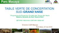
Sustainable Land Protection in the Upper Watersheds of Southwestern Haiti
- Links watershed protection, land management, program governance and donor-financed implementation.
- Shows the implementation baseline in May 2016 before Hurricane Matthew changed regional priorities.
- Complements the 2010 watershed papers and the 2017 post-Matthew Macaya assessment.
The document is a program-management view of environmental planning in the Macaya and southwestern watershed area. Its significance is not a single technical recommendation, but the way it links watershed protection, land management, program governance and donor-financed implementation in one portfolio. For the CIAT archive it complements earlier watershed papers from 2010 and the later post-Matthew Macaya deck: it shows what was under implementation in May 2016, before the hurricane altered both ecological conditions and coordination priorities.
How to cite
Government of Haiti; Ministry of the Environment (MDE); Ministry of Economy and Finance (MEF); Inter-American Development Bank (IDB); Interministerial Committee for Territorial Planning (CIAT), 2016, Sustainable Land Protection in the Upper Watersheds of Southwestern Haiti, http://ciat.gouv.ht/sites/default/files/articles/files/Pr%C3%A9sentation%20Parc%20National%20Macaya.pdf