
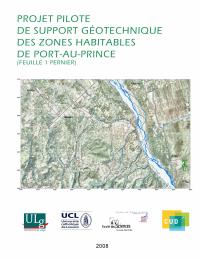
Pernier Zone 1: Explanatory Note
- The notice states its own limits before its results, and that is the finding to carry: geotechnical mapping is an orientation tool that makes no claim to perfect precision and does not relieve a planner of site-specific complementary investigation. A user who treats these sheets as a substitute for a site study is misusing them.
- Coverage is partial by design. This is part 1 of the project zone, 60 square kilometers, published as a first installment to be improved and updated as the remaining maps are produced.
- The knowledge base is dated November 2008, before the 12 January 2010 earthquake, so the sheet predates the microzonation work that followed it and should be read alongside rather than in place of the 2013 microzonation.
- The atlas is eight items, not one map: the geological map of Port-au-Prince, the project location map, the land-use map, the test-location map, the hydrographic map, the geological map of Pernier, the hydrogeological map, and this notice with interpretative cross-sections and annexes. The CD carries the annexes that the paper version does not.
- The stated purpose is anticipatory rather than descriptive. The maps are meant to govern which areas are urbanized and where works are sited, to warn builders of problems they will meet in execution, and to inform on the probable evolution of active phenomena such as erosion and water-table fluctuation.
- The work is a Belgian-financed university partnership, not a state program: a Targeted Interuniversity Project funded by the Commission Universitaire pour le Développement of the French Community of Belgium, led by the Faculty of Sciences of the State University of Haiti with Louvain and Liège, with LNBTP, BME and CNIGS supporting. LNBTP contributed its laboratory and the geotechnical data it held, and CNIGS the base cartography.
- The publication's aim is stated as pedagogic: to make a tool that is new for Haiti known to Haitians and to teach its use, which explains why the notice spends its opening pages on what geotechnical maps are for.
The explanatory notice to sheet 1, Pernier, of the geotechnical atlas produced under the pilot project for geotechnical support of the habitable zones of Port-au-Prince. Geotechnical mapping is presented as a graphical synthesis of the main geotechnical characteristics of the subsoil, intended to give planners, architects and civil engineers accessible documentation with which to study a project against the characteristics of its site.
The notice sets out three levels at which such maps intervene: they govern the choice of areas to urbanize and the siting of works such as roads, bridges and dams; they alert the builder to the problems likely to be met on the ground during execution; and they carry a predictive element, informing on the probable evolution of active phenomena such as erosion and water-table fluctuation.
The atlas comprises eight items: the geological map of Port-au-Prince, the project location map, the land-use map, the map locating the geotechnical and geophysical tests, the hydrographic map, the geological map of Pernier, the hydrogeological map, and this explanatory notice with its interpretative cross-sections and annexes. The paper document carries the notice and the seven maps drawn, while the CD reproduces the paper content plus the annexes.
The work covers only part 1 of the project zone, an area of 60 square kilometers, and is explicitly a first installment to be improved and updated as the other maps are produced. It reflects the state of the authors' knowledge in November 2008; the authors are D. Boisson (UEH), J.F. Thimus (UCL), K. Guerrier (UEH-UCL), B.J. Jean (UEH-UCL) and H. Saint Jean (UEH).
The notice carries its own warning, which is the part a user should read first: geotechnical mapping is an orientation tool that does not claim perfect precision, and in no case should it relieve the planner of carrying out complementary investigations suited to the particularities of a given site.
The institutional arrangement is a university partnership rather than a government program. It was produced under a Targeted Interuniversity Project financed by the Commission Universitaire pour le Développement of the French Community of Belgium, led by the Faculty of Sciences of the State University of Haiti with the Université catholique de Louvain and the Université de Liège, supported by LNBTP, BME and CNIGS, with CNIGS supplying the base maps and LNBTP its laboratory and existing geotechnical data. The stated aim of publishing on paper and digital support is to make this tool, new for Haiti, known to Haitians and to teach its use.
How to cite
National Laboratory for Buildings and Public Works (LNBTP), 2010, Pernier Zone 1: Explanatory Note, https://lnbtp.gouv.ht/publications/pernier/Notice explicative Zone 1 Pernier.pdf