
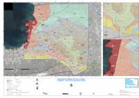
Seismic Microzonation Map of Port-au-Prince
Summary — Official LNBTP/MTPTCE seismic microzonation map for Port-au-Prince.
Key Findings
- The sheet is the published map itself rather than a report about it, so what it carries is the microzonation's zoning of seismic response for metropolitan Port-au-Prince in the form planners and designers are expected to use.
- It is the distribution artifact of the 2011 to 2013 BRGM, LNBTP and BME study, whose synthesis report, fact-sheet edition, geological and hazard maps and measurement annexes are all held separately in this corpus. Read it against the synthesis report for the definitions, the limits of validity and the precautions of use, which a map sheet cannot carry.
- The record is short for a reason that is a property of the file and not of the map: no text could be extracted from it, so nothing in the legend, the scale bar or the plate title is searchable, and the sheet cannot be described from its own content beyond what the title states.
How to cite
Laboratoire National du Batiment et des Travaux Publics (LNBTP), 2015, Seismic Microzonation Map of Port-au-Prince, http://www.mtptc.gouv.ht/media/upload/doc/publications/Carte_Microzonnage.pdf