
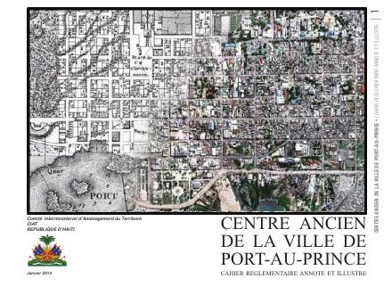
Historic Centre of Port-au-Prince: Annotated and Illustrated Regulatory Handbook
- This is a zone-level regulatory instrument for downtown Port-au-Prince, issued three years after the 2010 earthquake.
- Each zone carries stated intentions, permitted and prohibited uses, block-interior treatment and building placement rules.
- The commercial Bord-de-Mer zone is treated first in the sequence.
- The handbook is deliberately annotated and illustrated so non-specialists rebuilding downtown can actually apply it.
Three years after the January 2010 earthquake destroyed much of downtown Port-au-Prince, the reconstruction of the historic center needed a rule that said what could be built where. This CIAT handbook is that rule, presented in an annotated and illustrated form so that owners, professionals and municipal staff can read it without specialist training. It opens with a letter from the Mayor, then sets out the general orientations and the precise area of application, and then works zone by zone. For each zone it states the intentions behind the rule, the uses that are authorized and those that are prohibited, how the interiors of blocks are to be treated, and how buildings are to be placed on their plots, with further requirements following.
The commercial Bord-de-Mer zone leads the sequence. The choice to annotate and illustrate is substantive rather than cosmetic: a regulatory instrument for a rebuilding downtown only works if the people rebuilding can apply it, and Haiti's wider planning literature repeatedly identifies unreadable or absent urban documents as a cause of unregulated construction. This is one of the few zone-level regulatory instruments for a Haitian city in the public record.
How to cite
Government of Haiti; Interministerial Committee for Territorial Planning (CIAT), 2013, Historic Centre of Port-au-Prince: Annotated and Illustrated Regulatory Handbook, http://ciat.gouv.ht/sites/default/files/docs/Centre%20Ancien%20de%20la%20ville%20de%20port-au-Prince.pdf