Full Document Text
Extracted text from the original document for search indexing.
[page 1]
Ministère de l'Environnement Republique d’Haïti
=
The Protected Area of Managed Natural Resources
of the Three Bays (PA3B)
Management Plan
2017 - 2027
à ft sf * 7 LL À - TT 7
ee. … s F- ep
rat ms. à F AL
[page 2]
ii
Prepared by:
William D. Henwood, Serge Aucoin and Mel Turner
Global Parks / International Conservation Caucus Foundation
March, 2017
for
The National Agency of Protected Areas (ANAP), Haiti
and
the Caribbean Marine Biodiversity Program implemented by Fondation pour la
Protection de la Biodiversité Marine (FoProBiM), and The Nature Conservancy (TNC).
This management plan was made possible by the generous support of the American
people through the United States Agency for International Development (USAID).
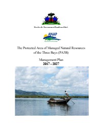
Cover Photo: Fishermen pole their boats in Baie Liberte. Photo credit: © Tim Calver for The
Nature Conservancy
Management plan of the Three Bays Protected Area
[page 3]
ii
ACKNOWLEDGEMENTS
The authors are particularly indebted to Jean Wiener, Founder/Director of the Fondation
pour la Protection de la Biodiversité Marine (FoProBiM) based in Caracol (Haiti) and
Maxene Atis, Conservation Coordinator of The Nature Conservancy Caribbean Program
in Miami (Florida) for their support and guidance in the preparation of this management
plan. Thanks are also due to FoProBiM staff in Haiti, most notably Claude Patrick Millet
and Widlin Florvil in Cap-Haïtien and Caracol who were especially helpful in the field.
Many thanks are also to be extended to all the local stakeholders, community groups,
NGOSs, and government officials, particularly the Minister of Environment Pierre Simon
Georges, the director of the National Protected Areas Agency (ANAP) Michelet Louis
and assistant director Prenor Coudo, who participated in consultative meetings and
provided important input and support. Appreciation is extended to Sonide Simon and her
staff for their assistance in conducting the stakeholders’ workshop in Caracol in May
2016, a meeting with government agencies and partners in Port-au-Prince in June 2016
and a subsequent stakeholders meeting at the Universite d’Etat d’Haiti Campus de
Limonade in January, 2017. Finally, this project would not have been possible without
support through the International Conservation Caucus Foundation (ICCF) and its
affiliate Global Parks in Washington, DC; San Juan, Puerto Rico; and Vancouver, British
Columbia, Canada.
Management plan of the Three Bays Protected Area
[page 4]
iv
LIST OF ACRONYMS
ANAP Agence nationale des Aires Protégées
BI Birdlife International
CBD Convention on Biological Diversity
CEPF Critical Ecosystem Partnership Fund
CEPROBAC Coordination Environnementale pour la Protection de la Baie de Caracol
CCVI Climate Change Vulnerability Index
CMBP Caribbean Marine Biodiversity Program
CIAT Comité Interministériel d'Aménagement du Territoire
CITES Convention on International Trade in Endangered Species of Wild Flora
and Fauna
CLME Caribbean Large Marine Ecosystem Project
CNIGS Centre National de l'Information Géo-Spatiale
DR Dominican Republic
EBA Endemic Bird Area
EBSA Ecologically or Biologically Significant Marine Area
ESA U.S. Endangered Species Act
FoProBiM Fondation pour la Protection de la Biodiversité Marine
GDP Gross Domestic Product
GEF Global Environment Facility
IBA Important Bird Area
IDB Inter-American Development Bank
ICCF International Conservation Caucus Foundation
ICRI International Coral Reef Initiative
IPCC International Panel on Climate Change
ISPAN Institut de Sauvegarde du Patrimoine National
IUCN International Union for Conservation of Nature
KBA Key Biodiversity Area
LDC Least Developed Country
MIDA Muiti-International Designated Areas
MMA Marine Managed Area
MOE Ministry of Environment
MOT Ministry of Tourism
MPA Marine Protected Area
NBSAP National Biodiversity Strategy and Action Plan
NGO Non-Governmental Organisation
PA3B Protected Area of Managed Natural Resources of the Three Bays
PIC Parc Industriel de Caracol
PMA PA3B Management Authority
Management plan of the Three Bays Protected Area
[page 5]
v
PPT Parts Per Thousand
SCUBA Self Contained Underwater Breathing Apparatus
SEMANAH Service Maritime et de Navigation d'Haïti (SEMANAH)
SIDS Small Island Developing State
SPAW Specially Protected Areas and Wildlife
SAP Strategic Action Plan
TNC The Nature Conservancy
UGeBFo Unité de Gestion de la Baie de Ft. Liberté
UN United Nations
UNESCO United Nations Education, Scientific and Cultural Organization
UNEP United Nations Environment Programme
UNDP United Nations Development Programme
USAID United States Agency for International Development
UTE Unité Technique d’Exécution
WCR Wider Caribbean Region
WHC World Heritage Convention
WRI World Resources Institute
Management plan of the Three Bays Protected Area
[page 6]
vi
TABLE OF CONTENTS
Page
Acknowledgements ii
List of Acronyms iii
Table of Contents V
List of Tables and Figures viii
Executive Summary ix
1.0 Introduction 1
1.1 Purpose and Scope of the Management Plan 2
12 The Management Planning Process and Methodology 3
1.3 Key Indicators of Success 5
2.0 Regional, National, and International Context 6
2.1 Location and Administrative Boundary 6
2.2 Socio-Economic Context of the Region and Local Communities 7
2.2.1 Economic Activities 7
2.2.2 Transportation Infrastructure 10
2.2.3 Demographic Trends 10
2.3 Land Tenure and Ownership 12
2.4 Boundary Related Issues 12
2.5 Legal and Policy Framework and Management Authority 13
2.6 Regional and Global Biological Significance 13
2.7 International Agreements and Obligations 15
2.8 The Implications of IUCN Category VI 15
3.0 Physical Environment and Biological Resource Descriptions 17
3.1 Physical Environment 17
3.1.1 Climate, Weather Systems and Trends 17
3.1.2 Geology, Relief and Soils 18
3.1.3 Hydrology and Oceanography 20
3.1.4 Natural Hazards 22
3.2 Biological Resources 22
3.2.1 Overview of Terrestrial and Freshwater Habitats
and Ecosystems 23
3.2.1.1 Freshwater Fauna 26
3.2.1.2 Avian Species 26
3.2.1.3 Terrestrial Reptiles and Amphibians 26
3.2.1.4 Terrestrial Mammals 26
3.2.2 Overview of Marine Habitats and Ecosystems 26
3.2.2.1 Mangroves, Seagrass and Coastal Wetlands 27
Management plan of the Three Bays Protected Area
[page 7]
vii
3.2.2.2 Coral Reefs 30
3.2.2.3 Marine Benthic Invertebrates 31
3.2.2.4 Marine Fish and Megafauna 31
3.3 Unique, Rare, and Species at Risk 32
4.0 Historical and Cultural Values 36
4.1 Features of Historical and Cultural Interest 36
5.0 Threats and Issues Analysis with Key Findings 39
5.1 Prognosis for Climate Change Related Impacts for PA3B 39
5.1.1 Implications for Community Growth and Development
within PA3B 42
5.2 Description of Major Threats to PA3B 45
5.2.1 Overfishing 46
5.2.2 Wood Harvesting and Charcoal Production 47
5.2.3 Land-based Sources of Pollution 48
5.2.4 Unsustainable Coastal Development 49
5.2.5 Agriculture 50
5.2.6 Aquaculture and Caged Fish Farming 51
5.2.7 Invasive Species 51
5.2.8 Salt Production 52
5.2.9 Hunting 53
52.10 Sport Fishing 54
52.11 Mining 54
5.2.12 Proposed Sisal Plantation 54
5.2.13 Proposed Dump Site in Limonade 55
5.2.14 Other Risks: The Caracol Industrial Park (PIC) 55
5.3 Toward an Ecotourism Development Strategy for PA3B 57
5.3.1 An Initial Focus on Fort Liberté 58
5.3.2 Benefits of Multiple National and International
Designated Areas 59
5.3.3 Consideration of a World Heritage Site 60
6.0 Vision, Zoning and Management Programs 62
6.1 A Vision for PA3B 62
6.2 The Zoning Plan 62
6.2.1 Description and Rationale for the Zoning Plan 63
6.2.1.1 The Restoration Zone 63
6.2.1.2 The Conservation Zone 64
6.2.1.3 The Sustainable Use Zone 65
6.2.1.4 The Community Management Zone 65
6.2.1.5 The Cultural Conservation Zone 69
6.2.3 Implementation of the Zoning Plan 69
Management plan of the Three Bays Protected Area
[page 8]
viii
6.3 Management Programs, Goals, Objectives and Actions 71
6.3.1 The Biodiversity Conservation Program 72
6.3.1.1 Objectives and Actions 72
6.3.2 The Sustainable Resource Use Program 76
6.3.2.1 Objectives and Actions 77
6.3.3 The Environmental Education and Awareness Program 81
6.3.3.1 Objectives and Actions 81
6.3.4 The Cultural Resource Conservation Program 83
6.3.4.1 Objectives and Actions 83
6.3.5 The Ecotourism Program 86
6.3.5.1 Objectives and Actions 86
6.3.6 The Community Management Program 89
6.3.6.1 Objectives and Actions 90
6.3.7 Governance, Co-management and Enforcement Program 92
6.3.7.1 Objectives and Actions 92
6.3.8 The Infrastructure Program 94
6.3.8.1 Objectives and Actions 95
6.3.9 The Monitoring Program 95
6.3.9.1 Objectives and Actions 96
7.0 A Model for Cooperative Management of PA3B 97
8.0 An Implementation Plan for Phase I (2017-2022) 98
REFERENCES 108
APPENDICES
APPENDKX 1 The Presidential Decree 116
APPENDIX 2 Summary of Results of Community, Stakeholder
and Government Consultations 120
APPENDKX 3 International Agreements and Obligations 126
APPENDIX 4 Plants Surveyed 129
APPENDIKX 5 Wetland Plant Species Surveyed 130
APPENDKX 6 Freshwater Fauna Surveyed 131
APPENDKX 7 Birds Surveyed 132
APPENDKX 8 Reptiles and Amphibians Surveyed 133
APPENDIX 9 Marine Benthic Invertebrates Surveyed 134
APPENDIX 10 Marine Megafauna 136
APPENDKX 11 Marine Fish Surveyed 137
Management plan of the Three Bays Protected Area
[page 9]
ix
LIST OF TABLES AND FIGURES
Figures Page
Figure 1: PA3B boundary limits, administrative departments and communities 6
Figure 2: Agricultural lands within PA3B 8
Figure 3: Existing road network in PA3B and the surrounding region 10
Figure 4: Projections of the population base for slow and high growth scenarios 11
Figure 5: Bathymetric map of PA3B 19
Figure 6: The four watersheds of PA3B 20
Figure 7: Land cover and land use within PA3B 25
Figure 8: Vegetation types in PA3B 28
Figure 9: Aquatic and benthic habitats in PA3B 29
Figure 10: Cultural sites in Northern Haïti within PA3B 36
Figure 11: Depiction of the construction of the fort of La Navidad 37
Figure 12: An early map showing the possible location of La Navidad
and wreck site of the Santa Maria 37
Figure 13: Fort La Bouque built in 1736 at the entrance to Fort Liberté Bay 38
Figure 14: A French fortification at the mouth of the Massacre River 38
Figure 15: Hurricane Matthew in 2016 40
Figure 16: Coastal flooding for a 50-year return storm event 41
Figure 17: Main land uses and areas of high risk of flooding in Bord de Mer de Limonade 43
Figure 18: Main land uses and areas of high flooding risk in Caracol 44
Figure 19: Main land uses and areas of high flooding risk in Jacquezy 44
Figure 20: Preferred location for consolidating new urban development in the PIC area 56
Figure 21: The Zoning Plan for PA3B 68
Figure 22: A Proposed Model for Cooperative Management of PA3B 93
Tables
Table 1: International Recognition of the PA3B Area 14
Table 2: Principle watersheds and their characteristics 21
Table 3: PA3B habitat types and area 22
Table 4: Land cover within PA3B 23
Table 5: Marine classification and estimated benthic habitat area in PA3B 30
Table 6: Coastal marine mammals and sea turtles at risk 32
Table 7: Surveyed coral species at risk in PA3B 32
Table 8: Surveyed marine fish species at risk in PA3B 33
Table 9: Surveyed freshwater fish species at risk in PA3B 34
Table 10: Surveyed terrestrial reptile and amphibian species at risk in PA3B 34
Table 11: Surveyed terrestrial plant species at risk and expected to occur in PA3B 35
Table 12: Surveyed birds at risk in PA3B 35
Table 13: The Proposed Zoning System for PA3B 66
Table 14: The Size and Relative Proportion of Zones Within PA3B 69
Table 15: The Implementation of Phase I (2017-2022) 94
Management plan of the Three Bays Protected Area
[page 10]
X
EXECUTIVE SUMMARY
The Protected Area of Managed Natural Resources of the Three Bays (PA3B) (Aire
Protégée de Ressources Naturelles Gérées des Trois Baies - AP3B) was created by
Presidential Decree on March 21, 2014 as Haiti’s largest marine protected area.
Encompassing an area of 75,406 hectares, the PA3B protects a unique marine complex of
fringing and barrier coral reefs, seagrass beds, mangrove forests, deep offshore waters, and
adjoining coastal plains known for their diverse aquatic and brackish water habitats, and
dry tropical forests. The area has witnessed centuries of human activity dating from pre-
Columbian times and the occupation of indigenous Taino people, to the arrival of
Christopher Columbus and the sequence of world-altering events through Spanish and
French colonization and the Haitian Revolution.
These many centuries of human occupation have created a seascape and landscape that are
highly altered from their natural state, and as required by the Presidential Decree, the
management of the marine and terrestrial environments of PA3B will focus on the
maintenance and restoration of their biodiversity and ecological integrity while responding
to the needs of the communities within the protected area’s borders. Therein lies the central
challenge of this management plan — to guide the transition from a highly and unsustainably
utilized environment, with its attendant poverty and poor living conditions, to a protected
area characterized by sound environmental management, economic viability, and social
balance.
In its description of the regional, national, and international context for PA3B, this plan
emphasizes the need for the protected area to ‘find its place’ among a host of pre-existing
conditions, not the least of which are the presence of several communities and a range of
economic activities that have existed for long periods of time. These conditions create
challenges with respect to uncertainty about ongoing resource use, land ownership and
boundary delineation, and an appropriate form of governance. In addition to the PA3B’s
regional and national significance, the area’s international importance is recognized as is
its potential to become a natural and cultural resource of global renown through possible
designation as a national park and/or a World Heritage Site.
This plan progresses through a description of the physical environment and biological
resources of PA3B, both marine and terrestrial, noting, in particular, the special and unique
features and those of conservation concern that will require directed management attention
over the coming years and decades. The extensive and often unrecognized cultural
resources of PA3B are also described with the view of increasing their profile in the
management framework for PA3B and in accordance with their international caliber and
significance.
Management plan of the Three Bays Protected Area
[page 11]
xi
The management plan directly addresses all of the threats and issues that had previously
been identified through a comprehensive analysis of conditions that may constrain or
compromise PA3B’s management into the future. As an overarching concern, the plan
addresses the need to prepare for what now appears to be the inevitable impacts of climate
change. Within that context, a number of threats and issues are described and ‘key
findings’ identified that, in turn, form the basis of both the Vision and the Zoning Plan, and
drive the development of nine management programs and their goals, objectives, and
strategic actions.
A long-term Vision is presented for PA3B that is a reflection of both the Decree and the
management of PA3B as an IUCN Category VI protected area. Accordingly, PA3B will
provide for a range of levels of protection and conservation as well as sustainable human
uses and activities that are compatible with the conservation of nature. The Vision is:
The ecologically rich and fragile marine, coastal, and terrestrial resources in the
PA3B, most notably the complex of coral reefs, seagrass beds, mangrove forests,
aquatic habitats and tropical dry forests, with their associated archaeological and
historic features, are assured their long-term protection and the maintenance of their
biological diversity in perpetuity, while, in this spirit, providing for the sustainable use
of select resources in support of local communities.
The plan presents a Zoning System for the management of PA3B that includes five zones.
The resulting zoning plan seeks a balance between the conservation and protection of
natural resources and their continued sustainable use and includes:
e Regeneration Zones
e Conservation Zones
e Sustainable Use Zones
e Community Management Zones
e Cultural Conservation Zones
The Regeneration and the Conservation zones, will apply equally in both the marine and
terrestrial environments. The other three zones, Sustainable Use, Community Management
and Cultural Conservation, are solely terrestrial. Much of the terrestrial Restoration Zone
is dedicated to the protection of the coastal fringe adjacent to fragile marine environments
and to the recovery of the Tropical Dry Forest. In the marine environment, the Restoration
Zone includes the mangrove forests, most seagrass beds and a significant portion of the
nearshore marine waters and coral reefs. A relatively small portion of the offshore waters
will also be placed in the Restoration Zone. The remaining portions of the marine waters
Within PA3B are included in the Conservation Zone where limited fishing can continue to
occur.
Management plan of the Three Bays Protected Area
[page 12]
xii
The Sustainable Use Zone is restricted to the agricultural lands and the salt pans along the
coast to provide for their continued use but with limits on their expansion and the scope of
activities and management practices to ensure sustainability. The Community
Development Zone recognizes those communities within PA3B’s boundaries and the need
for their ongoing management, especially given the possible impacts of climate change and
sea level rise. The Cultural Conservation Zone contains significant cultural resources and
are identified as ‘spot zones” to recognize specific features, such as the fortifications at Fort
Liberté, pre-Columbian archaeological sites or shipwreck sites on the coral reef. The table
below illustrates the size and relative proportion of the zones within the whole of PA3B.
* Size and proportion figures are approximate. The spot zones in the Cultural
Conservation Zone are not included.
The plan presents a total of nine management programs with approximately 120 specific
actions to be implemented, to the extent possible, over the life of the plan. The nine
management programs include:
1. Biodiversity Conservation
2. Environmental Education and Awareness
3. Sustainable Resource Use
4. Cultural Resource Conservation
5. Ecotourism
6. Community Management
7. Governance, Co-management and Enforcement
8. Infrastructure
9. Monitoring
Through these programs, the plan presents an assembly of management actions necessary
to realize the ultimate goal of achieving the recovery and restoration of the PA3B’s
ecosystems, as well as the many ancillary goals of effectively recognizing its cultural
resources, creating the means for a cooperative management regime with stakeholders and
Management plan of the Three Bays Protected Area
[page 13]
xiii
communities, promoting ecotourism and others. The plan has a time horizon of ten years
(2017-2027) with an interim five-year review, but it is recognized that the successful
implementation of a number of programs and actions will extend well into the future.
The plan will be undertaken in phases based on continued consultations with communities
and stakeholders and the availability of human, technical and financial resources. An
implementation plan for Phase I (2017-2022) is provided that targets those actions that
should be initiated immediately and over the first five years at an estimated cost of
approximately US$12.5 million.
Management plan of the Three Bays Protected Area
[page 14]
1.0 INTRODUCTION
Haïti is an active participant in a regional initiative designed to improve the conservation
and protection of the marine environment in the wider Caribbean. The 5-year, US$12.5
million Caribbean Marine Biodiversity Program (CMBP) was announced by the United
States Agency for International Development (USAID) in 2015 with the overall objective
of reducing threats to marine and coastal biodiversity in seven priority marine managed
areas (MMASs) in four priority seascapes located in Haïti, the Dominican Republic,
Grenada, St. Vincent and the Grenadines and Jamaica. These seascapes are recognized as
the “jewels in the crown of marine resources in the Caribbean” and feature high
biodiversity ecosystems such as coral reefs, mangroves and seagrass beds. CMBP
supports the effective governance of these marine resources in order to: achieve sustained
biodiversity conservation, maintain critical ecosystem services; strengthen fisheries
management; maintain economic benefits and sustainable livelihoods derived from a
healthy marine environment; and realize tangible improvements in human wellbeing for
communities adjacent to and dependent on these marine managed areas (USAID, 2015).
In Haiti, the priority seascape is known as the “Protected Area of Managed Natural
Resources of the Three Bays” (PA3B) on Haïiti’s north-east coast. The Government of
Haïti created the PA3B, the largest protected area in its history, by Presidential Decree on
March 21, 2014 (see Appendix 1). The PA3B is 75,406 ha in size, and contains some of
the most extensive and healthiest fringing and barrier coral reefs, seagrass beds, mangrove
forests and other marine coastal habitats in the country. Many of the fish and other marine
life in this area serve as critically important sources of protein for local communities. The
marine habitats also provide local communities with critical coastal protection.
While the CMBP is primarily funded by USAID (US$10 million), The Nature Conservancy
(TN) is also a major funder, contributing US$2.5 million, and serves as the leader of a
non-government (NGO) consortium to implement the Program. Also providing support is
the local implementing partner in Haïti, the Fondation pour la Protection de la Biodiversité
Marine (FoProBiM), which, with the assistance of the US-based International
Conservation Caucus Foundation and its affiliate Global Parks, was charged with the
responsibility of preparing this management plan for the PA3B. Global Parks is a volunteer
organization based in Washington, DC providing protected area experts to assist
government and non-government organizations on protected area issues. The plan is
prepared for Haiti’s National Agency of Protected Areas (ANAP) which will be
responsible for the ongoing management and administration of PA3B.
[page 15]
2
1.1 Purpose and Scope of the Management Plan
The management of PA3B as a protected area will represent dramatic change for Haiti’s
north-east coast and for its communities and ecosystems. The purpose of this management
plan is to facilitate that change over the next decade and beyond by guiding the transition
from a coastal and marine ecosystem that has been settled for centuries and that is in
continuing ecological decline with communities facing a fragile and uncertain future, to a
protected area characterized by sound environmental management, economic viability and
social balance.
This mission is mandated by the Presidential Decree to create the PA3B, Article 1 of which
outlines in specific terms what is expected:
“The marine complex, coastal and terrestrial, located in the eastern half of the
northern coast of Haiti is declared a protected area under the name of "protected
area of managed natural resources of the Three Bays” (Aire Protégée de
Ressources Naturelles Gérées des Trois Baies). It is composed of natural systems
for which the long-term protection must be ensured and the biological diversity
maintained, while responding to the needs of the communities dependent on these
systems.”
Fulfilling this vision is a significant conservation challenge. The management of PA3B
needs to lead the restoration and regeneration of Haiti’s environment in the north-east
region, and in so doing, help to alleviate poverty, improve living conditions, support
alternative livelihoods and provide improved governance, administration and financial
sustainability. As an overarching concern, it also needs to prepare for what now appears
to be the inevitable impacts of climate change.
Accordingly, the management plan pursues the implementation of a number of initiatives
simultaneously, all of which are necessary for long-term environmental and social health
of PA3B. There are numerous threats to coastal and marine ecosystems that threaten their
long-term ecological integrity. There are economic activities, in particular fishing and
agriculture, that are not sustainable as currently practiced. Community development and
growth are unregulated, living conditions are poor, security of food and water is low and
prospects for future livelihoods are uncertain. The local governance regime lacks strength
and leadership, there is little or no law enforcement, and little coordination exists among
the various communities and levels of government. The effective management of PA3B
needs to address all of these issues and more, and be a cooperative effort among ANAP,
local stakeholders and potential NGO partners to strengthen the management of PA3B and
the conservation of its natural resources.
Management plan of the Three Bays Protected Area
[page 16]
3
While generally following the IUCN’s Guidelines for Management Planning of Protected
Areas (Thomas and Middleton, 2003), the structure of this management plan is a close
reflection of the structure preferred by ANAP (ANAP, 2016). The timeframe for this
management plan is for a ten-year period — 2017 to 2027 — with a five-year review. The
purpose of the five-year review is to re-visit the management plan with an in-depth
consultation program to review progress on the plan’s implementation and revise direction
as necessary without undertaking a full management planning process.
The plan presents a comprehensive assembly of management programs and actions
necessary to achieve the ultimate goal of achieving the recovery and restoration of the
PA3B’s ecosystems. It is recognized that all cannot be accomplished during the ten-year
timeframe of the plan and that its implementation will likely extend well into the future.
The plan should be undertaken in phases based on continued consultations with
communities, stakeholders and government officials and on the availability of human,
technical and financial resources. The full effect of the plan will likely take decades to
emerge and strategies for implementation will evolve over time as conditions change. A
plan for the implementation of Phase I (2017-2022), for those programs and actions that
should be initiated immediately and over the first five years, is outlined in Section 8.
1.2 The Management Planning Process and Methodology
In 2012 a process for developing a management plan for the area which would become the
PA3B began with the formation of a Steering Committee (Comité de Suivi) in Port-au-
Prince among agencies of the Government of Haiti and the main donors involved in the
funding and implementation of PA3B. This committee met regularly and provided senior
level guidance for the management planning process and coordination of preliminary
initiatives that would lead to the management of the PA3B. This committee is composed
of representatives of key entities, chaired by the National Agency of Protected Areas
(ANAP), and includes the United States Agency for International Development (USAID),
the Inter-American Development Bank (IDB), the Ministry of Environment (MOE), the
United Nations Development Programme (UNDP), Marine and Navigational Services of
Haiti (SEMANAH), the Technical Execution Unit (UTE) of the Ministry of Economy and
Finance, and Haïiti’s Inter-ministerial Committee for Territorial Planning (CIAT). Other
institutions and government departments occasionally participate depending on the agenda
to be addressed.
In 2014 and 2015, with the inception of the USAID-sponsored CMBP and the IDB-
sponsored ecological baseline assessment ANAP, in collaboration with TNC, FOPROBIM
and members of the Steering Committee held consultations with local stakeholders in an
attempt to create a local Stakeholder’s Committee for the park (Comite d’ Appui).
Management plan of the Three Bays Protected Area
[page 17]
4
The process has been assisted through the completion of a number of studies by TNC and
financed by USAID and the IDB during 2015 and early 2016. These include:
e Baseline Ecological Inventory (Kramer et al., 2016a)
e Threat Assessment (Schill et al., 2016)
e Fisheries Sector Assessment (Miller, 2015)
e Fisheries Sector Action Plan (Miller, 2016)
e Stakeholders’ Assessment (TNC, 2015)
e _Ecological Monitoring Plan (Kramer et al., 2016c).
In early 2016, arrangements were made with Global Parks to initiate the management
planning process beginning with a desktop review of these and other background materials
and an initial field visit during the week of April 4-9 to understand context and the needs
of local communities and stakeholders. Information gaps were identified and information
gathered, to the extent possible, to fill these gaps. An interim report and background
materials were prepared for stakeholder consultations and meetings with the Steering
Committee held in May and early June 2016.
A stakeholder workshop was held in Caracol, Haïti on May 31, 2016; and attracted 71
participants representing a number of economic sectors from several local communities,
including fishers, merchants, charcoal producers, salt producers, religious leaders and
government officials. The focus of the workshop was to continue to inform participants
about the establishment of PA3B and to introduce a draft vision and management
objectives including a proposed zoning system and proposed targets for resource
conservation. The management objectives addressed the topics of Resource Conservation
and Protection; Sustainable Resource Use; Heritage (Cultural) Conservation and
Presentation, Recreation and Tourism; Collaboration with Local Communities; and
Governance and Law Enforcement. Five group sessions were held to further define the
vision for the Park where the stakeholders outlined what they deemed important to be
actualized in PA3B. They also raised concerns, offered suggestions and prioritized the
principles within the management objectives. Participants found the workshop to be highly
relevant and useful and an essential step in the development of the management plan.
Highlights from this workshop are provided in Appendix 2 and a detailed report on the
outcomes of the workshop is available from TNC (Simon, 2016àa).
The meeting with government agencies and partners (Comite de Suivi) was held in Port-
au-Prince on June 2, 2016; and was attended by 11 participants from Haiti’s Ministry of
Environment, the Technical Execution Unit of the Ministry of Economy and Finance, and
key institutions including the United Nations Environment Programme and the Inter-
American Development Bank. The meeting addressed the same material as was discussed
Management plan of the Three Bays Protected Area
[page 18]
5
at the stakeholders' workshop as well as provided a brief summary of the results of the
workshop. It adopted a round table approach that allowed participants to ask questions for
clarification, provide constructive criticism and suggest amendments. Highlights from this
workshop are provided in Appendix 2 and a detailed report on the outcomes of the meeting
is available from TNC (Simon, 2016b).
In late 2016, ANAP established the local stakeholder’s committee. However, this
committee has yet to become fully functional.
The first draft of the plan was completed in September, 2016. Further inter-agency reviews
and meetings with local stakeholders were held by through the autumn months leading to
the preparation of a revised version of the plan. for further consultation with stakeholders
and community organizations and the Steering Committee. À meeting was held on January
25, 2017 hosted by FoProBiM and TNC at the Université d’Etat d'Haïti Campus du
Limonade with approximately 120 people, representing numerous stakeholders,
communities and organizations as well as ANAP. A report on the outcomes of this meeting
has been prepared; the highlights of concerns presented during the meeting and discussion
are provided in Appendix 2.
1.3 Key Indicators of Success
The Presidential Decree for PA3B and the Vision that is derived from it (see Section 6)
clearly outline the conditions upon which the success of this and subsequent management
plans can be determined, through asking two key questions:
e Are the fragile resources of PA3B being managed to ensure their long-term
protection and the maintenance of their biological diversity in perpetuity?
e Are the resources of PA3B continuing to provide for the support of local
communities in a sustainable way?
The timeframe for this management plan is ten years, with a five-year review, and over that
time, a monitoring program will be put in place designed to inform protected area managers
about trends in the use and condition of natural resources in PA3B that, in turn, will provide
guidance in answering these questions (see Section 6.3.9). The monitoring program will not
only assist protected area managers in measuring resources” response to management
initiatives, but also raise awareness among the communities and stakeholders about the
importance of PA3B and measure changes in their attitudes on specific issues such as
management of fisheries, the protection of mangroves or community planning.
The key indicators for monitoring the marine, freshwater and terrestrial environments in
PA3B are outlined in the Ecological Monitoring Plan for PA3B (Kramer et al, 2016b). In
the marine environment, they include monitoring for water quality, the quality and health
Management plan of the Three Bays Protected Area
[page 19]
6
of shallow marine environments including such parameters as habitat loss, coral cover,
seagrass productivity and the health of marine species, especially reef fish species and their
abundance, diversity and size. In freshwater environments, monitoring focuses on
hydrology, water quality, sediment quality and aquatic biology. The monitoring of
terrestrial ecosystems, where the greatest losses in habitat and species has occurred,
measures climatic factors, habitat health and species presence and absence for flora and
fauna. It is here where the monitoring plan needs to pay particular attention to measuring
stakeholder’s awareness of the importance of the remaining terrestrial resources and any
changes in their attitudes about specific management initiatives to help restore terrestrial
ecosystems.
2.0 REGIONAL, NATIONAL AND INTERNATIONAL CONTEXT
2.1 Location and Administrative Boundary
The PA3B is located on the north-east coast of Haïti with the boundary and local
communities illustrated in Figure 1 (see Appendix 1—Article 3 for boundary coordinates).
The PA3B has a boundary perimeter of approximately 170 kilometers (km) encompassing
75,406 hectares (ha) (Section 3.2—Table 3). The east-west boundary extends for over 40
km from Rivière du Massacre (bordering the Dominican Republic border, where it is
known as ‘rio Dajabôn') to the Grande Rivière du Nord to the west. The north-south
boundary extends from the 12-mile (19.3 km) territorial sea limit inland to the 10-metre
topographic contour line.
fl \
<
CRÉOTLRES “Dominican
5 Haiti 7% Republic À
Figure 1: PA3B boundary limits and communities.
Management plan of the Three Bays Protected Area
[page 20]
7
The western boundary is near Cap-Haïtien, Haiti’s second largest city and capital of the
Departement du Nord, served by Hugo Châvez International Airport and the Port
international du Cap-Haïtien. The eastern boundary includes Fort Liberté, the capital ofthe
Departement du Nord-est, and is directly adjacent to the ‘Parque Nacional Manglares de
Estero Balsa' in the Dominican Republic (DR), near the city of 'San Fernando de Monte
Cristi', national parks ‘Parque Nacional Submarino de Monte Cristi', Parque Nacional el
Morro, ‘Parque Nacional Manglares del Estero Balso', marine refuge ‘'Cayos Sietes
Hermanos' and wildlife refuge "Laguna Saladilla'.
2.2 Socio-Economic Context of the Region and Local Communities
PA3B spans across the administrative boundaries of the Department du Nord-est and the
Department du Nord whose combined population is approximately 500,000. With Haiti’s
population growth rate of 2.5%, this population is anticipated to increase to 600,000 —
800,000 people by 2030 (ERM, 2015; IDB, 2012b), depending on development scenarios
(see Section 2.2.3). Most of this growth would occur around the Caracol Industrial Park
(PIC) and in Limonade, Trou-du-Nord, Terrier Rouge and Fort Liberté, and could have
significant implications for the management of PA3B. Several regional plans have been
prepared to attempt to guide this impending population growth in Haiti’s north-east in a
rational manner and will be an important ally to this management plan as PA3B copes with
the impacts of rapidly increasing development around its boundaries (IDB, 2012b; ERM,
2015).
2.2.1 Economic Activities
Overall, the area within the region surrounding PA3B is rural, exhibiting mostly traditional
land use patterns of small to medium-sized family farming operations combined with larger
plantations. These rural areas are supported by the four main towns of Limonade, Trou-du-
Nord, Terrier Rouge and Fort Liberté, the largest communities within the region, along
with smaller, mostly coastal fishing communities of Bord de Mer de Limonade, Caracol,
Madras, Jacquezy, Phaeton and Derac. A total of 25.5% of the population are involved in
the ‘informal employment sector’, 18% in agriculture, 13.4% in fishing, 12.5% raising
livestock, 11.5% in formal employment (including in the PIC), 9.4% in the trade of
charcoal and wood and 0.8% in salt production (unpublished BRL, 2016).
Within the protected area, approximately 3,000 fishers use the waters for their daily
subsistence and almost 1,000 fishers live in the protected area. Some 800 boats, most
propelled by oar and sail, provide access to the fishing grounds. Another 233 boats and
480 fishers occur in the neighboring province of Monte Cristi (Dominican Republic), with
occasional reports of fishing within territorial waters of Haïti. The waters of PA3B are
Management plan of the Three Bays Protected Area
[page 21]
8
heavily overfished by net, line, traps and spear and the species caught are generally
undersized. However, the need for subsistence fishing continues to exist. In addition, other
species such as the American eel and sea cucumbers are being harvested for offshore
markets and a tilapia aquaculture project initiated in Lagon aux Boeufs in the past could
happen again in the near future (Miller, 2015).
Overfishing has affected the seagrass, coral reef, and mangrove ecosystems of the PA3B
and has resulted in the depletion of the fisheries including macro-invertebrate species such
as conch, lobster, and sea cucumbers. All of these impacts will need to be addressed, likely
through enforced selected area, species and/or time closures, gear restrictions and
alternative fish production, including mariculture and aquaculture, if the protected area is
to meet basic conservation goals and continue to provide livelihoods for the communities.
There are 12 fishing associations operating in the protected area and FoProBiM has
established two stakeholder groups (CEPROBAC and UGeBFo) to provide oversight to
their fishing activities, to build capacity, and to provide input into the protected area’s
management (Miller, 2015).
With respect to agriculture, much of the terrestrial component of the protected area is or
has been devoted to agriculture over many decades. Figure 2 shows the extent of the
agricultural area within and adjacent to the protected area.
Management plan of the Three Bays Protected Area
[page 22]
9
= Residential
ùS
ES Agriculture
LL. Mangroves
D Salt Ponds
ÈS Park Boundary
LS Rivers
\, Roads Primary
1 “A on DS Roads Secondary /\
Sn : N
À *e
> \ " _ ——
F4 SE
Un ER
K é | 4 D 4 CN
à Ë Lie: ÿ Mr, . . 1.1 D Ze Éo
æ e ? ) se ns #5 a >: g a, à
Ra * À Si ë À CEE LS FI
\ À 8x A | DR: je il
i À L rs FRE £ 4 PAPE A à
2.2 + F À Ér EN 2 A MC
Figure 2: Agricultural lands within PA3B and within watershed drainages that flow into PA3B
(Kramer et al., 2016b)
Most of the agriculture practiced in the protected area is subsistence in nature where fruits
and vegetables (e.g. plantain, cassava) and livestock are produced primarily for personal
and local consumption. There are also commercial scale operations in the form of larger
plantations of sisal, banana, citrus fruits and sugar cane. The majority of farmers are
reported to own their land (ERM, 2016). The grazing of cattle and goats primarily occurs
on the areas that were once used for sisal production, mostly on the two peninsulas that
form the northern part of Fort Liberté Bay.
Charcoal production within the protected area focuses on the mangroves and the upland
species, primarily the aggressive successional needle bush (Acacia farnesiana) that has
rapidly spread across much of the area formerly used for sisal production. Botanists at this
time are actively debating whether À. farnesiana is native or an introduced invasive
species. Regardless, its aggressive nature is of concern and may hinder the restoration of a
more heterogeneous native vegetation over the short term. The harvesting of mangroves
is prohibited by the Arrêté Ministériel of July, 2013 and will be reinforced within PA3B
by zoning, access restrictions and enforcement as the protected area becomes managed on
a day-to-day basis. Charcoal production using the rapid growing woody species Acacia
farnesiana in appropriately zoned areas may be considered in an effort to support
livelihoods and communities as well as managing local biodiversity.
Management plan of the Three Bays Protected Area
[page 23]
10
Relatively few households are involved in salt production, with most activity occurring in
Madras, Caracol, Jacquezyl and Derac. Salt ponds, occupying some 140 ha, are constrained
by climatic conditions and flooding, poor prices, and an unskilled labour force (ERM,
2015).
The Caracol Industrial Park (PIC) is anticipating the need for about 20,000 workers once
it reaches full capacity in 2020. Presently, approximately 9,000 people are employed in the
garment, sisal and paint industries in the PIC. The potential impact of the industrial park
on PA3B as it relates to the liquid and solid wastes generated by the industrial park has
been assessed in the past and will continue to be monitored into the future (Koios
Associates LLC, 2011; ENVIRON, 2011; Wiener et al., 2013; Titan Engineering Inc.,
2013).
Tourism presently plays a minor role in the protected area but the very designation of the
protected area and the significant natural and cultural values, coupled with the international
air access to Cap Haïitian, will focus attention and interest in the future. The potential role
of tourism, in both type and location, as well as recreation for the local communities is
addressed in the management plan.
2.2.2 Transportation Infrastructure
The protected area is accessed by the National Road #6 (RN6) paved highway from Cap
Haitian on the west to the DR border to the east as shown in Figure 3. Currently Cap
Haitian can be accessed by air with American Airlines from the east coast of the United
States and from other regional airlines in the Caribbean. Paved roads lead to the main
villages and gravel roads to various other areas along the coast, including the beach access
at the mouth of Rivière du Massacre at the eastern end of the protected area to the Grande
Rivière du Nord at the western end. There are many kilometers of tertiary roads on either
side of the sea entrance to Fort Liberté Bay that resulted from the former sisal operation.
Management plan of the Three Bays Protected Area
[page 24]
11
Ross Primary AA
2 Rosds Secondary Z 21
*0s Rosds Teriary /'\,/1
F 2At RIT SE Park Boundary
PASS “a il ' (f fie $ Fe nai o
LE 28 KT ik: 2
er Nr Ba Gi d ‘ LE NN LA CRD ‘7
1e " 2 4 k
; MTS { 3 AL A ER La ee bot
2, ta # F1 ) AE Le
Æ, : RE ue‘ . AP Ab | Kg |
rs 4 À F Je" X <a ! P
; D 4 À
Figure 3: Existing road network in PA3B and the surrounding region (Schill et al 2016).
2.2.3 Demographic Trends
Demographically, Haiti has a very young population with 50% of the population under 20
and 40% below 15 years of age. The population is becoming increasingly clustered in
urban settlements where 40% of Haitians now live. Rural poverty is driving urban
migration and rapid urbanization. This trend is reflected in local communities in the north-
east, with most migration to urban areas from local rural areas rather than other parts of
Haïti (ERM, 2015). Most local communities have seen dramatic growth since 1985, led
by Bord de Mer de Limonade, Caracol and Jacquezy. Caracol tripled in size over the 25
years between 1985 and 2010. The development of the PIC has had a marked impact on
this growth where almost 20% of PIC employees live in Caracol and the local housing
project, whereas the remaining 80% live in other towns throughout the two departments
(DB, 2012b).
Management plan of the Three Bays Protected Area
[page 25]
12
Detailed population projections have been made for these communities using ‘slow
growth” and ‘high growth’ scenarios, depending on the progress of several development
projects. The results of these projections are found in Figure 4 below. Population
projections for the communities within PA3B are particularly alarming, especially given
the anticipated impacts of climate change and the associated risk of inundation (see Section
5.1.1) (IDB, 2012B).
= =
CIAT (Siow Growth} Pa IE Projections
2030 (High) (High
(Slow) Growth}
rares | 1 | 47 | 7
Quartier de Bord de : 4,617 7,589
EEE Laon Le fau [a [fee ur [ne |
es w ua 4
El EE 27 EE ER ECC
Ville de Trou-du- Ville de Trou-du-
EEE IE RER ER ECS
[vite ge caracot | 2,979 | 4157 | 5494 | 7007 || ViledeCaracol | 297% | 7098 | 540 |
[ue devance | 1835 | 2162 | 3737 | 47es ||wedenemc | 1555 | 4172 | 676 |
[vite gererner | 8,165 | 11391 | 15,054 | 19198 || Villede Ferrier |" 8,165 | 15029 | 727234 7
[vilederonuvene | 20355 | ss | ze |
[vite de Limonade | 17,556 | 23,005 | 5056e | 71,205 || Villedetimonade | 17,556 | 39,279 | 101010 |
Ville de Ouana- Ville de Ouana-
LEE Lun [a fun pu [ss Lau fau | asrs |
HER us [aus | | |
Re ne [nue [ue (on [a | aus |
[ut aucapremen | 165227 [2031 | 06e | 21381 || Vue aucapnamen | 16522 | sos | 22 ||
zanne 2 zanne 1,712 3,034.00
[roue Jess [e2472 [664373 [0326 [Mon 777 | azsess | messes | 1iuios |
Figure 4: Projections of the population base for slow and high growth scenarios (IDB,
2012b)
2.3 Land Tenure and Ownership
Most of the land designated within the PA3B is public, however, there are many hectares
of private land The Presidential Decree ensures that public lands within the PA3B cannot
be sold or otherwise disposed of and that any interventions for land use change must be
approved by the Minister of the Environment. The Decree also guarantees that those
private lands within the Protected Area will remain in the possession of their owners,
although they do remain subject to defined public rights-of-way and the management plan
(see Appendix 1).
Management plan of the Three Bays Protected Area
[page 26]
13
To date, however, there is little detailed information currently available on the distribution
of public and private lands within PA3B. This remains an important data gap and one that
should be filled during the first five-year period of this management plan through the
ongoing work of Haiti’s National Centre of Geographic and Spatial Information (CNIGS).
2.4 Boundary Related Issues
The terrestrial boundary for PA3B follows the 10-metre topographic contour in a deliberate
effort to encompass lands adjacent to the more natural and high biodiversity components
of PA3B to enable more effective management of the impacts that may come from these
lands. These impacts primarily include, but are not limited to, land-based sources of water
pollution from sewage, chemicals and pesticides (see sections 5.2.3 and 5.2.4). As
discussed in Section 2.3, some of these lands are privately owned although the distribution
of private and public lands is not known.
The boundary for the PA3B also includes a small portion of the PIC and seven small
communities, including Bord de Mer de Limonade, Caracol, Jacquezy, Phaeton, Fort
Liberté, Dérac and Gillote-Meillac-Nan Contrée. The management of these communities,
even though shared with local governments, may take too much time and energy away
from managing PA3B, and it may be useful to consider the possible removal of these
communities and the included portion of the PIC from the protected area.
Further, as the boundary follows a contour line, it becomes quite convoluted and difficult
to identify on the ground, thereby possibly encumbering effective management and law
enforcement. It will likely become necessary within the first decade of this management
plan to undertake a review of the terrestrial boundary, in accordance with ANAP’s manual
for boundary delineation (ANAP, 2016), with the view of: 1) incorporating only those lands
necessary for effective management of the Protected Area; 2) demarcating a simpler
boundary using identifiable straight lines and landscape or man-made features where
possible; and 3) properly posting the boundary for enforcement and management purposes.
2.5 Legal and Policy Framework and Management Authority
The PA3B exists by virtue of the Presidential Decree creating The Protected Area of
Managed Natural Resources of the Three Bays, adopted at the National Palace in Port-au-
Prince, Haïti on February 13, 2014 (see Appendix 1). The subsequent declaration by Order
in the Official Journal of the Republic of Haiti was published on March 21, 2014.
The ongoing management and administration of the Protected Area falls under the
jurisdictional authority of Haiti’s National Agency of Protected Areas (ANAP), itself
Management plan of the Three Bays Protected Area
[page 27]
14
created through the General Decree on Environmental Management in 2005. ANAP will
exercise its authority directly and in collaboration with its local partners, authorities and
municipal governments. A PA3B Management Authority (PMA) will be created to provide
a local governance and administrative structure for PA3B and will establish a warden
service, enforce regulations and carry out monitoring and surveillance. A proposed
governance structure is outlined in Section 7.0 of this plan. In time, the 1978 Fisheries
Law may be revised to support new initiatives in the management of fisheries within PA3B.
2.6 Regional and Global Biological Significance
The PA3B area is recognized by the Critical Ecosystem Partnership Fund (CEPF) as
being among the most biologically diverse and productive marine and coastal ecosystems
in Haïti, and is included within the top five global biodiversity hotspots in the world
(CEPF, 2010). This international recognition is summarized in Table 1 below.
Management plan of the Three Bays Protected Area
[page 28]
15
Table 1: International Recognition of the PA3B Area
CEPF Caribbean Islands e The north-east coast of Haiti is included in the Caribbean Islands Biodiversity Hotspot recognized as part of
Biodiversity Hotspot— | one ofthe world’s greatest centers of biodiversity and endemism.
Key Biodiversity e The entire PA3B area is identified as a CEPF high-priority KBA within the Caribbean Islands Biodiversity
Areas (KBA) Hotspot (CEPF, 2010).
e The Côtes du Nord to the west of PA3B and the Massif du Nord corridor to the south are identified as an
important conservation corridor and KBA, respectively.
e Parque Nacional Manglares del Estero Balso, contiguous to the east (DR), is also identified as a KBA
(Anadén-lrizarry et al., 2012).
UNEP Caribbean Biological | e Recognizes ecological links among Haiti, Cuba and the Dominican Republic, including the PA3B area, to
Corridor facilitate collaboration among related initiatives for the integration of long-term conservation actions.
e Provides a framework for cooperation among the countries of the insular Caribbean for protecting and
reducing the loss of biodiversity, by rehabilitating the environment, developing livelihood alternatives,
particularly in Haïti, and alleviating poverty as a means to reduce the pressure on biological resources (UNEP,
2016).
UNEP, Ecologically or e EBSAs are identified as among the most important marine areas in the world according to criteria such as
CBD Biologically uniqueness or rarity, biological diversity, importance to species’ life cycles, productivity and vulnerability.
Significant Marine The area of Caracol Bay, Fort Liberté and Monte Cristi (the Northern Hispaniola Binational Area) in the DR
Arca (EBSA) has been identified as an EBSA, recognized for its complex of mangroves, coral reefs and seagrass beds,
important spawning areas for fish and important habitat for turtles and manatees (CBD, 2014).
BI Important Bird and e Hispaniola is recognized as one of the world’s Endemic Bird Areas (EBA) for its particularly distinct avifauna.
Biodiversity Area e The 450-ha Lagon aux Boeufs (within this EBA) is one of 10 areas recognized in Haïti as an IBA giving it
(BA) international recognition as a priority site for bird conservation.
e Bird diversity is far higher than any other area in the coastal plain of the Northeast, and together with the Fort-
Liberté Bay and the Massacre River delta, forms part of an ecoregion of outstanding value for waterfowl and
marine birds.
e The Lagon-aux-Boeufs IBA provides feeding grounds for Caribbean Flamingoes and to an important
population of the Vulnerable West Indian Whistling-duck, as well as potential habitat for the Near Threatened
Caribbean Coot and Piping Plover.
Management plan of the Three Bays Protected Area
[page 29]
16
2.7 International Agreements and Obligations
The implementation of the management plan will be cognizant of the obligations that Haiti
has accepted by virtue of being a signatory nation to international conventions or regional
agreements, including the World Heritage Convention and the Convention on Biological
Diversity. Of equal importance is awareness of the environment-oriented international and
regional arrangements such as the Caribbean Challenge Initiative of which Haiti is a
signatory member and other regional arrangements that Haiti is not a signatory to,
including the International Coral Reef Initiative (ICRI) (although FoProBiM is a member),
the Cartagena Convention, the Convention on Wetlands of International Importance
especially as Waterfowl Habitat (RAMSAR) and the Convention on International Trade in
Endangered Species of Wild Flora and Fauna (CITES). Over the course of the
implementation of this management plan, Haïti may wish to consider the merits of
becoming a signatory nation to these conventions. The details of the implications of these
conventions and agreements to the management of PA3B are found in Appendix 3.
2.8 The Implications of IUCN Category VI
As a matter of policy, ANAP has made the decision that PA3B will be managed as a
Category VI protected area according to the IUCN’s system of protected area categories.
Since most of the PA3B is marine and considered a marine protected area (MPA), the
IUCN guidelines specifically designed for Category VI MPAs will have implications for
the planning and management of PA3B.
The IUCN defines an MPA as “a clearly defined geographical space, recognized, dedicated
and managed, through legal or other effective means, to achieve the long-term conservation
of nature with associated ecosystem services and cultural values” (Day et al, 2012).
According to the IUCN and its “Guidelines for Applying the IUCN Protected Area
Categories to Marine Protected Areas” (2012), a Category VI protected area is defined as
follows:
“Category VI protected areas conserve ecosystems and habitats, together with
associated cultural values and traditional natural resource management systems. They
are generally large, with most of the area in natural condition, where a proportion is
under sustainable natural resource management and where low-level non-industrial
use of natural resources compatible with nature conservation is seen as one ofthe main
aims of the area” (Day et al, 2012).
As such, Category VI areas have as their primary objective: “To protect natural ecosystems
and use natural resources sustainably, when conservation and sustainable use can be
mutually beneficial” (Day et al, 2012). Other objectives can include:
Management plan of the Three Bays Protected Area
[page 30]
17
e to promote low-level and sustainable use of natural resources that is compatible
with nature conservation, considering ecological, economic and social dimensions;
e to promote social and economic benefits to local communities where relevant,
whilst conserving biodiversity;
e to facilitate inter-generational security for local communities’ livelihoods —
therefore ensuring that such livelihoods are sustainable (Day et al, 2012).
This definition and these objectives are compatible with the Presidential Decree.
The IUCN guidelines also state that “areas which may incidentally appear [authors italics]
to deliver nature conservation but DO NOT HAVE STATED nature conservation
objectives should NOT automatically be classified as MPAs, as defined by IUCN”. These
include, among others:
e _ fishery management areas with no wider stated conservation aims;
° community areas managed primarily for sustainable extraction of marine products;
or
e marine and coastal management systems managed primarily for tourism, which
also include areas of conservation interest.
In summary, Category VI protected areas must have nature conservation as their primary
management objective with sustainable use being clearly secondary. The guidelines
include “the 75% rule” where the primary objective of the protected area should apply to
at least three quarters of its area and the remaining 25% of can be managed for other
essential and unavoidable purposes so long as these uses are compatible with the definition
of a protected area (Day et al, 2012). Given the clear direction of the Presidential Decree,
and in order for the PA3B to be recognized as an MPA within the IUCN system, the
management plan will need to provide clear direction on the priority of conservation in
tandem with the types and extent of sustainable use that enables long-term conservation in
perpetuity.
Management plan of the Three Bays Protected Area
[page 31]
18
3.0 PHYSICAL ENVIRONMENT AND BIOLOGICAL
RESOURCE DESCRIPTIONS
3.1 Physical Environment
3.1.1. Climate, Weather Systems and Trends
PA3B is classified as having a dominant Tropical Savanna Climate (e.g. Fort Liberté,
Terrier Rouge, Meillac) and a Tropical Monsoon Climate to a lesser degree (e.g. Trou-du-
Nord). Annual average rainfall is -1600 mm, with rainfall increasing from north to south
and from east to west, with the west side of PA3B receiving about 25% more rainfall than
the east side. Generally, all months receive some precipitation, but two rainy seasons occur
from September to January and from April to June, with drier periods occurring from
December to March and from July to August. Average annual temperature is reported to
be between 25-26°C, with temperatures ranging from 23° to 35°C. The hottest months are
July through August and the coolest months are December through January.
Typical to the Greater Antilles and the Caribbean, northeasterly trade winds prevail across
the region. Wind speed averages 3.3 m/s and wind direction is almost always from the
north to northeast. Winds rise in the morning around 10:00 and come down at night after
21:00. Hurricane season occurs from June through November.
Recent climate change models for Haïti predict increases of 0.9° C by 2020 and 1.8°C by
2050. Other climate models for the greater region (including PA3B) for the period 2046-
2065 predict maximum and minimum yearly average temperatures to increase 1.5 to 2°C
(Eïitzinger et al., 2013). Rainfall projections due to climate change have been difficult to
assess for the region because of its topography. Projections predict that the average annual
rainfall will decrease anywhere from 0 to 33 mm in total annual rainfall, with an average
rainfall for January increasing 12 to 16 mm, and an average rainfall for July decreasing 16
to 22 mm. A decrease in rainfall along with increases in temperature would adversely effect
vegetation and agricultural yields, as well as impact groundwater recharge through
increased evapotranspiration. The likelihood of temperature increases over time, potential
drought, and increased rainfall variability highlight the need for more efficient water
management.
PA3B is one of the more significant areas at risk of flooding related to climate change.
General circulation models predict a mean sea level rise (MSLR) of 6-8 cm by 2020 and
23-25 cm by 2050 for the region (El Fouladi, 2012). Up to an estimated 7% of the
Departement du Nord-Est (11,294 ha) could be directly impacted by a rise in sea level
along with increases in storm surges and other extreme meteorological phenomena. These
Management plan of the Three Bays Protected Area
[page 32]
19
impacts would include reductions in mangrove cover affecting fisheries, salinity intrusion
affecting available freshwater resources, and the inundation of homes and agricultural
lands affecting human settlements within PA3B.
3.1.2. Geology, Relief and Soils
The terrestrial area of PA3B is characterized as a lowland coastal plain (0 to 10-m
elevation; <4% slope) and is located north of more upland and mountainous terrain. PA3B
is part of the Pleine du Nord (between Cap Haïtien and Monte Cristi in the DR), which
formed over geological time from deposits of siliciclastic detritus coming from the Massif
du Nord, the longest mountain range in Haiti. The current terrestrial geology of the greater
region can be roughly characterized as 60% sedimentary with a limestone or alluvial base,
and 40% igneous (e.g. basalt, andesite). In general, alluvial detrital soil in the PA3B is
characterized as fine-grained and fertile. It is rich in iron, often with significant organic
matter and considered a rich farming soil, particularly around rivers. Areas around Fort
Liberté and Lagon aux Boeufs have distinctly different soils than the soils generally
encountered across the rest of the Pleine du Nord. These areas are uplifted terraces of coral
reef limestone and are characterized by loosely cemented coral fragments that on occasion
include red silicilastic clay.
Mornes Deux Mamelles is the highest point in PA3B at 33 metres and occurs along a
secondary fault line. These formations are characterized as igneous intrusions (andesite,
granite). À deep paleoriver channel (Caracol Channel) bisects the PA3B barrier reef,
which consists of different coral reef formations typical of windward island shores. For
example, deep forereefs vary along the platform shelf edge in response to differences in
geo-morphology and wave energy that have formed reefs with high structural complexity
(dominated by star coral Orbicella formations). Seabed topography within the bays is also
relatively complex with frequent occurrences of karst depressions and deep water in close
proximity to the coastline. More offshore, the seafloor includes deep canyons greater than
1000 metres in depth associated with the tectonically active Septentrional fault, which has
shaped the geomorphology of Haiti's north coast. Figure 5 shows bathymetric values
across PA3B and the greater region.
Management plan of the Three Bays Protected Area
[page 33]
20
ec mr = PC nn CR me LL te a Se NUS RON Sasmeps «
= De, D - ne . E 4, nu << , D,
Fos = 5 - | M" » = ” Os “ : 2 A “ AS
Ra . É ou. US | = ” = Va Ses C
AE T À = um ! = = ” . ” ® F ds + |
À mr ACT ! « _ ! mm LL F ee Loi = … + ra ss à
ROLE [ex La © + = + 7 = 2. 2 _.
A HS ! Le SE , - ! - = : = * br Fou
> EEE TR. £ on = = =! a = uU« r ” = RD
CNRS VV te: Le — CRC = : Nr Qu
SX: D ÉSggf a TS er se | = _ = Re À
à en Fe SA x où, "2 2.6 Rs — Li . . MAN
k da 2 LE hé EC ARE NN “ à Le = LS
: Es ni à nn LT = À - : e , mautar (E
ER À LR Es D. © ” = “À
À Re CEE 4 = | =. =
F ED M a DT er >= À
Ba IT ÉCÉmeasne LP % Q CSN TS
muy A a md. re W ne
fer 2 CE
Se. 4 P:
k NU À
Cr.
f A LE Pa.5 à à
26.9028",-7 d À in * Dir44 > E
——— à
Esri | Est, DeLorme, NaturalVue
: : Source: ESRI
Figure 5: Bathymetric map of PA3B.
Management plan of the Three Bays Protected Area
[page 34]
21
3.1.3. Hydrology and Oceanography
Four watersheds covering an area of 1,708 km? drain into PA3B (Figure 6). Table 2 shows
reported drainage basin characteristics. The lower reaches of the watershed are dynamic
with shifting riverbeds and river mouths, and create deltas where they enter the bays. River
flow is bi-modal (similar to precipitation) with high flows during rainy seasons and low
flows during drier periods. High rainfall can cause hazardous flash floods and large
volumes of sediment runoff.
The Grande Rivière du Nord accounts for nearly two-thirds of the total freshwater
discharge and flows year-round, whereas the other watersheds are smaller and may run
completely dry towards their lower reaches. This has had a significant impact on aquatic
flora and fauna, and may likely increase in the future as the demand for water increases.
D RES) De d D.
4 cl ÉET. ere RÉ C2 4 FA y
1 Aa FE ride. A (
rod re. LE NL) Fire à L
ÉPERRSS à ENT DNS de Pers) 7,
COR: EN CN IT de PATES RES NA
nous sr AE ES ESCLAA LE + 12 PA FR
AL ALP TRE y.
LOT SP SES EF RE
Figure 6: The four watersheds of PA3B, each drained by a primary river of the same name
(Schill et al, 2016).
Management plan of the Three Bays Protected Area
[page 35]
22
Table 2: Principle watersheds and their characteristics
. Average annual Average flow
. . Drainage area Does de .
Primary River (ha) precipitation (discharge)
(mm) (m/s)
Grande Rivière du Nord 62,746 1,743 17
Rivière Jassa 43,421 1,350 9
Rivière Trou-du-Nord 42,830 1,217 8
Rivière Marion 21,803 1,361 5
D (Kramer et al., 20164)
The major groundwater in the region (including PA3B) is from an unconfined alluvial
aquifer composed primarily of sands and gravels. The aquifer flows and grows in thickness
from south to north, reaching nearly 300 m near the ocean. It is recharged from rainfall
from the nearby mountains and from bi-annual floods over the plains. The aquifer is
productive with a sustained yield estimated at 685,000 m°/day (8 m°/s) (AVANSE, 2015).
Baseline conditions around PIC, indicated groundwater transmissivity values ranging from
5x10% m?/s to 2x10% m?/s and salinity values between 0.25 to 0.28 ppm (ENVIRON,
2011).
The oceanography of PA3B is influenced by the Antilles Current (an arm of the North
Atlantic Gyre). It is characterized as a highly variable, generally weak surface current
containing rich-nutrient warm waters flowing northwesterly, and connects to the Gulf
Stream at the intersection of the Florida Straight. In deeper offshore waters, the upper 600
m of the water column moves at 0.1-0.2 m/s with a net transport from east to west, whereas
the lower layer of the water column (600 m) tends to move at 0.2-0.4 m/s in the opposite
direction, which results in a large southward transport for the entire water column.
Nearshore and in the shallower waters of PA3B, water circulation is mainly driven by daily
tides in Fort Liberté, whereas in Caracol Bay it is influenced by tides as well as daily
northeasterly winds. Water flows westward along the shore near Limonade Bay, but shifts
eastward and out through the Caracol Channel further to the east. Water clarity examined
by Secchi disk methods indicates visibility decreases from east to west along the coast
(concomitant with rainfall; see Section 3.1.1). Visibility is generally less than 15 m within
Fort Liberté and Caracol bays. In Lagon aux Boeufs, visibility is less than 1 m due to high
concentrations of algae.
Annual sea surface temperatures (SST) and seawater levels are highest in the Fall (October
to November) and are lowest in the Spring (March to April). Water temperatures for
Caracol Bay range from 24.5° C to 30.6° C. Slight local and regional variations in SST and
water temperatures will occur, often influenced by wind direction, heavy rains and river
outputs. Tides are characterized as mixed-semidiurnal tides, where high and low tides
Management plan of the Three Bays Protected Area
[page 36]
23
differ significantly in height. Tides in Lagon aux Boeufs are nearly absent (-10 cm daily
variation) and may lag up to a 3-hour difference from tides occurring on the coast. Ocean
salinity values are typically stable at around 36 parts per thousand (ppt). Bay salinity values
are generally near ocean salinity values, but with daily variability recorded to range from
16 ppt (after heavy rains) to 40 ppt. Dissolved oxygen values in the bays range from 3.6 to
6.3 milligrams per litre (Rust et al., 1986).
3.1.4. Natural Hazards
Haiti is ranked as the 10{ most vulnerable state in the world in terms of natural hazards.
This is largely because of Haiti's lack of coping capacity. In general, major natural disasters
such as cyclones, floods and droughts affect Haiti every 5-7 years. The country is rated to
be at the highest relative vulnerability to tropical cyclones amongst the Small Island
Developing States (SIDS), with Hispaniola being the most susceptible island to hurricanes
in the Caribbean. While there is still debate on the effects of climate change on the number
of hurricanes and storms that are likely to strike the island, there is widespread agreement
that the intensity of these storms and accompanying rainfall will increase.
The major natural hazards in Haïti include hurricanes and associated major floods and
landslides, tropical storms and associated flash floods, earthquakes and droughts. Flooding
is a common occurrence throughout the island, and PA3B is especially vulnerable due to
its location, topography, and insufficient infrastructure to respond to high surface water
flows. Moreover, the PA3B offshore seafloor includes deep canyons associated with the
tectonically active Septentrional fault, which imposes a significant seismic hazard, with
resulting tsunamis that could cause severe coastal flooding, salinization and impact a
highly-populated coast.
3.2 Biological Resources
The PA3B is primarily a marine protected area (MPA), with its deep marine (>30 metres),
shallow marine (<30 metres) and mangrove forest environments comprising 77% of the
total protected area, but there are also significant terrestrial and freshwater components as
described below (Table 3).
Table 3: PA3B habitat types and area
Major Habitat Type Area (ha)
Deep Marine >30 m 43,386
Shallow Marine <30 m 10,657
177
Management plan of the Three Bays Protected Area
[page 37]
24
Schill et al 2016
3.2.1. Overview of Terrestrial and Freshwater Habitats and Ecosystems
PA3B is situated in the most extensive Tropical Dry Forest in Haiti. Second to Cuba, it is
among the largest remaining Tropical Dry Forest Ecoregion in the Caribbean (contiguous
with northwestern Dominican Republic). Acacia and shrubland are the dominant
vegetation types in PA3B, where the aggressive successional needle bush Acacia
farnesiana is widespread, spreading, and its rapid colonization outcompeting much of the
native flora. A total of 235 plant species have been confirmed in PA3B (Appendices 4 and
5). Much of the existing native vegetation has been displaced due to agricultural
conversion, ranching, and development.
The important terrestrial habitats in PA3B include scrubland (mostly Acacia and Dry
Broadleaf Evergreen Formations —DBEF), saline mudflats (transitional areas between
mangrove), and scrubland riparian vegetation along rivers and lagoons. Terrestrial habitat
types and other land classification information across PA3B, including land-use areas, are
shown in Figure 7. Table 4 further shows land area and percent cover.
PA3B comprises important freshwater ecosystems and habitats, including permanent
rivers, seasonal streams, wetlands, and the large brackish Lagon aux Boeufs (450 ha),
which is linked hydrologically to Rivière du Massacre to the east on the Haitian-Dominican
border. Rivière du Massacre, as well as both Grande Rivière du Nord and Rivière Trou-
du-Nord to the west, also provide important estuarine ecosystems, which comprise distinct
habitats with corresponding floral and faunal assemblages. Estuarine river mouths and
freshwater portions of permanent riverine habitats have the highest freshwater vertebrate
and invertebrate diversity, whereas seasonal streams and the brackish lagoons show the
lowest diversity.
Table 4: Detailed land cover within PA3B
Management plan of the Three Bays Protected Area
[page 38]
25
Duels | 18 | 00 |
ES SP
* DBEF: Dry Broadleaf Evergreen Formation (Schill et al 2016)
Management plan of the Three Bays Protected Area
[page 39]
26
Faik Beundary CD
Ataci Shrublane CD
Agiodute RS]
à Bern D
: 4. ns DBEF Acc D
F2 À de, QU OSEF Snntine D
\ SE me et 2 _ Detorésies 2000-2014 Me
TRS MS j . . s 3 SE 4 PA
che ; nl Le J ) ns ‘ Prés Crasshands
FX PASS 1 at sn Ÿ Ne 5 La A.) SORT SUR) Son Pords D
RS Ds MN PS han Er ES PNG a (2) anse @
4/1 A , 4 ce À DA LÉATRNRr, RSS à IS: TR 2, "10 y 4 vate QD
Figure 7: Land cover and land use within PA3B (Schill et al 2016).
Management plan of the Three Bays Protected Area
[page 40]
27
3.2.1.1 Freshwater Fauna
A total of 26 fish have been identified across freshwater habitats of PA3B (Appendix 6),
including amphidromous and brackish species. A total of 4 invasive species have been
confirmed. Invasive tilapia Oreochromis spp. are widespread due to past introductions
from aquaculture. The endemic Few-rayed Limia pauciradiata, is only known to occur in
Grande Rivière du Nord and the Rivière Trou du Nord. The transoceanic migratory
American eel Anguilla rostrata (IUCN Endangered) is commonly found in PA3B and
considered an important socioeconomic species in the region and around the world.
A total of 30 freshwater invertebrates have been identified across PA3B including 3
invasive snails (Appendix 6). Prawns, shrimp, and snaïils are the most common freshwater
invertebrates in PA3B. The freshwater associated blue land crab Cardisoma guanhumi is
also widely distributed and commercially important for the region.
3.2.1.2 Avian Species
A total of 95 birds, including 71 breeding residents have been identified in PA3B
(Appendix 7). The inland Lagon aux Boeufs (450 ha) is classified as an international
Important Birding Area (IBA). Lagon aux Boeufs, along with Fort Liberté, Rivière du
Massacre, the Cayos Sietes Hermanos and the wildlife refuge of Laguna Saladilla in the
DR form an ecoregion of outstanding value for waterfowl and marine birds.
3.2.1.3 Terrestrial Reptiles and Amphibians
A total of 4 amphibians and 11 reptiles have been identified in PA3B. The dominant
amphibians are the invasive Cane toad Rhinella marina and the invasive American bullfrog
Lithobates catesbeianus (Appendix 8). A low amphibian diversity is likely the result of
heavy contamination and eutrophication in the majority of inland bodies of water. Reptiles
such as lizards are more frequently encountered in lowland areas with large trees and
agricultural fields.
3.2.1.4 Terrestrial Mammals
The most dominant mammals in PA3B are invasive species such as the Small Indian
mongoose Herpestes auropunctatus, feral cats, rats and mice. The Solenodont So/enodon
paradoxus and the Hutia Plagiodontia aedium are species endemic to Haïti and the
Dominican Republic, but no recent evidence exists of their occurrence in PA3B. Riverine
corridors would be the most likely places to survey for these animals because of the
availability of food and shelter. This habitat would also be the most prospective place to
survey for bats.
3.2.2 Overview of Marine Habitats and Ecosystems
The PA3B is reported as high priority for biological resource conservation in Haiti.
Ecosystems within its boundaries are of significant regional importance with Lagon aux
Boeufs, and the bays of Caracol, Bord de Mer de Limonade, and Fort Liberté showing high
indices of biodiversity and productivity. PA3B includes one of the two largest contiguous
mangrove habitats in Haiti and a significant coral reef complex, including the largest
barrier reef nationwide protecting its northern shoreline and fringing reefs occurring near
continuously along the coast. More than 3,000 fishers depend directly on aquatic resources
within PA3B where its large bays, extensive mangroves, seagrass beds, and reefs also
provide nurseries, spawning grounds, and important organic input to other marine areas
Management plan of the Three Bays Protected Area
[page 41]
28
offshore and outside its boundaries.
3.2.2.1 Mangroves, Seagrass and Coastal Wetlands
The mangroves of the northern coast of Haïti comprise 18% (5250 ha) of all mangrove
forests in the country. A total 4,274 ha of mangrove forests and associated coastal wetlands
occur in PA3B (Figure 8). Mangrove stands are typical of the region, including black
mangrove Avicennia germinans, red mangrove Rhizophora mangle, white mangrove
Laguncularia racemosa, buttonwood Conocarpus erectus, and saltwort Batis maritima
occurring at the drier and higher elevations. Caracol Bay harbors an estimated 4,030 ha of
mangrove with an extensive network of channels occurring throughout.
The seaward fringe and hammock mangroves of Caracol Bay experience regular tidal
action, whereas its landward basin mangroves only experience periodic flooding. The
mangrove of Bord de Mer de Limonade is predominantly comprised of shrubs within a
fairly protected inland basin. It is influenced by tides affecting the Grande Rivière du Nord
and two other freshwater drainages. Fort Liberté Bay harbors an estimated 168 ha of
mangrove. Its discontinuous narrow bands of fringing mangrove are within a relatively
well-flushed marine system. In contrast, Lagon aux Boeufs has limited tidal
influence/exchange and is dominated by narrow bands of tall fringing mangroves. This
brackish embayment provides a unique mangrove habitat with some of the tallest
mangroves in the country.
Adjacent to most mangrove stands, are varied and highly productive seagrass beds
including turtlegrass Thalassia testudinum, manatee grass Syringodium filiforme, and
shoalgrass Halodule wrightii. PA3B has large expanses of habitat with seagrasses across
its shallow marine waters (< 30 m) (Figure 9). Table 5 shows the surface area of seagrass
and other benthic habitat types identified in PA3B. The largest seagrass beds are generally
found in Caracol Bay, where over 25% of its area is covered in seagrasses. Seagrass beds
in PA3B likely serve as important nurseries and feeding grounds for many species and
overall are in good condition. Nonetheless, Caracol Bay does appear to be impacted by
somewhat heavy sediment loads. Other more minor impacts stem from shoreline seine nets
that are repeatedly deployed by fishers over the same seagrass areas.
A total of 38 wetland plant species have been identified in PA3B (Appendix 5). The coastal
wetland at the outlet of Rivière du Nord (Bord de Mer de Limonade) is likely the most
botanically diverse area in PA3B. Even though few mangroves occur in this area and the
floodplain has been converted to agriculture, small discontinuous brackish tidal patches of
vegetated banks and fluvial delta remain. The area contains typical herbaceous species,
including widgeon grass Ruppia maritima, cattail Typha domingensis, yellow burhead
Limnocharis flavis, and several species of spikerush (Æleocharis spp.), and represents a
critical diversity hotspot for native species (Schill et al 2016).
Management plan of the Three Bays Protected Area
[page 42]
29
Figure 8: Vegetation types in PA3B (Schill et al 2016)
Management plan of the Three Bays Protected Area
[page 43]
30
N
"T2 fi v , :
‘à Les. fi : 3
S 4 h VY he 7 "
" m
: à ai È " ; ÿ.1 =
Ce d , = & x
ch À x ü ù
/ 3 4)
LE …
| ERAPEREER Mcrsoniar-harderound Bo UM Shallow-coral-build-up
| Ft | IE Mnontastrea-with-gorgonians UM Sparse-lagoonal-patch
| t t t | B:cp ot EN hacrvalgoe-un-sarni Eu Mud-and-silt M 5porsc-scogr as)
2.5 kn 7.5 km 12.5 km | LS scagrass M macroalgot hardground 5and-and-sediments FE Turf-hardground
Figure 9: Aquatic and benthic habitats in PA3B (Schill et al 2016)
Management plan of the Three Bays Protected Area
[page 44]
Table 5: Marine classification and estimated benthic habitat area in PA3B.
Classification Benthic habitat type Area (ha)
Scagrass Dense seagrass beds 62
Sparse seagrass beds 259
Lagoonal patch reef 62
Algal rim 75
Coral reef Shallow coral build-up 446
Orbicella forereef 551
. Hardground with gorgonians 501
Gorgonian / Macroalgac Hardground with macroalgae 3,036
Bare sand 794
Sand .
Sand with sparse macroalgae 2,510
Mud / Silt Mud / Silt 1,678
D Schillet al 2016
3.2.2.2 Coral Reefs
A 20-km fringing and barrier reef complex spreads across to the outer limits of Caracol
and Fort Liberté bays. This reef complex is estimated at 1100 ha (see Table 6) and covers
about 10% of the shallow shelf area within PA3B (< 30 m in depth). Surveys have
identified a number of distinct coral reef zones, including reef crests, backreefs, reef walls,
patch reefs, deep forereefs, and spur-and-grove reef habitats. Spur-and-groove reefs (2-4
metre high coral ridges separated by sand channels) are typically found in front of Caracol
Bay. Forereefs are typical at Bord de Mer de Limonade and consist mostly of flat
hardgrounds with low topographic relief dominated by seafans (i.e. gorgonian plains) and
are subject to discharges from Grande Rivière du Nord and Cap Haïtien rivers. Deep
forereefs found mostly near Fort Liberté to the east of the bay opening show the highest
structural complexity and are dominated by the star coral Orbicella. Live coral cover is
generally low across PA3B with the exception of the Fort Liberté area, where Orbicella
reefs show the highest coral diversity, with corals being relatively healthy, and the highest
species richness of any other habitat found in PA3B. In Caracol and Limonade, outer coral
reefs show a high fleshy macroalgal cover and considered in an unhealthy state.
A total of 51 coral species, 43 octocoral species, and over 140 species of sponge comprise
the main living structural components of PA3P reef habitats (Appendix 9), with the most
frequent corals identified as mustard hill coral Porites astreoides, lettuce coral Agaricia
agaricites, brain coral Pseudodiploria strigosa, and star coral Montastraea cavernosa.
[page 45]
32
3.2.2.3 Marine Benthic Invertebrates
Over 300 marine benthic invertebrates have been identified in PA3B, with -85% of
invertebrate species identified found within coral reef habitats (Appendix 9). Sponges show
the highest species richness in PA3B, followed by corals, and octocorals. Total benthic
invertebrate species richness is found to vary significantly between coral reef sites
surveyed ranging from 23 to 123 species. The outer forereefs of Fort Liberté are identified
as having the highest invertebrate diversity of PA3B.
3.2.2.4 Marine Fish and Megafauna
Over 180 marine fish have been identified within PA3B (Appendix 11), including a
potential endemic hamlet (family Serranidae: Hypoplectrus sp.) that has only been found
in Fort Liberté Bay. The outer forereefs of Fort Liberté also show some of the highest fish
diversity surveyed in PA3B, with 71 species of fish encountered at the deep forereef site
FL-26 (coordinates 19.72742, -71.90593) and 69 species at the hardground wall site FL-
13 (coordinates 19.71123, -71.84519) (see Schill et al 2016). The most frequent fish species
identified at coral reef sites are parrotfish (Scarus iseri, Sparisoma viride, S. aurofrenatum)
and the blue tang Acanthurus coeruleus. Over 60 species of fish found in reefs of PA3B
also use mangroves and adjacent seagrass beds during some stage of their life.
Fish richness and biomass is low in PA3B. There is also a near complete absence of typical
large top predators (e.g. sharks, groupers). Top predator roles in PA3B have cascaded down
the foodweb and have been filled by Coneys (Cephalopholis fulva), Graysbys (C.
cruentatata), and Red hinds (Epinephelis guttatus).
Marine megafauna, such as manatees, dolphins, whales, sea turtles, sharks, rays, and larger-
bodied groupers and snappers are reported as rarely occurring in PA3B. However, sightings
of dolphins, whales and captures of sea turtles and some large-bodied fishes (e.g., Nurse
sharks, Nassau groupers, Black groupers, Tarpons) indicate these species do currently enter
PA3B waters and highlight important habitat occurring within PA3B for these species of
conservation concern. For example, inshore waters of PA3B harbor some of the more
important sea turtle foraging and developmental habitats reported in Haïti (Ottenwalder
1987). Sea turtle surveys in neighbouring Monte Cristi (DR) indicate that mostly juvenile
and sub-adult hawksbills and green turtles frequent these inshore waters (Len et al., 2008),
whereas loggerhead and leatherback turtles tend to occur further offshore (Wiener and
Deloire 2014). Many beaches within PA3B provide adequate nesting habitat for hawksbills
and green turtles, but historical and current information indicating the extent of potential
nesting turtles within PA3B is lacking.
Management plan of the Three Bays Protected Area
[page 46]
33
Most of the megafaunal species are considered ecologically extinct (i.e. non breeding
populations) most likely as a result of long-term heavy overfishing and hunting pressures
in the region. For example, hunted manatees are reported to occur more in PA3B than
elsewhere in the country (out of nine Departments surveyed) (Kiszka 2014). Interestingly,
these fisher surveys also indicate that manatees occur relatively more in PA3B waters than
elsewhere in the country. Indeed, recent surveys indicate the region as one of three
identified Antillean manatee hotspots occurring in Haiti (Dominguez Tejo 2016). Marine
mammals and sea turtles occurring or expected to occur within PA3B waters are shown in
Appendix 10.
3.3 Unique, Rare and Species at Risk
Of the possible 30 species of marine mammals (see Whitt et al., 2011; Ward et al., 2001)
and 4 known sea turtles identified to frequent the waters of Haiti, 21 species have been
evaluated under the IUCN Red List criteria. Appendix 10 lists these species and their
known conservation statuses. Table 6 shows the mammal and turtle species mostly
occurring within inshore waters of PA3B that are at risk. Little or no information exists on
the other species of megafauna potentially using more offshore waters of PA3B.
Table 6: Coastal marine mammals and sea turtles at risk known to occur in
inshore waters of PA3B
Manatee within PA3B assessed under IUCN criteria
Trichechus manatus Vulnerable
Sea turtles within PA3B assessed under IUCN criteria
Eretmochelys imbricata Critically Endangered
Chelonia mydas Endangered
(Dominguez Tejo, 2016; Leon et al, 2007)
Of the 51 hard coral species surveyed in PA3B, 43 species have been evaluated under the
IUCN Red List criteria. Appendix 9 shows all coral species identified in PA3B and their
known conservation statuses. Table 7 shows the 9 known coral species at risk in PA3B.
Table 7: Surveyed coral species at risk in PA3B
Coral species IUCN status ESA status
SPOPOTR CETPICOTRES Critically Endangered Threatened
Acropora palmata
Orbicella annularis Endangered Threatened
Management plan of the Three Bays Protected Area
[page 47]
34
Orbicella faveolata
Agaricia tenufolia Near Threatened NE
Agaricia lamarcki Vulnerable NE
Dendrogyra cylindrus
Mycetophyllia ferox Vulnerable Threatened
Orbicella franksi
IUCN: Red List of Threatened Species 2015-4. ESA: U.S. Endangered Species Act; NE: not evaluated.
The Orbicella reef at site FL-12 (coordinates 19.71582, -71.83204) (see Schill et al 2016)
is of particular conservation importance since all corals listed under the U.S. Endangered
Species Act (ESA) are found on its reef crest or deeper (Table 7). The FL-12 reef is also
reported as having the highest fish richness (87 species), the highest coral diversity
surveyed, high live coral cover (>60 %) and relatively healthy corals.
Interestingly, the cup coral Cladopsammia manuelensis, which is more typical of deep
reefs (>50 m) in the Straits of Florida and the Gulf of Mexico, also occurs in the shallow
reefs of PA3B. Its presence in PA3B is the only known occurrence of its kind in the central
Caribbean.
The only known occurrence of a serranid of the genus Hypoplectrus has also been
identified in PA3B and may be an endemic fish to Fort Liberté Bay. Of the 504 marine fish
reported from Haiti (Fishbase, 2016), Schill et al 2016) recently surveyed 187 marine fish
species in PA3B. Of these 187 marine fish, 175 species have been evaluated under the
IUCN Red List criteria. Appendix 11 shows all marine fish species identified in PA3B and
their known conservation statuses. Table 8 shows the 7 known marine fish species at risk
in PA3B (excluding the Endangered America eel Anguilla rostrata; see Table 9).
Table 8: Surveyed marine fish species at risk in PA3B
Marine fish species IUCN status*
Lutjanus lis
PATES aa 5 Near Threatened
Lutjanus synagris
Coryphopterus eidolon
hopt li
Coryphopterus lipernes | Vulnerable
Coryphopterus personatus/hyalinus
Megalops atlanticus
*IUCN Red List of Threatened Species 2015-4
Of the 22 freshwater fish species surveyed in PA3B, 9 species have been evaluated under
the IUCN Red List criteria. Appendix 6 shows all freshwater fish species identified in
PA3B and their known conservation statuses. Table 9 shows species of conservation
Management plan of the Three Bays Protected Area
[page 48]
35
concern. The Few-rayed limia Limia pauciradiata is endemic and only known to occur in
Grande Rivière du Nord and the Rivière Trou du Nord. The Mozambique tilapia
Oreochromis mossambicus is considered Near Threatened in its native habitat, but it is
widespread and considered a highly invasive species across PA3B that is extremely
harmful to native species.
Table 9: Surveyed freshwater fish species at risk in PA3B
Freshwater fish species IUCN status*
Anguilla rostrata** Endangered
Oreochromis mossambicus Near Threatened Invasive
Limia pauciradiata Not Evaluated Endemic
*IUCN Red List of Threatened Species 2015-4; **amphidromous
Of the 15 terrestrial reptile and amphibian species surveyed in PA3B, 7 species have been
evaluated under the IUCN Red List criteria. Recent surveys did not confirm the presence
of rhino iguanas Cyclura cornuta (IUCN Vulnerable), but it is more than likely that they
are found in the eastern reaches of PA3B as they are protected in neighbouring Monte Cristi
parks. The American crocodile Crocodylus acutus ((UCN Vulnerable) has also recently
been reported to occur in the nearby Saladilla lagoon in the Dominican Republic. Within
PA3B, the last official sighting of C. acutus was reported from a short one-night survey
conducted in 1981 at Rivière du Massacre (Throbajarnanson 1984). It is likely that night
surveys in Rivière du Massacre and Lagon aux Boeufs could reveal small remnant
crocodile populations. Appendix 8 shows reptiles and amphibians identified in PA3B and
their known conservation statuses. Table 10 shows species at risk in PA3B.
Table 10: Surveyed terrestrial reptile and amphibian species at risk in PA3B
Reptiles /Amphibians IUCN status*
Anolis cybotes Near Threatened
Bufo guentheri
Cyclura cornuta** Vulnerable
Crocodylus acutus **
*IUCN Red List of Threatened Species 20154
**confirmed in neighboring Monte Cristi parks
Of the 197 terrestrial plants, trees and cacti surveyed in PA3B, 18 species have been
evaluated under the IUCN Red List criteria (Appendix 4). The Endangered holywood bush
Guaicum sanctum is known to be harvested for charcoal. Four more species at risk are
likely to occur within PA3B boundaries, but have yet to be confirmed (Table 11).
Management plan of the Three Bays Protected Area
[page 49]
36
Table 11: Surveyed terrestrial plant species at risk and expected to occur in PA3B
IUCN assessed species* occurring in PA3B
Guaiacum sanctum
End d
Guaiacum officinale PORREETe
IUCN assessed species“ occurring in Haïti and
expected to be found in PA3B
Magnolia emarginata Critically Endangered
Copernicia ekmanii Endangered
Tillandsia paniculata
. Near Threatened
Melocactus lemairei
*IUCN Red List of Threatened Species 2015-4
Of the 38 floral species (excluding seagrasses) surveyed in saline, brackish and freshwater
environments in PA3B, 23 species have been evaluated under the IUCN Red List criteria,
but are mostly classified as Least Concern (Appendix 5). Interestingly, an additional black
mangrove, Mangle negro (4. schaueriana), typically found in the lower Lesser Antilles
and South America also occurs in PA3B and likely represents the northern most limit of
this species or it may be an undocumented hybrid species.
Of the 95 bird species surveyed in PA3B, 92 species have been evaluated under the
IUCN Red List criteria. Resident rare birds observed include the Hispaniolan Parrot
Amazona ventralis (Vulnerable), Roseate Spoonbills Platalea ajaja (Least Concern) and
White Ibises (Eudocimus albus - Least Concern). Lagon aux Bouefs also hosts a small
flock of flamingos Phoenicopterus ruber (Least Concern) as well as large numbers of
migratory ducks and shorebirds. Appendix 7 shows all bird species identified in PA3B
and their known conservation statuses. Table 12 shows the 6 known bird species at risk in
PA3B.
Table 12: Surveyed birds at risk in PA3B
Bird species IUCN status*
Charadrius nivosus
s pal
Corvus p 4 nrarun Near Threatened
Patagioenas inornata
Patagioenas leucocephala
Amazona ventralis Vulnerable
Corvus leucognaphalus
*IUCN Red List of Threatened Species 2015-4
Management plan of the Three Bays Protected Area
[page 50]
37
4.0 Historical and Cultural Values
It is said that the north coast of Haïti is where its history happened. The cultural heritage
in northern Haïti is extensive and highly representative of cultural eras and events from
pre-Columbian times, the Taino occupation, the 15° century arrival of the Spanish to the
New World, the 16"-17% century Spanish and French colonial settlement to the slave
rebellion in the late 18* century, culminating in the declaration of Haiti’s independence in
Fort Liberté in 1804 and the creation of the world’s first Black Republic.
4.1 Features of Historical and Cultural Interest
Northern Haiti may have the earliest pre-Columbian sites in all the Caribbean dating to the
early lithic period, perhaps to 4000 BC (IDB, 2012). Cultural sites of the Taïno, dating to
as early as 2,500 BC, are distributed along the shorelines and nearshore inland sites of
PA3B where they lived a subsistence lifestyle from the sea and from crops such as cassava,
corn and sweet potato. The Taino lived mostly in the vicinity of present-day
Caracol, Bord de Mer de Limonade and Fort Liberté. Their main village of Cacique
Guacanagari was settled about 1200 AD, 300 years before the arrival of Columbus, and is
located about one kilometre inland from Bord de Mer de Limonade in what is now known
as En Bas Saline. This site was the regional capital for the Taino and was one of the largest
© F Dh
AE pv? TO La, LS CE
27 PASS ES ce LPS. me
and most important Taino village sites in Haïti (CIAT, nd) (Figure 10).
Management plan of the Three Bays Protected Area
[page 51]
38
The history of human occupation in Haïti took a dramatic turn with the arrival of
Christopher Columbus in 1492. Having survived the wreck of his flagship, the Santa
Maria, on the reefs near En bas Saline (between
nié y " Bord de Mer de Limonade and Caracol),
MEL IT SU ” Columbus built what is considered to be the first
4 | } ke RES ALU ÿ j bu known European community in the Americas at
È) © \ Me A act AL) La Navidad in 1493. La Navidad was
Ô { LES Lie > cssentially a fort surrounded by a moat (Figure
\ JUMP N ose 7. 11), and while it’s exact location is still
se Et uncertain, it would appear to have been either
Figure 11: Depiction of the construction of part of or in close proximity to En bas Saline.
La Navidad from the recovered timbers of An early map places La Navidad very close to
the Santa Maria (Hollowav, 2014). Bord de Mer de Limonade (Figure 12). The
wreck site of the Santa Maria is also uncertain but the ship is thought to have foundered on
the reefs off the shoreline between Bord de Mer de Limonade and Caracol (Figure 12).
Figure 10: Cultural sites in Northern Haiti (CIAT, nd).
Management plan of the Three Bays Protected Area
[page 52]
39
SE 1e PS 2
Le. Dumas as $ 300 fathons | Es
Be mr ane er. = te re
Sa Mgr ss =
Frobable sites of LA "HER: RÉRSS E
the wreck of Santa Maria": PRE 2m
Lx RESTE FE 27 ñ 12 10 PE
Le Se Ag Da Du
D + QUE
: Se Le
Mud 4 A s
So : - : =
— Lens Qu TZ mod.
22 -monade Bord de Mer : rs
sa ANS Mound (Tavi6as?) . —
C9 RME RES mn nd ee A
5 ie T Herve PLI pi
: Q H HE: HSerse LPimonade 26
orin SISUITIVATED FRERE MOINE S Bay SE
A << 0/4, CGatepost and Lodge SOLE SSSR be … A
FH À f= Ruins of IÉÉENEE7 à RXS
+ Habitation Montholgn SERRE XN
Figure 12: An early map (date unknown) showing the possible location of La Navidad
and wreck site of the Santa Maria. Source: Florida Museum of Natural History, nd)
The European influence took hold and grew. During the Spanish period in the 16! century,
permanent settlements were established at Puerto Real (midway between Caracol and Bord
de Mer de Limonade) in 1503 and Bayaha (now Fort Liberté) in 1578. Puerto Real was
abandoned in 1578 in favour of Bayaha, and now lies almost invisibly in agricultural and
grazing fields near the town of Limonade, just inland from En bas Saline. Bayaha was
abandoned three decades later in 1605 after being destroyed by the Spanish. The site was
then occupied by buccaneers in the mid 1600’s, then by the French in the early 1700s,
recaptured by the Spanish in the late 1700’s and then restored to the French just before the
Haitian Revolution.
Management plan of the Three Bays Protected Area
[page 53]
40
In the 1700’s, the French began establishing an agricultural economy, including sugar,
coffee and sisal. By the end of the 18° century, the colony was the wealthiest in the
Es "ssl nr Fe
D
RS Re -
Photo: Bill Henwood
Figure 13: Fort La Bouque built by the French in 1736 at the entrance to Fort Liberté Bay.
Caribbean and the world with almost 3,000 plantations for sugar, coffee, cotton and sisal,
all dependent on slave labour for their production. The remains of several French
plantations lie within PA3B and are still visible today. In keeping with colonial tradition,
the French renamed Bayaha to Fort Dauphin, building the fort in 1731 under the directive
of Louis XV, King of France to defend Haïti against further invasions. The French also
constructed numerous colonial defense fortifications in the mid 1700°s along the coast from
Rivière du Massacre at the eastern boundary of PA3B to the entrance of Fort Liberté Bay.
Five of these fortifications are designated as national monuments (Figures 13 & 14).
_ P ù ) : 7 By the late 18Ÿ century,
ES noms “Hi Ÿ LE 90% of the population of
, “+ % à the colony was comprised
| Po of slaves from Africa,
ut among the largest in the
é Hrste © . .
FER EE" HET } Caribbean, and in 1791
= ile, “Mémemerr-27 Ron (M°y rose up in one of the
> id - — cn | A carliest slave revolts in the
F - = New World. The Haitian
Figure 14: A French fortification at the mouth of the Massacre River. Revolution saw Fort
Dauphin and the surrounding area seized in 1793, renaming the fortress to Fort Liberté.
Ultimately, the rebellion led to the creation of the first Black Republic in the Americas and
the world in 1804 and the newly independent nation adopted the original Taino name
‘Haïti, meaning the ‘mountainous land”.
5.0 Threats and Issues Analysis with Key Findings
Notwithstanding the rich resource values in PA3B, the area is beset with numerous threats
that have, and unless addressed, will continue to impact upon its ecological integrity. A
Management plan of the Three Bays Protected Area
[page 54]
41
Threat Assessment was undertaken for the PA3B in 2015 by TNC, the purpose of which is
to inform the preparation of this management plan and to guide future management and
monitoring (TNC, 2015). The assessment recognizes that climate change is an overarching
threat to PA3B, and indeed all of the specific and local threats assessed and reviewed below
must all be understood in the context of the risks associated with climate change. Section
5.1 below provides a prognosis for the likely impacts of climate change and their
implications for community growth and development within PA3B. Section 5.2 then
addresses each specific threat directly.
5.1 Prognosis for Climate Change Related Impacts for PA3B
The anticipated impacts of a changing climate will be significant for Haïti and PA3B. Over
and above the actual physical and ecological impacts is the uncertain capacity of
governments and communities to address them. A 2011 study that combines measures of
the risk of climate change with the social and financial ability of communities and
governments to cope, known as the Climate Change Vulnerability Index (CCVD), found
that Haïti is he most at risk nation in the world from the impacts of climate change (Verisk
Maplecroft, 2016; Slagle and Rubenstein, 2012).
The impacts of climate change will manifest themselves through increasing temperatures,
decreasing precipitation, more frequent and extreme weather events and sea level rise. It
is probable that average temperatures in Haiti will increase by 0.8-1°C by the year 2030
and by 1.5-1.7°C by 2060, with the highest increases in June and July. Precipitation is
expected to decrease by 5.9-20% by 2030 and 10.0-35.8% by 2060, with the greatest
decreases also expected in June and July. The coincidental occurrence of these two
climatic shifts is expected to cause even more exacerbated stresses on agricultural
production and on a range of ecosystems (GEF, 2013).
Haïti is already subject to extreme weather events including hurricanes, tropical storms,
floods and droughts. Extreme storm events are also often accompanied by strong storm
surges that flood coastal agricultural areas with salt water, ruining crops and salinizing soils
and fresh water supplies. Haiti is among the most hurricane-prone areas in the world,
although it is not among the most frequently hit islands in the Caribbean. Nevertheless, the
Food and Agriculture Organization (FAO) reports that Haiti has been hit by 47 tropical
storms and hurricanes between 1909 and 2004, with several since then, especially
devastating in 2008 and 2016 (see Figure 15) (IDB, 2012b). According to the International
Panel on Climate Change (IPCC), the Caribbean is likely to be exposed to more intense
and frequent storm events in the future (Simspon et al., 2010; IPCC, 2016).
Management plan of the Three Bays Protected Area
[page 55]
42
/ Ke "7 LC k as Re The coastal plains on the
x y HAL. és
L, £ ni Fr. PE Fa se + nie sue of Haïti are
HËc FF Cage. vulnerable to storm surges
/ OR 2e ke associated with major
à : <. Ÿ à 4 er storm events. The towns
& A A Ÿ UN of Bord de Mer de
x à x nn. ” Limonade, Caracol,
£- A à 4 Er , Jaquezy and Phaeton are
AR, De À * particularly susceptible to
Me MONS D dé d 1 coastal flooding under
de LE A 5 4 4° these conditions (see
r EN 1 kte: Section 5.1.1) (IDB,
es ,: 2012b; ERM, 2015). The
Figure 15: Hurricane Matthew in 2016. This category 4 hurricane extent of coastal flooding
killed up to 1,600 people with damage estimated in the order of from wave and storm
USD$2.25 billion (Mühr et al., 2016).
surge heights during a 50-
year return storm event is illustrated in Figure 16.
With respect to sea level rise and coastal flooding, and the accelerated coastal erosion that
accompanies it, this impact of climate change will likely become the most problematic
issue for both the ecosystems and communities within PA3B. A 2010 study by UNDP and
Caribsave, based on an estimated sea level rise of one to two metres during the 21% century,
suggests that even a one metre rise in sea level would have a significant impact on Haïti
through the inundation of its coastal plains, mangroves and seagrass beds. The greatest
impacts to Haiti would be on tourism where 46% of existing resort facilities would be
inundated (61% with a two metre rise), and the loss of 44% of its turtle nesting beaches
(53% with a two metre rise) (Simpson et al., 2010).
Agriculture was found to be less vulnerable than tourism with a 3% loss of agricultural
land (5% with a two metre rise and up to 9% when combined with a storm surge). However,
given Haiti’s very high reliance on agriculture (over two-thirds of its population is
dependent on agriculture and it accounts for 28% of GDP), the potential impacts on this
sector are considered the highest of all Caribbean nations. Haïti was also found to be among
the most affected nations regarding the potential for population displacement and
associated relocation costs (Simpson et al., 2010).
Management plan of the Three Bays Protected Area
[page 56]
43
# ESS
4 *-f 0 " à, FN! A 1 “A
EU A L LC PR : | &
f pp - < s? ee \ LAS re,
ré sa ss S 3 ÿ o (as 5 . À
C1 Zone d'étude Réocif corallien
: Limite commune MM Océan Atlantique
EM Zones urbaines
Très faible
mn Faible
Em Modéré
En Éievé
mn Très élevé
Figure 16: Coastal flooding with climate change projections for a 50-year return storm event (IDB,
2012b).
Sea level rise will also have significant repercussions for the marine environment,
including the flooding and consequent recession of the seaward edges of mangrove forests,
coral mortality due to reduced light penetration and coral bleaching due to higher water
temperatures (GEF, 2010). Mangroves are susceptible to a number of interrelated factors
in addition to sea level rise, including changing ocean currents, increases in storminess,
temperature and CO and changes in precipitation (Ward et al., 2016). It is anticipated that
mangrove forests will try to ‘keep up’ with sea level rise by migrating landward and
possibly occupying and displacing coastal wetlands in certain locations. Rising
temperatures and decreasing precipitation may hinder this ability to migrate. Coastal
populations and development may also present barriers to this migration.
Climate change threats are projected to push the proportion of coral reefs at risk in the
Caribbean to 90% by 2030 and up to 100% by 2050 (UN, 2016). The Reefs at Risk
Revisited report by the World Resources Institute (WRI) used a similar index to the CCVI
incorporating highest threat exposure, strongest reef dependence and lowest adaptive
capacity. The index placed Haïiti’s coral reefs among the most threatened in the world
(WRI, 2011). Haiti is a global priority for concerted efforts to reduce immediate threats to
the reefs, reduce social reliance on reefs and build adaptive capacity (WRI, 2011). This
will be an important role for the management of PA3B.
Management plan of the Three Bays Protected Area
[page 57]
44
°e There is reasonable certainty that Haïti will need to prepare for and adapt to
a sea level rise of at least one metre by the end of the 21‘ century;
°e The low lying coastal plains of Haitiÿs north-east, including PA3B, will be
especially vulnerable and the inundation of coastal communities can be
expected;
e Under this scenario, the mangrove forests will likely begin to migrate
landward and it will be important to provide space to enable this migration
to occur so as to maintain healthy coastal mangrove forests;
e _Concerted efforts will need to be taken to reduce dependency of local
communities on reef ecosystems and maximize the resiliency of coral reefs to
withstand the effects of sea level rise and warmer waters, primarily through
the restoration of healthy populations of herbivorous reef fishes and top
predators;
e Plans will need to be developed for the ‘managed retreat” of coastal
communities landward, potentially including the removal of infrastructure,
homes and salt pans in vulnerable areas, combined with the restoration of
mangroves and seagrass beds and possibly the armoring of portions of the
coast with ‘living shorelines”’ where relocation is not possible.
5.1.1 Implications for Community Growth and Development within PA3B
As noted above, of the coastal communities located within PA3B, Bord de Mer de
Limonade, Caracol, Jaquezy and Phaeton are at particular risk from climate change,
especially from sea level rise and storm surges. These communities have all expanded
rapidly in the years prior to the establishment of PA3B, and now that they are located within
PA3B, strategies are required to guide their development and management into the future.
Generally speaking, it is recommended that in order to protect marine and coastal
ecosystems and their cultural heritage, development should be restricted to the footprints
of the existing coastal communities with any expansion directed to inland communities
near the PIC and along the highway RN6 corridor (ERM, 2015).
Three of these communities have been assessed through the Emerging Sustainable Cities
Initiative (ESCD. The study identified those areas within these communities that are at
risk from flooding and identified strategies for mitigating the effects over the longer term
(ERM, 2015). In the community of Bord de Mer de Limonade, for example, of the 52 ha
Within town limits, 47 ha, or 90% of the total urban area, are at high risk of flooding (Figure
17). The study presents five options for a management response to this dilemma:
e__ prohibit any further spatial expansion of the town;
Management plan of the Three Bays Protected Area
[page 58]
45
e develop and implement incentives for new settlers to locate elsewhere outside of
PA3B in areas not prone to natural hazards;
e _ reallocate lands within the community to increase the proportion assigned to less
vulnerable uses such as roads, institutional buildings or open space, with only 22
ha or 42% available for residential purposes;
e develop housing models for the 22 ha available for housing that adapt to the
flooding hazard by being elevated above flood levels, and aggressively converting
all existing housing to this model;
° increase housing density in residential areas to 80 homes per hectare (ERM, 2015).
RÉAT ART AT SEAT AE A AE RRNOE dE AE EE ES
DT Ne
1e 2e e VE a rs 2 LN cs LL)
CR A >
; PSS —
104
: i a o for 02 a, À
C2 Zone urbaines MM institutionnel — Route tertiaire
[SN Zone inondable élevé EZA Vide Em Océan Atlantique
Zone inondabie très élevé EME Vide
Zone inondable élevé Plus attractif
Zone inondable très élevé
MM Habitation 2
EE Commerciale Plus restreint
2 Fspacs publie. —— Route secondaire
Figure 17: Main land uses and areas of high risk of flooding in Bord de Mer de Limonade (ERM,
2015).
Caracol and Jacquezy are also similarly at risk from flooding. In Caracol, 49% of its area
is subject to flooding, whereas 8% of the area in Jacquezy is at risk. In both cases, the
ESCPSs study recommendations are the same as those for Bord de Mer de Limonade, the
most significant of which is prohibiting any further expansion of these communities
beyond, and potentially reducing, their current footprint (ERM, 2015). Figures 18 and 19
below, illustrate the current situation in Caracol and Jacquezy.
Management plan of the Three Bays Protected Area
[page 59]
46
Fr
“ E; N
at
ti EE uit A Fr
72 CSS RE
k + 5 En o ; 02 LES
CT Zone urbaines En Plus attractif Vide
SSS Zone inondable En Vide - pas constructible
Zone inondable élevé Plus restreint 7 Route secondaire
JE Zone inondable très élevé mg Commerciale = ROUES tertiaires
[1 Zone inondable/Forêt riveraine mu Espace public En Océan Atlantique
EE
[ns Habitats M institutionnel
Figure 18: Main land uses and areas of high flooding risk in Caracol (ERM, 2015).
an. À
PT pr)
7 LA
@ 4 = nt "|
OC Zone urbaines SM Habitation
Zone inondable M Commerciale
Be Zone inondable élevé M Espace public
DM Zone inondable très élevé M Institutionnel
ban Plus attractif Vide
M Vide - pas constructible
— Route secondaire
Plus restreint — Routes tertiaires
Figure 19: Main land uses and areas of high flooding risk in Jacquezyl (ERM, 2015).
Management plan of the Three Bays Protected Area
[page 60]
47
e_In accordance with the ESCI study’s Smart Growth Scenario proposed for the
Northern Development Corridor, the urban footprints of Bord de Mer de
Limonade, Caracol and Jacquezy should, at a minimum, be limited to their
current dimensions, or reduced through relocation programs in accordance
with the presence of natural hazards and/or the need to protect areas of high
biodiversity;
e While the ESCI study did not assess Phaeton or Fort Liberté, these
communities should be subject to similar limitations as the others, recognizing
that there may be potential and the need for growth in Fort Liberté to support
an emerging tourism destination;
e Initiate a process of resettlement wherein population growth pressures are
directed to communities outside PA3B in the surrounding region, including
Trou-du-Nord, Limonade and Terrier Rouge, as well as to possible new
communities in the Champin-Jesus area and the University of Limonade —
EKAM area in association with the PIC;
°e The urban boundaries of those communities within PA3B should be clearly and
legally defined and incorporated into the protected area”’s zoning plan wherein
expansion of these communities beyond these boundaries should not be
permitted.
5.2 Description of Major Threats to PA3B
The Threat Assessment undertaken for PA3B in 2015-2016 by TNC identified a total of
ten local threats to the biodiversity of PA3B, the most significant being overfishing,
mangrove cutting for charcoal production and coastal development (Schill et al 2016). In
terms of their impacts on biodiversity, the assessment found that the “ ...remaining
biodiversity which is most at risk are freshwater fish, mangroves, native terrestrial plants,
birds, and coral reefs and their associated fish and invertebrates. Marine mammals and
reptiles appear to be currently locally extinct but their reintroduction would also be highly
threatened” (Schill et al 2016). These threats are addressed below in addition to three other
potential threats recently recognized including a proposed dump site in Limonade, the
proposed sisal plantations and the activity of sport fishing:
e Overfishing
e__ Wood Harvesting and Charcoal Production
e Land-based Sources of Pollution
e Unsustainable Coastal Development
e Agriculture
e Aquaculture and Caged Fish Farming
Management plan of the Three Bays Protected Area
[page 61]
48
e _Invasive Species
e Salt Production
e Hunting
e Sport Fishing
e Mining
e _Proposed Sisal Plantation
° _Proposed Dump Site in Mouchinette, Limonade
While not listed as a specific threat to PA3B, the potential impacts of the Caracol Industrial
Park are also addressed below.
5.2.1 Overfishing
The most significant threat and priority for resource management in the PA3B is
overfishing and the need to reform the local artisanal fishery. The overfishing problem in
PA3B is a microcosm of what is happening throughout Haiti, where high levels of poverty
and unemployment have caused many to turn to fishing as a means of survival.
Consequently, fisheries are over-subscribed everywhere and fish catches have been
declining for decades. Today, the fisheries in PA3B are highly unsustainable where small-
scale subsistence artisanal fisheries primarily utilize illegal, small-mesh seine nets catching
immature juvenile fish. Other gear types include gill and trammel nets, traps and varying
hook-and-line methods. All fishing activity is unmanaged and unregulated with no limits
enforced. Fishers themselves know this cannot continue, and have clearly expressed the
desire for change. They see the establishment of PA3B as an opportunity to effect
meaningful change through reducing the overfishing and improving their standards of
living, thereby benefitting both the local communities and the marine ecosystem (Miller,
2015, 2016).
In terms of overall fishing effort, it is evident there are too many fishers chasing too few
fish, and when this is combined with the use of gear that is both non-selective and
destructive of habitat, a decline in productivity is inevitable. There is universal agreement
among the fishers that the use of small-mesh seine nets is one of the most destructive types
of fishing gear currently in use. Fish traps and bottom nets are also non-selective and are
often lost or abandoned, and continue to fish and disrupt habitat. Recent surveys indicate
that many of the larger fishes, including species of sharks and groupers are locally extinct,
and that sea turtles and manatees are rarely encountered. Reef fishes have also experienced
serious declines leading to alterations in reef trophic structure. The almost complete
absence of the larger bodied reef fishes, especially the parrotfish and other herbivorous
fishes, that play such a key role in the grazing of macroalgae, has led to decreased herbivory
and a potentially deadly increase in algae growth. This will significantly reduce the reefs'
resilience to withstand the impacts of climate change. Even though coral reefs make up
Management plan of the Three Bays Protected Area
[page 62]
49
only 2% of PA3B and 3% of its marine area, the reefs have been the most heavily fished,
having significant effects on production, abundance and diversity that cascade through the
entire marine ecosystem.
The ongoing loss of biodiversity and degradation of habitats will continue unless
significant changes are made to the existing fisheries management regime, particularly with
respect to the overall fishing effort and the development and enforcement of fisheries
regulations regarding zoning, catch limits and gear restrictions. Further, there is evidence
to suggest that future trends toward increased mechanization, less biodegradable materials
and newly emerging markets from Asia could exacerbate current challenges with fishing
effort.
With effective reforms, the highly productive waters and depleted fish stocks of PA3B
should recover relatively quickly, and perhaps be able to support a smaller scale sustainable
fishery in the future as an ongoing component of local economies. It will be essential for
fisheries management in a future PA3B to be driven by the ecological capacity of its
ecosystems rather than by market forces.
e It will be essential as an immediate management priority to eliminate the use of
the illegal small-mesh seine nets through a compensation program and
replacement with larger mesh size nets upon the future recovery of fish stocks;
e As an accompanying measure, it will also be essential to reduce the overall
fishing effort within PA3B in cooperation with local communities, working
groups and Fishing Associations and to seek alternative livelihoods for
displaced fishers;
e The Park Management Authority, in coordination with the Fisheries
Directorate, will need to develop a comprehensive fisheries management plan
and new regulatory framework, a strong enforcement presence and education
programs for training and to raise awareness of the issues and the new
regulations.
5.2.2 Wood Harvesting and Charcoal Production
Even though mangrove forests are legally protected in Haïti (by the Arrêté Ministériel
interdisant l’exploitation des mangroves, 10 juillet, 2013), the cutting of mangroves and
the subsequent production of charcoal as a source of firewood and cooking fuel is occurring
in PA3B. Overall, the cutting of mangroves occurs on a fairly small scale and the coverage
of mangroves within PA3B remains fairly high. It often takes place as a substitute when
fishing is poor, and could affect as many as 60 species of fish that utilize mangroves during
Management plan of the Three Bays Protected Area
[page 63]
50
a portion of their life cycle, as well as birds, mammals and invertebrates. Ancillary impacts
include the reduction in primary production that supports fish production, coastal
protection and tourism services.
With the establishment of PA3B, and more stringent enforcement of the law protecting
mangroves, it is anticipated that harvesting patterns will decrease in the short term, in
particular if programs are implemented to raise awareness and educate local communities
regarding illegal harvesting. Programs promoting the use of more sustainable species such
as the often problematic and fast growing Acacia for charcoal production, along with
efforts to use sugar cane and other plant material for fuel, will further assist to curb illegal
harvesting. Finally, economic development in and around 3BNP will increase demand for
cleaner energy, and make it more viable for utilities and suppliers to invest in the
infrastructure necessary to provide electricity, natural gas, and water to developing
communities over time. All of these factors should reduce and eventually eliminate the
demand for charcoal, as has occurred in other places that have modernized in the past
century.
°e The illegal harvesting of mangroves needs to cease and the law protecting
mangroves vigorously enforced while providing viable alternatives for
cooking fuels incorporating the use of the fast growing Acacia harvested
under sound silvicultural practices, the provision of natural gas, the use of
more efficient stoves and access to renewable energy.
e Small-scale restoration of degraded areas is necessary to return forest
structure and help build resilience in advance of coming climate change
impacts, particularly along coastal fringing mangrove, where natural
recruitment potential is most hindered. Opportunities for mangrove
restoration have been identified in each of the Bays.
5.2.3 Land-based Sources of Pollution
In addition to the possible sources of pollution from the PIC, as discussed above, there are
other potential land-based sources of pollution that could impact upon the biodiversity and
ecological integrity of the PA3B. Such sources of pollution can include sediments eroded
from hillsides, nutrients, pesticides, plastics, sewage and a variety of chemicals derived
from human activities within the watersheds. Freshwater ecosystems and nearshore marine
ecosystems are most at risk but the mobile nature of pollutants potentially puts the entire
PA3B at risk.
Management plan of the Three Bays Protected Area
[page 64]
51
The greatest risk for external sources of pollution from watersheds draining into PA3B
arise in Grande Rivière du Nord, Rivière Trou-du-Nord, and Rivière du Massacre. The
potential for sediments, nutrients and other pollutants to enter these rivers and hence
downstream estuaries and marine environments may grow given increased development
pressures around PA3B and throughout these watersheds.
e Effective management measures, including monitoring programs, by both local
municipalities and the PA3B Management Authority will be necessary to
ensure these external impacts are minimized;
e The implementation of a ‘ridge to reef” approach (GEF, 2013) for the
watersheds draining into the bays of PA3B will assist in the restoration of
ecologically sensitive parts of these watersheds and in soil and water
conservation projects to reduce communities” vulnerability to climate change.
5.2.4 Unsustainable Coastal Development
Potential issues associated with coastal development primarily relate to the ongoing
development and growth of the seven coastal communities within PA3B, as well as the
development of the PIC (see Section 5.2.3). Technically, these communities are located
within the boundaries of PA3B, and conflicts may arise between PMA objectives to protect
mangroves and other coastal habitats and community desire to promote coastal
development, in particular for tourism purposes. Unplanned and unregulated development
can have significant impacts on coastal scenery, especially in such beautiful locations as
the largely undeveloped shoreline of Fort Liberté Bay and its outside beaches. Such
pressure for residential development on the coast is already quite evident in Fort Liberté,
and it is also occurring in Caracol and Bord de Mer de Limonade.
The most direct impacts are the loss of coastal vegetation and nearshore marine habitats
through land clearing, filling and dredging during construction. Ongoing impacts can
include sedimentation, sewage and pollution. Planning and zoning restrictions, including
coastal setbacks, are required to mitigate these types of impacts. Appropriate development
can have a positive effect by supporting activities that are compatible with the goals of
PA3B such as nature-based tourism that, in turn, support less destructive livelihoods
thereby lowering overall threats.
e The need for proper planning and zoning to constrain coastal development and
direct development to compatible areas is urgent; it is essential for the PA3B
Management plan of the Three Bays Protected Area
[page 65]
52
Management Authority to have the mandate to regulate and control coastal
development;
e Given the close proximity to the Dominican Republic and its active tourism
industry, similar tourism development is likely and desired in the Fort Liberté
area so long as it is planned and regulated appropriately.
5.2.5 Agriculture
The boundaries of PA3B have been drawn to include a number of agricultural areas where
crops include banana, rice, sugar cane and sisal. Some production is on an industrial scale
such as the banana plantation near the University of Haïti campus and various sugar cane
fields, but most are subsistence and small scale such as rice, corn, beans, cacao, peanuts,
peppers and pineapple. While most farming is organic, and so minimize potential impacts
due to pesticide runoff, they can still contribute to negative environmental effects including
soil erosion and nutrient depletion, as well as disrupting water regimes and the flow of key
nutrients downstream. Most impacts on PA3B are outside the boundaries, but there are
secondary impacts including sedimentation and limited nutrient loading and chemical
dispersion.
Ofsignificant concern is the recent announcement of the placement of a new and large sisal
plantation within PA3B in an area previously used for sisal production decades ago . This
situation will need to be monitored carefully, and if it proceeds, assurances made that
impacts would be minimal and amenities secured to assist in the management of PA3B.
e As food security is a major emphasis of the Haitian government, and there is a
high degree of dependence by local communities on locally produced food, this
activity should continue within PA3B and be zoned accordingly.
e The PA3B Management Authority will need to work closely with farmers and
other agricultural operators to ensure sustainable practices are followed at all
times.
e Zoning through the management plan needs to clearly delimit the area that
shall be used for agricultural purposes and confine agriculture to this area,
recognizing that there may be areas removed from agricultural use if the needs
for biodiversity conservation prevail.
e Cattle and goats that are currently being grazed illegally in the dry forest region
should be removed to enable the restoration of this ecosystem.
Management plan of the Three Bays Protected Area
[page 66]
53
5.2.6 Aquaculture and Caged Fish Farming
There have been recent and past attempts to cultivate various species for food through
aquaculture; notably, the culture of Red tilapia (a hybrid of the Mozambique tilapia
Oreochromis mossambicus and the Nile tilapia ©. niloticus) in floating cages in Lagon
aux Boeufs and in some of the small inland waterways (Schill et al 2016). Other raised
species reported are mollusks, eels, and ornamental fish. There may also be a growing
capture of wild ornamental fish in the vicinity of Caracol and Fort Liberté. Potential
impacts include the risk of introducing invasive species that could be detrimental to
native and especially endemic species, the risk of depleting native populations of utilized
species and impairing coastal water quality.
Given the ongoing need for increasing food production in Haiti, fish farming and
aquaculture is expected to grow. Under effective management, there may be a place for
aquaculture operations in PA3B, possibly utilizing land-based options. Using existing
natural bodies of water, especially the Lagon aux Boeufs that is internationally recognized
for its high biodiversity, and other waterways known to support endemic species, may not
be appropriate in PA3B. If growth trends were to continue without adequate regulation or
conservation measures, it would pose a significant risk to the future of PA3B.
e Given the international recognition of the Lagon aux Boeufs for its biodiversity,
and the presence of endemic species in other waterways, these natural water
bodies should not be used in the future for aquaculture operations.
e In the interest of increasing local and national food supplies, the PA3B
Management Authority should work with the Fisheries Directorate and potential
aquaculture operators to find best practice production facilities for which there
is now considerable international experience.
5.2.7 Invasive Species
In the marine environment, lionfish Prerois volitans is an invasive species of critical
concern. Itis a highly predatory fish that is known to have significantly depleted reef fishes
in other parts of the Caribbean and has been reported in the PA3B area. In freshwater
environments, introduced ciclids, more commonly known as tilapia, occur in fresh water
streams and in Lagon aux Beoufs and may be having an impact on native, and in particular,
endemic species.
On land, the needle bush Acacia farnesiana is now the dominant vegetation type
surrounding PA3B. It has extensively colonized past agricultural lands (e.g. sisal
Management plan of the Three Bays Protected Area
[page 67]
54
plantations) and impeded the establishment of the more heterogeneous native dry forests
that once occupied much of the area in the eastern portions of PA3B. Botanists at this time
are actively debating whether À. farnesiana is native or an introduced invasive species. Its
status must be defined, and if left unchecked, there is a risk that this species could
eventually supplant all native species.
e The ongoing monitoring and systematic removal of lionfish from the coral reef
ecosystems in PA3B, as well as surrounding waters, should be a management
priority.
e The introduction of tilapia into natural freshwater systems within PA3B pose
a considerable risk to native and endemic species, thus should be discontinued;
opportunities for fish cage aquaculture for existing tilapia or other species
within PA3B may be pursued in appropriately zoned areas.
e The status of Acacia farnesiana as a potential invasive species in the region
needs to be resolved.
e The selective removal of Acacia should be pursued as a management objective
in re-establishing the more heterogeneous dry forests of the past; the removal
of this species under sound silvicultural strategies could expedite the
restoration of native forests and become part of the management program to
eliminate the illegal harvesting of mangroves for charcoal production.
5.2.8 Salt Production
Salt ponds are found primarily in former mangrove areas that have been cleared and diked
to exploit tidal waters. Most ponds are found in the vicinity of the populated Caracol area
where many fishers pursue salt production, as well as agriculture, as alternative sources of
income. The construction of these salt ponds has significant impacts on transitional
mangrove communities, fish nursery habitats and associated fauna due to habitat
conversion. They also contribute to destabilizing shorelines and increase groundwater
salinities. The greatest future risk is the unregulated expansion of these ponds into virgin
mangrove areas, salt marshes and wetland areas.
e Existing salt ponds should remain in production, but a moratorium on the
development of any new salt ponds and the clear delimitation of where salt
ponds are permitted is needed.
e Where possible and as they are retired, old ponds should be restored back to
mangrove habitats.
Management plan of the Three Bays Protected Area
[page 68]
55
e With effective planning, zoning and regulation, the ongoing operation of
existing salt ponds should be manageable without incurring further threats to
biodiversity.
5.2.9 Hunting
Hunting occurs sporadically around PA3B both at the subsistence level by local residents
and also as sport by wealthy Haitians. The main species hunted are larger birds such as
ducks and pigeons, but may also include mammals and larger reptiles when they are found.
Most bird hunting is concentrated around Lagon aux Beoufs and the former agricultural
area around Fort Liberté. The overall level of hunting is low and sporadic, partially due to
the low numbers of targeted species. The recovery of targeted species will continue to be
limited until hunting within PA3B is regulated and enforced. It is likely that continued
hunting is suppressing bird populations within PA3B, and is a particular concern for larger
species including flamingos, herons, ducks and pigeons. There is also evidence that marine
mammals such as whales, dolphins, manatees and sea turtles are taken on occasion and is
no doubt having an impact on their recovery.
°e The management of PA3B must provide for the restriction and regulation of all
hunting and be a high priority for implementation and enforcement during the
first decade of the management plan.
e Given the high level of international recognition for Lagon aux Boeufs and the
dry forests in the eastern portion of PA3B as priority areas for bird
conservation, bird hunting should not be permitted there; à limited sustainable
harvest for subsistence could potentially continue in the agricultural areas on
the periphery of PA3B.
e Given critically low numbers of native and/or endemic mammals and reptiles
in PA3B, in particular the Hispaniola solenodon, the Hispaniola hutia and the
rhino iguana Cyclura cornuta, which are all endemic to the island and of high
conservation concern, all hunting for these animals should cease at the earliest
opportunity.
°e The continued control of introduced predators, in particular feral cats and
mongoose, should be encouraged as a strategy to eradicate these populations
within PA3B.
° The hunting of all marine mammals and sea turtles should cease immediately.
Management plan of the Three Bays Protected Area
[page 69]
56
5.2.10 Sport Fishing
While there is little information available about sport fishing in the PA3B area, sport
fishing charters are offered out of Labadee and Cap Haïitien in deeper offshore waters with
the most popular target species being wahoo, blue marlin, dorado (mahi-mahi) and tuna.
Key Findings
e Sport fishing in offshore waters for certain species may become a popular
sport in the future if offered from coastal towns such as Caracol or Fort
Liberté and suitable boats were made available.
e Any sport fishing undertaken within PA32B would need to be properly
regulated and consistent with the zoning plan for PA3B.
e Regular monitoring of fishing activity and the population levels of target
species would be required to ensure sustainability.
5.2.11 Exploitation of Non-Renewable Resources
The exploitation of non-renewable resources refers to the exploration for and
development of mining for sand, minerals, aggregates and rock for construction purposes,
and the extraction of coal, lignite, and oil and/or natural gas, or other non-renewable fuel
sources both on land and on the seafloor. Also, due to the long period of time required
for their growth, for the purposes of this management plan, corals are considered a non-
renewable resource.
While mining is not a serious or pervasive issue in PA3B, it does occur in limited areas in
the form of rock quarrying on the peninsulas east and west of Fort Liberté Channel, and
the occasional removal of sand from river courses. There may also be the potential for
the mining of rock, sand or minerals (such as manganese nodules) from the seafloor.
Further, despite its illegality, there is a history of the removal of live and dead coral from
reefs for construction purposes, aquaria (including “live-rock”), and curio in Haïti. Also,
there is increasing interest in Haïiti’s possible reserves of oil and natural gas on land and
offshore, although there appears to be limited potential on Haiti’s northern coast and
offshore areas.
Key Findings
e The exploration for and exploitation of non-renewable resources almost
inevitably comes with immediate environmental impacts and significant
potential for future and long-term risks for ecosystem alteration that are
incompatible with management objectives for PA3B. The extraction of
non-renewable resources, in all its forms, should not be permitted within
PA3B.
Management plan of the Three Bays Protected Area
[page 70]
57
5.2.12 The Proposed Sisal Plantation
During the preparation of this management plan, the Government of Haïti, through the
Ministry of Environment, entered into a 25-year agreement with SISALCO to develop a
sisal plantation on approximately 2.000 ha of leased land within the boundaries of PA3B.
While the agreement asserts the compatibility between the development of these lands for
sisal production and the ‘needs of preservation, protection and conservation’ of PA3B,
there are significant concerns over the potential impacts of this development and its
associated infrastructure on the sustainable use of resources within PA3B and on the
viability of conservation and protection programs as outlined in this management plan.
Key Findings
e The proposed sisal plantation development, and the process through
which it was approved, is an unfortunate occurrence and not in keeping
with the air of openness and transparency that the planning process for
PA3B is attempting to demonstrate.
e _ Notwithstanding the above, the PMA for PA3B will need to work in
cooperation with Sisalcoand seek its logistical and financial assistance in
the implementation of PA3B’s management programs.
5.2.13 The Proposed Dump Site in Mouchinette, Limonade
The proposed dump site intended to accept solid waste from Cap Haitien is located near
the community of Mouchinette in Limonade. The dump site lies either directly adjacent
to, or in places may actually cross, the boundary of PA3B. While the dump site does not
appear to be in close proximity to surface drainage flowing north into PA3B, the authorities
responsible for the management of the site will need to work in close collaboration with
PA3B and local communities to ensure there are minimal external impacts arising from the
use of the site.
Key Findings
e The Limonade dump site could potentially be a source of point or non-point
pollution for PA3B and should be carefully monitored over the course of
time to ensure any external impacts on PA3B are minimized.
5.2.14 Other Risks: The Caracol Industrial Park (PIC)
The Caracol Industrial Park (PIC) was constructed in 2012 near the fishing community of
Caracol in a location that straddles Rivière Trou-du-Nord approximately three kilometers
Management plan of the Three Bays Protected Area
[page 71]
58
from where it drains into Caracol Bay. While the Park currently has aspirations of
providing employment for about 20,000 people, it currently only employs about 9,000 in
several garment, sisal and paint factories. The Park has provided electricity to some local
communities and now serves 43,000 homes. The Park does have a waste water treatment
facility, but there are ingering concerns “about the potential risks to the fisheries on which
they rely when wastewater is released by the industrial park authorities. Since this industrial
park features apparel manufactures, they fear that chemicals and dyes used in treating cloth
could harm the environment. Impacts of the industrial park may include soil and water
contamination (freshwater, underground water, ocean/coastal waters), and these pollutants
could threaten the marine and coastal ecosystems” (Schill et al 2016).
While the impacts on terrestrial biodiversity through the construction of the PIC were
relatively minimal, there is the potential for the PIC to disrupt local species’ migrations,
and interfere with the flow regime of Rivière Trou-du-Nord and its subsidiaries. Generally,
it is regarded that if a high quality environmental management and monitoring plan is put
in place these impacts can be mitigated. Of greater concern are the impacts that the PIC is
having through the migration and settlement of people to neighbouring communities (such
as Caracol) in the hope of finding work, while increasing demands for water, charcoal, fish,
agricultural products, housing, and the generation of greater volumes of solid waste and
sewage occur. Growth and land conversion in and around Caracol is already evident, and
if these trends continue within PA3B, there is a high likelihood that local mangroves and
nearshore water quality will be at risk of declining (Schill et al 2016; ERM, 2016).
Management plan of the Three Bays Protected Area
[page 72]
59
The planned and orderly future development of the region to accommodate the anticipated
rise in population, largely drawn to the area by the PIC, can be achieved through the design
of a new neighbourhood centered on the PIC and the highway RN6 corridor, as espoused
11
€ 4 TÉNNATS ‘ s
PISE PRES 47 Der
= Parc des Trois Baies Zone de développement urbain planifié = Route principale
Zone urbaines EX Zone de agriculture durable —— Route secondaire
Zone inondable/Forét riverains 772 Zones de peuplement très contrôlés Routes tertiaires
___] Bétiments EX Plantation de banana
En Plus restreint = Polygones d'extension
= — Rivière principale
EM Pius attractif —— Rivière secondaire
Figure 20: Preferred locations for consolidating new urban development in the PIC area (ERM, 2015)
through the ESCI proposals for the Northern Development Corridor
(Figure 20) (ERM, 2015). Such a development, combined with the proposed development
restrictions for coastal communities within PA3B (see Section 5.1.1), could lead to the
evolution of a more balanced landscape in the region featuring a number of sustainable
communities, viable agricultural production and effective environmental protection.
Key Findings
e Itis necessary that PIC authorities implement a high quality environmental
management and monitoring plan to ensure negative impacts on rivers,
estuaries, coral reefs and other fragile environments are minimized as required
by the Presidential Decree.
e Development controls and community neighbourhood plans need to be
developed to regulate and constrain land conversion, settlement and growth in
the region surrounding the PIC and to direct such development in a planned
and orderly fashion to appropriate areas and minimize impacts on coastal and
marine ecosystems.
Management plan of the Three Bays Protected Area
[page 73]
60
5.3 Toward an Ecotourism Development Strategy for PA3B
Haïti is the least developed for tourism of all Caribbean island nations. The CBD'’s Country
Profile completed for Haïti in 1997 began to address this in urging Haïti to embrace
ecotourism as a key strategy for the country, to specifically integrate biodiversity
conservation into a tourism strategy for the north-east region and to better integrate coastal
zone and watershed management with the DR (CBD, 2001, 2016). Since then, the Ministry
of Tourism (MOT) has reinforced a tourism priority for the north-east and expressed the
desire to “capture some of the benefits of the tourism trade” in the DR. The MOT has also
cautioned to avoid reliance on large-scale resort-based tourism, favouring a priority on
adventure tourism, ecological tourism, cultural tourism and social tourism (living and
working in rural communities) (CBD, 2016).
PA3B is well suited to make a significant contribution to these objectives in north-east
Haïti, both in terms of integrating biodiversity conservation with adventure, ecological and
culture based tourism, as well as combining initiatives in Haïti with those in the DR. In
2014 the World Bank initiated the Cultural Heritage Preservation and Tourism Support
Project (known as PAST) in northern Haiti (P144614), scheduled for completion in 2020,
with $45SUS million in funding and a focus on Cap Haïtien and the National Historic Park
and World Heritage Site including the Citadel, Sans Souci and Ramiers. As part of the
Project, a 2015 study undertaken for the Ministry of Tourism (MOT) identified a number
of tourism destinations and circuits, one of which proposes to expand the tourism offer to
encompass a broader view of the coastal defense system while integrating this experience
With the natural and cultural environment of the north-east (Chauvel, 2015). One of the
proposed circuits would expose tourists to the rural character of the northern plains in the
vicinity of Quartier Morin, an area near PA3B’s boundary that includes a number of
historic sites and plantation ruins dating to colonial times, the shorelines of the Baie de
l’Acul and Fort Liberté.
5.3.1 An Initial Focus on Fort Liberté
With its rich history combined with its exceptional natural values, the study regarded Fort
Liberté, as the origin of Haiti’s independence, as an ‘incredible and undiscovered” place
with a ‘prestigous past” that could be an ideal ecotourism destination in north-east Haiti,
one with direct access to the DR and only 50 km from Cap Haïtien. The study emphasizes
that any development would have to respect its natural surroundings and the fact that it is
located within PA3B (Chauvel, 2015). Some of the specific features of interest to tourists
in Fort Liberté and its surrounding area include:
e The colonial defensive fortifications that are still in relatively good condition, five
Management plan of the Three Bays Protected Area
[page 74]
61
of which were declared national monuments in 1985;
e The many colonial buildings that remain in Fort Liberté amenable to a tour of the
colonial town;
e The close proximity to Lagon aux Boeufs and an expansive area of Tropical Dry
Forest with their internationally recognized birdlife;
e The close proximity to marine life in the Bay as well as the coral reefs and seagrass
beds in the ocean beyond the entry channel;
e Direct access to excellent opportunities for SCUBA diving, snorkeling, kayaking,
pleasure boating, bird watching and beach camping while touring the coastal
fortifications;
e The configuration of Fort Liberté Bay for the potential development of a marina
destination catering to the yachting community;
e Unparalleled opportunities for an integrated transboundary multi-site tourism
destination with other nearby historical sites and national parks in the DR (Chauvel,
2015).
The potential constraints to tourism development in Fort Liberté are also well recognized,
and include:
e The advanced degradation of the community, its access road and its historic
buildings, including Fort Dauphin, a central attraction;
e The lack of some form of legal protection and maintenance standards for the
historic town and its buildings, such as a National Historic Park designation;
e Virtual absence of infrastructure, facilities and services to support tourism;
e _Extensive pollution, lack of sanitation and accumulation of solid waste; and
e The accelerated degradation of mangroves and associated ecosystems (Chauvel,
2015).
Fort Liberté and its environs can become the hub of a major tourism destination focused
on the vast and diverse natural and cultural values of PA3B. Such a development could
provide significant income generating opportunities and alternative livelihoods for many
people. Initial steps toward making this a reality include:
e Ensuring the management plan and zoning for PA3B supports the development of
an ecotourism hub in Fort Liberté;
e _ Conduct a comprehensive feasibility study and development/management plan for
ecotourism development in Fort Liberté and its surroundings;
e The rehabilitation and enhancement of natural and historical sites of interest, in
particular the coastal fortifications;
e Ongoing archaeological research and excavations of the many pre- and post-
Columbian sites;
Management plan of the Three Bays Protected Area
[page 75]
62
e Depending on the results of the feasibility study and development planning, the
construction of the necessary infrastructure, tourism facilities and services,
including eco-hotels and a marina, all built to the highest of environmental
standards;
e _Develop an integrated transboundary approach to nature- and culture-based tourism
With the Monte Cristi province in the DR.
Currently, there appears to be no funding in the PAST project’s budget for an ecotourism
feasibility study for Fort Liberté, although such a need is referenced in the MOT study
(Chauvel, 2015). A 2016 evaluation of the World Bank project suggests the entire Project
is not performing well and may warrant “adjustments and flexibility in implementation”.
With the PA3B management plan expressing a clear interest in an ecotourism focus for
Fort Liberté and it environs, there may be opportunity to have funding directed toward this
area (Chauvel, 2015; Keane, 2016). UNESCO and the Smithsonian Institution have also
expressed keen in interest in providing better protection for Fort Liberté’s cultural assets
and using them to support a tourism industry (Phys.org, 2014).
5.3.2 Benefits of Multiple National and International Designated Areas
At the national and international levels, Multi-International Designated Areas (MIDA) are
well-known to provide a platform for strengthened inter-institutional cooperation and may
provide many more advantages (Schaaf and Rodriguez, 2016). Having multiple forms of
international recognition for PA3B is feasible and eventual multiple designations could
facilitate:
e fundraising efforts for management at the national level and also contribute to
securing financial resources from international donors;
e raising national visibility and global prestige, which in turn may bolster the
economic base of PA3B and the surrounding region through tourism, related visitor
spending and the marketing of locally branded products and services;
e __increasing the resilience of PA3B conservation areas to external pressures as they
underline the exceptional and diverse values of the area at the global level;
° _accentuating the scientific significance of PA3B for research, education and public
awareness and help to foster transboundary collaboration, global knowledge
sharing, and partnership programmes.
Linking conservation with sustainable development is common to designations such as the
Ramsar Convention, the Man and Biosphere Programme, the International Geoscience and
Geoparks Programme and the World Heritage Convention and thus may further facilitate
the engagement of local communities.
Management plan of the Three Bays Protected Area
[page 76]
63
There is also merit in considering the designation of a portion of PA3B as a national park
to raise its profile both within Haïti and around the world and augment its appeal as a
tourism destination.
5.3.3 Consideration of a World Heritage Site
Haiti is a signatory nation to the World Heritage Convention (WHC), and the National
History Park comprising the Citadel, Sans Souci and Ramiers, inscribed in 1982, is Haiti’s
sole World Heritage Site. The historic centre of Jacmel is on Haiti’s Tentative List for
future consideration. Haiti is being encouraged by UNESCO to update its WHC Tentative
List giving specific consideration to ‘underwater cultural heritage” in connection with the
still unknown location of the wreck site of the Santa Maria (UNESCO, 2015).
It is not inconceivable that the rich and internationally significant complex of
archaeological and historic resources within PA3B, both terrestrial and marine, combined
With the high natural resource values ofthe PA3B, could warrant World Heritage Site status
as a mixed natural/cultural site. Such a designation would help immeasurably in supporting
ecotourism in PA3B. Since Haiti’s Tentative List may be revised, the PA3B could be
considered, either as a stand-alone site or as an additional component of the Citadel, Sans
Souci and Ramiers site. Further, the DR has placed the city and surrounding natural
environment of Monte Cristi on its Tentative List, raising the potential for regional
collaboration. Since UNESCO recognizes Haiti as both a Small Island Developing State
(SIDS) and a Least Developed Country (LDC), it has programs in place to provide
assistance (see Appendix 3).
e The PA3Bis well positioned to support Haïti’s desire to embrace
ecotourism, as well as adventure, cultural and social tourism, as a Key pillar
in its overall development strategy;
° PA3B can lead the integration of biodiversity conservation into a tourism
strategy for Haïiti’s north-east coast;
°e The extraordinary mix of archaeological, historical and natural resources
found in Fort Liberté and its environs makes it ideally positioned to become
a central hub of this tourism strategy, especially given its close proximity to
both Cap Haïtien and the Monte Cristi region in the DR;
°e There are serious constraints to the ability of Fort Liberté to serve this role,
with advanced degradation of the community and its historic buildings, poor
infrastructure, the absence of facilities and services, excessive pollution and
solid waste and the degradation of surrounding natural environments;
Management plan of the Three Bays Protected Area
[page 77]
64
°e With proper planning, development controls and improvements in
infrastructure, along with the appropriate types of development, these
constraints can be overcome and Fort Liberté can become à significant
tourism destination;
e ANAP and the PA3B Management Authority may wish to consider
approaching the World Bank about possible funding for an ecotourism
feasibility study as part of its ongoing Project P144614;
e Haiti should give consideration to adding PA3B to its revised WHC
Tentative List and, with UNESCOSs assistance, assessing its potential for a
mixed natural/cultural World Heritage Site.
e Haiti should also give consideration to designating a portion of PA3B as a
national park.
Management plan of the Three Bays Protected Area
[page 78]
65
6.0 VISION, ZONING AND MANAGEMENT PROGRAMS
Based on the above resource descriptions; the assessment of threats, issues and key
findings; a review of Haiti’s international obligations and opportunities; and given the
direction of the Presidential Decree, the Vision statement and a portfolio of nine
management programs, objectives and actions for PA3B is outlined below.
6.1 A Vision for PA3B
The following is the proposed Vision for the PA3B:
6.2 The Zoning Plan
Consistent with this Vision, and as is characteristic of IUCN Category VI protected areas,
PA3B will provide for a range of levels of protection and conservation as well as
sustainable human uses and activities. Zoning is a classification tool that spatially
recognizes these differences in management focus and objectives, and guides the
application of appropriate management strategies. Within a geographic area identified by
a zone, the management emphasis will be applied equally where the levels of resource
protection are consistent throughout the zone and similar levels and types of uses are
allowed or not allowed as the case may be. In this way, zoning is primarily intended to
achieve an appropriate balance between the conservation and protection of natural
resources and the degree and types of human use (Henwood and Otuokon, 2015).
In accordance with Articles 1 and 2 of the Presidential Decree, zoning in PA3B must
provide for the protection of natural systems and their biodiversity while responding to the
needs of local communities that depend upon those resources and that are compatible with
nature conservation. The Decree also declares that ‘different categories of protected areas”,
or zones, will be specifically ‘identified and boundaries determined”, with each zone
subject to different protection status according to scientific information (see Appendix 1).
Zones in PA3B will, therefor, have the following purposes:
Management plan of the Three Bays Protected Area
[page 79]
66
e create core conservation areas for strict protection and/or scientific research;
e identify areas with significant conservation, recreation and cultural values;
e focus visitor use or other types of human use into certain areas and control the
provision of services (e.g. water, electricity), and conversely, disperse or prohibit
use in fragile areas, to minimize their environmental effects;
e _isolate areas requiring restoration from select or all activities;
e partition areas to separate incompatible or conflicting uses; and
e __identify areas for the exclusion of certain inappropriate activities.
A description of the portfolio of management zones proposed for PA3B is found below in
Table 12 and the zoning map is found below in Figure 21.
6.2.1 Description of and Rationale for the Zoning Plan
The following zones are proposed for the management of PA3B (Table 13). This zoning
system is relatively simple with only five zones, two of which, the Restoration and the
Conservation zones, will apply equally in both the marine and terrestrial environments.
The other three zones, Sustainable Use, Community Management and Cultural
Conservation, are solely terrestrial.
6.2.1.1 The Restoration Zone
The Restoration Zone is central to implementing the Decree and to achieving the Vision
for PA3B. In the marine environment, the zoning plan recognizes the long-standing and
ongoing decline in the health of the marine environment and its flora and fauna, primarily
due to overfishing and the harvesting of mangroves for charcoal production. Therefor, all
of the mangrove forests (in accordance with Haïitian law), most seagrass beds and a
significant portion of the nearshore marine waters and coral reefs within PA3B are placed
within the Restoration Zone. Further, this zone spans the breadth of the marine
environment east and west of Caracol Bay from the high tide line through all of the
representative habitats of this marine ecosystem, including mangroves, seagrass, hard and
soft bottom areas, the fringing and barrier coral reefs and their seaward slope into deeper
waters.
This action will cease the harvesting of mangroves, marine mammals, sea turtles and
marine invertebrates (including the Queen conch Sfrombus gigas in recognition of the
CITES moratorium) and curtail or cease (depending on location) the harvesting of fish.
The closure of harvesting for marine mammals and sea turtles is permanent, but given the
ten-year time frame of this management plan, there may be sufficient time for the recovery
of fish populations and some invertebrates to enable a sustainable fishery to resume. In the
Management plan of the Three Bays Protected Area
[page 80]
67
interim, the plan includes proposals for alternative livelihoods to enable displaced fishers
to provide for their families.
A relatively small portion of the offshore waters will be placed in the Restoration Zone in
the interest of providing a high level of protection for an area that would not encroach on
local fishermen and may encompass significant habitat for a range of deep-water
species. Ongoing research and monitoring will be required to assess the significance
of these waters to offshore species.
Much of the terrestrial Restoration Zone is dedicated to the protection of the coastal fringe
in an approximately 100 metre band adjacent to fragile marine environments, in particular
the mangrove forests and the beaches and riparian forests west of Bord de Mer de
Limonade, and to the recovery of the Tropical Dry Forest that occurs on the peninsulas east
and west of the Fort Liberté Channel. As noted in Section 3.2.1, PA3B contains one of the
most extensive examples of the Tropical Dry Forest Ecosystem in Haïti, and is only second
to Cuba in the Caribbean. This forest also contains many of the IUCN red-listed species
found in PA3B, including important habitat for the endemic Hispaniolan Parrot (IUCN
Vulnerable), and is consequently a high priority for protection. This forest is also found in
close association with the internationally recognized Lagon aux Boeufs known to be a
globally significant priority for bird conservation. The plan provides for the removal of the
greatest sources of impact in this forest and the lagoon, mostly the free-ranging cattle and
goats, artisanal fishing and aquaculture for tilapia.
6.2.1.2 The Conservation Zone
To complement the Restoration Zone in the marine environment, portions of the nearshore
waters inside the reef, and parts of the reef itself, are included in the Conservation Zone
where, in accordance with the recommendations in the Fisheries Sector Action Plan
(Miller, 2016), limited fishing can continue to occur with fishing effort substantially
reduced through the regulation of the number of fishers and gear type. The closure of much
of the reef and seagrass beds to fishing in the Restoration Zone should result in higher
recruitment of many species and spillover into areas where limited harvesting can continue.
It may also be possible over the decade-long period of this management plan to rotate
closed versus open portions of the reef and inside waters depending on rates of recovery.
At this time, no portion of the marine environment is included in the Sustainable Use Zone.
The zoning plan continues to provide limited access for fishers in the Conservation Zone
to portions of the nearshore waters inside the reef and the reef itself to fishers from Bord
de Mer de Limonade, Caracol, Jacquezil, Phaeton, Fort Liberté, Derac, and, depending on
agreements to use the Conservation Zone, fishers from outside the PA3B.
Management plan of the Three Bays Protected Area
[page 81]
68
Most of the deeper offshore waters extending from the seaward slope of the coral reef out
to the limit of territorial waters will also be managed as part of the Conservation Zone,
wherein the limited and regulated harvest of fish, including artisanal and sport fishing, can
occur.
The terrestrial Conservation Zone encompasses those lands where limited agricultural
activity has occurred over time, but where there may still remain some degree of natural
values worth conserving or giving the opportunity for recovery and restoration. À more
though assessment is required to determine future management priorities. The
Conservation Zone to the north and west of Phaeton is intended to accommodate the
proposed sisal plantation in this area, and if or when developed, the zoning for the
plantation should be revised to Sustainable Use.
6.2.1.3 The Sustainable Use Zone
As an imperative directed by the Presidential Decree the plan recognizes existing types and
levels of human use while guiding the transition of, and placing limits on, future use and
activity to achieve sustainability. The plains along the southern limits of PA3B, for
example, are largely in agricultural use, and have been for centuries, and local communities
continue to rely on this food production for their sustenance. Also, the salt pans near the
communities of Caracol and Jacquezil will remain in production. These agricultural lands
and salt pans are contained within the Sustainable Use Zone which, while providing for the
continued use of these lands for these purposes, will also place limits on the expansion of
these uses and the scope of activities and management practices that may impact resource
quality in the more fragile natural ecosystems adjacent to or downstream from them.
6.2.1.4 The Community Management Zone
The Community Development Zone the zoning plan recognizes the seven main
communities within PA3B’s boundaries but places limits on their expansion beyond their
current footprint. This direction is principally in response to the severe risk of flooding
posed by climate change, in particular from sea level rise and stronger storm surges, but
also the potential to threaten nearby areas of high biodiversity through community
expansion. Placing spatial limitations on these communities will help direct future
population growth to more appropriate locations to the south of the PA3B boundary, in
association with the PIC and along the highway RN6 corridor as recommended in recent
regional planning initiatives (ERM, 2015).
Management plan of the Three Bays Protected Area
[page 82]
69
Table 13: The Proposed Zoning System for PA3B
e The restoration and recovery of species, habitats and
Restoration To provide the highest level of protection ecosystems, and the maintenance of ecosystem health and
to terrestrial and marine species, habitats ecological services, are the management priorities;
and ecosystems due to their unique, rare, | + The regeneration of at risk species, habitats and
threatened or endangered status, and/or ecosystems, supported by scientific research, including
their high representation values, special nursery programs for mangroves, corals, spawning fishes
features or critical wildlife habitat. and critical terrestrial habitats are encouraged;
e Motorized access is generally not permitted or tightly
regulated for research purposes only;
e Limited non-motorized recreational or tourism use may be
possible where resource concerns permit;
e_ No other forms of human access or disturbance are
permissible without a permit.
e In terrestrial areas, resource conservation, species and
Conservation To provide for the conservation of the habitat recovery with limited but non-consumptive human
natural and cultural characteristics of the use is the management priority;
landscape and/or seascape while ° In marine areas, resource conservation, species and habitat
providing for modest levels of recovery with limited human use is the management
subsistence, tourism or recreational use priority;
and providing a buffer adjacent to e Limited fishing is permitted constrained by regulations and
Restoration zones. strict limitations on the numbers of participating fishers,
target species, seasonality and gear type;
° In marine areas, motorized access can be permitted for
regulated fishing, non-consumptive recreational activity
(i.e. SCUBA-diving), tourism and to facilitate research;
e In terrestrial areas, motorized access to periphery trailheads
is permitted but not within the zone.
Management plan of the Three Bays Protected Area
[page 83]
70
e Providing the essential management direction for the
Sustainable Use To provide for the continuation of select sustainable continuation of existing uses, such as
and environmentally sustainable agriculture, is the management priority;
terrestrial resource use practices that are | + The nature and scope of all sustainable activities are clearly
compatible with nature conservation, defined and spatially delimited with detailed management
primarily sustainable agriculture. prescriptions of what is or is not permitted, prepared in
consultation with affected stakeholders.
e The protection, and where feasible, the restoration of the
Cultural Conservation To protect the archaeological, historical historical and cultural resources of PA3B, and their
and cultural resource features of PA3B, interpretation to the public, is the management priority;
to conduct research and, where ° Research programs to identify and confirm the presence of
appropriate and feasible, to present archacological and historic features are encouraged;
interpretive programs to the visiting e Facilities, services and infrastructure for visitors including
public. interpretation programs, exhibits and visitor centers can be
located in this zone when appropriate, subject to site
design.
e The management of community growth and development,
Community Management To provide for the collaborative in collaboration with local governments, is the management
management of lands within PA3B priority;
occupied by communities, industries and | + The provision of facilities, services and infrastructure for
rural land-owners, guided by and in tourism, including accommodation, museums and visitor
cooperation with local governments. centres, is a compatible use in this zone subject to site
design and community development priorities;
e Where feasible, zone boundaries will delimit the maximum
spatial extent of existing communities beyond which they
will not expand while directing population growth to take
place in communities outside of PA3B;
Management plan of the Three Bays Protected Area
[page 84]
71
Zone Purpose General Policies
+ _ Where feasible, the provision of land- or marine-based
facilities to support protected area operations and
administration can occur in this zone.
Figure 21: Conceptual Zoning Plan for PA3B
Management plan of the Three Bays Protected Area
[page 85]
| DS
| en,
Î ÈN
î \,
Prems
VS ,
RSR S. .
tes Ts
nn nie
RO DR PR RRQ RER +
RO RSS >: ù
RÉ RSC ge? F3 \
Rs sn
RER RON RE
RSR 2 PRE] |
RE pi 4 k Eee] "n,
ré 4 LOGOS AE > .
RS RS EE ere
RSR a RD T7 rerrape ÉRE s.
Re ES Ee E-7 m e, s , 20 emaur
SE pal RERO OR nn .
Ne sen REC OASIS PSRRRSSINNRNNnnEnnn en nsnEi
RE] RESTE RL NE MR RE] RRRRRRRRRRRRRRRR ER RRRRRE ER ORIO GOUT
BÉRAEN TER OMR] Re 2 PEN RERO OI NI RIR IN IR RO R OR IR RE
ol CN arr RS Nr RD RATS Rae en SIN RO | RSNOSG ORIGIN SELON OICO INC ONNN
TRE TE RNA ARS € ÉD LE En A ST RE | Tes |
T RE NO A Pa el TE RTC SAS ET De RRQ OISE DNS OISE
Ru e NEE cet PER PRET ne SNS ENST AGO ON RES OO RO NOR
— HS RES PR eo | RER EAU a Le) Re |
Œ LR PART SU IEEE NP CR EE x] PI PEER AE ESS à F I COS.
on RARE ARE HR SUR OR PSE EEE De LG 0000000000 0000000000 00
à PA EC TRS RS TETE CAEN] ne NES te dl se D TA
Km DE A TT 2 OL ERA A %,
I fe PR ER Rp re | Fa) LR el Pa
AE ES n = 1 PARA. a
= TP PUS ? BR
È . Pte ns POUR REV A VUE ET &- & :
£ LA = Fu \ F5 RE RP PURE | per, ÿ ;
1 © ‘ } en Ÿ PÉTARE PS FR ; se VE
Sa Ne [ : ] CL EC À a 4 É É
PE F = NI RS 2 MOT : u. 4
fl ù 5 dE LÀ sé La #, É u é L,
Ne FE k - ve rÉT # Fe
4 A AE SAS à | er
AH X : L wc ; Dr É , ( RTE k
MA À e NAS is HW mie à \ PAGE. & Ja PER E
ET proectd res Bouréary
D ce
D 20m Wide Riparian Buffer zone
72 potential Shipwreck Areas
Management plan of the Three Bays Protected Area
[page 86]
73
6.2.1.5 The Cultural Conservation Zone
As discussed in Section 4.0, the PA3B contains significant cultural resources representing
all of the major historical eras and events over past centuries. These resources are
recognized in the plan in the Cultural Conservation Zone, and are identified as ‘spot zones”
to recognize specific features, such as the fortifications at Fort Liberté and its channel, the
site of La Navidad, pre-Columbian archaeological sites west of Caracol or shipwreck sites
on the coral reef.
6.2.3 Implementation of the Zoning Plan
The most important step in implementing the zoning plan is, as required by the Decree, the
identification of the boundaries of the zones by applying the best science available. The
zoning plan is conceptual in nature and the zone boundaries have not yet been finalized;
this will be an early priority for ANAP and the PA3B Management Authority in
consultation with stakeholders. Wherever possible, the terrestrial zone boundaries should
reflect recognizable features on the ground, such as a watercourse (or a fixed distance from
it) or a height of land, or man-made features such as roads or fencing. In many instances
this is not possible and boundaries will need to be identified by posting. In the marine
environment, these methods of boundary identification are rarely possible and other means
such as the placement of buoys and shoreline signage will be necessary.
Table 14 below is an approximate estimate of the size and relative proportion of the zones
as they appear in the Conceptual Zoning Plan in Figure 21 (the ‘spot zones’ in the Cultural
Conservation Zone are not included). With the insight of management experience and
boundary refinement, these figures will likely change over time.
Table 14: The Size and Relative Proportion of Zones Within PA3B
Management plan of the Three Bays Protected Area
[page 87]
74
Since zoning is essentially a spatial representation of what human use or activity can or
cannot occur in a particular area, the key to effective zone management is the control of
access: whether there is or is not access, and if so, how. In the final identification of zone
boundaries, the control of access is fundamental, either through the provision of roads,
trails or boat launching facilities, for example, or by controlling the number of users, as is
contemplated in PA3B through a register of approved fishers. It is easier on land to clearly
delineate the protected area and zone boundaries through signage or fencing, but in the
open water surface in marine protected areas, the control of access to both the protected
area and to the zones within it can be much more challenging. Access by boat can be
difficult to control, boundaries are difficult to identify, maintenance of buoys is expensive
and the enforcement of infractions can become legally untenable.
In addition to identifying zones spatially, there are other considerations, especially in the
marine environment, that can affect the implementation of a zone’s management policy.
These relate to resource mobility and multiple dimensions. With respect to mobility, there
are considerably fewer challenges due to the mobility of ecosystem elements in terrestrial
environments than in marine. Surface vegetation on land is static, and while birds and
animals are mobile, the ecosystem is essentially stationary and easier to manage. In the
marine environment, the primary medium — the water — is constantly moving due to wind,
tides and currents. This mobility of the water column makes marine protected areas more
vulnerable to external influences such as water-borne pollution. Fish and marine mammals
are also constantly moving, often in and out of protected area boundaries, especially the
larger species such as dolphins and other cetaceans, manatees, sea turtles and large
migratory fish. In these cases, zoning can apply seasonally to protect critical habitats for
breeding, feeding, resting or the rearing of young.
Terrestrial ecosystems are primarily two dimensional, whereas marine environments are
virtually unique in being three dimensional. Most management issues in the marine
environment, in one way or another, are three dimensional in scope: fishing, most
recreational activity, sub-surface impacts from boating such as anchoring, and dredging,
among others. This multi-dimensional aspect is further complicated by the water being
constantly in motion, but some stability in the approach to management is derived from the
immobile physical substrate on the seabed. Thus, the protection of seabed habitat is often
a driving force in marine zoning. Also, the concept of “vertical zoning” can be employed
where different zones, or management policy within a zone, can apply to the seabed, the
water column and the surface in the same place at the same time. It is possible, for example,
to provide complete protection (such as from harvest or anchoring) to seabed habitats such
as seagrass beds or coral reefs, apply fishing or other use restrictions in the water column,
while managing access on the surface to minimize conflict among user groups. This
approach can, however, complicate management, and can be a difficult concept to convey
to the public and stakeholders and to illustrate on maps and signage.
Management plan of the Three Bays Protected Area
[page 88]
75
Finally, the effective implementation of zoning will depend on the clarity of management
policies that area to apply in each zone. The descriptions of each zone and applicable
management policy for the proposed zoning system in PA3B in Table 13 is a beginning,
and experience gained in the implementation of the management plan will no doubt lead
to greater definition of policy for each zone, or perhaps the need for more or different
zones.
6.3 Management Programs, Goals and Objectives and Actions
The following portfolio of nine management programs with goals, targets and objectives
are designed to implement, or to make demonstrable progress on, the Decree and the Vision
for PA3B over the first ten years of management plan implementation. The management
programs include the following:
e _Biodiversity Conservation Program
e Sustainable Resource Use Program
e Environmental Education and Awareness Program
e Cultural Resource Conservation Program
e Ecotourism Program
e Community Management Program
e Governance, Co-management and Enforcement Program
e Infrastructure Program
e Monitoring Program
Management plan of the Three Bays Protected Area
[page 89]
76
6.3.1 The Biodiversity Conservation Program
Goal: To manage PA3B with priority on the protection and maintenance of marine and terrestrial biodiversity of resources and
habitats of particular ecological importance: coral reefs, seagrass beds, mangroves, aquatic habitats, tropical dry forests
and their associated wildlife.
The high priority targets for the Biodiversity Conservation Program are:
High Priority Targets for Biodiversity Conservation
1. Provide a high level of protection for Coral Reefs.
2. Provide a high level of protection for Seagrass Beds.
3. Provide a high level of protection for Mangrove Forests.
4. Provide a high level of protection for Riparian Habitats.
5. Provide a high level of protection for Freshwater Habitats.
6. Provide a high level of protection for Unique, Rare and Species at Risk.
7. Provide a high level of protection for Tropical Dry Forests.
These targets correspond to the objectives discussed below.
6.3.1.1 Objectives and Actions for Biodiversity Conservation
Obijective 1: Provide a high level of protection for Coral Reefs
_ Strategic Actions Responsibility
la. | Protect at least 75% of the fringing, patch and barrier coral reefs from PMA
all forms of fishing in the Restoration Zone to enable fish populations Ministry of Very high Years 1-5
and live coral to recover. Agriculture/Fisheries
Management plan of the Three Bays Protected Area
[page 90]
77
1b. | As an immediate priority, undertake actions to protect the inshore PMA
patch reefs near Limonade on the western edge of PA3B and the Ministry of Very high Years 1-5
coral reefs close to Fort Liberté Channel and outside Fort Liberté . J< . UE
Bay. Agriculture/Fisheries
lc | Engage in coral reef restoration activities, including coral reef PMA
nurseries. Ministry of .
Agriculture/Fisheries Very high Years 1-5
1d. | Provide for ongoing but limited fishing opportunities in the PMA
Conservation Zone over the remaining 25% of the reef in accordance Ministry of .
. . . . . . . . Very high Years 1-5
with the reformed regime for fisheries management in PA3B with Agriculture/Fisheries
respect to limited entry and gear restrictions (see Section 6.3.2.1).
le. | Develop and enforce regulations and management measures for the PMA
protection of ornamental aquarium fish. | Ministry of | High Years 1-5
Agriculture/Fisheries
1f. | Encourage the fishing for and consumption of lionfish (Pterois PMA
volitans), and the eradication or control of other introduced species if Ministry of High Years 1-10
deemed problematic (e.g. tube coral Tubastrea faulkneri, seagrass Agriculture/Fisheries £
Halophila stipulaceaà).
1g. | Undertake regular monitoring of coral reef fish populations to assess PMA
overall reef health, in particular herbivorous fish (scarids and Ministry of High Years 1-10
acanthurids), changes to food-web interactions, live coral cover and Agriculture/Fisheries £
disease and the extent of macroalgal growth.
Objective 2: Provide a high level of protection for Seagrass Beds
_ Strategic Actions Responsibility
2a. | Protect at least 75% of seagrass beds from all forms of fishing in the PMA
Restoration Zone to enable fish populations and seagrass to recover. | Ministry of | Very high Year 1-5
Agriculture/Fisheries
Management plan of the Three Bays Protected Area
[page 91]
78
2b. | Provide for ongoing but limited fishing opportunities in the PMA
Conservation Zone over the remaining 25% of seagrass beds in Ministry of
accordance with the reformed regime for fisheries management in Agriculture/Fisheries Very high Years 1-5
PA3B with respect to limited entry and gear restrictions (see Section
6.2.2.1).
2c. | Undertake regular monitoring of seagrass beds and associated fish PMA
and invertebrate populations, including the Queen conch (Strombus Ministry of .
gigas), to assess Gverall seagrass health. Agriculture/F isheries Very high Years 1-5
[7 Strategie Actions "| Responsibility | Priority | Timeframe
3a. | Enforce existing Haitian law providing total protection to all PMA
mangroves, with an immediate priority on the mangrove forests Government of Haiti Very high Year 1-5
around Lagon aux Boeufs and Fou Lasho, among the tallest in Haïti.
3b. | To identify and promote methods and potential partners to reduce
te . PMA
RE
alternative fuels such as solar and natural gas, more efficient types of
stoves and local sources of electricity.
3c. | Encourage the selective harvesting of Acacia (Acacia farnesiana) and
identified invasive species to provide an alternative source of fuel PMA High Vears 1-10
while helping to restore the indigenous Dry Tropical Forest.
3d. | Provide programs for local communities to increase awareness and .
an an eo mngove amine, MMA | Hu | venrs |
[7 Strategic Actions "| Responsibility | Priority | Timeframe
4a. | Establish a Conservation Zone encompassing all lands, whether
public or private, within a 100-metre corridor on both sides of all PMA Very High Vears 1-10
water-courses to restore native riparian habitat structure.
Management plan of the Three Bays Protected Area
[page 92]
79
4b. | Develop land use guidelines for vegetation harvesting and animal
EE ES
. 27 Local Governments High Years 1-5
flood damage and enable opportunities for the recovery of indigenous Le
nes - . . . Government of Haiti
riparian species such as the Hispaniola solenodon and hutia.
| Strategie Actions "| Responsibility | Priority | Timeframe
Sa. | Establish as immediate priorities the protection of the internationally
recognized Lagon aux Boeufs, and the tidal brackish community near
the mouth of the Grande Rivière du Nord, Grand saline and similar PMA Very high Vear 1-5
ephemeral ponds and lagoons by providing signage, fencing and
other methods as deemed necessary.
5b. | Develop and enforce regulations to protect native and endemic
aquatic species to restore natural ecosystems and to evaluate PMA Very high Vear 1-5
potential methods to control existing tilapia populations.
Sc. | Monitor discharge and flow regimes into all freshwater and brackish
water bodies, with an immediate priority on ensuring the PIC puts in PMA High Years 1
place a high quality environmental management and monitoring
system for Rivière Trou-du-Nord and Caracol Bay.
Sd. | Ensure adequate environmental flow and that any freshwater
diversions do not significantly affect flow discharges and/or impact PMA High Years 1-5
marine ecosystems downstream (e.g. through PIC water
consumption, farm irrigation, dams, etc.).
| Strategie Actions "| Responsibility | Priority | Timeframe
Identify the principal locations and habitats of the unique, rare and
species at risk in PA3B, particularly in the coral reefs, seagrass beds, .
freshwater systems and the Dry Tropical Forest, and ensure their PMA Very high Year 1-5
protection in the Restoration Zone.
Management plan of the Three Bays Protected Area
[page 93]
80
Reduce the populations and mitigate the impacts of invasive species,
both faunal and floral, and marine and terrestrial, on indigenous and PMA Very high Year 1-10
endemic species.
6c. | Assess the feasibility of re-introducing locally extirpated species, .
notably the Hispaniola solenodon, hutia, and other endemics. PMA High Year 1-10
Obijective 7: Provide a high level of protection for Tropical Dry Forests
_ Strategic Actions Responsibility
Ja. | Place at least 75% of the remaining intact Dry Broadleaf Evergreen
forest in the Restoration Zone, with an immediate priority for
protection on the eastern and western portions of the Fort Liberté PMA Very high Vear 1-5
Peninsula, les Deux Mammelles and the forest surrounding Lagon
aux Boeufs.
7b. | Encourage the selective harvesting of the fast growing Acacia PMA
(Acacia farnesiana) and other potentially detrimental species to assist Very high Vears 1-10
the restoration of the indigenous Dry Tropical Forest.
6.3.2 The Sustainable Resource Use Program
Goal: To reduce the dependency of local communities on resources within PA3B and to promote types of development and
sustainable resource uses that are not harmful to fragile environments within PA3B
while continuing to respond to the needs of local communities.
The high priority targets for the Sustainable Resource Use Program are:
High Priority Targets for Sustainable Resource Use
1. Reform fisheries management by significantly reducing fishing pressure in PA3B and eliminating destructive fishing
practices.
2. Manage agriculture through sustainable and non-polluting land use practices.
Management plan of the Three Bays Protected Area
[page 94]
81
3. Limit aquaculture and caged fish farming to appropriately zoned areas where necessary, and encourage sustainable
aquaculture outside of PA3B.
4. Manage salt pond production to remain within its existing footprint.
5. Eliminate hunting throughout the terrestrial and marine environments of PA3B, with the exception of hunting to eliminate
introduced species.
6. Regulate and control coastal development through planning, zoning and permitting to mitigate impacts from inappropriate
development.
These targets correspond to the objectives discussed below.
6.3.2.1 Objectives and Actions for Sustainable Resource Use
Objective 1: Reform Fisheries Management
En Strategic Actions
la. Reduce overall fishing effort by creating a Closed Access fishery, PMA
phased in over the first five years, comprised of a reduced number Ministry of
of licensed fishers from local communities. Agriculture/Fisheries Very high | Years 1-5
1b. Complete a census and register of licensed local fishers, their boats PMA
and gear types. Ministry of .
Agriculture/Fisheries Very high Year 1
lc. Eliminate destructive fishing practices including the use of small- PMA
mesh seine nets, fish traps and the herding of juvenile fish, and Ministry of .
promote the use of more ecologically benign gear types such as Agriculture/Fisheries Very high Year 1-$
hand lines and regulation gillnets.
Id. Develop and rigorously enforce new fisheries regulations regarding PMA Very high | Years 1-5
target species, size, gear specifications and seasonality.
Management plan of the Three Bays Protected Area
[page 95]
82
Ministry of
Agriculture/Fisheries
le. Develop exchange or compensation programs to facilitate the PMA
necessary reforms in fishing gear, particularly the elimination of | Ministry of | Very high Year 1-5
small-mesh seine nets. Agriculture/Fisheries
If. Develop robust alternative livelihood programs for displaced PMA
fishers related to their existing skill sets and knowledge in such .
. . . . Ministry of -
areas as marine guides, tourism and sustainable aquaculture Agriculture/Fisheries Veryhigh | Years 1-5
(outside of PA3B) as well as through increased employment in the E
Caracol Industrial Park (PIC) and in the proposed sisal plantation.
1g. Develop an education, training and leadership program for the new PMA
fisheries management regime to build understanding, capacity and Ministry of .
leadership among the fishers and their communities. Agriculture/Fisheries Very high Year 1-5
1h. Promote increased involvement in a local tourism industry among
. Le PMA
community fishers, or former fishers, that demonstrates traditional Ministry of
fishing methods, including the use of traditional, non-motorized Agricul refisheries High Years 1-5
boats, supplemented by other activities such as snorkeling and E
SCUBA diving.
li. Seek greater and more diverse opportunities for the involvement of PMA
women in the fishery. Ministry of Hich
Agriculture/Fisheries £ Year 1-5
1j. Encourage the ongoing harvesting and consumption of the invasive PMA
lionfish to reduce and hopefully eliminate its impact on coral reef Ministry of Very hich
fish recruitment. Agriculture/Fisheries UE Year 1-10
Management plan of the Three Bays Protected Area
[page 96]
83
Ik. Conduct a ‘fish marketing study’ to better understand the current PMA
Value Chain, new and emerging markets and the potential for Ministry of Hich
branding of ‘sustainably harvested fish” from PA3B. Agriculture/Fisheries £ Vear 1-5
Il. Develop a network of proper fish landing sites providing facilities PMA
for improved fish handling with flake ice and standardized hygienic Ministry of Hich
storage. Agriculture/Fisheries £ Vear 1-5
Im. | Develop and enforce new regulations to carefully manage the PMA
harvesting of sea cucumbers, urchins, mollusks and other Ministry of Medium Vear 1-5
invertebrate communities in appropriately zoned areas of PA3B. Agriculture/Fisheries
In. Assess the feasibility of and the potential for strictly regulated PMA
mariculture within the PA3B for such species as bivalves, sea Ministry of Hich Year 1-5
cucumbers, urchins, conch, lobster and oysters. Agriculture/Fisheries Ë
Objective 2: Promote Sustainable Agriculture
| Strategic Actions
2a. Limit ongoing agricultural production to its existing footprint Ministry of Agriculture
within appropriately zoned areas of PA3B, and if deemed necessary PMA Very High
guide future agricultural operations/expansion to sustainable-use IE Vear 1-5
Zones.
2b. Manage agricultural land use practices sustainably to mitigate Ministry of Agriculture
potential impacts to the natural hydrological regime, soil fertility High Vear 1-10
and from nutrient loading and chemicals from pesticides. PMA
2c. Consider the possibility of creating an external buffer zone adjacent Ministrv of Agriculture
to PA3B boundaries to help mitigate potential impacts on PA3B PM Ni High Vear 1-10
resources from agricultural and other land uses.
2d. Eliminate the free-ranging of cattle and goats in PA3B, in particular Ministry of Acriculture
throughout the dry forests of the eastern Fort Liberté peninsula. PM Ni Very high Vear 1-5
Management plan of the Three Bays Protected Area
[page 97]
84
1 Strategic Actions") Responsibility | Priority | Timeframe |
3a. Develop and enforce new regulations to prohibit the introduction PMA
and farming of invasive species of fish, especially tilapia, in Ministry of Very high Vear 1-5
freshwater and brackish aquatic ecosystems within PA3B, with an Agriculture/Fisheries
immediate priority on removing or controlling exotic fish species
in Lagon aux Boeufs.
3b. Develop and enforce regulations to prohibit the capture of PMA High
ornamental/aquarium fish in fresh water and marine ecosystems Ministry of Vear 1-5
within PA3B. Agriculture/Fisheries
3c. Manage the potential for growth in aquaculture operations by PMA High
limiting such growth within appropriately zoned areas of PA3B, Ministry of Vear 1-5
and encouraging sustainable aquaculture outside of PA3B. Agriculture/Fisheries
| Strategie Actions "| Responsibility | Priority | Timeframe
da. Develop and enforce new regulations to restrict the spatial extent PMA
of salt ponds and salt production to their existing footprint, which Ministry of Very high Vear 1-5
would be clearly delimited and zoned accordingly, and prohibit the Agriculture/Fisheries
development of new ponds.
4b. Develop and enforce new regulations regarding the potential PMA
conversion of salt ponds into aquaculture operations. Ministry of High Vears 1-5
Agriculture/Fisheries
4c. Reverse the impacts of habitat conversion by rehabilitating retired PMA
salt ponds back to the salt marsh or mangrove habitat that preceded Ministry of High Vears 1-10
their development. Agriculture/Fisheries
Management plan of the Three Bays Protected Area
[page 98]
85
1 Strategic Actions "| Responsibility | Priority | Timeframe |
Sa. Develop and enforce new regulations to prohibit the hunting of all
native and endemic species in both the terrestrial and marine PMA Very high Vear 1-5
environments of PA3B.
5b. Develop programs and alternative livelihood opportunities for the
targeted hunting of introduced species within PA3B, especially PMA Very high Vear 1-5
feral cats and mongoose.
Sc. Develop programs for the education and training for, and consistent
monitoring of, all hunting activity in PA3B and the recovery of PMA Very high Vear 1-5
native and endemic species.
| Strategie Actions | Responsibility | Priority | Timeframe
Develop new regulations, zoning and planning controls to regulate
community, and especially coastal, development to mitigate impacts PMA Veryhigh | Years 1-5
from inappropriate coastal development and dredging, infilling and Local Governments
shoreline hardening.
Recognize coastal communities, especially Fort Liberté, Caracol,
Bord de Mer de Limonade and Phaeton as communities at risk and PMA Very high Vear 1-5
develop specific regulations to regulate, control and effectively Local Governments
manage coastal development.
6.3.3 The Environmental Education and Awareness Program
Management plan of the Three Bays Protected Area
[page 99]
86
Goal: To increase the level of awareness and knowledge of the residents and stakeholders of local communities of the
ecological, social and economic values of PA3B, and the role of protected area management in ensuring sustainability and
stable livelihoods.
The high priority targets for the Environmental Education and Awareness Program are:
High Priority Targets for Environmental Education and Awareness
1. Provide environmental education programs to highlight the ecological, social and economic values of PA3B.
2. Build awareness of the benefits of protected areas for local communities, for providing sustainable livelihoods and
facilitating appropriate socio-economic development.
3. Build local community and political support for protected areas.
4. Alter land and resource use practices that have a negative effect on the health and integrity of PA3B ecosystems.
These targets correspond to the objectives discussed below.
6.3.3.1 Objectives and Actions for the Environmental Education and Awareness Program
Objective 1: Provide environmental education programs to highlight the ecological, social and economic values of
PA3B.
| | Strategic Actions Responsibility
la. | Develop outreach materials to disseminate information on the high PMA
biodiversity values of PA3B ecosystems at the national, regional and Local Governments High 1-5
community levels.
1b. | Build awareness of the role and importance of protected areas and PMA High
PA3B in the conservation of biodiversity. Local Governments 1-5
1c. | Incorporate outreach materials into local school curriculums and PMA High
provide for PA3B staff presentations in schools. Local Governments 1-5
Management plan of the Three Bays Protected Area
[page 100]
87
livelihoods and facilitating appropriate socio-economic development.
[7 Strategie Actions "| Responsibility | Priority | Timeframe |
2a. | Engage local communities through training and capacity building PMA
workshops, community meetings and presentations to educate the full Local Governments High 1-5
range of stakeholders on the ecological values of PA3B and their
[7 Strategie Actions "| Responsibility | Priority | Timeframe |
3a. | Engage community and stakeholder leaders and national politicians in PMA
the process of managing PA3B to showcase the benefits of protected Local Governments High 1-5
l'est ee ne |
ecosystems.
[7 Strategie Actions "| Responsibility | Priority | Timeframe |
4a. | Develop training and community education programs to raise PMA
awareness about the impacts of inappropriate or illegal activities on Local Governments High 1-5
livelihoods.
4b. | Engage community leaders in the development of rules and PMA
regulations, in accordance with Haitian law, regarding the use and Local Governments High 1-5
CREER ae [ne [0e
6.3.4 The Cultural Resource Conservation Program
Management plan of the Three Bays Protected Area
[page 101]
88
Goal: To research, protect and present the rich cultural heritage of PA3B and the north coast of Haiti.
The high priority targets for the Cultural Resource Conservation Program are:
High Priority Targets for Cultural Conservation
1. Research, recognize and protect evidence of pre-Columbian and Taino cultures.
2. Address the regional and international implications of Columbus” arrival and settlement.
3. Protect and present evidence of 15"-171 century Spanish Settlement.
4. Protect and present evidence of 18" century French Fortifications and Plantation Era.
5. Address the regional role in, and the national and international implications of, the Haïtian Revolution.
6. Describe and present traditional Haïitian livelihoods and customs.
These targets correspond to the objectives discussed below.
6.3.4.1 Objectives and Actions for the Cultural Resource Conservation Program
Objective 1: Research, recognize and protect evidence of pre-Columbian and Taino cultures
| | Strategic Actions Responsibility
la. | Prepare a comprehensive archaeological resource assessment plan for ISPAN
PA3B and seek partnerships with educational institutions to implement PMA Very high Vears 1-2
excavations where warranted.
1b. | Confirm the location, conduct conclusive on-site research and provide ISPAN
formal recognition of and protection for pre-Columbian and Taino PMA Very high Years 1-2
sites, with an immediate priority for the Taino village at En Bas Saline.
1c. | Provide protected area zoning protection around all known and ISPAN
suspected archaeological sites and have the most significant sites PMA Very high Year 1
designated as monuments under the 1985 National Heritage Decree.
Management plan of the Three Bays Protected Area
[page 102]
89
programs and live events to celebrate this cultural heritage. PMA
historical sites. PMA
[7 Strategie Actions "| Responsibility | Priority | Timeframe |
2a. | Confirm the location, conduct conclusive on-site research and provide ISPAN
formal recognition and protection of Columbus” settlement at La PMA High Year 1-5
Navidad and the wreck of the Santa Maria.
2b. | Protect, stabilize and conserve marine areas associated with the coral ISPAN
reefs with potential for historic shipwrecks, most notably the possible PMA High Vears 1-5
site of Christopher Columbus” Santa Maria, wrecked in 1492.
2c. | Provide protected area zoning protection around all known and ISPAN
suspected archaeological sites and have the most significant sites PMA Very high Vear 1-5
designated as monuments under the 1985 National Heritage Decree.
2d. | Encourage and establish interpretation signage, educational material, ISPAN High Years 1-5
programs and events to celebrate this cultural heritage. PMA
[7 Strategie Actions | Responsibility | Priority | Timeframe |
3a. | Confirm the location, conduct conclusive on-site research and provide ISPAN
formal recognition and protection of and protection for the Spanish PMA High Year 1-5
settlement sites at Puerto Real and Bayaha.
3b. | Provide protected area zoning protection around all known and ISPAN
suspected archaeological sites and have the most significant sites PMA Very high Year 1
designated as monuments under the 1985 National Heritage Decree.
3c. | Encourage and establish interpretation signage, educational material, ISPAN High Years 1-5
programs and events to celebrate this cultural heritage. PMA
[7 Strategie Actions | Responsibility | Priority | Timeframe |
Management plan of the Three Bays Protected Area
[page 103]
90
4a. | Encourage further research on the French fortifications and provide ISPAN
live interpretation as part of alternative livelihood opportunities PMA High Vear 1-5
associated with PA3B.
4b. | Prepare an assessment and rehabilitation and/or stabilization plan for ISPAN
all the fortifications, but especially Fort Liberté, and ensure the most PMA High Vear 1-5
significant sites have designation as monuments under the 1985
National Heritage Decree.
4c. | Conduct further research on the French plantations found within or in ISPAN
close proximity to PA3B and encourage and establish interpretation PMA High Vear 1-5
signage and programs.
Ad. | Provide protected area zoning protection around all known and ISPAN
suspected archaeological sites and have the most significant sites PMA Very high Year 1
designated as monuments under the 1985 National Heritage Decree.
programs and events to celebrate this cultural heritage. PMA
Revolution.
[7 Strategie Actions "| Responsibility | Priority | Timeframe |
Sa. | Incorporate the history of the Haitian Revolution as it evolved within PMA
PA3B into the protected area’s interpretive plan for presentation to ISPAN High Year 1-5
visitors, particularly at Fort Liberté. Ministry of Culture
Ministry of Tourism
[7 Strategie Actions "| Responsibility | Priority | Timeframe |
In collaboration with local communities, determine whether or not, and PMA
if so, how, the lifestyles, customs and harvesting activities of local ISPN Moderate Year 5-6
communities can be explained and understood by visitors to PA3B. Ministry of Culture
Ministry of Tourism
6.3.5 The Ecotourism Program
Management plan of the Three Bays Protected Area
[page 104]
91
Goal: To ensure PA3B leads the integration of biodiversity conservation into a tourism strategy for Haiti’s north-east coast,
and embraces ecotourism, including adventure, cultural and social tourism, as a key pillar in its overall development and
management strategy.
The high priority targets for the Ecotourism Program are:
High Priority Targets for Ecotourism
1. Promote the appropriate integration of ecotourism into the management of PA3B.
2. Promote cultural tourism as a driver of revenue generation and a source of alternative livelihoods for local communities.
3. Encourage the development of Fort Liberté as a major ecotourism destination.
4. Facilitate improvements in local infrastructure and tourism facilities and services in other PA3B communities.
5. Assess the potential for PA3B to be designated a mixed natural/cultural World Heritage Site.
6. Develop an integrated, transboundary, multi-site tourism destination with the Monte Cristi region in the DR.
These targets correspond to the objectives discussed below.
6.3.5.1 Objectives and Actions for the Ecotourism Program
Objective 1: Promote the appropriate integration of ecotourism into the management of PA3B.
| | Strategic Actions Responsibility Timeframe
la. | Integrate ecotourism objectives into biodiversity conservation Ministry of Tourism
initiatives in PA3B where possible, given constraints with carrying PMA High Vears 1-10
capacity and resource sensitivities to disturbance.
1b. | Ensure ecotourism objectives, marketing and promotion, especially Ministry of Tourism
from the private sector, properly reflect biodiversity conservation PMA High Years 1-10
initiatives in PA3B, particularly as they relate to fisheries and wildlife
management.
Management plan of the Three Bays Protected Area
[page 105]
92
Ic. | Ensure that ecotourism initiatives are responsible, are sensitive to the
needs of local communities and the environment, enhance the quality Ministry of Tourism High Vears 1-10
of life and do not further contribute to resource depletion, pollution PMA
and solid waste.
Objective 2: Promote cultural tourism as a driver of revenue generation and a source of alternative livelihoods for
local communities.
| Strategie Actions "| Responsibility | Priority | Timeframe |
2a. | In collaboration with local communities, and as key opportunities for
revenue generation and providing alternative livelihoods, enable Le -
= Le . Le Ne Ministry of Tourism
community members to participate in delivering activities such as PMA Very High | Years 1-10
snorkeling and SCUBA diving on the coral reefs and touring the IE
mangroves and dry forests for bird watching and other nature-based
activities.
2b. | Solicit community members to participate in cultural tourism to
enable visitors to experience local villages and gain an understanding Ministry of Tourism Hich Years 1-10
of Haitian lifestyles, customs and harvesting activities. PMA £
assistance to help local families understand the needs of visitors, how Ministry of Tourism .
: ne High Years 1-10
to manage a business and how to create and manage opportunities in PMA
agri-tourism such as vending, homestays and volunteer farm workers.
2d. | Encourage community participation in global events such as World Ministry of Tourism
Environment Day, Water Day, Oceans Day and the Coastal Cleanup PMA High Years 1-5
Day.
| Strategie Actions "| Responsibility | Priority | Timeframe |
3a. | As an immediate priority, undertake a study to assess the feasibility of
developing Fort Liberté as an ecotourism destination and prepare a Ministry of Tourism Very High Year 1
tourism development plan for the community, and the Bay and its PMA
environs.
Management plan of the Three Bays Protected Area
[page 106]
93
3b. | Assuming feasibility is affirmative, immediately undertake detailed Ministry of Tourism
studies and designs for infrastructure improvements including roads, PMA Very High Year 2
parking, sanitation and solid waste management.
3c. | Assuming feasibility is affirmative, immediately undertake detailed
studies and designs for the rehabilitation and enhancement of, and Ministry of Tourism .
É Lo pr ee Very High Year 2
undertake any necessary research and excavations in, historic sites of PMA
interest both in the community and the coastal fortifications.
3d. | Invite tenders from private investors for the development of Ministry of Tourism
commercial tourism facilities and services such as an international PMA Very High | Years 2-3
standard visitor centre and museum, eco-hotels, docks and a marina.
3e. | As studies are ongoing, immediately undertake modest improvements Ministry of Tourism
to local infrastructure, parking, sanitation, solid waste management, PMA Very High | Years 1-3
visitor communications and site restoration.
3f. | Seek the appropriate form of legal protection and the application of Ministry of Tourism
maintenance and development standards that would ensure the PMA High Vears 3-4
longevity of historic buildings and fortifications.
Objective 4: Facilitate improvements in local infrastructure and tourism facilities and services in other PA3B
communities.
En Strategic Actions Responsibility
4a. | Undertake improvements in select PA3B communities to local L .
. . . Le . Ministry of Tourism
infrastructure, signage, parking, roads, sanitation, solid waste .
2 D ne PMA Very High | Years 1-2
management, visitor communications and other site improvements
. Local Governments
and restoration.
4b. | All unused and unnecessary roads throughout PA3B shall be closed to
all vehicular traffic, with gates where necessary, and allowed to Ministry of Tourism High Years 1-10
rehabilitate naturally. PMA
4c. | Prepare a feasibility study, including a development plan and a Ministry of Tourism
business plan, for the construction of a replica Taino Village at En Bas PMA High Vears 1-2
Saline. Local Governments
Management plan of the Three Bays Protected Area
[page 107]
94
4d. | Encourage the development of private support facilities, such as Ministry of Tourism
vending and a variety of accommodations, including homestays, in the PMA High Vears 1-5
RÉ Re EI
| Strategie Actions "| Responsibility | Priority | Timeframe |
Sa. | In cooperation with UNESCO and the Government of Haïti, facilitate ISPN
I ES
PA3B to the list as a proposed mixed natural/cultural World Heritage PMA
Site.
5b. | If approved, participate in the preparation of the nomination ISPN
CÉSSRNU | qi ne [uen
supporting this recommendation and follow through with the WHC PMA
review and approval process.
Sc. | Consider the additional designation of a portion of PA3B as a national Ministry of Tourism
FÉren ge e
the DR.
[7 Strategie Actions "| Responsibility | Priority | Timeframe |
Prepare a strategy in cooperation with the Government of DR for an Ministry of Tourism
integrated, transboundary and multi-site ecotourism destination with PMA High Vears 3-4
'ÉRRREreees [TETT Lns Le
6.3.6 The Community Management Program
Goal: To manage the coastal communities of PA3B to mitigate the impacts from climate change, primarily flooding from sea
level rise and storm surges, and to limit the expansion of these communities by directing future population growth in the region
to communities outside of PA3B.
Management plan of the Three Bays Protected Area
[page 108]
95
The high priority targets for the Community Management Program are:
High Priority Targets for Community Management
1. Limit the spatial extent of coastal communities in PA3B and direct future population growth to communities outside PA3B.
2. Regulate and control coastal development to protect nearshore marine habitats.
3. Work collaboratively with the PIC to manage settlement pressure and decrease land conversion.
4. Identify and map the distribution of privately owned lands and those in the public domain.
These targets correspond to the objectives discussed below.
6.3.6.1 Objectives and Actions for the Community Management Program
Objective 1: Limit the spatial extent of coastal communities in PA3B and direct future population growth to
communities outside PA3B.
| | Strategic Actions Responsibility
1a. | Clearly describe, legally define and zone the outer boundaries of the
coastal communities of PA3B, including Bord de Mer de Limonade, PMA Very Hioh | Years 1-5
Caracol, Jacquezy, Phaeton and Derac to limit their spatial extent to Local Governments JE
their existing footprint.
1b. | Clearly describe, legally define and zone the outer boundary of Fort PMA
Liberté to limit its future spatial extent following development of Very High | Years 1-5
. . Le Local Governments
the community as an ecotourism destination.
1c. | Work with local government and communities to encourage some
residents to relocate, to reallocate lands within communities to PMA Hich Years 1-10
reduce housing density and develop new housing models to avoid Local Governments £
the flooding risk.
Id. | In accordance with recent regional planning initiatives, direct future PMA .
. ne High Years 1-1-0
population growth and development pressure to communities Local Governments
Management plan of the Three Bays Protected Area
[page 109]
96
outside PA3B, including Trou-du-Nord, Limonade and Terrier
Rouge, as well as to possible new communities in the Champin-
Jesus area and the University of Limonade - EKAM area in
association with the PIC.
le. | As part of a broader reassessment of the boundaries for PA3B, PMA
determine whether these communities should remain within the Moderate | Years 1-10
Local Governments
protected area.
Obijective 2: Regulate and control coastal development to protect nearshore marine habitats.
|] Strategic Actions
2a. | Develop the necessary legal authorities to enable the regulation and
control of coastal development in all coastal communities within Le .
. . Government of Haiti Very High | Years 1-5
PA3B to protect vulnerable and nearshore marine habitats,
. - , Local Governments
especially Fort Liberté.
2b. | Implement effective planning controls to constrain coastal PMA
development, particularly in Fort Liberté Bay in view of growing Very High | Years 1-5
- . Local Governments
pressures for coastal housing and tourism related developments.
Objective 3: Work collaboratively with the PIC to manage settlement pressure and decrease land conversion.
| Strategic Actions Responsibility
3a. | Work collaboratively with the PIC to manage increased settlement
pressure and the threat of land conversion in communities located PMA Very Hieh | Years 1-5
within PA3B and direct this pressure to new communities centered Local Governments JE
on the PIC and the highway RN6 corridor.
Objective 4: Identify and map the distribution of privately owned lands and those in the public domain.
En Strategic Actions
4a. | Develop a detailed registry and map of the distribution of privately PMA
owned lands and those lands in the public domain. Haiti’ s National Centre of
Geographic and Spatial | Very High | Years 1-5
Information (CNIGS)
Local Governments
6.3.7 The Governance, Co-management and Enforcement Program
Management plan of the Three Bays Protected Area
[page 110]
97
Goal: To ensure effective governance, co-management, administration and law enforcement for PA3B through the
development of a protected area management authority, thorough laws and regulations, the placement of sufficient planning,
management and law enforcement staff and collaboration with government agencies, local governments and communities.
The high priority targets for the Governance, Co-management and Enforcement Program are:
High Priority Targets for Governance, Co-management and Enforcement
1. Establish a PA3B Management Authority (PMA).
2. Enhance cooperative management with local governments and stakeholders.
3. Develop a thorough set of laws and regulations necessary for protected area management.
4. Employ protected area wardens to enforce all laws and regulations.
5. Provide outreach, training and technical support for local community leaders, committees, fishers and fishing associations
to improve understanding of PA3B management and existing and new regulations.
6. Prepare a Sustainable Finance Plan.
These targets correspond to the objectives discussed below.
6.3.7.1 Objectives and Actions for the Governance, Co-management and Enforcement Program
Objective 1: Establish a PA3B Management Authority.
EE Strategic Actions Responsibility
la. Create a PA3B Management Authority (PMA) in collaboration
with local governments and committees, defining responsibilities ANAP
and the legal and administrative authorities necessary for Local Governments Very High Year 1
implementing the management plan and enforcing laws and Government of Haiti
regulations.
Management plan of the Three Bays Protected Area
[page 111]
98
1b. Develop the necessary management agreements between ANAP ANAP
and its partners to clearly assign and delegate management Very High Year 1
responsibilities and identify clear lines of authority and leadership.
Objective 2: Enhance cooperative management with local governments and stakeholders.
| | Strategic Actions Responsibility
2a. | Develop a cooperative approach to the management of PA3B PMA
through strengthening the role of local governments, fishing Local Governments Very High Year 1
associations, local committees including CEPROBAC and Local Committees
UGeBFo and a new multi-sector advisory committee to the PMA.
2b. | Provide training for capacity building and leadership development. PMA
Local Governments .
Local Committees Very High | Years 1-5
Objective 3: Develop a thorough set of laws and regulations necessary for protected area management.
| | Strategic Actions Responsibility
3a. Develop new laws and regulations to give the PMA the legal ANAP
authorities it requires to manage PA3B in accordance with the PMA Very High | Years 1-2
management plan and its zoning plan. Government of Haiti
3b. Promote revisions to the 1978 Fisheries Law and Regulations to PMA
bring fisheries management up to modern standards. | Ministry of | Very High | Years 1-2
Agriculture/Fisheries
Government of Haiti
Objective 4: Employ protected area wardens to enforce all laws and regulations.
| Strategic Actions Responsibility
da. Employ and properly resource protected area wardens to manage
PA3B and enforce all applicable laws and regulations in .
accordance with the management plan, in collaboration with local PMA Very High | Years 1-2
governments, committees and associations.
Objective 5: Provide outreach, training and technical support.
| Strategic Actions Responsibility
Management plan of the Three Bays Protected Area
[page 112]
99
Sa. On an ongoing basis, provide training and technical support for PMA
local community leaders, committees, fishers and fishing Local Governments Very Hich Years 1-10
associations to improve understanding of PA3B management, Local Committees AY UE
zoning and existing and new regulations.
Objective 6: Prepare a Sustainable Finance Plan.
| | Strategic Actions Responsibility Priority
Prepare a business plan that will ensure sufficient resources are
available on a sustainable basis to enable the PMA to fund core | PMA Very High Year 1
management responsibilities and manage PA3B in accordance with
this management plan.
6.3.8 The Infrastructure Program
Goal: To strengthen the PMA through the development of the necessary infrastructure
to facilitate effective protected area management.
The high priority targets for the Infrastructure Program are:
High Priority Targets for Infrastructure
1. Develop centralized infrastructure for protected area administration, management and enforcement, including an office
with satellite warden stations.
2. Provide the necessary vehicles and equipment for effective protected area management.
These targets correspond to the objectives discussed below.
Management plan of the Three Bays Protected Area
[page 113]
100
6.3.8.1 Objectives and Actions for the Infrastructure Program
Objective 1: Develop centralized infrastructure for protected area administration, management and enforcement,
including an office with satellite warden stations.
| | Strategic Actions Responsibility
la. | Develop an office for PA3B administration in a central location, ANAP
equipped with the necessary furniture and equipment, including a Local Governments ; :
PA3B-wide communications system, to enable effective protected PMA Very High | Year 1-2
area management.
1b. | Develop a network of warden stations located strategically ANAP
throughout PA3B to enable effective management and enforcement. Local Governments Very High | Year 1-3
PMA
Objective 2: Provide the necessary vehicles and equipment for effective protected area management.
__ Strategic Actions
2a | To provide the necessary equipment for field operations and law ANAP
enforcement, including vehicles, boats, uniforms, law enforcement Local Governments Very High Vear 1-3
and communications. PMA
6.3.9 The Monitoring Program
Goal: to establish a well funded, long-term monitoring program to inform PA3B managers about trends in the condition of
natural resources and about changing attitudes among stakeholders and communities.
The high priority targets for the Monitoring Program are:
High Priority Targets for Monitoring
1. Determine the status and trends of key indicators of the condition of PA3B ecosystems to allow managers to make better informed
decisions for the benefit of protected area resources.
Management plan of the Three Bays Protected Area
[page 114]
101
costs of management.
These targets correspond to the objectives discussed below.
6.3.9.1 Objectives and Actions for the Monitoring Program
managers to make better informed decisions for the benefit of protected area resources.
[7 Strategie Actions | Responsibility | Priority | Timeframe |
la. | Develop and undertake comprehensive monitoring programs of
CRUE | ne jen
accordance with objectives and protocols developed in the
Monitoring Plan.
natural resource protection.
Objective 2: Provide early warnings of abnormal conditions of selected resources to help develop effective
[7 Strategic Actions "| Responsibility | Priority | Timeframe |
RÉ IE
and highlight changes in environmental conditions that may threaten PMA High Vears 1-5
the ongoing health of ecosystems, habitats and/or species.
changing attitudes toward PA3B management programs.
1 Strategie Actions | Responsibility | Priority | Timeframe |
Management plan of the Three Bays Protected Area
[page 115]
Aire Protégée de Ressources Naturelles Gérées des Trois Baies 102
3a. | Develop monitoring programs and protocols to measure social
acceptance in the communities of PA3B and their compliance with .
P . np PMA High Vears 1-5
specific management programs that impact upon their use of
resources.
Management plan of the Three Bays Protected Area
[page 116]
Aire Protégée de Ressources Naturelles Gérées des Trois Baies 103
7.0 A MODEL FOR COOPERATIVE MANAGEMENT OF
PA3B
The cooperative management of protected areas is becoming common-place throughout the
Caribbean, and that will likely be no less the case in Haïti. Cooperative management, also
commonly referred to as co-management, is essentially the sharing of responsibilities and,
in some cases the authorities, among government agencies, stakeholders, local governments
and other partners for the management of protected area resources (McConney et al., 2003).
The Presidential Decree clearly places primary management responsibility with the
Department of Environment, and, by extension ANAP, and recognizes the responsibilities
of the Ministry of the Interior and Territorial Communities and the departments of Public
Works, Transport and Communications; Economy and Finance; Agriculture; Natural
Resources and Rural Development; and Energy. There is also a dedicated commitment by
the Government of Haiti to cooperate with a wide range of stakeholders, local governments
and other partners in the implementation of this management plan.
As displayed graphically in Figure 22, it is proposed that there be a direct line of authority
and communication from the Ministry of Environment to 1) ANAP, as the lead agency for
protected area management, and 2) to the Direction de l’Inspection et de Surveillance
Environnemental (DISE) as the lead agency for the enforcement of all relevant laws and
regulations. ANAP appoints the Protected Area Director (Direction du Parc) and the Co-
gestionnaire, the primary cooperating partner or partners, who then share the execution of
all management responsibilities (except law enforcement) for PA3B through providing
direction and guidance to protected area staff: the agents de conservation, the agents
d'Administration, the educators and others. The Protected Area Director (Direction du Parc)
will play a pivotal role in coordinating the activities of his/her office with those of the Co-
gestionnaire and DISE through a central coordinating body, the Park Management Authority
(PMA). As noted above, the enforcement of all relevant laws and regulations within PA3B
will remain the responsibility of DISE through the Direction de la Protection and its staff of
wardens (Agents de Protection) who will maintain a close relationship with and respond to
the Protected Area Director and the PMA.
The success of a cooperative management relationship with stakeholders, local
governments, community organizations, private operators and other partners, such as the
university, will depend primarily on the efforts of the Co-gestionnaire and Protected Area
Director (Direction du Parc), through the PMA to seek their involvement in a meaningful,
consistent and regular way. The donors will also play an influential role in this respect
through their funding initiatives.
Management plan of the Three Bays Protected Area
[page 117]
Aire Protégée de Ressources Naturelles Gérées des Trois Baies 104
Figure 22: À Proposed Model for the Cooperative Management of PA3B
8.0 AN IMPLEMENTATION PLAN FOR PHASE I (2017-2022)
The timeframe for this management plan is a ten-year period — 2017 to 2027. The actual
implementation of the entire plan may extend well beyond this timeframe and will be
undertaken in phases based on continued consultations with the Project Management
Authority and the availability of human, technical and financial resources. The full effect
of the plan will likely take decades to emerge and will evolve over time as conditions
change.
Table 15 below outlines the implementation of, and a notional budget for, Phase I over the
period of 2017 to 2022, that targets those activities and programs that must be initiated
immediately and over the first five years.
Table 15: The Implementation of Phase I (2017-2022)
Management plan of the Three Bays Protected Area
[page 118]
105
Management Actions for Biodiversity Conservation
Priority Actions Notional
TT
la. | Protect at least 75% of the fringing, patch and barrier coral reefs from all forms
of fishing in the Restoration Zone to enable fish populations and live coral to 100,000
recover.
1b. | Provide for ongoing but limited fishing opportunities in the Conservation Zone
over the remaining 25% of the reef in accordance with the reformed regime for 50.000
fisheries management in PA3B with respect to limited entry and gear ?
restrictions (see Section 6.3.2.1).
1c. | As an immediate priority, undertake actions to protect the inshore patch reefs
near Limonade on the western edge of PA3B and the coral reefs close to Fort 20,000
Liberté Channel and outside Fort Liberté Bay.
Restoration Zone to enable fish populations and seagrass to recover. ?
2b. | Provide for ongoing but limited fishing opportunities in the Conservation Zone
over the remaining 25% of seagrass beds in accordance with the reformed
: : . . . 50,000
regime for fisheries management in PA3B with respect to limited entry and
RÉ
2c. | Undertake regular monitoring of seagrass beds and associated fish and
invertebrate populations, including the Queen conch, to assess overall seagrass | 20,000
health.
3a. | Enforce existing Haitian law providing total protection to all mangroves, with
an immediate priority on the mangrove forests around Lagon aux Boeufs and 50,000
Fou Lasho, among the tallest in Haïti.
3b. | To identify and promote methods and potential partners to reduce demand for
charcoal, assess the feasibility of securing access to alternative fuels such as 100.000
solar and natural gas, more efficient types of stoves and local sources of É
electricity.
4a. | Establish and demarcate a Conservation Zone encompassing all lands, whether
public or private, within a 100-metre corridor on both sides of all water-courses | 100,000
to restore native riparian habitat structure.
4b. | Develop land use guidelines for vegetation harvesting and animal husbandry to
be applied in this zone to protect water quality, mitigate flood damage and 25,000
enable opportunities for the recovery of indigenous riparian species such as the
Hispaniola solenodon and hutia.
Management plan of the Three Bays Protected Area
[page 119]
106
Sa. | Establish as immediate priorities the protection of the internationally
recognized Lagon aux Boeufs, and the tidal brackish community near the 50,000
mouth of the Grande Rivière du Nord, Grand saline and similar ephemeral
ponds and lagoons by providing signage, fencing and other methods as deemed
necessary.
Sb. | Develop and enforce regulations to protect native and endemic aquatic species
to restore natural ecosystems and to evaluate potential methods to control 75,000
existing tilapia populations.
Identify the principal locations and habitat of the unique, rare and species at
risk in PA3B, particularly in the coral reefs, seagrass beds, freshwater systems | 200,000
and the Dry Tropical Forest, and ensure their protection in the Restoration
Zone.
Reduce the populations and mitigate the impacts of invasive species, both 150,000
faunal and floral, and marine and terrestrial, on indigenous and endemic
species.
Ja. | Place at least 75% of the remaining intact Dry Broadleaf Evergreen forest in
the Restoration Zone, with an immediate priority for protection on the eastern 100,000
and western portions of the Fort Liberté Peninsula, les Deux Mammelles and
the forest surrounding Lagon aux Boeufs.
7b. | Encourage the selective harvesting of the fast growing Acacia (Acacia
farnesiana) and other potentially detrimental species to assist the restoration of | 100,000
the indigenous Dry Tropical Forest.
Management Actions for Sustainable Resource Use
Priority Actions Notional
I
la. | Reduce overall fishing effort by creating a Closed Access fishery, phased in
over the first five years, comprised of a reduced number of licensed fishers 100,000
from local communities.
1b. | Complete a census and register of licensed local fishers, their boats and gear 30,000
a
1c. | Eliminate destructive fishing practices including the use of small-mesh seine
nets, spear fishing, fish traps and the herding of juvenile fish, and promote the | 200,000
use of more ecologically benign gear types such as hand lines and regulation
gill nets.
species, size, gear specifications and seasonality. ?
Management plan of the Three Bays Protected Area
[page 120]
107
reforms in fishing gear, particularly the elimination of small-mesh seine nets. ?
1f. | Develop robust alternative livelihood programs for displaced fishers related to
their existing skill sets and knowledge in such areas as marine guides, tourism 100.000
and sustainable aquaculture (outside of PA3B) as well as through increased É
employment in the Caracol Industrial Park (PIC).
1g. | Develop an education, training and leadership program for the new fisheries
management regime to build understanding, capacity and leadership among the | 100,000
fishers and their communities.
reduce and hopefully eliminate its impact on coral reef fish recruitment. ?
D
2a. | Limit ongoing agricultural production to its existing footprint within
appropriately zoned areas of PA3B, and if deemed necessary guide future 50,000
agricultural operations/expansion to sustainable-use zones.
2b. | Manage agricultural land use practices sustainably to mitigate potential impacts
to the natural hydrological regime, soil fertility and from nutrient loading and 50,000
chemicals from pesticides.
the dry forests of the eastern Fort Liberté peninsula. ?
3a. | Develop and enforce new regulations to prohibit the introduction and farming
of invasive species of fish, especially tilapia, in freshwater and brackish aquatic | 25,000
ecosystems within PA3B, with an immediate priority on removing or
controlling exotic fish species in Lagon aux Boeufs.
4a. | Develop and enforce new regulations to restrict the spatial extent of salt ponds
and salt production to their existing footprint, which would be clearly delimited | 50,000
and zoned accordingly, and prohibit the development of new ponds.
Sa. | Develop and enforce new regulations to prohibit the hunting of all native and
Lente pa mt man Pa | 210 |
Sb. | Develop programs and alternative livelihood opportunities for the targeted
hunting of introduced species within PA3B, especially feral cats and 50,000
mongoose.
Sc. | Develop programs for the education and training for, and consistent monitoring
of, all hunting activity in PA3B and the recovery of native and endemic 100,000
species.
Develop new regulations, zoning and planning controls to regulate community,
and especially coastal, development to mitigate impacts from inappropriate 100,000
coastal development and dredging, infilling and shoreline hardening.
Management plan of the Three Bays Protected Area
[page 121]
108
Recognize coastal communities, especially Fort Liberté, Caracol, Bord de Mer
de Limonade and Phaeton as communities at risk and develop specific 100,000
regulations to regulate, control and effectively manage coastal development.
Management Actions for Environmental Education and Awareness
Objective 1: Provide environmental education programs to highlight the ecological, social
Priority Actions Notional
D
values of PA3B ecosystems at the national, regional and community levels. ?
protected areas and PA3B in the conservation of biodiversity. ?
(Past pat cg ||
cc 50,000
PA3B staff presentations in schools.
e2: Build awareness of the benefits of protected areas for local communities, for providing
2a | Engage local communities through regular meetings and presentations to
educate the full range of stakeholders on the ecological values of PA3B and 150,000
their contribution to socio-economic sustainability.
3a | Engage community and stakeholder leaders and national politicians in the
process of managing PA3B to showcase the benefits of protected areas to local | 50,000
communities.
e 4: Alter land and resource use practices that have a negative effect on the health and
4a | Develop training and community education programs to raise awareness about
the impacts of inappropriate or illegal activities on PA3B ecosystems and on 100,000
the sustainability of communities and livelihoods.
4b | Engage community leaders in the development of rules and regulations, in
accordance with Haitian law, regarding the use and management of PA3B 50,000
resources.
Management Actions for Cultural Resource Conservation
Objective 1: Research, recognize and protect evidence of pre-Columbian and Taino
Priority Actions Notional
D"
Management plan of the Three Bays Protected Area
[page 122]
109
la. | Prepare a comprehensive archaeological resource assessment plan for PA3B
and seek partnerships with educational institutions to implement excavations 250,000
where warranted.
1b. | Confirm the location, conduct conclusive on-site research and provide formal
recognition of and protection for pre-Columbian and Taino sites, with an 250,000
immediate priority for the Taino village at En Bas Saline.
1c. | Provide protected area zoning protection around all known and suspected
archaeological sites and have the most significant sites designated as 50,000
monuments under the 1985 National Heritage Decree.
Objective 2: Address the regional and international implications of Columbus” arrival and
2a. | Confirm the location, conduct conclusive on-site research and provide formal
recognition and protection of Columbus’ settlement at La Navidad and the 300,000
wreck of the Santa Maria.
2b. | Protect, stabilize and conserve marine areas associated with the coral reefs with
potential for historic shipwrecks, most notably the possible site of Christopher | 100,000
Columbus’ Santa Maria, wrecked in 1492.
2c. | Provide protected area zoning protection around all known and suspected
archaeological sites and have the most significant sites designated as 75,000
monuments under the 1985 National Heritage Decree.
3a. | Confirm the location, conduct conclusive on-site research and provide formal
recognition and protection of and protection for the Spanish settlement sites at | 200,000
Puerto Real and Bayaha.
3b. | Provide protected area zoning protection around all known and suspected
archaeological sites and have the most significant sites designated as 50,000
monuments under the 1985 National Heritage Decree.
Objective 4: Protect and present evidence of 18 Century French Colonization and the
4a. | Encourage further research on the French fortifications and provide live 150,000
interpretation as part of alternative livelihood opportunities associated with
PA3B.
4b. | Prepare an assessment and rehabilitation and/or stabilization plan for all the
fortifications, but especially Fort Liberté, and ensure the most significant sites | 200,000
have designation as monuments under the 1985 National Heritage Decree.
4c. | Conduct further research on the French plantations found within or in close
proximity to PA3B and encourage and establish interpretation signage and 100,000
programs.
4d. | Provide protected area zoning protection around all known and suspected
archaeological sites and have the most significant sites designated as 50,000
monuments under the 1985 National Heritage Decree.
Objective 5: Address the regional role of PA3B in, and the national and international
Management plan of the Three Bays Protected Area
[page 123]
110
Sa. | Incorporate the history of the Haitian Revolution as it evolved within PA3B
into the protected area’s interpretive plan for presentation to visitors, 100,000
particularly at Fort Liberté.
Management Actions for Ecotourism
Objective 1: Promote the appropriate integration of ecotourism into the
Priority Actions Notional
Lu
la. | Integrate ecotourism objectives into biodiversity conservation initiatives in
PA3B where possible, given constraints with carrying capacity and resource 75,000
sensitivities to disturbance.
Objective 2: Promote cultural tourism as a driver of revenue generation and a source of
2a. | In collaboration with local communities, and as key opportunities for revenue
generation and providing alternative livelihoods, enable community members
to participate in delivering activities such as snorkeling and SCUBA diving on | 150,000
the coral reefs and touring the mangroves and dry forests for bird watching and
other nature-based activities.
2b. | Provide training in community workshops and other forms of assistance to help
local families understand the needs of visitors, how to manage a business and 100,000
how to create and manage opportunities in agri-tourism such as vending,
homestays and volunteer farm workers.
Objective 3: Encourage the development of Fort Liberté as a major ecotourism
3a. | As an immediate priority, undertake a study to assess the feasibility of
developing Fort Liberté as an ecotourism destination and prepare a tourism 100,000
development plan for the community, and the Bay and its environs.
3b. | Assuming feasibility is affirmative, immediately undertake detailed studies and
designs for infrastructure improvements including roads, parking, sanitation 100,000
and solid waste management.
3c. | Assuming feasibility is affirmative, immediately undertake detailed studies and
designs for the rehabilitation and enhancement of, and undertake any necessary 100.000
research and excavations in, historic sites of interest both in the community É
and the coastal fortifications.
3d. | Invite tenders from private investors for the development of commercial
tourism facilities and services such as an international standard visitor centre 50,000
and museum, eco-hotels, docks and a marina.
3e. | As studies are ongoing, immediately undertake modest improvements to local
infrastructure, parking, sanitation, solid waste management, visitor 750,000
communications and site restoration.
Management plan of the Three Bays Protected Area
[page 124]
111
Objective 4: Facilitate improvements in local infrastructure and tourism facilities and
4a. | Undertake improvements in select PA3B communities to local infrastructure,
signage, parking, roads, sanitation, solid waste management, visitor 500,000
communications and other site improvements and restoration.
Objective 5: Assess the potential for PA3B to be designated a mixed natural/cultural
Sa. | In cooperation with UNESCO and the Government of Haiti, facilitate the
review of Haiti’s WHC Tentative List with the aim of adding PA3B to the list 20,000
as a proposed mixed natural/cultural World Heritage Site.
Objective 6: Develop an integrated, transboundary, multi-site tourism destination with the
Prepare a strategy in cooperation with the Government of DR for an integrated,
transboundary and multi-site ecotourism destination with the Monte Cristi 75,000
region in western DR.
Management Actions for Community Management
Objective 1: Limit the spatial extent of coastal communities in PA3B and direct future
Priority Actions Notional
|
la. | Clearly describe, legally define and zone the outer boundaries of the coastal
communities of PA3B, including Bord de Mer de Limonade, Caracol, 250.000
Jacquezy, Phaeton and Derac to limit their spatial extent to their existing ?
footprint.
1b. | Clearly describe, legally define and zone the outer boundary of Fort Liberté
to limit its future spatial extent following development of the community as 50,000
an ecotourism destination.
Objective 2: Regulate and control coastal development to protect nearshore marine
2a. | Develop the necessary legal authorities to enable the regulation and control of
coastal development in all coastal communities within PA3B to protect 100,000
vulnerable and nearshore marine habitats, especially Fort Liberté.
2b. | Implement effective planning controls to constrain coastal development,
particularly in Fort Liberté Bay in view of growing pressures for coastal 50,000
housing and tourism related developments.
Objective 3: Work collaboratively with the PIC to manage settlement pressure and
and the threat of land conversion in communities located within PA3B and ?
Management plan of the Three Bays Protected Area
[page 125]
112
direct this pressure to new communities centered on the PIC and the highway
nes EE
Objective 4: Identify and map the distribution of privately owned lands and those in the
lands and those lands in the public domain. ?
Management Actions for Governance, Co-management and Enforcement
Priority Actions Notional
lue
la. | Create a PA3B Management Authority (PMA) in collaboration with local
governments and committees, defining responsibilities and the legal and 700.000
administrative authorities necessary for implementing the management plan ?
and enforcing laws and regulations.
1b. | Develop the necessary management agreements between ANAP and its
partners to clearly assign and delegate management responsibilities and 25,000
identify clear lines of authority and leadership.
2a. | Develop a cooperative approach to the management of PA3B through
strengthening the role of local governments, fishing associations, local 150.000
committees including the Comite d’Appui, CEPROBAC and UGEBFO and ?
potentially a new multi-sector advisory committee to the PMA.
Objective 3: Develop a thorough set of laws and regulations necessary for protected area
3a. | Develop new laws and regulations to give the PMA the legal authorities it
requires to manage PA3B in accordance with the management plan and its 50,000
zoning plan.
fisheries management up to modern standards. ?
4a. | Employ and properly resource protected area wardens to manage PA3B and
enforce all applicable laws and regulations in accordance with the 750.000
management plan, in collaboration with local governments, committees and ?
associations.
Sa. | On an ongoing basis, provide training and technical support for local
community leaders, committees, fishermen and fishing associations to 100.000
improve understanding of PA3B management, zoning and existing and new ?
regulations.
Management plan of the Three Bays Protected Area
[page 126]
113
Prepare a business plan that will ensure sufficient resources are available on
a sustainable basis to enable the PMA to fund core management
responsibilities and manage PA3B in accordance with this management 100,000
plan.
Management Actions for Infrastructure
Priority Actions Notional
DR
la. | Develop an office for PA3B administration in a central location,
most likely in Caracol, equipped with the necessary furniture and 300.000
equipment, including a PA3B-wide communications system, to ?
enable effective protected area management.
2° ge ADD ce emma enen. |__|
. 200,000
throughout PA3B to enable effective management and enforcement.
management.
Priority Actions Notional
DR
2a. | To provide the necessary equipment for field operations and law
enforcement, including vehicles, boats, uniforms, law enforcement 500,000
and communications.
8.3 Budget Summary
Budget
Management plan of the Three Bays Protected Area
[page 127]
Aire Protégée de Ressources Naturelles Gérées des Trois Baies 114
Management plan of the Three Bays Protected Area
[page 128]
Aire Protégée de Ressources Naturelles Gérées des Trois Baies 115
REFERENCES
Anadôn-Irizarry V., Wege DC., Upgren A., Young R., Boom B., Leon YM., Arias Y.,
Koenig K., Morales AL., Burke W., Pérez-Leroux A., Levy C., Koenig S., Gape L. and
P. Moore. 2012. Sites for priority biodiversity conservation in the Caribbean Islands
Biodiversity Hotspot. Journal of Threatened Taxa 4 (8): 2806-2844.
ANAP, 2016. Méthodologie pour développer les Plans de Gestion des Aires Protégées
Terrestres et Marines d'Haïti. Agence Nationale Des Aïres Protegees,
Ministere De L’environnement. 122pp.
Aubé M and Caron L. 2001. The mangroves of the north coast of Haiti. Wetlands
Ecology and Management. 9: 271-278.
AVANSE 2015. Appui à la valorisation du potentiel agricole du Nord pour la sécurité
economique et environmentale. Programmatic Environmental Assessment. USAID/Haiti.
459 pp.
Bayard B. 2014. Agricultural production in AVANSE intervention zones: A baseline
survey. AVANSE, for USAID/Haiti. 72 pp.
Birdlife International 2016a. Hispaniola Endemic Bird Area. Available at:
http://www.birdlife.org/datazone/ebafactsheet.php?id=24
Birdlife International 2016b. Lagon-aux-Boeufs Important Bird and Biodiversity Area.
Available at: http://www.birdlife.org/datazone/sitefactsheet.php?id=20464
BRL 2016. Etablissement d’une ligne de base pour l’utilisation des ressources naturelles
et l’analyse de la situation socio-économique dans l'aire du Parc National des 3 Baies:
Résultats d’enquête et base de données. BRL ingénierie, Pierre Mendès, France. 138 pp.
CBD 2001. Profile of the Haiti National Biodiversity Strategy and Action Plan with
Implications For Binational Actions with Dominican Republic. Prepared by J. Ronald
Toussaint, Neap Secretariat/Ministry Of Environment, Haiti. 18 pp. Available at:
https://www.cbd.int/doc/world/ht/ht-nbsap-01-en.pdf
CBD 2014. Ecologically or Biologically Significant Marine Areas (EBSAs): Special
places in the world’s oceans. Volume 2: Wider Caribbean and Western Mid-Atlantic
Region. Secretariat of the Convention on Biological Diversity. 86 pp.
CBD 2016. Haïti - Country Profile. Available at:
https://www.cbd.int/countries/profile/default.shtml?country=ht
Management plan of the Three Bays Protected Area
[page 129]
Aire Protégée de Ressources Naturelles Gérées des Trois Baies 116
CEPF 2010. Caribbean Island Biodiversity Hotspot Ecosystem Profile Summary.
Critical Ecosystem Partnership Fund. Available at:
http://www.cepf.net/SiteCollectionDocuments/caribbean/Caribbean EP_Summary.pdf
Chauvel C. 2015. Identification et Developpement de Circuits et Produits Touristiques —
Parc National Historique — Citadelle Sans Souci Ramiers & Du Centre Historique du Cap
Haïtien. Rapport Final. Project PAST. Pour le Compte du Ministere du Tourisme & des
Industries Creatives. 155 pp.
CIAT nd. Cultural Sites in Northern Haiti. Powerpoint presentation. Inter-ministerial
Committee for Territorial Planning Port-au-Prince, Haïti. 11 pp.
CLME 2016. The Caribbean Large Marine Ecosystem Project. Accessed June 16, 2016.
Available at: http://www.clmeproject.org/pilotprojects.html
Day J., Dudley N., Hockings M., Holmes G., Laffoley D., Stolton S. & S. Wells, 2012.
Guidelines for applying the IUCN Protected Area Management Categories to Marine
Protected Areas. Gland, Switzerland: IUCN. 36pp.
Dominguez Tejo, H. D. 2016. Distribution and Conservation of the Antillean manatee in
Hispaniola. PhD Dissertation. Duke University. 194 pp.
Eitzinger A., Laderach P., Carmona S., Navarro C. and L. Collet 2013. Prediction of the
impact of climate change on coffee and mango growing areas in Haïti. Full technical report.
Centro Internacional de Agricultura Tropical (CIAT), Cali, Colombia. 36 pp.
ERM 2015. The Northern Development Corridor - Haiti: Urban Development and
Climate Change Study. Environmental Resources Management, Washington, DC. 414pp.
ENVIRON 2011. Preliminary Hydrological Assessment for the Development of an
Industrial Park in Haïti. Project #01-27631A, Inter-American Development Bank,
Washington, D.C. 44 pp.
El Fouladi A. 2012. Surveillance cotiere et systeme d'alerte / Reseau pour l'adaptation au
changement climatique. Rapport soumis au PNUD et le Ministere de l'Environnement,
Haiti. 50 pp.
Florida Museum of Natural History nd. Historical Archaeology at the Florida Museum of
Natural Hiustory. Newsletter found at: https:/www.flmnh.ufl.edu/histarch/ebs_intro.htm
GEF 2013. Increasing resilience of ecosystems and vulnerable communities to climate
change and anthropic threats through a ridge to reef approach to biodiversity conservation
and watershed management. Global Environment Facility Project Identification Form.
Management plan of the Three Bays Protected Area
[page 130]
Aire Protégée de Ressources Naturelles Gérées des Trois Baies 117
Haggerty RA. 1991. Dominican Republic and Haïti Country Studies. Federal Research
Division, Library of Congress, Second Edition, First Printing, Washington, DC. 72 pp.
Henwood W.D. and S. Otuokon 2015. Report on the Methodological Approach to
development of Protected Areas Zoning. The National Environment and Planning
Agency, Kingston, Jamaica. 77pp.
Holloway A. 2014. Shipwreck found in Haïti may be Santa Maria, the flagship of
Christopher Columbus. Ancient Origins, May13, 2014. Available at:
http://www.ancient-origins.net/news-history-archaeology/shipwreck-found-haiti-may-be-
christopher-columbuss-santa-maria-98768
IDB 2012a. HAITI PRODUCTIVE INFRASTRUCTURE PROGRAM III (HA-L1076)
Subcomponent 2.b. (iv): Contribute to the establishment, implementation and
management of a protected area in the Caracol Bay, to preserve the coastal environment
and fisheries. Final Draft, June, 2012. 7 pp. Available at:
IDB 2012b. Cumulative Impact Assessment for Regional Development in the Cap-
Hatien/Quanaminthe Urban Corridor. Final Draft. 154 pp.
IDB 2013. Haiti Productive Infrastructure Program lii (Ha-L1081). Environmental and
Social Management Report (ESMR). November, 2013. Available at :
http://www.iadb.org/en/projects/project-description-title,1303.html?id=HA-L1081
IDB 2014. Haiti Productive Infrastructure Program lii (Ha-L1091) Project Profile.
Document of the Inter-American Development Bank, USA. Available at:
http://idbdocs.iadb.org/wsdocs/getdocument.aspx?docnum=38770014
Koios Associates LLC 2011. Etude des Impacts Environnementaux et Sociaux — Parc
Industriel de la Région du Nord d'Haïti. Acton, MA. 208 pp.
Keane MC. 2016. Haiti - Cultural Heritage Preservation and Tourism Sector Support
Project : P144614 - Implementation Status Results Report : Sequence 04. Washington,
D.C. : World Bank Group. Available at:
http://documents.worldbank.org/curated/en/671251467318058563/Haiti-Cultural-
Heritage-Preservation-and-Tourism-Sector-Support-Project-P 144614-Implementation-
Status-Results-Report-Sequence-04.
Kiszka J. 2014 Bycatch assessment of the West Indian manatee (Trichechus manatus)
and other megafauna in artisanal fisheries of the Caribbean. Final report to SPAW-RAC.
41 pp.
Management plan of the Three Bays Protected Area
[page 131]
Aire Protégée de Ressources Naturelles Gérées des Trois Baies 118
Kramer P., Atis M., Schill S., Williams SM. Freid E., Moore G., Martinez-Sanchez JC.,
Benjamin F., Cyprien LS., Alexis JR., Grizzle R., Ward K., Marks K. and D Grenda
2016a. Baseline Ecological Inventory for Three Bays National Park, Haïti. The Nature
Conservancy: Report to the Inter-American Development Bank. Pp. 171 pp.
Kramer P., Atis M., Williams SM. and J. Bays 2016b. Ecological Monitoring Plan for
Three Bays National Park, Haïti. The Nature Conservancy: Report to the Inter-American
Development Bank. 71 pp.
Lee TN. Johns W., Schott F. and R. Zantopp 1990. Western boundary current structure
and variability east of Abaco, Bahamas at 26.5 ° N. Journal of Physical Oceanography,
20:446-466
Leén YM., Diez CE., Aucoin S. and Dominguez E. 2007. In-water surveys for sea turtles
in two national parks of the Dominican Republic. Avaliable at:
http://www.grupojaragua.org.do/documents/In-water surveys 2natl parks LeonetAl 2007.pdf
McConney P., Pomeroy R. and R. Mahon 2003. Guidelines for coastal resource co-
management in the Caribbean: communicating the concepts and conditions that favour
success. Caribbean Conservation Association. Available at:
http://www.cavehill.uwi.edu/cermes/docs/publications/comanagementguidelines.aspx
Menanteau L. and JR Vanney 1997. Atlas cotier du Nord-Est d’ Haïti. Environnement et
patrimoine culturel de la region de Fort Liberté. Project “Route 2004”. 62 pp.
Miles L, Newton AD, DeFries RS, Ravilious C, May I, Blyth S, Kapos V and JE Gordon
2006. A global overview of the conservation status of tropical dry forests. Journal of
Biogeography, 33:491-505.
Miller, J. 2015. Rapid Fisheries Sector Assessment: Three Bays National Park, North
East Haïti. Prepared for The Nature Conservancy, Caribbean Marine Biodiversity
Program. Miami, USA. SOpp.
Miller, J. 2016. Fisheries Sector Action Plan: Three Bays National Park, North East
Haiti. Prepared for The Nature Conservancy, Caribbean Marine Biodiversity Program.
Miami, USA. 42pp.
Mühr B., Daniell J., Wisotzky C., Wandel J., Becker F., Buchholz M., Baumstark S.,
Schäfer A. and A. Dittrich 2016. CEDIM Forensic Disaster Analysis Group - Hurricane
Matthew. Center for Disaster Management and Risk Reduction Technology. Available
at: https://www.cedim.de/download/FDA matthew 2016 reportl_update2.pdf
Management plan of the Three Bays Protected Area
[page 132]
Aire Protégée de Ressources Naturelles Gérées des Trois Baies 119
Mulongoy KJ., Webbe J., Ferreira M. and C. Mittermeier 2006. The Wealth of Islands -
A Global Call for Conservation. Special Issue of the CBD Technical Series, Montreal,
vi+23 pages.
Ottenwalder JA. 1987. Ad Hoc National Report to WATS II for Haiti. Prepared for the
Second Western Atlantic Turtle Symposium (WATS IT), 12-16 October 1987, Mayagüez,
Puerto Rico. Doc. 044. 29 pp.
Oxfam Québec and CATIE 2011. Réalisation d’études techniques et élaboration de plans
d’aménagement pour trois bassins versants prioritaires dans le cadre du Programme de
Mitigation des Désastres Naturels: Rapport final du diagnostic du bassin versant Grande
Rivière du Nord. MARNDR, Port-au-Prince, Haiti. 252 pp.
Perkus S. and S. Schill 2015. Draft Mapping report for Three Bays National Park, Haïti.
Unpublished report by TNC. 23 pp.
Phys.org 2014. Experts seek to save Haiti’s archaeological sites (Update). Available at:
http://phys.org/news/2014-08-experts-haiti-archaeological-sites.html
Posner S., Michel GA and JR Toussaint 2010. Haiti Biodiversity and Tropical Forest
Assessment. USAID, USDA Forest Service. 84pp. Available at:
http://www.usaidgems.org/Documents/FAA&Regs/FAA118119LAC/Haiti FAA 118-
119 Dec 2010%20(1).pdf
Rowe E, Mariano AJ and EH Ryan 2016. The Antilles Current. Ocean Surface Currents.
University of Miami, RSMAS, CIMAS. Available at:
http://oceancurrents.rsmas.miami.edu/atlantic/antilles.html> accessed on 01/04/2016.
Rust MB., Wicklund RI and BL Olla1986. Environmental Potential for Saltwater Cage
Culture of the Florida Red Hybrid Tilapia along the Northeast Coast of Haiti.
Proceedings of the Thirty-Seventh Annual Gulf and Caribbean Fisheries Institute,
Charleston, SC. 40:382-397.
Schaaf T. and D. Clamote Rodrigues 2016. Managing MIDAs: Harmonising the
management of Multilnternationally Designated Areas: Ramsar Sites, World Heritage
sites, Biosphere Reserves and UNESCO Global Geoparks. Gland, Switzerland. 140 pp.
Sergile F. (2008) Waterbirds in Haïti. Waterbird Conservation for the Americas. 15 pp.
Schill, S, P Kramer, and M Atis (2016) Threat assessment for Three Bays National Park,
Haiti. The Nature Conservancy: Report to the Inter-American Development Bank. Pp.1-
Management plan of the Three Bays Protected Area
[page 133]
Aire Protégée de Ressources Naturelles Gérées des Trois Baies 120
60
Simpson MC. Scott D., Harrison M., Sim R., Silver N., O’Keeffe E., Harrison S., Taylor
M. Lizcano G., Rutty M., Stager H., Oldham J., Wilson M., New M. Clarke J., Day O.J.
Fields N., Georges J., Waithe R., McSharry P. 2010. Quantification and Magnitude of
Losses and Damages Resulting from the Impacts of Climate Change: Modelling the
Transformational Impacts and Costs of Sea Level Rise in the Caribbean (Full Document).
United Nations Development Programme (UNDP), Barbados, West Indies. Available at:
http://www.caribbeanclimate.bz/featured-articles/sea-level-rise.html
Slagle T. and M. Rubenstein 2012. Climate Change in Haiti. General Earth Institute.
Feb. 1,2012. Available at: http://blogs.ei.columbia.edu/2012/02/01/climate-change-in-
haiti/
Smucker G, Bannister M, D’Agnes H, Gossin Y, Portnoff M, Timyan J, Tobias S. and
Toussaint R. 2007. Environmental vulnerability in Haiti: Findings and recommendations.
Chemonics for USAID/Haiti. 129 pp.
Simon S. 2016a. Stakeholders’ Workshop to Design a Management Plan for Three Bays
National Park. Held in Caracol, Haïti, May 31, 2016. Prepared on behalf of The Nature
Conservancy. 60 pp.
Simon S. 2016b. Government and Partners Meeting to Design a Management Plan for
Three Bays National Park. Held in Port au Prince, Haïti, June 2, 2016. Prepared on
behalf of The Nature Conservancy. 23 pp.
Sukhdev P. 2007. The Economics of Ecosystems and Biodiversity. IUCN Director
General’s Special Event, 4* World Conservation Congress, Barcelona, Spain. Available
at: https://www.cbd.int/doc/meetings/cop-bureau/cop-bur-2008/cop-bur-2008-10-teeb-
en.pdf
Thomas, Lee and Middleton, Julie, (2003). Guidelines for Management Planning of
Protected Areas. IUCN Gland, Switzerland and Cambridge, UK. ix + 79pp.
Thorbjarnarson, J.B. 1984. Status and ecology of the American Crocodile in Haïti. MSc.
thesis. School of Forest Resources and Conservation. University of Florida. 183 p.
UN 2016. Sea Level Rise in Small Island Nations to Cost US$ Trillions: Shift to Green
Policies and investment Critical. UN and Climate Change. Available at:
un.org/climatechange/blog/2014/06
Management plan of the Three Bays Protected Area
[page 134]
Aire Protégée de Ressources Naturelles Gérées des Trois Baies 121
UNEP 2015. SPAW -— Specially Protected Areas and Wildlife. United Nations
Environment Programme. Available at: http://www.cep.unep.org/content/about-
cep/spaw.
UNEP 2016. Caribbean Biological Corridor. Accessed June 18, 2016. Available at:
http://www.unep.org/disastersandconflicts/CountryOperations/Haiti/AidCoordinationforS
ustainableDevelopment/CaribbeanBiologicalCorridor/tabid/106585/Default.aspx
UNESCO nd. Haiti - Making Culture a Motor for Reconstruction. UNESCO and
Ministere de la Culture et de la Communication, Port au Prince, Haiti. Available at:
whc.unesco.org.
UNESCO 2014. Caribbean Action Plan for World Heritage 2015-2019. Adopted in
Havana on 28 November, 2014. Accessed on June 16, 2016; Available at:
http://whc.unesco.org/en/sids/
UNESCO 2015. Director of UNESCO World Heritage Centre meets with Haitian
Minister of Culture. Accessed on June 15, 2016 at: http://whc.unesco.org/en/news/1385/
UNESCO 2016. Convention on the Protection of the Underwater Cultural Heritage 2001.
Accessed June 15, 2016. Available at: http://portal.unesco.org/en/ev.php-
URL ID-13520&URL DO=DO TOPIC&URL SECTION=201.html
UNDP 2007. Establishing a financially sustainable National Protected Areas System
PIMS No. 4150, ATLAS project ID No. 00070685. UNDP Project Document. 76pp.
Available at:
https://info.undp.org/docs/pdc/Documents/HTI/00058509 PIMS 4150 SNAP_ BD FS
P_Prodoc Haiti 24Jul091.pdf
UNDP 2013. The Strategic Action Programme for The Sustainable Management of
the Shared Living Marine Resources of the Caribbean And North Brazil Shelf
Large Marine Ecosystems. Accessed on June 16, 2016. Available at:
ftp://ftp.fao.org/FIDOCUMENT/wecafc/1Sthsess/refl2e.pdf
USACE (US Army Corps of Engineers) 1999. Water Resources Assessment of Haïti.
Mobile District and Topographic Engineering Center, US Army Corps of Engineers,
United States Southern Command, August 1999. 93 pp.
Management plan of the Three Bays Protected Area
[page 135]
Aire Protégée de Ressources Naturelles Gérées des Trois Baies 122
Verisk Maplecroft 2016. Latest Product News. Advisory Services: Calcutta, Dhaka,
Jakarta and Manila rated “extreme risk” in study of climate change vulnerability.
Available at: https://maplecroft.com/about/news/ccvi 2012.html
VOA 2015. 1n Northern Haiti, Conservation Efforts Focus on Coastlines.
http://www.voanews.com/content/northern-haiti-conservation-efforts-focus-on-
coastlines/2813059.html. Accessed April 25, 2016.
Ward N., Moscrop A. and C. Carlson C. 2001. Elements for the Development of a
Marine Mammal Action Plan for the Wider Caribbean: A Review of Marine Mammal
Distribution. UNEP(DEC)/CAR IG.20/INF.3. 76 pp.
Ward RD. Friess DA., Day RH. and RA MacKenzie 2016. Impacts of climate change on
mangrove ecosystems: a region by region overview. Ecosystem Health and
Sustainability 2(4):e01211.doi:10.1002/ehs2.1211
Whitt AD. Jefferson TA., Blanco M., Fertl D. and D. Rees 2011. A review of marine
mammal records of Cuba. Latin American Journal of Aquatic Mammals 9(2):65-122.
Wiener J., Cronin G., May T. and D. Dubois 2013. Rapid ecological baseline assessment
- Lower Trou du Nord. Inter-America Development Bank, Report HA-T1184-SN1. 75
PP.
Wiener J. and O. Deloire 2014. Hawksbill Sea Turtle Bycatch Assessment — Haïti 2012-
2014. Project #0104.12.034362. National Fish and Wildlife Foundation. 36 pp.
WRI2011. Reefs at Risk Revisited. World Resources Institute, Washington, DC.
114pp. Available at: http://www.wri.org/sites/default/files/pdf/reefs_ at risk revisited.pdf
Management plan of the Three Bays Protected Area
[page 136]
Aire Protégée de Ressources Naturelles Gérées des Trois Baies 123
APPENDIX 1
THE PRESIDENTIAL DECREE
The protected area was declared by Order in the Official Journal of the Republic of Haiti
on March 21, 2014 and designated as the Protected Area of Managed Natural Resources
of the Three Bays. The Decree establishing the protected area and associated Articles was
passed on February 13, 2014.
The Order referenced the following:
e Articles 36-3, 36-5, 136, 253-1 and 254 of the Constitution;
e the Conventions on the Territorial Sea, the Contiguous Zone and the Continental
Shelf adopted April 29, 1958 and ratified October 26, 1959;
e Convention on the protection of the archaeological, historical and artistic heritage
of the American nations, sanctioned by decree March 14, 1983;
e Convention on the Law of the Sea, adopted December 10, 1982 and ratified July
31, 1966;
e Act of April 23, 1940 authorizing by presidential decree the designation and the
delimitation of moveable and immovable property, whose protection is of
historical or artistic public interest;
e Act of April 29, 1963 establishing special rules relating to housing and town and
country planning to enhance urbanization;
e__ Rural Code of 1964;
e _ Decree of March 18, 1968 regarding National Parks, Natural Sites, all tracts of
wooded land or not which are established historical or natural monuments;
e _ Decree of April 6, 1972 laying down the limit of territorial waters of Haïti of 12
nautical miles;
e _ Decree of March 2, 1977 on boundary marks;
e _ Decree of April 8, 1977 laying down the limit of the Territorial Sea, the
Contiguous Zone and the Exclusive Economic Zone;
e _ Decree of October 27, 1978 regulating the exercise of the right to fish;
e _ Decree of October 12, 2005 on the management of the environment and for
regulating the conduct of citizens for a sustainable development.
and considering:
e the importance of marine and coastal resources of the Departments of the North
and Northeast;
e the ecological interest of natural sites and particularly the marine area of the
North and Northeast, the dry forests, coral reefs and associated mangroves;
Management plan of the Three Bays Protected Area
[page 137]
Aire Protégée de Ressources Naturelles Gérées des Trois Baies 124
e the archaeological, historical and tourism importance of sites;
e the need to protect against all development at odds with the principles of proper
management of fragile environments.
the following Articles were adopted:
Article1. The marine complex, coastal and terrestrial, located in the eastern half of the
northern coast of Haiti is declared a protected area under the name of "protected area of
managed natural resources of the Three Bays” (Aire Protégée de Ressources Naturelles
Gérées des Trois Baies). It is composed of natural systems for which the long-term
protection must be ensured and the biological diversity maintained while responding to
the needs of the communities dependent on these systems.
Article 2. The different categories of protected areas will be identified and boundaries
determined within the "protected area of managed natural resources”. Each will be
subject to different protection status according to scientific information provided by
ongoing scientific studies necessary to determine these boundaries and will be subject to
a specific order of delimitation.
Article 3. The Managed Protected Area of Natural Resources of the Three Bays is an
area of 75,618 hectares and a perimeter of 170 kilometres. It is bounded in accordance
With the map annexed to the present order following the coordinates listed in the
following table:
Points Latitude Longitude y_proj X_pro)j
A 19.75171606 72.13275592 2186549.0114 800493.6045
B 19.69919615 72.14297179 2180713.6152 799520.2548
C 19.63937488 71.84849735 2174632.8000 830537.7909
D 19.63544854 7182641352 2174240.8566 832863.9458
E 19.64041659 71.78641915 2174869.9900 837051.8079
G 19.70210530 71.75893086 2181759.4102 839806.9781
1 1994716924 72.12890379 2208205.3872 800528.9010
H 19.94626485 72.06955946 2208212.6613 806746.5984
F 19.64040079 71.78236164 2174876.2821 837477.7558
Starting from point A located on the coast at 30 metres to the axis and on the left bank of
the North Great River (la Grande Rivière du Nord), the boundary goes south following
the left bank of the river at a constant distance of 30 metres from the river bed axis until
point B, where the boundary meets the 10-m contour line. From there, the boundary
Management plan of the Three Bays Protected Area
[page 138]
Aire Protégée de Ressources Naturelles Gérées des Trois Baies 125
continues east following the 10-m contour line until point C, which is the intersection of
the 10-m contour line and the national road no. 6. The boundary then follows the national
road no. 6 to point D, which is the crossroads Chévry (Carrefour Chévry). From there, the
boundary follows east along the road leading to Meillac and continues east to meet the
River Lamatry at point F. From there, the boundary follows the axis of the Lamatry River
until the confluence of the Lamatry and Massacre rivers, and then follows the Massacre
River bed axis northward to the country border limit located on the left bank of the river,
which constitutes point G. At point G, the boundary continues northwest following the
maritime border of Haiti, until point H, representing the northern limit of the territorial
waters of Haiti, 22.2 kilometres from the base of the coastal line. From there, the limit
runs straight west along the limit of the territorial waters to the point I, perpendicular to
the point of departure of the protected area boundary (Point A). Finally, the boundary
runs straight south to the coast to the point of departure (Point A).
Article 4. This delimitation will be materialized, on land, by the installation of numbered
markers every 400 m bearing the inscription AP-TB and at sea by phosphorescent surface
marker buoys every 500 metres and also bearing the inscription AP-TB.
Article 5. The lands of the private domain of the state included in the area cannot be
sold/transferred by the Director-General for Taxation (la Direction Générale des Impots)
in any capacity or for any reason whatsoever. Any intervention on these lands and any
use of the latter must be submitted to the approval of the Ministry of the Environment and
be strictly controlled by them (Ministry of the Environment).
Article 6. The private properties included in the protected area are recognized as such
and will remain in the possession of their owners. These properties will be subject to the
public rights-of-way defined by the Act and the management plan of the said protected
area.
Article 7. The Department of the Environment, the Ministry of the Interior and
Territorial Communities as well as the Department of Public Works, Transport and
Communications are responsible for the implementation of this Order.
Article 8. The order dated 9 October 2013 published in the Official Journal “The
Monitor” No 230 of Wednesday, 11 December 2013, creating a national marine park
called “Park of the Three Bays and Lagoons of Oxen” (Parc des Trois Baies et des
Lagons aux Boeufs) is hereby repealed.
Article 9. This Order will be printed, published and executed by the Ministers of the
Interior and Territorial Communities, Economy and Finance, Agriculture, Natural
Management plan of the Three Bays Protected Area
[page 139]
Aire Protégée de Ressources Naturelles Gérées des Trois Baies 126
Resources and Rural Development, Public Works, Transport, Energy and
Communications, and the Environment, each in accordance with those matters that
concern them.
Finding: All of the stipulations referenced in the Decree will need to be considered and
addressed in the preparation of the management plan. Some Articles in the Decree,
including boundary, boundary marking and inclusion of villages, should be reviewed for
potential amendments.
Management plan of the Three Bays Protected Area
[page 140]
APPENDIX 2
Summary of Results of Community, Stakeholder and Government Consultations
Regarding
The Draft Management Plan for the PA3B
Stakeholders Workshop, Caracol, Haiti, May 31, 2016
Objectives 1. To increase awareness and understanding of the Protected Area;
2. To document the issues and concerns regarding the potential implications of the Protected Area to their interests and communities; and
3. To document suggestions on how the management of the Protected Area, and their involvement in it, can maximize benefits for both conservation and the sustainable
use of resources.
and government ministry departmental leaders.
Awareness and | Leaders commented on how this workshop was a positive step in community partnership/involvement to lead to effective management during the implementation stage.
Understanding
Issues, Issues and Concerns: Suggestions:
Concerns and e_ Many groups and individuals concerns were of the e The community must assist in decision making in order for it to effectively be implemented.
. actual applications of the management plan e Participants suggested that the local organizations and stakeholders get copies of all drafts as
Suggestions o Will the plan actually be implemented? they are published.
o How long will it take for actual °__FoProBiM and TNC should be the organizations continually doing follow up with the
implementation to occur? community.
o Will the community actually be able to e Overall the group believe that training and outreach programs will be necessary for the
participate? community to fully understand the need and participate.
+ What role does the State play in this management e Alternative livelihoods and technical support needs to be prioritized for sustainable use.
plan? What roles so the NGOs leading the initiatives Historical sites and artifacts as well as tourism can help develop alternative livelihoods.
play? e Government needs to be the lead in regulations and any managing groups should consist of
+ How will managing committees and regulation residents of the area for maximum protection and effectiveness.
enforcement groups be formed?
e Will there be livelihood options that can meet their
demands the way the different types fishing currently
does?
127
[page 141]
Vision
Vision: The groups envision a beautification of the 3 Bay National Park area and changing the community’s attitude towards preservation in the areas of
Protection ° Mangroves
o Fishing calendar
o Forests
o National heritages
o Fishing methods
Vision: The groups see the need for a governing body to oversee good management practices in the 3 Bay area. This overseeing entity must include local members of the
Structure community and work closely with local state representatives. Its members must be filled with integrity and committed to sustainable development of the area.
Vision: Training of best practices and awareness raising of the community on the need to protect natural resource uses was requested by all present. One particular idea
Education presented is to organize such activities around a center.
Vision: The groups see the development of the 3 Bay National Park as an opportunity to improve livelihoods, particularly around fisheries.
Livelihood
Development
Resource Conservation and Protection/Sustainable Resource Use
Protection of the biodiversity and the mangroves were documented by the groups. For protection of biodiversity of both terrestrial and marine types. Some mentioned
rotect y 8 y the group: P y JP
specific animal with one group being particular attention to birds. One particular groups (group 3) mentioned threaten animals such as the sea cucumbers as needing
protection.
Managed areas Three of the groups mentioned the need for management. Two specifically stated the protection of young fishes or nurseries while groups two mentioned that some areas
should be considered reserved areas or zoned.
Water Good quality water is important to the groups. Four of the five groups stated that the water/ water shed needs protecting. This is one of their present challenges as their
quality of water is degrading for various reasons.
The groups’ overall believe there is a need for restructuring the management of the fisheries. Some stakeholders call for a need for policies and regulations, some have
eiorm group 8 8 P gu
Fisheries- stated that defining the fishing limitations and one group asked for a complete reform of the industry
iveli As fishing is the form of economic means for many in the community, alternative livelihoods that meet or exceed each individuals needs are important for consideration
1VEélinoods 8 y y. p
of fishery reform or other changes. One group also mentioned the need for technical support in their trade or new trades.
Training/ All groups agreed that educating the community of the importance of the managed areas and the need for protecting the marine and terrestrial biodiversity.
Education
128
[page 142]
Tourism
Infrastructure All of the groups stated that tourism cannot happen if proper infrastructure to provide basic needs (such as water and lighting), allow access, and provide comfort is
needed to make tourism more feasible.
Kinds of Tourism to the community members was having outsiders spending tie within their community. Four out of five of the groups felt that local production and the culture
Tourism (music and dance). Other attractions included enjoying the natural beauty and resources (beaches) as well enjoying their history and heritage.
Maintenance Maintenance was very important to the groups. Sanitation management included both trash and human waste. Keeping areas that are visited by tourist clean was
mentioned as important by most groups.
Community Some ideas were to involve the local community, whether as vendors, employees, managers within a governing body. Others felt that the community should educated on
tourism and how they can benefit from it.
Security Security was found to be very important for the groups. Especially with stigmas of insecurity (personal and infrastructure)surrounding Haïti, it was found important for
the groups to include.
Heritage
Outreach and . . nou . … Lo .
Educati To encourage the community to hold artifacts and sites with value, the groups found that having awareness raising campaigns is very important.
ucation
n general, the groups felt that protection is necessary for conserving national heritage. Protection is found in various forms, rehabilitation of the heritage sites an
rotection ani In g 1, the groups felt that protect ry g nat l heritage. Protect found fc habilitat f the heritage sit d
conservation of artifacts, display artifacts, cultural music and dance, management committees and government regulations, and securing the space.
sites
Protect and Protection and conservation of marine areas is found in the form of protecting these spaces with wardens and management structures.
COnSErve
marine areas
e groups see the development of the 3 Bay Park as an opportunity to improve livelihoods, particularly taking advantage of the heritage and artifacts as forms to draw
ivelihoo The group the development of the 3 Bay Park pportunity to imp livelihoods, particularly taking advantage of the heritage and artifacts as f to dr.
development | "Urist.
nfrastructure improvement in the form of roads was found to be necessa wo groups because a way to allow these sites to be used for tourism.
Collaboration with Community
Outreach and Four of the groups suggested community outreach and training is necessary for the members to be a part of the management plan. Two suggested that technical support
Training for fishermen is necessary as a form of collaboration in their support in the management plan.
Enforce Majority of the groups believed that the community should be a part of the implementation process. One way they identified was actually being a part of enforcing the
law or providing action.
Communication Three of the groups felt that communication and dialog about the management plan with the community is important is an important form of collaboration for the plans
group 8 8 P y p' pi P
implementation and success.
Industrial Park Three groups agreed that Caracol industrial Park needs to be a part of the conversation in order to minimize the impact on the water and land.
129
[page 143]
Define Coastal Three groups agreed that the community should be involved in defining future developments. This is a great indicator that the community prioritizes being involved in
Communities the process.
Community Community involvement is seen as part of the solution for government laws being applied in the 3 Bay National Park. All of the groups identified that the community
members should serve in collaboration with law enforcement to help enforce laws. Group 1 believes that community members should be involved throughout the law
process (‘ideas to decisions") in order to make enforcement smoother.
Education and All five groups believed that the Haitian laws are more effective if the community receives educational and outreach on the fishing laws in order for them to be
Outreach respected. One group also believes that technical support for fishermen are important.
Communal Decree No group mentioned existing laws (1978 Fisheries Laws) but two groups suggested that local communal decrees are necessary for the laws to be applied. It was not
specified on what the laws were about besides protection of the area in general. Another group prioritized enforcing the laws in general as important.
government. Group 4 suggests that 15 rangers and three supervisors will be best for this initiative.
|
Government and Partners Meeting, Port au Prince, Haiti, June 2, 2016
Objectives 1. To increase awareness and understanding of the Protected Area;
2. To document the issues and concerns regarding the potential implications of the Protected Area to their interests and communities; and
3. To document suggestions on how the management of the Protected Area, and their involvement in it, can maximize benefits for both conservation and the
sustainable use of resources.
Participants At ANAP's invitation, the meeting was well attended with 11 participants from pertinent ministry departments such as Ministry of Environment, Unite de Technique
d'Execution of the Ministry of Economy and Finance and key institutions including United Nations of Environment Program and International Development Bank.
Issue, Concerns and Issues and Concerns: Suggestions:
Suggestions e _ Whatis the level of synergy that is being used with the e The management plan should include a process of encouraging fishermen outside of the
project that ensures coordination. protected area.
e __ Whyinclude cities within the protected areas? Mayors e Ensure that the population targeted in this work is from throughout the area and at different
and park authorities will clash. The mayor will want to levels.
increase city ( people and space) which park authority o Have different meetings for these different groups identified
will want to increase the park. So the question becomes, ° __ Responsibility of the business to the environment needs to be addressed
what's more important, the people or the conservation e The targets need to be more diverse and should include culture
effort. Limit the amount of social structures in the areas that are not large cities in order to limit population
e M. Louis of ANAP stated that the zones are not what growth.
was talked about, though similar, and will respond
about this later.
130
[page 144]
e An observation was made that the strategies and
techniques seem to be geared to mostly to fishing and
need to emphasize other types users as well.
e __ How do we see reintroducing species that are extirpated
but not extinct?
[| Add fighting against invasive species to the vision.
Resource Conservation and Protection/Sustainable Resource Use
[ e The approach being used may be limited to fisheries. Needs to be more diverse.
e Plan should adapt to climate change
[ e The social responsibility of businesses to the environment should be considered.
[| e Salt community is one way of looking at alternate livelihoods
Heritage
[| e Lots of focus on Physical Heritage
[| e Research on discovering new species
[| e A look at showcasing cultural heritage in this rich cultural community
Collaboration with Community
[ e Caracol Industry's goals are contrary to conservation goals
e Ensure collaboration with Caracol Industry in order to understand impact within community. To do this, Caracol Industrial Park should set up an independent
monitoring process that helps calculate population growth and limit harm to resources.
e Access to SONAPI by community members to help with transparency. Community should help with statistic gathering so any potential harm from Industrial Park is
managed
[| e Use the industrial park to help with longer lasting funding through a partnership.
[| e _ Sustainability of projects after project funds complete; add sustainable financing and an objective
e_ Careful not to create obstacles for sustainability of plan; Co-management of Protected Area: ANAP and Funder/NGO since ANAP cannot afford to pay for
initiative.
[| e _ANAP wants to ensure that they play a leading role in the management plan.
[| e Must target funders and private stakeholder with funds for sustainability of project
LE
131
[page 145]
Comments and Feedback from Stakeholder Consultations, Universite d’Etat d'Haïti Campus du Limonade
January 25, 2017
e Identify gaps that can affect the development of an effective management plan;
e __ Collect stakeholders feedback in order to complete the final editing prior to publishing the management plan.
120 stakeholders had the opportunity to comment, ask questions, and most importantly provide feedback to the information discussed.
Outcomes (early results pending preparation of final report)
There were a few concerns presented numerous times during the session.
e When will implementation begin? Many stakeholder are concerned that the time for the plan to be in place and implementation is taking too long since degradation is
increasing in the region.
e The need for the initiative to be emphasized on a local level. This includes training and involvement of local government and local constituents involved in the process as
employees. There was great concern that outside hires would not be a durable solution.
e Alternative livelihoods was mentioned by many stakeholders. There is a hope that the management plan will diversify jobs for the population. This is an important point which
needs to be addressed and assessed.
e _ Several women were concerned that they were being left out in the process because they are not fishermen. They believed that there needs to be more support for the work
they do and include alternative livelihoods. One women's group suggested that they were prepared and ready for training on how to protect The Three Bay National Park.
e Many stakeholders felt that the University was not being used to its greatest capacity. This was an interesting concern. Students of the Planning department expressed interest
in helping provide research and serving as a form of human resource to be trained in preserving the park. This and any relationship would help establish a long standing and
durable relationship in preserving the parks alongside of government.
e Finally, an important issue expressed was the financing of this endeavor outside of donors and projects. How will the government continue to manage the park area?
Pending issues
e Financial development plan to support the management plan
e Role of womenin the plan (economic alternatives, sexual reproduction awareness programs, direct participation in economic opportunities, merchant trainings, etc)
e Anincrease in valuing local capacity. More expectations of using local knowledge and expertise (residents, university, and local government).
®e An analysis of recent and current government approved projects that may impact the area indirectly (gold mining, sisal plantation, tourism, etc.
132
[page 146]
APPENDIX 3
INTERNATIONAL AGREEMENTS AND OBLIGATIONS
The implementation of the management plan will be cognizant of the obligations that Haiti has
accepted by virtue of being a signatory nation to international conventions or regional agreements,
including the World Heritage Convention and the Convention on Biological Diversity. Of equal
importance is awareness of the environment-oriented international and regional arrangements that
Haiti is not a signatory to, including the Caribbean Challenge Initiative, the International Coral Reef
Initiative (ICRID), the Cartagena Convention, the Convention on Wetlands of International
Importance especially as Waterfowl Habitat (Ramsar) and the Convention on International Trade
in Endangered Species of Wild Flora and Fauna (CITES). Over the course of the implementation
of this management plan, Haïti may wish to consider the merits of becoming a signatory nation to
these or other conventions.
The Convention on Biological Diversity
Haiti became party to the Convention on Biological Diversity (CBD) by ratification in December,
1996. To meet this obligation, Haiti began the process of preparing a National Biodiversity Strategy
and Action Plan (NBSAP) in 1997 whose major objective was to capture views on the main
biodiversity issues and to gain a clear sense of the measures for the sustainable management and
conservation of the country’s biodiversity (UNDP, 2012). Although never completed, the NBSAP
profile that was prepared established as a 1% priority “to increase the number of protected areas to
cover all major ecosystems in Haïti” and the declaration of PA3B is a significant contribution to
this objective. The profile also sought “...a vision that links the future of the Haïtian nation with
the way the local population plans to use the diversity of biological resources. This future, to
become sustainable, needs to integrate a management approach that reconciles Haitian people with
their environment and satisfies their present needs without compromising the well-being of future
generations” (CBD, 2001). In the absence of a completed NBSAP, the management plan for PA3B
aspires to implement this vision in the PA3B area.
The Convention Concerning the Protection of the World Cultural and Natural
Heritage (World Heritage Convention)
Haiti has been a member of the World Heritage Convention (WHC) since 1980 and currently has
one World Heritage Site, a cultural site at the National History Park - the Citadel, Sans Souci,
Ramiers, inscribed in 1982. In addition, the Historic Centre of Jacmel has been on Haïiti’s Tentative
List since 2004. Following little activity since then, the Director of the UNESCO World Heritage
Centre met with the Haitian Minister of Culture in November 2015 and discussed the need to revise
the country’s Tentative List and to address “critical issues related to the 2001 Convention on the
Protection of the Underwater Cultural Heritage, including work on inventories in the northern part
of the country” (UNESCO, 2015).
This interest by UNESCO is in part due to the 2014 private mission that initially thought it had
discovered the infamous Santa Maria, Christopher Columbus” flagship from his maiden trip to the
new world, now since disproven. This event raised concerns over measures to recognize and protect
the significant underwater cultural heritage on Haïti’s north-east coast according to UN convention
standards. It is not inconceivable that the rich and internationally significant complex of
archaeological and historic resources within PA3B, both terrestrial and marine, combined with the
high natural resource values of the PA3B, could warrant World Heritage Site status. Since Haïiti’s
WHC Tentative List may be revised, the management plan supports this possibility.
133
[page 147]
UNESCO recognizes Haiti as both a Small Island Developing State (SIDS) and a Least Developed
Country (LDC). The UNESCO SIDS Program specifically provides support for new nominations
from SIDS nations to the World Heritage List, now a point of focus for World Heritage
identification and protection. UNESCO’s Caribbean Action Plan for World Heritage 2015-2019,
while not specifically mentioning opportunities in Haiti, has a number of objectives that
complement potential opportunities in the PA3B, including improving the conservation and
management of World Heritage resources, updating the Tentative Lists and supporting nominations,
reducing the impacts of climate change, strengthening the role of local communities, creating
employment through sustainable tourism and strengthening capacity and partnerships (UNESCO,
2014). Further, one of the 13 sites on the DR’s Tentative List is the city and natural environment
of Montecristi, raising the potential for regional collaboration between Haiti and the DR in both
protected area and World Heritage Site management.
The Convention on the Protection of the Underwater Cultural Heritage
Haiti ratified this Convention in 2009 when it was formally entered into force. This Convention
aims to “ensure and strengthen the protection of underwater cultural heritage” and commits member
states to “preserve underwater cultural heritage for the benefit of humanity” and to “...take all
appropriate measures.…to protect cultural heritage...” (UNESCO, 2016).
There is a common understanding that numerous shipwrecks lie on or near the coral reefs adjacent
to Caracol Bay, possibly including the Santa Maria. There is also likely as yet undiscovered
submerged cultural heritage associated with the numerous fortresses and other fortifications from
the colonial eras of Spanish and French settlement in the 17° and 18 centuries. Considering the
transformative global impacts of the events that are represented by this complex of underwater
cultural heritage, they may be worthy of international recognition under this Convention.
The Convention for the Protection and Development of the Marine Environment in
the Wider Caribbean
In the marine and coastal environment of the Caribbean, one of the primary vehicles for the regional
implementation of the CBD is the 1983 Convention for the Protection and Development of the
Marine Environment in the Wider Caribbean Region (WCR), often referred to as the Cartagena
Convention. The Cartagena Convention is the only legally binding regional environmental treaty
for the wider Caribbean and it, along with its Protocols, “...constitute a legal commitment by these
countries to protect, and manage their common coastal and marine resources individually, jointly,
and in a sustainable manner” (UNEP, 2015). Unfortunately, Haiti is the only island nation in the
Caribbean to not be a member state.
Even as a non-member, however, Haïti can potentially benefit from one of the Convention’s three
Protocols, the Specially Protected Areas and Wildlife (SPAW) Protocol. The SPAW Protocol has
as a specific objective to “significantly increase the number, and improve the management of,
protected and/or managed areas in the Wider Caribbean Region (WCR), including support to
national and regional conservation management strategies and plans” (UNEP, 2015). SPAW is
supporting two initiatives that involve Haïti: the UNDP/GEF”s Caribbean Large Marine Ecosystem
Project (CLME) and the Caribbean Biological Corridor project.
The original CLME project, which terminated in 2013, seeks to assist Caribbean countries to
improve the management of their shared living marine resources through an ecosystem-based
approach (EBA) to “improve the conservation and effective management of coral reef ecosystems
and their resources in order to maintain their functional and structural integrity and biodiversity,
and to ensure economic and social benefits for local communities and the region as a whole”
(CLME, 2016). Although the project originally targeted four sites including Caracol Bay in Haïti
134
[page 148]
(as well as Montecristi National Park in the DR, Pedro Bank in Jamaica and the Seaflower
Biosphere Reserve in Colombia), the final Strategic Action Plan (SAP) for the project does not
make any site-specific recommendations (UNDP, 2013).
The Convention on International Trade in Endangered Species of Wild Flora and
Fauna (CITES)
Haiti is one of the few countries in the world to not be a signatory nation to the CITES convention.
Haïti has, however, been affected by the convention through a recommended boycott since 2003
by CITES member states on the importation of Haitian Queen Conch (Strombus gigas). The Queen
Conchis an Appendix II species under CITES and is a species of concern throughout the Caribbean.
Haiti has not yet implemented the CITES recommendations for conservation of the species, and, as
0f 2015, CITES has continued the recommended suspension in trade.
135
[page 149]
APPENDIX 4 - PLANTS SURVEYED
Acacia macracantha . Croton humilis . lOplonia spinosa -
Croton linearis . [Opuntia antillana -
lAcalypha sp. - Croton sp. - lOpuntia taylorii Data Deficient
lAchyranthes aspera - Cryptostegia madagagascariensis - IParthenium hysterophorus -
lAdiantopsis reesii - Dalbergia ecastophylyllum - Paspulum sp. -
Agave antillarum : Echites umbellata : Ipetitia domingensis :
Agave intermixta . Erithalis fruticosa . Phragmites australis Least Concern
lAgave sisilana - Erythroxylum rotundifolium - Phyla nodiflora Least Concern
Aloe vera - Eugenia axillaris - IPilocereus polygnous -
lAlternanthera caracasana - Eugenia foetida - pisonia aculeata -
Andropogon sp. - Eugenia sp. - IPisonia rotundata -
Amaranthus sp. . Euphorbia cyathophora . Ipithecelliobium unguis-cati .
Ambrosia peruviana - Euphorbia hyssopifolia - Pluchea symphytifolia -
lAmbrosia velutina - Euphorbia lactea - Plumeria obtusa -
Amyris elemifera . Euphorbia sp. . Plumeria tuberculata .
Angadenia sp. - Euphorbia tirucalli Least Concern IPolygonum sp. -
lAntigonon leptopus . Evolvulus alsinoides . IPortulaca oleracea .
Artemisia absinthium - Evolvulus convolvuloides - Portulaca sp. -
JArygthmania candicans - Evolvulus sp. - Pouteria dictyoneura fuertesii -
lAzadirachta indica . Exostema sp. . Prosopis juliflora -
Bambusa vulgaris - Ficus aurea - Pseudocarpidium sp. -
Batis maritima . Ficus sp. . psychoteria ligustrifolia Least Concern
Bucida buceras - Fimbrystylis spadicea - Phyllostylon brasiliensis -
Bursera simaruba - Galactia sp. - IRandia aculeata -
Boerhavia coccinea - Rhabdadenia biflora -
Borreria laevis - Ricinus communis -
Bothriochloa saccharoides . Guapira discolor - IRitterocereus sp. -
Bourreria succulenta - Guettarda sp. - Roystonea hispaniola -
Bromelia pinguin - Haematoxylon campechianum - IRuellia brittoniana -
Broughtenia domingensis - Hamelia patens - ISchaefferia frutescens -
Bunchosia nitida - Harrisia nashit - [Selenicereus pteranthus Data Deficient
Bursera simaruba - Helicteres jamaicense - Senna bicapsularis Least Concern
Caesalpinia bonduc - Helicteres semitriloba - [Senna siamea -
Calliandra haematomma . Heliotropium curassavicum Least Concern ISesuvium portulacastrum .
Calotropis procera - Heliotropium sp. - Isetaria sp. -
Capparis flexuosa - Herissantia crispa - [sida acuta -
Capraria biflora - Hibiscus sp. - [Sida acutifolia -
Cassytha filiformis - Hura crepitans - [Sida ciliaris -
Casuarina equisetifolia . Hylocereus triangularis Least concern [Sideroxylon celestrina -
Catharanthus roseus - Indigofera tinctoria - ISolanum sp. -
Cecropia peltata L Ipomoea pes-capre - Ispondias mombin -
Centrosema angustifolia - Jacquemontia havanensis - Ésporobolus virginicus -
Chaemacyse mesembrianthemifolia - Uasminum fluminense - IStachytarpheta jamaicensis -
Chenopodium sp. . Uatropha curcas . Istemodia maritima .
Chiococca alba Least Concern Hatropha gossypifolia - [Stenostomum lucidum Least Concern
Chromoleana sp. - Kallstroemia maxima - Istylosanthes hamata -
Cissus sicyoides - Lantana involucrata - ISuriana maritima .
Gissus trifoliata - Lasiacis sp. - Thespesia populnea -
Cleome pilosa - Leuceana leucocephala - Tillandsia balbisiana -
Clitoria ternatea - Leptochloa filiformis - Tillandsia fasiculata -
Cypselea humifusa . Ludwigia erecta - Tillandsia recurvata .
Clusea sp. - Lysiloma latissiliquum - Tournefortia gnaphalodes -
Coccoloba uvifera - Maïpighia polytricha - Tournefortia sp. -
Codium varigaetum - Mammilaria ekmanii - Tradescantia spathacea -
Colubrina arborescens - Moytenus sp. - Tridax procumbens -
Commelina erecta Least Concern Melinis repens - Turnera diffusa -
Comocladea cuneata - Melochia pyramidota - Typha domingensis Least Concern
Conocarpus erectus Least Concern Melochia tomentosa . Vanilla poitaei .
Consolea picardae Data Deficient Melochia tomentosa - Vernonia cinerea -
Conzya canadensis . Metastelma sp. . Waltheria indica -
Corchorus hirsutus - Metopium brownei - Weinmannia sp. -
Corchorus siliquosus - Mimosa pudica Least Concern Wedelia trilobata -
Cordia globosa . Momordica charantia . Yucca aloifolia .
Crossopetalum sp. - Moringa oleifera . (Zanthoxylon fagara -
Crotolaria incana . Zanthoxylon flavum -
|*The status of A. farnesiana is currently undecided between Native or Invasive
136
[page 150]
APPENDIX 5 - WETLAND PLANT SPECIES SURVEYED
(excluding seagrasses)
Avicennia germinans Least Concern Cyperus esculentus Least Concern Heteranthera reniformis -
Avicennia schaueriana Least Concern Cyperus luzulae - Limnocharis flavis -
Conocarpus erectus Least Concern Cyperus polystachyos Least Concern Ludwigia octovalvis Least Concern
Laguncularia racemosa Least Concern Cyperus rotundus Least Concern Ludwigia peruviana -
Rhizophora mangle Least Concern Echinochloa colona Least Concern Marsilea sp. -
Acrosticum aureum - Eclipta prostrata Data Deficient Panicum hemitomon -
Bacopa monnieri Least Concern Eleocharis equisetoides - Pluchea caroliniana -
Chara sp. - Eleocharis flavescens Least Concern Polygonum punctatum Least Concern
Najas marina Least Concern Eleocharis geniculata Least Concern Rotala ramosoir -
Rhabdadenia biflora - Eleocharis interstincta - Saccharum gigantium -
Ruppia maritima Least Concern Eleocharis mutata - Sagittaria latifolia Least Concern
Commelina diffusa Least Concern Eragrostis hypnoides Least Concern Typha domingensis Least Concern
Cyperus compressus Least Concern Fimbristylis quinquangularis Least Concern
137
[page 151]
Fish species IUCN Status Decapod species IUCN Status [Mollusk species __IUCN Status |
Anguilla rostrata* Jonga serrei Least concern Biomphalaria sp. E
Awaous banana . Macrobrachium acanthurus Least concern Cerithium sp. -
Bothidae sp. - Macrobrachium crenulatum Least concern Chione cancellata -
Centropomus sp. 1* . Macrobrachium faustinum Least concern Crassostrea rhizophorae .
Centropomus sp. 2° - Micratya poeyi Least concern Lucina pectinata -
Cyprinus carpio Palaemon pandaliformis - Melanoides tuberculata
Dormitator maculatus* Least concern Palaemonetes sp. - Melanoides turricula
Eleotris amblyopsis* Least concern Penaeus sp. - Neritidae sp. 1 -
Eleotris perniger* Least concern Potimirim mexicana Data Deficient Neritidae sp. 2 -
Eucinostomus sp.* . Potimirim sp. . Pinctada sp. .
Gambusia affinis Xiphocaris elongata Least concern Pomacea sp. -
Gambusia hispaniolae - Tarebia granifera
Gambusia nicaraguensis - JAnnelid species IUCN Status Thais rustica -
Gobiidae sp. - Spirorbis sp.
Gobiosox sp. -
Hemiramphus balao* Least concern Insect species IUCN Status
Limia pauciradiata lAbedus herberti -
Limia tridens - Dineutus sp. -
Mugil sp.* Least concern Lethocerus indicus -
Oreochromis aureus Libellulidae sp. -
Oreochromis mossambicus Tramea sp. -
Poecilia dominicensis =
Poecilia hispaniolana -
Rivulus roloffi -
Sparisoma sp.* -
Sphoeroides testudineus* Least concern
*amphidromous, brackish, or marine
[page 152]
APPENDIX 7 - BIRDS SURVEYED
lActitis macularius Least Concern Elaenia fallax Least Concern Phaenicophilus palmarum Least Concern
lAmazona ventralis Eudocimus albus Least Concern Phoenicopterus ruber Least Concern
LAmmodramus savannarum Least Concern Falco sparverius Least Concern Platalea ajaja Least Concern
lAnas bahamensis Least Concern Fregata magnificens Least Concern Plegadis falcinellus Least Concern
Anas discors Least Concern Fulica caribaea Least Concern Ploceus cucullatus Least Concern
lAnthracothorax dominicus Least Concern Gallinago delicata Least Concern Pluvialis squatarola Least Concern
lArdea alba Least Concern Gallinula galeata Least Concern Podilymbus podiceps Least Concern
lArdea herodias Least Concern Gelochelidon nilotica Least Concern Quiscalus niger Least Concern
Arenaria interpres Least Concern Geothlypis trichas Least Concern Rallus crepitans Least Concern
lAythya affinis Least Concern Himantopus mexicanus Least Concern ISetophaga caerulescens -
Bubulcus ibis Least Concern Leucophaeus atricilla Least Concern ISetophaga palmarum -
Butorides virescens Least Concern Limnodromus griseus Least Concern [setophaga petechia -
Calidris minutilla Least Concern Lonchura malacca Least Concern Setophaga ruticilla Least Concern
Charadrius nivosus Lonchura punctulata Least Concern ISetophaga striata Least Concern
Charadrius semipalmatus Least Concern Loxigilla violacea Least Concern ISternula antillarum Least Concern
Charadrius vociferus Least Concern Megaceryle alcyon Least Concern Tachybaptus dominicus Least Concern
Charadrius wilsonia Least Concern Melanerpes striatus Least Concern Thalasseus maximus Least Concern
Chlorostilbon swainsonii Least Concern Mellisuga minima Least Concern Thalasseus sandvicensis Least Concern
Chordeiles gundiachii Least Concern Mimus polyglottos Least Concern Tiaris bicolor Least Concern
Coccyzus longirostris Least Concern Molothrus bonariensis Least Concern Tiaris olivaceus Least Concern
Coccyzus minor Least Concern Myiarchus stolidus Least Concern Todus subulatus Least Concern
Coereba flaveola Least Concern Numenius phaeopus Least Concern Tringa flavipes Least Concern
Columba livia Least Concern Numida meleagris Least Concern Tringa melanoleuca Least Concern
Columbina passerina Least Concern Nyctanassa violacea Least Concern Tringa semipalmata Least Concern
Corvus leucognaphalus ANycticorax nycticorax Least Concern Tyrannus caudifasciatus Least Concern
Corvus palmarum Pandion haliaetus Least Concern Tyrannus dominicensis Least Concern
Crotophaga ani Least Concern Parkesia noveboracensis Least Concern Vireo altiloquus Least Concern
Cypseloides niger Least Concern Passer domesticus Least Concern Vireo flavifrons Least Concern
Dulus dominicus Least Concern Patagioenas inornata Zenaida asiatica Least Concern
Egretta caerulea Least Concern Patagioenas leucocephala IZenaida aurita Least Concern
Egretta thula Least Concern Pelecanus occidentalis Least Concern Zenaida macroura Least Concern
Egretta tricolor Least Concern Petrochelidon fulva Least Concern
139
[page 153]
APPENDIX 8 - REPTILES AND AMPHIBIANS SURVEVED
Amphibian species IUCN Status
Rhinella marina
Bufo guentheri
Lithobates catesbeianus
Osteopilus dominicensis Least Concern
Terrestrial reptile species IUCN Status
Anolis chlorocyanus -
Ameiva chrysolaema Least Concern
Anolis cybotes
Anolis distichus -
Chilabothrus fordii -
Chilabothrus striatus -
Hemidactylus mabouia (-)
Leiocephalus personatus -
Leiocephalus schreibersii Least Concern
Uromacer catesbyi -
Uromacer oxyrhynchus -
140
[page 154]
APPENDIX 9 - MARINE BENTHIC INVERTEBRATES SURVEYED
(excluding mollusks)
lAcropora cervicornis 'Allogorgia acerosa E lActinoporus elegans s
Acropora palmata lAllogorgia americana - lAiptasia tagetes -
lAgaricia agaricites Least Concern 'Allogorgia elisabethae . Bartholomea annulata -
lAcropora prolifera - lAllogorgia rigida - Bartholomea lucida -
lAgaricia agaricites Least Concern lAllotogorgia bipinatta - Cassiopea frondosa -
lAgaricia fragilis Data Deficient Briareum asbestinum . Condylactis gigantea .
lAgaricia humilis Least Concern Ellisella barbadensis . Lebrunia coralligens .
lAgaricia lamarcki Erythropodium caribaeorum . Lebrunia danae .
lAgaricia tenufolia Eunicea asperula . Phymanthis crucifer .
Cladocora arbuscula Least Concern Eunicea calyculata - Stichodactyla helianthus -
Cladopsammia sp. - Eunicea clavigera . Telmatactis americana .
Colpophyllia natans Least Concern Eunicea colombiana - Viatrix globulifera 5
Dendrogyra cylindrus Eunicea flexuosa .
Dichocoenia stokesi - Eunicea fusca -
Diploria clivosa Least Concern Eunicea laciniata . Halocordyle disticha .
Eusmilia fastigiata Least Concern Eunicea laxispica . Isertularella speciosa -
Favia fragum Least Concern Eunicea mammosa - Cnidoscyphus marginatus .
Isophyllia rigida - Eunicea pallida . Halocordyle disticha -
Isophyllia sinuosa Least Concern Eunicea sp. -
Helioseris cucullata Least Concern Eunicea succinea -
Madracis auretenra Least Concern Eunicea tournefort - lActinopygia agassizit .
Madracis decactis Least Concern Gorgonia mariae - Analcidometra armata .
Madracis formosa Least Concern Gorgonia ventalina . Astichopus multifidus Least Concern
Madracis pharensis Least Concern Muricea atlantica - Clypeaster subdepressus -
Manicina areolata Least Concern Muricea laxa - Davidaster rubiginosa -
Meandrina jacksoni - Muricea muricata - Diadema antillarum -
Meandrina meandrites Least Concern Muricea pinnata . Echinometra lucunter .
Millepora alcicornis Least Concern Muriceopsis bayeriana - Echinometra viridis L
Millepora complanata Least Concern Muriceopsis flavida . Eucidaris tribuloides -
Montastraea cavernosa Least Concern Plexaura homomalla - Holothuria mexicana Least Concern
Mussa angulosa Least Concern Plexaura kuekenthali . Holothuria thomasi Least Concern
Mycetophyllia aliciae Least Concern Plexaurella dichotoma . Isostichopus badionotus Least Concern
Mycetophyllia ferox Plexaurella fusifera . Linckia guildingii .
Mycetophyllia lamarckiana Least Concern Plexaurella nutans . Luidia sp. -
Orbicella annularis Plexaurella sp. 1 . Lyechitnus variegatus -
Orbicella faveolata Plexaurella sp. 2 . Mellita sexiesperforata .
Orbicella franksi Pseudoplexaura flagellosa / wagenari - Meoma ventricosa L
Phyllangia americana - Pseudoplexaura purosa - Oreaster reticulatus -
Porites astreoïdes Least Concern Pseudoplexaura sp. - Tripneustes ventricosus -
Porites divaricata Least Concern Pterogorgia anceps .
Porites furcata Least Concern Prerogorgia citrina .
Porites porites Least Concern Prerogorgia guadalupensis -
Pseudodiploria labyrinthiformis Least Concern
Pseudodiploria strigosa Least Concern
[Scolymia cubensis Least Concern lAscidia sydneiensis . Palythoa caribaeorum -
Scolymia lacera Least Concern Botryllloides nigrum - Zoanthus pulchellus .
ISiderastrea radians Least Concern Botrylloides sp. 1 . Palythoa caribaeorum .
ISiderastrea siderea Least Concern Botrylloides sp. 2 . Zoanthus pulchellus .
IStephanocoenia intersepta Least Concern Clavelina picta . Parazoanthus parasiticus .
IStylaster sp. - Distaplia corolla . Palythoa caribaeorum .
Tubastraea coccinea - Gray tunicate sp. - Palythoa grandis _
Pink tunicate sp. - Zoanthus pulchellus -
Polyandrocarpa tumida - Parazoanthus parasiticus -
Discosoma carlgreni . Polycarpa spongiabilis .
Discosoma neglecta - Rhopalaea abdominalis -
Rhodactis osculifera - [symplegma viride -
Ricordea florida = Trididemum solidum -
141
[page 155]
APPENDIX 9 - MARINE BENTHIC INVERTEBRATES SURVEYED
(CONT'D)
Jaoptos sp. (brown) - Cliona aprica - Petrosia pellasarca -
lAaptos pernucleata . Cliona caribbaea . Petrosia sp. .
lAoptos tuberculate - Cliona delitrix - Phorbas amaranthus -
lAgelas citrina - Cliona laticavicola - Placospherastra micraster -
lagelas clathrodes - Cliona peponaca - Plakinastrella onkodes -
lAgelas conifera - Cliona tenuis - Plaktoris angulospiculatus -
lAgelas dilatata - Cliona varians - Plaktoris halichondrioides -
lAgelas dispar - Desmapsamma anchorata - Plaktoris sp. -
lagelas schmidti - Dictyonella funicularis - Pleraplysilla sp. -
lAgelas sp. . Dysidea etheria . Ptilocaulis walpersii .
lAgelas tubulata . Dysidea janiae . [Scopalina ruetzleri .
lAgelas wiedenmayeri - Ectyoplasia ferox - Ésiphonodictyon xamaycaense -
'Aiolochoria crassa - Erylus formosus - [smenospongia aurea -
lAiolochoria sp. - Geodia neptuni . Smenospongia conulosa .
lAmphimedon compressa - Geodia papyracea - Éspheciospongia vesparium -
lAmphemidon viridis - Haliclona ruetzleri - Spirastrelle coccinea -
lAmphimedon sp. - Haliclona sp. - Spirastrella hartmani -
lApiysina archeri - Haliclona tubifera - Éspongia obscura -
lApiysina cauliformis - Halisarca caerulea - ÉSpongia sp. -
lApiysina fistularis « Hyrtios cavernosus . [Spongia tubulifera .
lApiysina fuiva - Hyrtios violaceus - Stelletta kallitetilla -
lApiysina insularis - Igernella notabilis - [svenzea flava -
lAplysina lacunosa . lotrochota arenosa . [Svenzea zeai .
Batzella rubra . lotrochota birotulata . Tectitethya crypta .
Biemna caribea - Ircinia sp. (black) - Tedania ignis -
Chalinula molitba - Ircinia sp. (brown) - Tedania klausi -
Chalinula pseudomolitba - Ircinia campana - Topsentia ophiraphidites -
Callyspongia armigera - Ircinia felix - Verongula sp. (encrusting) -
Callyspongia fallax - Ircinia strobilina - Verongula gigantea -
Calyspongia pallida - Monanchora arbuscula - Verongula reiswigi -
Callyspongia plicifera - Mycale laevis - Verongula rigida -
Callyspongia strongylophora - Mycale laxissima - IXestospongia muta -
Callyspongia tenerrima . Mycale microsigmatosa . Yellow unknown sp. -
Callyspongia vaginalis - Myrmekioderma gyroderma - Black unknown sp. 1 -
Chalinula molitba - Myrmekioderma rea - Black unknown sp. 2 -
Chalinula pseudomolitba - Neofibularia nolitangere - Blue unknown sp. -
Chondrilla caribensis - Neopetrosia carbonaria - Cream unknown sp. -
Chondrosia collectrix - Neopetrosia proxima - Gray unknown sp. 1 -
Chondrosia reniformis - Neopetrosia rosariensis - Gray unknown sp 2 -
Chondrosia kuekenthali - Niphates digitalis - Green unkown sp. -
Cinachyrella apion - Niphates erecta - Maroon unknown sp. -
Cinachyrella kuekenthali - Niphates sp. (purple) - Orange unknown sp. 1 .
Clathria curacaoensis . Niphates recondita . Orange unknown sp. 2 .
Clathria echinata - Oceanapia bartschi - Orange unknown sp 3 -
Clathria faviformis - Pandaros acanthifolium - Pink unknown sp. -
Clathria minuta .
Clathria sp. (subgenus Thalysios) -
Clathria sp. (black) -
Clathria sp. (turquoise) -
Clathria sp. (yellow) -
Clathria virgultosa =
142
[page 156]
APPENDIX 10 MARINE MEGAFAUNA
(excluding sharks and rays)
Eretmochelys imbricata
Chelonia mydas
Dermochelys coriacea
Caretta caretta
Balaenoptera acutorostrata Least Concern
Balaenoptera borealis
Balaenoptera edenia Data Deficient
Balaenoptera. musculus
Balaenoptera. physalus
Cystophora cristata
Eubalaena glacialis
Feresa attenuata Data Deficient
Globicephala macrorhynchus Data Deficient
Grampus griseus Least Concern
Kogia breviceps Data Deficient
Kogia sima Data Deficient
Lagenodelphis hosei Least Concern
Megaptera novaeangliae Least Concern
Mesoplodon bidens Data Deficient
Mesoplodo densirostris Data Deficient
Mesoplodo europaeus Data Deficient
Orcinus orca Data Deficient
Peponocephala electra Least Concern
Physeter macrocephalus
Pseudorca crassidens Data Deficient
Stenella attenuata Least Concern
Stenella clymene Data Deficient
Stenella coeruleoalba Least Concern
Stenella frontalis Data Deficient
Stenella longirostris Data Deficient
Steno bredanensis Least Concern
Trichechus manatus
Tursiops truncatus Least Concern
Ziphius cavirostris Least Concern
143
[page 157]
(excluding Chondrichthyes)
lAbudefduf saxatilis Least Concern IMonacanthus ciliatus Least Concern IMulloidichthys martinicus Least Concern
Abudefduf taurus Least Concern IMonacanthus tuckeri Least Concern Myrichthys breviceps Least Concem
lAcanthemblemaria aspera Least Concern |Gnatholepis thompsoni Least Concern IMyripristis jacobus Least Concern
Acanthemblemaria spinosa Least Concern IGobioclinus bucciferus Least Concern IMyrophis sp. -.
Acanthurus bahianus Least Concern [Gobiosoma evelynae Least Concern Neoniphon marianus Least Concern
[Acanthurus chirurgus Least Concern |Gobiosoma horsti Least Concern Nes longus Least Concern
Acanthurus coeruleus Least Concern IGobiosoma prochilos lOcyurus chrysurus Data Deficient
Achirus lineatus Least Concern |Gramma loreto Least Concern lOdontoscion dentex Least Concern
| Ahlia egmontis Least Concern IGramma melacara Least Concern Ogcocephalus nasutus Least Concern
Aluterus scriptus Least Concern |Gymnothorax milioris Least Concern Ophioblennius atlanticus Least Concern
lAmblycirrhitus pinos Least Concern IGymnothorax moringa Least Concern Opistognathus aurifrons Least Concern
lAnisotremus virginicus Least Concern IHaemulon aurolineatum Least Concern Opistognathus macrognathus Least Concern
Anguilla rostrata Hoemulon chrysargyreum Least Concern Opistognathus maxillosus Least Concern
lApogon binotatus Least Concern Haemulon flavolineatum Least Concern Pareques acuminatus Least Concem
lApogon lachneri Least Concern IHaemulon parra Least Concern Pempheris schomburgkii Least Concern
|Apogon maculates - Haemulon plumieri Least Concern Phaeoptyx pigmentaria Least Concem
lApogon phenax Least Concern Haemulon sciurus Least Concern Phaeoptyx xenus Least Concern
lApogon townsendi Least Concern IHaemulon striatum Least Concern Plectrypops retrospinis Least Concern
|Archosargus rhomboidalis Least Concern Haemulon sp. - Pomacanthus arcuatus Least Concermn
Aulostomus maculatus Least Concern IHaemulon vittatum Least Concern Priolepis hipoliti Least Concern
[Bathygobius soporator Least Concern Halichoeres bivittatus Least Concern Pseudupeneus maculatus Least Concern
Bodianus rufus Least Concern IHalichoeres cyanocephalus Least Concern Ptereleotris calliurus Least Concern
Bothus lunatus Least Concern Halichoeres garnoti Least Concern Prereleotris helenae Least Concern
|Bothus ocellatus Least Concern Halichoeres maculipinna Least Concermn Pterois volitans .
ICoryphpterus glaucofraenum/C. bol/C. tortugoe - IHalichoeres pictus Least Concern Rypticus saponaceus Least Concem
Calamus calamus Least Concern Halichoeres poeyi Least Concern Rypticus subbifrenatus Least Concern
Cantherhines pullus Least Concern Halichoeres radiatus Least Concemn | Sardinella aurita Least Concern
Canthigaster rostrata Least Concern IHemiemblemaria simulus Least Concern [Sargocentron vexillarium Least Concern
|Caranx bartholomaei Least Concern IHeteroconger longissimus Least Concern IScarus iseri Least Concern
Caranx crysos Least Concern IHeteropriacanthus cruentatus Least Concern |Scarus toeniopterus Least Concern
Caranx ruber Least Concern IHolacanthus ciliaris Least Concern IScarus vetula Least Concern
Centropomus undecimalis Least Concern IHolacanthus tricolor Least Concern [Scomberomorus regalis Least Concern
|Cephalopholis cruentata Least Concern IHolocentrus adscensionis Least Concern ISeriola rivoliana Least Concern
|Cephalopholis fulva Least Concern IHolocentrus coruscus Least Concern Serraniculus pumilio Least Concern
Chaetodon aculeatus Least Concern IHolocentrus rufus Least Concem ISerranus baldwini Least Concern
Chaetodon capistratus Least Concern IHolocentrus sp. ISerranus flaviventris Least Concern
|Chaetodon ocellatus Least Concern Hypoplectrus (Hybrid) - ISerranus tabacarius Least Concern
|Chaetodon sedentarius Least Concern Hypoplectrus chlorurus Least Concern ISerranus tigrinus Least Concern
Chaetodon striatus Least Concern Hypoplectrus guttavarius Least Concern ISerranus tortugarum Least Concern
Chloroscombrus chrysurus Least Concern Hypoplectrus indigo Least Concern [Sparisoma atomarium Least Concern
IChromis cyanea Least Concern Hypoplectrus nigricans Least Concern [Sparisoma aurofrenatum Least Concem
Chromis insolata Least Concern Hypoplectrus puella Least Concern [Sparisoma chrysopterum Least Concern
IChromis multilineata Least Concern IHypoplectrus sp. - [Sparisoma radians Least Concermn
IClepticus parrae Least Concern Hypoplectrus unicolor Least Concern | Sparisoma rubripinne Least Concern
Coryphopterus dicrus Least Concern Labrisomus nuchipinnis/L. conditus/L.cricota Least Concemn |Sparisoma viride Least Concern
Coryphopterus eidolon ILactophrys bicaudalis Least Concern |Sphoeroides greeleyi Least Concern
ICoryphopterus lipernes ILactophrys polygonia Least Concern Sphoeroides testudineus Least Concem
ICoryphopterus personatus/hyalinus ILactophrys triqueter Least Concern [Sphyraena barracuda Least Concern
ICosmocampus elucens Least Concern LLiopropoma rubre Least Concern [Sphyraena picudilla .
ICryptotomus roseus Least Concern Lophogobius cyprinoides Least Concern Stegostes adustus Least Concern
ICyclichthys antennatus - Lucayablennius zingaro Least Concern [Stegostes diencaeus Least Concern
IDiodon holocanthus Least Concern ILutjanus analis IStegastes leucostictus Least Concern
lEchidna catenata Least Concern Lutjanus apodus Least Concern [Stegastes partitus Least Concemn
lEmblemariopsis signifer Least Concern Lutjanus griseus Least Concern Istegastes planifrons Least Concem
lEmblemariopsis sp. - [Lutjanus mahogoni Least Concem IStegastes variabilis .
Epinephelus guttatus Least Concern Lutjanus synagris [Synodus intermedius Least Concern
Equetus lanceolatus Least Concern [Malacanthus plumieri Least Concern [Synodus sourus Least Concern
Équetus punctatus Least Concern IMalacoctenus aurolineatus Least Concern [Synodus synodus Least Concern
lEucinostomus qua Least Concern IMolacoctenus macropus Least Concern Thalessoma bifasciotum Least Concem
Eucinostomus jonesii Least Concern IMalacoctenus triangulatus Least Concern Urobatis jamaicensis Least Concem
Eucinostomus lefroyi Least Concern IMegalops atianticus Exyrichtys martinicensis Least Concern
Gerres cinereus Least Concern IMicrognathus ensenadae Least Concern LXyrichtys splendens Least Concern
IMicrospathodon chrysurus Least Concern
144