
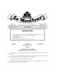
Decree of 12 October 2005 Creating the National Center for Geospatial Information
Summary: This decree establishes CNIGS, a core institution for mapping, geospatial information and territorial data.
Key Findings
- Defines a legal or institutional rule for Haiti's land and territorial-governance system.
- Provides primary-source evidence from Le Moniteur or a public legal repository.
- Supports research on cadastre, registration, land use, territorial planning, agricultural land or public land.
Full Description
This decree establishes CNIGS, a core institution for mapping, geospatial information and territorial data. The text is part of the legal and institutional framework used to understand land administration, territorial planning, property registration, rural land use, or state land governance in Haiti.
How to cite
Government of Haiti; Le Moniteur; FAOLEX; Land Portal, Decree of 12 October 2005 Creating the National Center for Geospatial Information, https://faolex.fao.org/docs/pdf/hai175694.pdf