Full Document Text
Extracted text from the original document for search indexing.
e
\:
~.
s FEWS NET
La Famine Early Warning Systems Network
Haiti - Seasonal Monitor
August 1, 2024
Favorable conditions for crop development
Key Messages
Above-average rainfall conditions continue over Haiti.
Environmental conditions are forecasted to become conducive
to the development of a tropical depression later the week of
July 29th or over the weekend.
Some scattered areas show signs of negative vegetation
health.
Update on Seasonal Progress
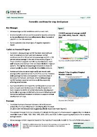
Consistent, above-average rainfall has been observed over
Haiti. In selected southern and central areas, rainfall
conditions are 25 to 50 percent above-average and 50 to 100
percent above average in the rest of the country (Figure 1).
These conditions support normal crop development, retain
soil moisture, and maintain river and water levels for irrigation
systems. The slightly above-average temperature does not
present problems, given these levels of available moisture.
Harvest activities are set to begin early next month, with
average yields expected across much of the country. However,
below-average harvests are expected in scattered areas of
Gonaives, Nord-Ouest, and Ouest, where below-average
rainfall has been experienced since early May especially
affecting small farmers.
Hurricane Beryl did not impact the rainfall pattern across Haiti
due to its path and the distance of the cloud's bands from
Haiti. Despite the deficit of rainfall observed as Beryl passed
by the island, average rainfall both prior to and following Beryl
maintained sufficient moisture conditions to support normal
development of crops.
Forecasts
“USAID
FROM THE AMERICAN PEOPLE
The NOAA hurricane forecast indicates a 40 to 60 percent
probability of a tropical depression developing later the week
Figure 1
CHIRPS percent of average rainfall
(%) (1981-2010), June 26 — July 25,
2024
CHIRPS 6-Pentad Percent of Average Rainfall (%)
Period: 26)un2024 - 25Jul2024
Source: UCSB-USGS/FEWS NET
Figure 2
Atlantic 7-Day Graphical Tropical
Weather Outlook
GS, Seven-Day Graphical Tropical Weather Outlook
7] National Hurricane Center Miami, Florida
. —
All Disturbances
(07;44)PMED I)
iMoniJull29}2024)
Current Disturbances and Seven-Day Cyclone Formation Chance: $3 <40% 9% 40-60% %% >60%
Tropical or Sub-Tropical Cyclone: © Depression § Storm Hurricane
© Post-Tropical Cyclone or Remnants
Source: NHC/NOAA
of July 29, with the forecast track suggesting a likely impact over Haiti (Figure 2).
The updated forecast from the University of Colorado for this year’s hurricane season suggests that it is likely to
resemble those of 1886, 1926, 1933, 1995, 2005, 2010, and 2020, further supporting expectations for an above-
average season.
Above average rainfall is expected based on the majority of mesoscale models for the rest of 2024 rainy season,
Government.
FEWS NET Haiti
haiti@fews.net
FEWS NET is a USAID-funded activity. The content of this report does not necessarily reflect the
view of the United States Agency for International Development or the United States
Seasonal Monitor August 1, 2024
providing adequate rainfall to support crop activities.
Recommended citation: FEWS NET. Haiti Seasonal Monitor August 1, 2024: Favorable conditions for crop
development, 2024.
About Seasonal Monitor
FEWS NET's Seasonal Monitor reports are produced for Central America and the Caribbean, West Africa, East Africa, Central Asia, and Somalia every 10-to-30 days during the region's
respective rainy season(s). Seasonal Monitors report updates on weather events (e.g., rainfall patterns) and associated impacts on ground conditions (e.g., cropping conditions,
pasture and water availability), as well as the short-term rainfall forecast. Find more remote sensing information here.
aN.
lar
SP FEWS NET Famine Early Warning Systems Network