Teks Konple Dokiman an
Teks ki soti nan dokiman orijinal la pou endeksasyon.
Techno-‐Economic
Feasibility
Study
to
improve
the
salt
industry
of
Commune
Anse
Rouge
Jetty
(future)
Area
of
Pilo t
Pro
ject
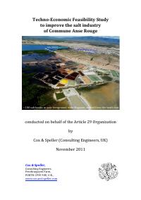
~100
salt
basins
in
near
foreground,
near
Magazen,
viewed
from
the
south
east.
conducted
on
behalf
of
the
Article
29
Organization
by
Cox
&
Speller
(Consulting
Engineers,
UK)
November
2011
Cox
&
Speller,
Consulting
Engineers.
Penrhiwgwynt
Farm,
PORTH
CF39
9UE,
U.K.,
www.cox-‐and-‐speller.com
�
ACRONYMS
used
in
the
report
Accenture
Company name for a market research consultancy
ADP
Accenture Development Partnerships
AMURT
Amanda Marga Universal Relief Team
Baumé
Measure of the density/concentration of a brine
CuMs
Cubic Metres
DDA
Direction Départementale d'Agriculture
dwt
dead weight tonnage (maximum bulk cargo weight)
fob
Freight on board
GAIN
Global Alliance for Improved Nutrition
GIS
Geographic Information System
IDD
Iodine Deficiency Disorder
IOM
International Organization for Migration
MARNDR
Ministère de l’Agriculture des Ressources Naturelles et
du Développement Rural [Ministry of Agriculture]
MI
Micronutrient Initiative
MSPP
Ministère de la Santé Publique et de la Population
[Ministry of Health]
UND
University of Notre Dame
UNICEF
United Nations Children’s Fund
USI
Universal Salt Iodisation (for a country or community)
WFP/PAM
World Food Programme /
Programme Alimentaire Mondial
�
Contents
Introduction
1
2
3
4
Executive
Summary
Investigations
2.1
Depths
survey
2.2
Topographical
survey
2.3
Geotechnical
survey
2.4
Evaporation
tests
2.5
Community
liaison
Recommendations
3.1
The
Magazen
area
3.2
The
Pilot
Project
site
3.3
Coridon
3.4
Iodisation
3.5
Excess
earth
3.6
Flood
barriers
Perspective
4.1
Costs
4.2
Timing
4.3
The
AMURT
‘factory’
4.4
Next
Steps
4.5
Irrigation
Appendices
1
Objectives
of
this
study*
2
Location
of
deep
water
for
jetty
3
Topographical
survey
4
Geotechnical
(soils’)
survey
5
Evaporation
tests
6
References
*
includes
outline
of
scope
of
Design
Study
�
Techno
Economic
Feasibility
Study
for
the
salt
industry
of
Commune
Anse
Rouge
Introduction
About
70%
of
Haiti’s
salt
is
produced
in
Commune
Anse
Rouge1
-‐
one
of
the
poorest2
and
most
isolated
regions
of
Haiti.
Due
to
its
arid
climate,
it
is
one
of
only
two
regions
in
Haiti
that
are
chronically
food
insecure
throughout
the
year
and,
without
the
income
from
salt,
it
would
become
even
more
impoverished.
Annual rainfall (mms)
IncreaseIng raIn
Over 2000
Anse Rouge
Gonaives Island
under 25
Port au Prince
Salt
production
at
Commune
Anse
Rouge
takes
place
in
“salt
basins”
hand-‐
dug
below
sea
level
(see
cover
and
next
page).
The
seawater
that
enters
evaporates
and
forms
salt
crystals
that
are
hand-‐harvested
-‐
a
primitive
labour-‐intensive
and
commercially
uncompetitive
process.
The
industry
is
threatened
by
cheaper
better
quality
salt
from
near
neighbours3
and,
if
it
does
not
modernise,
the
livelihoods
of
the
already
impoverished
salt
producing
communities
will
suffer.
Another
problem
is
the
vulnerability
of
these
salt
basins
to
inundation
from
floods
caused
by
rain
falling
on
high
hills
some
20Kms
inland.
On
several
occasions
these
have
destroyed
dykes
and
necessitated
expensive
emergency
rebuilding.
Modernisation
could
resolve
both
these
problems,
improve
salt
quality
and
increase
output.
However,
unless
new
outlets
for
Haitian
salt
can
be
found,
this
might
depress
prices
and
reduce
the
net
income.
This
issue
was
addressed
by
a
market
study
commissioned4
in
January
2011,
when
road
salt
sales
to
the
USA
were
identified
as
potentially
a
large
income
generator
worth
well
over
$2million/year5.
Later,
in
April
2011,
Cox
&
Speller6
were
asked
to
assess
the
technological
feasibility
of
transforming
several
hundreds
of
existing
salt
basins
into
a
modern
saltworks
that
could
satisfy
all
Haiti’s
domestic
needs
for
iodised
salt
and
also
to
make
and
export
≥200,000
tonnes/year.
Our
technical
findings
were
positive
-‐
but
we
learnt
that
many
salt
basin
owners
initially
may
be
reluctant
join
a
cooperative.
-‐
1
-‐
�
Techno
Economic
Feasibility
Study
for
the
salt
industry
of
Commune
Anse
Rouge
Currently
there
are
over
2,700
salt
basins
in
Commune
Anse
Rouge
with
more
than
1,400-‐recorded
individual
owners,
more
than
95%
of
whom
live
in
or
near
Commune
Anse
Rouge7.
Because
of
the
inability
of
most
villages
within
the
coastal
range
and
unirrigated
plain
to
rely
on
agricultural
crops,
it
is
likely
that
30-‐50%
of
the
40,000
population
of
Commune
Anse
Rouge
is
directly
or
indirectly
dependent
on
salt
production
for
their
livelihoods.
The
basins
receive
seawater
by
gravity
by
seepage
and/or
channels.
This
evaporates
to
less
than
10%
of
its
original
volume
and
deposits
a
mixture
of
all
salts
of
seawater
in
the
salt
basins
–
where
they
are
‘harvested’
as
shown
below.
Harvesting
from
a
salt
basin
near
Magazen
This
procedure
contrasts
with
the
‘modern’
method
(actually,
1500
years
old)
of
having
the
seawater
flowing
through,
and
evaporating
from,
a
sequence
of
ponds.
After
90%
of
the
water
has
evaporated
in
this
system,
sodium
chloride
is
deposited
virtually
free
of
the
less
soluble
calcium
salts
(deposited
earlier)
or
the
more
soluble
magnesium
salts
(discharged
with
the
residual
brine).
Apart
from
making
a
better
salt
(>98%
sodium
chloride),
this
method
can
be
10
times
more
productive
and,
if
technically
feasible
and
viable
commercially,
it
could
substantially
improve
the
livelihoods
of
the
people
of
Anse
Rouge.
For
the
field
studies
of
11-‐27
April
2011,
Cox
&
Speller
deployed
two
engineers,
Dr
John
Cox,
a
chemical
engineer/
solar
salt
expert
and
Simon
Griffiths,
a
civil
engineer/roads
and
ports
expert.
We
were
accompanied
in
Commune
Anse
Rouge
by
a
team
that
included:
Local
Bureau
of
Agriculture
for
Commune
Anse
Rouge:
Pascal
Addison,
Agronomist,
Oxfam
America
Livelihoods
-‐
2
-‐
�Techno
Economic
Feasibility
Study
for
the
salt
industry
of
Commune
Anse
Rouge
Coordinator
and
Article
29
Organisation
Founder,
Amber
Lynn
Munger,
Article
29
Organization
Coordinator
Hebert
Pierre
and
two
others.
Whereas
the
Oxfam
America
team
participated
in
all
technical
discussions
in
Haiti,
the
report
was
written
and
completed
in
the
UK
following
discussions
that
included
Peter
Speller
(another
chemical
engineer
with
solar
salt
experience).
Subsequently,
when
it
became
apparent
that
it
was
unrealistic
to
expect
all
of
the
1,400
salt
basin
owners
to
modernise
without
first
seeing
a
small-‐scale
pilot
project
demonstrating
its
advantages8,
the
scope
of
the
salt
project
altered.
Whilst
the
ultimate
objective
remains
to
enable
all
the
salt
basins
(in
the
Magazen
area)
to
be
modernised
–
eventually
producing
around
200,000
tonnes/year
-‐
the
present
proposal
is
more
modest
and
realistic.
The
new
perspective
is
to
modernise
as
many
salt
basins
as
feasible
(maybe
300)
in
a
limited
area
and,
initially,
target
for
substitution
the
15,000
tonnes/year
imports
recently9
identified.
What
is
now
envisaged
is
a
Pilot
Project
whose
benefits
should
become
evident
within
a
three-‐year
period
-‐
as
an
example
for
other
owners
to
follow
later
by
joining
the
cooperative
created
for
the
Pilot
Project.
This
report
retains
much
of
the
original
text
written
for
Oxfam
America
for
the
200,000
tonnes/year
perspective
-‐
but
alters
passages
where
appropriate
for
the
Pilot
Project
perspective.
In
accordance
with
normal
professional
practice,
Cox
&
Speller
has
sole
and
total
responsibility
for
all
opinions
and
technical
judgements.
**************
Project
Area
-‐
showing
the
proposed
Pilot
Project
area
(light
blue),
the
proposed
fully
modernised
Magazen
saltworks
(hatched
yellow)
and
the
area
of
existing
salt
basins
at
Coridon
(lighter
yellow
hatching),
for
which
we
have
no
immediate
proposals.
Pilot
Project
area
0
1
2
3
Kilometres
4
5
6
7
8
9
-‐
3
-‐
10
�Techno
Economic
Feasibility
Study
for
the
salt
industry
of
Commune
Anse
Rouge
1
EXECUTIVE
SUMMARY
The
study
in
April
2011
assessed
critical
technical
issues
relevant
to
saltworks
design
and
found
no
fundamental
obstacle
to
modernising
saltworks
at
these
locations
or
any
flaw
in
previous
assumptions.
These
critical
technical
issues
are
the
topography,
soils’
characteristics
and
weather
and,
for
exports,
adjacent
sea
depths
and
availability
of
appropriate
local
building
materials.
In
every
instance,
the
outcomes
of
the
investigations
in
April
2011
met
or
surpassed
the
criteria
Cox
&
Speller
previously
postulated
as
essential
for
the
project
to
satisfy
techno-‐economic
feasibility.
In
view
of
these
findings,
Cox
&
Speller
recommended
flood
protection
for
the
saltworks
(wherever
cost
effective)
and
to
protect
local
communities
and,
as
and
when
community
organisations
are
in
place,
modernisation
of
the
salt
basins
and
the
provision
of
facilities
for
iodisation
and
exports.
This
perspective
was
outlined
to
individuals
at
saltworks,
in
discussions
in
the
community
and
at
meetings
in
Magazen
(>125)
and
Coridon
(>35)
and
at
various
meetings
with
producer
groups
in
the
salt
producing
zones.
Subsequent
liaison10
with
the
community
confirmed
significant
support
amongst
the
salt
basin
owners
around
Magazen
for
step-‐by-‐step
modernisation,
beginning
with
a
Pilot
Project
for
about
300
salt
basins
that,
in
due
course,
could
be
extended
to
include
all
the
basins
of
the
Magazen
area,
The
Pilot
Project
is
now
(November
2011)
the
main
focus
of
our
attention.
A
“Design
Study”
is
needed
to
refine
the
cost
estimates
needed
for
any
potential
investor
and
complete
the
work
of
this
Feasibility
Study.
Concurrently
with
the
construction
and
operation
of
the
Pilot
Project,
it
is
realistic
to
allow
two
years
for
the
creation
of
the
essential
community-‐based
local
organisations.
Timing
The
recommendations
for
earth
moving
and
flood
protection
at
Magazen
are
already
sufficiently
detailed
that
work
could
commence
once
the
funding
and
institutional/organisational
support
becomes
available.
Flood
protection
plans
for
the
Coridon
area
require
further
liaison
and
discussion11.
The
implementation
of
proposals
for
modernisation
require
the
creation
of
appropriate
local
organisations
to
become
the
proprietors,
to
resolve
issues
relating
to
ownership,
to
explore
investment
opportunities
and
act
for
the
local
community
on
relevant
issues
as
and
when
they
arise.
Financing
The
investment
costs
for
a
fully
modernised
saltworks
and
salt-‐exporting
jetty
(generating
perhaps
$2million/year)
may
cost
up
to
$6million.
This
might
be
financed
by
a
single
private
investment
-‐
but
a
preferable
arrangement
would
be
to
begin
with
a
“Pilot
Project”
to
demonstrate
the
technical
and
commercial
advantages
on
a
small-‐scale
and
thereafter
self-‐finance
full-‐scale
modernisation.
Flood
protection
(other
than
the
dyke
improvements
included
as
part
of
saltworks
modernisation)
could
be
accomplished
using
development
tools
such
as
Cash
For
Work
or
other
project
related
employment
schemes
and,
if
so,
could
involve
the
removal
and
transport
of
~0.5million
CuMs
of
excess
earth
currently
piled
around
the
salt
basins
to
new
flood
barriers
located
in
the
near
vicinity.
-‐
4
-‐
�
2
Techno
Economic
Feasibility
Study
for
the
salt
industry
of
Commune
Anse
Rouge
INVESTIGATIONS
These
paragraphs
summarise
the
findings
from
the
investigations
defined
in
the
scope
of
work
for
the
consultant
in
April
2011
(Appendix
1).
2.1
Depths
survey
The
purpose
of
this
survey
was
to
confirm
that
sea
depths
of
>12
metres
(required12
by
the
25,000
dwt
ships
needed
for
salt
exports)
existed
offshore.
It
was
conducted
with
a
line
and
weight
and
confirmed
that
12-‐15m
depths
exist
just
outside
the
lagoon,
less
than
250m
offshore,
close
to
shallow
water
that
may
well
be
suitable
for
a
rock
fill
constructed
jetty.
This
“area
of
interest”
is
shown
on
the
satellite
photographs
appearing
in
Appendix
2.
This
location
is
close
to
the
edge
of
surveyed
waters
to
far
greater
depths
and
more
than
adequate
to
confirm
that
a
salt
exporting
jetty
could
be
built
at
this
location.
However,
an
investor
will
require
a
detailed
bathymetric
survey
to
be
conducted
along
this
coastline
(for,
perhaps,
about
1Km.)
in
order
to
inform
the
detailed
design
of
the
jetty
at
this
location.
For
the
more
modest
Pilot
Plant
project,
there
will
be
no
need
for
a
jetty.
If
the
perspective
is
to
export
bagged
salt
in
(say)
10,000
dwt
ships
to
the
USA,
no
more
than
8-‐10m
depths
are
needed
–
and
as
these
exist
within
the
sheltered
Magazen
lagoon,
the
costs
of
the
jetty
will
be
very
much
reduced.
2.2
Topographical
survey
The
purpose
of
this
survey
was
to
establish
how
much
of
the
unused
and
otherwise
unusable
land
north
of
the
road
near
Magazen
could
be
used
for
a
new
modern
saltworks.
It
confirmed
that
there
are
120
hectares
that
could
be
added
to
existing
salt
basins
to
create
a
600-‐hectare
saltworks
(Appendix
3).
No
surveys
were
conducted
elsewhere:
as
the
existing
salt
basins
are
fed
by
gravity
from
the
sea,
they
must
be
all
close
to
and/or
below
sea
level.
2.3
Geotechnical
survey
The
purpose
of
this
survey
was
to
establish
the
suitability
of
the
ground
to
build
a
modern
saltworks.
It
was
conducted
using
a
‘backhoe’
to
dig
18
holes
in
the
Magazen
saltworks
area
and
sampling
for
clay,
sand
and
silt
(Appendix
4).
This
confirmed
that
most
of
this
site
is
underlain
by
impermeable
clay
that,
moreover,
was
sufficiently
abundant
that
it
could
be
used
to
‘key
in’
to
the
base
of
flood
barriers
and
thereby
eliminate
any
need
to
purchase
expensive
plastic
sheet
rolls
to
prevent
seepage
losses.
So
these
investigations
more
than
confirmed
the
suitability
of
the
site.
However,
it
should
be
noted
that
the
Coridon
area
was
not
sampled
and
it
is
possible
(although
unlikely
in
view
of
our
observations)
that
the
composition
of
the
Coridon
soils
differ
markedly
from
those
obtained
in
the
Magazen
area.
If
this
were
to
be
the
case,
it
might
be
necessary
to
‘import’
clay
to
the
Coridon
area
from
the
Magazen
area
to
seal
any
dykes
constructed
for
new
flood
barriers.
2.4
Evaporation
tests
The
purpose
of
this
investigation
is
to
obtain
a
realistic
estimate
of
the
potential
salt
output
from
the
area
available
for
the
new
modernised
saltworks.
-‐
5
-‐
�
Techno
Economic
Feasibility
Study
for
the
salt
industry
of
Commune
Anse
Rouge
Whilst
we
are
confident
that
a
lot
more
salt
can
be
made
than
at
present,
in
the
absence
of
local
weather
records
we
have
to
obtain
this
data
using
test
ponds.
These
tests
(Appendix
5),
which
are
being
supervised
by
the
Bureau
of
Agriculture,
need
to
continue
over
an
extended
period
to
obtain
a
truly
realistic
estimate
of
the
potential
output
of
the
new
saltworks
(more
than
one
season
is
advisable).
Early
results
suggest
that
the
potential
output
of
the
new
saltworks
may
exceed
200,000
tonnes/year
-‐
but
it
will
be
some
months
yet
before
there
are
sufficient
readings
to
make
firm
predictions.
2.5
Community
Liaison13
During
our
investigations,
the
Bureau
of
Agriculture
(Commune
Anse
Rouge)
initiated
meetings
between
producer
associations,
Article
29
and
Oxfam
and
meetings
were
held
at
Magazen
(>125)
and
Point
de
Mangles
(>35)
-‐
where
Dr
John
Cox
and
Amber
Munger
presented
basic
information
about
the
research
and
answered
questions.
Additionally,
numerous
one-‐to-‐one
discussions
took
place
during
the
visits
to
the
salt
basins
and
nearby
communities.
It
became
clear
that
the
removal
of
excess
earth
and
its
for
new
flood
barriers
would
be
welcomed
–
not
least
because
these
also
could
protect
the
villages
and
houses.
However,
for
the
saltworks’
modernisation,
the
costs
are
generally
too
high
to
justify
protecting
all
but
the
most
vulnerable
locations
(crystallisers,
salt
stockpiles
and
processing
plant).
For
a
comprehensive
flood
protection
scheme
to
be
undertaken,
it
has
to
be
justified
by
community
benefits
or
as
part
of
an
irrigation
system
–
saltworks’
modernisation
on
its
own
cannot
justify
an
all-‐encompassing
flood
protection
scheme.
In
our
(Cox
&
Speller)
opinion,
a
comprehensive
study
of
all
aspects
of
flood
protection
should
be
undertaken
in
order
that
the
community,
salt
basin
owners
and
local
farmers
all
may
benefit.
Modernisation
(of
the
saltworks)
is
critically
dependent
on
societal
issues
and
it
is
important
to
attempt
to
integrate
any
engineering
and
construction
that
is
undertaken
for
the
saltworks
with
other
societal
benefits.
3
RECOMMENDATIONS
Because
the
salt
producing
areas
stretch
from
20kms
from
east
to
west,
it
is
appropriate
to
restrict
the
primary
modernisation
to
the
relatively
compact
area
at
and
near
Magazen,
and
provide
it
with
a
salt-‐exporting
jetty.
There
is
also
some
scope
for
limited
improvements
to
the
salt
basins
near
Coridon
-‐
if
desired
and
deemed
appropriate
by
the
stakeholders.
Although
the
basic
science
and
technology
is
the
same,
the
detailed
design
depends
on
the
respective
locations
and
will
be
described
separately.
3.1
The
Magazen
area
(includes
the
Pilot
Plant
area)
The
available
low-‐lying
flat
area
(~600
Hectares)
and
proximity
to
deep
water
(>15m)
make
Magazen
potentially
suitable
for
a
major
salt
exporting
investment.
Details
of
a
possible
integrated
and
modernised
saltworks
appeared
as
an
Attachment
to
the
report
for
Oxfam
and
its
basic
principles
remain
valid:
a)
The
position
of
the
jetty
is
determined
by
the
location
of
sea
depths
of
at
the
appropriate
depth
and
proximity
to
appropriate
building
materials.
-‐
6
-‐
�Techno
Economic
Feasibility
Study
for
the
salt
industry
of
Commune
Anse
Rouge
b)
The
associated
salt
stockpiles
and
washing
facilities
should
be
nearby
on
shore
to
minimise
the
length
and
cost
of
conveying
operations.
c)
The
crystallisers
should
be
grouped
around
the
washing
and
stockpiling
facilities
to
minimise
handling
costs.
d)
Several
seawater
intakes
may
be
appropriate
to
minimise
the
pumping
duties
and
costs
–
before
pumping
to
the
crystalliser
ponds.
e)
Additionally,
washing
facilities,
a
canteen
and
other
personnel
facilities,
the
engineering
workshop
and
a
power
generator
and
a
brine
reservoir
would
be
located
near
the
new
crystallisers.
Whilst
several
alternative
layouts
could
satisfy
these
criteria
(and,
indeed,
have
been
considered),
the
site
chosen
for
the
Pilot
Project
has
pre-‐determined
where
the
crystallisers
are
to
be
located
and,
effectively,
where
best
to
locate
the
stockpiles,
processing
and
bagging
units
and
the
jetty.
3.2
The
Pilot
Project
site
The
area
in
which
the
Pilot
Project
is
likely
to
be
located
is
known
locally
as
“Tet
Bai”
or
“TetB”.
It
was
chosen
by
virtue
of
the
high
level
of
support
already
expressed
by
local
salt
basin
owners.
It
also
has
other
desirable
features
as
the
location
for
crystallisers
and
salt
processing,
notably:
a)
b)
c)
It
is
less
vulnerable
to
flooding
than
most
other
locations14.
It
is
near
relatively
deep
water
(>8m)
in
a
sheltered
lagoon15.
It
is
central
to
the
majority
of
salt
basins
in
the
Magazen
area.
The
precise
design
of
the
Pilot
Project
will
be
determined
by
the
proposed
Design
Study
when,
at
the
same
time,
realistic
project
costs
will
be
estimated.
3.3
Coridon16,
17,
18
The
usable
low-‐lying
flat
area
(~125
Hectares)
that
includes
salt
basins
from
Coridon
to
Pointe
des
Mangles
could
produce
>25,000
tonnes/year.
This
is
too
small
an
output
for
a
salt
exporting
investment
–
although
it
could
supply
the
domestic
market
for
salt
in
Haiti
by
road
and
by
boat
(as
it
does
now).
The
Coridon
salt
basins
differ
from
those
near
Magazen
in
two
important
ways:
(1)
a
smaller
total
area
and
(2)
they
are
more
widely
dispersed.
Whereas
at
Magazen
there
is
merit
in
linking
basins,
the
cost
of
doing
so
at
Coridon
would
outweigh
any
benefits.
Whilst
there
is
scope
for
some
improvements,
local
salt
basin
owners
and
workers
have
yet
to
indicate
any
wish
to
modernise
and,
until
they
do
so,
there
is
little
point
in
devising
any
proposals.
3.4
Iodisation
Irrespective
of
progress
towards
full
modernisation,
it
is
feasible
for
salt
producers
to
upgrade
salt
quality
and
supply
the
domestic
market
with
iodised
salt
without
necessarily
proceeding
to
implement
full
modernisation.
To
iodise
to
international
standards,
three
conditions
have
to
be
satisfied.
a)
The
salt
quality
may
be
improved
by
reducing
the
amount
of
solid
and
magnesium
salt
impurities.
A
small
customised
washing
unit
could
do
this
short-‐term
but
will
become
redundant
after
the
salt
basins
have
been
upgraded
to
become
a
modern
saltworks,
-‐
7
-‐
�Techno
Economic
Feasibility
Study
for
the
salt
industry
of
Commune
Anse
Rouge
b)
A
modernised
saltworks
must
be
able
to
iodise,
dry
and
package
the
produced
salt
-‐
as
outlined
below
-‐
and
the
salt
workers
have
to
be
trained
in
the
use
of
these
facilities.
c)
Institutional
obstacles,
such
as
the
government’s
current
preference
for
iodisation
to
be
conducted
centrally,
must
be
addressed.
In
respect
to
iodisation
technology,
Cox
&
Speller
recently
(March
2011)
conducted
a
comprehensive
review
of
progress
in
Ghana
towards
USI
(Universal
Salt
Iodisation)
and
it
is
instructive
to
refer
to
this
experience.
Knapsack
spraying
(Ghana
March
2011)
at
Tradevco
(right)
and
Elmina
(left)
There
are
about
30-‐40
salt
enterprises
in
Ghana,
varying
in
output
from
as
large
as
100,000
tonnes/year
down
to
less
than
50
tonnes/year.
The
technology
used
varies
from
wholly
manual
knapsack
spraying
at
small
saltworks
(above)
to
machine-‐controlled
iodisation
using
a
screw
conveyor
(below).
Machine
operated
iodisation
at
Nyanyano
Cooperative,
Ghana,
March
2011
Whereas
WFP/MI
tend
to
promote
and
supply
machines
to
willing
salt
enterprises
and
provide
training,
UNICEF/GAIN
believe
knapsacks
also
have
a
rôle
to
play.
Either
could
be
used
at
a
modernised
saltworks
–
the
level
of
support
offered
by
these
agencies
might
determine
the
eventual
choice.
Drying
is
the
next
stage
of
iodisation
–
if
needed
(the
salt
already
may
be
dry
enough).
It
then
has
to
be
packaged
and
dispatched.
In
Haiti,
bearing
in
mind
the
importance
of
creating
sustainable
paid
work,
it
is
likely
to
be
appropriate
to
dispense
and
pack
measured
amounts
of
iodised
salt
into
airtight
sachets,
place
these
in
retail-‐size
packets
and
package
the
boxes
for
sale
to
Port
au
Prince
and
elsewhere
in
Haiti.
There
is
therefore
no
technological
obstacle
to
iodising
salt
(even
without
full
modernisation
–
though
that
is
preferable).
Cox
&
Speller
understand
that
the
major
obstacle
to
iodising
at
Anse
Rouge
is
an
institutional
preference
to
have
it
conducted
near
Port-‐au-‐Prince.
Whilst
this
is
doable
technically,
and
the
Pilot
Project
certainly
could
supply
Port-‐au-‐Price
with
appropriate
salt
for
iodisation,
-‐
8
-‐
�
Techno
Economic
Feasibility
Study
for
the
salt
industry
of
Commune
Anse
Rouge
centralisation
incurs
unnecessary
transport
costs
and
runs
counter
to
experience
of
iodisation
in
other
countries.
These
options
were
outlined
in
Attachments
to
the
earlier
report
to
give
producers
an
informed
choice
but,
whatever
is
done,
there
will
need
to
be
an
intensive
programme
of
training
in
new
production
methods
and
iodisation
to
ensure
that
an
acceptable
quality
iodised
salt
is
produced
(and
sold).
3.5
Excess
earth
The
salt
basins
were
created
by
digging
out
sand
and
clay
to
depths
below
sea
level
to
allow
seawater
to
flow
by
gravity
into
the
basin.
This
excess
earth
was
piled
around
the
individual
basins,
as
it
would
have
been
costly
to
pay
for
it
to
be
carried
to
locations
outside
the
salt
basin
area.
Typical
salt
basin
and
earth
dykes
near
Pointe
des
Mangles
(west
of
Coridon)
The
deposited
earth
can
reach
heights
of
metres,
making
it
difficult
and
arduous
for
workers
to
harvest
and
carry
the
salt
away.
Apart
from
the
physical
difficulty
of
walking
through
the
basins,
with
or
without
salt,
loose
or
in
bags,
and
the
excessive
heights
to
which
the
salt
has
is
lifted
to
drain
after
harvesting,
and
the
loss
of
production
due
to
the
absence
of
wind
within
the
basins,
the
major
concern
is
the
tough
working
conditions.
In
short:
1)
2)
3)
4)
High
dykes
create
wind
barriers
that
reduce
evaporation
and
thereby
salt
production
(without
air
movement,
no
evaporation
can
occur
and
the
salt
ponds
simply
heat
up
without
evaporation).
Whereas
a
pond
with
300mm
high
dykes
can
rarely
exceed
35-‐40°C,
it
is
usual
for
a
pond
such
as
pictured
above
to
exceed
65-‐70°C
–
which
is
why
harvesting
at
this
location
has
to
take
place
during
3-‐7am.
The
physical
operations
of
harvesting
and
carrying
the
salt
are
made
far
more
onerous
by
the
presence
of
these
mounds
of
earth.
The
dykes
require
constant
maintenance
and
whenever
it
rains
or
floods
there
is
a
risk
of
damage
to
the
salt
basins.
-‐
9
-‐
�
Techno
Economic
Feasibility
Study
for
the
salt
industry
of
Commune
Anse
Rouge
Removing
excess
earth
will
assist
modernisation
but
for
health
and
safety
reasons
is
worthwhile
even
for
unimproved
salt
basins.
Moreover,
this
earth
can
be
used
usefully
elsewhere
–
for
flood
protection
barriers
and
irrigation.
If
Cash-‐
for-‐Work
or
other
funding
could
be
obtained,
there
is
enough
earth
for
several
thousand
people
to
be
employed
removing
earth
for
many
years
on
community
schemes
–
in
addition
to
using
it
to
assist
saltworks’
modernisation.
Scouring
can
cut
through
a
highway
3.6
Flood
barriers
Flooding
is
common
in
the
rainy
season
and
can
inundate
villages,
cut
roads
and
cause
stress
and
loss
to
the
local
community.
So
besides
issues
for
the
saltworks
(loss
of
production
and
repairing
dykes),
this
is
a
major
ongoing
issue
for
the
local
communities.
In
April
2011
we
viewed
newly
constructed
flood
defences
near
Coridon
that,
in
our
opinion,
may
prove
unsuccessful
as
they
lack
reinforcements
(clay
core
and
rock
armour)
and
also
do
not
completely
enclose
the
vulnerable
area.
We
outline
in
the
next
pages
what
we
think
is
needed
for
full
and
reliable
flood
protection
for
the
modernised
saltworks
(or
for
community
use
or
irrigation).
-‐
10
-‐
�Techno
Economic
Feasibility
Study
for
the
salt
industry
of
Commune
Anse
Rouge
Design
The
design
of
all
dykes
and
flood
barriers,
whether
intended
to
retain
the
floodwaters
for
irrigation
or
simply
to
protect
salt
ponds
or
the
community,
has
to
cater
for
seepage
(particularly
important
in
a
saltworks)
and
flood
erosion.
To
minimise
costs,
clay
is
preferred
to
plastic
sheeting
at
a
saltworks
and
armouring
with
rock
is
used
to
prevent
erosion.
The
soils’
testing
(Appendix
4)
revealed
a
clay
underlying
most
of
the
site
(typically
as
illustrated
below).
The
construction
of
new
flood
barriers
for
the
saltworks
will
utilise
this
local
clay
to
seal
potential
leaks
(where
appropriate).
Top
soil
Clay
Water?
More
clay?
The
next
sketch
represents
the
first
stage
of
construction
(note,
for
a
new
dyke)
–
removal
of
(say)
a
2-‐3
metres
wide
strip
of
top
soil
(stacking
it
nearby)
and
then
using
some
of
the
clay
layer
as
a
new
base.
Stage
1:
Digging
into
the
clay
Top
soil
Clay
The
work
for
this
first
stage
is
best
done
by
machine:
all
remaining
work
could
be
manual
–
covering
the
whole
dyke
with
earth
(removed
from
the
salt
basins)
and
‘armouring’
the
faces
with
stones.
Final
Stage:
Clay-‐sealed
dyke
with
an
armoured
wall
and
ditch
on
flood
side
Top
soil
Clay
Earth
from
salt
basins
For
existing
dykes,
armouring
is
straightforward
(as
above)
but
sealing
may
require
the
use
of
plastic
inserts
(which
can
be
costly
and
time-‐consuming).
-‐
11
-‐
�
Techno
Economic
Feasibility
Study
for
the
salt
industry
of
Commune
Anse
Rouge
Perimeter
dykes
(for
the
saltworks)
Every
saltworks
needs
perimeter
dykes
to
prevent
ingress
of
seawater
(during
a
storm
surge)
or
flood
waters
(during
the
rainy
season).
At
Magazen,
both
need
to
be
about
2m
high.
The
latter
also
has
to
divert
the
floods
coming
from
the
inland
hills
to
controlled
escape
routes
to
the
sea.
In
all
instances,
the
side
of
the
barrier
in
contact
with
the
sea
or
floodwater
has
to
be
‘armoured’
–
the
other
side
need
not
be
armoured
and
may
be
simply
earth.
Some
barriers
may
cross
well-‐used
access
routes
(for
people,
mopeds
and
cars).
It
is
important,
during
the
construction,
to
provide
access
up
and
over
the
flood
barriers
that
is
both
convenient
and
attractive.
Otherwise,
people
create
‘unofficial’
routes
through
the
barriers
rendering
them
ineffective.
After
all
the
flood
barriers
have
been
built,
there
will
be
about
ten
times
as
much
excess
earth
left
over.
If
modernisation
proceeds
to
utilise
the
unused
land
north
of
the
highway,
some
could
be
used
to
build
internal
dykes.
Internal
dykes
These
will
not
contain
fast
flowing
floodwaters
and
will
not
need
to
be
armoured
and,
moreover,
with
the
brine
level
almost
the
same
on
either
side,
there
will
be
no
need
for
a
clay
key.
Also,
as
the
brine
is
only
250-‐350mm
deep,
the
dykes
need
not
be
higher
than
1m
–
for
many,
600mm
is
acceptable.
Also,
unless
the
earth
is
very
sandy,
it
can
be
used
for
the
sides
with
a
1:3
slope.
Brine
storage
In
a
later
phase
of
full
modernisation,
high
dykes
may
be
needed
to
store
concentrated
brine
before
the
rains
arrive,
ready
for
the
next
production
season.
This
construction
could
utilise
a
lot
of
the
remaining
excess
earth
as
its
walls
will
be
of
earth
with
an
inner
core
of
clay
rising
above
4
m
high.
Short-‐term
Employment
To
maximise
work
opportunities,
excess
earth
is
to
be
removed
from
the
salt
basins
by
manual
labour.
Then,
perhaps
using
machines,
it
should
be
taken
to
the
line
of
the
proposed
flood
barriers
where,
again
using
both
manual
labour
and
machines,
the
flood
barriers
would
be
built
with
local
materials.
Cash-‐for-‐
Work
or
other
appropriate
schemes
may
be
used
to
fund
this
phase
of
the
work.
Aside
from
a
few
designated
internal
dykes
(maybe
<10%
of
the
total),
this
earth
removal
should
leave
all
the
salt
basins
with
dyke
heights
≤300mm,
this
height
being
a
necessary
stage
in
the
conversion
to
a
modern
saltworks.
The
base
for
all
new
flood
barriers
must
be
clay,
keyed
to
the
existing
clay
strata
and
the
flood
side
‘armoured’
as
illustrated
earlier.
Depending
on
location,
they
can
be
up
to
2m
high
and
in
many
sections
might
serve
for
vehicle
access.
About
0.5
million
Cubic
Metres
(CuMs)
of
earth
is
sufficient
for
all
flood
barriers
in
the
saltworks,
mostly
not
further
than
50m
away
from
where
it
is
now.
More
than
4
million
CuMs
will
be
available
for
additional
flood
barriers
for
the
local
communities
or
for
flood
attenuation
and
irrigation.
For
these
other
uses,
possibly
more
than
2
kilometres
distant,
trucking
would
be
necessary.
-‐
12
-‐
�Techno
Economic
Feasibility
Study
for
the
salt
industry
of
Commune
Anse
Rouge
4
PERSPECTIVE
Whereas
the
Cox
&
Speller
study
focused
on
the
technical
aspects
of
the
saltworks’
design,
its
implementation
will
depend
on
how
those
people
most
affected
view
the
proposals
and
the
response
of
organisations
and
institutions
that
are
–
or
may
become
–
involved.
This
section
is
included
to
provide
miscellaneous
additional
information
that
is
likely
to
be
of
interest
to
people,
organisations
and
institutions
that
may
contemplate
or
consider
becoming
involved
in
the
project.
4.1
Costs
The
engineering
and
construction
costs
of
the
Pilot
Plant
are
estimated
at
around
$1million
–
but,
to
make
this
a
success,
perhaps
as
much
again
needs
to
be
spent
on
project
organisation,
community
liaison,
capacity
building
(for
the
local
community
and
local
authorities)
–
and
other
‘soft’
items.
If
the
Pilot
Plant
is
successful
and
further
investments
take
place,
most
of
the
significant
items
of
expenditure
for
the
Pilot
Plant
need
not
be
replicated
–
notably,
the
engineering
design,
construction
of
a
Works
Office
and
associated
facilities,
creation
of
the
Saltworks
Enterprise
–
and
many
others.
This
report
is
confined
to
engineering
issues
and
the
commercial
outlook.
Developments
at
Magazen
after
the
Pilot
Plant
is
operational
The
design
concept
for
the
Pilot
Plant
is
to
link
the
90%
of
the
salt
basins
that
will
continue
as
evaporation
ponds
and
to
pump
to
the
10%
that
have
to
be
elevated
in
order
to
serve
as
crystallisers.
Provided
that
the
Pilot
Plant
successfully
demonstrates
the
superiority
of
the
modernised
techniques
and
more
salt
basin
owners
decide
to
join,
a
similar
arrangement
will
be
implemented,
with
more
and
more
crystalliser
ponds
being
created
(in
the
TetB
area)
to
use
the
saturated
brine
then
available.
The
ultimate
design
will
centralise
the
crystallisers
around
the
Pilot
Plant
crystallisers
and
be
adjacent
to
the
location
for
the
future
jetty,
in
the
sheltered
lagoon.
Our
estimates
imply
that
the
fully
completed
Magazen
saltworks
and
jetty
may
cost
~$6
million
and,
hopefully,
might
be
self-‐financed
by
the
Pilot
Plant.
Coridon
This
is
not
part
of
the
Pilot
Plant
proposal.
Iodisation
at
this
location
(see
Section
3.3)
could
begin
if
institutional
restrictions
on
local
iodisation
are
lifted
–
but
no
modernisation
will
be
suggested
until
local
salt
basin
owners
indicate
a
desire
to
do
so.
If
iodisation
were
to
be
undertaken
prior
to
modernisation,
it
will
require
facilities
to
wash
the
current
quality
of
salt
as
well
as
to
iodise,
dry
and
package
it.
Based
on
costs
for
similar
plants
of
this
size
in
other
countries,
and
without
taking
account
of
the
very
substantial
assistance
potentially
available
from
agencies
such
as
UNICEF
and
WFP,
this
investment
might
cost
up
to
$½
million.
If
the
investment
is
postponed
until
the
salt
basins
have
been
modernised,
there
will
be
no
need
for
the
customised
washing
plant
and
the
investment
may
cost
up
to
$¼
million
–
some
of
which
might
be
funded
by
UNICEF
or
WFP.
-‐
13
-‐
�
4.2
Techno
Economic
Feasibility
Study
for
the
salt
industry
of
Commune
Anse
Rouge
Timing
The
Pilot
Project
is
scheduled
to
take
up
to
3
years
–
but,
if
the
owners
of
contiguous
salt
basin
owners
wish,
it
may
be
feasible
for
them
to
join
within
this
three-‐year
period.
The
primary
constraint
on
implementation
is
the
speed
with
which
owners
become
fully
committed19
and
establish
institutions
to
promote
the
work.
Preliminary
soundings
of
potential
investors
and
salt
buyers
suggest
that
their
support
will
be
forthcoming
once
the
necessary
organisations
are
in
place.
4.3
The
AMURT
‘factory’
Discussions
took
place
in
April
with
representatives
of
AMURT
in
respect
to
their
unfinished
‘factory’
(then
lying
idle),
followed
by
a
site
visit.
At
that
time
it
was
agreed
that
it
was
feasible,
from
a
technical
perspective,
to
include
this
area
in
the
ultimate
new
integrated
saltworks
including
all
the
unused
flat
land
north
of
the
highway
running
from
Magazen
to
Anse
Rouge.
Several
modifications
to
the
existing
facilities
would
be
essential
to
make
it
suitable
for
integration
into
the
proposed
modern
saltworks:
(1)
reduce
the
number
of
ponds
to
~37,
by
removing
redundant
dykes,
(2)
standardise
the
pond
sizes
to
~120m
x
~100m,
(3)
raise
internal
dyke
heights
to
~600mm
and
widen
some
as
appropriate,
(4)
provide
Archimedes’
screw-‐type
pumps
for
inflows
and
outflows.
There
is
no
technical
impediment
why
this
area
could
not
eventually
be
included
in
the
envisaged
fully
modernised
saltworks
-‐
which
would
include
all
the
low-‐lying
flat
land
north
of
the
highway.
At
that
stage,
this
entire
extra
120
hectares
(Appendix
Three)
would
be
enclosed
by
flood
barriers
with
clay
cores
and
the
considerable
costs
of
so
doing
could
be
recovered
from
the
extra
output
from
this
extra
area.
By
contrast,
integration
with
the
Pilot
Project
would
be
problematic.
Its
smaller
area
(33
hectares)
has
a
disproportionately
long
perimeter
(3Kms)
and
it
would
be
relatively
costly
to
provide
it
with
full
flood
protection.
Whilst
we
did
give
this
possibility
serious
consideration,
we
now
understand
that
AMURT
do
not
want
their
area
incorporated
into
the
Pilot
Project
and,
as
this
will
be
better
from
a
commercial
standpoint,
we
see
no
reason
to
pursue
this
matter
further.
4.4
Next
Steps
The
report
for
Oxfam
America
focused
on
the
technology
and
concluded
that
modernisation
of
the
Magazen
salt
basins
could
be
commercially
viable.
The
difficulty
with
full-‐scale
modernisation
(still
a
desirable
goal)
is
that
every
single
individual
salt
basin
owner
needs
to
be
convinced
that
it
is
worthwhile
joining
the
envisaged
Cooperative
Enterprise.
This
is
why
we
envisage
making
progress
in
stages,
beginning
with
salt
basin
owners
already
willing
to
cooperate
and
then
persuading
the
others
to
join
having
seen
the
example
of
the
Pilot
Project.
Our
proposals
impinge
on
various
organisations
and
institutions
and
will
affect
many
–
maybe
everyone
–
in
the
community.
In
order
to
progress,
it
will
be
necessary
to
pursue
several
parallel
leads:
-‐
14
-‐
�
a)
Techno
Economic
Feasibility
Study
for
the
salt
industry
of
Commune
Anse
Rouge
Financing
Potential
institutional
partners,
sources
of
funding
and
investors
need
to
be
approached
and
some
sort
of
strategy
devised
in
respect
to
financing
and
long-‐term
planning.
•
Possible
financing
and/or
institutional
partners
to
include
WFP/PAM,
UNICEF,
GAIN,
BID,
IOM,
Micronutrient
Initiative,
and
others.
•
Financing
to
include
the
same
mix
as
above
but
may
rely
more
heavily
on
international
financing
institutions
(especially
for
public
infrastructure
improvements
such
as
the
jetty
and
potable
water
lines).
Additionally,
private
sector
partners
from
the
salt
industry
and
corporate
sponsors
may
also
be
engaged.
b)
Organising
the
Salt
Producers
A
local
Haitian
Organization
is
needed
to
work
with
the
salt
producing
communities
for
the
following
objectives:
•
Forming
an
association
or
associations
that
can
effectively
advocate
for
salt
producing
communities
to
local
government
(and
NGOs
if
necessary)
•
Enabling
the
communities
to
absorb
the
information
about
the
different
options
that
exist
for
them
regarding
salt
production
and
the
risks
and
benefits
to
salt
production
and
the
individual
producer
•
Assessing
willingness
of
the
producers
to
modernize
collectively
at
key
checkpoints
in
the
process
(Year
One,
Year
Two)20
•
Helping
to
frame
or
facilitate
participatory
processes
and
relations
between
local
government
and
the
producer
groups
c)
Employment
opportunities
Identify
opportunities
for
maximising
employment
during
the
Pilot
Project,
expansion
and
rehabilitation
phases,
including
but
not
limited
to
Cash-‐For-‐Work21.
d)
The
national
highway
(post
Pilot
Project)
Rehabilitation/construction
of
bridges
and
placement
of
any
other
minor
infrastructure
that
will
result
in
temporarily
altering
the
national
highway
•
Approval
from
the
Ministries
of
Planning
and
Commerce
must
be
received
to
move
forward.22
This
recently
took
place
for
similar
purposes
in
2008
when
the
bridge
that
currently
crosses
over
a
canal
along
the
national
highway
was
constructed
(and
financed
by
IOM).23
•
While
an
engineer
from
outside
of
Anse
Rouge
may
be
necessary
to
design
the
bridge,
local
labour
and
transport
trucks
should
be
used
to
construct
the
bridge.
The
existing
bridge
was
constructed
using
local
work
crews
and
project
managers
and
these
should
be
relied
on
to
execute
the
project
in
order
to
maximise
livelihood
benefits
in
the
region.
•
Construction
of
the
bridge
should
take
no
more
than
two
months
and
should
start
as
soon
as
the
rainy
season
has
ended.
-‐
15
-‐
�
e)
Techno
Economic
Feasibility
Study
for
the
salt
industry
of
Commune
Anse
Rouge
Flood
barrier
design
The
institutions
responsible
for
the
recently
constructed
flood
barriers
at
Coridon
and
Pointe
des
Mangles
need
to
be
contacted
to
discuss
and
agree
on
the
enhancements
that
are
needed.
It
is
important
to
engage
the
local
representatives
of
the
communities
who
the
barriers
and
dykes
are
meant
to
protect
and
WFP
to
ensure
alignment
with
their
project
priorities
and
that
the
local
organisation
responsible
for
constructing
the
recent
barriers
and
dykes
(a)
receives
approval
for
enhancing
their
previous
work
and
(b)
assesses
whether
they
can
execute
at
least
this
portion
of
the
project.
f)
Design
Study
The
next
stage,
possibly
after
the
cash-‐for-‐work
activities
are
started,
is
to
commission
a
comprehensive
Design
Study
for
the
salt
exporting
and
iodisation
investments
to
specify
in
detail
what
is
to
be
built.
[This
would
have
a
similar,
but
far
more
detailed,
scope
of
work
to
this
current
Feasibility
Study
and,
typically,
will
cost
~5%
of
the
investment
–
about
$300,000
if
our
budget
estimate
of
$6
million
is
correct.]
g)
National
strategy
for
salt
A
multi-‐stakeholder
entity
(salt
producers
from
Commune
Anse
Rouge,
salt
producers
from
other
regions,
local
and
regional
government)
championed
by
government
and
charged
with
determining
appropriate
strategies
for
national
salt
production
must
be
formed
to
determine
best
uses
for
the
Magazen
and
Coridon
areas.
This
entity
also
should
be
tasked
with
addressing
issues
of
salt
production
for
iodisation,
as
an
important
part
of
the
salt
value
chain.
Capacity
building
for
local
authorities
so
that
appropriate
scale-‐ups
are
possible
in
other
regions
(such
as
Gonaives
or
the
north)
in
order
to
address
local
iodisation
in
the
more
remote
localities.
4.5
Irrigation
The
new
saltworks
will
block
the
path
to
the
sea
for
seasonal
rivers
and,
with
appropriately
designed
flood
barrier
dykes,
could
assist
irrigation24.
The
design
of
an
irrigation
system
is
outside
the
scope
of
a
Design
Study
for
the
new
saltworks
but,
ideally,
should
take
place
concurrently.
In
principle,
as
any
flood
barrier
keyed
into
the
underlying
clay
(as
recommended
herein)
will
retain
water
flowing
from
the
hills,
the
location
and
height
of
these
dykes
simply
has
to
be
chosen
to
ensure
that
the
retained
water
is
available
for
irrigation.
The
precise
details
need
to
be
discussed
with
the
relevant
institutions
and
authorities
so
that,
when
the
detailed
design
of
the
saltworks
is
undertaken,
the
desirable
heights
for
the
weirs
that
retain
the
floodwaters
are
already
known.
-‐
16
-‐
�Techno
Economic
Feasibility
Study
for
the
salt
industry
of
Commune
Anse
Rouge
APPENDICES
1
Objectives
of
the
Study
2
Depths’
Survey
3
Topographical
Survey
4
Geotechnical
Survey
5
References
-‐
17
-‐
�
Techno
Economic
Feasibility
Study
for
the
salt
industry
of
Commune
Anse
Rouge
Appendix
1
Objectives
of
the
Study
The
essentials
of
the
objectives
for
the
Oxfam
America
study
were
as
follows:
Ø
The
principal
task
has
been
to
assess
the
technological
feasibility
of
transforming
existing
salt
basins
into
modernised
saltworks
(1)
to
satisfy
Haiti’s
requirements
for
iodised
salt
and
also
(2)
to
make
and
export
≥200,000
tonnes/year.
Ø
This
was
formalised
in
the
Contract25
as
“Develop
a
plan
for
a
commercially
viable
investment
in
salt
production
that
will:
(a)
maximise
economic
and
social
benefits
to
the
local
community;
(b)
enable
production
of
high
quality
local
salt
for
iodisation
in
quantities
sufficient
to
meet
Haiti’s
national
demand;
and
(c)
enable
export
of
Haitian
produced
solar
sea
salt”
….
and
continues,
“Within
the
above
over-‐arching
objectives,
analyse
the
opportunities
that
exist
to
maximize
gainful
employment
and
utilise
local
resources”.
Ø
This
required
basic
engineering
data26
about
the
proposed
site
in
Commune
Anse
Rouge
so
that
Cox
&
Speller
could
design
the
new
saltworks
in
sufficient
detail
to
make
budget
cost
estimations
to
assist
informed
investment
decisions.
Obtaining
this
basic
engineering
data
accounted
for
most
of
the
field
investigations.
Ø
A
further
requirement
from
Oxfam
America
(OA)
requested
that
special
attention
should
be
paid
to
the
need
to
develop
the
project
in
phases
(that
could
be
stand-‐
alone
investments),
so
that
OA
“may
proceed
in
the
near
term
with
cash-‐for-‐work
projects”
….
to
improve
salt
production
for
the
region
and
provide
immediate
employment
for
host
communities27.
Ø
The
consultants
were
asked
to
“note
any
opportunities
for
maximising
secondary
benefits
to
the
community,
including
improved
agricultural
potential”
in
adjacent
regions,
the
potential
for
hydro
and
solar
power
and
potable
water
to
support
the
facilities
and
infrastructure
improvements
(such
as
a
jetty
and
better
roads)28.
Ø
The
Consulting
Engineers
are
very
aware
of
associated
environment
issues
and
in
particular
the
need
to
protect
the
mangrove
forests
surrounding
the
salt
works
and
the
need
to
maximise
agricultural
use
of
rainwaters.
All
these
questions
were
answered
either
specifically
in
the
report
to
Oxfam
America
or
in
memoranda29
forwarded
to
or
received
by
Amber
Lynn
Munger.
In
essence,
the
terms
of
reference
for
this
update
(for
the
Article
29
Organization)
are
identical
to
that
specified
for
Oxfam
America
in
April
2011
-‐
save
for
the
perspective
of
beginning
the
work
with
a
Pilot
Plant
project
of
~300
basins
and
incrementally
adding
extra
salt
basins
as
and
when
additional
owners
decide
to
join
the
envisaged
producers’
cooperative
that
would
have
ultimate
responsibility
for
the
project.
A
significant
number
of
salt
basin
owners
in
the
area
known
locally
as
“Tet
Bai”
or
TetB”
(along
the
north
east
coastline
of
the
lagoon)
already
have
expressed
support
for
this
perspective
and,
for
this
reason
(amongst
others),
the
plans
for
the
Pilot
Project
have
focussed
on
this
area
(over
page).
-‐
18
-‐
�Techno
Economic
Feasibility
Study
for
the
salt
industry
of
Commune
Anse
Rouge
B
C
F
D
A
E
0
100
200
300
400
500m
This
Google
Earth
satellite
photograph
shows
the
area
envisaged
for
the
Pilot
Project.
•
Within
A-‐B-‐C-‐D-‐E-‐A,
roughly
10%
of
the
used
area
will
be
elevated
crystalliser
ponds
–
all
other
salt
basins
will
be
evaporation
ponds
linked
for
sequential
operation.
Salt
basins
outside
the
Pilot
Project
will
be
left
alone/untouched
and
circumnavigated.
•
From
A
to
B
there
needs
to
be
a
2m
high
sea
wall
and
perimeter
access
road,
utilising
as
many
as
available
of
the
dykes
of
participating
salt
basins.
•
From
B
to
C
there
needs
to
be
a
2m
high
flood
barrier
and
perimeter
access
road
that
utilises
as
many
as
available
of
the
dykes
of
participating
salt
basins.
•
From
C,
D,
E
to
A,
there
should
be
provision
to
divert
rainwater
from
the
hillsides.
•
The
area
near
and
adjacent
to
A
will
be
quarried
to
provide
rock
for
the
roads
and
a
future
rock-‐fill
jetty
at
F.
The
quarry
base
will
be
used
for
saltworks’
facilities
(office,
workshop,
personnel
facilities,
salt
stockpile,
bagging
and
processing,
etc.).
The
proposed
Design
Study
has
to
specify
all
of
the
above
in
detail.
-‐
19
-‐
�Techno
Economic
Feasibility
Study
for
the
salt
industry
of
Commune
Anse
Rouge
Appendix
2
Location
of
deep
water
for
jetty
The purple line superimposed on this Google Earth satellite view is the 20m-depth
contour that appears on the relevant Admiralty Chart - the shallowest useable depth recorded
nearby. The two photographs show “areas of interest” and adjacent salt basins in close-up.
Area
of
interest
2
Area
of
interest
1
N
Admiralty
Chart
data
Area 1 has shallow water near in shore and deeper water within 250m of the coastline.
The line-and-weight depths survey conducted during the field studies confirmed the existence
of 15m sea depths within this area of interest. This should be sufficient for bulk salt exports
25,000dwt ships using a 12m (low tide) berth.
Area
1
A bathymetric survey, acceptable to the Haiti coastal authorities as a navigation chart,
will be needed to decide on a precise jetty location.
-‐
20
-‐
�Techno
Economic
Feasibility
Study
for
the
salt
industry
of
Commune
Anse
Rouge
Pilot
Plant
Area
2
8-‐10m
Marine
Summary
Inspection
indicated
that
during
the
normal
sea
state:
• The
tidal
range
is
in
the
order
of
300mm
to
500mm.
• The
beach
slopes/gradients
are
shallow
suggesting
nominal
wave
action
• No
evidence
of
significant
wave
action
was
noted
or
reported
–
waves
such
as
those
photographed
(above
right)
being
described
as
“choppy”!
• No
evidence
of
significant
beach
erosion/deposition
was
noted
or
reported
Winds
are
reported
to
vary
seasonally
from
the
South
East
and
the
North
East,
the
former
being
an
onshore
wind
and
the
latter
an
offshore
wind.
During
the
Autumn/rainy
season
(low
pressure)
with
on
shore
winds
it
was
reported
that
waves
break
over
the
back
of
the
beach
and
inundate
the
coastal
plain.
But,
as
this
is
in
the
hurricane
‘season’,
there
is
no
obligation
to
design
for
ship
movements
during
this
period.
During
the
boat
survey,
inspection
of
the
shallower
seabed
indicated
shelving
rock
or
possibly
dead
coral
with
limited
sand
or
silt
overburden.
Equally
the
water
was
clear
enough
to
see
to
depths
of
circa
8m.
This
confirms
limited
littoral
drift.
Due
to
the
availability
of
suitable
material,
a
solid
jetty
construction
using
locally
won
hearting
material,
reverse
stone
filters
and
wave
armour
rock
is
recommended.
A
concrete
bank
seat
would
be
provided
seaward
to
support
a
floating
pontoon
berthing
face.
The
solid
jetty
would
be
“T”
shaped
to
allow
a
vessel
to
be
“tied”
during
loading.
Suitable
rock
is
available
nearby.
In
the
isolated
hills
within
the
coastal
plain
there
are
originally
sedimentary
rocks
of
various
types
and
with
various
degrees
of
metamorphism
containing
occasional
lenses
of
igneous
rock.
Within
a
few
hundred
metres
of
the
jetty
location,
there
is
a
large
isolated
hill
of
mixed
metamorphic
rocks.
For
a
complete
design
specification
for
the
jetty,
the
designers
will
ask
for
extra
data,
notably:
(a)
Wave
data
(Rose),
(b)
Wind
data
(Rose),
(c)
Current
data,
(d)
Littoral
draft
data/scour,
(e)
Significant,
extreme
and
design
wave,
(f)
An
accurate
bathometric
survey
that
is
approved
by
the
Haiti
Coastguard/Pilot
(for
an
official
navigation
chart),
(g)
Similar
official
berthing
lighting
and
warning
buoys
to
define
the
channel.
For
the
Pilot
Project,
nothing
more
complicated
than
a
rock
fill
jetty
(to
depths
of
~6m)
need
be
built.
If
additional
depth
is
needed
(for
larger
shipments),
the
jetty
could
be
supplemented
by
a
floating
extension
(as
the
lagoon
is
relatively
sheltered).
-‐
21
-‐
�
Techno
Economic
Feasibility
Study
for
the
salt
industry
of
Commune
Anse
Rouge
Appendix
3:
Topographical
Survey
Whereas the levels of the existing salt basins can be inferred as at or just below sea
level, no such assumptions can be made for the large unused area north of the national road.
The topographical study was commissioned specifically to determine how much was close
enough to sea level to enable it to be incorporated in the new modernised saltworks.
135°
panoramic
view
of
unused
land
north
of
highway
-‐
photographed
from
top
of
small
hill
at
north
of
site
The
survey
revealed
that
there
are
some
120
hectares
within
1-‐2m
of
sea
level
that
can
be
readily
utilised
by
the
new
saltworks
and
that
the
slope
trend
is
such
that
it
will
be
essential
to
provide
one
extra
(north-‐south)
dyke
to
ensure
that
the
brine
flows
throughout
the
area
without
needing
extra
pumps.
This
data
is
available
(from
Oxfam)
in
electronic
format
and
may
be
used
for
the
‘cut
and
fill’
calculations
required
to
optimise
the
depth
profile
when
the
design
of
the
saltworks
comes
to
be
specified
in
detail.
-‐
22
-‐
�Techno
Economic
Feasibility
Study
for
the
salt
industry
of
Commune
Anse
Rouge
Appendix
4
Geotechnical
survey
In
the
higher-‐level
platform/gentle
hills
the
dominant
strata
seems
to
be
weakly
cemented
conglomerate
with
occasional
areas
of
increased
metamorphism
(intrusions).
This
is
the
material
that
the
rainfall
runoff
erodes
and
is
evident
on
the
surface
of
the
roadways.
The
cobble-‐sized
fraction
is
mainly
rounded
indicating
a
fluvial
or
marine
source.
This
(well
mixed
with
the
matrix
material)
could
be
used
for
hearting
to
the
bunds
(together
with
impermeable
clay)
and
the
jetty
and
for
surfacing
the
bunds
to
form
roadways.
In
the
isolated
hills
within
the
coastal
plain
there
are
a
series
of
metamorphic,
originally
sedimentary,
rocks
of
various
types
and
with
various
degrees
of
metamor-‐
phism.
Lenses
of
igneous
rock
were
noted
very
occasionally.
There
seems
to
be
sand-‐
stone,
limestone
and
conglomerate
metamorphic
rocks.
With
careful
choice
these
could
be
used
for
constructing
the
armour
layers
and
reverse
filters
on
the
bunds/dykes
and
for
the
Jetty.
The
above
materials
are
evident
for
the
whole
East
West
length
of
the
site.
The
18
trial
holes
on
the
coastal
plain,
dug
by
a
back
hoe
(listed
on
the
next
page),
show
variation
in
the
underlying
shallow
strata
east
and
west
of
the
central
lagoon.
West
of
the
central
lagoon
the
general
sequence
is:
Windblown
sandy
silty
surface
layer
-‐
Brown
SILTS
with
clay
-‐
Brown
CLAYS
with
silt
(clay
content
increasing
with
depth)
-‐
Brown
CLAYS
-‐
Grey
CLAYS
(possibly
organic
-‐
in
one
location
mangrove
was
found
underlying
grey
clays).
The
clays
varied
between
soft
and
firm
and
would
be
suitable
as
impermeable
barriers
within
the
core
of
dykes
and
bunds
and
for
the
floors
of
any
basins.
The
clays
would
need
protection
using
the
locally
won
materials
from
the
higher-‐level
platform
/gentle
hills
noted
above.
East
of
the
central
lagoon
the
strata
are
more
variable
and
significant
clays
were
only
found
in
the
central
eastern
area
-‐
and
these
clays
had
a
sand
content
and
were
relatively
soft.
The
area
immediately
east
is
underlain
by
very
wet,
almost
liquid,
sandy
stony
strata,
overlain
by
loamy
silts
with
nominal
clay
content.
The
area
adjacent
to
the
Eastern
beach
is
underlain
by
sandy
materials
with
shell
fragments
and
nominal
clay
content
overlain
by
loamy
silts
with
nominal
clay
content.
Notwithstanding
this,
these
materials
could
be
utilised
to
form
core
protection
in
dyke/bund
construction
-‐
but
it
is
expected
that
clay
would
be
required
from
the
centre
of
the
Eastern
area
and/or
West
of
the
central
lagoon
to
supplement
this
material
for
impermeable
linings
and
cores
to
dykes/bunds.
If
the
eastern
clays
were
used,
a
further
geotechnical
assessment
would
be
recommended.
-‐
23
-‐
�Techno
Economic
Feasibility
Study
for
the
salt
industry
of
Commune
Anse
Rouge
Hole
1
2
Location
Western
extremity
of
the
salt
basins
50m
to
east
of
Hole
1
3
By
Mayor’s
pond
4
South
of
highway
near
to
outlet
for
floods
~50m
south
of
Hole
4
5
6
7
8
9
~500m
north
of
Hole
4
where
floods
reported
to
exit
plain
West
extremity
of
the
northern
extension
~500m
east
of
Hole
7
and
250m
more
north
Further
north
east
and
near
to
a
small
hill
10
Close
to
NW
corner
of
AMURT
construction
11
Close
to
SE
corner
of
AMURT
construction
South
from
Magazen
to
easterly
salt
basins
12
13
1.2Kms
east
of
Hole
12
14
16
1.2
Kms
south
east
of
Hole
13
1.1
Kms
south
east
of
Hole
14
1Km
south
of
Hole
15
17
50m
east
of
Hole
16
18
Near
beach
15
Observations
0-‐300mm
of
top
soil,
sandy
loam
/
300mm
to
2000mm
CLAY
/
Coral
bedrock
at
1m
through
clay
0-‐300mm
of
top
soil,
sandy
loam
/
300mm
to
2000m
brown
CLAY
/
Coral
bedrock
at
2m
/
Seawater
seepage
on
CLAT
bedrock
horizon
0-‐300mm
of
top
soil,
sandy
loam
/
300-‐1500mm
loamy
sand
with
increasing
clay
content
with
depth/
1500-‐2500
1m
grey
CLAY
with
mangrove
remnants
/
underlain
by
DEAD
MANGROVE
0-‐300mm
of
top
soil,
sandy
loam
/
Immediately
cemented
stony
CONGLOMERATE,
probably
run
from
hills
just
to
north
of
road
/
Hole
ended
at
600mm
0-‐300mm
of
top
soil,
sandy
loam
/
300-‐1300mm
brown
CLAY
/
1300-‐1500
black
CLAY
/
1.5m
bedrock
/
Seawater
seepage
at
1.5m
on
CLAY
bedrock
horizon
0-‐300mm
of
top
soil,
sandy
loam
/
300-‐800mm
brown
silty
CLAY.
Clay
content
increasing
with
depth
/
800-‐1200mm
darker
brown
CLAY
/
At
1500mm
CLAY
becoming
soft
/
By
3000mm
getting
very
soft
and
wet
/
3.4m
water
strike
0-‐300mm
of
top
soil,
clay/silt
(mainly
silt)
/
300-‐1.5m
SILT
with
clay
(increasing
with
depth)
/
1.5m
CLAY
with
silt
/
water
strike
(lens)
on
silt/clay
horizon
300mm
of
SILT
with
clay,
300-‐1500mm
SILT
with
clay
getting
softer
and
wetter
with
depth
/
very
wet
at
1500mm
/
1500-‐3500mm(end
hole)
CLAY
0-‐1.1m
of
SILT
with
clay
getting
softer
and
wetter
with
depth
/
1.1-‐2.2m
CLAY
with
silt
/
water
strike
at
CLAY/SILT
horizon
/
2.2m
top
of
soft
grey
CLAY
/
water
strike
on
Clay/grey
clay
Clay
horizon
0-‐1m
SILT
with
clay
/
1m
water
strike
/
1-‐1.3m
soft
SILT
with
increasing
clay
/
1.3m
substantial
water
strike
/
1.3-‐2m
soft
SILT
with
significant
clay
/
2-‐3m
soft
blue-‐grey
clay
and
mangrove
remnants
/
3m
stiffer
blue-‐grey
clay,
more
mangrove
remnants
0-‐300mm
of
top
soil,
sandy
loam
/
300mm
SILT
with
clay
content
increasing
with
depth
/
2000mm
CLAY
/
water
strike
at
SILT/CLAY
horizon
0-‐0.5m
top
soil,
sandy
loam
/
500-‐1000mm
CLAY
with
sand
and
silt
clay
/
CLAY
becoming
soft
at
1m
/
1.3m
major
water
strike,
standing
water
at
1.4m
/
1300mm
to
end
hole
light
coloured
wet
(flowing)
conglomerate
of
sandy/stony/silt
800mm
silt
overburden
/
800-‐1400mm
yellow
conglomerate
comprising
pebbles
and
sand
in
silt/CLAY
matrix
/
saline
water
strike
at
1.4
metres
0-‐1100mm
SILT
/
1100-‐2200mm
sandy
CLAY
quartz
fragments
/
Water
strike
at
2.1m,
2.3m
finish
0-‐1200mm
SILT
/
1200-‐1300mm
Soft
sandy
silty
CLAY
becoming
soft
grey
clay
/
1.3m
soft
organic
CLAY
/
Water
strike
on
1.3m
horizon
silty
clay
and
grey
CLAY
0-‐800mm
SILT
/
800-‐1500mm
sandy/silty
CLAY,
high
silt
fraction
/
1500-‐2200mm,
grey
CLAY
with
sand
/
1.8m
water
strike
(probably
indicates
increased
clay
content
/
2.2-‐2.7m
black
SAND,
2.7m
sand
with
organic
odour
/
2.7m
water
strike
0-‐1.4m
SILT
/
1.4-‐2.2m
grey
CLAY
with
a
small
amount
of
sand
/
2.2-‐2.4m
SAND
with
clay
/
2.2-‐2.7m
water
ingress
through
sand
with
clay,
2.4m
SAND
0-‐800mm
of
SILT
/
water
strike
at
900mm
/
900-‐1700mm
SAND
with
silt
and
clay
/
1.7-‐2.2m
SAND
with
shells
/
2.2-‐3m
SAND
with
whole
clam
shells
9
Approximate
positions
of
numbered
dug
holes
1
2
6
8
4
5
3
7
10
0
1
11
12
2
3
13
4Kms.
14
2
15
17
16
18
-‐
24
-‐
�Techno
Economic
Feasibility
Study
for
the
salt
industry
of
Commune
Anse
Rouge
Appendix 5
Evaporation tests’ log sheet
Other relevant information
Pond
Date
Day
dd/mm
Depth
(mm)
ºBé
ºC
(e.g. on weather, before and after
pond refilled, etc.)
examples
20/4
550
5.1
35
Before pond refilled
Monday
Thursday
Monday
Thursday
Monday
Thursday
Monday
Thursday
Monday
Thursday
Monday
Thursday
Monday
Thursday
Monday
Thursday
Monday
Thursday
Monday
Thursday
Monday
Thursday
Monday
Thursday
Monday
Thursday
-‐
25
-‐
�
Techno
Economic
Feasibility
Study
for
the
salt
industry
of
Commune
Anse
Rouge
Appendix
6
References
1
TechnoServe
Value
Chain
Research,
2011
2
Supporting
Rural
Health
in
Haiti
-‐
An
Assessment
of
the
Health
System
of
Commune
Anse
Rouge,
Remie
Stubbs-‐Dame,
May
5,
2010
3
There
are
large
established
solar
saltworks
in
Turks
and
Caicos,
Bahamas
and
Bonaire
and
–
a
more
recent
investment
-‐
the
Dominican
Republic.
The
total
imports
identified
by
the
recent
TechnoServe
report
(Ref.
7
below)
were
15,000
tons/year.
4
“Haiti
Livelihoods:
Salt
Market
Assessment”
–
ADP
(commissioned
by
Oxfam).
5
ADP
identified
several
other
potential
market
outlets
but
this
was
the
largest
and
on
its
own
considered
sufficient
to
justify
proceeding
with
this
TechnoEconomic
study.
6
See
www.cox-‐and-‐speller.com
-‐
the
pages
on
SALT.
7
AMURT-‐Haiti
Project
Report,
January
2008,
GIS
study
of
salt
basins
8
Diagnostic
Report
for
Oxfam
America
Visit
Conducted
July
19-‐21,
2011
Anse
Rouge
Exploratory
Visit
Report,
production
cooperatives
Haiti
(pcH)
9
The
Haitian
Salt
Industry:
An
Analysis
and
Strategic
Growth
Plan:
TechnoServe
September
2011
10
Diagnostic
Report
for
Oxfam
America
Visit
Conducted
July
19-‐21,
2011
Anse
Rouge
Exploratory
Visit
Report,
production
cooperatives
Haiti
(pcH)
11
The
salt
basins
at
Coridon
are
widely
dispersed
and
it
would
not
be
cost-‐effective
to
provide
flood
protection
for
them.
On
the
other
hand,
the
villages
along
this
stretch
of
the
coastline
suffer
from
regular
inundation
and
flood
protection
here
is
more
justified
for
the
protection
of
the
community
than
the
salt
basins.
12
“Haiti
Livelihoods:
Salt
Market
Assessment”
–
ADP
(commissioned
by
Oxfam).
13
Since
superseded
by
other
interventions
–
notably
by
Diagnostic
Report
for
Oxfam
America
Visit
Conducted
July
19-‐21,
2011
Anse
Rouge
Exploratory
Visit
Report,
production
cooperatives
Haiti
(pcH)
14
It
is
bounded
on
the
south
and
east
by
hills,
so
only
the
700m
northern
boundary,
which
already
has
2m
high
earthen
dykes,
has
to
be
upgraded
(Appendix
1).
There
is
also
need
for
a
western
perimeter
sea
wall,
also
utilizing
existing
dykes
of
potential
participating
salt
basins.
Both
also
should
serve
as
access
roads
to
the
built
works.
15
The
rock
fill
jetty
could
use
rock
quarried
from
the
adjacent
hill
side
and
the
base
of
the
quarry
could
be
used
for
appropriate
buildings
and
works
facilities
(Appendix
1)
16
Improvement
of
Micronutrient
Nutrition,
September
2009,
WFP/MI
17
A
Summary
of
an
evaluation
of
a
project
supported
by
the
Micronutrient
Initiative
“Assistance
to
Food
Insecure
People
in
Crisis
Situation
–
Salt
Iodization
Activities”
Haiti,
August
2010
18
Proposal
to
resolve
Haiti’s
IDD
problems
by
iodizing
salt
produced
in
Anse
Rouge
commune.
Dr.
John
Cox
(Cox
&
Speller)
August
2010
-‐
26
-‐
�Techno
Economic
Feasibility
Study
for
the
salt
industry
of
Commune
Anse
Rouge
19
It
is
not
essential
to
have
100%
consensus
from
the
existing
basins’
landowners.
If
the
owners
of
a
minority
of
the
basins
wish
to
continue
with
the
present
methods,
their
basins
could
be
bypassed
and
still
allow
a
modern
saltworks
to
be
built.
20
One
year
after
initial
organising
begins,
it
needs
to
be
known
(for
the
saltworks’
design
and
organisational
matters)
how
many
producers
are
interested
in
pooling
their
lands
together
for
a
new
system
and
where
these
lands
are
located.
It
is
assumed
that
the
Magazen
area
are
likely
to
support
modernisation,
as
producers
in
this
area
have
already
started
to
convert
to
the
new
method
on
their
own,
and
the
owners
of
the
unused
land
in
the
area
are
proponents
of
modernisation.
21
Cox
&
Speller
are
available
for
an
initial
supervisory
role
but
the
work
should
be
executed
and
managed
by
a
Haitian
Contractor.
22
The
process
that
the
project
manager
must
follow
to
construct
the
bridge
is
to
(1)
get
sign
off
from
the
Mayor’s
Office;
(2)
get
sign
off
from
regional
government
that
the
purpose
of
the
project
is
in
alignment
with
government
priorities;
(3)
have
an
engineer
design
the
specifications
for
the
bridge;
(4)
have
the
engineer
visit
the
site
with
an
engineer
from
the
Ministry
of
Planning;
(5)
have
the
plans
approved
by
the
Ministry
of
Planning;
(6)
in
conjunction
with
the
Mayor’s
Office,
plan
for
the
construction
in
such
a
way
as
to
appropriately
divert
existing
traffic.
23
Although
the
weight-‐bearing
load
of
the
bridge
far
surpasses
what
could
possibly
be
needed
at
that
location,
the
bridge
is
insufficient
for
the
volumes
of
water
that
will
pass
once
appropriate
diversion
dykes
are
constructed.
So
it
has
to
be
widened
–
unless
the
scope
of
engineering
is
widened
to
include
irrigation
schemes
that,
as
a
by-‐product,
would
reduce
the
rate
of
flow
of
flood
waters
at
this
point.
24
Pre-‐feasibility
Report
on
a
salt-‐exporting
opportunity
to
be
located
in
Commune
Anse
Rouge,
Dr.
John
Cox
(Cox
&
Speller)
&
Amber
Lynn
Munger
(Article
29
organization,
June
2010.
25
Services
Agreement
between
Oxfam
America
and
Cox
&
Speller,
Exhibit
A,
Responsibilities.
26
ibid
27
Services
Agreement
between
Oxfam
America
and
Cox
&
Speller,
Exhibit
A,
description
of
Research,
Research
Topics
28
ibid
29
Pre-‐feasibility
Report
on
a
salt-‐exporting
opportunity
to
be
located
in
Commune
Anse
Rouge,
Dr.
John
Cox
(Cox
&
Speller)
&
Amber
Lynn
Munger
(Article
29
Organization,
June
2010.
“Water
and
Electricity”,
Letter
to
Amber
Lynn
Munger
from
John
Cox,
July
2010
-‐
27
-‐
�