
Vilnerabilite Anviwònmantal ann Ayiti: Konsta ak Rekòmandasyon
Rezime — Yon evalyasyon USAID nan avril 2007 ki prezante vilnerabilite anviwònmantal Ayiti ak sa pou fè, ki kouvri jeyoloji, presyon demografik, konsomasyon enèji ak degradasyon tè.
Dekouve Enpotan
- Chabon bwa ak bwa chofaj bay 75 pousan konsomasyon enèji Ayiti, sa ki mare enèji fwaye dirèkteman ak dechèchay.
- Kwasans vil 3,63 pousan pa ane kont 0,92 pousan andeyò konsantre presyon anviwònmantal sou vil yo.
- Li te prevwa popilasyon an rive 10 milyon an 2010 soti 8,4 milyon nan resansman 2003, yon monte 19 pousan nan kat an.
- Li egzamine pèspektiv byokarburan kòm ranplasman chabon bwa, se pi gwo pwopozisyon rapò a.
Deskripsyon Konple
Yon evalyasyon USAID nan avril 2007 ki prezante vilnerabilite anviwònmantal Ayiti ak sa pou fè, ki kouvri jeyoloji, presyon demografik, konsomasyon enèji ak degradasyon tè. Chif demografik ak enèji li yo se sa yo pi reprann: li chifre pati konsomasyon enèji nasyonal chabon bwa ak bwa chofaj kouvri, ak diferans ant kwasans vil ak andeyò ki konsantre presyon sou vil yo. Plizyè dokiman nan korpis la site l epi ni achiv gouvènman ni miltilateral pa genyen l.
Teks Konple Dokiman an
Teks ki soti nan dokiman orijinal la pou endeksasyon.
ENVIRONMENTAL
VULNERABILITY IN HAITI
FINDINGS & RECOMMENDATIONS
April 2007
This publication was produced for review by the United States Agency for International
Development. It was prepared by Chemonics International Inc. and the U.S. Forest Service.
ENVIRONMENTAL
VULNERABILITY IN HAITI
FINDINGS & RECOMMENDATIONS
Prepared by:
Glenn R. Smucker, Editor and Team Leader
Mike Bannister, Heather D’Agnes, Yves Gossin, Marc Portnoff, Joel Timyan
Scot Tobias, Ronald Toussaint
CONTENTS
Preface.................................................................................................................................. i
Executive Summary ............................................................................................................ ii
I. Introduction ..................................................................................................................... 1
II. Population, Health, and the Environment ...................................................................... 4
Haiti’s Demographic Profile ........................................................................................... 4
Factors Influencing Population Growth .......................................................................... 5
Lack of access to family planning ............................................................................... 5
Impacts of Poverty on Access to Family Planning...................................................... 7
Current USAID Efforts in Access to Family Planning ............................................... 8
Health Services, Poverty, and Vulnerability ................................................................... 8
Environmental Health Services ................................................................................... 8
Population Trends, Poverty, and Vulnerability ........................................................... 9
Household Cooking Fuel and Indoor Air Pollution ...................................................... 10
Recommendations for Action........................................................................................ 11
E.1. Macro Level Recommendations ........................................................................ 11
E.2. Other Recommendations.................................................................................... 12
References ................................................................................................................. 14
III. Interventions in Watersheds........................................................................................ 16
Background ................................................................................................................... 16
Natural Resource Project Models.................................................................................. 18
Landscape Engineering.............................................................................................. 19
Civic Infrastructure and Job Creation........................................................................ 19
Plot-based Models ..................................................................................................... 19
Watershed-based Strategies....................................................................................... 20
Market-Driven Models .............................................................................................. 21
Cross-Border Model .................................................................................................. 21
New Mutual Interest Coalitions................................................................................. 22
Participatory Local Community Development.......................................................... 23
Mixed Models and the Convergence of Ideas ........................................................... 24
Lessons Learned ........................................................................................................ 25
Soil Conservation and Agroforestry Technologies ....................................................... 26
Linear Structures with Plant Material........................................................................ 26
Linear Structures Made with Rock or Soil ................................................................ 30
Ravine Control Structures ......................................................................................... 31
Planting Timber Trees ............................................................................................... 32
Fruit Trees.................................................................................................................. 33
Lessons Learned: NRM Project Success....................................................................... 36
Case Studies .................................................................................................................. 37
Value added and Landscape Change in Fond-des-Blancs......................................... 37
Landscape and Agricultural Change in Les Perches ................................................. 38
Site Transformation in Ti Lacombe........................................................................... 38
Tree Products and Trade ............................................................................................... 39
Recommendations ......................................................................................................... 41
Strategic Elements ..................................................................................................... 41
2. Technologies.......................................................................................................... 42
Appendix A: Discussant Response: Gael Pressoir .................................................... 47
Appendix B: Contacts for Field Interviews............................................................... 49
IV. Watershed Vulnerability and Prioritization ................................................................ 50
Overview of Haitian Watersheds .................................................................................. 51
Environment, Vulnerability and Watershed Management............................................ 53
Targeting Critical Watersheds....................................................................................... 56
A Watershed Vulnerability Analysis............................................................................. 59
Soil Erosion Risk Index............................................................................................. 60
Soil Potential Index ................................................................................................... 63
The Factor of Biodiversity......................................................................................... 64
Population Vulnerability............................................................................................ 66
Infrastructure Vulnerability Indices........................................................................... 69
Overlapping Risks and Watershed Priorities............................................................. 75
Governance and Disaster Mitigation............................................................................. 77
Disaster Preparedness ................................................................................................ 77
Investments in Early Warning Systems..................................................................... 78
Municipal Land Use Planning ................................................................................... 78
Capacity Building among Parks Managers ............................................................... 80
Co-management Activities ........................................................................................ 81
Recommendations for Mitigating Flood Risk & Soil Erosion...................................... 82
High Priority Watersheds .......................................................................................... 83
Sector-Based Watershed Interventions...................................................................... 84
Institutional and Policy Recommendations ............................................................... 86
Appendix C: GIS Analysis of Watershed Vulnerability ............................................... 92
V. Prospects for Solid and Liquid Biofuels in Haiti ....................................................... 101
Solid Biofuels.............................................................................................................. 101
Liquid Biofuels............................................................................................................ 103
Clean and Alternative Fuel Markets........................................................................ 103
Biofuel Background................................................................................................. 104
Biofuels in the Caribbean ........................................................................................ 105
Ethanol in Haiti........................................................................................................ 107
Haiti Petroleum Energy Sector ................................................................................ 107
Biofuel Selection ..................................................................................................... 109
Prospective Markets ................................................................................................ 117
Training and Access to Improved Cultivars ............................................................ 120
Liquid Biofuel Policy Options................................................................................. 120
Recommendations ....................................................................................................... 121
Solid Biofuels .......................................................................................................... 121
Liquid Biofuels ........................................................................................................ 121
Appendix D: Soap Production from Jatropha Oil ................................................... 123
Appendix E: Jatropha Seed Production Calculations .............................................. 124
Appendix F: Jatropha Seed Cake as a Fuel Substitute ............................................ 126
VI. Towards a Strategy for Mitigating Natural Disaster in Haiti’s Watersheds............. 127
ii
PREFACE
The assessment team for this report is deeply appreciative of the time and enthusiasm
shown by all those interviewed in the field, the stimulating questions and comments by
workshop participants in Petion-Ville and Washington, and the special support provided
by Julie Kunen, USAID/Washington, Dana Roth, US Forest Service, and Lionel
Poitevien and Ben Swartley of the USAID/Haiti Mission.
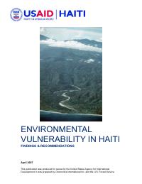
This report will be available in both English and French. The cover photograph of the
Roseaux watershed in Grand’Anse was taken by Joel Timyan. Authors can be contacted
as follows:
Glenn R. Smucker, Cultural Anthropologist
Smucker Consulting, grsmucker@aol.com
Michael Bannister, Forester, Agroforester
Center for Subtropical Forestry, University of Florida, Mikebann@ufl.edu
Heather D’Agnes, Population-Environment Technical Advisor
USAID/Washington, GH/PRH/PEC, hdagnes@usaid.gov
Yves Gossin, Agronomist, Lawyer
Consultant, Haiti, yvesgossin@yahoo.fr
Marc Portnoff, Engineer
Center for Advanced Fuel Technology, Carnegie-Mellon University,
mp1a@andrew.cmu.edu
Joseph Ronald Toussaint, Agronomist, Biodiversity Specialist
Consultant, Haiti, josephronaldt@yahoo.fr
Joel Timyan, Forester Ecologist, Oak Hill, Florida
(386) 345-0048, jctimyan@yahoo.com
Scot Tobias, Environmental Health Specialist
Associates in Rural Development, Inc., Stobias@ardinc.com
ENVIRONMENTAL VULNERABILITY IN HAITI: FINDINGS & RECOMMENDATIONS i
EXECUTIVE SUMMARY
This report was prepared in response to a Congressional directive that, “after consultation
with appropriate international development organizations and Haitian officials,
organizations and communities, the Administrator of the United States Agency for
International Development shall submit a report to the Committees on Appropriations
setting forth a plan for the reforestation of areas in Haiti that are vulnerable to erosion
which pose significant danger to human health and safety.” This launched an iterative
process that has encompassed analyses and consultations, and follow-up
recommendations.
BACKGROUND
For this report, which contributes to furthering the response to this mandate, USAID
contracted a multi-disciplinary team of experts to assess environmental vulnerability in
Haiti. The assessment team has interpreted its scope broadly to include not only
vulnerability to erosion but also an array of land use practices and related concerns, such
as better management of critical watersheds, improved rural livelihoods, sustainable
forest management, and reduction in the vulnerability of the Haitian populace to natural
disasters such as floods and hurricanes.
METHODS
The team was composed of nine international and Haitian specialists with advanced
degrees in cultural anthropology, natural resource management, agronomy, GIS analysis,
public health, and biofuel technologies. Five team members are well known Haiti
specialists with extensive field experience in research and program implementation. To
carry out its study, the team consulted widely with the government, the private sector,
major international donors, and grassroots organizations. In May 2006, the team carried
out two weeks of fieldwork in Haiti. The team presented its preliminary findings for
feedback and discussion at workshops in Haiti (July 2006) and Washington (August
2006). An earlier study, which reviewed Haiti’s public sector capacity for natural
resource management and disaster preparedness, and current activities of other major
environmental donors in Haiti, laid the ground for the present report.
TRENDS
Natural Disasters
Haiti has long been vulnerable to tropical storms and hurricanes; however, in recent
years, the country has been afflicted by a significant increase in severe natural disasters.
The country lies on the primary pathway of tropical storms that originate in the Atlantic
and strike Caribbean islands every hurricane season. Despite the destructive power of
gale force winds, loss of human life from tropical storms in Haiti is due primarily to
severe flash floods in eroded watersheds that wash down on poor riverine and coastal
floodplain communities. Haiti’s disastrous floods of 2004 in Gonaïves and other areas
serve as a warning of major threats to densely populated districts of Port-au-Prince and
other major coastal cities.
ii ENVIRONMENTAL VULNERABILITY IN HAITI: FINDINGS & RECOMMENDATIONS
Population
Haiti has a youthful and rapidly growing population which is increasingly clustered in
urban areas. Based on the census of 2003, Haiti's current population is estimated at 8.4
million people. The annual population growth rate is 2.5 percent per year and women
average 4.9 children. At present rates, the Haitian population will grow to 10 million by
2010, an increase of 19 percent in just four years. Haiti’s mountainous agricultural base
has long surpassed its carrying capacity and cannot support this rate of population
growth.
Rapid Urbanization
Like other countries in the region, Haiti is experiencing rapid urban growth, but not urban
job creation. On the contrary, since the early 1980s, the Haitian economy has been
marked by a long-term pattern of negative growth and increased poverty. As in sub-
Saharan Africa, Haiti is experiencing "premature urbanization” — the agricultural sector
is not productive and urban areas are not generating economic growth. Despite these
economic conditions, Haiti’s overall rate of urban population growth is 3.63 percent
compared to 0.92 percent in rural areas. Port-au-Prince alone is growing by 5 percent
annually, and 40 percent of Haiti's population lives in urban settlements, including
shantytowns in coastal flood plains such as Cité Soleil in Port-au-Prince, Raboteau in
Gonaïves, and La Faucette in Cap-Haïtien. The Port-au-Prince metropolitan area now
comprises one-fourth of Haiti’s entire population. Given the sheer scale of settlement in
coastal flood plains, predicted deaths due to catastrophic flooding in Port-au-Prince
would far surpass all other disasters in Haiti’s meteorological record.
The high rate of population growth and rapid urban expansion do not allow aquifers and
floodplains to function as natural storage and filters particularly during flood conditions.
Due to unplanned urbanization, hard surfaces caused by anarchic construction methods
prevent the infiltration of surface water required to recharge the country’s most important
aquifers, located in the major plains of Cul-de-Sac, Gonaïves, Léogane, Les Cayes and
Cap-Haïtien.
FINDINGS AND RECOMMENDATIONS
Root Causes of Environmental Disaster
The assessment team has concluded that the root causes of environmental disaster in
Haiti are acute poverty, rapid population growth and unplanned urbanization. In the short
term, it remains critical to convert hillsides to tree-based perennial agriculture; however,
the team’s most important recommendations are for long-term actions that fall outside the
realm of traditional soil conservation and reforestation efforts.
First, prospects for reduced vulnerability to natural disaster in Haiti are very limited in
the absence of broad based economic development. In the long run, it is imperative to
generate a large number of permanent long-term jobs and viable alternatives to farming
the country’s hillsides. This objective could be facilitated, for example, by US legislation
ENVIRONMENTAL VULNERABILITY IN HAITI: FINDINGS & RECOMMENDATIONS iii
favoring trade policy to support the assembly industry in Haiti and also the export of high
value fruit crops1.
Second, an environmental management plan geared to mitigate environmental
vulnerability must integrate demographic parameters and take steps to alleviate
population pressure by providing access to voluntary family planning information and
services. This argues for a national effort (building off current mission and donor efforts)
to integrate voluntary family planning service provision with the protection of vulnerable
watersheds, economic growth activities, and mitigation efforts in urban flood plain
communities.
Hillside Agriculture
The present assessment shows clearly that the future of Haiti does not reside with
intensively-managed hillside agriculture. The country’s steeply sloped agricultural plots
require substantial investments to keep soil, water and agricultural inputs in place.
Hillside farmers have long farmed Haiti’s slopes; however, these slopes were never
suited to annual agriculture and most farmers cannot afford the cost of installing and
maintaining appropriate agricultural practices. There is also no evidence that either the
Haitian state or donors can afford the high investments required to make hillside
agriculture productive on a sustainable basis. Therefore, despite our best efforts, most
Haitian landscapes will never consist of an ideal of hillside farms meeting high standards
of soil and water conservation, mixing perennial and annual crops, benefiting from
profitable marketing strategies, attaining adequate rural incomes, and providing equitably
for upstream and downstream users alike. There will undoubtedly be sites where
something close to this ideal model can be achieved, but these will be islands in the
overall landscape.
Rather, the primary “natural” resource to be managed in Haiti is the intellectual power
and work ethic of the Haitian people. Dysfunctional economic and political structures
have prevented Haitians from exploiting their individual capacities. In the long run, Haiti
must develop non-agricultural economic motors in secondary cities throughout the
country, with improved education feeding employees into those businesses. Instead of
succeeding though natural resource management projects, it is more likely that improved
watershed management will eventually be achieved when the rural population leaves
mountainous regions and finds alternate employment in lowland areas, coastal cities and
beyond — the Puerto Rican model. Unless the current hillside population density
decreases significantly, reforestation in the sense of reestablishing the previously-existing
forest will never be possible.
Watershed Interventions
In the near term, landscape restoration is urgently needed in selected watersheds. This
will buy time for longer-term efforts to boost broader economic growth, family planning,
improved education, and good governance in secondary cities. Up to now, there has been
no precedent in Haiti for successful interventions at the level of whole watersheds;
1
This legislation has now been adopted.
iv ENVIRONMENTAL VULNERABILITY IN HAITI: FINDINGS & RECOMMENDATIONS
success has been achieved at localized or pilot scales. Nevertheless, to effectively reduce
vulnerability, interventions must engage a critical mass of farmers and affect the
preponderance of slopes within watersheds. The challenge, therefore, is to scale up
interventions in scattered plots and isolated ravines, and promote alternatives to erosion-
intensive agriculture on Haiti’s slopes. This includes increasing the proportion of the
landscape devoted to perennial crops rather than erosion-intensive annual food crops, off-
farm employment generation including transformation of local agricultural products, and
generally shifting agricultural pressures away from slopes onto more intensively
cultivated lowlands and other sites less vulnerable to erosion.
Valuable lessons have been learned from the successes and failures of previous projects
in Haiti, especially in the areas of tree culture and marketing of agroforestry products.
When properly targeted and implemented, project interventions on slopes can speed
landscape restoration, restore the functions of ecosystems, mitigate poverty, and slow the
anarchic population growth of Haiti’s cities. Using a participatory methodology,
watershed management plans should be prepared for whole watersheds and should
include identification of assets as well as high risk sites within watersheds. This process
should include the direct participation of local farmers and other watershed stakeholders
including local government.
Conversion of hillsides to tree-based perennial agriculture should be undertaken in a
context of national planning that takes food security into account as well as the capacity
for urban centers and lowland agricultural zones to absorb significant increases in
population. If grain and pulse production were to decline due to the widespread conversion
of slopes to tree crops, Haiti would become even more dependent on food imports.
Therefore, complementary improvements in flatland agriculture are needed as well.
Watershed Vulnerability and Prioritization
There is little chance of reducing vulnerability to natural disaster unless the interventions
encompass whole catchment areas and incorporate ridge-to-reef planning. To be
effective, interventions must be part of an integrated approach, directly linking natural
resource management with other pertinent sectors such as early warning, urban planning,
reproductive health, and job creation programs. To be sustainable, watershed
interventions must be rooted in participatory approaches with local levels of government,
grassroots organizations, and resource user groups.
Given the overwhelming challenges, it is imperative to establish priorities and make
choices based on reliable data and careful analysis of risk and opportunity Prior to the
present study, Haiti’s watersheds had never been compared and ranked quantitatively in
terms of their vulnerability to loss of human life, productive infrastructure, soil potential,
or erosion risk. Therefore, the assessment team used geographic information systems
(GIS) analysis and hazard mapping to develop an unprecedented new tool for (i) ranking
the relative vulnerability of Haiti’s watersheds and (ii) establishing priorities to mitigate
risks of natural disaster and promote economic growth (please see map below that
identifies priority watersheds). The team’s vulnerability analysis of Haiti’s 54 major
watersheds identified four thematic clusters of high priority watersheds:
ENVIRONMENTAL VULNERABILITY IN HAITI: FINDINGS & RECOMMENDATIONS v
• Port-au-Prince. There is virtually no chance of diminishing Haiti’s vulnerability to
severe flooding without mitigation efforts that target densely populated urban
neighborhoods. The Port-au-Prince metropolitan area has far and away the highest
potential for loss of life and infrastructure if a disastrous flood occurs. This is due to
the sheer density of people living in the metro region, many in floodplains. Therefore,
a task force is urgently required to create flood maps of high risk zones of the Port-
au-Prince metropolitan area. A programmatic response should be firmly rooted in
partnerships with neighborhood groups. The sheer scale of investment and
organizational effort required to alleviate flood risk in the Cul-de-Sac watershed that
encompasses Port-au-Prince will undoubtedly require a multi-donor strategy rather
than reliance on a single donor.
• Secondary Cities (Les Cayes, Trou du Nord and Jassa, La Quinte-Gonaïves, and Cap-
Haïtien). This cluster links high risk to population and infrastructure with high
production potential. Therefore, program interventions in secondary cities and their
rural uplands should emphasize economic development along with natural resource
protection and disaster preparedness. The Inter-American Development Bank and
USAID job creation programs are already active in Les Cayes, Gonaïves, and Cap-
Haïtien.
• High Mountains and Protected Areas (Grand’Anse, Rivière Jacmel, and Fonds
Verrettes). The highland forests of these watersheds exercise a critical hydrological
HAITI
COMPOSITE MAP OF PRIORITY
WATERSHEDS BASED ON MEDIAN
VALUE OF 5 INDICES
• Cap-Haitien
• Limbé
• Trou du Nord
• Gonaïve
• Verrettes
Grand’Anse .
Léogane • Pine Forest Reserve
• Pic Macaya National Park
• Tiburon • Aquin • La Visite National Park
• Les Cayes • Jacmel
• Port Salut
vi ENVIRONMENTAL VULNERABILITY IN HAITI: FINDINGS & RECOMMENDATIONS
function as headwaters of more than a dozen rivers and have global significance for
biodiversity. According to recent reports, the Grand’Anse region has become the
country’s principal source for the unsustainable harvest of wood charcoal. Therefore,
this cluster links very high erosion risk with the region’s high frequency of hurricanes
and the opportunity to conserve Haiti’s most significant protected areas, Macaya and
La Visite National Parks and the Pine Forest Reserve. Watersheds in this cluster
would benefit from the development of a national heritage strategy together with the
Haitian government and international NGOs, including co-management with local
user groups and the promotion of ecotourism.
• Manageable Size, Donor Absence and Vulnerability (Trou du Nord, Momance-
Léogane, Limbé, Tiburon/Port-Salut, Aquin/St. Louis du Sud). This cluster overlays
manageable size with the absence of other donors whose efforts have instead targeted
the lower Artibonite and some of the larger secondary cities. Watersheds in cluster 4
are conducive to ridge-to-reef management plans encompassing both urban and rural
sectors, and the income-generating capacity of local producer groups.
In sum, the USAID/Haiti Mission cannot directly intervene in all 54 major watersheds of
Haiti. Therefore, it should devise a near term strategy for interventions in high priority
watersheds. In general, prioritization should target high risk sites and link early warning
systems with watershed interventions, including best management of natural buffering
systems such as highland forests, the estuaries of mangroves, and coastal wetlands.
Prospects for Biofuels in Haiti
Charcoal and fuelwood currently provide 75 percent of Haiti’s energy consumption.
Given the importance of these products, the assessment team was asked to make
recommendations regarding improved biofuels and biofuels management as an element
of watershed management. The team recommends expansion of bio-energy crops
including wood and oil bearing plants in response to viable markets, and incorporation of
such crops on slopes and in soil conservation structures where feasible.
Future efforts should promote sustainable planting and harvesting of trees for charcoal
and other wood products. Measures to increase the supply of fuelwood should include
farm-site tree planting, more efficient carbonization, and massive diffusion of more
efficient cookstoves, including more efficient charcoal stoves. To support these efforts, it
is also important to advocate for a national strategy on sustainable charcoal production.
Production of oil bearing crops in drier agricultural zones may be used to reduce soil
erosion and improve watershed management; however, at the present time these crops
and their markets are not well established. Therefore, the Mission should closely monitor
liquid biofuel opportunities and work with local stakeholders to define an action plan for
pilot efforts in this sector.
ENVIRONMENTAL VULNERABILITY IN HAITI: FINDINGS & RECOMMENDATIONS vii
CONCLUSION
A USAID strategy for intervening in high priority watersheds should be just one element
of a long-term multi-sector strategy for major investments in economic development and
off-farm employment in secondary cities, small towns, and flatlands. In order to have a
discernible impact, there should be a significantly heightened level of inter-donor
collaboration at policy levels as well as the targeting of field interventions. Also, Mission
programming should make use of other US government resources in addition to USAID
expertise in urban planning, environmental management, coastal and marine resources,
and disaster preparedness.
For such an approach to be effective, the US government should make a long-term
commitment to poverty alleviation and to interventions in critical watersheds. An
effective strategy will require seamless continuity of funding at major funding levels
going well beyond scattered projects and intermittent three to five year project cycles.
This will require a major commitment on the part of the US government, as well as an
enabling political environment in Haiti.
viii ENVIRONMENTAL VULNERABILITY IN HAITI: FINDINGS & RECOMMENDATIONS
I. INTRODUCTION
This report presents findings and recommendations of a USAID-funded policy study
undertaken to define program interventions to reduce Haiti’s vulnerability to natural
disaster and to improve management of watersheds and erosion-prone hillsides.
Hurricanes and tropical storms have long been the primary causes of natural disasters in
the Caribbean. In the spring rains of May 2004, more than 2,000 people died due to
tropical storms and severe flooding in the Haitian mountain towns of Fonds-Verettes and
Mapou, and the neighboring town of Jimani in the Dominican Republic. A few months
later in September 2004, flooding related to the passage of Tropical Storm Jean killed
more than 3,000 Haitians in Gonaïves and Port-de-Paix.2
This policy study was undertaken in response to a Congressional directive. In the 2005
Appropriations Bill, Congress directed that USAID develop “a plan for the reforestation
of areas in Haiti that are vulnerable to erosion which pose significant danger to human
health and safety.” USAID has interpreted this mandate broadly to include better
management of critical watersheds, improved rural livelihoods, sustainable forest
management, and reduction in the vulnerability of Haiti’s populace to natural disasters
such as floods and hurricanes.
In order to identify the most effective interventions in these sectors, USAID conducted an
initial assessment of current and past watershed management activities in July 2005.3
This assessment identified environmental stabilization activities that have improved the
condition of vulnerable hillsides and rural livelihoods. The key to these successes was the
use of market-based incentives that connect soil and water conservation measures to
improvements in farmer incomes.
Subsequently, between November 2005 and September 2006, USAID commissioned a
somewhat broader overview of environmental vulnerability including (i) a background
analysis of environmental risks and opportunities in Haiti, 4 and (ii) the present report of
findings and recommendations for alleviating Haiti’s environmental vulnerability. The
background analysis reviewed Haiti’s environmental policy and legal framework, and
public sector capacity for natural resource management and disaster preparedness. It also
reviewed current activities of other major environmental donors in Haiti including The
World Bank, the Inter-American Development Bank, the European Union, and the
Canadian International Development Agency. Background analysis took special note of
the Interim Cooperation Framework (July 2004) established by donors and the Interim
Government of Haiti (2004-2006) in the months following the fall of Aristide (February
29, 2004).
The assessment team conducted its background analysis prior to the February 2006
election of President René Préval and the establishment of a new government in May
2006. The 2004 Interim Cooperation Framework established by donors with Haiti’s
2
See Potter et al., (2004) and OCHA Situation Report (2006).
3
Agriculture in a Fragile Environment: Market Incentives for Natural Resource Management in Haiti (July 2005), Glenn Smucker,
editor, and Gardy Fleurantin, Mike McGahuey, and Ben Swartley, USAID/Haiti Mission.
4
Environmental Risks and Opportunities in Haiti: A Background Analysis (October 2006), Glenn Smucker, editor, Marc-Antoine
Noel, and Jean-André Victor.
Interim Government was scheduled to end in September 2006. After the election of
Préval, a new donor conference was held in July 2006. At that point donors attending the
International Conference for the Economic and Social Development of Haiti pledged an
additional $750 million of assistance to Haiti, and the Interim Cooperation Framework
was extended to September 2007. Consequently, the assessment team updated its
background analysis to take into account the evolving political and policy environment,
including the newly elected government of René Préval and the new donor conference.
The present report is based on an overview of critical sectors that have an impact on
Haiti’s vulnerability to disaster, including watershed management, disaster preparedness,
sustainable forest and parks management, urban planning, population and health linkages,
institution-building and policy reform, the use of biomass for energy, and markets for
agroforestry products. The report’s findings and recommendations are designed to inform
USAID efforts to develop a watershed strategy and define interventions that are (a) likely
to be effective, (b) able to produce impact at a broad scale, and (c) within the Agency’s
manageable interest.
To carry out its study, the assessment team consulted widely with a broad range of
stakeholders inside and outside of government including grassroots organizations. As a
culminating phase of this consultation process, the team presented its principal findings
and recommendations at two stakeholder workshops, one in Port-au-Prince (July 20,
2006) and the other in Washington (August 2, 2006). Workshop presentations included
opportunity for questions and discussion of the issues raised by workshop presentations.
The workshops also served as a forum to test the team’s findings in response to
stakeholder concerns and feedback. These concerns have been taken into account in the
chapters that follow. Some workshop discussants and presenters contributed to workshop
presentations but are not listed here as authors.5
Stakeholders participating in the two workshops included the US government and other
donors including CIDA, The World Bank, and the Inter-American Development Bank,
Haitian government representatives including the Ministers of Agriculture and
Environment and representatives of other Haitian government agencies and ministries
(Ministry of Interior, Directorate of Civil Protection, Bureau of Mines and Energy),
Haitian and international non-governmental organizations, representatives of the Haitian
business sector, women’s groups, peasant organizations, and ordinary citizens.
The following chapters track the panels and themes presented in the two recent
workshops. This includes an overview of population, health and the environment in Haiti
(Heather D’Agnes and Scot Tobias), practical approaches for intervening in watersheds
based on lessons learned from earlier efforts along with new developments of special
interest (Mike Bannister and Yves Gossin), and priorities for public policy and for
ranking the relative vulnerability of critical watersheds (Joel Timyan and Ronald
5
Gael Pressoir, plant geneticist, served as a discussant at both the Haiti and Washington workshops, and Andy White, forest
economist, at the Washington workshop. In Washington, Rochelle Rainey presented findings on population, health, and the
environment, based on the chapter co-authored by D’Agnes and Tobias. Haitian co-authors for the team’s background analysis, Marc-
Antoine Noel (agronomist) and Jean-Andre Victor (environmental lawyer), also made presentations at the Haiti workshop.
2 ENVIRONMENTAL VULNERABILITY IN HAITI: FINDINGS & RECOMMENDATIONS
Toussaint). A brief final chapter draws on earlier sections of the report and synthesizes
key elements of an emergent strategy for mitigating natural disaster in Haiti’s watersheds.
In the early stages of this assessment, high level representatives of the Haitian
government asked the team to assess prospects in Haiti for liquid biofuels including plant
oil and biodiesel. The team responded in keeping with its mandate to take into account
the concerns of critical stakeholders. Therefore, this report also includes a chapter that
explores prospects for biofuels in Haiti (Marc Portnoff).
The role of biofuels (including wood charcoal) in donor environmental strategies remains
controversial in Haiti. This is due in part to environmentally destructive aspects of
charcoal as the predominant cooking fuel in urban Haiti. In addition, current controversy
over prospects for new biofuels stems from recent trends for high fuel costs. This has
generated high levels of enthusiasm for liquid biofuel alternatives such as biodiesel,
although there is little experience with it in Haiti. At the present time, promotion of liquid
biofuels as an element of USAID/Haiti strategy remains exploratory and is not a near
term option for large direct investments. The Mission’s near term planning does include
initiatives to improve charcoal efficiency and sustainability. The Mission’s longer term
strategy may also support pilot efforts and continued monitoring of liquid biofuel
opportunities in Haiti, including prospects for private-public partnerships.
Some of the findings in this report reflect natural resource management (NRM) themes
and recommendations already presented in earlier studies, particularly the July 2005
report noted earlier, Agriculture in a Fragile Environment: Market Incentives for Natural
Resource Management in Haiti. This is hardly surprising due to inescapable recurring
themes that emerge when confronting the persistent dilemma of how to make an impact
in Haiti’s highly degraded watersheds. One persistent dilemma, for example, is the
difficulty of scaling up from scattered farm plots in order to treat entire slopes or whole
watersheds with erosion control measures or market-oriented perennial crops.
So what is new in the present report? The assessment team consulted with a much
broader range of stakeholders, including interlocutors outside of the usual network of
environmental partners.6 Secondly, the team used GIS analysis to quantify and rank all of
Haiti’s major watersheds in terms of their vulnerability to severe flooding. This type of
science-based ranking has never been done before and is an unprecedented new
contribution. Third, this study takes note of current new developments that show promise,
e.g., business partnerships between small peasant farmers and affluent private sector
interests, and new evidence of landscape level changes in tree cover due to peasant tree
gardens cropped for sustainable charcoal harvest.7 Fourth, this assessment takes special
note of highly stressed mangrove ecosystems and estuaries as an important target for
flood control and protection of livelihoods in river delta areas. Finally, this report
recognizes new biofuel trends in the world, and examines prospects for biofuel in Haiti as
an element of watershed strategy.
6
This process also included extended conversations with representatives of both the outgoing Interim Government and the newly
elected government of President Préval.
7
This pattern of market-oriented tree cropping and these particular sites were originally established by small peasant farmers under the
AID funded Agroforestry Outreach Project of the early 1980s.
ENVIRONMENTAL VULNERABILITY IN HAITI: FINDINGS & RECOMMENDATIONS 3
II. POPULATION, HEALTH, AND THE ENVIRONMENT
by Heather D’Agnes and Scot Tobias8
Calamities from extreme weather highlight how environmental hazards combine with
socioeconomic conditions to magnify the threat of disaster for tens of millions of people
in both the developed and the developing world. In an attempt to understand the full
range of factors that affect Haiti’s growing vulnerability to severe storms, this chapter
links population and health trends with the environment as pivotal factors that greatly
exacerbate the effects of natural disasters. The present chapter also briefly examines
health problems of indoor pollution due to the use of firewood and wood charcoal as
cooking fuel.
Policymakers and practitioners routinely assert that high population growth and rapid
urbanization increase the negative effects of natural disasters; however, these declarations
rarely lead to effective action since standard responses to natural disasters focus on short
term alleviation of immediate distress. A long-term approach should examine the
relationship among natural disasters and development patterns, population growth, spatial
distribution, and the underlying rationale for demographic behaviors. This type of
analysis generates recommendations that address structural issues rather than short-term
remedial actions.
HAITI’S DEMOGRAPHIC PROFILE
Haiti has a youthful and rapidly growing population with an increasing tendency to
cluster in urban areas. A recent census by the Haitian Institute of Statistics (IHSI)
estimates Haiti’s population at 8.4 million.9 The annual population growth rate of 2.5
percent per year is higher than previous estimations; women average 4.9 children.
Population growth results exclusively from childbearing since Haiti’s net migration rate
is –1.3 migrants per 1,000. It is estimated that the Haitian population will grow to 10
million by 2010, an increase of 19 percent in just four years.
This growth rate is striking since the average life expectancy was 53 years in 2006, 51.9
years for males and 54.6 years for females. Haiti’s health indicators are the worst in the
western hemisphere with an annual death rate of 12.2 deaths per 1,000 population, infant
mortality at nearly 72 deaths per 1,000 live births, a maternal death ratio of 523 women
per 100,000 live births, and an HIV prevalence rate of 4-5 percent of the total population
(UNFPA, 2006). This further demonstrates that high fertility is the primary cause of
burgeoning population growth.
In addition, Haiti’s population is increasingly dense and concentrated in urban areas.
Haiti is the western hemisphere’s second most densely populated country with 302
persons per square kilometer, trailing only Barbados (UNFPA, 2006). With an
urbanization ratio of 40 percent, a growing proportion of Haiti's population now lives in
urban settlements including shantytowns in coastal flood plains such as Cité Soleil and
La Saline in Port-au-Prince, Raboteau in Gonaïves, and La Faucette in Cap-Haïtien. The
8
Rochelle Rainey also contributed to this chapter and presented its findings at the Washington workshop.
9
The 2003 census is Haiti’s fourth, following those of 1950, 1971 and 1982.
4 ENVIRONMENTAL VULNERABILITY IN HAITI: FINDINGS & RECOMMENDATIONS
country’s high urban population growth rate of 3.63 percent and low rural population
growth rate of 0.92 percent reflects high rates of migration from rural to urban areas (UN
Habitat, 2001). The Port-au-Prince metropolitan area alone, including seven neighboring
municipalities, now comprises more than one-fourth of Haiti’s population. This reflects
an urban growth rate of five percent annually between 1982 and 2003 in Haiti’s most
urbanized département (Ouest). Consequently, an estimated 62 percent of all urban
dwellers in Haiti live in the metropolitan area of Port-au-Prince (IHSI, 2003).
Haiti’s population will continue to grow rapidly due in large part to its high population
momentum. Population momentum refers to the percentage of the population that has not
yet had children but will eventually add to the population through reproduction. In Haiti,
50 percent of the country’s population is under the age of 20 (see Figure 1). Haitians are
sexually active in their teens; the median age of sexual debut for women is 18.2. In
addition, 31.3 percent of women age 20-24 give birth before the age of 20 (ORC Macro,
2000). As a result, the higher the percentage of people age 20 and under, the larger the
population growth will be. Therefore, Haiti’s population will continue to grow – even if
the fertility rate over the next few years begins to decline. For a graphic representation of
past and projected population growth by age, see Figure 2 on the next page.
SOURCE: United States Census Bureau (BUCEN), International Programs Center. International Database.
FACTORS INFLUENCING POPULATION GROWTH
Lack of access to family planning
There is scant data on access to family planning services and information in Haiti;
however, data gathered by the Haiti Demographic Health Survey (DHS) in 1994/5 and
2000 demonstrate a clear lack of sufficient family planning services (see Table 1).
Contraceptive prevalence rate is low at 28.1 percent for all methods of family planning
and 22.8 percent for modern methods. Expressed desire for family planning services
exceeded availability of those services; 56.9 percent of married women want no more
ENVIRONMENTAL VULNERABILITY IN HAITI: FINDINGS & RECOMMENDATIONS 5
children and 39.6 percent Figure 2. Haiti’s Projected Population by Age
of women express an
unmet need for family
planning. In addition,
women only want an
average of 3.1 children but
end up having 4.7 children.
One reason for the high
unmet need for family
planning is that Haiti’s
reproductive health
services are primarily
health centers and district
hospitals clustered in
urban areas (see Table 2).
Thus, a large percentage
of the population lacks
Source: World Resources Institute
sufficient access to outlets
for family planning. Due
to the limited distribution network, the population depends largely on permanent to semi-
permanent family planning methods such as female sterilization and Norplant implants
rather than shorter-term family planning commodities such as pills and condoms. This
inhibits the ability of many women, especially rural women, to space the births of their
children without eliminating the ability to have more children.
Table 1. Key Family Planning Indicators
FERTILITY INDICATORS 1994/95 2000
Total fertility rate (children per women) 4.8 4.7
Percent (%) of teenagers who have begun childbearing 14.5 18.0
Fertility preferences
Percent (%) of married women who want no more children 52.5 56.9
Percent (%) of married women with an unmet need for family planning 44.5 39.6
Mean ideal number of children 3.3 3.1
Family planning use indicators
Percent (%) of married women currently using any method of family planning 18.0 28.1
Percent (%) of married women currently using any modern method of family planning 13.2 22.8
Other proximate determinates of fertility
Median age at first marriage for women age 25-49 (years 20.8 20.5
Median age at first sex for women age 25-49 (years) 19.0 18.2
Source: ORC MACRO, 2006. MEASURE DHS STATCOMPILER. May 29 2006. http://www.measuredhs.com
6 ENVIRONMENTAL VULNERABILITY IN HAITI: FINDINGS & RECOMMENDATIONS
Table 2. Percentage Distribution of Current Users of Modern Methods by the Most
Recent Source of Supply according to Method
Source Contraceptive Method
Female
Pill Implant Injectable Condom
sterilization
Public sector
21.9 21.9 24 4.5 55.5
(hospital and health centers)
Private medical sector
(hospital/clinic, health centers, 41.2 45.7 25.8 37.4 23.4
physician, pharmacy)
Mixed sector medical sector
(hospital/clinic, health center, 24.3 32 39.4 4.8 18.1
family planning clinic)
Noninstitutional medical sector
(mobile clinic, health 8.4 0 10.3 1.1 0.3
agent/promoter, midwife)
Other informal sector
4.2 0.0 0.5 51.3 0.0
(store, market, acquaintances)
Source: Studies in Family Planning, “HAITI 2000: results from the demographic and health survey,” 2003.
Unfortunately, family planning services in Haiti tend to be poor in quality. Based on the
Maternal and Neonatal Program Effort Index (MNPI), Haiti received a low overall
ranking of 49 out of 100 for family planning services provided at health centers and
district hospitals (Bulatao and Ross, 2002; Ross, Campbell, et al., 2001). Figure 3 shows
individual ratings for family planning services provided at health centers and district
hospitals. Both health centers and district hospitals received relatively high ratings for pill
supplies (56 and 57, respectively) and postpartum family planning (both 56). Male
sterilization (43) was the lowest-rated service for district hospitals, whereas IUD insertion
was the lowest for health
centers (26).
Figure 3. Provision of family planning services at
Impacts of Poverty on health centers and district hospitals in Haiti
Access to Family
Planning
High population growth is
particularly acute among
the poor. The 2000 DHS
demonstrates that fertility
levels differ significantly
among social groups, with
the poorest sectors
showing much higher
levels of fertility. These
fertility patterns reflect the
fact that limited
ENVIRONMENTAL VULNERABILITY IN HAITI: FINDINGS & RECOMMENDATIONS 7
availability of family planning and health services in Haiti has the severest impact on
poor women. Women frequently bear full responsibility for all family-related decisions
and concerns but have the least capacity to exercise their reproductive preferences.
Women from the lowest socioeconomic level in Haiti have twice as many children as
they would like to have. Their inability to exercise their reproductive rights is the starting
point for a vicious circle centered on the intergenerational transmission of poverty. Poor
women have limited information and resources to limit the number of births. Forced to
rear many children, these women have greater difficulty in obtaining paid employment,
leading to a lower per capita income for their families. During emergency situations and
disasters, such inequities become more acute.
Current USAID Efforts in Access to Family Planning
USAID funds several projects to provide support to family planning programs in Haiti. In
particular, USAID is reinforcing the capacity of institutions nationwide to deliver clinical
family planning methods. Anticipated results are increased access to and use of modern
and natural family planning services and related maternal health care, and strengthened
quality of essential maternal and neonatal care. Reproductive health services are closely
integrated with HIV-related activities under the President's Emergency Plan for
HIV/AIDS Relief (PEPFAR). 10
Between 1995 and 2000, a USAID-funded project operated by Management Sciences for
Health (MSH) and its partners established an NGO network (34 members) to streamline
services, deliver a minimum package of services, and develop strategies to inform and
educate the public. This network has had a significant impact. Between 1997 and 1999,
use of modern contraceptive methods increased from 15.7 percent to 25 percent at project
sites; “three plus” prenatal visits increased from 44 percent to 61 percent; and the number of
trained personnel attending deliveries increased from 63 percent to 79 percent. The
appropriate use of oral rehydration therapy (ORT) and full immunization also improved
significantly in project areas.
HEALTH SERVICES, POVERTY, AND VULNERABILITY
Environmental Health Services
Following natural disaster, any affected population requires shelter from the elements and
access to clean water, proper sanitation, and energy sources. The number of people put at
risk by interruption of water and sanitation service due to natural disaster can easily be
three or four orders of magnitude greater than the number of people killed or injured by
that same disaster. Provision of environmental health, water, and sanitation services in
the absence of a natural disaster is complex and requires coordinated efforts by national
government ministries, local government units, civil society, and the private sector. When
these institutions and their coordination are weak, the systems and infrastructure for these
services are particularly vulnerable to disruption due to natural disasters.
10
Principal contractors are Johns Hopkins Program for International Education in Gynecology and Obstetrics, the Futures Group,
Management Sciences for Health (MSH), and Population Services International.
8 ENVIRONMENTAL VULNERABILITY IN HAITI: FINDINGS & RECOMMENDATIONS
In the case of reproductive health services, natural disasters can accentuate reproductive
health needs by intensifying the inability of couples and individuals to exercise their
reproductive rights due to:
• Deterioration of health services
• Difficulty in access to services as a direct consequence of disaster
• A shift in medical priorities away from reproductive health services
Natural disasters also tend to increase the incidence of sexual abuse, sexually transmitted
diseases, unwanted pregnancies due to the poor conditions in shelters, and the
vulnerability of minors separated from caretaker adults. For example, the 3,000 deaths
attributed to Tropical Storm Jeanne in Gonaïves (2004) generated a sizeable number of
orphaned children.
Overall, fertility tends to decrease in times of crisis, but fertility later tends to increase
along with recovery. Experiences of war, famine, and other disasters clearly demonstrate
this trend. Recent data from a 2001 survey show that fertility in Honduras for the period
1999-2001, after a period of recovery from Hurricane Mitch, were much higher than
projected (ASHONPLAFA, & CDC, 2002).
Population Trends, Poverty, and Vulnerability
Links between population trends, poverty, and degraded natural resources are the central
feature of Haiti’s vulnerability to tropical storms. Growing rural poverty is the dominant
precipitating factor behind the country’s rapid rate of urbanization. High rural-urban
migration is motivated largely by the search for employment and access to schooling.
Rapid urbanization has severely aggravated the impact of natural disasters in Haiti,
especially among the poor, and has imposed heightened pressures on the environment.
The urban poor in Haiti often have no choice but to occupy the least-valued plots of land
in disaster-prone areas such as riverbanks, unstable hillsides, deforested lands, or fragile
catchment areas. In general, the densely populated slum districts of Haiti’s coastal cities
are located to a large degree in flood plains.11
These populations are highly vulnerable to disease “...poverty and population
and natural disaster. Upland soil erosion causes pressure force growing numbers
massive deposit of solids in lowland floodplains, of poor people to live in harm’s
overwhelming the capacity of both natural and way — on flood plains, in
manmade drainage systems. Downstream flooding earthquake-prone zones and on
creates breeding grounds for insect vectors. unstable hillsides.”
Flooding also mobilizes pathogens in human feces
and other solid waste deposited on the ground.
- Kofi Annan, 1999
Public systems for the handling and disposal of
human waste are virtually non-existent. Open pit
latrines, field defecation, and use of “scandal bags”
11
Chapter IV addresses this issue in more detail with a view to prioritizing interventions in order to mitigate the effects of natural
disaster.
ENVIRONMENTAL VULNERABILITY IN HAITI: FINDINGS & RECOMMENDATIONS 9
or “flying latrines” are common solutions to human feces disposal, especially in urban
districts with few or no public services. The impact of flooding on these open sanitation
systems has the effect of contaminating every surface touched by floodwaters. Overall,
large urban areas in Haiti tend to be more hazardous than sparsely populated rural areas
because of their population size and the potential scale of damage.
Disasters, although terrible in their impacts, often “wipe the slate clean” with respect to
reconstruction. An important opportunity exists after disasters to rebuild in a more
responsible and sustainable manner, as has happened to some extent in Gonaïves.
Communities can be planned, and drainage and transportation systems designed that will
increase resilience to natural disasters.
HOUSEHOLD COOKING FUEL AND INDOOR AIR POLLUTION
Globally, about 2.4 billion people rely on inefficient and highly polluting biomass fuel —
mostly wood, animal dung, and crop wastes — for everyday household energy needs
(IEA 2002; Smith, Mehta, and Feuz 2004). The majority of households using solid fuels
burn them in open fires or simple stoves that release smoke into enclosed areas. The
resulting indoor air pollution (IAP) comprises a variety of health-damaging pollutants,
including particles, carbon monoxide, and carcinogens, and is a major threat to health,
particularly for women and young children, who may spend many hours close to the fire
(Smith 1987). Every year, 1.5 million people die from inhaling indoor pollutants that
often exceed accepted guideline limits for outdoor air; in the case of fine particles, the
limit is exceeded by 100 times or more (Smith et al., 2004; WHO, 2006).
Children and women are disproportionately affected with nearly 800,000 deaths annually
attributable to indoor air pollution occurring among children under five years of age, and
more than 500,000 such deaths occurring among women (WHO, 2006). This issue is
inextricably linked to poverty, as it is primarily the poor who rely on solid fuels and
inefficient stoves, and many are trapped in this situation. Health and economic
consequences contribute to keeping them in poverty, and their poverty stands as a barrier
to change (Bruce et al., 2006).
In Haiti, the standard charcoal cook stove burns inefficiently with little ability to control
air or conserve heat.12 In addition to the burden that this reliance on biomass puts on
Haiti’s tree cover, cooking with charcoal and firewood on crude stoves has a significant
adverse impact on human health in Haiti. It has been estimated that the average life span
in Haiti is shortened by 6.6 years because of the impacts of indoor air pollution caused by
indoor burning of biomass (United Nations, 1998). Acute Lower Respiratory Illness
(ALRI), the global number one killer of children under five years of age is also the
number one killer of under-fives in Haiti — with ALRI mortality estimated to be more
than 40 percent (Fenand et al., 2005). This mortality burden is undoubtedly related to the
massive use of biomass as cooking fuel. It is common to have outside cooking shelters
separated from living quarters in Haiti; however, cramped households in densely
12
The most commonly used stove consists of a charcoal pan on three legs, and the pan has holes in the bottom for air and for ashes to
drop. The cooking pot sits on top of the charcoal pan quite close to the coals.
10 ENVIRONMENTAL VULNERABILITY IN HAITI: FINDINGS & RECOMMENDATIONS
populated urban neighborhoods are strongly affected by the use of smoky fuels in
enclosed areas.
In addition to the negative health effects, use of solid biomass fuel has important
environmental consequences. Many low income urban populations rely on wood charcoal
for cooking, and the production of charcoal can place severe stress on forests, particularly
if the charcoal production technology is inefficient. Reliance on wood fuels may
contribute significantly to deforestation when linked to population pressure, poor forest
management, and clearance of land for agriculture and construction materials. Reduction
of tree cover tends to increase distance traveled to obtain wood and can result in the use
of freshly cut (green) wood, dung, and twigs, which are more polluting and less efficient.
Most households in Haiti rely on local biomass for cooking fuel (ECVH 2003, ESMAP
2005). Furthermore, most wood harvest in Haiti is for cooking fuel, primarily for
charcoal in urban areas and firewood in rural areas. The high and growing demand for
wood-based cooking fuel in Haiti has had significant environmental consequences. Wood
charcoal and fuelwood markets, including prospects for sustainable charcoal harvest in
Haiti, are discussed in more detail in Chapter V.
Efforts to introduce improved cooking systems in Haiti include locally manufactured
adobe stoves, hand-crafted and mass produced stoves constructed of metal, and solar
cook stoves. Improved cook stoves have made only minor inroads due to their high cost
compared to traditional Haitian charcoal stoves, and also the expense and difficulty of
constructing adequate chimneys for indoor use. Traditional Haitian cook stoves are
cheaper to acquire but less efficient in the use of energy. Among the urban poor, cash
shortage and rising fuel costs commonly result in cooking fewer meals, perhaps only one
per day, and also unhygienic “cold” storage and consumption of previously cooked food.
Large scale use of improved cook stoves in Haiti could have a significant impact on the
scale of tree harvest as well as human health, particularly under-five mortality. Due to
prospective savings on fuel, economic incentives exist to acquire improved cook stoves,
especially in urban households; however, the majority of urban households cannot afford
up-front acquisition costs for improved cook stoves. There are also culinary preferences
for cooking over charcoal rather than other fuels.
RECOMMENDATIONS FOR ACTION
Macro-Level Recommendations
Any serious effort to mitigate Haiti’s environmental crisis must directly address Haiti’s
dominant population trends — rapid population growth and rapid urbanization, especially
the anarchic growth of Port-au-Prince. This argues for a national effort to reduce
population growth and mitigate environmentally destructive patterns of urbanization.
There should be a major effort to promote widespread use of improved cook stoves that
direct less smoke into enclosed cooking areas and consume less fuel, especially in Haiti’s
rapidly growing urban neighborhoods.
ENVIRONMENTAL VULNERABILITY IN HAITI: FINDINGS & RECOMMENDATIONS 11
Other Recommendations
Family planning services should be directly integrated with other program interventions
to protect watersheds and other natural resources. Family planning should be linked to
the management of watersheds, protected areas and forests, and conservation of
mangroves and other coastal resources. There is growing evidence that programs linking
natural resource management with health and family planning provide substantial value
(Pielemeier, 2005):
• Health and family planning services may serve as an important entry point for
conservation and natural resource management activities. Integrated programs build
positive relationships with communities, and local commitment to land use planning
and management of protected areas.
• Integrated programs result in increased participation of groups traditionally
marginalized or left out in both health and natural resource management projects.
They are more likely to increase male involvement in family planning and health
activities, female involvement in natural resource management activities, and
increased participation of adolescents of both sexes in natural resource and
reproductive health behavior change activities.
• Environmental health services (water and sanitation) may serve as the “entry point”
for other family planning interventions. These activities gradually open the door to
family planning among conservative rural communities that are traditionally hard to
reach.
• Population-health-environment projects have shown themselves to be both cost-
efficient and effective. A large number of NGOs have demonstrated that they can
successfully implement integrated programs with the positive effects of expanding
target audiences, reducing operating expenses, and fostering community goodwill and
trust.
Policy and donor attention to the linked population and environment dimensions of
natural disasters should be strengthened.13 These issues are intrinsically linked in both
urban and rural settings, but programs are generally designed as stand alone
environmental management or reproductive health programs.
• The supply chain for family planning products should be strengthened: Links between
vulnerability to natural disaster and population can be used to promote equal access to
family planning services for all Haitian populations. Community-based social
marketing and distribution networks can increase access to family planning services
and boost the contraceptive prevalence rate of modern methods.
13
See Chapter IV for other recommendations on disaster preparedness in addition to family planning services.
12 ENVIRONMENTAL VULNERABILITY IN HAITI: FINDINGS & RECOMMENDATIONS
• Local population risk analysis should be undertaken for more effective targeting:
Analysis of vulnerability should take note of population density and distribution to
determine numbers at risk, and age structure to determine young and older segments
of the population that may be at greater risk.
• Targeting the rural poor: High priority should be given to the provision of family
planning services for populations living in fragile upland zones of critical watersheds.
• Targeting the urban poor: This population tends to live in neighborhoods that are
more vulnerable to natural disaster, as well as to sexually transmitted infections and
HIV/AIDS.
• Targeting youth (ages 13-20): Youth are an important population due to Haiti’s high
population momentum, young average age of sexual debut, and promotion of social
and political stability.14 Communication campaigns that integrate environment and
population messages make family planning information and services more acceptable
to youth.
• Improved information management and communication about population and
environment drivers of disaster. Researchers need to more effectively communicate
the importance and economic benefits of disaster mitigation to educators, journalists,
advocacy groups, and local communities — emphasizing the role of population,
health, and the environment.
Improved cook stove efficiency and behavior change for better health should be
promoted.
• Improved cook stoves should be promoted and made accessible to the poor.
• The economics of mass-produced cook stoves for urban areas should be studied as a
basis for promoting private sector marketing of stoves that consume less fuel and
direct less smoke to indoor areas.
• Behavior change campaigns should be undertaken to reduce the exposure of children
and women to smoke from biomass cooking fires.
• Women should be integrated into the design and execution of any behavior change or
appropriate technology intervention that involves cook stoves.
14
In the 1990s, countries in which young adults made up a large proportion of the adult population (40 percent or more) were more
than twice as likely to experience an outbreak of civil conflict (Cincotta et. al, 2003).
ENVIRONMENTAL VULNERABILITY IN HAITI: FINDINGS & RECOMMENDATIONS 13
REFERENCES
Annan, Kofi, 1999, Introduction to Secretary General’s Annual Report on the Work of
the Organization of United Nations. Document A/54/1. New York: United Nations.
Bruce N., G. Hutton, S. Mehta, R. Nugent, E. Rehfuess, K. Smith, 2006. Indoor air
pollution. In D.T. Jamison, J.G. Breman, A.R. Measham, G. Alleyne, M. Claeson, D.B.
Evans, et al., editors. Disease Control Priorities in Developing Countries. NY: Oxford
University Press.
Bulatao, Rodolfo, A., and Ross, J. 2002, Rating Maternal and Neonatal Health Services
in Developing Countries. Bulletin of the World Health Organization 80: 721–727.
Cincotta, R., R. Engleman, & D. Anastasion, 2003,The Security Demographic:
Population and Civil Conflict after the Cold War. Population Action International,
Washington D.C.
De Souza, Roger-Mark, 2004. In Harm’s Way: Hurricanes, Population Trends, and
Environmental Change, Population Reference Bureau.
ECVH, 2003, Enquête sur les conditions de vie en Haiti. Institut Haitien de Statistique et
de Informatique (IHSI).
ESMAP, July 2005, Strategy to Alleviate the Pressure of Fuel Demand on National
Woodfuel Resources, Port-au-Prince: Ministry of Environment, Bureau of Mines/Energy.
Fenand F., A. Ross, H. Perry, 2005, PAHO 18(3):178-186.
IEA, 2002, “Energy and Poverty,” World Energy Outlook 2002. Paris: International
Energy Agency.
IHSI, August 2003. Résultats Préliminaires: 4ème Recensement gèneral de la population
et de l’habitat. Port-au-Prince: IHSI, Bureau du 4ème recensement.
Martine, George and Guzman, Jose Miguel, (Summer 2002), Population, Poverty, and
Vulnerability: Mitigating the Effects of Natural Disasters, ECSP Report 8: 45-68.
Mathieu, P ; Constant, J-A ; Noel, J; Piard, B. 2003, Cartes et études de risques de la
vulnerabilité et des capacités de réponse en Haiti (Oxfam).
OCHA Situation Report No. 4, UN Consolidated Appeal, May 28, 2004; and Jim Loney,
Reuters Foundation, March 3, 2006.
ORC Macro, Haiti 2000 DHS Survey. 2001. M. Cayemittes, M-F Placide, B. Barrere, S.
Mariko, B. Severe. Enquete Mortalite, Morbidite et Utilisation des Services, Haiti 2000.
Calverton, Maryland: Ministry of Public Health and Population, IHE, ORC Macro.
14 ENVIRONMENTAL VULNERABILITY IN HAITI: FINDINGS & RECOMMENDATIONS
Pielemeier, John. Review of Population, Health, Environment Projects Funded by USAID
and the Packard Foundation, August, 2005. Contact Heather D’Agnes
(hdagnes@usaid.gov) for a copy of the report.
Potter, R., et al., 2004, The Contemporary Caribbean, Essex, UK: Pearson Prentice Hall.
Ross, John A., O. Campbell, & R.Bulatao, 2001, The Maternal and Neonatal Programme
Effort Index.
Secretaría de Salud, ASHONPLAFA, & CDC, 2002, Encuesta nacional de epidemiología
y salud familiar (ENESF), Tegucigalpa: ASHONPLAFA.
Smith, K.R. 1987. Biofuels, Air Pollution, and Health: A Global Review. New York:
Plenum Press.
Smith K.R., S.Mehta, M.Feuz, 2004, Indoor air pollution from household use of solid
fuels. In: Ezzati M, Lopez AD, Rodgers A, Murray CJL, editors. Comparative
quantification of health risks: global and regional burden of disease attributable to
selected major risk factors. Geneva: World Health Organization.
United Nations. Energy Statistics Yearbook, 1998.
United Nations Habitat. http://www.unhabitat.org/list.asp?typeid=44&catid=153, 2001.
United Nations Population Fund (UNFPA). Census, Haiti.
http://www.un.org/apps/news/story.asp?NewsID=18421&Cr= Haiti&Cr1= and
http://www.unfpa.org/news/news.cfm?ID=777, 2006.
WHO, 2006, Fuel for life: household energy and health. Geneva.
ENVIRONMENTAL VULNERABILITY IN HAITI: FINDINGS & RECOMMENDATIONS 15
III. INTERVENTIONS IN WATERSHEDS
by Mike Bannister and Yves Gossin
BACKGROUND
This chapter considers agricultural practices in watersheds that have shown potential for
reducing erosion and vulnerability to flooding both inside and outside of small farm plots.
The scope of the analysis is broader than a discussion of trees and soil conservation
practices; these are only a part of several models executed over the last several decades
along with others presently evolving or proposed for implementation. This chapter is
based on recent field visits, experience working on projects since 1981, and review of
project documents. It reviews models for intervention as well as individual plot practices,
and then makes recommendations about the scale and type of interventions USAID might
consider. The following discussion begins by considering the longer-term future of
hillside land use in Haiti and some assumptions that guide the assessment and
recommendations.
Intensive Hillside Agriculture Is Not the Future
This assessment is based on the assumption that the future of Haiti does not reside with
intensively managed hillside agriculture. Although it makes a good painting, a future
ideal will not be attained wherein most Haitian landscapes consist of hillside farms
conforming to high standards of soil and water conservation, mixes of perennial and
annual crops, profitable marketing strategies, and whole watershed planning based on
equity between upstream and downstream users that result in the provision of
environmental services and an adequate rural income stream.
There will be sites where something close to the ideal model can be achieved, but these
will be islands in the overall landscape. The main reasons are the following:
• It is prohibitively expensive and risky to do hillside agriculture “correctly” on a
severely degraded resource base.
• Switching completely away from annual cropping in favor of tree-based cropping will
not be culturally acceptable to most farm families.
• Demographic trends and farm plot sizes are not favorable.
• The majority of small farmers on Haiti’s slopes do not seek to attain this objective.
Steep topography means extra investments must be made to keep the soil, water, and
agricultural inputs on the plot. Although Haiti had rich hillside soils in the past, the
current degraded condition of these soils means that to improve yield and make
agricultural systems sustainable, a substantial investment is required to improve soil
stability and fertility. Most farmers cannot afford the cost of installing and maintaining
appropriate practices. The Haitian state can’t afford it and neither can donors. For
example, the five-year budget for an upcoming IDB/MARNDR agricultural
16 ENVIRONMENTAL VULNERABILITY IN HAITI: FINDINGS & RECOMMENDATIONS
intensification project is $25 million (Horton et al., 2005). The project area covers about
18,000 hectares of agricultural land and about 10,000 farmers. Projecting this cost per
hectare ($1,389/ha) over the hilly 70 percent of Haiti, it would cost $2.7 billion to treat
the entire country.15
The percent of rural family income derived from agriculture is less than 50 percent and is
probably decreasing (Horton et al., 2005). Rural populations already migrate to cities and
overseas, but continued growth of rural populations has the effect of decreasing average
plot size beyond the point where small hillside plots are economically viable. Rural
families are investing heavily in schooling, and generally preparing their children for
non-agricultural futures.
In some rural areas, there are local labor shortages due to cross border migration of young
men seeking work in the Dominican Republic. There are also farm labor shortages in
areas where NGOs have established a large number of elementary schools. This is
reportedly the case, for instance, in the Maissade area. Labor shortages are another
constraint to intensifying agriculture on slopes.
In sum, the protection of downstream infrastructures from environmental damage will
require far more than promoting labor intensive mixed agroforestry systems on hillsides
to produce food crops. In many cases, a more cost effective hillside farm strategy would
be to promote tree crops on slopes, i.e., stands of trees, including fruit trees, which
require fewer labor inputs than annual food crops.16
In the near term, it is critical to convert hillsides to tree-based perennial agriculture;
however, substantial conversion of hillsides to tree-based perennial agriculture should be
undertaken in a national planning context that takes food security into account as well as
the capacity for urban centers and lowland agricultural zones to absorb significant
increases in population. If grain and pulse production were to decline due to the
widespread conversion of slopes to tree crops, Haiti would become even more dependent
on food imports. The problem with being a net food importer is that, if China becomes a
net grain importer, as is predicted, then the worldwide grain surplus will not meet
projected needs (López et al., 2001).
Regarding urbanization, the traditional model experienced by North America and Europe
pushed people away from the countryside by mechanizing agriculture, and pulled people
into urban areas by offering jobs and wages. Haiti, as in Sub-Saharan Africa, which has
the world's highest rate of urban migration, is not following this pattern. It is experiencing
what the UN-Habitat calls “premature urbanization” — the agricultural sector is not
productive and the urban areas are not generating economic growth. Instead, crop failure,
natural disasters, and conflicts are forcing people to flood into towns and cities.17
15
Proceedings of a workshop on watershed management (MARNDR, MPCE, MICT, MDE, 2000) contain an estimate of the cost of
watershed management of $500 to $700 per hectare. Even at $700 per hectare, the total cost of a national effort would be still be about
1.4 billion dollars.
16
The distinction here is between agroforestry systems that are inherently interactive, such as living hedgerows in close proximity to
annual food crops, or shade overstory for shade loving crops, versus tree farming whereby trees are managed as a crop or planted as
an orchard.
17
http://news.bbc.co.uk/2/hi/science/nature/5054052.stm..
ENVIRONMENTAL VULNERABILITY IN HAITI: FINDINGS & RECOMMENDATIONS 17
In the end, the primary “natural” resource in Haiti is the intellectual power and work ethic
of the Haitian people — and Haitians have these in abundance. Dysfunctional economic
and political structures prevent them from exploiting their individual capacities. In the
long run, Haiti must develop non-agricultural economic motors in secondary cities
throughout the country, with education through university level feeding employees into
those businesses. Rather than succeeding though natural resource management (NRM)
projects, it is more likely that proper national watershed management will eventually be
achieved because forests regenerate over time as the rural population leaves the
mountainous regions and finds alternate employment in non-agricultural endeavors in
secondary cities, the capital, and elsewhere — the Puerto Rican model. This spontaneous
reforestation (Rudel et al., 2000) is distinct from the various tree distribution projects
done in Haiti which have improperly been described as “reforestation.” Unless the
current hillside population density decreases significantly, reforestation in the sense of
reestablishing the previously existing forest will never be possible.
It Is Worthwhile to Do Project-Based Activities in the Short and Medium Term
In spite of macro-level constraints requiring long-term investment, micro-level
interventions and shorter-term treatment of watersheds are still needed for landscape-
level restoration. It is in fact imperative to target high priority watersheds in order to
mitigate the heightened risks of natural disaster. Chapter IV assesses the relative
vulnerability of Haiti’s watersheds and proposes a strategy for prioritizing program
interventions in watersheds and other fragile landscapes such as mangroves.
When properly targeted and implemented, project interventions on slopes can speed
landscape restoration, restore the functions of ecosystems, mitigate poverty, and slow the
anarchic population growth of Haiti’s cities. This buys time to boost broad-based
economic growth, universal education, and good governance in secondary cities. Lessons
have been learned from the successes and failures of previous projects; these are
discussed in the next section of this chapter. Case studies demonstrate that project
interventions can transform local landscapes, increase farmer income, and positively
influence agricultural practices. In particular, there have been important successes in
promoting tree culture and marketing. These successes can be used as models for projects
with broader watershed protection objectives.
NATURAL RESOURCE PROJECT MODELS
Since the 1950s there have been several programmatic trends in conservation and
agricultural extension, and new ones are evolving.18 Several models are described briefly
in this section, followed by a summary of lessons learned. Newer natural resource
projects draw lessons from several of these models, and there appears to be a recent
convergence of project design elements.
18
See Smucker et al., 2005, Agriculture in a Fragile Environment.
18 ENVIRONMENTAL VULNERABILITY IN HAITI: FINDINGS & RECOMMENDATIONS
Landscape Engineering
From the 1950s to the 1970s there were bilateral projects with the Government of Haiti
using an approach commonly described as “équipement du territoire,” a landscape
engineering strategy. These projects were done on both private and public lands using a
top-down management approach to cover large, contiguous areas with conservation
structures. Soil conservation was considered to be a strictly technical problem to be
solved by engineers installing mechanical structures, mainly rock walls and contour
canals, using paid (cash or food for work) labor. Neither land tenure nor the interests of
peasant landowners were taken into account.19
In many cases this resulted in very expensive rock walls constructed on infertile, steep,
and droughty garden plots. The cost of installing the structures was many times greater
than the value of any added increment of crop yield due to these conservation effects. In
general this model is noted for its unsustainability and its near total lack of upkeep of the
structures, most of which eventually disintegrated. This model should be discarded;
although, there were some limited positive results derived from teaching farmers certain
techniques or introducing tree species.
Civic Infrastructure and Job Creation
Job creation projects that became widespread during the middle 1990s share certain
characteristics with the landscape engineering model in that public works projects were
accomplished with paid labor. Some of these projects made a serious effort to respond to
the specific needs and local characteristics of rural localities, for example, the
rehabilitation and expansion of irrigation works operated by grassroots water user
organizations outside of Mirebalais. Others merely served as a pretext to distribute
salaries for political reasons and had no lasting results. In the future, job creation projects
will be required as a needed element of watershed management, especially for
infrastructure repair and treatment of water courses, but such efforts must fit within an
overall strategy so that resources are used efficiently.
Plot-Based Models
Beginning in the 1980s, donors funded agricultural extension projects through grants and
cooperative agreements directly with NGOs. They specifically sought a greater
understanding of peasant farming systems and tried to design field approaches
accordingly. Programs emerged which engaged in tree planting and many other types of
soil conservation techniques beyond the rock and canal structures favored previously.
Fund management was often done by a large international NGO acting as an umbrella
agency, receiving funds from the donor and in turn administering smaller agreements
with local NGOs or farmer groups of various sizes and strengths.
Some projects concentrated their activities in smaller regions while others spread out over
larger areas. The basic unit of work within the NGO or community-based farmer
19
In 1982, one of the authors of this report spoke to a project officer supervising one of these projects near Les Cayes, who said the
project just “marched imperialistically across the hillsides” with its interventions, and sometimes the landowners were not even
present when work was being done on their land.
ENVIRONMENTAL VULNERABILITY IN HAITI: FINDINGS & RECOMMENDATIONS 19
organization (CBO) was the farmer work group, and project interventions were offered
from a basic list of contour and gully soil conservation practices, tree planting, crop seed
improvement, fruit tree grafting, marketing, and institutional strengthening activities.
Extension agents were selected by the contracting groups from within their own
members; these were trained by project technicians and acted as liaisons between project
staff and participating farmers.
These projects were not designed to cover whole watersheds. Farmers did not treat all of
their plots, which varied in their slope, distance from the residence, security of access,
soil fertility, contribution to household economy, and other factors. The principal reason
farmers chose not to treat all plots was undoubtedly the high threshold costs for doing so.
Treating degraded hillside slopes “correctly” was beyond the means of most farm
families. Significant landscape-level changes did occur in some regions due to plot-based
project interventions, and three such case studies are presented later in this chapter. This
was an interesting period because new technical approaches and new partnerships between
technicians and farmers were developed, and the implementing agencies attained greater
understanding of peasant farming systems. Nevertheless, the plot-based model, although
useful, was not designed to solve the fundamental problems of watershed protection.
Watershed-Based Strategies
The stated focus of these projects is the watershed, or more realistically, a portion of a
watershed. This focus defines the geographic limits and the intended type of outcomes,
which are primarily environmental and intended to benefit the broader society by
reducing the damage to infrastructure. Paradoxically, design of watershed projects is
often based on lessons drawn from plot-based projects where the objectives are mainly
concerned with increasing agricultural income rather than producing environmental
benefits for downstream users. Resolving the differences between these contrasting
objectives will be crucial to designing an effective watershed project. The technical
approach and outreach, funding and benefit-flow mechanisms vary across projects.
Much debate has taken place in Haiti about watersheds, especially since the release of a
report by Löwenstein (1984) on the deteriorating condition of the Macaya watershed;
however, no satisfactory watershed-level solution has yet evolved, even though some
interesting results were obtained along the way. For example, the USAID-funded ASSET
project (see timeline below) worked for three years in the Grise/Blanche watersheds and
was designed to work at a landscape scale (Israel et al., 2001); however, the project did not
Timeline of Selected USAID Projects
1981-1989 AOP — Agroforestry Outreach Project
1990-1991 AFII — Agroforestry II
1992-2000 PLUS — Productive Land Use Systems
1997-2002 ASSET — Agriculturally Sustainable Systems & Environmental Transformation
2000-2007 HAP — Hillside Agricultural Program
20 ENVIRONMENTAL VULNERABILITY IN HAITI: FINDINGS & RECOMMENDATIONS
have a major effect on flooding, sedimentation, or water supplies in the lower watershed.
This was due largely to the project’s limited scale of operation in the upper watershed.
In general, evaluation of watershed projects points to the importance of designing
approaches that consider charcoal markets, animal markets, infrastructure, household
water supply, and appropriate social structures. Most importantly, building local social
capital needs to be taken to a new level when considering watershed-level interventions.
It is imperative to consider off-farm externalities and build new social links that protect
the interests of participating farmers whose long history of economic and social
disadvantage has led to the creation of their present systems. These persistent systems
will not readily be put at risk.
Market-Driven Models
This approach seeks to augment small farmer income by developing or improving
marketing links for agricultural crops. The objective of the marketing strategy is to assist
farmers to generate sufficient profits to cover their normal agricultural expenses plus the
additional expenses required to invest in better germplasm and soil and water
conservation. In other words, the intent of project designers is for marketing to drive
improved natural resource management.
A market driven strategy was introduced in the Productive Land Use Systems project
(PLUS)20 and then substantially expanded by the Hillside Agricultural Program (HAP)
since 2001. The HAP project included natural resource management components in the
early years, but specific NRM interventions were eliminated in 2003 due to funding cuts.
HAP marketing activities have successfully created new opportunities for tree crops
(coffee, mangos, and cacao) that have benefited farmers by boosting farmgate sale prices.
This may have had a positive effect on the environment, but the project has not tracked
the effect of marketing on NRM. Furthermore, HAP promotes improved marketing
opportunities for a given crop regardless of where it is grown, so the effects are not
concentrated nor do they consider whole farming systems and their impacts on the
watershed. The narrow scope of marketing projects limits their ultimate effect on natural
resource management. Nevertheless, marketing is a key consideration and must be central
to future watershed projects (see “Tree Products and Trade” later in this chapter).
Cross-Border Model
There is no typical cross-border agroforestry project model, as only two examples of this
kind of project were encountered. For example, Floresta is an NGO that operates in both
Haiti and the Dominican Republic. Floresta Haiti plans to operate a trans-border project
together with Floresta Dominican Republic in the area of the Pine Forest and Fonds
Verettes.
Another cross-border NGO is AgroAction Allemande, an agroforestry project that mainly
follows the PLUS plot-based model, including timber tree and fruit tree distribution, top
grafting, crop seed improvement, agroforestry on plots, gully protection, marketing,
20
PLUS, Productive Land Use Systems project, 1992-2000 (see Table 1).
ENVIRONMENTAL VULNERABILITY IN HAITI: FINDINGS & RECOMMENDATIONS 21
institutional strengthening of local farmer organizations, and concentration in particular
regions (AgroAction
Allemande Haiti, 2005).
AgroAction Allemande goes
beyond PLUS in that it has
sites in the Dominican
Republic (DR), does well-
capping in the DR, sponsors
technician cross-frontier
visits, and has compiled a
cost benefit analysis of
activities in both countries.21
There is a historical cross-
border labor flow (in one
direction) and an active trade
in animals and other products In this aerial view, the border between Haiti (left) and the
(in both directions). Tree- Dominican Republic (right) is clearly delineated.
based or perennial crop
markets that could be exploited include charcoal and wood products, tamarind, and
pigeon pea, among others (see information on trade with the Dominican Republic in
“Tree Products and Trade” later in this chapter).
One recent study reports that an estimated 50,000 tons of charcoal transit annually into
Haiti via Malpasse-Fond Parisien (ESMAP 2005, 10). According to a Dominican-based
project officer of the Pan American Development Foundation (PADF), Haitian farmers
presently cross the border to harvest wood on the Dominican side, and the effects of this
practice can be seen on aerial photographs as deforested wedge-shaped patterns (see
Figure 1). The extent to which Haitians are engaged in cross-border charcoal harvest
requires further verification; however, growing demand for charcoal suggests there may
be opportunities to improve watershed management by using the market as an incentive
for tree planting and sustainable harvest strategies, including tree planting on both sides
of the border.
New Mutual Interest Coalitions
These models are of particular interest because they reflect a new realism on the part of
the elite and business classes: difficult problems can be solved by inter-class
collaboration in which all parties benefit. These projects are characteristically based on
an economic engine with attendant financial and marketing plans, social development,
and a concern for appropriate natural resource management. Assessment team members
met with the principal directors of four examples of this model:
• The Haitian Environmental Foundation (HEF) is promoting a project in collaboration
with Ateliers École de Camp Perrin and Coopération Française in the area of
21
The cost of this project over four years (2002-2005) was 933,285 euros ($1,200,233 at June 2006 exchange rates).
22 ENVIRONMENTAL VULNERABILITY IN HAITI: FINDINGS & RECOMMENDATIONS
Montrouis. This is a collaboration of farmers, agro-industry investors, the agricultural
ministry, and the tourist industry.
• Gregory Mevs, a leading Haitian industrialist, has a 200 hectare block of land
formerly in sugar cane.22 The land abuts the Cite Soleil slum district, and the
landowner was confronted with the prospect of losing control of his land through
occupation by squatters. An objective of this project is to prevent squatters from
building on the land by creating a business partnership geared to make money for
small farmers working the land, as well as the landlord. The business partnership is
based on raising organic bananas for export. Mevs calls this partnership a “productive
alliance,” and it has social development as well as business objectives.
• Paul Duret (head of Agricorp SA and a former Minister of Planning) is a central
figure in two emerging projects with farmers near the Forêt des Pins (pine forest
reserve), one centered on dairy production and the other on sawmill operations.
• The Haitian NGO, Caribbean Harvest, is operating a project near Archaie in a
mountain village called Ti Bwa. A focus of interest is the production of biodiesel fuel
from Jatropha curcas. Project personnel have written two proposals ($366K and
$600K) to fund this activity. The objective is to create a profit-making enterprise that
benefits small farmers.
USAID should encourage these types of projects in targeted watersheds because they are
based on economic enterprises that generate employment, and they focus on perennial
crops. These initiatives are also potential models for a long-term strategy.
Participatory Local Community Development
Recent assessments conclude that assisting solely in the agricultural domain will produce
very limited results in improving natural resource management (GRAP 2003, Horton et
al., 2005, MARNDR/World Bank 2005). The argument is that farmers will not be able to
fully participate in watershed management until their more basic needs have been met.
Integrated rural development is not a new concept, having been done in Haiti since the
1970s or earlier. A well-established and a relatively recent example are cited here.
The Mouvman Peyizan Papay (MPP) directed by Chavannes Jn-Baptiste is a well known
example of integrated rural development. The outreach approach used by MPP is based
on a nine-year cycle of interaction with small groups of farmers who share labor. This
includes three years of building soil conservation structures, three years of consolidation
of structures, and three years of work on income-generating activities. Soil conservation
in ravines is given priority. Local tree nurseries operate for three years during the soil
conservation consolidation phase, and the farmers plant trees to strengthen those
structures. Income generating interventions include agricultural credit, workshops
teaching transformation of crops, sugar mills, and cooperative selling of kleren (sugar
cane liquor), fruit preserves, and peanut butter. Certain products are raised for the
Dominican markets including mangos, cashews, guavas, pigeon peas, tamarind, goats,
22
This cane land was formerly a large plantation operated by the Haitian-American Sugar Company (HASCO).
ENVIRONMENTAL VULNERABILITY IN HAITI: FINDINGS & RECOMMENDATIONS 23
and guinea fowl. MPP also works with farmers on small irrigation systems, family water
cisterns, and public works job creation projects such as road repair, ravine control, and
tree plantations to protect springs, in addition to plot-based activities.
A another recent example is the Association des Planteurs de Vallue (APV), an NGO
established in 1987 in the Petit Goave and Grand Goave watersheds. The association
operates a primary school, builds and repairs roads, constructs peasant housing, has built
a community market and cistern, caps springs, and operates a health center that has a
resident doctor, two health agents, and a peasant health committee. Women’s groups
make and market fruit preserves and peanut butter, and girls learn embroidery and
clothing. Animals, the primary source of revenue, are picketed and not allowed to graze
freely. The association provides veterinary services and promotes ecotourism. Youth
learn how to make steel sculpture and metal recho mirak (“miracle stoves”), i.e.,
improved charcoal stoves. The association operates a tree nursery including fruit and
timber species, and promotes soil conservation (rock walls, grass hedgerows) and tree
planting. This activity has reportedly lessened the pressure that hillside agriculture exerts
on the watershed.
The concept of “social engineering” or local participative community development is
discussed in a CIDA report (GRAP 2003). The authors recommend a model of long-term,
demand driven, participatory and locally managed community development including
involvement of local and state government and entrepreneurs. The report recommends
bridging the gap between environmental and socioeconomic approaches. The focus of
these projects is the general wellbeing of rural people rather than environmental
protection, although environmental benefits are a by-product.
Mixed Models and the Convergence of Ideas
Based on recent field visits and document review, there appears to be a convergence of
ideas regarding natural resource project design. This convergence appears in reports on
project design, watersheds, and rural development. An inter-ministerial workshop on
watershed management recommended that a multi-sector support unit be established for
each watershed, noting that watershed management requires good local governance and
diagnostic studies (MARNDR, MPCE, MICT, MDE, 2000).
A recently published diagnostic exercise on rural development states that for the short
and medium term, it is important to support the agricultural sector as the indispensable
engine for rural growth, and it calls for a multi-sector approach to rural development,
notes that each region of the country has its own characteristics and requires its own
development strategy, emphasizes the importance of social capital development (farmer
groups), and recommends fruit tree crops, especially those with a high market value for
both export and regional markets, including niche markets (MARNDR/World Bank
2005). It recommends tree crops that lend themselves to production in close association
with other crops important to farm families. The report also recommends re-
establishment of MARNDR field stations as support centers for regional agricultural
development, promotion of regional development plans, promotion of small
24 ENVIRONMENTAL VULNERABILITY IN HAITI: FINDINGS & RECOMMENDATIONS
producer/buyer alliances, and payment to farmers for environmental services
(MARNDR/World Bank 2005).
Existing and proposed natural resource projects (e.g., the IDB/MARNDR Ennery-Quinte
Agricultural Intensification Project; Horton et al., 2005) include several common
elements:
• Working through local farmer organizations and NGOs
• Promoting soil conservation structures on hillsides and in ravines
• Distributing wood-producing tree seedlings
• Top grafting fruit trees and growing/grafting fruit trees in nurseries
• Improving marketing opportunities
• Strengthening grassroots organizations, including administrative skills
• Concentrating activities in geographic regions
• Public works interventions (large check dams, irrigation system and road repair, etc.)
that support watersheds through job creation methods
Lessons Learned
Current donor initiatives suggest that lessons learned from different approaches are
coming together in a new model. New elements, such as mutual interest coalitions
between farmers and businesses and an emphasis on marketing, are presently a part of the
mix. Although there appears to be a convergence of ideas regarding the design of
watershed management projects, there are still unresolved issues such as how to make
payment for environmental services, how to coordinate several sector activities in the
same watershed, and how to ensure long-term commitment.
A few lessons learned from the models cited above are listed below; others based on
experience with particular agroforestry and soil conservation techniques are presented
later in the chapter. There have been some successes; however, an important finding is
that no project has ever succeeded in treating whole watersheds in Haiti.
• Plot-based projects can have a positive impact in concentrated areas, but plot-based
NRM is unlikely to result in the treatment of all areas of a watershed.
• Watershed projects cannot succeed by concentrating only on engineering solutions. A
mixed model and innovative approaches are needed because contiguous areas that
need to be protected are not all reachable with a single approach.
• Working through local NGOs, grassroots organizations, and farmer labor groups can
be effective, especially if trust is built based on long-term relationships.
ENVIRONMENTAL VULNERABILITY IN HAITI: FINDINGS & RECOMMENDATIONS 25
• Local NGOs and peasant organizations have become stronger institutions due to the
long-term association with projects and training for institutional strengthening.
• Linking social scientists with farm technicians is an effective program strategy.
• Successful project implementation requires participatory strategies that ensure
ongoing input from farmers and field staff.
• Regional infrastructure projects using paid rural labor need to consider how other on-
farm projects operate so that payment for one kind of activity does not jeopardize
farmer commitment to others.
SOIL CONSERVATION AND AGROFORESTRY TECHNOLOGIES
This section is organized by practices that conserve soil and water and provide
economically useful products to farmers. These are the physical structures that have been
shown to function, in certain situations, from a technical standpoint. The difficulty lies in
their application and on-farm adaptation, and how they fit into the development model
used to support them. The general kinds of agroforestry and soil conservation techniques
are described below, followed by a discussion of their relative costs, benefits, and risks to
farmers.
Linear Structures with Plant Material
Contour structures have been promoted by development projects since the 1950s. A
UNESCO project in the community of Marbial paid people to plant sisal (Agave
sisalana) on the contour to control soil erosion in the early 1950s, and a FAO project near
the town of Les Cayes in the late1960s promoted contour hedges of napier grass
(Penisetum purpureum), lemon grass (Cymbopogon citratus), vetiver (Vetiveria
zizanioides), and guinea grass (Panicum maximum).23 Farmers were paid stipends based
on the number of hedges installed. They were not always appropriately designed and did
not last.
LIVING FENCES
Living fences are not strictly soil conservation structures, but they are traditional
agroforestry practices very common in Haiti (Ashley 1986). They function as boundary
markers, protection against trespassing animals or people, decoration, and sources of
useful products. In many cases, several types of plants are seen in the same living fence.
They commonly contain succulent euphorbs having milky, poisonous sap that can be
used to brand livestock, or medicinal plants such as the Jatropha curcas (see photo on the
following page). The presence of jatropha in traditional living fences is an advantage to
projects seeking to develop biodiesel plantations.
23
G. Brice, personal communication, 1998.
26 ENVIRONMENTAL VULNERABILITY IN HAITI: FINDINGS & RECOMMENDATIONS
Creation of boundary markers with living fences, such as this fence made of Gommier and Jatropha
curcas, is a common practice in Haiti.
RANPAY
Mintz (1962) noted that Haitian farmers have been building seasonal crop residue barriers
staked roughly on the contour to harvest water and soil since the 1950s. These structures,
known as ranpay in Creole, are still commonly built in many parts of the country. They
last only a single planting season. Some farmers say that stover barriers provide habitat
for rats and insects, and so they prefer to burn the crop residue. Traditionally they were
built roughly on the contour, positioned by eye. Some projects have modified them by
using an A-frame level to get a better approximation of the contour and by covering the
crop residue with soil in an attempt to reduce the insect and rodent habitat. A further
development was to build the improved ranpay and then direct-seed a perennial crop or
tree into the structure in order to convert to a contour hedgerow. The advantage of ranpay
is that it is well known to farmers and costs little to build in the traditional way. The
disadvantages are that it needs to be re-built every year and can harbor pests.
HEDGEROWS
Hedgerow intercropping is an agroforestry practice consisting of closely planted and
regularly spaced rows of fast-growing trees or shrubs together with short cycle
agricultural crops cultivated in the alleys or spaces between the hedges. The initial
motivating objective of hedgerow intercropping was to increase crop production in the
ENVIRONMENTAL VULNERABILITY IN HAITI: FINDINGS & RECOMMENDATIONS 27
alleys by applying the pruned tops of the hedgerow trees to the soil as a green manure to
improve soil fertility. More commonly in Haiti, hedgerows fulfill other purposes
including harvest of marketable crops from hedgerow plants, soil erosion control, and
production of fodder and fuel.
Hedgerow intercropping using the fast-growing, nitrogen-fixing tree Leucaena
leucocephala was tried on a small scale in Haiti for the first time in the early 1980s.
Initial interest in tree-based hedgerow intercropping was stimulated by reports of
developments in West Africa, Indonesia, and the Philippines, and general interest in the
use of Leucaena leucocephala as a fuelwood tree. There is a variety of leucaena native to
Haiti known locally as delen, oriman, ti movye, or ti pingi. This variety is not suited to
hedgerow construction because it is extremely invasive, does not produce sufficient
biomass, and is very unpopular among farmers. To promote the use of leucaena, USAID
introduced seeds of productive varieties to Haiti in 1978, including seeds of Leucaena
K8, K28, and K67 from trees grown in the Philippines, and later seeds from Flores,
Indonesia (Benge 1985).
In 1979, a USAID agronomist proposed leucaena hedgerows for Haiti.24 The number of
hedgerows built by farmers participating in the PADF-PLUS project and its two
predecessor projects probably represents the largest number of hedgerows built in Haiti.25
Contour hedgerows, such as this of Leucaena leucocephala, fulfill many purposes, including harvest
of marketable crops from hedgerow plants, soil erosion control, and fodder and fuel production.
24
M. Benge, personal communication, 1995.
25
See the timeline on page 20 for project sequence. The Pan American Development Foundation (PADF) was an implementing
agency for the USAID-funded Productive Land Use Systems (PLUS) project.
28 ENVIRONMENTAL VULNERABILITY IN HAITI: FINDINGS & RECOMMENDATIONS
During the seven-year period from 1985 through 1991, 848 km of hedgerows were
reported (PADF 1990). The number of hedgerows installed was much greater under the
PLUS project with more than 12,000 km installed from 1993 through mid-1999 (PADF
1999).
The composition and management of contour hedgerows is not static. Farmers
continually modify them according to their household needs, their ability to invest
resources, their experience with hedgerows, and changing marketing opportunities for
crops and products derived from hedgerow trees. Leucaena leucocephala (pictured on
page 28) was originally the predominant hedgerow species, but that changed. During
1995, PADF reported hedgerows made with 22 different tree, perennial food crop,
grasses, and other perennial species planted in 54 different combinations. Leucaena was
present in less than half of the hedgerows. This reinforces the notion that introducing
hedgerow intercropping is just the initial phase of an adaptive technology that farmers
will tend to modify as they discover (or not) its as-yet unknown economic possibilities
(Sumberg and Atta-Krah 1988, Wiersum 1994).
A CARE project manager recently noted that if participating farmers attained a harvest
during the first rainy season after installation, they tended to repair and maintain
hedgerows in anticipation of the next season. If not, they tended not to maintain or repair
them. There are not enough data to make any solid conclusions about the current level of
adoption and management of hedgerow technology in Haiti, but this would make a
worthwhile study.
Based on a worldwide review of hedgerow trials covering some of the possible
biophysical conditions and hedgerow configurations, Sanchez (1995) lists conditions
where alley cropping is most likely to succeed: areas having fertile soils with no major
nutrient limits, adequate rainfall during the cropping season, sloping land with erosion
hazard, ample labor and scarce land, and secure land tenure.
BANN MANJE
Bann manje (a play on words — either “band of food” or “a lot of food”) are an evolution
of hedgerows. They consist of rows of food crops planted across the contour with spacing
up and down the slope of more than one meter. Perennial crops such as pineapple or
sugar cane serve as the structural components, but annuals such as yam and sweet potato
are also planted within the band. Field crops are planted in the interspaces as in
hedgerows. During 1999, 20 different combinations of nine species of perennial food
crops, trees, and other perennials were used in crop contour bands (PADF 1999). This
evolution of the technology is based on farmer needs for short-term cash return.
The structural crops such as pineapple respond directly to a marketing opportunity — a
quintessentially Haitian strategy (Murray 1991), and one found in indigenous
agroforestry associations in other cultures (Khaleque and Gold 1993). The pineapple
based hedgerows are more demanding than tree-based hedgerows. Pineapple-based
structures are able to hold soil on the slope; however, the site for such hedgerows needs
to be fertile enough and sufficiently well watered to grow the crop, and this limits their
ENVIRONMENTAL VULNERABILITY IN HAITI: FINDINGS & RECOMMENDATIONS 29
Left: A bann manje of pineapple and sugar cane is planted. Right: This bann manje, of plantain and
sugar cane, is fully matured.
placement. They are also more costly to install because of the materials used and labor
requirements. The photos above show a bann manje being installed and a mature system.
Linear Structures Made with Rock or Soil
BENCH TERRACES, CONTOUR DITCHES, ROCK WALLS
These three types of structures were commonly used in the earliest soil conservation
projects. They are all very labor intensive to install. Bench terraces and contour ditches
require a lot of soil movement that exposes the soil to erosion, and terrace construction
often results in the most fertile soil being buried under the subsoil. Both contour ditches
and terraces accumulate soil after every rainfall, and this needs to be corrected or they
become ineffective, or worse, channel rainwater that forms new gullies. Neither structure
is common now with one notable exception.
In contrast to the historically widespread non-adoption of soil conservation strategies
designed by technicians, the tram is a notable example of a successful practice designed
by Haitian farmers that responds to a particular market opportunity. This involves the
yearly, labor-intensive construction of contour soil bunds (tram) to conserve expensive
chemical fertilizers used to produce high-value vegetables in a small region (Kenscoff)
close to the capital city (Murray 1980). These are re-made every planting season, and are
economically viable since the locality is near a paved road with good public transport
leading to a very large nearby market.
Rock walls are constructed across the contour after first excavating a level soil base; they
require specialized knowledge to build them and a nearby supply of the right sized rocks.
Those built by paid labor as part of early équipement du territoire projects often
30 ENVIRONMENTAL VULNERABILITY IN HAITI: FINDINGS & RECOMMENDATIONS
disappeared after a year or two because they were not maintained — the slope was too
steep, free-ranging animals kicked the rocks off the slope, or the conveniently placed
rocks were used to build foundations for houses. In some areas they are used where high-
value crops are grown for nearby markets.
During the PADF/PLUS project, farmers using rock walls in the Marigot area made an
interesting observation. Snails hid under rocks during the day, coming out at night to feed
on bean plants. Therefore, in addition to ridding the garden of rock obstacles, holding soil
on the slope, and slowing the flow of water, rock walls removed the snail shelters from
the middle of the garden to the contour rows. The farmers were able to find and kill them
more conveniently, and the snails were removed further away from the beans.
Ravine Control Structures
Gully plugs can be made in large ravines or small, but those built in large ravines, usually
by paid labor, are intended to correct large problems and are built to a higher standard of
construction and often strengthened by gabions (rock and wire mesh retaining walls).
Small gully plugs are built by farmers on their own plots with the expectation that they
will derive direct benefits from the structures. These can be made with rocks, woven
nylon sacks filled with soil, or plant material such as stakes (living or dead) cut from
trees. The small gully plugs more commonly have agroforestry plant associations because
they are more likely to be near the farmer’s residence in a plot having secure access.
The photo below shows a gully plug built with rocks. After construction, eroded soil
quickly fills in the uphill side of the structure allowing the farmer to plant high value
crops like plantains and taro to take advantage of the flow of rainwater directed to these
mini gardens. The drawback is that unless a sufficient number of stable gully plugs are
built in a given
ravine, and unless the
sides of the slopes
above the gully are
also protected,
erosion and water
flow can overwhelm
them. In Marigot,
ravines stabilized with
gully plugs having
permanent water are
producing watercress;
those with ephemeral
water are used for
taro, plantain, and
sugar cane. This was
also seen in the Ti
This gully plug, built with rocks, was built by a farmer to capture
Lacombe garden eroded soil and use the flow of rainwater.
discussed below as a
case study.
ENVIRONMENTAL VULNERABILITY IN HAITI: FINDINGS & RECOMMENDATIONS 31
Planting Timber Trees
To farmers, trees are neither a natural resource nor a watershed protection device, but a
cash crop and a store of value (Smucker and Timyan, 1995). Trees, like animals, are less
vulnerable to climatic variations, and that makes them less risky investments than annual
crops. Farmers have always practiced
some form of timber tree culture in
Haiti; however, prior to USAID
agroforestry projects of the 1980s, 26
farmers relied almost entirely on
protecting or transplanting volunteer
seedlings, and only if the tree was
recognized as useful to the farmer.
With the advent of large-scale tree
distribution projects, there was a
gradual shift in attitude. In many rural
areas today, hardwood trees are grown
as cash crops that are well integrated
into the agricultural system. More than
80 million trees were distributed during
the 1980s and 1990s, grown by local
NGOs in their own nurseries using
small container technology and planted
by farmers reached by extension agents
trained for that purpose (see photos at
right). The demand for these tree
seedlings at no cost to farmers was
never satisfied. Farmers have shown
ample willingness to invest heavily in
their land and labor resources in order
to plant project trees on their own land;
however, asking farmers to pay for
these seedlings would have drastically
reduced demand due to chronic and
severe cash shortages among Haitian
farmers, especially the 80 percent of
peasant farm families Haiti that fall
below the poverty line.
The central issue to consider for a
prospective watershed management
project is whether or not tree planting
can have landscape-scale effects such Top: A farmer works an NGO small container nursery.
that the watershed becomes more Bottom: Farmers plant neem seedlings.
26
USAID tree distribution projects since the 1980s included the following: Agroforestry Outreach Project (1981-1989); Agroforestry
II (1990-1991); Productive Land Use Systems (1992-2000) (See timeline on page 20).
32 ENVIRONMENTAL VULNERABILITY IN HAITI: FINDINGS & RECOMMENDATIONS
stable. Opinion regarding large scale tree distribution projects in Haiti appears to be
polarized. Some believe they did not live up to expectations; others feel they were a great
success and should never have stopped. Field visits made during this assignment suggest
that a second look is merited. In two regions, one in the Northeast and one in the
Southeast, a major shift in tree culture spawned by project interventions now appears to
be widespread and has changed the look of the landscape and the economics of the
region. There are other such sites in Haiti, but the team had little time to explore this
cultural shift more broadly. Two field visit sites are discussed in the case study section
below.
During the PLUS project period, some plots were not usually planted with trees because
of tenure issues, so alternative strategies were also tried on a small scale. Two of these
are briefly mentioned here. In the Les Cayes region there were absentee landowners
interested in planting trees on their land. A contract was written between the landowners
and a local community-based organization (CBO) that participated in the PLUS project,
and had been trained in administrative procedures. It allowed CBO members to use the
land to raise annual crops on condition that they plant tree seedlings and care for them for
the life of the contract, which was about five years. After the first contract was
successful, several others were written.
The other model was a community forest planted to protect the land above the famous
waterfall in Saut d’Eau in the lower Central Plateau. This waterfall is extremely
important to the local economy as a religious pilgrimage site for thousands of visitors.
The mayor of Saut d’Eau had previously been an extension agent for the PLUS project.
He was able to establish a protective community forest. This illustrates the need to make
use of a range of creative ideas to protect watersheds, and the importance of site-specific
adaptation of program interventions.
In addition to economic and environmental benefits, another advantage of tree seedling
distribution programs is the potential to improve tree productivity and reduce risk. Some
native trees may be rare and seedlings are hard to find. Also, farmers tend to cut the
largest trees having the best form,27 leaving the least productive trees to provide seed for
local planting. In many cases, the seed for propagating exotic trees such as neem, cassia,
and others has been collected from very few original mother trees. Therefore, the seed
available to nurseries in Haiti may be low in quality with a narrow genetic base. This is
risky since susceptibility to pests and diseases are heritable traits in trees. Tree
distribution programs supplied with high-quality seeds could mitigate this risk, increase
biodiversity, and boost productivity. This would require a long-term parallel program of
tree seed improvement carried out by a Haitian institution.
Fruit Trees
Fruit trees and hardwood trees are complementary farm enterprises and should not be
thought of as mutually exclusive activities. Small container hardwood trees distributed by
projects tend to be planted in larger numbers and at a greater distance from the home;
27
This practice is called high-grading.
ENVIRONMENTAL VULNERABILITY IN HAITI: FINDINGS & RECOMMENDATIONS 33
Mangos and akee grow in a cooperative nursery in Gros Morne.
fruit trees are typically grown in plastic sacks (because of the large seed size) or are
direct-seeded and planted in fewer numbers closer to the home.
In contrast to hardwood trees, there is some scope for selling fruit tree seedlings at a
subsidized price to farmers. The photo above shows a 40,000 plant mango and akee
nursery operated by a mango cooperative in Gros Morne. At the time the photograph was
taken, the entire nursery production had already been sold to local people at 10 gourdes
per mango seedling ($0.25). Alternative modes of production include distributing plastic
sacks for farmers to grow seedlings in smaller numbers close to their residence, or
training farmers to graft bud wood of export-quality fruit on established low-value fruit
trees (see the photo on the following page). In this way the whole crown of the tree is
replaced and the trained grafter also gains a saleable skill.
The most commonly planted fruit trees include coffee, mango, cacao, citrus, and
avocado. These have been linked to marketing projects with varying degrees of success
such as creation of the Haitien Bleu brand of gourmet coffee for export. Other locally
popular fruit trees such as Melicoccus bijugatus (“kenèp”) also have potential for export
to the Haitian Diaspora.
Trends in fruit tree culture observed during recent field visits include the following:
34 ENVIRONMENTAL VULNERABILITY IN HAITI: FINDINGS & RECOMMENDATIONS
This mango, which a farmer has top grafted to improve the export quality of the tree’s fruit, is an
example of an alternative mode of production.
• Some individuals and projects are applying for organic certification, e.g., the HAP
project for mangos and the Mevs project cited earlier for plantains.
• New arrangements between large landowners and farmers allow for planting fruit
trees in orchards instead of just a few trees located near the house. For example, in
Dubedo a mango exporter planted more than 25 hectares of mangos intended for
export. He has a sharecropping arrangement with local farmers: they grow annual
crops (maize, sorghum, peanuts) and give one-third of the harvest to the landowner
on condition that the farmers take care of the mangos. When the mangos are ready to
harvest, the planters gain the benefit of the harvest on condition that they sell them
only to the landowner, who will develop a brand name and sell the mangos as organic
produce.
• In Acul Samedi, an ex-PADF agronomist has planted six hectares of pineapple in
contour rows. In the same field, there is a fruit tree every 10 meters: mango, coconut,
or citrus, and in the future he will also plant some cashews. The pineapple is very
demanding on the soil, so when the trees mature, the garden will convert to a mixed
fruit tree orchard.
ENVIRONMENTAL VULNERABILITY IN HAITI: FINDINGS & RECOMMENDATIONS 35
LESSONS LEARNED: NRM PROJECT SUCCESS
Although NRM project interventions have not corrected problems of environmental
degradation in watersheds, technical review has shown they can be successful in some
regions and under some conditions.28 The list of lessons learned below is followed by
three case studies demonstrating that project interventions can change landscapes,
increase farmer income, and positively influence agricultural practices.
• Agroforestry and soil conservation measures require more complex and skilled use of
the land than annual cropping; they include more than one plant species, and if there
is a tree component, the period between initial planting and economic payoff will be
much longer than for annual crops.
• The cost of correcting depleted hillside garden plots using contour structures, such as
hedgerows or rock walls, is beyond the economic capacity of most farmers without
project support. The cost of management and upkeep of the structures is as important
as the initial installation.
Figure 4. NRM Field Sites Visited by the Assessment Team
Perches/Acul
Ti Lacombe
Ti Bwa
Fond des Blancs
28
See Smucker, 2002.
36 ENVIRONMENTAL VULNERABILITY IN HAITI: FINDINGS & RECOMMENDATIONS
• If threshold costs are supported over an extended period, garden plots can be
recovered, productivity increased, and damage to local roads decreased.
• The menu of technical interventions (soil conservation, trees, etc.) initially proposed
has evolved in different directions over a period of years due to site feedback and
farmer preferences. This evolution is based primarily on economics, plot and
household characteristics, and farmer experience.
• Tree culture becomes increasingly important in some plots over time. In part, this is
because trees are relatively inexpensive to install and manage compared to other
conservation practices, and there is a ready market for their products.
• The large-scale distribution of small-container hardwood trees has had a significant
impact on certain regional environments and charcoal economics. This phenomenon
should be studied, including a cost-benefit analysis.
• Plot-based projects rarely take animal culture into consideration, but in many places
income from animals is the largest percent of agricultural income, and income from
trees is second.
CASE STUDIES
Value Added and Landscape Change in Fond-des-Blancs
Fond-des-Blancs is a semi-arid region (about 800 mm annual rainfall) located 20 km
south of the national highway half way between Port-au-Prince and Les Cayes. This is
the site where PADF made its first delivery of tree seedlings under the AOP project in the
spring of 1982. After a few seasons, a local cooperative of small farmers, the Coopérative
de Développement de Fond-des-Blancs (CODEF), took over activities and constructed an
on-site nursery with the capacity to produce 250,000 seedlings per year. A recent site
visit shows evidence of a “radical” change in the landscape since 1982 with trees of
project derivation now covering a large percent of the land.29 CODEF has 3,000 local
farmer members, most of whom have tree gardens of 250 to 500 trees. Cooperative
members commit to planting 10 new trees for each mature tree that is harvested. There
are presently six trucks carrying out one thousand 35-lb. sacks of charcoal daily to Port-
au-Prince, and this charcoal is mainly from project-related trees. Charcoal sales are now
second in importance to local farmer revenues (after animal-raising).
CODEF has also worked with farmers on potable water, introduction of Nubian goats,
swine re-population, fruit tree grafting, and a pilot sawmill project. The reasons for this
apparent success include the long-term commitment of CODEF (an NGO cooperative
created by a Protestant mission), the multiple areas of intervention that have great
economic interest to the farmers, the improved road from Fond-des-Blancs to the national
highway that allows efficient transport of pigs, charcoal, and fruit; and the planting of
coppicing tree species that permit repeated harvests. CODEF has also organized a pilot
wood cooperative with a mobile sawmill to buy wood and transform it into planks, poles
29
The manager of this local cooperative (CODEF) has lived in Fond-des-Blancs for the past 24 years and has observed this dramatic
change in tree cover from the very beginning (1982).
ENVIRONMENTAL VULNERABILITY IN HAITI: FINDINGS & RECOMMENDATIONS 37
and charcoal. Farmer-members may choose to make their own charcoal without selling to
the cooperative. The cooperative also has a woodshop that makes furniture. The scraps
left from planks and poles are made into charcoal. All cooperative products are sold in
Port-au-Prince; profits are redistributed among the cooperative members.
Landscape and Agricultural Change in Les Perches
The authors of this chapter recently observed significant stands of PADF/PLUS project
trees between Terrier Rouge (on the highway to the Dominican Republic east of Cap-
Haïtien), and Les Perches and Acul Samedi. Many trees were planted near the road and
some in more distant fields. The number of trees visibly increased closer to Les Perches
and Acul Samedi. The authors observed Eucalyptus camaldulensis, Senna siamea, and
Acacia auriculiformis in sizeable numbers. Some were coppicing after harvest for at least
the third time. Seedlings (about 50 cm high) of the prolifically seeding Acacia had been
allowed to grow in gardens with food crops (maize, peanut, cassava, sugar cane, and
pineapple). As the shade from the trees increased, gardens were managed as woodlots for
poles and charcoal, and then food crops were subsequently being established again in
rotation.
This constitutes a dramatic change in local agricultural practices. One informant indicated
that people in this area considered Acacia to be a “treasure” in the garden because it
makes such good charcoal and poles. Reportedly, before project trees were established in
such great numbers, only about two truckloads of charcoal per week came out of this
area, but several times that amount goes out at present.
Site Transformation in Ti Lacombe
The locality of Ti Lacombe is near Grande Rivière du Nord east of Cap-Haïtien. A group
of 15 farmers cultivate about nine hectares of land owned by an absentee landowner. This
area has undergone a remarkable transformation since the PLUS project began using it as
a training site over a five-year period during the mid-1990s. It was originally weedy and
infertile with few crops and no tree cover. Two ravines running through the property
periodically damaged the adjacent road to Grande Rivière du Nord during the rainy
season. PADF chose this as a demonstration and training site, so more project subsidies
than usual were invested here. Several project-supported training sessions contributed
free labor that benefited the farmers working the land here (this was not done on
“normal” participant plots).
The former PADF team leader in the area estimated that project investment was about
$665 per hectare over a five year period, an amount well beyond the means of most
farmers. Because of these investments, the Ti Lacombe gardens were completely
transformed. More than 50 gully plugs were installed in two ravines. This effort has
completely stabilized the ravines, and they no longer cause damage the road. One ravine
now has running water all year long. High value plantains and taro are grown in the soil
accumulated uphill from the gully plugs, and they are maintained as a regular part of
garden maintenance. Although some of the upper plots still have hedgerows and produce
maize, lower plots nearer the road are now almost entirely covered with fruit and timber
38 ENVIRONMENTAL VULNERABILITY IN HAITI: FINDINGS & RECOMMENDATIONS
trees. Linear soil conservation structures are no longer much in evidence, nor are they
needed to stabilize the tree-covered slopes.
The authors interviewed a farmer about revenue from his 5.2 ha plot, which he estimated
as $221/ha for the past year. Of this income, 80 percent came from tree products.
Charcoal is the most valuable income-generating product and constitutes 24 percent of
total income. The sale of fruit tree products is 46 percent of total income, and wood-
based products (charcoal, planks, and joists) 34 percent. The farmer also donated 30
eucalyptus poles to the community for electric lines during the past year. This
undoubtedly increased his social capital, an important asset in protecting his livelihood.
PROVEN ELEMENTS OF SUCCESS
In many areas, farmers have demonstrated a vested economic interest in shifting away
from annual cropping to heightened reliance on perennial polycultures on hillsides. In
retrospect, the distribution of free or highly subsidized seedlings has proved to be a
successful strategy for transforming local landscapes.
The case studies as well as project models discussed earlier point to several elements that
contribute to the success of watershed projects. These include locally focused rather than
widely dispersed interventions, long-term commitment on the part of NGOs, and
consideration for the multiple concerns of farm families. Successful projects also point to
the utility of using social scientists together with technicians, promoting long-term
presence of technicians as residents in project areas, creating mechanisms for channeling
feedback from participants, using horizontal forms of collaboration between project
management and field staff, and conducting independent evaluation of project progress.
TREE PRODUCTS AND TRADE
Trade in crops, such as coffee, cocoa, mango, citrus fruits, banana, and yam, has played
an important part in protecting the quality of the Haitian environment; however, there has
been a significant decrease in production of these crops due to weak investment, the drop
in coffee and cocoa prices on the international market, the ageing of plantations, the
production of annual food crops, decreasing farm size, lack of technical assistance, and
losses caused by insects and diseases. After the elimination of Creole pigs in 1983 due to
African swine fever, large numbers of mango trees with low grade fruit lost their fruit-
bearing value as a cheap and abundant pig food. Therefore, many mango trees were cut
for fuel and planks.
ENVIRONMENTAL VULNERABILITY IN HAITI: FINDINGS & RECOMMENDATIONS 39
Table 3. National Production of Environmentally Beneficial Crops in 2003
CROP PRODUCTION (MT) CROP PRODUCTION (MT)
Coffee 25,500 Avocado 40,000
Cocoa - Plantain 400,000
Mangos 400,000 Fuelwood 2,500,000
Yams 120,000 Charcoal 300,000
Bananas 270,000 Vétiver (vétiver oil) 200
Sugar cane 1,050,000 Amyris (bois chandelle 40
Pigeon peas 30,000 il) & Bitter orange
Lime 804
Citrus 550,000 Plantain 400,000
Cocoa -
Source: FAO
Recent production of environmentally beneficial tree and perennial crops is shown in
Table 3, above. Future initiatives should build on project-driven marketing successes
based on trees and perennial polycultures. For example, in 2005 the FACN coffee
cooperative sold more than 500,000 dollars worth of coffee on the international market.
Haiti’s proximity to the Dominican Republic also offers trade benefits to the two
countries although the Dominican Republic controls the lion’s share of the market due to
Haiti’s weak production levels. The Dominican Republic sells Haiti more than 72 million
dollars worth of agricultural products annually compared to Haitian sales of 13 million
dollars to the DR. High and growing demand for Haitian agricultural crops by Dominican
purchasers has created enormous opportunities for Haitian producers. Furthermore, the
Dominican market is far less demanding than the American market. Haitian crops such as
coffee, yam, pumpkin, pigeon peas, mangos, avocado and tamarind are traded on a daily
basis with Dominican purchasers (see Table 4, below). There is also strong demand for
Haitian livestock such as goats, cattle, and guinea fowl.
Table 4. Annual Export of Livestock and Tree-based and Perennial Crops to the
Dominican Republic
Exported crops Volume (MT) Value (1000 US$)
Coffee 5,100 5,100
Avocado 3,290 1,744
Pigeon peas 4,420 1,702
Mango 4,650 1,023
Pumpkin 910 268
Tamarind 920 156
Passion fruit 450 140
Vegetables - 300
Corn 1,640 225
Cattle 49,000 2,199
Poultry 51,500 149
Total - 13,006
Source: RESAL study (2001)
40 ENVIRONMENTAL VULNERABILITY IN HAITI: FINDINGS & RECOMMENDATIONS
RECOMMENDATIONS
Strategic Elements
OVERALL LONG-TERM DONOR GOALS
A general characteristic of project-driven development is that activities are closely linked
to funding cycles, which is usually about five years. This will not be a long enough
period to develop the most effective combination of interventions for protecting
watersheds. NGOs with a long-term view of development in a particular region need to
count on continued support to maintain the thread of their activities and the trust of their
farmer members. Supporting research done by MARNDR in their regional centers will
need some time to produce results. Private sector efforts to engage in profit-driven
protective activities need time to establish their enterprises before realizing benefits. Both
on-farm and jobs-creation infrastructure will be installed progressively and need time to
manifest their protective and profit-making functions. Markets go through cycles, and
farmer groups learning new market linkages and processes need help to get through the
initial phases. Finally, since the development commitment is to geographically fixed
watershed regions, leaving after initial failures is not an option. These issues have to be
addressed; developing the process to do that will take time and will be the most important
result.
USAID should make a 20-year commitment to work in targeted watersheds. This will
allow partner organizations and farmers a reasonable chance to evolve and produce
returns from their investments in nurseries and watershed improvements. Commitment to
these partnerships should be flexible enough to allow for evaluation and evolution.
NEAR-TERM INTERVENTIONS IN WATERSHEDS
Up to now, there has never been successful NRM intervention at the level of whole
watersheds in Haiti. Small-scale geographic concentration has succeeded in some cases.
A realistic strategy would be to target an intermediate scale of intervention based initially
on critical zones within watersheds.
WATERSHED PLANNING
USAID projects should begin with a participatory analysis of selected watersheds,
describing the characteristics of plots, households, farmer groups, infrastructure, market
networks, and watershed issues (fragile sites, danger of flooding, etc). This analysis
should identify critical zones and key assets and result in a division of the watershed into
prioritized sections of manageable size. Some activities should concentrate on targeted
sections (e.g., large ravine correction, irrigation repair, cistern construction) and others
should extend over as large an area as farmer participation allows (e.g., tree crops).
BACKGROUND STUDIES
Some rapid background studies could help validate observations regarding the impact and
cost/benefit of tree distribution and soil conservation successes noted earlier including the
case studies and also new models of entrepreneurial partnership:
• Identification of old AOP and PLUS project sites where tree cover has attained
landscape levels of change.
ENVIRONMENTAL VULNERABILITY IN HAITI: FINDINGS & RECOMMENDATIONS 41
• A tree inventory and charcoal production and market study in areas where project tree
coverage appears to be significant (e.g., Fond-des-Blancs, aux Perches/Acul Samedi,
and other old project sites).
• A look at the cost/benefit and cash flow of areas where contiguous soil conservation
and tree planting appear to have succeeded, e.g., Ti Lacombe (Grande Rivière),
Champagne (Plaisance-Pilate), Maissade.
• A closer look at mutual interest coalitions based on partnership between small peasant
farmers and affluent private sector operators.
Technologies
COSTS AND BENEFITS
Agroforestry and soil conservation interventions should be promoted primarily as money-
making ventures rather than conservation practices. Technologies should be selected in
consultation with farmer groups and NGOs, taking into account the farmer’s installation
and management costs and the timing of return on investment.
SITE MATCHING
To some extent, it is possible to target technology recommendations by site, physical
properties, and rainfall. For instance, drier areas will be more appropriate for energy
(charcoal plantations) and essential oil plantations such as jatropha and silvopastoral
systems involving goats and forage-trees. In wetter areas, certain hedgerow and bann
manje systems and vegetable cropping would be better suited. There are species of trees
suited to both areas, for instance cashew nut in dry areas and avocado in wetter areas;
however, it is imperative to elicit farmer feedback before making decisions about
technologies to promote in each region.
FRUIT TREES
Promotion of fruit tree activities should be directly linked to the market. CBO nurseries
and on-farm fruit tree nurseries as well as direct seeding could all be used as appropriate.
There is a distinct advantage to concentrating on fruit with a well established existing
market (e.g., mango Françique), and to identify other niche crops for export (e.g.,
Melicoccus bijugatus). Promotion of fruit trees should include training in top grafting,
facilitation of access to improved budwood, establishment of a seed improvement
component, e.g., embryo selection in mangos, and establishing fruit tree orchards rather
than planting scattered individual trees.
Fruit tree efforts should also include promotion of valued added activities. This should
include cooperatives and women’s organizations engaged in fruit transformation in
watersheds with good production potential, and promotion of market share and value-
added employment generation.
HARDWOOD TREES
NGOs should be encouraged to operate small-container nurseries and distribute
hardwood trees at no charge, focusing on zones in need of protection such as springs, and
42 ENVIRONMENTAL VULNERABILITY IN HAITI: FINDINGS & RECOMMENDATIONS
work groups engaged in soil conservation. Outreach efforts should include widespread
tree distribution to the extent possible, and should elicit feedback from farmers on choice
of tree species. Tree distribution programs should promote the rights of farmers to harvest
trees freely from managed plots, work with farmers on woodlot management and
nurseries to ensure better seed, and support long-term tree seed improvement programs
through regional MARNDR stations and private universities.
CONSERVATION PRACTICES
Conservation efforts should emphasize gully plugs linked to markets for high-value
crops, and emphasize practices that supply raw material to value-added activities. Farmer
organizations or other local groups should be trained in rapid watershed assessment
techniques. Outreach programs should develop local level ability to define management
objectives and identify critical mechanisms to achieve conservation goals.
Local participatory planning should identify natural areas of high infiltration or high
erosion risk, and promote buffer zones including field borders and wind breaks to
recharge groundwater. In areas of high disturbance, conservation measures should
include no-till bands, hedgerows, and perennial crop bands. Plots not usually planted with
trees may include planting of community forests or afforestation of absentee
landholdings. Labor intensive employment may be needed for large ravine corrections,
repair of irrigation systems, and improved channeling or diversionary canals near
vulnerable urban areas and irrigation networks. River and stream banks may be stabilized
with grasses, bamboo, and riparian forest species.
WATER MANAGEMENT
Watershed protection should promote and diffuse technologies that combine improved
water productivity with maintenance of soil productivity, e.g., gully plugs, mulching, and
shade-adapted and drought-resistant cultivars. Ponds and cisterns may be constructed for
multiple purposes including fish-rearing, irrigation, potable water, and household uses.
Alternatives to concrete should be explored, particularly for ponds. Investment in cisterns
should be linked to vegetable production, marketing, and public health programs.
Improved water management includes construction of small scale irrigation systems as
feasible, including hillside irrigation, water courses and ponds. Rehabilitation of
irrigation systems would allow for increased annual crop production in less vulnerable
sites and diminish the need for annual crop production on hills. Pump irrigation may be
practical in some arid plains.
ANIMALS
Since animals are commonly the most significant source of farm income, watershed
protection strategies should also target small farmer reliance on livestock, including pig
multiplication as needed. Don’t fight goats, take advantage of them. It is advantageous to
promote collaboration with existing animal-based programs such as Veterimed rather
than creating new ones. Promotion of animal husbandry should be directly linked to trees
and marketing, including introduction of more productive varieties of cows and goats and
improved forage crops.
ENVIRONMENTAL VULNERABILITY IN HAITI: FINDINGS & RECOMMENDATIONS 43
TRADE
Marketing efforts should fit the total watershed model and strengthen farm systems and
value-added employment in target areas. Promotion of markets for environmentally
friendly products should include the Dominican Republic, Antilles, North America, and
the Haitian and Caribbean diaspora.
Trade promotion should include exploration of a broader range of niche markets for
Haitian products that are beneficial to the environment, including development of organic
certification and marketing of tree crops. Strong urban demand for charcoal should be
used as an economic motor for sustainable production, including niche markets for
“green” branded charcoal produced on certified plots and managed as a renewable
resource. The fruit market may be expanded by promoting transformation of fruits such
as mangos, oranges and grapefruit that cannot be stored fresh.
44 ENVIRONMENTAL VULNERABILITY IN HAITI: FINDINGS & RECOMMENDATIONS
REFERENCES
AgroAction Allemande Haiti 2005. Programme agroforestier de la stabilization de
production de la petite paysannerie en Haiti et en Republique Dominicaine. Rapport 1
janvier – 31 Decembre 2004.
Ashley MD. 1986. Agroforestry systems in Haiti. UMO/AFORP. Port-au-Prince, Haiti:
USAID.
Benge MD. 1985. Memorandum to USAID/ Haiti regarding Leucaena seed dated 25
September 1985.
Floresta Haiti Program. http://www.floresta.org/annualrep05.pdf.
Groupe de recherche en administration publique et management international (GRAP).
2003. Valorisation des expériences de développement local en Haiti. Rapport de
recherché presente a ACDI.
Horton J, Arias D, Corrales D, Le Pommellec M, Aldana M, Echeverria S. 2005. Project
concept document : Ennery-Quinte Agricultural Intensification Project. IDB.
Israel M, Jemison R, McDowell W, Saint-Cyr J-W, Smucker G. 2001. Assessment of the
ASSET project. USAID/Haiti, 11 pp.
Khaleque K and Gold MA. 1993. Pineapple agroforestry: an indigenous system
amongthe Garo community of Bangladesh. Society & Natural Resources 6: 71-78.
López T del M, Aide TM, Thomlinson JR. 2001. Urban expansion and the loss of prime
agricultural lands in Puerto Rico. Ambio 30:49-54.
Löwenstein F Prinz zu. 1984. Le déboisement du périmètre « Pic Macaya » et son impact
sur la Plaine des Cayes. Rapport au Ministre d’Agriculture des Ressources Naturelles et
du Développement Rural. 20 pp.
MARNDR/World Bank. 2005. Développement rural en Hait: Diagnostic et axes
d’intervention. Rapport de Synthèse. 64 pp.
MARNDR, MPCE, MICT, MDE. 2000. Actes de l’atelier de concertation
interministérielle pour la gestion des bassins versants. 120 pp.
Mintz SW. 1962. Living fences in the Fond-des-Negres region, Haiti. Economic Botany
16: 101-105.
Murray GF. 1991. The tree gardens of Haiti: agroforestry among Caribbean peasants--
from extraction to domestication. In: Challinor D and Frondorf MH (eds) JohnsHopkins
ENVIRONMENTAL VULNERABILITY IN HAITI: FINDINGS & RECOMMENDATIONS 45
University. Social forestry: communal and private management strategies compared.
Case studies presented at a conference, February 14, 1991, Johns Hopkins University.
Murray GF. 1980. Haitian peasant contour ridges: The evolution of indigenous erosion
control technology. HIID Development Discussion Paper No. 86. Cambridge,
Massachusetts: Harvard University.
PADF. 1990. Pwoje Pyebwa 1990 Annual Report. Agroforestry II Project. Report for
U.S. Agency for International Development (USAID). Port-au-Prince, Haiti: PADF (Pan
American Development Foundation).
PADF. 1999. PLUS Project 1999 Annual Report. Report for U.S. Agency for
International Development (USAID). Port-au-Prince, Haiti: PADF (Pan American
Development Foundation).
Rudel TK, Perez-Lugo M, Zichal H. 2000. When fields revert to forest: Development and
spontaneous reforestation in post-war Puerto Rico. Professional Geographer 52:386-397.
Sanchez PA. 1995. Science in agroforestry. Agroforestry Systems 30: 5-55
Smucker, Glenn R. 2003. Do Small Farmers in Haiti Invest in NRM without External
Subsidy? A Post-Project Review. DAI/HAP.
Smucker, G., ed., and G. Fleurantin, M. McGahuey, B. Swartley. 2005. Agriculture in a
Fragile Environment: Market Incentives for Natural Resource Managment in Haiti.
USAID/ Haiti. Port-au-Prince.
Smucker, G., and J. Timyan. 1995. Impact of Tree Planting in Haiti: 1982–1995.Haiti
Productive Land Use Systems Project, South-East Consortium for International
Development and Auburn University, Petion-Ville, Haiti.
Wiersum KF. 1994. Farmer adoption of contour hedgerow intercropping, a case study
from east Indonesia. Agroforestry Systems 27: 163-182.
46 ENVIRONMENTAL VULNERABILITY IN HAITI: FINDINGS & RECOMMENDATIONS
APPENDIX A
DISCUSSANT RESPONSE TO INTERVENTIONS IN WATERSHEDS:
GAEL PRESSOIR
As mentioned in workshop presentations by Mike Bannister and Marc Portnoff (August
2, 2006), one of the main concerns in promoting perennial plants for Haiti’s watersheds is
the choice of varieties or genetic stock. Mike Bannister mentioned genetic erosion in tree
species caused by their over-exploitation and the total absence of seed selection before
planting. Both problems affect the quality and quantity of wood being produced.
Marc Portnoff highlighted toxicity issues and oil storage requirement of the potential
species of choice, Jatropha curcas, for development of a biofuel agro-industry in Haiti.
These concerns would best be addressed by selection and distribution of improved
varieties. Sustainable agroforestry could be practiced on Haiti’s hillsides and watersheds
through management of quality genetic stocks for wood tree species, and selection of
high yielding non-toxic varieties producing stable oil under minimum storage
requirements. Planting unimproved seeds or plantlets condemns growers to mediocre
yields and jeopardizes potential positive outcomes of any given agroforestry project.
All agriculture success stories have been made possible because of local know-how to
apply new technologies, e.g., the “green revolution” in India, and biofuels in Brazil. The
Brazilian success story is due in part to the creation of sugarcane varieties for cost-
effective ethanol production. If agroforestry is to become a Haitian success story,
building local capacity will be needed, including a local university, research institute, and
seed or plantlet propagation companies), to assure durable and self-sustainable
agroforestry systems.
A single funding agency such as USAID cannot fund research and breeding in all
plant/shrub/trees of potential interest for agroforestry in Haiti’s watersheds; however,
funding to breed and disseminate improved technologies (varieties, for example) for one
model species (which could be Jatropha curcas), would help to build local teams capable
of addressing new needs for other tree or other perennial crops. In addition, funding for
jatropha variety development would also respond to a stated interest of the Haitian
government which has pinpointed biofuels as one of its priorities for agriculture.
Jatropha holds promise for improving the livelihood of poor people in local communities
generating rural employment, contributing to Haiti’s reforestation, land reclamation, and
easing the burden of oil imports. Nevertheless, applied basic research is needed to
determine its suitability for specific watersheds in Haiti, to release and distribute
improved varieties through an organized selection and breeding program, and to conduct
agronomic studies on the productivity of these varieties in various watersheds.
RECOMMENDATION
Fund a local university, eventually in collaboration with a US-based university, to lead a
local effort to select locally adapted, improved Jatropha curcas varieties and
corresponding seed or plantlet dissemination technologies. This university would also
ENVIRONMENTAL VULNERABILITY IN HAITI: FINDINGS & RECOMMENDATIONS 47
train graduate students in crop improvement techniques and seed and plantlet propagation
technologies.
48 ENVIRONMENTAL VULNERABILITY IN HAITI: FINDINGS & RECOMMENDATIONS
APPENDIX B
CONTACTS FOR FIELD INTERVIEWS
CONTACT ORGANIZATION PROJECT SITE
Tanguy Armand Haitian Environmental Foundation Montrouis
Junior Paul HAP, marketing Various sites
Joanas Gue “ “
Tim Aston “ “
Joel Ducasse Permagri SA, Jatropha pilot proj Cul-de-Sac
Gregory Mevs Alliance Productive Cul-de-Sac
Maulik Radia Terminal Varreux Biofuels
Paul Duret Agricorp SA Foret des Pins
Philippe Mathieu Minister of Agriculture
Frederick Nicolas PADF/PLUS Marigot
PRODESELA,
Patrick Vilaire Ti Bois (Arcahaie)
jatropha project site
PRODESELA,
Valentin Abe Ti Bois (Arcahaie)
jatropha project site
PRODESELA,
Local farmers Ti Bois (Arcahaie)
jatropha project site
Local farmers Ti Lacombe (Grande Riviere
Former PADF project site
du Nord)
AFII, PLUS, and private sector case Terrier Rouge, aux Perches,
Local farmers
study information Acul Samedi
Rene Eugene Mango cooperative Gros-Morne
Lee Nelson Save the Children & PADF Port-au-Prince
Wilner Alix Save the Children Maissade
Yves-Laurent Regis CARE CARE-PLUS
Jean Thomas CODEF Fonds des Blancs
Association des Planteurs de
IRD Vallue
Vallue ( APV)
Local farmers PADF, Presten, FACN, MARNDR Marigot
Chavannes Jn-Baptiste (MPP) MPP Papay (Hinche)
ENVIRONMENTAL VULNERABILITY IN HAITI: FINDINGS & RECOMMENDATIONS 49
IV. WATERSHED VULNERABILITY AND PRIORITIZATION
By Joel Timyan and Ronald Toussaint
PURPOSE
This chapter proposes a strategy for prioritizing Haiti’s most vulnerable landscapes
according to topography, climate, ecological importance, productive infrastructure, and
settlement location and density. It analyzes and ranks all of Haiti’s major watersheds and
sub-basins in relation to the threat of loss of human life and productive infrastructure due
to severe flooding, and assesses current watershed priorities used by the Haitian
government and other donors. This chapter also briefly examines other sectors that have a
bearing on prospects for watershed stabilization and disaster mitigation including national
and local governance, urban planning, sustainable forest and protected area management,
and disaster preparedness and risk management.
Degrees of Vulnerability and Risk
The problems of watershed vulnerability are enormous; therefore, it is imperative to
establish priorities and make choices. Haiti’s watersheds have never been compared and
ranked quantitatively in terms of their vulnerability to loss of human life, productive
infrastructure, soil potential, or erosion risk. In response to this problem, the assessment
team designed a methodology using GIS analysis and hazard mapping to develop an
unprecedented new tool for (i) ranking the relative vulnerability of Haiti’s watersheds,
and (ii) establishing priorities to mitigate risks of natural disaster and promote economic
growth. This approach included the following elements:
• Assessment of current approaches used by the government of Haiti to identify and
prioritize watersheds
• Acquisition of in-country geospatial data essential to watershed vulnerability analysis
• Ranking of watersheds in terms of their threat to human safety and well being
according to three measures of risk and vulnerability: soil erosion risk, population
vulnerability, and infrastructure vulnerability
Watershed Management and Vulnerability in Haiti
Watershed management in Haiti involves complex development issues and poses
important challenges because of its links to (a) poverty reduction including agricultural
productivity, health, energy and water supply, and sustainable growth of communities,
and (b) growing evidence of the heightened exposure of Haitian society to natural
disaster. The following section reviews Haiti’s policy framework for watershed
management including principles and criteria used to identify vulnerable watersheds.
50 ENVIRONMENTAL VULNERABILITY IN HAITI: FINDINGS & RECOMMENDATIONS
OVERVIEW OF HAITIAN WATERSHEDS
Haitian government reports and policy statements use variable definitions of watershed.
Sometimes it is defined as a basin or hydrological zone as in the present report, while at
other times it is used to refer to Haiti’s principal rivers. The scale of Haiti’s watersheds
also varies greatly. Authorities have used the criterion of size to divide the country into
30 major watersheds (see Table 5 below and Figure 5 on the following page).
Table 5. Major Watersheds and Hydrological Basins of Haiti
Drainage
Basin or Zone (# sub-basins) Basin or Zone (# sub-basins) Km2
Area (Km2)
1. Bombardopolis/Gonaïves (3) 1130 16. Cayes-Jacmel/Anse à Pitres (3) 1201
2. Môle St Nicolas/Moustique (4) 975 17. Grande Rivière de Jacmel 561
3. Trois Rivières 898 18. Côte de Fer/Baînet (2) 1064
4. Port-de-Paix/Port Margo 547 19. St Louis du Sud/Aquin 714
5. Limbé 313 20. Cavaillon 400
6. Cap Haitie 325 21. Cayes 661
7. Grande Rivière du Nor 680 22. Tiburon/St Jean 657
8. Limonade/Ouanaminthe (3) 1085 23. Jérémie/Les Irois 368
9. La Quinte 700 24. Grande Anse 554
10. Estère 800 25. Roseaux/Voldrogue 524
11. Artibonite (10) 6336 26. Corail/Anse à Veau 849
12. Saint Marc/Cabaret (3) 1118 27. Grande Rivière de Nippes 465
13. Cul-de-Sac 1598 28. Pte. Riv. de Nippes/Grd.Goâve (3) 691
14. Fonds Verrettes 189 29. Ile de la Tortue 179
15. Léogane/Carrefour (2) 598 30. Ile de la Gonâve 691
Source: OAS (1972); PNUD (1998); UTSIG (2001). a This listing follows a geographic order of proximity. Numbers are
derived from the OAS study. See Figure 5 below for all 30 watersheds plus 24 sub-basins.
The major watersheds in Table 5 include two major offshore islands, La Gonave and Ile
de la Tortue; however, the list also excludes other notable islands including Ile à Vache,
Grande Cayemitte, and Navasse. More recently, the geospatial division of the Ministry of
Planning has recognized 54 watershed units including 24 sub-basins shown on current
maps (see Figure 5).
The geographic limits of Haiti’s watersheds do not necessarily follow administrative or
political boundaries. Haiti’s national environmental action plan (NEAP) identifies
municipalities (communes) as planning units for watersheds; however, there are
watersheds that cover several different communes. In terms of jurisdictions for watershed
planning, the Constitution of 1987 identifies the département as the largest scale planning
unit; however, there are also major interdepartmental watersheds including the Trois
Rivières (North and North-West départements) and the Artibonite (Plateau Central and
Artibonite départements). Furthermore, Haiti shares four cross-border watersheds with
the Dominican Republic (Artibonite, Pédernales, Massacre, and Fond Verrettes). The
Artibonite is the most important by far, covering about 6,400 km2 within Haiti’s
ENVIRONMENTAL VULNERABILITY IN HAITI: FINDINGS & RECOMMENDATIONS 51
Figure 5. Watersheds and Rivers of Haiti
boundaries. This constitutes about two-thirds of the Artibonite’s total drainage area and
one-fourth of Haiti’s entire land area.
Aside from lakes and ponds, Haiti’s surface waters are concentrated in a restricted
number of important rivers that account for about 60 percent of the flow regime (World
Bank, 1991). Haiti’s major river beds are defined by the high water mark at flood stages.
Due to changes in the environment and the lack of watershed management in Haiti,
formerly exceptional floods have become yearly floods. At present it is not unusual for
Haiti’s rivers to reach the high water line twice each year. See Table 6 on the next page
for characteristics of Haiti’s major river systems.
52 ENVIRONMENTAL VULNERABILITY IN HAITI: FINDINGS & RECOMMENDATIONS
Table 6. Major river systems in Haiti
Runoff
Drainage Area Average Flow
River Coefficient Department
(Km2) (M3/Sec)
(%)
Artibonite 6,336 99 22.6 Artibonite & Central Plateau
Trois Rivières 898 6.5 18.6 North & Northwest
L’Estère 800 3.1 12.7 Artibonite
Gde Rivière du Nord 680 5.4 20.5 North
Grande Anse 554 12 46.2 Grande Anse
Cavaillon 400 8.0 42.0 South
Momance (Léogane) 437 5.6 - West
Rivière Grise 290 3.3 24.0 West
Gde Ravine du Sud 205 3.9 32.4 South
Source: GOH Ministries of Agriculture and Environment, MARNDR/MDE (2000)
ENVIRONMENT, VULNERABILITY AND WATERSHED MANAGEMENT
Haiti’s population and economy are highly vulnerable to natural disasters. This
vulnerability has tended to increase due to climate change, droughts, frequent hurricanes
and floods, landslides, earthquakes, and repeated small tremors along fault lines.
Vulnerability
Vulnerability refers to the degree to which a country, a community, or a sector of activity
is exposed to damage by external forces such as natural disaster. These risks can be a
combination of social and physical processes. Haiti is marked by a mosaic of
environmental vulnerabilities due to structural, social and physical factors including weak
government and other weak institutions, political instability, extreme poverty, rapid
population growth, acute pressure on the natural resource base including coastal and
marine resources, wood scarcity, an almost complete disappearance of forest cover, an
energy crisis, and pressure on water reserves. The environmental vulnerabilities of Haiti
include natural disasters such as hurricanes, floods, earthquakes, and landslides, and also
man-made disasters such as deforestation, fire, and pollution.
Climate Change
Growing scientific evidence shows new climate trends in the Caribbean. The recorded
rise in sea levels and sea surface temperatures are primary causes for increased beach
erosion, salinization of fresh water aquifers and estuaries, and increased coral reef
bleaching throughout the Caribbean (Burke & Maiden, 2004; Trotz, 2004). There is also
a trend that suggests an overall decrease in precipitation combined with increased
frequencies of extreme weather events and hurricane intensities. A 20 percent decrease in
summer rainfall is predicted by the end of the century (ENS, 2006). Haitian observations
tend to confirm these scientific findings: people report dry seasons that last longer, and
shorter but more intense rainy seasons.
ENVIRONMENTAL VULNERABILITY IN HAITI: FINDINGS & RECOMMENDATIONS 53
The North Atlantic has shown a significant increase in hurricane intensities and duration
as part of a 30-year trend (Webster et al., 2005). Rising sea surface temperatures and the
trend in hurricane patterns are undoubtedly linked to global climate change; however,
there is insufficient evidence to support a simple, causal relationship.
How climate change will Figure 6. Hurricane Trajectories Across Haiti
affect watershed
vulnerability remains
uncertain. It is reasonable to
expect that more extreme
weather events expose
watersheds to greater stress
than periods of more
moderate climate. The
Caribbean’s natural systems
have evolved mechanisms
that enable resilience to
cyclical disturbance such as
hurricanes; however, the
combined effects of climate
change and human-related
changes in the landscape are
forcing watersheds into Source: Mathieu et al., 2002
uncharted territory.
HURRICANES
Between 1900 and 2004,
Haiti was victimized by 50 Figure 7. Maximum Likelihoods of 50-Year Return
Hurricanes
major natural disasters
including 17 hurricanes, 26
severe floods, and 7 droughts
(CCI, 2004). The trajectories
of a portion of these
hurricanes are shown in
Figure 6 (above, right).
Figure 7 (right) summarizes
the maximum likelihood of
hurricane force winds for 50-
year periods of return, i.e., a
hurricane force that occurs
once in 50 years. The two
figures clearly show the
heightened vulnerability of
the southern peninsula to
hurricanes compared to the
Source: Wagenseil, 2000
54 ENVIRONMENTAL VULNERABILITY IN HAITI: FINDINGS & RECOMMENDATIONS
rest of the country. The Figure 8. Hurricane Frequencies by Department in
pattern of wind speeds on the Haiti (1954-2001)
island corresponds to
elevation and location.
Therefore, the higher
mountain ranges of the
southern peninsula are more
exposed. This is supported
by Figure 8 (right) showing a
much higher frequency of
hurricanes hitting Haiti’s
southern départements:
South (59 percent),
Grand’Anse (44 percent),
South-East (37 percent), and
West (30 percent).
FLOODS
Hurricanes or tropical storms Figure 9. Flood Frequencies by Département (1968-
threaten the country; 1997)
however, in the past decade,
severe flooding has caused
the most damage and
accounts for a higher number
of deaths than the gale force
winds. The départements
most affected by floods are
the West with 36 percent of
the cases followed by the
Artibonite, the South, the
North-West and the North.
The other départements all
together represent only about
10 percent of the cases
(Figure 9, right).
The risk of floods is high in most of Haiti’s coastal and lowland areas. Mathieu et al.
(2002) note that in 53 percent of the cases, floods strike coastal cities or localities where
the average population density is relatively high. The scale, extent and high number of
victims and deaths caused by the floods of major hurricanes is shown in Table 7.
The severe floods of 2004 in Gonaïves (Artibonite), Fonds Verrettes (West), and Mapou
(South-East) forced a new awareness of Haiti’s heightened risk of catastrophic floods.
These recent precedents also serve as a warning of major threats to densely populated
districts of Port-au-Prince. Prospective deaths due to catastrophic flooding in Port-au-
Prince would far surpass all other disasters in Haiti’s meteorological record.
ENVIRONMENTAL VULNERABILITY IN HAITI: FINDINGS & RECOMMENDATIONS 55
Improved watershed management could reduce the social, economic and ecological
vulnerability of watershed populations and landscapes. Recent response strategies include
establishment of early warning systems. Several watersheds are being equipped with such
systems, e.g., Fonds Verrettes and Ennery/La Quinte.
TARGETING CRITICAL WATERSHEDS
This section examines various Haitian government criteria for prioritizing critical
watersheds and guiding efforts at watershed intervention. Four key ministries are directly
concerned with watershed management and their vulnerability: the Ministry of
Agriculture, the Ministry of Interior and Territorial Collectivities,30 the Ministry of the
Environment, the Ministry of Planning and External Cooperation; and the Ministry of
Public Works, Transportation, Communications is also concerned with the vulnerability
of both infrastructures and the population to risks of flooding.31
Table 7. Major Hurricanes of Haiti
Speed Disaster Loss
Date Name Impacted Area Mortalities
(Km/H) Victims (US$1,000)
12/08/1915 NA* South 76 1,600 NA NA
South, Southeast,
1935 NA NA 2,150 NA NA
Grand’Anse
South, Grand’Anse,
12/10/1954 Hazel NA 410 250,000 NA
Port-au-Prince
3 /10/1963 Flora South, Southeast 240 5,000 NA 180,000
Cayes, Camp-
24/08/1964 Cléo 150 100 80,000 10,000
Perrin, Arniquet
South, Port-au-
29/09/1966 Inez Prince, Marigot to 120-190 480 67,000 20,000
Grand-Goâve
13/11/1994 Gordon All of Haiti NA 1,122 NA NA
80,000 -
22/09/1998 Georges All of Haiti NA 242 385,000
180000
Tropical
23/05/2004 Southeast NA 3,000 6,000 NA
Storm
18/09/2004 Jeanne Northwest NA 1,800 300,000 NA
*NA = data not available
30
The term “territorial collectivities” refers to local levels of government including municipalities (communes) and rural jurisdictions
(sections communales).
31
The ministry’s Laboratoire National de Bâtiment et des Traveaux Publics has submitted a project entitled, « Reduction de la
vulnérabilité de la population et des infrastructures aux Risques d’inondation. » (Wilfrid Saint Jean, Bureau of Mines and Energy,
personal communication, August 2006).
56 ENVIRONMENTAL VULNERABILITY IN HAITI: FINDINGS & RECOMMENDATIONS
Ministry of Agriculture, Natural Resources and Rural Development (MARNDR)
Since 2000, MARNDR has gradually pulled back from a program implementation role
and focused more on its normative and coordinating role. The ministry issued a policy on
watershed management that includes principles for intervening in watersheds
(MARNDR, 2000). According to MARNDR, watershed planning and management
should be addressed at municipal levels of government (communes).
MARNDR has identified priority watersheds but this selection does not appear to reflect
a standardized GOH approach based on clearly defined criteria. According to the
ministry’s director of natural resources, priority watersheds are those with productive
infrastructures (irrigation works, roads, bridges) and other socially or culturally
significant structures such as public markets, beach hotels, and historic buildings.32
Ministry of the Environment (MDE)
The Aristide government created the MDE in 1995 in the wake of the 1992 world summit
at Rio. This ministry is responsible for overall coordination of environmental activities in
Haiti including implementation of the National Environmental Action Plan (NEAP).
The MDE uses the notion of watershed management as a strategic tool for determining
priorities, interventions, and environmental planning to promote macro-economic
development. Management of strategic watersheds is one of the ten guiding themes of the
National Environmental Action Plan (NEAP). The MDE approach to watershed
management integrates ridge-to-reef planning, water, and protection of ecosystems.
According to a ministry spokesman, MDE watershed priorities are not formalized but
take into account the following components: (a) earlier efforts at natural resource
management, (b) a ridge-to-reef orientation linking upstream and downstream, (c) the
vulnerability of local populations and productive assets (threats of loss of human life,
infrastructure, and natural capital), and (d) threats to the country’s natural heritage,
especially forests and mangroves.33
Ministry of Planning and External Cooperation (MPCE)
MPCE interests in watershed management are channeled through its area planning unit
(Unité d’Aménagement du Territoire et de Développement Local et Régional) and its GIS
unit (UTSIG). The ministry’s approach includes zoning, preparation of land use maps,
maintaining a geospatial database, and preparation of regional and national development
plans.
Ministry of Interior and Territorial Collectivities (MICT)
The ministry’s civil protection directorate (DPC, Direction de la Protection Civile) has
put into place a National Risk and Disaster Plan (PUGRD) to pursue two general goals:
32
Ogé Pierre Louis, personal communication, May 2006.
33
Joseph Vernet, personal communication, May 2006.
ENVIRONMENTAL VULNERABILITY IN HAITI: FINDINGS & RECOMMENDATIONS 57
• Diminish the risk of natural disasters;
• Strengthen capacity to respond to natural disaster at the national, departmental,
municipal, and local levels.
In the wake of severe flooding in Gonaïves and Fonds Verettes, the DPC assigned
priority to recent storm sites afflicted by severe flooding (La Quinte and Fonds Verrettes)
and also to densely populated watersheds including Les Cayes.
The IDB and World Bank are making significant investments in DPC efforts to mitigate
watershed vulnerability. The World Bank is assisting DPC to establish local protection
committees, and the IDB is helping the DPC to create an early flood warning system
focused on a list of watersheds deemed critical. (See “Governance and Disaster
Mitigation” below for more detailed discussion of early warning systems.) The UNDP-
financed PAGE (Projet d’Appui pour la Gestion de l’Environnement) is laying the
groundwork for more sophisticated GOH monitoring and vulnerability assessment,
including the Observatoire National de l’Environnement et de la Vulnérabilité.
Priority Watersheds
Historically, determination of priority watersheds has been the domain of the forest
service (Service des Ressources Forestières) and the Ministry of Agriculture. A list of
priority watersheds, difficult to obtain, is presently being finalized by MARNDR to
support DPC implementation of the IDB-assisted early warning system. A MARNDR list
of 15 watersheds was recently increased to 19 in response to DPC priorities. The revised
list includes six additional rivers along with those noted in Table 7 above: La Rouyonne
and Cormier (part of the Léogane watershed); Acul du Sud (part of the Cayes watershed);
Grande Rivière de Nippes; Grande Rivière de Jacmel; and Ennery (part of the La
Quinte/Gonaïves watershed). In most cases, this prioritization does not identify specific
portions of watershed basins deemed most critical. Two key selection criteria appear to
be driving the current list of GOH priority watersheds: (1) potential loss of human life,
and (2) damage to the economic infrastructure due to flood events.
In a recent development, the most active governmental initiative to address watershed
prioritization is an inter-ministerial committee, the Comité Thématique du Système
d’Alerte, operating under the IDB-assisted framework, including representatives of the
Ministry of Agriculture, the geospatial unit (UTSIG) of the Ministry of Planning, and the
civil protection directorate (DPC) of the Ministry of Interior. This effort includes the
selection of priority watersheds based on flood risks. According to field interviews, this
committee has discussed factors useful for analyzing watersheds (see Table 8 below);
however, at the time of the present assessment, the committee had not formally proposed
criteria nor scientifically assessed watershed vulnerability.
In sum, donor support to the DPC for disaster mitigation is based on a list of critical
watersheds established by the agricultural ministry and the DPC; however, up to now, no
donor or government agency has used a systematic approach to compare and rank the
relative vulnerability of Haiti’s watersheds.
58 ENVIRONMENTAL VULNERABILITY IN HAITI: FINDINGS & RECOMMENDATIONS
Table 8. Factors Being Considered as a Basis for Prioritizing Watersheds
CATEGORY DESCRIPTION
Floods Frequency, intensity, extent of damage (humans, infrastructure)
Climate Rainfall patterns, hurricane trajectories, climate cycles
Morphology Digital elevation models, slopes, geomorphology, geology
Hydrography River systems, flow rates, hydrogeology
Land Use Vegetative cover, land use
Population Habitat density, building categories, growth rates, density, migration rates
Infrastructure & Communication channels (roads, ports, utilities), agriculture (irrigation networks,
Utilities dams), public buildings (schools, government administration, clinics & hospitals)
A WATERSHED VULNERABILITY ANALYSIS
• A rapid assessment tool. Due to the absence of clearly defined priorities, the
assessment team designed a GIS-based rapid assessment tool to identify Haiti’s most
vulnerable watersheds. This tool ranks Haiti’s watersheds by using indices devised to
measure risk. This tool takes into account factors noted in Table 8 for which GIS data
were already available.34 The following discussion is based on ranking the relative
vulnerability of Haiti’s 54 major watersheds and subwatersheds.35
• Hazard mapping. This approach is based on review of the vulnerability assessments
and hazard mapping studies that have been conducted in Haiti since 2000. Given the
results of the analysis, USAID managers will be able to substantiate their project
proposals more effectively, use the results as a tool in project planning, and identify
gaps in the strategic assessment of watersheds by donors and the Haitian government.
The new GIS rapid assessment tool should also be useful to the inter-ministerial
committee and the IDB-assisted review of priority watersheds presently underway.
• National assessment versus localized risk factors. This broad-scale national level
approach to rapid assessment does not adequately capture certain regional risk factors
such as the heightened propensity for hurricanes to strike Haiti’s southern coast. As
shown earlier in Figures 6 and 7, the south face and steep slopes of Haiti’s highest
ridges (Massif de la Hotte and Massif de la Selle) are especially prone to hurricanes,
landslides, floods, and changes in local surface and ground water. Other regional risk
factors include the dry coastal zone stretching from Môle St. Nicolas to the northern
edge of Lac Azuei. This zone is typical of Haiti’s coastal limestone formations
marked by sparse vegetative cover, low infiltration rates, and a tendency to flash
flooding.
34
GIS coverages were not available for all pertinent criteria for measuring vulnerability, including a number of the factors noted in
Table 8.
35
For methodology see Appendix C at the end of this chapter, “GIS Analysis of Watershed Vulnerability.”
ENVIRONMENTAL VULNERABILITY IN HAITI: FINDINGS & RECOMMENDATIONS 59
• Environmental factors. Various environmental factors determine the vulnerability of
watersheds. Climate and climate change affect all watersheds, yet the interaction of
climate with geological and biological features cause certain watersheds to be more
vulnerable than others. The index used here to rank and prioritize Haiti’s watersheds
may be adjusted depending on the factors of primary concern.
• Soil and water resources. A challenge in the rain fed agricultural systems on Haiti’s
slopes is to increase water productivity (i.e., water use efficiency). Properly managed,
this can reduce soil erosion and optimize soil productivity. The coupling of increased
water productivity with reduced soil erosion can create a “hydrologically functional
landscape” (DER, 1999; USEPA, 2006; World Bank, 2006). Such landscape
interventions may compensate for changes in water balance due to land development:
an increase in runoff rates coupled with a decrease in evapo-transpiration and
infiltration rates. The goal is to minimize runoff and capture excess water runoff for
future use. This is especially important for rain fed cropping systems, but it also sets
the stage for a more diverse local economic base. Elements of such a landscape are
noted below in “Urban Planning” and recommendations for soil and water
conservation in Chapter III.
Soil Erosion Risk Index
The risk of soil erosion is a leading parameter for vulnerability analysis of Haiti’s
watersheds. The soil erosion risk map in Figure 10 (next page) serves as the basis here for
deriving an erosion risk index. This classification combines four factors: slope, soil
erodibility, climate erosivity, and vegetative cover (MPCE, 2002). The weight of each
factor is determined by its relative importance to soil erosion and the confidence in
assigning weights to the sub-categories of each factor. Thus, slope is given the highest
weight (5), followed by soil erodibility and vegetative cover (2), then erosive climate
factors (1). Erosion risk is then computed for each map unit, dividing the map into six
categories ranging from 0 (zero or very low risk) to 6 (extreme risk).
There are several advantages in using this map to assess watershed vulnerability. Soil
erosion is an exorbitant cost to agriculture and other forms of land use in Haiti. The map
clearly shows what is at stake given current agricultural practices and policies. Soil
erosion is also intricately linked to runoff and water quality since soil erosion is the
primary pollutant of surface water systems, diminishing potable water reserves and
stressing estuaries and coral reefs.
For this assessment, the erosion risk index combines a number of environmental factors
that explain vulnerability. There are several shortfalls to the map: (1) no soil map of Haiti
exists on a national scale, thus soil erodibility is based on presumed affinities with the
geological parent material; (2) rainfall records are outdated or incomplete for large
sections of the national grid; and (3) little or no empirical data are available to support the
relationship between erosion rates and vegetation type.
Despite these shortfalls, it can be argued that the erosion risk map is the best single map
to index natural resource vulnerability. It shows the differences among watersheds in
60 ENVIRONMENTAL VULNERABILITY IN HAITI: FINDINGS & RECOMMENDATIONS
terms of the factors that determine their hydrological behavior, water quality and the
fragile nature of the montane ecoystems.
See Table 9 on the following page for a ranking of the erosion risk index by watersheds.
The highest ranked watersheds for erosion risk all occur in the southern peninsula. This
is due primarily to the steep terrain, high elevations (the highest peaks in Haiti occur in
these watersheds), higher rainfall, and the frequency of extreme storm events. The lowest
ranked watersheds occur along the northern coast and are generally characterized by low
mountains and large alluvial plains.
For readers familiar with the Grand’Anse, it may seem counter intuitive that despite the
area’s relatively high level of vegetative cover, this region still scores high for erosion
risk. To understand this apparent anomaly, it should be noted that the erosion risk
analysis weights slope much higher than ground cover. Furthermore, the risk of soil
erosion should not be confused with measures of the present rate of erosion. The
significance of this analysis lies in the region’s heightened erosion risk compared to other
watersheds that are less steep, lower in altitude, less frequented by hurricanes.
Figure 10. Soil Erosion Risk Map of Haiti
Source: Derived in part from interpretation of SPOT XS satellite images (1998)
ENVIRONMENTAL VULNERABILITY IN HAITI: FINDINGS & RECOMMENDATIONS 61
Table 9. Erosion Risk Index of Watersheds in Haiti (Index scale: 0-100)
RANK WATERSHED INDEX RANK WATERSHED INDEX
1 Grande Anse 100 28 Aquin/St. Louis du Sud 57
2 Voldrogue/Roseaux 94 29 La Quinte 55
3 Tiburon/Port-Salut 89 30 Baie de Henne 54
4 Les Irois/Jérémie 86 31 Lociane 54
5 Rivière de Jacmel 84 32 Cavaillon 52
6 Fonds Verrettes 83 33 Thomonde 52
7 Petit Goave 81 34 Cul-de-Sac 52
8 Limbé 78 35 Moustique 52
9 Grand Goave 78 36 Saint Marc 52
10 Fer à Cheval 77 37 Corail/Anse à Veau 51
11 Momance (Léogane) 77 38 Péligre Sud 50
12 Cours Moyen (Artibonite) 76 39 Gatinette 48
13 Belle Anse 74 40 Libon 48
14 Cabaret 72 41 Colombier 46
15 Bainet 71 42 Môle Saint Nicolas 44
16 Trois Rivières 70 43 Bouyaha 42
17 Gde Rivière de Nippes 70 44 La Gonave 41
18 Montrouis 69 45 Canot 41
19 Anse à Pitre 69 46 Anse Rouge 39
20 Jean Rabel 69 47 Les Cayes 35
21 Marigot 69 48 Cap-Haïtien 29
22 La Tortue 64 49 L’Estère 27
23 Port-de-Paix/Port Margot 63 50 Guayamouc Aval 26
Cours Inférieur (lower
24 Rivière Froide 61 51 14
Artibonite)
25 Côtes de Fer 60 52 Marion 11
26 Miragoane 59 53 Jassa 10
27 Gde Rivière du Nord 57 54 Trou du Nord 0
The high risk of erosion in the Grand’Anse is not simply a matter of theoretical risk. The
most recent available study of woodfuel resources in Haiti states that the Grand’Anse has
now replaced the Northwest region of Haiti as the country’s principal source of wood
charcoal.36 The present erosion risk analysis thus sounds a warning: If present trends for
reduced ground cover in the Grand’Anse are not reversed, the region’s high erosion risk
renders it highly vulnerable to disaster. This risk is also heightened by the region’s high
rate of endemic species, the highest in the Caribbean, especially in Pic Macaya National
Park, a protected area in the high ridges of southwest Haiti.
Notably, the watersheds that are most vulnerable to erosion also contain the most
significant cloud forests remaining in Haiti (Macaya and La Visite National Parks and the
36
See the ESMAP study (July 2005, 32) of the Ministry of Environment and the Bureau of Mines and Energy.
62 ENVIRONMENTAL VULNERABILITY IN HAITI: FINDINGS & RECOMMENDATIONS
Forêt des Pins). These highland forests, their critical hydrological function as headwaters
of more than a dozen rivers, and their global significance for biodiversity are a strong
argument for targeting them as high priority watersheds. These sites are also excellent
opportunities to create synergies with GOH and establish co-management approaches
discussed later in this chapter.
Soil Potential Index
The team’s GIS analysis takes into account the productive potential of watersheds as well
as their vulnerability. The soil potential map in Figure 11 (below) serves as the basis for
this study’s soil potential index. This map was created in 1978 to show the areas of Haiti
most capable of supporting agriculture (BDPA, 1982). The map weights factors favored
for agriculture: slope, soil properties, lithology, and geomorphology. The map divides the
land surface of Haiti into eight classes of soils, following the USDA potential soils
classification system.
SOIL POTENTIAL INDEX RANKING
The ranking of the watersheds in terms of their soil potential index is basically the
inverse of the erosion risk index ranking (see Table 10). The correlation between the two
indices is highly significant as shown by the Spearman R statistic: - 0.922. This is
expected since slope is the overriding factor and correlated with many other factors
included in the agronomic potential of the soil: parent soil material, erodibility, drainage,
and salinity.37
Figure 11. Soil Potential Map of Haiti
37
The map shown in Figure 3 of the Appendix illustrates the soil potential index of Haiti’s watersheds.
ENVIRONMENTAL VULNERABILITY IN HAITI: FINDINGS & RECOMMENDATIONS 63
The top three watersheds for soil potential are located in the north of the country (Trou
Nord, Jassa, Cap-Haïtien) and the lowest ranked watersheds occur along the high ridges
of the southern peninsula (Massif de la Hotte and Massif de la Selle). The highest index
values are northern watersheds near the important trade corridor between Haiti and the
Dominican Republic, especially Ouanaminthe-Dajabon and Cap-Haïtien, a GOH priority
for economic expansion.
Growing urban population densities in the region offer excellent economic opportunities
to expand variants of “charcoal gardens,” and agroforestry configurations designed for
market driven NRM, e.g., fast growing species such as Acacia auriculiformis and
Eucalyptus camaldulensis. 38
MANGROVES
The delta areas of northern rivers also contain significant stands of mangroves.
Mangroves play an essential role as fish habitat and serve a valuable buffering role during
storm surges; however, mangroves along the north coast of Haiti are presently under
intense pressure especially in the vicinity of Cap-Haïtien (Aubé and Caron, 2001). The
main causes for mangrove decline include intensive harvesting of mangroves for charcoal
and poles, heavy fishing, and the conversion of coastal areas to residential sites. The
entire band of mangroves from Cap-Haïtien to the DR border should be targeted for
protection and management.
The Factor of Biodiversity
NATURAL FOREST AND FISHERY RESOURCES
The objective of reducing watershed vulnerability requires an optimal balance of
undisturbed natural areas on the most sensitive lands combined with sustainable harvest
of locally adapted native species on less sensitive lands.
GIS data were not available to assess biodiversity-based vulnerability for the present
study; however, protection of natural areas and biodiversity should be an essential feature
of watershed interventions and strategies for flood control. According to 1998 satellite
imagery, 9.2 percent of Haiti’s land area is considered natural, and categorized as forest
(1.3 percent), savanna (7.3 percent) and mangrove estuaries (0.6 percent).39 Lands with at
least 75 percent tree-dominated agroforestry systems cover 18.3 percent of the total
surface and occupy moister life zones. The vegetation of the drier areas, dominated by
converted grasslands, cacti, shrub and thorny tree species, cover 22 percent of the land.
The latter vegetation type, adapted to hurricanes and droughts and further modified by
grazing pressures, is common throughout the Caribbean.
38
See Chapter III on NRM and landscape level change in the semi-arid North-East (Les Perches and Acul Samedi) due to charcoal
gardens. Also, see Chapter V on biofuels, including wood charcoal.
39
See UTSIG (2002), “Statistiques générées à partir de la carte d’Occupation du sol (par image SPOT XS 1998).
64 ENVIRONMENTAL VULNERABILITY IN HAITI: FINDINGS & RECOMMENDATIONS
Table 10. Soil Potential Index of Watersheds in Haiti (Index scale: 0-100)
RANK WATERSHED INDEX RANK WATERSHED INDEX
1 Trou du Nord 100 28 Moustique 32
2 Cap Haïtien 78 29 Baie de Henne 32
3 Jassa 66 30 Gde Rivière du Nord 31
4 Anse Rouge 61 31 L’Estère 29
5 Les Cayes 60 32 Petit Goave 29
6 Marion 58 33 Marigot 27
7 La Gonave 56 34 Cabaret 26
8 Môle Saint Nicolas 55 35 Trois Rivières 26
9 La Tortue 54 36 Les Irois/Jérémie 25
10 Gatinette 52 37 Belle Anse 25
11 Colombier 50 38 Libon 23
12 Canot 49 39 Limbé 22
13 Bouyaha 46 40 Tiburon/Port-Salut 21
14 Anse à Pitre 46 41 Péligre Sud 21
15 Guayamouc Aval 46 42 Grand Goave 21
16 Aquin 44 43 Momance (Léogane) 20
St Lo is d S d
17 Côtes de Fer 44 44 Montrouis 20
18 Cours Inférieur (Artibonite) 42 45 Fer à Cheval 17
19 La Quinte (Gonaïves) 41 46 Thomonde 15
20 Miragoane 40 47 Rivière Froide 15
21 Gde Rivière de Nippes 38 48 Bainet 13
22 Cavaillon 36 49 Port-de-Paix 12
Port Margot
23 Corail/Anse à Veau 35 50 Gde Rivière de Jacmel 10
24 Cours Moyen (Artibonite) 35 51 Lociane 10
25 Jean Rabel 35 52 Grande Anse 4
26 Cul-de-Sac 34 53 Voldrogue/Roseaux 1
27 Saint Marc 32 54 Fonds-Verrettes 0
Interventions to maintain a robust genetic base of cash crops and native species are a
critical issue that lacks an easy solution. While there may be market incentives to secure
the best available germplasm for cash crops and some domesticated animal breeds, this is
not the case for most native species exploited for their economic value. Therefore, a
special effort should be made to protect Haiti’s few remaining natural areas and
incorporate Haiti’s rich biodiversity heritage into natural resource management.
The most important natural biological systems left in Haiti in terms of their relative
integrity are areas of the country that are the most inaccessible to human habitation:
mangroves, coral reefs, montane rainforest, and remnants of the dry forest. These are all
highly vulnerable since they are presently exploited for their natural capital with few
safeguards to govern sustainable harvests. A risk index would be based on the greater
biological value of larger natural areas rather than small fragmented areas.
ENVIRONMENTAL VULNERABILITY IN HAITI: FINDINGS & RECOMMENDATIONS 65
As noted earlier, mangroves are important for flood control, especially in river deltas.
The most important mangroves are those located in the delta areas of Haiti’s northern
rivers and the Artibonite. Haiti’s major stands of mangroves also include the islands of
La Gonave, Grande Cayemitte, and Ile à Vache, and the northern coast of the southern
peninsula from Mariani to Baradères.
BIODIVERSITY HOTSPOT
Numerous reports identify Haiti as a biodiversity hotspot. Haiti is located at the
geographic center of the Greater Antilles, an area with one of the highest concentrations
of endemic species on earth (Mittenmeier et al., 2000). Within Haiti, the spatial
distribution of endemism is complex due to the geological history of the island and the
wide range of life zones. Biologists consider southwest Haiti’s high ridge (the Massif de
la Hotte), including Pic Macaya National Park, one of the two most prominent centers of
biodiversity in the Caribbean (Borhidi, 1991). This region is also the wettest spot on the
island.
The watersheds of the southwest, including montane forest along Haiti’s high southern
ridges, would therefore rank the highest in terms of (a) the risk of biodiversity lost and
(b) the volume of rainfall as a source of fresh, clean water.
On a biodiversity vulnerability index, the highest ranking natural ecosystems would also
include (i) the mangrove deltas (particularly the Artibonite delta, the Baie de Caracol in
the North, and Baradères in the Grand’Anse), and (ii) coral reefs throughout Haiti.
Population Vulnerability
Population is perhaps the index of greatest concern to this study since it focuses on the
vulnerability of densely populated urban districts along the coast, and requires costly
efforts to mitigate disaster and improve current living conditions.
DRIVING FORCE OF VULNERABILITY
As noted in Chapter II, the rapid growth of Haiti’s population coupled with uncontrolled
urbanization and acute poverty are the driving forces of Haiti’s vulnerability to natural
disaster. Therefore, watershed management geared to mitigate environmental
vulnerability must integrate demographic parameters and take steps to control population
growth.
The rapid increase in population and urbanization do not allow aquifers and wetlands to
function as a natural storage, filter and regulator during flood conditions. Hard surfaces
caused by anarchic construction methods prevent the infiltration required to recharge the
most important aquifers of Haiti’s major plains: Cul-de-Sac, Gonaïves, Léogane, Les
Cayes, and the northern plains. Demographic pressures further aggravate the trend for
increased runoff and flooding during periods of torrential rains.
66 ENVIRONMENTAL VULNERABILITY IN HAITI: FINDINGS & RECOMMENDATIONS
HABITAT DENSITY
Figure 12. Habitat density based on 1998 SPOT images
Haiti has an overall
population density of
286 inhabitants per
square kilometer. Figure
12 shows the most
current habitat density
map available, based on
1998 satellite imagery
aggregated by
communal sections.
About 40 percent of the
population is presently
urban, densely
inhabiting less than 2
percent of the land
area.40
POPULATION
Source: Adapted from Guilland (2005)
VULNERABILITY INDEX
The vulnerability of the
population is defined here as the intersection of habitat density with flood prone areas
(see Figures 12 and 13).
The map in Figure 12 Figure 13. Flood Prone Area Map of Haiti
features three categories
of plains that are likely
to flood: low elevations
near the coast, alluvial
plains, and elevated
plains. The intersection
of the habitat density
map with the flood
prone area map serves
as the basis for
estimating the
population exposed to
floods, and therefore a
population vulnerability
index.
Source: Adapted from Guilland (2005)
The watersheds
representing the
country’s largest urban centers scored highest on the index of population vulnerability
(Table 11), i.e., high population densities residing in low coastal plains. At the other
40
Though the map reflects population density, it is based on the density of habitat structures and therefore caution should be exercised
in its interpretation. The map shows categories based on a logarithmic distribution rather than equal intervals.
ENVIRONMENTAL VULNERABILITY IN HAITI: FINDINGS & RECOMMENDATIONS 67
extreme, the lowest values were characterized by low population densities residing in
areas with little or no coastal plain. See Figure 17 of the Appendix to this chapter for an
index map of population vulnerability in Haiti’s 54 watersheds.
Ironically, watersheds scoring low in vulnerability may be struck by deadly floods as in
the severe flooding of Fonds Verettes in May 2004. Fonds Verettes scored low on this
index because the GIS-based flood prone map registered no flood plain in this steeply
sloped mountain town — and therefore no population living in a flood plain. Hence, the
population vulnerability index cannot accurately predict all severe flood events. The
index could be refined by overlaying maps of historical flood areas with technically
derived flood prone areas. Nevertheless, this index accurately points to the extremely
high levels of vulnerability in Haiti’s densely populated urban flood plains.41
The index value of the Cul-de-Sac plain is more than three times higher than the second
ranked Les Cayes, and more than 14 times the average index value of all watersheds. The
sheer scale and acute vulnerability of the flood plains of Port-au-Prince makes Haiti’s
major metropolitan areas a high priority for mitigating the risk of major disaster.
Meaningful efforts to mitigate risk on this scale will require a multi-donor strategy and
close coordination with NGOs, contractors, and local and national bodies of government.
For secondary cities with less than 30,000 people, a single donor such as USAID could
play a significant role. The vulnerability rankings shown in Table 11 (next page) suggest
the following priorities: L’Estère, Léogane, Montrouis, Aquin, St. Louis du Sud, Port-de-
Paix, Ouanaminthe, and Trou du Nord. Program interventions in these urban areas might
well resemble past disaster recovery efforts to rebuild and improve essential
infrastructure, incorporate more efficient aspects of urban planning, reinforce the capacity
of municipal governments to manage disasters, and rebuild urban areas with closer
attention to risk management, including engineering works.
41
See Figures 20-22 of the Appendix for maps of populous flood prone districts in the Port-au-Prince metropolitan area. See Louis
and Laplanche (2006) for other satellite images of densely populated neighborhoods in flood plains of the metropolitan area.
68 ENVIRONMENTAL VULNERABILITY IN HAITI: FINDINGS & RECOMMENDATIONS
Table 11. Population Vulnerability Index of Watersheds in Haiti
(Index scale: 0-100)
RANK WATERSHED INDEX RANK WATERSHED INDEX
1 Cul-de-Sac 100 28 Gatinette 3
Cours Inférieur
2 38 29 Tiburon/Port-Salut 3
(Artibonite)
3 Les Cayes 30 30 Gde Rivière de Jacmel 2
4 L’Estère 25 31 Guayamouc Aval 2
5 Momance (Léogane) 23 32 Miragoane 2
6 Cap Haïtien 20 33 Saint Marc 2
7 La Quinte (Gonaïves) 18 34 Colombier 2
8 Montrouis 13 35 Marigot 2
9 Aquin/St. Louis du Sud 10 36 Les Irois/Jérémie 2
10 Trois Rivières 9 37 Grande Anse 2
11 Jassa 9 38 Fer à Cheval 1
12 Trou du Nord 9 39 Petit Goave 1
13 Gde Rivière du Nord 9 40 Jean Rabel 1
14 Cours Moyen (Artibonite) 8 41 Bainet 1
15 Port-de-Paix/Port Margot 7 42 Voldrogue/Roseaux 1
16 Bouyaha 6 43 Péligre Sud 1
17 Cabaret 5 44 La Gonave 1
18 Gde Rivière de Nippes 5 45 Moustique 1
19 Cavaillon 5 46 Lociane 0
20 Canot 4 47 Thomonde 0
21 Limbé 4 48 Libon 0
22 Anse Rouge 3 49 Anse à Pitre 0
23 Côtes de Fer 3 50 Belle Anse 0
24 Grand Goave 3 51 Baie de Henne 0
25 Corail/Anse à Veau 3 52 Môle Saint Nicolas 0
26 Marion 3 53 La Tortue 0
27 Rivière Froide (Carrefour) 3 54 Fonds Verrettes 0
NOTE: See Figure 22 of the Appendix for an index map of population vulnerability
Infrastructure Vulnerability Indices
Productive infrastructure is defined in the GIS study for this assessment as the total of
roads, markets and irrigation networks. See the map in Figure 14 followed by a ranked
list of the combined infrastructure indices for Haiti’s watersheds in Table 12. Although
roads, markets, and irrigation works are only part of the country’s economic
infrastructure, these were the only infrastructural GIS data available for the present
analysis. For example, national scale layers were not available for mapped public
buildings (e.g., schools, administrative, churches, shelters) or electric and water utilities.
The portion of infrastructures falling within the flood prone area of the watershed is the
basis of the combined infrastructure vulnerability index. Vulnerability indices are also
ENVIRONMENTAL VULNERABILITY IN HAITI: FINDINGS & RECOMMENDATIONS 69
shown below for roads (Table 13), markets (Table 14), and irrigation networks (Table
15).
The highest ranked watersheds for combined infrastructural vulnerability fall into a
clearly defined group characterized by dense concentrations of population including Les
Cayes, Gonaïves, Port-au-Prince (Cul-de-Sac), and the lower Artibonite. In general, the
rankings for infrastructural vulnerability in Table 12 closely parallel the population
vulnerability index shown in Table 11 above. Therefore, infrastructural improvements
would have important economic synergies and would support efforts to mitigate the
vulnerability of urban populations.
Figure 14. Major Roads, Markets, and Irrigation Systems of Haiti
70 ENVIRONMENTAL VULNERABILITY IN HAITI: FINDINGS & RECOMMENDATIONS
Table 12. Combined Infrastructure Vulnerability Index of Watersheds in Haiti
(Roads, Markets, and Irrigation Works) (Index scale: 0-100)
RANK WATERSHED INDEX RANK WATERSHED INDEX
1 Les Cayes 100 28 Saint Marc 13
2 La Quinte (Gonaïves) 96 29 Colombier 12
3 Cul-de-Sac 92 30 Cabaret 12
Cours Inférieur Voldrogue
4 90 31 10
(Artibonite) Roseaux
5 L’Estère 78 32 Grand Goave 9
Aquin
6 45 33 Marigot 9
St. Louis du Sud
7 Cap Haïtien 41 34 Guayamouc Aval 8
8 Trou du Nord 40 35 Péligre Sud 8
9 Montrouis 38 36 Grande Anse 6
10 Bouyaha 35 37 Jean Rabel 5
11 Gde Rivière du Nord 32 38 Cavaillon 5
12 Momance (Léogane) 31 39 Anse Rouge 5
13 Trois Rivières 31 40 Les Irois/Jérémie 5
Cours Moyen
14 28 41 Lociane 4
(Artibonite)
15 Jassa 27 42 La Gonave 4
16 Gde Rivière de Jacmel 27 43 Rivière Froide 3
17 Tiburon/Port-Salut 26 44 Baie de Henne 3
Port-de-Paix
18 23 45 Gatinette 2
Port Margot
19 Limbé 22 46 Moustique 2
20 Miragoane 20 47 Thomonde 2
21 Marion 19 48 Anse à Pitre 2
22 Gde Rivière de Nippes 19 49 Belle Anse 1
Corail
23 18 50 Bainet 1
Anse à Veau
24 Fer à Cheval 16 51 Môle Saint Nicolas 1
25 Petit Goave 16 52 Libon 0
26 Canot 14 53 La Tortue 0
27 Côtes de Fer 13 54 Fonds Verrettes 0
ENVIRONMENTAL VULNERABILITY IN HAITI: FINDINGS & RECOMMENDATIONS 71
Road Vulnerability Index. A ranking of road vulnerability by index value is provided in
Table 13 below and illustrated in the map shown in Figure 18 of the Appendix. As might
be expected, the densest concentration of paved roads is located in the vicinity of urban
areas, and many of these are located in large flood plains. The top three watersheds
contain major cities: Port-au-Prince, Gonaïves, and Les Cayes. Though the Froide River
watershed includes the major city of Carrefour, the narrow flood plain of this coastal
zone explains its low index value.42
Table 13. Road Vulnerability Index of Watersheds in Haiti (Index Scale: 0-100)
RANK WATERSHED INDEX RANK WATERSHED INDEX
1 Cul-de-Sac 100 28 Marion 23
2 La Quinte (Gonaïves) 100 29 Corail/Anse à Veau 16
3 Les Cayes 90 30 Grand Goave 15
4 Aquin/St. Louis du Sud 80 31 Fer à Cheval 15
5 Cours Inférieur (Artibonite) 69 32 Grande Anse 14
6 L’Estère 67 33 Marigot 13
7 Trou du Nord 62 34 Gde Rivière de Jacmel 11
8 Bouyaha 57 35 Guayamouc 11
9 Trois Rivières 55 36 Les Irois/Jérémie 11
10 Montrouis 51 37 Anse Rouge 10
11 Gde Riv. Du Nord 50 38 Cavaillon 9
12 Cap Haïtien 45 39 Jean Rabel 6
13 Miragoane 36 40 Rivière Froide 6
14 Cours Moyen (Artibonite) 31 41 Péligre Sud 4
15 Petit Goave 29 42 Anse à Pitre 4
16 Momance (Léogane) 29 43 Thomonde 3
17 Tiburon - Port-Salut 29 44 Gatinette 2
18 Jassa 27 45 Bainet 2
19 Limbé 27 46 La Gonave 2
20 Côtes de Fer 23 47 Moustique 2
21 Port-de-Paix/Port Margot 23 48 Baie de Henne 2
22 Cabaret 19 49 Belle Anse 1
23 Voldrogue/Roseaux 19 50 Lociane 1
24 Gde Riv. De Nippes 18 51 Môle Saint Nicolas 1
25 Colombier 18 52 Libon 1
26 Saint Marc 17 53 La Tortue 0
27 Canot 17 54 Fonds Verrettes 0
42
A road vulnerability index map of watersheds in Haiti is shown in Figure 18 of the Appendix to this chapter.
72 ENVIRONMENTAL VULNERABILITY IN HAITI: FINDINGS & RECOMMENDATIONS
Market Vulnerability Index. The market vulnerability index is based on the weighted
value of markets (rural, regional or urban) falling within flood prone areas (see Table 14
below and the map in Figure 19 of the Appendix). The highest indices reflect the
importance of urban markets located in coastal flood prone areas. The most vulnerable
are those of Cayes, Gonaïves, Jacmel, and Cap-Haïtien. In general, the market
vulnerability index is positively correlated with the road vulnerability index. 43
Table 14. Market Vulnerability Index of Watersheds in Haiti (Index scale: 0-100)
RANK WATERSHED INDEX RANK WATERSHED INDEX
1 Les Cayes 100 15 Miragoane 6
2 La Quinte (Gonaïves) 83 16 La Gonave 6
3 Gde Rivière de Jacmel 45 16 Guayamouc 4
4 Cap Haïtien 43 16 Canot 4
5 Cul-de-Sac 34 16 Lociane 4
6 Cours Inférieur (Artibonite) 30 16 Petit Goave 4
Port-de-Paix
7 28 16 Trois Rivières 4
Port Margot
8 Trou du Nord 26 16 Côtes de Fer 4
8 Jassa 26 16 Voldrogue/Roseaux 4
8 Tiburon/Port-Salut 26 16 Grand Goave 4
9 Momance (Léogane) 23 16 Baie de Henne 4
9 Gde Rivière de Nippes 23 17 Gatinette 2
9 Corail/Anse à Veau 23 17 Belle Anse 2
9 L’Estère 23 18 Cabaret 0
10 Limbé 21 18 Anse Rouge 0
11 Marion 19 18 Môle Saint Nicolas 0
11 Cours Moyen (Artibonite) 19 18 Thomonde 0
11 Aquin/St. Louis du Sud 19 18 Fonds Verrettes 0
12 Montrouis 17 18 Rivière Froide 0
13 Péligre Sud 13 18 Cavaillon 0
13 Fer à Cheval 13 18 Grande Anse 0
13 Grande Rivière du Nord 13 18 La Tortue 0
13 Bouyaha 13 18 Moustique 0
14 Colombier 9 18 Libon 0
14 Saint Marc 9 18 Anse à Pitre 0
15 Marigot 6 18 Bainet 0
The La Quinte and Jacmel watersheds are extremely challenging due to the unique shape
of the watersheds — extensive upland catchments that funnel into a narrow channel to the
ocean where the highly vulnerable cities of Gonaïves and Jacmel are located. PADF
(2002b) detailed a preliminary study to deviate the Orangers river channel in order to
reduce chronic flooding in areas of Jacmel. The most economical option was estimated at
$1.8 million.
43
A market vulnerability index map is provided in Figure 19 of the Appendix to this chapter.
ENVIRONMENTAL VULNERABILITY IN HAITI: FINDINGS & RECOMMENDATIONS 73
Irrigation Vulnerability Index. The largest irrigation works occur in the alluvial plains
of the Artibonite, L’Estère, La Quinte, Cul-de-Sac, Léogane, Arcahaie, and Les Cayes.
Smaller networks are widely dispersed throughout the country along major rivers and
other water courses. The Figure 14 map shown earlier does not include the many small
irrigation works in current use. The highest index values for irrigation vulnerability in
Table 15 are the large irrigation works along the lower Artibonite River, including Cours
Inférieur and L’Estère.44
Table 15. Irrigation Vulnerability Index of Watersheds in Haiti (Index scale: 0-100)
RANK WATERSHED INDEX RANK WATERSHED INDEX
1 Cours Inférieur (Artibonite) 100 28 Grand Goave 2
2 L’Estère 81 29 Côtes de Fer 1
3 Cul-de-Sac 71 30 Marion 1
4 Les Cayes 32 31 Rivière Froide 1
5 La Quinte (Gonaïves) 30 32 Bassin du Limbé 1
6 Momance (Léogane) 16 33 Corail/Anse à Veau 1
7 Montrouis 16 34 Miragoane 1
8 Cours Moyen (Artibonite) 13 35 Colombier 1
9 Canot 10 36 Péligre Sud 1
10 Fer à Cheval 9 37 Thomonde 1
Port-de-Paix
11 Trois Rivières 9 38 1
Port Margot
Aquin
12 Cabaret 8 39 1
St. Louis du Sud
13 Bouyaha 8 40 Môle Saint Nicolas 1
14 Gde Riv. Du Nord 7 41 Baie de Henne 0
15 Jassa 7 42 Bainet 0
16 Lociane 4 43 Gde Rivière de Nippes 0
17 Cap Haïtien 4 44 Fonds Verrettes 0
18 Saint Marc 3 44 Grande Anse 0
19 Guayamouc 3 44 Trou du Nord 0
20 Gde Rivière de Jacmel 3 44 Belle Anse 0
21 Cavaillon 3 44 Gatinette 0
22 Petit Goave 3 44 La Gonave 0
23 Tiburon/Port-Salut 2 44 La Tortue 0
24 Marigot 2 44 Voldrogue/Roseaux 0
25 Anse Rouge 2 44 Libon 0
26 Moustique 2 44 Anse à Pitre 0
27 Jean Rabel 2 44 Les Irois/Jérémie 0
44
See Figure 20 of the Appendix for an irrigation index map of Haiti’s watersheds.
74 ENVIRONMENTAL VULNERABILITY IN HAITI: FINDINGS & RECOMMENDATIONS
Overlapping Risks and Watershed Priorities
There are several groups of watersheds that consistently score high in two or more
indices. The overlap of risk factors tends to heighten their status as priority watersheds
since they address multiple mandates, as shown in Table 16.
Table 16. High Soil Potential Linked with High Vulnerability for Population, Roads,
Markets, and Irrigation Works, According to Median Values for Watershed Indices
INDEX INDEX
RANK WATERSHED RANK WATERSHED
MEDIAN MEDIAN
1 Cul-de-Sac 71 19 Marigot 6
2 Les Cayes 60 19 Miragoane 6
3 Cap-Haïtien 43 20 Cavaillon 5
4 Cours Inférieur (Artibonite) 42 21 Côtes de Fer 4
5 La Quinte (Gonaïves) 41 21 Grand Goave 4
6 L’Estère 29 21 Guayamouc Aval 4
7 Jassa 26 21 Jean Rabel 4
7 Trou du Nord 26 21 Lociane 4
8 Momance (Léogane) 23 21 Peligre Sud 4
9 Limbé 21 21 Petit Goave 4
9 Tiburon/Port-Salut 21 22 Anse à Pitre 3
10 Aquin/St. Louis du Sud 19 22 Rivière Froide 3
10 Cours Moyen (Artibonite) 19 23 Anse Rouge 2
10 Marion 19 23 Baie de Henne 2
11 Gde. Rivière de Nippes 18 23 Gatinette 2
12 Montrouis 17 23 Grand’ Anse 2
13 Corail/Anse à Veau 16 23 La Gonave 2
14 Bouyaha 13 23 Les Irois/Jérémie 2
14 Fer à Cheval 13 23 Moustique 2
14 Gde. Rivière du Nord 13 24 Bainet 1
15 Port-de-Paix/Port Margot 12 24 Belle Anse 1
16 Canot 10 24 Môle St. Nicolas 1
16 Gde. Rivière de Jacmel 10 24 Thomonde 1
17 Colombier 9 24 Voldrogue/Roseaux 1
17 Saint Marc 9 25 Fonds Verrettes 0
17 Trois Rivières 9 25 La Tortue 0
18 Cabaret 8 25 Libon 0
• Group 1: The Cul-de-Sac (Port-Au-Prince) is by far the most vulnerable of all of
Haiti’s watersheds in terms of the threat of loss of human life and livelihood due to
flooding (see Table 11 population vulnerability index). This is due primarily to the
large number of people living in densely settled urban slum districts.
As noted in the Table 11 population vulnerability index, the index value of the Cul-
de-Sac plain is more than three times higher than the second ranked Les Cayes, and
more than 14 times the average index value of all watersheds. The sheer scale and
ENVIRONMENTAL VULNERABILITY IN HAITI: FINDINGS & RECOMMENDATIONS 75
acute vulnerability of the flood plains of Port-au-Prince makes Haiti’s major
metropolitan areas a high priority for mitigating the risk of major disaster.
• Group 2: High population and infrastructural vulnerability combined with high soil
potential. Another group is composed of watersheds that consistently rank high in
vulnerability indices as well as the soil potential index. The top watersheds in this
group correlate those most vulnerable in terms of population-and-infrastructure with
those that offer heightened economic opportunity due to the availability of arable
land, as indicated by the ranking in Table 16. The corresponding index map
associated with these rankings is shown in Figure 15 below. Again, the analysis
points to watersheds containing Haiti’s largest cities as well the densely populated
lower Artibonite and neighboring L’Estère.
• Group 3: High erosion risk combined with protected areas. This group of watersheds
was noted earlier in relation to the erosion risk index (see Table 9). These watersheds
respond directly to priorities for reducing erosion vulnerability and for protection of
high priority National Parks (Pic Macaya and La Visite) and the Pine Forest Reserve
(Forêt des Pins). The location of these southern watersheds in the most hurricane-
prone region of Haiti heightens the priority for this grouping.
• Group 4: High vulnerability, high potential, and the absence of donors. Within this
group, there are several watersheds of interest to the USAID/Haiti Mission that have
low potential to duplicate the activities of other donors. Table 17 shows the top 10
watersheds that fall within this group. Most of these are ridge-to-reef watersheds with
important regional markets that serve to balance the strong migratory pull of larger
urban areas. The economic opportunities associated with these emerging towns have
the potential to create a significant impact on local livelihoods. For this grouping, the
top five watersheds in order of their index medians are Trou du Nord, Momance
(Léogane), Limbé, Tiburon/Port-Salut, and Aquin/St. Louis du Sud.
Table 17. Watersheds of Potential Interest to USAID/Haiti Mission, Based on Index
Medians in Table 16
Index Index
Rank Watershed Rank Watershed
Median Median
1 (7) Trou du Nord 26 4 (10) Marion 19
2 (8) Momance 23 5 (11) Gde. Rivière de Nippes 18
3 (9) Limbé 21 6 (12) Montrouis 17
3 (9) Tiburon/Port-Salut 21 7 (14) Bouyaha 13
4 (10) Aquin/St. Louis du Sud 19 7 (14) Fer à Cheval 13
Note: Ranks in parentheses compared to 54 watersheds
76 ENVIRONMENTAL VULNERABILITY IN HAITI: FINDINGS & RECOMMENDATIONS
Figure 15. Watershed Index Map Linking High Soil Potential with High
Vulnerability for Population, Road, Markets, and Irrigation Works
GOVERNANCE AND DISASTER MITIGATION
Responsible governance is critical to reducing the vulnerability of local populations and
the economy to the high risks of flooding. Governance refers here to those responsible for
implementing policies and programs affecting vulnerable watersheds, including regional
planning and decentralized levels of government. This also includes both governmental
as well as non governmental actions, formal and informal arrangements, and local as well
as regional and national actions. The following sections address governance issues and
specific questions raised in the scope of work for the vulnerability assessment team.
Disaster Preparedness
Early warning systems (EWS) allow individuals and communities to react in time to
reduce the risk of loss of human lives, wounds, and damage to belongings and fragile
areas. There has been a wide range of disaster preparedness programs in Haiti initiated as
early as the mid 1990s (OAS, 1999; PADF, 2002a; Oxfam, 2004a; PAM, 2006). Some
programs appear to be fairly advanced in selected areas of the country and include such
activities as community emergency response teams (CERTs), rehabilitation of
infrastructure, purchase of emergency equipment, network of emergency shelters,
community-based evacuation plans, and self-governing disaster preparedness
committees. Since most targeted areas were selected in response to a specific disaster, the
coverage of disaster preparedness is uneven and has focused for the most part on
downstream communities.
ENVIRONMENTAL VULNERABILITY IN HAITI: FINDINGS & RECOMMENDATIONS 77
Early warning systems are being installed by both the NGO community and the
government. Examples include the USAID-funded EWS in the La Quinte watershed and
the UNDP-funded EWS in the Fonds Verrettes watershed. The latter is serving as an
initial prototype for the civil protection agency (DPC) to establish local disaster
preparedness programs in 15 to 19 watersheds deemed critical. Mitigation has focused
primarily on improved storm water drainage, the rehabilitation of major roads,
construction and maintenance of gully dams in critical catchment areas, improvement of
irrigation works, and protective barriers to guard residential areas. Several relief NGOs
also promote tree planting and living barriers, though these tend to be given much lower
priority compared to the more costly but economically critical improvements of
infrastructure.
Investments in Early Warning Systems
Do such investments in EWS and disaster preparedness generate tangible environmental
benefits? According to the information reviewed by this team, tangible environmental
benefits of EWS are limited due to the way they are presently applied in Haiti. To obtain
such benefits, early warning mechanisms must be firmly integrated into an inclusive
environmental framework that encompasses whole watersheds. This has never been done.
Potential environmental damage could be reduced by reinforcing infrastructure
(modernizing buildings and construction codes), planting vegetation to stabilize the soil
or prevent mass movements (landslides, falls), and creating shelter areas. Most of these
measures require significant long-term investment. Early warning mechanisms should be
integrated into a framework of measures to improve environmental management and
stem erosion including protection or restoration of ecosystems such as mangroves and
riparian habitat, increased perennial ground cover, and increased natural vegetation in
water channels and flood plains. Such mechanisms would contribute to more sustainable
use of natural resources, reduce waste production, and restore the balance between
communities and their environment.
Municipal Land Use Planning
Protect natural buffers. Early warning mechanisms should reinforce the natural
systems which have evolved in response to specific environmental threats and have the
potential to absorb them. Early warning systems in the absence of serious efforts to
protect natural buffers are a case of lave men siye a tè (“washing one’s hands then wiping
them in the dirt”). Riparian vegetation stabilizes river banks, slows runoff, and prevents
floods. The seashore and mangroves absorb the energy of waves and protect Haiti’s
coastal areas. Environmental threats have worsened in Haiti because the buffering
functions of natural defenses have been destroyed. These natural defenses are a high
priority for protection and restoration.
Could municipal land use planning reduce impact of disasters and lead to reforestation
or improved environmental conditions? As noted earlier, rapid urbanization is the
dominant trend in the current growth and geographical re-distribution of Haitians. High
rural out-migration is having a major impact on Port-au-Prince and other major coastal
cities including Gonaïves, St. Marc, Cap-Haïtien, Port-de-Paix, Les Cayes, and Jacmel.
78 ENVIRONMENTAL VULNERABILITY IN HAITI: FINDINGS & RECOMMENDATIONS
This urbanization is almost entirely unplanned, characterized largely by "concrete slums"
that cause major problems of water runoff and infiltration. Government response is
limited primarily to inefficient “central planning” rather than decentralized planning and
provision of local public services.
The poor of urban areas are disproportionately exposed to the negative impacts of
urbanization including disastrous flooding. Burgeoning growth directly expands the
growth of urban poverty and poor neighborhoods such as Dézermite, Flippeau, Morne
Lazare, the southern slope of Juvenat in Petion-Ville, and Carrefour-Feuille, Martissant,
5th Avenue Bolosse, Portail Léogane, Cité de Dieu, La Saline, and Cité Soleil in Port-au-
Prince.
Urban ecological footprint. Urban areas leave a large ecological footprint and have an
important impact on the local environment. The environmental impact of Haiti’s cities
includes the following:
• Loss of arable lands due to urban sprawl (Cul-de-Sac Plain, Gonaïves Plain, Léogane
Plain);
• Drainage of wetlands (Bois Neuf wetland near the town of Saint Marc);
• Extraction of stones, sand, gravel and building materials in great quantities resulting
in landslides, loss of human life, and increased threats to infrastructure (Boutillier,
Carriès near Montrouis).
• Destruction of wooded areas for fuelwood, and increased demand for charcoal in
urban areas;
• Pollution of lakes, rivers and coastal water by untreated effluents (Port-au-Prince, St.
Marc, Cap-Haïtien);
• Destruction of sensitive ecosystems and modification of the erosion buffering
function of the coasts, including mangroves, coral reefs, and beaches (mangroves of
Cap-Haïtien/Rivière Salé and Mariani; the reefs of Montrouis).
The focus of urban planning in Haiti has been to improve basic services: sanitation and
waste removal, storm water drainage, traffic congestion, and potable water. Innovative
approaches include the EU-financed program to manage potable water as a commodity
through a single billing arrangement with CAMEP (public water utility). Using this
approach, water distribution in a limited number of urban neighborhoods is managed by
local water committees, including recovery of recurrent costs through neighborhood level
collection of water fees and investment of surpluses to meet other infrastructural needs
such as roads and storm water drainage (Snell, 1998).
In many situations, water systems damaged by flooding have created new opportunity to
redesign water and drainage systems, clean-up of drainage systems, and remove solid
ENVIRONMENTAL VULNERABILITY IN HAITI: FINDINGS & RECOMMENDATIONS 79
wastes (Oxfam, 2004b). Current initiatives also include IDB funding for urban programs
in departmental capitals and some portions of Port-au-Prince. 45 The primary goals are to
alleviate traffic congestion, create public parks, improve potable water access and restore
trash collection near urban markets. These are important initiatives; however, meeting
chronic shortfalls in urban services does not necessarily reduce the vulnerability of
urban areas to disaster.
Municipalities generally do not enforce building codes or zoning issues such as setbacks
and site permits and there is weak oversight of pollution and waste disposal. 46 USAID
should assist municipal governments in formulating policies and practical
implementation strategies. The creation of urban zone flood maps for highly vulnerable
urban neighborhoods would create an excellent opportunity for an integrated disaster
reduction strategy, e.g., Oxfam in Cap-Haïtien (Oxfam, 2004a).
It is urgent to develop urban action plans and to integrate them with watershed
plans and programs. Urban planning should be a high priority for managing watersheds
and for addressing the heightened vulnerability of human populations and productive
infrastructure. This should include reliable local data collection, mapping of flood plains
and habitat vulnerability, and risk analysis of specific urban neighborhoods. Disaster
mitigation measures should include green buffer zones, preparing urban architecture to
handle floods, targeting sites for urban expansion, designing and building protective
engineering works (drainage, water courses), and identifying places of refuge in case of
disaster.
Local level management. A key to successful urban planning is the creation of
decentralized, self-managed governing committees. Financial management and
governance at the local level takes time to develop and may require the intermediary role
of an NGO to provide local community organization services (“animation”), coordinate
specialized technical services (e.g., engineering) , and mediate local sociopolitical
dynamics.
Capacity Building among Parks Managers
Can capacity building among parks managers lead to stronger enforcement of protected
areas and remaining forest fragments? Haiti’s forest heritage is by far the most degraded
in the Caribbean region. Most of Haiti’s existing forest heritage is located in the
country’s three main protected areas (Macaya National Park, La Visite National Park, and
the Pine Forest Reserve). Technically, six percent of the national territory is under
protection; however, Parc Pic Macaya, Parc La Visite, and the Pine Forest Reserve cover
less than one percent of the territory, compared to 17 percent in the Dominican Republic,
six percent in Cuba, and three percent in Jamaica (IUCN, 1991). Furthermore, Haiti’s
legally protected areas such as Parc La Visite are under severe stress by resident and
transient farmers, grazing pressures that pollute the headwaters of major watercourses,
45
Services are outsourced to firms under contract to a technical executing unit of the Office of the Prime Minister (Inter-American
Development Bank Supports Urban Renewal in Haiti – US Department of State).
46
See www.disaster-info.net/carib/buildingcodescomparison.htm.
80 ENVIRONMENTAL VULNERABILITY IN HAITI: FINDINGS & RECOMMENDATIONS
illicit logging and limestone kilns, and anarchic fatwood harvest in old stands of Pinus
occidentalis.
In Haiti, interventions supporting sustainable forest management date back to 1926, when
the Saint Raphaël Forest Reserve was created in the northern part of the country. It was
only in the beginning of the 1980’s that the first concrete attempts at in situ forest and
biodiversity conservation were implemented in areas of the Pine Forest Reserve and La
Visite and Macaya National Parks. There is also a provision in Haitian law for the
creation of a national system of protected areas, but this has not been implemented.
Given current conditions, what can be achieved by enforcing the capacities of park
managers to strengthen forests and protected areas? Capacity building of park managers
can only be beneficial in terms of forest conservation; however, such training is not the
heart of the problem. The more fundamental problem is one of political will and
institutional development. At the systemic level, capacity building requires the creation
of an enabling environment, a coherent national policy and regulatory framework,
institutional mandates, close collaboration with stakeholders including local populations
in “protected” areas, and mobilization of science to support decision-making.
Co-Management Activities
How should co-management activities of forests be implemented to reinforce local
investment in natural resources? Co-management is understood here to mean a combined
effort of government and interested stakeholders to share responsibility and authority for
the management of resources (McConney et al., 2003). Smucker et al. (2005) suggested
that co-management options be explored for landscape features that provide essential
ecosystem services while generating revenues. Natural resources that lend themselves to
co-management options in Haiti include fisheries, pine forests and other woodlands on
state land, ravines and watercourses, mangroves, coastal salt evaporation ponds,
agricultural activities in riparian flood plains and shifting sands, protected area
peripheries, headwaters of springs, and water rights.
Co-management is theoretically possible, but would challenge government capacity since
there is little precedent for this in Haiti. Nevertheless, co-management is an option that
USAID should support as an alternative to the anarchic exploitation of valuable natural
resources in a tragedy of the commons.
Constraints. Factors inhibiting the approach should be addressed through stakeholder
analysis and participatory planning and implementation. Constraints include program
discontinuity due to a “project” orientation and limited funding cycles, a lack of political
will, conflicting interests among resource users and also between resource users and
government authorities on public lands, problems of corruption and the absence of
government authority over public commons, ambiguous property rights, opportunity
costs for changes in land use practices, and benefit:cost ratios that provide only limited
incentive for change.
ENVIRONMENTAL VULNERABILITY IN HAITI: FINDINGS & RECOMMENDATIONS 81
Opportunities. Co-management strategies should target sites with high value assets and
stakeholders with well defined vested interests. Obvious candidates would be
stakeholders in or near the Pine Forest Reserve and La Visite and Pic Macaya protected
areas, producer groups in high value coffee, cacao, mango and vegetable growing areas,
sites with opportunity for tourism, and fishers, salt harvesters, pole harvesters and other
stakeholders (local governments, flood control) with a vested interest in mangrove
habitat. Site selection criteria for co-management schemes should include political and
economic factors such as park boundaries and transportation nodes. Co-management
should be supported by long-term financial investment and technical assistance.
Co-management options should be tested with the GOH and local levels of government,
leveraging entrepreneurial interests to capitalize on opportunities presented by various
natural resources and forest ecosystems. Zoning and definition of use rights are among
the most difficult issues to resolve. Efforts to organize the fishers of Luly to conserve Les
Arcadins marine resources are a point of reference for initiating coastal co-management
strategies in other areas.47
There is some precedent for customary arrangements and sanctions governing access to
commons among Haitian fishermen, customary ownership of salt evaporation ponds on
public land, and customary buying and selling of small leaseholds on public land
classified as “private domain of the state.” These practices suggest a basis for local
governance of commons via organizational initiatives rooted in the vested economic
interests of local users; however, without clearly defined rules of local governance and
their active acceptance by local users, unsustainable exploitation of Haiti’s mangroves,
pine forests, and other resources in the public domain will continue unabated.
The Haitian government should legally promote co-management of forests and forge
strong alliances with organized elements of civil society and local populations to achieve
sustainable forest management. The involvement of stakeholders in the decision-making
process is essential to the viability of forest ecosystems in Haiti.
The government should serve as guarantor and partner to facilitate management of
protected areas, including establishment of an adequate regulatory and policy framework.
It must also train its personnel to implement these measures. The government should
make judicious use of co-management while retaining overall authority for protected
areas. Finally, natural forest protection should be directly linked to job creation and
poverty alleviation. Therefore, government policy should promote value-added benefits
of protected areas as a strategy for their protection, including tourism and the
conservation of biodiversity as an economic resource.
RECOMMENDATIONS FOR MITIGATING FLOOD RISK AND SOIL EROSION
The first set of recommendations below is based on the assessment team’s GIS-based
ranking of watershed vulnerability. The second set describes sector-specific interventions
that complement recommendations from Chapters II and III. The final set deals with
47
J. Wiener, oral communication, 2006.
82 ENVIRONMENTAL VULNERABILITY IN HAITI: FINDINGS & RECOMMENDATIONS
institutional and public policy requirements for a more effective government role in
reducing watershed vulnerability.
The recommendations that follow reflect cross cutting themes. First, given the
overwhelming challenges, it is imperative to establish priorities and make choices based
on reliable data and careful analysis of risk and opportunity. Secondly, to be effective,
interventions must be part of an integrated approach, directly linking natural resource
management with other pertinent sectors such as early warning, urban planning,
reproductive health, and job creation programs. Thirdly, there is little chance of reducing
vulnerability unless program targets encompass whole catchment areas and ridge-to-reef
planning. Fourth, to be sustainable, watershed interventions must be rooted in
participatory approaches with local levels of government, grassroots organizations, and
resource user groups. Finally, there is virtually no chance of diminishing Haiti’s
vulnerability to severe flooding without mitigation efforts that target densely populated
urban neighborhoods in flood plains.
High Priority Watersheds
This section summarizes recommendations drawn from GIS-based ranking of the relative
vulnerability of Haiti’s 54 major watersheds and sub-watersheds according to soil
potential, the risk of soil erosion, flood prone populations, and infrastructure. The index
tables facilitate grouping of priority watersheds according to various parameters,
depending on the guiding criteria for a donor’s watershed intervention strategy.
The first two groups prioritize high risks for loss of human life and infrastructures,
especially in urban coastal areas. The third group prioritizes erosion risk and protection of
natural areas, and the fourth group privileges the manageable scale of vulnerable but
underserved watersheds. The underlying assumption behind all of these groupings is the
development of economically based ridge-to-reef strategies that directly link urban with
rural interventions, and disaster mitigation linked to the protection of valuable natural
resources and access to reproductive health services.
Group 1. The Cul-de-Sac (Port-Au-Prince). A task force is urgently required to create
flood maps of high risk zones of the Port-au-Prince metropolitan area. A programmatic
response should be firmly rooted in partnerships with neighborhood groups incorporating
disaster preparedness with other essential services including potable water and waste
management. The sheer scale of programmatic response needed to alleviate flood risk in
the Cul-de-Sac will undoubtedly require a multi-donor strategy rather than reliance on a
single donor.
Group 2. Secondary cities (Les Cayes, Trou du Nord and Jassa, La Quinte-Gonaïves, and
Cap-Haïtien). These are high risk areas that also have high production potential.
Therefore, program interventions in secondary cities and their rural uplands should
emphasize economic development along with natural resource protection and disaster
preparedness. Risk management should be incorporated into the design of local
infrastructures. Program interventions should be partnered with municipal governments
as well as grassroots organizations including actions that target flood zones, building
ENVIRONMENTAL VULNERABILITY IN HAITI: FINDINGS & RECOMMENDATIONS 83
codes, waste management, and disaster preparedness. The Inter-American Development
Bank and USAID job creation programs are already active in Les Cayes, Gonaïves, and
Cap-Haïtien.
Group 3: High mountains and protected areas (Grand’Anse, Rivière Jacmel, and Fonds
Verrettes). The highland forests of these watersheds exercise a critical hydrological
function as headwaters of more than a dozen rivers and they have global significance for
biodiversity. This group links very high erosion risk with Haiti’s most significant
protected areas, Macaya and La Visite National Parks and the Pine Forest Reserve.
Watersheds in this group lend themselves to the development of a national heritage
strategy together with the Haitian government and international NGOs, including co-
management with local user groups, the promotion of ecotourism, expansion of perennial
polycultures on slopes, and protection of economically important native species.
Group 4. Mangeable size, donor absence and vulnerability (Trou du Nord, Momance-
Léogane, Limbé, Tiburon/Port-Salut, Aquin/St. Louis du Sud). These watersheds lend
themselves to ridge-to-reef management plans encompassing both urban and rural
sectors, off-farm employment, enhanced income-generating capacity of local producer
groups, risk management design of productive infrastructures, and interventions that
reduce economic risk and vulnerability to flooding.
Sector-Based Watershed Interventions
GIS-BASED MANAGEMENT
GIS-based, national flood map. It is urgent to identify the most vulnerable coastal
communities and create urban flood maps at a finer scale (1:1000) for high risk
neighborhoods, based on current studies by GOH and NGOs.
• This should include production of maps that reflect the spatial distribution of risk
and the magnitude and frequency of events likely to occur; locations of
emergency shelters and operation centers.
• Task forces should be organized in the most vulnerable urban neighborhoods
subject to severe flooding, using flood maps as an essential tool for planning and
organization
Rapid assessment tool. Applications of the GIS-based rapid assessment tool designed
for the present study include its use as a reference database for USAID efforts in the area
of disaster preparedness and risk management, natural resource management, and
infrastructural investments.
Monitoring and evaluation. Key economic indicators should be tracked using GIS-
based approaches. GIS data should be used as a reference for planning, evaluation and
monitoring to reduce watershed vulnerability, and improved productivity and
effectiveness of USAID investments, e.g., charting productivity differences in project
zones, regional productivity trends, demographic trends, infrastructural constraints, and
product flow barriers.
84 ENVIRONMENTAL VULNERABILITY IN HAITI: FINDINGS & RECOMMENDATIONS
NATURAL AREAS AND VEGETATION RESOURCES
Co-management and local governance by user groups. User groups should be
identified, such as sawyers, producer groups and mangrove fishers, and matched with
important natural forest and mangrove areas for local co-management plans. Local co-
management groups should be trained in rapid assessment of sustainable harvest regimes,
preparation of management plans, accountability, and auditing controls. The goal is to
establish self-governing user organizations to avoid resource conflicts and over-
harvesting. Financial instruments should be developed to support long-term management
of strategic natural resources, guarantee the commitment of local members, and provide
economic incentives for compliance with rules of sustainable harvest.
DISASTER MITIGATION
Early warning systems integrated with watershed stabilization and local
governance. High risk sites should be identified and targeted. Early warning should be
linked with best management of natural buffering systems, particularly the estuaries of
mangroves and coastal wetlands, and critical watersheds prone to flooding and
landslides. Management planning should include enforcement of appropriate setbacks
from waterlines, and strict zoning of floodplains and mangroves to mitigate human
vulnerability and the effects of pollution, salinization, and beach erosion. Program efforts
should strengthen linkages between job creation programs and the management of critical
mangrove and wetland resources.
Environmental health vulnerability. All water sources including wells, springs, and
water towers should be targeted for protection and emergency planning, including post-
disaster resiliency. There should be local post-mortem disposal systems for dead animals.
Local populations should be educated on post-disaster environmental health behaviors
such as household water treatment, sanitation, and hand washing.
Infrastructure. Measures should be taken to mitigate the risk of flooding to important
trade routes, including through raised road beds, improved drainage, reinforced bridges,
and deeper wharfs and jetties to control sedimentation and steer currents.
URBAN PLANNING
Urban planning is a high priority for watershed management and for addressing the
heightened vulnerability of urban populations and productive infrastructure. Flood
maps should be used as a tool for organizing around drainage, water supply, waste
management, building codes, and zoning. This should include promotion of partnerships
between local government and grassroots organizations, building on the proven success
of grassroots water distribution committees. Urban planning interventions should be
coordinated with current job creation programs.
Risk assessment and zoning. For high risk zones, the feasibility and mechanisms for
governing land use should be studied. Assistance should be provided to develop norms
for environmental risk assessments, and best construction practices for water systems,
hospitals, health posts, landfills, wastewater systems, drainage, etc. Zoning should
include optimal land use zones for flood prone areas and wetlands important for storm
ENVIRONMENTAL VULNERABILITY IN HAITI: FINDINGS & RECOMMENDATIONS 85
water discharge. Urban green spaces should be established incorporating storm-resistant
tree species in urban neighborhoods. Public parks and markets should be designed to
increase tree densities for both aesthetic and buffering purposes. Strategies should be
promoted for moving people from flood plains and rebuilding in planned areas, including
prospective commercial partnerships with investors and builders.
Waste management. Improved urban storm water drainages should be planned and
implemented in order to slow runoff velocities and channel runoff to gray water filtering
systems (e.g., settling ponds, soak ways). The feasibility of dry solid waste systems
should be reviewed, and such systems should be integrated with improved flood design of
houses in flood prone areas.
INSTITUTIONAL AND POLICY RECOMMENDATIONS
Strengthening of the forestry sector, biodiversity, and protected areas. The Haitian
government requires donor assistance to develop a Forestry Action Plan including a
National System of Protected Areas (SNAP), creation of an autonomous agency for
protected areas, and protection of natural ecosystems that reduce vulnerability. Donor
assistance should help the Haitian government to define roles and responsibilities for co-
management strategies with local populations related to national parks, forest reserves,
and other protected areas. This plan should also propose a strategy for delimitation,
surveillance, zoning, and control of protected areas.
Decentralized local governance to manage vulnerability at the level of local
municipalities and rural communities. Donor assistance should include support for
local municipalities, communal sectional councils, and grassroots organizations working
to diminish watershed vulnerability to erosion and flooding. Assistance to municipal
governments should include support for the creation and enactment of policies including
improved building codes and the design of storm drainage systems, zoning of high risk
flood zones, and partnerships to maintain urban services including disaster preparedness
and risk management.
Inter-ministerial agreement on land use planning designed to reduce vulnerability to
flooding. Donor support should include assisting the government of Haiti to develop a
consistent policy agenda that reflects the concerns of different ministries, including
support for the National Observatory of the Environment and Vulnerability (ONEV).
Watershed management planning and policy at the Ministry of Agriculture. Donor
assistance should include support for government initiatives to establish national
watershed management guidelines, and identify strategic watersheds to be targeted for
long-term interventions geared to diminish vulnerability.
Comprehensive energy policy geared to protect the environment. The Haitian
government should adopt innovative financial mechanisms through opportunities offered
by the UN Framework and the Convention on Climatic Change. Donor assistance should
include technical assistance to support Haitian government efforts to develop coherent
86 ENVIRONMENTAL VULNERABILITY IN HAITI: FINDINGS & RECOMMENDATIONS
environmental policies such as taxes on fossil fuels, promotion of renewable energy
industries, regulation on fuel options, and modernization of the regulatory framework.
ENVIRONMENTAL VULNERABILITY IN HAITI: FINDINGS & RECOMMENDATIONS 87
REFERENCES
Aubé, M. and L. Caron. 2001. The mangroves of the north coast of Haiti: a preliminary
assessment. Wetlands Ecology and Management 9: 271-278.
Banque Mondiale. 1991. Gestion des Ressources Naturelles en Haiti. BDPA. 101 pp.
BDPA. 1982. Cartographie thématique d’Haïti. Bureau pour le Developpement de la
Production Agricole, Paris & Secretairerie d’Etat du Plan (DATPE), Port-au-Prince. pp.
33-99.
Borhidi, I. 1991. Phytogeography and vegetation ecology of Cuba. Akad. Kiadó,
Budapest. 858 pp.
Burke, L. and J. Maiden. 2004. Reefs at Risk in the Caribbean. World Resources
Institute, Washington D. C.
CCI. 2004. Cadre de Coopération Intérimaire. Rapport de synthese. 87 pages.
CDERA. 2003. Status of hazard maps, vulnerability assessments and digital maps: Haiti
country report. Organization of American States, Washington D. C. 9 pp.
DER. 1999. Low-impact development hydrologic analysis. Programs & Planning
Division, Department of Environmental Resources, Prince George’s County, MD. 42 pp.
DPC/MDE. 2004. Notes d’evaluation preliminaire des inondations de Fonds verettes et
de Gonaives. 10 pages
ENS. 2006. Global warming means drier summers for Caribbean, Central America.
Environmental News Service, May 24, 2006. www.ens-ewswire.com/ens/apr2006/2006-
04-17-04.asp
Gibbs, T. nd. Report on the comparison of building “codes” and practices which are in
use in the Caribbean. Emergency Preparedness and Disaster Mitigation Program, Pan
American Health Organisation, Bardados. www.disaster-
info.net/carib/buildingcodescomparison.htm
Guillande, Richard. 2005. Consultation pour la définition d’une méthodologie de
réalisation de cartes sur les risques d’inondation en Haïti et élaboration d’un prototype.
Geosciences Consultants, Paris & Projet HAI/03/002 – Appui à la mise en oeuvre du Plan
National de Gestion des Risques et des Désastres, Programme des Nations Unies pour le
Développement. 55 pp.
ISDR. 2001. Stratégie Internationale de la Prévention des Catastrophes Naturelles.
Secrétariat ISDR.
88 ENVIRONMENTAL VULNERABILITY IN HAITI: FINDINGS & RECOMMENDATIONS
IHSI. 2004. Recensement General de la Population de l’Habitat. Institut Haïtien de
Statistique de d’Informatique, Ministère de l’Economie et des Finances. Port-au-Prince.
CD version, maps.
Israel, M., R. Jemison, W. McDowell, J.-W. Saint-Cyr and G. R. Smucker. 2001.
Assessment of the ASSET Project. USAID, Port-au-Prince. 11 pp.
Louis, Régine, Kareen Laplanche et al., 2006. Identification de risques
environnementaux dans la région métropolitaine de Port-au-Prince. Université de
Quisqueya, Port-au-Prince. PowerPoint presentation.
MARNDR. 2000. Politique sectorielle du MARNDR pour la gestion des bassins versants
MARNDR, MPCE, MICT, et MDE. 2000. Actes de l’Atelier de Concertation
Interministèrielle pour la Gestion des Bassins Versants. 27-28 juillet, 2000.
MARNDR. 2000. Politique sectorielle du MARNDR pour la gestion des bassins versants.
MARNDR, Port-au-Prince.
MARNDR/MDE. 2000 Etude de la vulnerabilité de Haiti aux changements climatiques.
MDE. 1997. Haiti dans le Dernier Carré. Actes du colloque sur la gestion des aires
protégées et le financement de la conservation de la biodiversité en Haïti. 251 pp.
MDE/UNEP/GEF 2001. Integrating the Management of Watersheds and Coastal Areas in
Haiti: Haiti National Report. 76 pages
Mathieu, P., J. A. Constant, J. Noël and B. Piard. 2002. Cartes et Étude de Risques, de la
Vulnérabilité et des Capacités de Réponse en Haïti. Oxfam – GB Haiti, Port-au-Prince.
McConney, P., R. Pomeroy and R. Mahon. 2003. Guidelines for coastal resources co-
management in the Caribbean: Concepts and conditions that favor success. Caribbean
Conservation Association, Barbados. 56 pp.
MICT/DPC 2000 – Plan National pour la Gestion des Risques et Désastres en Haïti.
Mittenmeier, R., N. A. Myers and C. G. Mittenmeier. 2000. Hotspots: Earth’s
Biologically Richest and Most Endangered Terrestrial Ecoregions. Conservation
International, Washington D. C. 432 pp.
MPCE. 2002. Notes explicatives des cartes thématiques: Occupation du sol, Risque réel
d’érosion. Groupement IGN France International – Aquater S. P. A. & Ministère de la
Planification et de la Coopération Externe, Port-au-Prince. 33 pp.
ENVIRONMENTAL VULNERABILITY IN HAITI: FINDINGS & RECOMMENDATIONS 89
OCHA. 2004a. Dominican Republic/Haiti: Floods Occurred 25 May 2004. OCHA
Situation Report No. 2 and 3, 26-27 May, 2004. Office for the Coordination of
Humanitarian Affairs, United Nations, Geneva & www.reliefweb.int.
OCHA. 2004b. Situation Report No. 15. Haiti – Socio-Political Crisis 24 August 2004.
Ref. OCHA/GVA – 2004/130. Office for the Coordination of Humanitarian Affairs,
United Nations, Geneva. 8 pp.
OEA. 1972. Haiti : Mission d’Assistance Technique Integrée. Washington, DC. 656 pp.
Oxfam. 2004a. Prévention des Risques en Haïti : Réalisation d’un prototype de système
d’information opérationnel sur les risques et leur prévention à Cap Haïtien.
Oxfam. 2004b. Oxfam, ECHO and DFID in Haiti. Oxfam, UK.
http://oxfam.org.uk/what_we_do/where_we_work/haiti/emergency/coordination080704.h
tm
PADF. 2002a. Program for Reduction of the Impacts of Disastrous Events: Final Report.
Pan American Development Foundation, Port-au-Prince. 7 p.
PADF. 2002b. Idée de Projet de Déviation de la Rivière des Orangers. Version Finale.
Pan American Development Foundation, Port-au-Prince. 35 p. + annexes.
PAM. 2006. SAPSAP Nord-est. Issue 1 (Dec. 05 – Jan. 06). Système d’Alerte Précoce sur
la Sécurité Alimentaire PAM, Programme Alimentaire Mondial, Port-au-Prince. 5 p.
PNUD. 1998. La gestion de l’environnement en Haïti : Réalités et perspectives et
MARNDR 2000.
PNUD. 1998. Haïti Econet. UNOPS/PNUD/HAI/92/001, Port-au-Prince. 237 pp.
PNUE. 2002 L’avenir de l’environnement mondial 3 ou GEO-3: le passé, le présent et les
perspectives d’avenir. 445 pages
SECA. 2000. Aire Protegée de La Visite: Plan Préliminaire de Gestion. Montpellier,
France. 100 pp. + annexes.
Sergile, F., Woods, C. A. and P. E. Paryski. 1992. Final Report of the Macaya Biosphere
Reserve Project. University of Florida, Gainesville. 130 pp.
Smucker, G. R. (ed.), G. Fleurantin, M. McGahuey and B. Swartley. 2005. Agriculture in
a Fragile Environment: Market Incentives for Natural Resource Management in Haiti.
USAID, Port-au-Prince. 80 pp.
Snell, S. 1998. Water and Sanitation Services for the Urban Poor. Water & Sanitation
Program, UNDP/World Bank, Washington D. C. 59 pp.
90 ENVIRONMENTAL VULNERABILITY IN HAITI: FINDINGS & RECOMMENDATIONS
Timyan, J. C. 1999. Large-scale Hillside Re-vegetation of the Upper Grise and Blanche
River Watersheds. Winrock International, Petionville. 44 p.
Trotz, U. 2004. Mainstreaming Adaptation to Changing Climate. Presentation at
Dialogue on Future International Actions to Address Climate Change, 16-19 November,
2004, Mexico City. Center for Clean Air Policy, Washington D. C.
Toussaint. R. 2006. Dispositif institutionnel et montage financier pour la mise en place de
l’Observatoire National de l’Environnement et de la Vulnérabilité: ONEV: Diagnostique,
analyse et recommandations. Ministère de l’Environnement, Port-au-Prince. 71 pp.
UNEP/CARICOM 2005. Caribbean Environment Outlook. 113 pages
USEPA. 2006. Agriculture management practices for water quality protection. USEPA,
Watershed Academy Web)
UTSIG. 2001. La carte de Bassins Versants d’Haïti. Unité de Télédétection et de
Systèmes d’Informations Géographiques, Ministère de la Planification et de la
Coopération Externe (MPCE), Port-au-Prince.
Victor, J. A. 1997. Le cadre légal et institutionnel des aires protégées en Haïti, pp. 38-56.
In Dalzon, W. and J. Valmé (eds.). Haïti dans le Dernier Carré. Ministère de
l’Environnement, Port-au-Prince. 251 pp.
Wagenseil, R. 2000. Haiti: Probable Storm Effects. IN: Atlas of Probable Storm Effects
in the Caribbean Sea, Section 2. Caribbean Disaster Mitigation Project/OAS & USAID,
Washington D. C. and Caribbean Institute for Meteorology and Hydrology, Barbados.
Webster, P. J., G. J. Holland, J. A. Curry & H.-R. Cheng. 2005. Changes in cyclone
number, duration, and intensity in a warming environment. Science 309 (5742): 1844-
1846.
World Bank. 2006. Re-engaging in agricultural water management: challenges and
options. Washington D. C. 218 pp.
ENVIRONMENTAL VULNERABILITY IN HAITI: FINDINGS & RECOMMENDATIONS 91
APPENDIX C
GIS ANALYSIS OF WATERSHED VULNERABILITY
By Joel C. Timyan48
Introduction. The GIS analysis used in this study is a versatile and standardized tool for
watershed assessment with several key advantages, including the following:
1. Decision-making tool based on quantitative data;
2. Rapid appraisal based of GIS data;
3. Defensible rationale to develop strategies and orient USAID development activities in
three major sectors:
— disaster preparedness and risk management,
— natural resource management,
— infrastructural investment;
4. Effective framework to organize and integrate spatial data for planning, evaluative
and monitoring purposes;
5. Reference database for current and future analytical purposes;
6. Opportunity to contribute to the development and use of geospatial tools in Haiti.
The team used existing data to conduct a GIS analysis of the vulnerability of Haiti’s 54
major watersheds and subwatersheds through comparing and ranking different indices
designed to measure risk.49 Index Tables 9-16 in Chapter IV summarize the results of this
GIS analysis. The indices used for this comparative analysis include soil erosion risk,
potential of soil for agriculture, population vulnerability, road infrastructure vulnerability,
market infrastructure vulnerability, irrigation infrastructure vulnerability and total
infrastructure vulnerability. The following text briefly describes and defines each index
used in the analysis. Table 18 below summarizes the GIS procedure used.
Erosion Risk Index. This index is based on the weighted score of the erosion risk
categories from the Erosion Risk map (Figure 10 in text). The erosion risk categories are
a function of slope, soil properties, vegetation cover and erosive climate factors. The
erosion risk score for each watershed is calculated by summing the weighted risk
categories, each category being weighted by multiplying its value (0-5) with its fractional
area of the watershed. The watersheds are ranked according to their environmental risk
index and summarized in a table.
Soil Potential Index. The index is based on the weighted score of the soil potential
categories from the Soil Potential map (Figure 11 in text). The categories are a function
of slope, soil parent material, salinity, and drainage factors that determine their
agronomic potential. Each category is weighted by multiplying the category value by its
48
Assessment team member Joel Timyan designed the methodology for a GIS-based analysis of Haiti’s watersheds. The technical
analysis was carried out by Scot E. Smith, Daniel Hersey, and Hesham Monsef of the School of Forest Resources and Conservation,
University of Florida, Gainesville, FL.
49
Initially, the team tested this tool against 21 watersheds drawn from the basic list of 15 critical watersheds used by DPC and
MARNDR plus other selected watersheds of interest to USAID and other donors. As the GIS study evolved, it became feasible to
analyze all of Haiti’s 54 major watersheds and subwatersheds.
fractional area of the watershed. The indices of the watersheds are ranked and
summarized in a table. See Figure 16 below for a soil potential index map.
Table 18. Summary of GIS Procedures to Determine Watershed Vulnerability
Indices
GIS Map Layers Procedure
Determine boundaries and drainage area for 21 watersheds (see below for list). Create
Watershed (WS)
WS1, WS2...WSi
Intersect WSi & ER = WSER. Determine drainage area fraction by category of ER index (0-
1998 Erosion Risk
5). Multiply drainage area fraction by ER index category to weight categories. Sum
(ER)
categories to calculate “watershed erosion risk” score. Normalize scores; ranks WSERs.
1998 Habitat Intersect WSi & FPA = WSFPAi . Intersect WSFPAi & HD = FPAHDi. Weight habitat
Density (HD), density by multiplying density and flood plain category (1-3). Determine watershed score
Flood Prone by summing weighted values. Normalize values on index scale 0-100. Rank watersheds by
Areas (FPA) population vulnerability index.
Intersect WSFPAi & R = FPARi. Assign road weights as proxy of “road replacement value”
(e.g., 10 = national hgwy, 4 = departmental road; 2 = commune road; 1= other roads).
Adjust values by multiplying road weights x distance per weight x flood plain category (1-
Roads (R)
3). Sum weighted values to determine watershed score. Calculate “road vulnerability
index” for each watershed by normalizing values on index scale of 0-100. Rank
watersheds by road vulnerability index.
Intersect WSFPAi & IP = FPAIPi. Weight IP areas by IP category (1-4) and multiply by
Irrigation actual area to determine weighted values. Sum IP values per watershed to calculate
Perimeter (IP) watershed vulnerability score. Normalize scores; rank watersheds by irrigation vulnerability
index.
Intersect WSFPAi & M = FPAMi. Weight markets by market category (urban, regional,
semi-rural) and multiply by flood prone area category. Sum market values to determine
Markets (M)
watershed vulnerability score. Normalize values on index scale of 0-100. Rank watersheds
by market vulnerability index.
Intersect WSi & PS = WSPS. Determine drainage area fraction by category of PS index (0-
8). Multiply drainage area fraction by PS index category to weight categories. Sum
Soil Quality
categories to calculate “soil potential” score. Calculate “soil potential index” by normalizing
(Potentialite SOL
scores on index scale of 0-100. Rank watersheds by soil potential index.
= PS)
NB: The attribute table of the “Potentialite Sol” was revised by Joel Timyan to quantify the
categories on scale 0-8.
Infrastructure Average road, market and irrigation perimeter indices to calculate infrastructure
Vulnerability Index vulnerability index. Rank watersheds by infrastructure vulnerability index.
Prepare hydro grid from Cul-de-Sac DEM. Compute weighted grid and flow direction.
Generate flow accumulation grid from flow direction. Generate link grid using stream and
flow accumulation grids. Generate catchment grid using link and flow direction grids.
10-m DEM, ESRI
Generate weighted flow accumulation grid using flow direction and weighted grids.
Hydro Model
Integrate catchment and weighted flow accumulation grids to produce flood risk zone map.
Overlay Grise Rive, road network, urban zones and other layers to graphically display
vulnerability of population and infrastructure to flood zone category.
Communal Map Cul-de-Sac population vulnerability at level communal section, based on weighted
Section Pop. values of habitat density x flood prone area union. Assign color ramp to show population
Vulnerability vulnerability to flooding.
ENVIRONMENTAL VULNERABILITY IN HAITI: FINDINGS & RECOMMENDATIONS 93
Population Vulnerability Index. The vulnerability of the population is defined here as
the portion of the habitat density map (Figure 12 in text) that intersects the three
categories of flood prone areas shown in Figure 13 in the text. It is based on the water
surface map created from 1982 aerial photos and features three categories of plains
susceptible to either a storm surge, a general rise in water levels, or floods: low elevation
plains near the coast, elevated plains, and alluvial plains. The intersection of the habitat
density map with the flood prone area map allows estimation of the population exposed
to floods and the creation of a population vulnerability index. Habitat density is weighted
according to its density unit multiplied by the flood plain value. The index values are
normalized on a scale of 0-100 to determine a relative index. The watersheds are ranked
by their index values and summarized in a table. See Figure 17 below for a population
vulnerability index map of Haiti’s watersheds.
Infrastructure Vulnerability Index. The productive infrastructure is defined here as the
total of roads, markets and irrigation networks (see Figure 14 of text). This is based on
data available as GIS layers. The portion of the infrastructure falling within the flood
prone area of the watershed is the basis of the infrastructure vulnerability index. A
separate vulnerability index is determined for roads, markets, and irrigation networks
based on the weighted score of roads (∑ road distance x road category x flood area
category), markets (∑ market number x market category x flood area category), and
irrigated land (∑ irrigation category x flood area category). The index maps
corresponding to these indices are shown in Figures 18-20 below.
Median Value Index Map. The watersheds were ranked according to the median values
of 5 indices representing the soil potential index and the 4 vulnerability indices:
population, roads, markets and irrigation systems. The results are provided in Table 16 of
the text, and an index map in Figure 14 of the text.
Digital Elevation Model. The digital elevation model of the Cul-de-Sac watershed was
selected to create a flood zone map using the ESRI Hydro model. This watershed
comprises the highly vulnerable urban population currently residing in the coastal flood
plain of the Grise River. A weighted flow accumulation grid is calculated using
hydrological functions based on slope and elevation. The union of this grid with the
catchment grid generates a flood risk zone map. Layers are added to graphically show the
population and infrastructure vulnerable to different levels of flood risk.
River Grise 3D flood zone map. A 3D map showing the most likely high flood risk
zones of the Grise River watershed is provided in Figure 21 below. The ESRI Hydro
model clearly shows the vulnerability of areas within metropolitan Port-au-Prince due to
the high density of an urban population residing in coastal flood plains. These areas
include Croix des Missions, Cité Soleil and the Industrial Park. Figure 23 at the end of
this Appendix also shows populous districts in the flood plains of Port-au-Prince.
Communal section vulnerability. Figure 22 shows population vulnerability within the
Cul-de-Sac watershed as delimited by communal section. Vulnerability is concentrated
94 ENVIRONMENTAL VULNERABILITY IN HAITI: FINDINGS & RECOMMENDATIONS
among the most densely populated urban areas of the Grise River flood plain. The
population residing in the upper catchment of the Grise River is not considered
vulnerable due to the absence of flood prone areas; however, localized landslides and
flood events may still occur though the data were not available for this assessment.
Figure 16. Soil Potential Index Map for Watersheds in Haiti
ENVIRONMENTAL VULNERABILITY IN HAITI: FINDINGS & RECOMMENDATIONS 95
Figure 17. Population Vulnerability Index Map for Watersheds
96 ENVIRONMENTAL VULNERABILITY IN HAITI: FINDINGS & RECOMMENDATIONS
Figure 18. Road Vulnerability Index Map of Watersheds in Haiti
Figure 19. Market Vulnerability Index Map of Watersheds in Haiti
ENVIRONMENTAL VULNERABILITY IN HAITI: FINDINGS & RECOMMENDATIONS 97
Figure 20. Irrigation Vulnerability Index Map of Watersheds in Haiti
Figure 21. Three dimensional map of flood risk zones in the River Grise catchment
area of the Cul-de-Sac watershed, including densely populated areas of Port-au-Prince in
the high risk flood zone (noted on map as “urban”).
98 ENVIRONMENTAL VULNERABILITY IN HAITI: FINDINGS & RECOMMENDATIONS
Figure 22. Population Vulnerability Index Map of The Cul-de-Sac Watershed
(showing index values by communal section jurisdictions)
ENVIRONMENTAL VULNERABILITY IN HAITI: FINDINGS & RECOMMENDATIONS 99
Figure 23. Populous Flood Prone Districts of the Port-au-Prince area (blue)
Source: Louis and LaPlanche (2006).
100 ENVIRONMENTAL VULNERABILITY IN HAITI: FINDINGS & RECOMMENDATIONS
V. PROSPECTS FOR SOLID AND LIQUID BIOFUELS IN HAITI
By Marc Portnoff 50
The focus of this chapter is to assess the potential of biofuel crops to promote increased
planting of perennials on slopes in place of erosion intensive food crops. As noted in the
introduction to this report, the role of both solid and liquid biofuels in Haiti remains
controversial. The solid biofuels in question are primarily fuelwood and wood charcoal.
Liquid biofuel alternatives include biodiesel, ethanol and pure plant oil.
SOLID BIOFUELS
According to the most recent ESMAP study (2005, 3), Haiti meets 72 percent of its entire
energy requirements from local resources, primarily firewood and charcoal (66 percent)
along with bagasse (4 percent) and hydro-energy (2 percent). Electricity constitutes on
2.6 percent of the national energy balance. There is growing demand for imported
transport fuel; however, there is only one car per 100 hundred persons in Haiti.
The country’s primary demand for energy is for household cooking fuel. Rural
households rely almost entirely on firewood rather than charcoal for cooking fuel (see
Table 1). The wood used for cooking in rural areas is mainly deadwood, small branches
from large trees or brush. This does not represent substantial danger to tree cover.
Other users of fuelwood, especially green wood, are bakeries using 156,000-208,000 tons
of fuelwood, laundries (23,000-26,000 tons), and distilleries. Charcoal is also produced in
rural areas but it is used mainly by urban consumers, and 80 percent of the charcoal is
consumed in the Port-au-Prince metropolitan area. Overall demand for charcoal is
estimated to be 370,000 to 390,000 tons per year, and it is made primarily from green
wood (ESMAP, 17). To the extent that charcoal and fuelwood production are not
managed as a renewable resource, the harvest of green wood as a solid fuel constitutes a
serious threat to the environment.
Table 19. Consumption of Renewable Primary Energy in Haiti in 2003 (ktep) a.
Sources Urban Rural Commerce Total Percent
consumption consumption & Industry consumption (%)
Fuelwood 17 862 112 991 79
Charcoal 162 - 35 197 16
Bagasse - - 66 66 5
Total 179 862 213 1254 100
Percent (%) 14 69 17 100
a
Source: BME-ESMAP report, July 2005. Kiloton equivalent to petrol (ktep).
50
This bulk of this chapter is devoted to liquid biofuels and authored by Marc Portnoff; however, the initial section on solid biofuels
(fuelwood, charcoal) was initially drafted by Yves Gossin and extends the discussion of charcoal gardens and case studies in Chapter
III, “Interventions in Watersheds.”
There is presently no national strategy for sustainable management of charcoal
production; however, it is possible to use the persistent growth of the charcoal market as
leverage for promoting environmental protection and sustainable development. Annual
charcoal sales in Haiti are at least US$ 80,000,000, and the charcoal value chain employs
some 150,000 people (IAEA/BME 2004, 4). The product’s contribution to the rural
economy is quite significant. Charcoal is made in virtually all rural areas of Haiti, and
about 20 percent of the selling price remains in the rural economy (ESMAP, 22).
Current charcoal production technologies in Haiti are inefficient. Charcoal yield from
rural kilns varies from 15 to 18 percent. In other words, five to six metric tons of wood
are required to produce one metric ton of charcoal. Technologies exist that could increase
output; however, they would be much more costly than traditional kilns and not nearly as
flexible since traditional kilns are constructed on site from soil and vegetation.
There are also inefficiencies in the use of charcoal as cooking fuel. With AID funding,
CARE developed more efficient charcoal stoves (Recho Mirak) able to save 40 to 50
percent of the energy used for cooking. Some households that used the Recho Mirak
reported that charcoal consumption dropped from five 35 kg bags of charcoal per month
to three bags per month. The improved cooking stoves offered other important
advantages including reduction in cooking time, ease of use, and reduced health dangers
(see Chapter II on indoor pollution). They were also cleaner than traditional charcoal
stoves and could be used inside as well as outside. Factors that reportedly limited wider
distribution of the Recho Mirak included a poor marketing strategy, dependence on the
external market for supply of the raw material to manufacture the stove, and its high price
compared to traditional charcoal stoves.51
Imported energy sources cost Haiti several times the amount spent on locally produced
energy (Table 20). Imported fossil fuels supply no more than a fourth of Haiti’s energy
but absorb three-fourths of energy costs and 35 to 50 percent of Haiti’s hard currency
(IAEA 2004, 4). Furthermore, imported propane gas (LPG) remains the most expensive
form of cooking fuel in Haiti and charcoal by the bag the cheapest.52 Long term trends in
charcoal prices do not reflect exhaustion of wood resources due to the over exploitation
of trees in Haiti. There has been a rise in charcoal prices over time; however, it has
tended to parallel the growth in prices of other fuels (ESMAP, 4-5).
It is important to promote alternative fuels. Nevertheless, for at least the next 20 years,
wood charcoal will almost certainly continue to be the fuel of choice for the vast majority
of Haiti’s urban population. Clearly, if fuelwood and charcoal could be managed to
promote soil conservation, the potential payoff would be highly significant to the Haitian
economy as well as its environment. Case studies of tree gardens in Chapter III illustrate
the potential for sustainable planting and harvest of trees, and for landscape level changes
51
The Substitution of Energy for Protection of the Environment project (SEPE) was funded by AID between 2002 and 2004. See
CARE, August 2004, Experiences de CareHaiti dans la conservation et la substitution d’energie, PowerPoint presentation, Montana
Hotel. Also, see BME/MDE, 2003, Evaluation des besoins d’Haïti en matière de transfert de technologies énergétiques.
52
Charcoal retailed by the marmit (small local unit of volume), however, is the most costly energy (ESMAP, 11). To the extent that
Haiti’s poor purchase charcoal in small retail quantities, they end up paying far more for cooking fuel than wealthier households.
102 ENVIRONMENTAL VULNERABILITY IN HAITI: FINDINGS & RECOMMENDATIONS
in tree cover due primarily to planting and managing trees for charcoal and other wood
products.
In future donor investments, the charcoal market should be used as an economic motor
including investment in improved efficiency of charcoal production, massive diffusion of
improved cook stoves such as the Recho Mirak, and integration of wood energy markets
into watershed management.
Table 20. Costs of energy in Haiti in 2003a.
Sources National Percent Price/ton Value (US$) Percent
Consumption (%) (US$) (%)
(MT)
Fuelwood 401,355 36 100 40,135,500 9
Charcoal 207,000 18 300 62,100,000 14
Gasoline 118,650 10 1,050 124,582,500 27
Kerosene 76,220 7 750 57,165,000 13
Diesel 321,300 29 523.6 168,232,680 37
a
Source: Bureau of Mines and Energy (BME), 2005.
LIQUID BIOFUELS
The following text provides an overview of clean and alternative energy markets and the
Haitian petroleum energy sector. This is followed by analysis of the potential and the
barriers to biofuels like ethanol, biodiesel and pure plant oil in Haiti; discussion of energy
crop selection and market development; and policy options to promote liquid biofuels.
The final section makes recommendations regarding the viability of biofuel and the
advisability of promoting this sector in future donor assistance to Haiti.
Clean and Alternative Fuel Markets
In 2005 the price of crude oil increased enough to change the economic paradigm for
renewable and clean energy. The US Energy Information Agency (EIA) 2006 forecast for
the price of crude oil increased 64 percent over the 2005 forecast because of the tight oil
market caused by both political and natural supply disruptions.53 According to the EIA,
this jump in crude oil prices is not an aberration but is expected to remain for the long
term because of changes in the global dynamics of supply and demand.
With oil and natural gas prices expected to remain high, the long-awaited crossover point
between the costs of clean energy and fossil fuels has arrived. Clean energy, particularly
wind power and biofuels, are now often price-competitive with their conventional rivals
because of supportive public policy.
The growth of clean energy markets reflects a growing awareness that clean energy
technologies are becoming cost-competitive with their fossil fuel counterparts. Global
53
EIA 2005, New Energy Market Outlook Raises Projected World Oil Price Path and Adds More Coal and Nuclear Power, EIA
Reports, December 12, 2005, U.S. Department of Energy, Washington DC 20585
ENVIRONMENTAL VULNERABILITY IN HAITI: FINDINGS & RECOMMENDATIONS 103
wind and solar markets reached $11.8 billion and $11.2 billion in 2005, up 47 percent and
55 percent, respectively, from a year earlier. The market for biofuels hit $15.7 billion
globally in 2005, up more than 15 percent from the previous year. According to Clean
Edge research, biofuels (global manufacturing and wholesale pricing of ethanol and
biodiesel) will grow from $15.7 billion in 2005 to $52.5 billion by 2015.54
The growth for homegrown biofuels is primarily taking place in countries with strong and
modern agricultural sectors and whose governments have adopted supportive public
policy and tax relief. Around the world, government and the private investment
community are putting money into the development of clean energy systems for the
future.
Biofuel Background
Ethanol and biodiesel are the dominant liquid biofuels in the global market. Ethanol can
be produced from a variety of crops containing appreciable amounts of sugar (e.g., sugar
beets, sugar cane) or materials that can be converted into sugar such as starch (corn,
barley, wheat) or cellulose (trees, grasses). It can be blended with petroleum gasoline and
is most commonly used to increase octane and improve the emissions quality of gasoline.
Ethanol blended at a 10 percent level (E10), can be used with current gasoline powered
vehicles without the need for adjustments. Engine adjustments are required when ethanol
blends at the 85 percent (E85) level are used.
Biodiesel is a renewable diesel fuel substitute derived from plant oil or rendered animal
fats. Unlike petroleum diesel, which is composed of hydrocarbons, biodiesel is composed
of alkyl esters. Biodiesel is not the same as straight vegetable oil (SVO) or pure plant oil
(PPO).55 Biodiesel can be used straight or as a blend in existing direct injection diesel
engines with little or no modifications.
Advantages attributed to bio-ethanol and biodiesel include the following:
• Home grown fuel promoting energy independence
• Promotes rural economic and agricultural development
• Renewable energy source (sustainable)
• Reduces greenhouse gas emissions
• Reduces public health risks associated with air pollution
• Can be used with the existing petroleum infrastructure
Future consideration should also be given to emerging technologies for biofuel
production as they come on line. Cellulosic based biofuels are the focus of researchers
worldwide.56 Development of an efficient process would change the paradigm for
54
Joel Makower, Ron Pernick, Clint Wilder, Clean Energy Trends 2006, March 2006, http://www.cleanedge.com/reports-
trends2006.php
55
Straight vegetable oil (SVO) is a term used primarily in the Americas. It refers to vegetable oils like soybeans. Pure plant oil (PPO)
is a similar term used primarily in Europe, Asia, and Africa; however, it is more inclusive, including rape, palm, and Jatropha oils.
56
Enhancing Yeast to Ferment Ethanol from Sugars from Cellulosic Biomass, 8 June 2006
104 ENVIRONMENTAL VULNERABILITY IN HAITI: FINDINGS & RECOMMENDATIONS
biofuels, providing opportunities for displacing 25 or 30 percent of petroleum based fuels
worldwide.57
As stated earlier, growth in ethanol and biodiesel markets has been based on supportive
public policy. Legislation in the EU, India, Brazil, and the USA has committed to ever
increasing levels of liquid biofuels as part of their transportation requirements. Even with
the explosive growth in biofuel production, legislative created demand will outpace
supplies well into the future.
Each country determines the mix of biofuel use based on the strengths of its agricultural
sector. For example, Brazil, the United States and the EU all promote ethanol and
biodiesel; however, each favors crops that provide for economies of scale and cost
effectiveness. For Brazil it is sugarcane based ethanol; for the EU, rapeseed based
biodiesel; and for the United States, corn based ethanol.
Public policy has also been effective in promoting biofuels growth through tax subsidies
to producers and agricultural sectors. For example, Brazil is the world’s leader in
renewable biofuels primarily because successive governments took the brave stand to
continue and encourage the use of renewable biofuels. They provided significant funds to
subsidize producers, and encouraged their own universities and research centers to take
the lead in developing improved seed varieties for local ecosystems. This policy has paid
off with the rise in crude oil prices. In 2006 Brazil should become energy independent,
allowing their energy dollars to further stimulate local economic growth.
Even with the cost of petroleum at a record high, biodiesel will not be cost competitive
until petroleum exceeds $90/bbl. To encourage its use, governments are providing tax
incentives. For example, in the United States a tax credit of one cent is provided for every
percent of biodiesel blended with petroleum diesel. A 20 percent biodiesel blend provides
a $0.20/gal ($0.53/l) tax credit, and straight biodiesel provides a $1/gal ($0.264/l) tax
credit. With government tax support, the price advantage moves from petroleum diesel to
biodiesel either straight or as a blend.
Biofuels in the Caribbean
Caribbean nations such as Dominican Republic, Jamaica, Puerto Rico, and Martinique
have similar opportunities and barriers for biofuels as Haiti. The tropical weather is good
for growing crops such as sugar and palm, but these countries lack the capital,
infrastructure, and public policy to support the development of a biofuels industries.58
In addition to the oil price shock of 2005, the African Caribbean and Pacific (ACP)
countries have also had to deal with the loss of EU price supports for sugar.59 This drastic
57
Breaking the Biological Barriers to Cellulosic Ethanol: A Joint Research Agenda, A Research Roadmap Resulting from the Biomass
to Biofuels Workshop, December 7-9, 2005, Rockville, Maryland
58
Will Grow Crops to Produce Biodiesel, Dominican Today, April 12, 2006,
http://www.dominicantoday.com/app/article.aspx?id=12381; Deputy: Dominican Republic Must Urgently Pass Alternative Energy
Law, Dominican Today, April 24, 2006, http://www.dominicantoday.com/app/article.aspx?id=12381
59
F.O.Licht’s World Ethanol and Biofuels Report, Vol. 3, No. 2/28.09.2004. The majority of ACP countries are former colonies of
European countries. During the post-colonial period, sugar exports from former colonies were commonly protected by preferential
ENVIRONMENTAL VULNERABILITY IN HAITI: FINDINGS & RECOMMENDATIONS 105
change in the sugar market is forcing ACP countries to consider alternative markets or
shut down production. In Trinidad, sugar plantations lay fallow, because more money can
be made in the petroleum markets. For other ACP countries, this alternative does not
exist. In Jamaica, Guyana, and Belize, sugar is a major foreign currency earner and
employs thousands of workers. To ensure continued survival of this industry, several
initiatives to evaluate the potential of sugar to fuel ethanol production were started in
2004 in these countries, as well as the Dominican Republic.
It will be difficult for the ACP countries to follow the path established by Brazil, but
lessons can be learned. Brazil achieved its competitive edge in sugar costs by dropping
price supports for food sugar. They also offered technical and financial support for the
sugar and ethanol producer industries, encouraging the required economies of scale.
Without price supports, sugar costs fell low enough for cost competitive ethanol to be
produced. In Brazil, more than 80 percent of the cost of ethanol is related to acquiring the
feedstock, i.e., the raw material (such as sugar cane) used to manufacture the biofuel
(ethanol).
ACP countries have only been profitable under the preferential price agreements. Their
costs of production are from 70 percent to more than 100 percent greater than Brazil. To
improve sugar production and reduce costs, the ACP can follow the investment strategy
of Brazil in the form of grants, loan guarantees and tax subsidies; however, they need to
develop biofuel industries scaled to the strengths and size of their agricultural sector.
While ACP nations may not be competitive with Brazil, the export market is large
enough that opportunities exist. The high cost to produce ethanol in the EU has opened
up export opportunities for Brazil. If the price is right, this also could be an opportunity
for the Caribbean nations.
With regards to energy production, Trinidad is the exception in the ACP because of its
vast petroleum natural resources. Trinidad is a net exporter of petroleum and natural gas
and is developing refining and chemical processing facilities to add value to its natural
resources. One such process is the conversion of natural gas into methanol. Trinidad
currently produces more than 6 million mT/year of methanol for export markets.
trade agreements and price supports between European countries and their former colonies in sugar growing regions. World sugar
markets changed drastically with the rise of temperate zone production of alternatives to cane sugar such as beet and corn sugars.
106 ENVIRONMENTAL VULNERABILITY IN HAITI: FINDINGS & RECOMMENDATIONS
With Trinidad being a major methanol producer in the region, and methanol being an
ingredient for biodiesel production, several business opportunities exist. One could either
export plant oil to Trinidad or import methanol into a Caribbean nation rich in plant oil.
The biodiesel produced could then be used for either local or export markets depending
on which provides the best return on investment.
Ethanol in Haiti
Ethanol in Haiti is produced primarily for alcohol (rum) consumption and not as a fuel. It
is produced primarily from sugar cane. Current production is insufficient to meet local
demand and is thus imported. No Haitian commercial venture was identified that
currently produces alcohol for use as an alternative fuel.60
Sugar cane crops have been used for erosion control on Haitian slopes (PADF-PLUS
project);61 however, small-scale cane farming is not cost competitive with plantation
economies of scale. Another sugar crop well adapted to Haiti is sorghum, commonly
grown in drier zones of Haiti where corn is less productive. There are sizeable acreages
of sorghum cultivated in the Central Plateau and the Plaine de l’Arbre of the North-
West,62 and the Ministry of Agriculture supports expanded production of sorghum in the
droughty North-East.63 Sorghum is drought tolerant but as an annual crop it contributes to
soil erosion and depletion when planted on slopes; however, if Haiti seeks to expand
sugar production, sweet sorghums might be considered for flatlands since sweet
sorghums accumulate sugar in their stems the way sugarcane does, and sorghums are well
adapted to drier zones of Haiti.64
The Caribbean Basin Initiative (CBI) may provide an economic advantage for Haiti to
establish fuel ethanol production for export to the USA.65 The USA has an import tax of
$0.14/l on imported Brazilian ethanol. This import tax does not apply to Caribbean
nations, suggesting a possible business opportunity for reactivating existing Haitian
ethanol production facilities (e.g., Terminal Varreux, 25,000 gallons per day capacity).
Haiti Petroleum Energy Sector
According to data from the U.S. Energy Information Agency in 2002, Haiti imports all of
its petroleum fuels. Table 21 provides a breakdown of the petroleum products used and
the level of consumption in barrels per day (bpd) and gallons per day (gpd). In 2002,
Haiti consumed more than 12,000 bpd of petroleum products. Some 35 to 50 percent of
Haiti’s export-generated foreign currency is spent each year to cover the costs of
petroleum imports.66
The tax structure for fuels is a significant revenue source for the government because of
its control on imports at receiving, blending, and distribution terminals. Table 22
60
Haiti Energy Sector Development Plan, 2005 – 2015
61
Gael Pressoir, Personal communications, June 27, 2006
62
Gael Pressoir, Personal communications, June 27, 2006
63
Minister of Agriculture Philippe Mathieu, personal communication, May 2006
64
Gael Pressoir, Personal communications, June 27, 2006
65
Jack Goldsmidt, CTI Biofuels, Personnel Communications, June 2006
66
ESMAP report
ENVIRONMENTAL VULNERABILITY IN HAITI: FINDINGS & RECOMMENDATIONS 107
tabulates the Haitian diesel price structure in May 2006. These data show that taxes on
diesel constitute only 6.4 percent ($0.048/l) of the price paid at the pump. In comparison,
18 percent taxes on diesel in the USA are almost three times as much (e.g. $0.138/l tax on
a sale price of $0.766/l),67 and taxes in Germany are more than ten times at much at 49.7
percent ($0.597/l tax on a sale price of $1.225/l).68 The relatively low level of fuel taxes
and the importance of fuel tax receipts to the Haitian government will influence how fuel
tax policy could be used to promote local biofuels markets.
The consumption of diesel fuel is close to 6,000 bpd, and makes up more than 50 percent
of Haiti’s petroleum consumption. Approximately 50 percent of diesel fuel is used in the
transportation sector; the other 50 percent is used for electric power generation. Homes,
government installations, small and big business, and industry all use diesel fuel to power
backup generators.
The focus of this report does not allow for a discussion of opportunities for clean and
renewable energy systems using solar, hydro and wind energy. The Haiti Energy Sector
Development Plan, 2005-2015 provides a good summary of the state of clean energy. It is
clear that only business models that allow the collection of fees for services rendered,
such as the cell phone industry in Haiti, will work in the current Haitian business climate.
Creativity in the business model is as important as creativity in the use of advanced
technology. For example, if people could get paid for supplying excess energy to the
electric power grid from their personal generators, a more reliable power network could
develop, furthering economic growth.
Table 21. Haiti 2002 Petroleum Consumption by Product Type
Product Consumption Consumption % of
Type (BPD) (GPD) Total
Gasoline 2,410 101,220 20.8
Jet fuel 720 30,240 6.2
Kerosene 1,570 65,940 13.5
Distillate 5,930 249,060 51.1
Residual 310 13,020 2.7
LPG 380 15,960 3.3
Unspecified 290 12,180 2.5
Totals 11,610 487,620 100
Source: http://www.eia.doe.gov/emeu/world/country/cntry_HA.html
67
http://tonto.eia.doe.gov/oog/info/gdu/gasdiesel.asp
68
End-User Petroleum Product Prices and Average Crude Oil Import Costs, International Energy Agency, Paris, prices@iea.org,
http://www.iea.org/Textbase/stats/surveys/mps.pdf, June 2006.
108 ENVIRONMENTAL VULNERABILITY IN HAITI: FINDINGS & RECOMMENDATIONS
Table 22. Haiti Diesel Price Structure, May 2006
Cost
Price Structure Category (US$)
Price at terminal 1.9900
Fees 0.2036
Taxes 0.1809
Company margin 0.4008
Transport cost 0.0542
Total 2.8295
SOURCE: Ministry of Economy and Finance, published in Le Novelliste.
Biofuel Selection
Ethanol is a biofuel for use with gasoline. Biodiesel and pure plant oil based fuels are
used as a diesel fuel substitute. In the Haitian context, biofuels like biodiesel and pure
plant oil are recommended over ethanol for the following reasons:
• Haiti consumes twice as much diesel as gasoline.
• Diesel is used for both electricity production and transportation
• Ethanol facilities are more expensive, complex and 3 to 10 times larger than those for
producing biodiesel. Also, the amount of biomass required to operate ethanol
facilities is significantly larger.
• The current price support structure favors sugar production for food rather than
feedstock for ethanol production.
• Haitian stakeholders raise concerns about growing food crops for fuel.
BIODIESEL AND PURE PLANT OIL
Biodiesel is not a perfect alternative fuel, but it has gained acceptance world wide as a
certified transportation fuel with a large market potential. Pure plant oil (PPO) based
fuels are not as popular in the industrialized nations. PPO fuels have primarily been
utilized at the village level in Africa and Asia, especially where petroleum transportation
costs are high. PPO has been used for generating electricity, powering small mills and
irrigation systems, and fueling cooking stoves and lights.
Pure plant oil is pressed from plant seeds, filtered to remove particles, and refined to
remove phospholipids, free fatty acids, and other trace contaminants. It is the filtered and
refined oil that is used as a feedstock for biodiesel. Biodiesel is produced from a chemical
process known as transesterification. While the biodiesel process is a relatively simple
industrial process, it still adds another layer of technology and infrastructure
requirements. If Haiti had a strong oil-seed crop agricultural sector, these added
requirements would not be such a barrier, but without a secure source of plant oil,
biodiesel economics are not promising.
Additionally, biodiesel producers will seek to depress the price of plant oil. Biodiesel
producers purchase plant oil which may be as much as 85 percent of the final product
cost of biodiesel. Furthermore, they expend money to convert the PPO to biodiesel.
Without subsidies, biodiesel needs to compete with regular diesel fuel prices. Therefore,
ENVIRONMENTAL VULNERABILITY IN HAITI: FINDINGS & RECOMMENDATIONS 109
to be cost competitive, they seek to minimize the price they pay for PPO. This in turn
reduces the return to local farmers unless they own the biodiesel production facilities.
Since the basic purpose here is to propose a model that maximizes return to the farmer,
plant oil based fuel is recommended over biodiesel.
ENERGY CROP PLANT SELECTION
There are numerous considerations when selecting a plant whose seed oil will be used for
biodiesel production or as a pure plant oil fuel. Most pertain to how well a plant grows,
whether it is an annual or perennial, and how it complements the local agricultural
ecosystem. Consideration is given to crop yields, oil content and composition,
agricultural inputs for crop production and harvesting, and market value for the seed oil
and seed cake. Oil and seed cake economics are not obvious to those unfamiliar with
agricultural economics. For example, sunflower plants yield more than twice the amount
of oil per unit area than do soybean plants, and yet sunflower oil is still more expensive
than soybean oil. The primary reason for this is that soybean seed cake is a highly valued
animal feed, whereas sunflower seed cake is not.
Seed oil composition is another key factor in plant selection. Seed oils differ in their fatty
acid profiles, which vary by the concentration of saturated, mono-saturated, and poly
saturated fatty acids. The level of saturation in the seed oil carries over into the methyl
esters that make up biodiesel and in turn influence its fuel properties such as oxidative
stability, cetane number, and freezing point. Other seed oil properties of importance are
density, viscosity, and energy content.69
An abundance of information exists on edible vegetable oils like soybean, sunflower,
canola (rapeseed), peanut, palm and coconuts. This is true to a lesser extent on non-edible
oils like castor, Jatropha curcas and Pongamia pinnata. A review article lists how 75
plant species were evaluated for use as a feed for making biodiesel.70 This paper
considers plants native to India whose seed oil content is 30wt percent or more, by dry
weight, including Azadirachta indica, Simarouba glauca, Elaeis guineensis (African oil
palm), Persea americana (avocado), Euphorbia sp., Aleurites sp.
Most of those species either grow in Haiti or represent genera that are present and
warrant further investigation such as native species of palm including the critically
endangered oil palm, Attalea crassispatha, and the common royal palm, Roystonea
borinquena.71 Additionally, the native Simarouba berteroana and species of the euphorbe
family adapted to drought-prone areas of Haiti should be investigated.72
For the Haitian context, additional attributes include selecting oil bearing perennials able
to grow in depleted soils with limited rainfall and minimal agricultural inputs, which
would minimize soil erosion when properly planted on slopes. Table 23 lists the oil yield
for the dominant edible oil seeds for biodiesel production, canola (rapeseed) and soybean,
69
Biomass Oil Analysis: Research Needs and Recommendations, NREL, June 2004, NREL/TP-510-34796
70
Azam, M., Waris, A., Prospects and Potential of Fatty Acid Methyl Esters of Some Non-traditional Seed Oils for use as Biodiesel in
India, Biomass & Bioenergy 29, 2005
71
Joel Timyan, Personal communications, June 2006
72
Joel Timyan, Personal communications, June 2006
110 ENVIRONMENTAL VULNERABILITY IN HAITI: FINDINGS & RECOMMENDATIONS
along with plants native to Haiti. Most of these plants are food based crops. High yield
plants like oil palm, avocado or coconuts do well on favorable sites in Haiti but are not
well suited to drought prone areas or degraded soils.73
The castor oil plant (Ricinus communis) has received much attention in Brazil, the
Dominican Republic, and throughout the Caribbean as a feed for making biodiesel.
Castor oil is unique in composition among all fats and oils, and has a unique combination
of physical properties. These physical properties in turn provide for technical challenges
in producing biodiesel and hinder its use in high concentrations. Also, a market for castor
oil already exists as a highly valued industrial lubricant, putting additional pricing
pressures on its use as a fuel.
JATROPHA CURCAS
Of the native high oil yield species, the Jatropha curcas will grow where other plants will
not and is well adapted to agro-systems in droughty agricultural zones.74 The jatropha
plant is indigenous in Haiti and produces a toxic, non-edible oil that has traditionally
been used for medicinal purposes.
Since the early 1980s, the jatropha has been studied in several agricultural settings
ranging from hedgerows, living fence, and small and large plantation settings.75 The oil is
obtained by processing seeds in pressing or expelling operations. The oil has been
evaluated and its properties are promising for use as a diesel substitute biofuel.76 Jatropha
pure plant oil can be used in its pure form without transesterification or it can be used as a
feed for manufacture of biodiesel. Significant work has been conducted in Africa and
Asia evaluating the uses of Jatropha curcas to improve the economy of rural villages.77
Jatropha curcas is a large shrub/small tree able to thrive in a number of climatic zones
with an annual rainfall of 250-1200 mm. It is well adapted in arid and semi-arid
conditions and has low fertility and moisture demand. It can also grow on moderately
saline, degraded and eroded soils. It has been reported that a jatropha living fence not
only protects valuable food or cash crop from foraging animals, but also benefits crop
growth by reducing moisture loss from winds and by increasing soil moisture retention.78
Jatropha can be grown from seeds or cuttings and the suggested density for plantations is
about of 1100-3300 plants/hectare.79 It should be noted that when grown from seeds, the
plants are edible for the first 3 months since the toxic material has yet to be produced.80
As a plantation crop, jatropha can be harvested within six months of planting, and
73
Gael Pressoir, Personal communications, June 27, 2006
74
Gael Pressoir, Personal communications, June 27, 2006.
75
Handbook of Jatropha Curcas, First Draft, March 2006, Fact Foundation, www.fact-fuels.org
76
Vaitilingom, G., Liennard, A., Various Vegetable Oils as Fuel for Diesel and Burners: J. Curcas Particularities, Biofuels and
Industrial Products from Jatropha curcas, Jatropha 97 Symposium, Managua, Nicaragua, February 1997.
77
Handbook of Jatropha Curcas, First Draft, March 2006, Fact Foundation, www.fact-fuels.org
78
Reinhard K. Henning, Using the Indigenous Knowledge of Jatropha: The use of Jatropha curcas oil as raw material and fuel,
Knowledge and Learning Center, Africa Region, World Bank, No. 47, August 2002, www.worldbank.org/afr/ik/default.htm
79
Openshaw, Keith, A review of Jatropha curcas: an oil plant of unfulfilled promise, Biomass & Bioenergy 19, (2000)
80
Handbook of Jatropha Curcas, First Draft, March 2006, Fact Foundation, www.fact-fuels.org
ENVIRONMENTAL VULNERABILITY IN HAITI: FINDINGS & RECOMMENDATIONS 111
productivity is stable after one year. It reaches its maximum productivity in five years
and can live up to 50 years.81
Jatropha oil has been used as a diesel fuel substitute to power stationary diesel engines in
rural African villages.82 These engines have in turn been used to provide electric power
and operate crop grinding and pressing operations, irrigation systems, and small
industrial concerns.
Jatropha pure plant oil has been shown to be a reliable fuel for indirect or pre-chamber
diesel engines. Direct injection diesel engines need to be modified in order to run
properly using straight PPO or blends.83 The costs and complexity of modifications is
diesel engine specific, but throughout Africa and India villages, diesel engines using PPO
have been used with great success.84
Jatropha oil has also been used for:
• Fuel for cooking stoves (replacement of charcoal or wood based fuels)
• Fuel for lighting (replacement for kerosene)
• Soap production
• Skin care and cosmetics
• Pesticides
• Medicinal uses (e.g. purging)
• Industrial lubricants
81
Azam, M., Waris, A., Prospects and Potential of Fatty Acid Methyl Esters of Some Non-traditional Seed Oils for use as Biodiesel in
India, Biomass & Bioenergy 29, 2005
82
Vaitilingom, G., Liennard, A., Various Vegetable Oils as Fuel for Diesel and Burners: J. Curcas Particularities, Biofuels and
Industrial Products from Jatropha curcas, Jatropha 97 Symposium, Managua, Nicaragua, February 1997. Also see Handbook of
Jatropha Curcas, First Draft, March 2006, Fact Foundation, www.fact-fuels.org.
83
Handbook of Jatropha Curcas, First Draft, March 2006, Fact Foundation, www.fact-fuels.org
84
Liquid Biofuels for Transportation: India country study on potential and implications for sustainable agriculture and energy, The
Energy and Resources Institute, India Habitat Centre, Lodhi Road, New Delhi 110003, German Technical Cooperation, 2005
112 ENVIRONMENTAL VULNERABILITY IN HAITI: FINDINGS & RECOMMENDATIONS
Table 23. Oil Producing Crop Yields
Plant Type Oil Yield(Kg Oil/Ha)
Soybean* 375
Rapeseed* 1,000
Corn 145
Cashew Nut 148
Rubber Seed 217
Cotton 273
Coffee 386
Rice 696
Tung Oil Tree 790
Sunflower 800
Cocoa 863
Peanut 890
Castor Bean 1,188
Jatropha 1,590
Avocado 2,217
Coconut 2,260
Oil Palm 5,000
*Non-native plant shown for comparison
Source: Joshua Tickell, From the Fryer to the Fuel
Tank, 2000.
For this report, the jatropha plant will serve as the example for developing a biofuels
market in Haiti. The same market development process can and should be applied to
other native oil bearing plant species sited above.
It should be noted that like all plants used for biofuels, there are proponents and
detractors. In Germany, farmers were proponents of rapeseed as the preferred source of
oil to make biodiesel. In the U.S.A. the farmers lobbied for soybean-based biodiesel, and
corn based ethanol. In Malaysia, farmers support biodiesel made from palm oil.
Who supports jatropha? The jatropha plant does not have a farmer base lobbying on its
behalf. Most of its promotion has been from NGOs, seed growers, and for-profit
companies like D1 Oils.85 While this lobbying group is small, it has been effective.
Jatropha has become a poster child among some proponents of renewable energy and
appropriate technology, especially as an oil-bearing, “drought resistant” tree for small
farmers on marginal lands.86
There is concern expressed by a vocal minority that the advantages of Jatropha are being
hyped and its disadvantages minimized. Some disadvantages raised include the
following: (1) the plant is toxic, and if not properly handled — including how it is used as
a fertilizer — may injure animals and humans; (2) when used as a living fence it may not
keep out goats and pigs; (3) high oil yields are speculative and not supported by science;
85
D1 Oils PLC, http://live.d1.greencathedral.com/
86
Benge, M., Assessment of the Potential of Jatropha curcas, (Biodiesel Tree,) for Energy Production and Other uses In Developing
Countries, Agency for International Development, USDA Forest Service, International Programs division, Washington, DC, 04/11/06
ENVIRONMENTAL VULNERABILITY IN HAITI: FINDINGS & RECOMMENDATIONS 113
(4) soil erosion benefits are speculative and not supported by science.87 For example, the
website titled “Jatrophacurcas” lists the potential yields of jatropha oil but not actual
yields.88
EXPERIENCE WITH JATROPHA IN HAITI
Some of the concerns raised about jatropha are not applicable to the Haitian context.
In Haiti, jatropha is an indigenous perennial known as gwo medsinye. Rural Haitians
generally know and readily identify jatropha for its folk medicinal purposes (e.g.,
purging). The other common medicinal use of jatropha in Haiti is to treat skin burns,
thrush, itches and skin disorders with the milky latex.
It is possible that children and livestock have died eating seeds and leaves; however, the
team is unaware of any such reports in rural Haiti. In general, newborn babies given
“lok” purgatives (such as jatropha oil) are vulnerable to dehydration which results in
higher mortality rates for babies. Jatropha plants are also used in protective magic
(protection of gardens from thieves). Farmers throughout rural Haiti commonly use
jatropha as a living fence, primarily for livestock control, including pigs and goats. Field
observations suggest that living fencing with jatropha is not used alone. It may also
include other plant species incorporated into the same fence (e.g., brizyèt/bwa panyol
(Comocladia sp.), gomye (Bursera simaruba), kandelab (Euphorbea lactea), and monben
(Spondias mombin).
Goats are known to dislike the taste of mature jatropha, and farmers interviewed recently
in Ti Bois (Arcahaie), an area where jatropha living fence is common, do not report any
problems with goats dying from jatropha. In order to keep goats out of gardens protected
by living fence, jatropha cuttings for living fence are planted together with other plant
species commonly used in living fence. Farmers enhance the efficiency of living fence by
attaching wooden collars to small animals left to roam freely.89
Two common varieties of jatropha are common throughout the rural landscape of Haiti,
especially in drier zones where euphorbes are more common. 90 The smaller species more
common on fallow and grazing lands is J. gossypiifolia L. Its mature height is one to two
meters. The species used for hedgerows and boundary fences is J. curcas L. It grows to
four meters in height and tends to live longer.91 There are additional species in Haiti: two
natives (J. hernandiifolia Vent. and J. multifida L.) and one introduced from Cuba (J.
integerrima Jacq.)92 Specific data on yields for these species in Haiti were not found.
JATROPHA OIL COSTS
There is no active market in Haiti for jatropha seeds, oil or seed cake. To encourage
farmers to plant jatropha, a market for their products needs to exist. Before reviewing
87
Benge, M., Assessment of the Potential of Jatropha curcas, (Biodiesel Tree,) for Energy Production and Other uses In Developing
Countries, Agency for International Development, USDA Forest Service, International Programs division, Washington, DC, 04/11/06
88
http://www.jatrophacurcas.com/about.asp
89
Glenn Smucker, personal communication, July 11, 2006
90
Glenn Smucker, personal communication, July 11, 2006
91
Joel Timyan, Personal communications, June 2006
92
Liogier, A. H. 1986. La Flora de la Española. IV. Serie Científica 24, Universidad Central del Este, San Pedro de Macorís, Rep.
Dominicana.
114 ENVIRONMENTAL VULNERABILITY IN HAITI: FINDINGS & RECOMMENDATIONS
potential markets for Jatropha plant products, the following discussion first examines the
impact of equipment on oil and seed cake costs. This is followed by a few scenarios for
market development. This list is by no means all-inclusive. It is meant to be illustrative
and promote discussion so that the best approach for market development can be
determined.
To start with, the cost of the seed, the base of the value chain, greatly impacts the sale
price of the plant oil. If the seed costs are too high, the oil will be priced out of the fuel
market. If the cost is too low, the farmer does not get a fair return for his or her labor.
Team members talked with Valentin Abe and Patrick Vilaire (PRODESELA/Caribbean
Harvest) who have initiated a trial jatropha project at Ti Bois (Arcahaie).93 They
speculated on purchasing seed at $0.05/lb to $0.10/lb, and estimated they could sell seed
cake back to farmers for around $0.03/lb. The price of seeds and seed cake needs to be
better defined as they are the foundation of the plant oil fuel value chain economics.
With a hand press (see Figure 24), five kilograms of seed yield 1 liter of oil. Using a
motor driven powered press (Figure 25), four kilograms of seed yield one liter of oil, a 25
percent increase in oil extraction efficiency. 94 This translates to 41.7 lbs of seed for every
gallon of raw oil produced manually, and 33.4 lbs of seed for every gallon of raw oil
produced with motor driven equipment.
At $0.10/lb ($0.22/kg) for dried seeds, the raw oil would be priced out of the market at
$4.17/gal ($1.10/l) for the seed costs alone. At the other extreme, at $0.01/lb ($0.02/kg)
for dried seeds, the raw oil seed costs would be $0.66/gal ($0.17/l). This would create a
huge demand for the oil, but the seed producers would not be rewarded for their labor.
Using data from Hennings,95 and assuming that seeds could be collected at a rate of two
kg/hr (4.1 lb/hr), a Haitian farmer would need $0.06/lb for dried seeds in order to exceed
the official minimum daily rate of 70 gourdes ($1.73). At $0.06/lb, with the more
efficient motor powered press, the seed costs translate to $2.00/gal ($0.53/l), still too high
for a viable fuel market.
93
Glenn Smucker and Michael Bannister, Personal communications, June, 2006.
94
Henning, K., Fuel Production Improves Food Production: The Jatropha Project in Mali, Biofuels and Industrial Products from
Jatropha curcas, Jatropha 97 Symposium, Managua, Nicaragua, February 1997.
95
Henning, K., Fuel Production Improves Food Production: The Jatropha Project in Mali, Biofuels and Industrial Products from
Jatropha curcas, Jatropha 97 Symposium, Managua, Nicaragua, February 1997.
ENVIRONMENTAL VULNERABILITY IN HAITI: FINDINGS & RECOMMENDATIONS 115
Figure 24. Bielenberg Hand Ram Press, Tanzania
Figure 25. Small Scale Production Press
MULTIFUNCTION, SEED OIL PRESS, WITH HEATING
CHAMBER AND VACUUM FILTER, 100 KG/HR, 5.5KW
WWW.OILPRESS.COM
116 ENVIRONMENTAL VULNERABILITY IN HAITI: FINDINGS & RECOMMENDATIONS
This exercise indicates the importance of efficiency in seed collection and oil extraction.
It also highlights the need for seed cake market development. The higher the seed cake is
valued, the more cost effective will be the jatropha oil. Continuing with our example, if
seed cake sold for $0.03/lb ($0.07/kg), then seed costs for the raw oil translates to
$1.25/gal ($0.33/l). At this price, a good return to the entire value chain is possible.
This example highlights how productivity can reduce price, which in turn increases
opportunities for an expanded market, or higher returns to the producers. This example of
increased productivity extends to selection of jatropha species with improved seed
production and higher seed oil content; however, to assure profits across the value chain,
it is crucial that appropriate training and technology to maximize plant products and
prevent waste or spoilage be adopted at every step of production (see Figure 26).
Prospective Markets
Village markets versus external markets. In Africa and Asia, the market for Jatropha
started slowly at the village level. Hand presses were used and the oil was used for local
electric power production, soap making (Appendix D), lighting and cooking. The seed
cake was processed to be used as an organic fertilizer. Over time, markets developed for
both the oil and seed cake. This approach has merit for Haiti; however, small Haitian
farmers need to see a real cash market before they will change their planting patterns. If a
cash market for jatropha seeds were established, farmers could determine the benefits of
planting jatropha perennials as part of their livelihood. Once established, local markets
for jatropha products would follow.
Jatropha oil fuel for utility electric power production. A market for jatropha oil fuel
could develop overnight if the local electric power utilities would use jatropha oil fuel,
even as a dilute blend, to power their diesel electric power generators. For example, the
Electric power utility in Port-au-Prince, Electricité d’ Haiti (EDH), burns 832,700
l/month (220,000 gal/month) of fuel oil and 13,200,000 l/month (3,500,000 gal/month) of
diesel to generate electricity for 8 hours/day.
If EDH consented to purchase PPO for blending with petroleum diesel, at the one percent
level, they would need a supply of 132,500 l/month (35,000 gal/month) of PPO. At the
one percent level, EDH will not need to make alterations to their equipment and this
should reduce their resistance to using PPO for powering their diesel generators.
ENVIRONMENTAL VULNERABILITY IN HAITI: FINDINGS & RECOMMENDATIONS 117
Figure 26. Oil Seed Crop Selection, Planting and Growth Flow Chart
Agricultural Inputs
(Seed Selection (e.g. Peanut, Coconut, Castor, Jatropha, & Indigenous Plants)
• Water (Rain fall, application method) • Solar energy (Latitude, climate, topography)
• Pesticide/Herbicide (Climate, region) • Fertilizer/ Manure (Soil type, cultural practices)
Seed Harvesting
• Field Operations (Equipment, quantity, distance, topography)
• Storing, handling, transport (Equipment, distance, topography, climate)
Seed Processing
(Methods & Equipment Sizing Selection)
• Seed Crushing • Cleaning • Drying • Cracking
• Dehulling • Conditioning • Flaking • Pressing
Oil Processing Meal Processing
(Methods & Equipment Sizing Selection) (Methods & Equipment Sizing Selection)
• Filtering • Evaporating • Degumming • Drying • Cooling
• Neutralizing • Bleaching • Deodorizing • Meal Grinding • Hull grinding
Pure Plant Oil (PPO) Processed Seed Cake
EDH currently purchases petroleum diesel in bulk at $0.61/l ($2.30/gal). The size of this
market for EDH alone at a one percent blending level would be 132,500 l/month and
would have an annual market value of $970,000. To meet this market demand would
require the annual production of jatropha oil from more than 7,480 km (4,650 miles) of
living fence (see Appendix E for assumptions and calculations).
This is not the highest value market, but it is a large and consistent market, and it does
provide sufficient value to process the seeds and transport the PPO to the nearest electric
power utility. For this market to develop, a market for the pressed seed cake would also
need to be developed.
Jatropha oil fuel for private industry. Smaller markets for jatropha oil potentially exist,
based on the interests of environmentally minded Haitians. Agronomist Joel Ducasse
suggests that private industry would consider using PPO in modified diesel engines at
$0.66/l ($2.50/gal). Agronomist Ducasse’s initial survey found several major diesel users
willing to use a blend of PPO. Their diesel fuel consumption is 7,570 l/day (2,000
118 ENVIRONMENTAL VULNERABILITY IN HAITI: FINDINGS & RECOMMENDATIONS
gal/day). A one percent PPO blend would yield a market of more than 55,000 l/yr, which
would be the predicted annual production from about 260 km of living fence. The market
increases rapidly if users would be willing to modifying their diesel engines to use higher
blends of PPO or even pure PPO; however, initially, the supply could not even meet
market demands for only a one percent blend.
Jatropha oil for export. One last market for jatropha PPO would be the export market.
Unlike castor oil, Jatropha oil has no international markets at present. Kevin Reilly,
President of CTI Biofuels located in Pittsburgh, Pennsylvania, USA, has suggested that if
the PPO is priced correctly, a large market would develop. He said Turkey, like Haiti,
gets a significant share of its tax revenue from fuel and is not interested in providing tax
breaks for biodiesel; however, Turkey is considering the importation of palm oil at
$0.16/lb -$0.19/lb ($0.35/kg - $0.42/kg) and exporting biodiesel to the EU at 32 cents/lb
($0.70/kg).
CTI Biofuels would be interested in that same model for Haiti in order to create a market
for Jatropha oil. The oil would need to be priced competitively with palm oil available on
the international market ($0.16/lb -$0.19/lb, delivered dock side Port-au-Prince). Key to
creating this market would be the need for limited export taxes on the oil, and long-term
contracts that are trustworthy. At $0.19/lb or $1.46/gal ($0.42/kg or $0.39/l), the market
size could quickly grow to more than 50 million gal/yr, well outpacing possible
production.
Seed cake. The other product from the Jatropha seed is the seed or press cake. No market
for jatropha seed cake currently exists in Haiti. Possible markets include the use as an
organic fertilizer or a substitute fuel source.
A major breakthrough would be development of a jatropha seed cake that could be used
as animal feed. The toxic component of Jatropha is the phorbol esters. Researchers in
Asia are working on methods to detoxify the seed cake. Also, jatropha plants free of
phorbol esters are available from Mexico and should be evaluated for use in Haiti.96
The annual production from 100 km of living fence yields about 100 mT (221,000 lb) of
seed cake (see Appendix F). In India, the de-oiled seed cake sells for the same price as
the seeds if it is used as chemical fertilizer replacement, or less than half the value of the
seed if used as organic fertilizer for local village farmer use. In Mali, the farmers sell the
seeds at a reduced rate, but get the seed generated from their seed in return.
In Haiti, it could take time for the seed cake to have a market value. Also it would require
new teaching to insure the seed cake is well incorporated in the soil so that pigs and goats
would not eat the toxic residue;97 however, the seed cake, with a nitrogen content (3.2 to
3.8 percent) similar to that from cake of castor bean or chicken manure has the potential
to increase the productivity of other cash crops.98 For this example, if the seed cake has a
96
Gael Pressoir, Personnel communications, June, 2006
97
Benge, M., Personal communications, July, 2006
98
Handbook of Jatropha Curcas, First Draft, March 2006, Fact Foundation, www.fact-fuels.org
ENVIRONMENTAL VULNERABILITY IN HAITI: FINDINGS & RECOMMENDATIONS 119
value of $0.66/kg ($0.03/lb) the market value of 100 km of living fence would be about
$5,100.
The seed cake could also be used as a boiler feed or processed to be used as a charcoal
fuel substitute (Appendix F). The seed cake has a relatively high energy value because
the motor driven seed pressing operations do not extract all the oil. Again, such markets
will need support to be developed.
Training and Access to Improved Cultivars
The oil seed and fuels markets are commodity markets with tight margins. In order to
maximize returns to the entire value chain, especially the rural farmers, the best
appropriate technology needs to be made available along with training at all levels of
planting, production, storage, transportation, and use.
Agricultural science has contributed to the agricultural success stories in the USA, EU,
India, and Brazil. The funding at universities and companies, developing local know how
and applying that know how on a continuous basis has led over the past 40 years in the
doubling of corn (maize) yields as well as palm and sugarcane. The Brazilian success
story is in part due to the fact that Brazilian scientists created the sugarcane varieties
which have resulted in higher sugarcane stalk yields, sugar content, and improvements in
disease resistance.99
Farmers should also have access to the best cultivars within a species to maximize the
seed oil content. Planting unimproved seeds/plantlets would condemn growers to
mediocre yields and revenue streams. If a durable and self-sustainable agroforestry is to
become a Haitian success story, the capacity for strong local teams (e.g., local
universities, research institutes, and seed or propagation companies) needs to be
established.100
Liquid Biofuel Policy Options
It is rare for an idea or concept to have broad support across a country’s economic, social
and political spectrum. Biofuels including ethanol, biodiesel, and plant oil based fuels all
represent such an idea in Haiti. There are several private sector groups evaluating how
best to start biofuels production. These groups have the technical competence (e.g.
agronomists, engineers, entrepreneurs), but lack financial and public policy support. Haiti
also lacks a strong agricultural sector upon which all other biofuel economies are based.
Tax credits, grants, and loan guarantees should all be evaluated in the Haitian context as
to how best to promote the growth of a local biofuel industry.
Some policy options include:
• Requiring biofuel blend for electric power production and for transportation fuels
• Tax exemptions for biofuels
• Tax penalties for petroleum fuels
99
Gael Pressoir, Personal communications, June 27, 200
100
Gael Pressoir, Washington DC USAID Stakeholder Workshop, August 2, 2006
120 ENVIRONMENTAL VULNERABILITY IN HAITI: FINDINGS & RECOMMENDATIONS
• Tax policy to promote diesel over gasoline use
RECOMMENDATIONS
As part of an overall watershed and economic development strategy, promote expansion
of bio-energy crops including wood and oil bearing plants in response to viable markets,
and incorporate such crops on slopes and in soil conservation structures as feasible.
Solid Biofuels
Promote sustainable planting and harvest of trees for charcoal and other wood products.
Take measures to increase the supply of woodfuel including farm-site tree planting and
more efficient carbonization. Advocate for a national strategy on sustainable charcoal
production. As recommended for health reasons in Chapter II, promote private sector
investment in more efficient cookstoves including the use of substitute fuels as well as
massive diffusion of the Recho Mirak charcoal stove in urban areas.
Liquid Biofuels
Biofuels are a growth industry in world energy markets, especially ethanol and biodiesel.
What is the potential to promote cutting-edge biofuels in Haiti as an economic incentive
for hillside farmers to plant tree and shrub crops useful for minimizing soil erosion?
Up to now the rapid expansion of world demand for such biofuels is directly attributable
to public policy support. Petroleum would need to approach $90/bbl before biodiesel fuel
would be cost competitive without government support. Petroleum may cross this
threshold in the not too distant future. The benefits of encouraging home grown fuel are
large.
The USAID/Haiti Mission should work with existing Haitian stakeholders to define an
action plan for liquid biofuels. Pure plant oil fuel should be encouraged first – before
biodiesel and ethanol production – in order to maximize the economic benefits to the
small farmer. The USAID mission can provide a positive example by using plant oil for
its local electric power generation and through its use of clean energy (wind and solar).
The biofuel action plan should promote markets that directly benefit small farmers and
create reliable incentives for biofuel plantations on slopes, including:
• An assessment of the most efficient small-scale seed harvesting and processing
technologies,
• A risk assessment of the advantages and disadvantages of Jatropha and other
perennial oil seed crops,
• An assessment of how best to use plant breeding and genetics to improve Jatropha oil
seed attributes and yields,
• An initial marketing campaign focused on the sale of pure plant oil to electric power
utilities,
• Seed cake market development,
ENVIRONMENTAL VULNERABILITY IN HAITI: FINDINGS & RECOMMENDATIONS 121
• Local investment in biofuels including loan guarantees to private investors, and grants
to non-governmental organizations working with local farmers,
• Support to develop new markets at the village level, after the initial electric power
utility market has demonstrated the potential for plant oil fuel,
• Training at all levels of planting, production, storage, transportation, and use in order
to maximize return to the entire value chain,
• Investigation of soap as a niche market. Local Haitian soap producers should be
approached to determine the potential for using locally available Jatropha oil to
manufacture soap products.
• Investment in a durable and self-sustainable agroforestry by building the capacity for
strong local agroforestry teams,
• Encouragement of the newly elected Haitian government to consider tax policies that
promote biofuels, including pure plant oils, biodiesel, and ethanol.
122 ENVIRONMENTAL VULNERABILITY IN HAITI: FINDINGS & RECOMMENDATIONS
APPENDIX D
SOAP PRODUCTION FROM JATROPHA OIL
Another proven market for Jatropha oils in rural Africa has been soap. Jatropha oil has
good properties for making soap and soap production can be accomplished with minimal
investment of supplies and equipment.
Presently soap is produced by artisanal methods in Mali and Tanzania.101 The oil is
boiled with a caustic soda solution and poured into molds.102 Upon cooling, the material
hardens into soap and is removed from the molds. Depending on the market, the soap is
ready for sale, or wrapped and packaged for higher value markets. The Jatropha based
soap has positive effects on the skin and is therefore marketed for medicinal use.
The local production of soap has been found to be one of the most economically
attractive uses of Jatropha oil. It is not a high volume market but is higher value than
using PPO as fuel. In The Jatropha System report, some economic calculations are given
for the production of soap, as well as the production of PPO, in Tanzania. In this
example, the inputs were 20 liters of oil, 3 kg of caustic soda, and plastic for wrapping
the finished soap. The total input costs to make 252 bars of soap were $55.24. The selling
price for the soap was $120, providing a revenue stream of $64.76 for 26 hours of work.
Using Henning’s example, the value added per hour of labor for soap making is several
times that of seed collection and processing.103
This is a niche market that requires further investigation. Local Haitian soap producers
should be approached to determine what value they see in using locally available
Jatropaha oil for their soap products.
101
(Arusha)
102
(Henning, 1994)
103
[The Jatropha system, Henning, 2004]
ENVIRONMENTAL VULNERABILITY IN HAITI: FINDINGS & RECOMMENDATIONS 123
APPENDIX E
JATROPHA SEED PRODUCTION CALCULATIONS
The production of jatropha oil and seed cake requires a capital investment in equipment
to press the seeds and filter the oil. Depending on the market, it would also require
equipment to refine the oil via degumming and neutralization. For this report, let’s
assume that 15 percent of the plant oil yield is required for equipment operations and
losses.
The input to the process is the jatropha seeds and the output is raw, filtered oil and seed
cake. The following examples assume that Jatropha is planted as a living fence in
marginal lands and mountain hillsides and not cultivated on a plantation. Not to be
forgotten, marginal yields are obtained from plants grown on marginal lands.104
Hennings105 reports seed production on the order of 1 kg of seeds per meter of living
fence per year. Azam106 reports for yields based on plantations on the order of 2.5 mT of
seed for a hectare of land containing 2500 plants. Reports in the literature range from
actual yields of 1.0 mT/ha to predictions of 25 mT/ha.
For the calculations below, the following assumptions are made:
• Jatropha are planted one meter apart, or 1000 plants/km
• Seed production per year is 1.0 kg/plant/year (2.2 lb/plant/yr)
• 1 km of jatropha living fence would yield 1.0 mT of seeds
Actual plant yield studies in Haiti are needed to develop a precise business plan. For 100
km (62 miles) of living fence, using the data above, the seed available for processing
would be 100 mT or almost 220,000 lbs. Using a motor powered press that yields a one
liter for 4 kg of seed (one gallon for 33.38 lbs of seed), then 25,000 l or 23,000 kg
(50,700 lbs or 6,600 gallons) of oil would be produced.
Assuming 15 percent of the plant oil yield is required for equipment operations and
losses, the amount of sellable oil would be 21,250 l or 19,550 kg (43,100 lbs or 5,600
gallons) of oil would be produced. The value of oil generated from 100 km of living
fence, with the assumptions above, would be almost $13,000.
What would be required to process the seeds from 100 km of living fence? In order to
process this amount of seed, a small 100 kg/hr diesel powered press and filtering system
would be needed to operate 8 hours/day, 250 days. If the production of 200 km of living
fence were available, then the 100 kg/hr system could be operated 16 hours a day, or a
100 kg/hr system could be installed.
104
Benge, M., Assessment of the Potential of Jatropha curcas, (Biodiesel Tree,) for Energy Production and Other uses In Developing
Countries, Agency for International Development, USDA Forest Service, International Programs division, Washington, DC, 04/11/06
105
Henning, K., Fuel Production Improves Food Production: The Jatropha Project in Mali, Biofuels and Industrial Products from
Jatropha curcas, Jatropha 97 Symposium, Managua, Nicaragua, February 1997.
106
Azam, M., Waris, A., Prospects and Potential of Fatty Acid Methyl Esters of Some Non-traditional Seed Oils for use as Biodiesel
in India, Biomass & Bioenergy 29, 2005
124 ENVIRONMENTAL VULNERABILITY IN HAITI: FINDINGS & RECOMMENDATIONS
Once a seed processing center is established, the press can also be used for processing
other oil seeds such as castor.
ENVIRONMENTAL VULNERABILITY IN HAITI: FINDINGS & RECOMMENDATIONS 125
APPENDIX F
JATROPHA SEED CAKE AS A FUEL SUBSTITUTE
Small motor driven press systems do not extract all the oil in the seed, so the seed cake
has about 50 percent of the energy value of the oil (20-25 MJ/kg) and it could be used as
a fuel substitute, such as boiler feed or charcoal fuel replacement.
Once again the market for seed as a boiler feed would need to be developed with some
test market trials to show the energy potential, but with Haiti’s experience with bagasse
this should be a reasonable possibility. Fuel oil sells $0.39/l or $0.42/kg but has more
than twice the energy density of seed cake, thus the seed cake could sell for about
$0.20/kg. At this price, the seed cake market value for the annual production of 100 km
of living fence (100 mT or 221,000 lb) could be as high as $15,400.
Another possible market for seed cake is as a charcoal fuel replacement. Diligent107 has
suggested that one could use a simple screw type press to make pellets out of the seed
cake. These pellets could be used for direct combustion creating a market similar to that
of boiler feed. It has also been suggested to convert the seed into charcoal, since the
demand for charcoal is so high in Haiti. Charcoal has energy content slightly higher than
seed at 30 MJ/kg and sells in Haiti for about $300/mT.108 Assuming an equivalent yield
loss as in the charcoal conversion process,109 about 25.6 MT of fuel pellet products would
be available for sale with a market value of about $7,700.
Each of these markets should provide sufficient return to encourage the planting,
harvesting, and processing of jatropha seeds.
107
Handbook of Jatropha Curcas, First Draft, March 2006, Fact Foundation, www.fact-fuels.org.
108
BME energy plan, 2004.
109
BME energy plan, 2004.
126 ENVIRONMENTAL VULNERABILITY IN HAITI: FINDINGS & RECOMMENDATIONS
VI. TOWARDS A STRATEGY FOR MITIGATING NATURAL
DISASTER IN HAITI’S WATERSHEDS
The following summary recommendations pick up on themes and findings discussed in
earlier portions of the report.
A watershed strategy. The USAID Haiti Mission cannot directly intervene in all 54
major watersheds of Haiti; however, it should devise a near term strategy for
concentrated interventions in high priority watersheds with a view to reducing
vulnerability to the loss of human life and livelihood due to flooding and severe storms.
An integrated and multi-sectoral strategy for natural resource management. A
USAID strategy for intervening in high priority watersheds should be just one element of
a long-term multi-sector strategy for major investments in economic development and the
generation of significant off-farm employment, especially in secondary cities, small
towns, and flatlands.
The multi-sector strategy should also give high priority to making reproductive health
services widely available and also for integrating family planning services directly with
interventions in targeted watersheds, especially with families living in fragile highlands.
Disaster preparedness and early warning systems should also be directly integrated with
watershed planning, and other efforts to improve natural resource management.
Twenty-year time frame. For such an approach to be effective, the US Government
should make a 20-year commitment to poverty alleviation through broad based economic
development along with targeted interventions in critical watersheds. An effective
strategy will require seamless continuity of funding at major funding levels going well
beyond intermittent three to five year project cycles. This will require a major
commitment on the part of the US Government as well as an enabling political
environment in Haiti.
Inter-donor and inter-agency collaboration. In order to have a discernible impact,
there should be a significantly heightened level of inter-donor collaboration at policy
levels as well as the targeting of field interventions. This should include active
participation in sectoral consultation groups such as the Interim Cooperation Framework,
and wide circulation of strategy documents and reports of project activities and successes.
Also, Mission programming should make use of other US government resources in
addition to AID expertise in urban planning, environmental management, coastal and
marine resources, and disaster preparedness.
Prioritizing critical watersheds. Intervention strategies should be guided by prioritizing
and targeting watersheds in keeping with science-based vulnerability assessment,
government and donor priorities, and available funding levels. Watershed selection
criteria should include manageable size and the absence of other significant donor
activities devoted to watershed management and disaster mitigation.
ENVIRONMENTAL VULNERABILITY IN HAITI: FINDINGS & RECOMMENDATIONS 127
Population vulnerability: The most vulnerable sites are densely populated cities in
flood-prone coastal areas. These sites are high priority but will require a multi-donor
strategy, especially to alleviate vulnerability in Haiti’s largest cities, particularly Port-au-
Prince. Intervention strategies for watersheds containing Haiti’s vulnerable secondary
cities should use a ridge to reef approach, including engineering works for irrigation
systems, drainage, and diversionary canals in lowland areas.
Watershed management plans. Management planning should use a participatory
methodology that encompasses whole watersheds but with particular attention to
specialized land use areas or zones, and the targeting of critical sites for different types of
interventions. This process should include the direct participation of local farmers and
other watershed stakeholders, including communal sectional and municipal levels of
government, and inter-communal collaboration in watersheds that cross jurisdictional
lines.
This process should include identification of assets as well as high risk sites within
watersheds, and development of local site-specific management plans. Targeting of
strategic sites should include fragile ravines considered to be commons (not privately
owned) as well as micro-catchments, springs, and other fragile sites. Targeting of
interventions should also identify sites with superior production potential including flat
areas, small artisanal irrigation systems, and pockets of fertility in highland zones.
Watershed interventions should encompass both urban and rural areas as inter-linked
elements of an integrated management plan including riparian zones vulnerable to
flooding in lowland areas, and urban planning in coastal towns and cities.
As feasible, conservation works should be directly linked to markets. Watershed plans
should identify local sites of heightened production potential as the primary starting
points for conservation interventions.
Watershed plans should also take into account the special requirements of protected areas
and forest eco-systems such as highland pine forest, including protection of the
headwaters of major watersheds, and protection and restoration of lowland mangroves,
estuaries, and coastal buffers to mitigate storm surges.
Promoting major shifts in land use on slopes. The primary focus should be to scale up
interventions from scattered farm plots and promote alternatives to erosion-intensive
agriculture on Haiti’s slopes, including the following:
• Increasing the proportion of the landscape devoted to perennial crops rather than
erosion-intensive annual food crops;
• Expanding employment via transformation of local agricultural and agroforestry
products;
128 ENVIRONMENTAL VULNERABILITY IN HAITI: FINDINGS & RECOMMENDATIONS
• Shifting agricultural pressures away from slopes onto more intensively cultivated
lowland plains and other sites less vulnerable to erosion, including irrigated
agriculture;
• Broadening opportunity for non-agricultural livelihoods. This might include
promotion of tourism in protected areas, certain border regions, and other special
interest sites; and
• Promoting market links conducive to spontaneous adoption of improved natural
resource management practices triggered by economic incentives.
Water. Water management should be a thematic focus of special interest in watershed
planning. This will require targeting high risk sites and points of vulnerability including
coastal areas, mangroves, springs, river banks, ravines, and irrigation works.
Energy. Investment in the energy sector should include a renewed emphasis on improved
cooking stoves, more efficient technology for charcoal manufacture, expansion of tree
planting for the production of charcoal as a renewable resource, and hillside production
as feasible for new biofuel markets.
Local governance and co-management arrangements. Program interventions should
use revenue generation as an incentive for promoting improved local governance, local
land use planning, and sustainable harvest practices. User groups should be organized
around specific local resources, e.g., mangroves, fisheries, and production of sea salt
from evaporation ponds; local micro-catchment areas as targeted units of program
intervention; co-management practices in protected areas and forest reserves.
Program interventions should include practical working partnerships with municipalities
and communal sectional councils, and tools of local governance such as local tax
collection and the enforcement of grazing restrictions.
Contracts should be negotiated with grassroots organizations or local bodies of
government for program-related partnerships. Such contracts should require the local
contracting organization to put its own resources at risk, including cash, and the local
organization should participate directly in tendering outside technical assistance or
service-delivery contracts.
A strategic response to vulnerability. In sum, the Haiti Mission should design a multi-
sector strategy in response to the Congressional directive that spurred this broad
assessment. Such a comprehensive strategy should have a national impact, respond to
Haitian government priorities, and complement the programs of other donors and non-
governmental organizations. Above all, a USAID strategy should be firmly rooted in
economic incentives geared to diminish Haitian vulnerability in the face of “dangers to
human health and safety” stemming from poverty, severe flooding, and a resource base
stretched to the breaking point.
ENVIRONMENTAL VULNERABILITY IN HAITI: FINDINGS & RECOMMENDATIONS 129
Kijan pou site
United States Agency for International Development (USAID), 2007, Vilnerabilite Anviwònmantal ann Ayiti: Konsta ak Rekòmandasyon, konsilte atravè HaitiDocs, https://www.haitidocs.org/doc/usaid-2007-environmental-vulnerability-haiti