
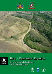
Ayiti ak Repiblik Dominikèn: defi anviwònmantal nan zòn fwontyè a
Rezime — Evalyasyon PNUE sou kondisyon anviwònman sou fwontyè Ayiti ak Repiblik Dominikèn, ak rekòmandasyon binasyonal ki chifre.
Dekouve Enpotan
- Dis rekòmandasyon binasyonal sible chifre a 136 milyon USD sou senk an, kidonk rapò a bay yon pri anplis yon dyagnostik.
- Li mete endikatè Ayiti ak Dominikani kòtakòt, ak yon diferans 76 pousan sou sipèfisi ak sou dansite popilasyon.
- Li trete basen vèsan yo pataje ak degradasyon tè olye pou egzamine zòn fwontyè chak peyi apa.
- Nòvèj ak Fenlann te finanse l.
Deskripsyon Konple
Yon evalyasyon PNUE sou defi anviwònman nan zòn fwontyè ant Ayiti ak Repiblik Dominikèn, ke Nòvèj ak Fenlann te finanse. Li konpare de peyi yo sou jeyografi, klima, demografi ak itilizasyon resous, li egzamine basen vèsan yo pataje ak degradasyon tè, epi li bay rekòmandasyon chifre pou aksyon binasyonal. Estatistik li mete kòtakòt fè l vin yon referans pou konparezon anviwònman sou tout zile Ispanyola.
Teks Konple Dokiman an
Teks ki soti nan dokiman orijinal la pou endeksasyon.
Haiti – Dominican Republic
Environmental challenges
in the border zone
http://unep.org/Haiti/ This report was made possible by the generous
contributions of the Government of Norway
and the Government of Finland
First published in June 2013 by the United Nations Environment Programme
© 2013, United Nations Environment Programme
United Nations Environment Programme
P.O. Box 30552, Nairobi, KENYA
Tel: +254 (0)20 762 1234
Fax: +254 (0)20 762 3927
E-mail: uneppub@unep.org
Web: http://www.unep.org
This publication may be reproduced in whole or in part and in any form for educational or non-profit purposes without special
permission from the copyright holder provided acknowledgement of the source is made. No use of this publication may be
made for resale or for any other commercial purpose whatsoever without prior permission in writing from UNEP. The contents
of this volume do not necessarily reflect the views of UNEP, or contributory organizations. The designations employed and
the presentations do not imply the expressions of any opinion whatsoever on the part of UNEP or contributory organizations
concerning the legal status of any country, territory, city or area or its authority, or concerning the delimitation of its frontiers or
boundaries.
Cover Image: © UNEP
Photos: Unless otherwise credited, images in this report were taken
by UNEP staff
UNEP promotes
Design and layout: Le Cadratin, Plagne, France environmentally sound practices
globally and in its own activities. This
publication is printed on recycled paper
using eco-friendly practices. Our distribution
policy aims to reduce UNEP’s carbon footprint.
Haiti – Dominican Republic
Environmental challenges in the border zone
United Nations Environment Programme
Table of contents
Foreword . . . . . . . . . . . . . . . . . . . . . . . . . . . . . . . . . . . . . . . . . . . . . . . . . . . . . . . . . . . . . . . . . . . . . . . . . . . . . . . . 4
Executive summary . . . . . . . . . . . . . . . . . . . . . . . . . . . . . . . . . . . . . . . . . . . . . . . . . . . . . . . . . . . . . . . . . . . . . . . 6
Part 1 Background . . . . . . . . . . . . . . . . . . . . . . . . . . . . . . . . . . . . . . . . . . . . . . . . . . . . . . . . . . . . . . . . . . . 10
1 Introduction . . . . . . . . . . . . . . . . . . . . . . . . . . . . . . . . . . . . . . . . . . . . . . . . . . . . . . . . . . . . . . . . . . . . . . . . . 10
1.1 A challenging time for the border zone . . . . . . . . . . . . . . . . . . . . . . . . . . . . . . . . . . . . . . . . . . . . . . 10
1.2 Assessment context and design . . . . . . . . . . . . . . . . . . . . . . . . . . . . . . . . . . . . . . . . . . . . . . . . . . . . . 11
1.3 Assessment process . . . . . . . . . . . . . . . . . . . . . . . . . . . . . . . . . . . . . . . . . . . . . . . . . . . . . . . . . . . . . . 13
2 Haiti and Dominican Republic country context . . . . . . . . . . . . . . . . . . . . . . . . . . . . . . . . . . . . . . . . . . . 19
2.1 Introduction . . . . . . . . . . . . . . . . . . . . . . . . . . . . . . . . . . . . . . . . . . . . . . . . . . . . . . . . . . . . . . . . . . . . . 19
2.2 Environmental status . . . . . . . . . . . . . . . . . . . . . . . . . . . . . . . . . . . . . . . . . . . . . . . . . . . . . . . . . . . . . . 21
2.3 Geography, Geology, Climate, Hydrology . . . . . . . . . . . . . . . . . . . . . . . . . . . . . . . . . . . . . . . . . . . 22
2.4 Natural Hazards . . . . . . . . . . . . . . . . . . . . . . . . . . . . . . . . . . . . . . . . . . . . . . . . . . . . . . . . . . . . . . . . . . 26
2.5 Society . . . . . . . . . . . . . . . . . . . . . . . . . . . . . . . . . . . . . . . . . . . . . . . . . . . . . . . . . . . . . . . . . . . . . . . . . . 28
2.6 Environmental Governance . . . . . . . . . . . . . . . . . . . . . . . . . . . . . . . . . . . . . . . . . . . . . . . . . . . . . . . . 29
3 The border region and transboundary activities . . . . . . . . . . . . . . . . . . . . . . . . . . . . . . . . . . . . . . . . . . 31
3.1 Introduction . . . . . . . . . . . . . . . . . . . . . . . . . . . . . . . . . . . . . . . . . . . . . . . . . . . . . . . . . . . . . . . . . . . . . 31
3.2 Border zone geography . . . . . . . . . . . . . . . . . . . . . . . . . . . . . . . . . . . . . . . . . . . . . . . . . . . . . . . . . . . 31
3.3 Border zone socio-economics and migration . . . . . . . . . . . . . . . . . . . . . . . . . . . . . . . . . . . . . . . . 39
3.4 Transboundary trade . . . . . . . . . . . . . . . . . . . . . . . . . . . . . . . . . . . . . . . . . . . . . . . . . . . . . . . . . . . . . . 42
3.5 Transboundary cooperation . . . . . . . . . . . . . . . . . . . . . . . . . . . . . . . . . . . . . . . . . . . . . . . . . . . . . . . 44
3.6 Development aid in the border area . . . . . . . . . . . . . . . . . . . . . . . . . . . . . . . . . . . . . . . . . . . . . . . . 45
Part 2 Identification and Analysis of Key Issues . . . . . . . . . . . . . . . . . . . . . . . . . . . . . . . . . . . . . . . . . . 47
4 Agriculture – the dominant activity in the border zone . . . . . . . . . . . . . . . . . . . . . . . . . . . . . . . . . . . . 47
4.1 Introduction . . . . . . . . . . . . . . . . . . . . . . . . . . . . . . . . . . . . . . . . . . . . . . . . . . . . . . . . . . . . . . . . . . . . . 47
4.2 Key issues . . . . . . . . . . . . . . . . . . . . . . . . . . . . . . . . . . . . . . . . . . . . . . . . . . . . . . . . . . . . . . . . . . . . . . . 47
4.3 Land Tenure . . . . . . . . . . . . . . . . . . . . . . . . . . . . . . . . . . . . . . . . . . . . . . . . . . . . . . . . . . . . . . . . . . . . . 49
4.4 Land degradation . . . . . . . . . . . . . . . . . . . . . . . . . . . . . . . . . . . . . . . . . . . . . . . . . . . . . . . . . . . . . . . . 49
4.5 Transboundary agriculture . . . . . . . . . . . . . . . . . . . . . . . . . . . . . . . . . . . . . . . . . . . . . . . . . . . . . . . . . 51
5 Forest resources and terrestrial protected area management . . . . . . . . . . . . . . . . . . . . . . . . . . . . . . 54
5.1 Introduction . . . . . . . . . . . . . . . . . . . . . . . . . . . . . . . . . . . . . . . . . . . . . . . . . . . . . . . . . . . . . . . . . . . . . 54
5.2 Key issues . . . . . . . . . . . . . . . . . . . . . . . . . . . . . . . . . . . . . . . . . . . . . . . . . . . . . . . . . . . . . . . . . . . . . . . 55
5.3 Forest clearance on private land in the Dominican Republic and forest fires . . . . . . . . . . . . . . 55
5.4 The uncontrolled transboundary charcoal trade . . . . . . . . . . . . . . . . . . . . . . . . . . . . . . . . . . . . . . 55
5.5 Collection of fuel wood . . . . . . . . . . . . . . . . . . . . . . . . . . . . . . . . . . . . . . . . . . . . . . . . . . . . . . . . . . . 62
5.6 Protected area management and biodiversity . . . . . . . . . . . . . . . . . . . . . . . . . . . . . . . . . . . . . . . 64
5.7 Reforestation . . . . . . . . . . . . . . . . . . . . . . . . . . . . . . . . . . . . . . . . . . . . . . . . . . . . . . . . . . . . . . . . . . . . . 68
6 Freshwater resources and flooding . . . . . . . . . . . . . . . . . . . . . . . . . . . . . . . . . . . . . . . . . . . . . . . . . . . . . 71
6.1 Introduction . . . . . . . . . . . . . . . . . . . . . . . . . . . . . . . . . . . . . . . . . . . . . . . . . . . . . . . . . . . . . . . . . . . . . 71
6.2 Key issues . . . . . . . . . . . . . . . . . . . . . . . . . . . . . . . . . . . . . . . . . . . . . . . . . . . . . . . . . . . . . . . . . . . . . . . 71
6.3 Transboundary flooding . . . . . . . . . . . . . . . . . . . . . . . . . . . . . . . . . . . . . . . . . . . . . . . . . . . . . . . . . . . 71
6.4 Water scarcity, access and pollution . . . . . . . . . . . . . . . . . . . . . . . . . . . . . . . . . . . . . . . . . . . . . . . . 74
6.5 Lake Azuei and Lake Enriquillo flooding . . . . . . . . . . . . . . . . . . . . . . . . . . . . . . . . . . . . . . . . . . . . . . 76
6.6 Transboundary dams and water extraction . . . . . . . . . . . . . . . . . . . . . . . . . . . . . . . . . . . . . . . . . . 79
7 Coastal and marine resources . . . . . . . . . . . . . . . . . . . . . . . . . . . . . . . . . . . . . . . . . . . . . . . . . . . . . . . . . 80
7.1 Introduction . . . . . . . . . . . . . . . . . . . . . . . . . . . . . . . . . . . . . . . . . . . . . . . . . . . . . . . . . . . . . . . . . . . . . 80
7.2 Key issues . . . . . . . . . . . . . . . . . . . . . . . . . . . . . . . . . . . . . . . . . . . . . . . . . . . . . . . . . . . . . . . . . . . . . . . 80
7.3 Illegal transboundary fishing and overfishing . . . . . . . . . . . . . . . . . . . . . . . . . . . . . . . . . . . . . . . . . 80
7.4 Mangrove cutting and salt production . . . . . . . . . . . . . . . . . . . . . . . . . . . . . . . . . . . . . . . . . . . . . . 82
7.5 Marine protected areas and biodiversity . . . . . . . . . . . . . . . . . . . . . . . . . . . . . . . . . . . . . . . . . . . . . 84
7.6 Transboundary trade in marine species . . . . . . . . . . . . . . . . . . . . . . . . . . . . . . . . . . . . . . . . . . . . . 85
7.7 Contamination of estuaries, coastal lagoons, and the sea . . . . . . . . . . . . . . . . . . . . . . . . . . . . . 86
8 Environmental aspects of trade, employment and industry . . . . . . . . . . . . . . . . . . . . . . . . . . . . . . . . 87
8.1 Introduction . . . . . . . . . . . . . . . . . . . . . . . . . . . . . . . . . . . . . . . . . . . . . . . . . . . . . . . . . . . . . . . . . . . . . 87
8.2 Key Issues . . . . . . . . . . . . . . . . . . . . . . . . . . . . . . . . . . . . . . . . . . . . . . . . . . . . . . . . . . . . . . . . . . . . . . . 87
8.3 Bi-national markets and their environmental aspects . . . . . . . . . . . . . . . . . . . . . . . . . . . . . . . . . 87
8.4 Rural population increase and transboundary migration . . . . . . . . . . . . . . . . . . . . . . . . . . . . . . . 89
8.5 Environmental aspects of mining and industrial development . . . . . . . . . . . . . . . . . . . . . . . . . . 91
Part 3 Analysing trends and causes . . . . . . . . . . . . . . . . . . . . . . . . . . . . . . . . . . . . . . . . . . . . . . . . . . . . 95
9 Strategic Analysis . . . . . . . . . . . . . . . . . . . . . . . . . . . . . . . . . . . . . . . . . . . . . . . . . . . . . . . . . . . . . . . . . . . . 95
9.1 Purpose and methodology . . . . . . . . . . . . . . . . . . . . . . . . . . . . . . . . . . . . . . . . . . . . . . . . . . . . . . . . 95
9.2 Issue comparative analysis . . . . . . . . . . . . . . . . . . . . . . . . . . . . . . . . . . . . . . . . . . . . . . . . . . . . . . . . 95
9.3 Identification of underlying driving forces . . . . . . . . . . . . . . . . . . . . . . . . . . . . . . . . . . . . . . . . . . . . 97
9.4 Shocks . . . . . . . . . . . . . . . . . . . . . . . . . . . . . . . . . . . . . . . . . . . . . . . . . . . . . . . . . . . . . . . . . . . . . . . . . 102
Part 4 The way forward . . . . . . . . . . . . . . . . . . . . . . . . . . . . . . . . . . . . . . . . . . . . . . . . . . . . . . . . . . . . . . 104
10. Findings and Recommendations . . . . . . . . . . . . . . . . . . . . . . . . . . . . . . . . . . . . . . . . . . . . . . . . . . . . . . 104
10.1 Key findings . . . . . . . . . . . . . . . . . . . . . . . . . . . . . . . . . . . . . . . . . . . . . . . . . . . . . . . . . . . . . . . . . . . . . 104
10.2 Preface to the recommendations . . . . . . . . . . . . . . . . . . . . . . . . . . . . . . . . . . . . . . . . . . . . . . . . . 105
10.3 Bi-national border zone recommendations . . . . . . . . . . . . . . . . . . . . . . . . . . . . . . . . . . . . . . . . . 108
10.4 Haitian national level investment recommendations . . . . . . . . . . . . . . . . . . . . . . . . . . . . . . . . . . 115
10.5 Implementation and financing of the recommendations . . . . . . . . . . . . . . . . . . . . . . . . . . . . . 117
Annexes . . . . . . . . . . . . . . . . . . . . . . . . . . . . . . . . . . . . . . . . . . . . . . . . . . . . . . . . . . . . . . . . . . . . . . . . . . . 120
Annex I – Report terminology . . . . . . . . . . . . . . . . . . . . . . . . . . . . . . . . . . . . . . . . . . . . . . . . . . . . . . . . . . . 121
Annex II – List of Acronyms and Abbreviations . . . . . . . . . . . . . . . . . . . . . . . . . . . . . . . . . . . . . . . . . . . . 123
Annex III – Sustainable livelihoods framework . . . . . . . . . . . . . . . . . . . . . . . . . . . . . . . . . . . . . . . . . . . . . 124
Annex IV – Table connecting the recommendations to the driving forces . . . . . . . . . . . . . . . . . . . . 125
Annex V – References . . . . . . . . . . . . . . . . . . . . . . . . . . . . . . . . . . . . . . . . . . . . . . . . . . . . . . . . . . . . . . . . . 126
Annex VI – Acknowledgements . . . . . . . . . . . . . . . . . . . . . . . . . . . . . . . . . . . . . . . . . . . . . . . . . . . . . . . . . 141
Foreword
The joint management of transboundary natural resources: a first step towards the resolution of
binational environmental and social conflicts
The issues in the border zone of Haiti and the Dominican Republic are perceived in different ways by
people living and working in the region. Some feel that despite the problems that may arise here, the
area provides an opportunity for the people of our two countries to cooperate, share experiences and
find joint solutions to shared problems. At the same time, others consider the border zone as a region
where development opportunities are limited by poverty and isolation.
Notwithstanding these different perspectives, addressing the challenges in the border zone is important not
only for the development of local communities, but also for the implementation of cooperation strategies
and joint initiatives between the two countries. For this reason, the governments, development actors,
and civil society in both countries have strengthened their efforts in the border zone and are building on
successful initiatives that have already taken place.
Among these efforts, we would like to mention those initiatives adopted at both the community and
government levels that seek to address the diverse challenges in the border zone, some of which have
stemmed from the short-sighted exploitation of natural resources. At the same time, we welcome the
efforts of the Joint Dominican-Haitian Bilateral Commission, a flagship initiative which will guide the
implementation of joint interventions in the border zone. This initiative, which originates from the highest
levels of both States, has catalyzed the development of an increasing number of binational programs.
In the environmental sector, momentum for joint programs has also grown. On 16 May 2011, the Ministry
of Environment and Natural Resources of the Dominican Republic, the Ministry of Environment of Haiti,
and the Norwegian Ministry of Foreign Affairs, signed a Declaration of Intent, in Ouanaminthe, for the
Triangular Cooperation between the three parties, to support the Frontera Verde Programme. The first step
in this cooperation was to implement the first phase of the Transboundary Natural Resource Management
and Restoration Project, focusing on the Massacre and Pedernales Watersheds. Technical support in the
implementation of this work is being provided by UNEP and UNDP. This commitment further highlights
the willingness of our two governments to jointly address the problems associated with natural resource
management in the border zone.
We are aware that in order to effectively address the challenges faced in the border zone, a deep
understanding and an accurate analysis of the driving forces that have contributed to the present situation
is necessary. For this reason, we welcome this report and analysis on the state of transboundary natural
resources and how they are linked with different aspects of life both within the border zone and within
our respective countries. This report provides information on natural resources and their role in trade,
agriculture, human mobility, energy, among others.
This document provides up-to-date information and confirms the close relationship that exists between
the state of transboundary natural resources, poverty, and recurring social conflicts. In this respect, this
report is an indispensable tool that will inform decision making in the coming years.
4 Haiti – Dominican Republic: Environmental challenges in the border zone
We congratulate all those who contributed to the preparation of this report, both from our Ministries, UNEP,
and other institutions. We invite all actors that are providing assistance, or that are asked to intervene in the
border zone, to consult this report and to take into consideration its recommendations when carrying out
future action. We are firmly committed and dedicated to take the conclusions and recommendations
of this report to the highest levels of our governments. It will inform the work of the Joint Dominican-
Haitian Bilateral Commission as well as guide the political decisions and actions undertaken in the
border zone.
DR. JEAN FRANCOIS THOMAS DR. BAUTISTA ROJAS GÓMEZ
Minister of Environment, Haiti Minister of Environment and Natural
Resources, Dominican Republic
Haiti – Dominican Republic: Environmental challenges in the border zone 5
Executive summary
This report presents the findings, conclusions and • Finally, it provides practical recommendations
recommendations of an 18 month long assess- for the two governments and their international
ment of the border between the two countries that partners on how to mitigate the identified
share the Caribbean island of Hispaniola – Haiti, risks, capitalize on the opportunities, increase
the poorest country in the Western Hemisphere transboundary environmental cooperation,
and the Dominican Republic, a middle-income and build resilience to identified areas of
country. It is along this 380 km border that there is vulnerability.
the most contact between the two populations,
and the highest likelihood of tension and conflict The assessment team found that the key issues
between them. It is here too that there is the great- of concern identified in the border zone can be
est opportunity to have a positive impact on the connected to four interlinked driving forces:
complex relationship between the two countries.
• Haitian poverty, food insecurity and under-
development affect virtually all parts of the
Paradoxically the challenges in the border zone
border zone.
are driven both by the interdependencies of the
two countries and by the stark contrasts in the • Environmental degradation manifests itself
economic, social and environmental conditions. mainly in soil erosion, deforestation, and a
These differences manifest themselves in the degraded marine environment.
chronic povert y and severe environmental • Weak governance, especially on the Haitian
degradation seen in many areas on the Haitian side of the border, affects all facets of the
side of the border, as well as illegal transboundary economy and society.
exploitation of natural resources.
• Finally, the economic and resource inequalities
The United Nations Environment Programme (UNEP) between the two countries are the cause of
and the United Nations Development Programme many of the transboundary problems identified
(UNDP) accompanied the Governments of Haiti in the border zone.
and the Dominican Republic, through their
Ministries of Environment, in undertaking a detailed Examples of some of the key issues in the border
assessment of the border area. The assessment zone include the illegal extraction and trade
covered both countries, however, emphasis was of natural resources (mainly charcoal, but also
put on the Haitian side where the information is firewood and marine resources), agriculture, and
scarce and the environmental problems are more large numbers of people crossing illegally from
pressing. rural areas in Haiti into the Dominican Republic in
search of livelihoods due to the degradation of
This assessment has three complementar y land and a surplus of labour on the Haitian side.
objectives: Several of the noted problems, such as deforesta-
tion and soil erosion, are very large scale and have
• Firstly, it sets out to assess how the use of natural
been developing for generations. Environmental
resources and environmental degradation in
degradation in the worst affected parts of the
the border zone are contributing to disaster
Haitian border zone is almost completely irrevers-
vulnerability, conflict risk, poverty and unsustain-
ible, due to a near total loss of vegetation cover
able practices. This also includes assessing how
and productive topsoil across wide areas.
resource dependent livelihoods are responding
to these challenges.
Several of the identified issues related to the
• Secondly, it presents an analysis of issues and environment and the use of natural resources
trends, as well as of underlying driving forces, also present a short term but high instability and
that affect the situation in the border zone. conflict risk to the relations between the two
6 Haiti – Dominican Republic: Environmental challenges in the border zone
countries. These issues include the uncontrolled On a more positive note the international relation-
transboundary charcoal trade; illegal farming ship between Haiti and the Dominican Republic
and tree cutting on Dominican land in general is quite good, with meetings up to the highest
and inside Dominican Republic protected areas political levels taking place on a regular basis.
in particular; unclear marine territorial delimitation Important progress has also been achieved by
and illegal transboundary fishing; and the flooding local and national initiatives, such as the financing
of land and infrastructure due to the rapid rise of of binational tree planting brigades within the
Lake Azuei and Lake Enriquillo. The uncontrolled framework of the Frontera Verde programme,
transboundary charcoal trade and tree felling commune level bi-national cooperation, and
has, for example, already triggered conflict that cooperation between local organizations and
has led to violence. associations on both sides of the border. Sustain-
able agricultural programmes, such as ones
At present the overall situation is gradually deterio- that promote agroforestry, and the associated
rating. If current trends continue in the border zone, trade represent a major opportunity for poverty
including practices similar to those which have reduction in the border region. Such initiatives
already caused much of the degradation in Haiti, could provide a critical foundation for larger
soil erosion and a reduction in land productivity will scale corrective action and investments in crisis
worsen significantly on the Dominican side of the prevention.
border zone as well. This scenario could change
dramatically as a result of shocks or sudden It is with this more positive outlook in mind that the
changes, such as natural disasters. Such a shock report concludes with 14 detailed recommenda-
might accelerate the decline and further degrade tions that should be developed and implemented
the stability and development of the border zone. by the two governments and their international
partners. If implemented, the recommendations
Climate change is also expected to have a are expected to reduce chronic poverty and
negative impact on the Caribbean in the long hunger in the border zone, while promoting more
term: the average temperature, the variability of sustainable livelihood practices and enhancing
rainfall, and the frequency and average intensity the resilience of the population to shocks and
of hurricanes are all expected to increase. All of stresses. They also set out to preserve peaceful rela-
these effects will have serious consequences for tions between the two countries through increased
the area in question: an adjustment in precipitation national and local level bilateral cooperation that
rates alone would have a negative impact on rain will reduce tensions over border zone issues.
fed agriculture, which is the mainstay of the border
zone economy. The recommendations are divided into ten
bi-national border zone recommendations and
Most of the driving forces identified are national in four Haitian national scale recommendations.
scale, which means that it would not be viable to Most solutions will need to be bi-national or at
only develop stand alone environmental or local least bi-nationally agreed, due to the very high
solutions. An integrated and larger scale approach inter-connectivity of populations and issues across
is needed. For example rural food insecurity and the border.
extreme poverty are in part driving the unsustain-
able slash and burn agricultural practices on
the Haitian side and triggering the associated Bi-national border zone
extensive soil erosion and deforestation. Similarly, recommendations
charcoal demand in the border area is low, but
in Port-au-Prince it is high, thus driving the national 1. P rotecting and increasing the vegetation
charcoal economy. A national scale solution on cover – Continue to financially and politi-
energy is needed to resolve this matter. Finally, land cally support the bi-national reforestation
tenure and tenant farming are major obstacles – and agroforestry efforts. Increase technical
farmers understandably are prepared to invest only assistance to improve the quality, consistency
in land they either own or can confidently control and sustainability of the re-forestation efforts
for longer periods. and implement a more strategic program.
Haiti – Dominican Republic: Environmental challenges in the border zone 7
Deforestation resulting in severe land degrada- 7. Improve existing transboundary co-operation
tion is a significant problem in the border zone, mechanisms that deal with environmental
therefore such investments are to be prioritized. issues and transboundary watersheds – Build
on the mechanisms and platforms for coopera-
2. S ustainable agricultural development – tion that already exist on various levels, to create
Reform and develop the artisanal and small a functioning network of cooperation, both
scale agricultural sector in the border zone to across the border, as well as between the local
improve the sustainability of livelihoods. Moving and national levels. In order to galvanize the
beyond the destructive cycle of slash and burn necessary political will, the overall cooperation
agriculture requires long term and intensive framework should be chaired by the presidents
investment in practical, technical support. of the two nations. In addition, there is a need to
Educational campaigns aiming at changing enhance the processes by which governments
attitudes and building the capacity of local and projects share information. Lastly it is vital
farmers are equally important. to build the Haitian Government’s capacity
to participate on an equal level in binational
3. Transboundary river flood risk reduction – Invest projects.
in flood containment and land use planning
for affected Dominican and Haitian townships, 8. Environmental governance for the regulation
based on a long term worst case scenario. The and control of the charcoal trade and other
flash floods which have damaged Dominican forest products – Increase enforcement of
and Haitian towns (Jimani, Fonds Verrets, Peder- Dominican and Haitian law on protected areas
nales, Anse-à-Pitre) in the border zone are linked and forest conservation. Include an analysis
to severe and mostly irreversible degradation of on the potential impacts a suppression of the
the catchments in Haitian territory. transboundary charcoal trade would have in
Haiti.
4. Improve the sustainability of transboundary
trade and the bi-national markets, while 9. Strengthen the management of marine and
reducing their environmental impacts – Sup- coastal resources – Reduce the decline of the
port the existing bi-national markets and provide marine and coastal environment in the border
better opportunities for fair, profitable and more zone by ensuring that encroachment and
sustainable trade between the two countries. practices that are degrading the state of the
The impact of the bi-national markets is overall environment are not taking place, in particular
positive but they need reform and in some cases in relation to overfishing and the cutting of
rebuilding, to reduce environmental impacts, mangroves.
improve equality, reduce conflict and increase
trade. 10. L ake Azuei and lake Enriquillo flooding
analysis – Undertake a hydrological data
5. B order zone economic development and collection and analysis study on the causes of
diversification – Encourage the transition the rise in the level of Lakes Azuei and Enriquillo
from subsistence agriculture and illegal and and their potential to keep rising.
damaging activities to Micro, Small and
Medium Enterprises (MSME) led local economic
development in agriculture, fisheries and tour- Haitian national level
ism. Boosting MSMEs and the service economy investment recommendations
is a proven route for economic development
and will draw local populations away from These recommendations are not new, rather they
unsustainable livelihoods. are part of existing initiatives at the Haitian national
level, specifically the Haitian Strategic Plan for the
6. Address the contamination of transboundary Development of Haiti: Emerging Country by 2030
rivers – Address the problem of rivers that are (Plan Stratégique de Développement d’Haïti: Pays
polluted by both solid and bacteriological waste émergent en 2030).1 The four recommendations
and as a consequence spread disease. are selected from the development plan and
8 Haiti – Dominican Republic: Environmental challenges in the border zone
are considered to be the ones that are of most Costs for the national level investments for Haiti
relevance for the situation in the border zone. will need to be detailed within the Haitian strategic
plan for development.
1. Improving governance in rural areas –
Increasing the presence and role of the state In closing, the situation is already serious in the
in rural areas, while ensuring the continuous border area and continues to deteriorate. In the
involvement of local stakeholders, covering a absence of significant corrective and preventative
broad range of responsibilities including social action, further decline and increased instability is
services, policing, customs, town administration, likely. International development assistance and
agricultural and business development and conflict prevention support will be required to
environmental protection. The aim of this recom- part-finance the recommendations of this report.
mendation is to extend the state presence to UNEP and UNDP are ready to help the Governments
rural areas, while prioritizing growth poles and of Haiti and the Dominican Republic implement
sensitive areas such as the border. the recommendations of this report, and call for
the support of international and national partners
2. Non-agricultural economic development and and donors.
diversification – Providing viable alternatives
to subsistence agriculture through large scale
development of the manufacturing and service
sectors, particularly in the main urban centres. Note on the text
3. Replace charcoal with LPG – Implement an For the sake of clarity, words that should be
integrated programme of regulatory reform, understood as terms carrying a specific technical
incentives and enforcement to replace the meaning that is not necessarily a property of those
use of charcoal (used for cooking) with LPG, words in ordinary usage, are defined in Annex I –
supplemented by other alternative energy Report terminology.
options (including renewables) and improved
electrification of the country. The programme
would focus on urban centres and Port-au-
Prince in particular.
4. S ustainable agricultural development and
re-forestation – Implement the Haitian National
Plan for Agriculture, with a particular emphasis
on sustainability. Replace unsustainable slash-
and-burn and the cultivation of annual crops
on steep slopes and degraded land with more
sustainable forms of agriculture and tree plant-
ing, with a focus on agroforestry and energy
cropping. Integrate erosion control measures
into all agricultural landscapes. Extract greater
value from remaining viable land with improved
techniques and investments in agricultural value
chain development.
The total estimated cost of the ten targeted
bi-national level recommendations for the border
zone is USD 136 million over five years. This is a
small sum compared to the possible cost of the
social and political crises – and the hunger and
violence – that might result from the continued
environmental degradation of the border area.
Haiti – Dominican Republic: Environmental challenges in the border zone 9
Part 1 Background
1 Introduction obvious than along their 380 km border. The area
around that border presents a long and rapidly
lengthening list of challenges, which includes weak
1.1 A challenging time for the border
governance, severe environmental degradation,
zone and a population that is profoundly vulnerable to
natural disasters and food insecurity.
Challenges and opportunities
Relations between the neighboring countries of
These many challenges are in part balanced
·
[
Haiti and the Dominican Republic have been
by positive short term trends and opportunities:
and remain complex. An enormous disparity exist
trans-boundary trade is substantial, levels of
·
[ between them in social, economic, and environ-
violence are relatively low, and there is substantive
mental wealth. Despite their problems the countries
formal and informal cooperation between the two
are major trading partners and political relations
·
[
governments in their efforts to resolve several of the
between them have improved dramatically since
issues listed above.
2010, thanks in part to the Dominican Republic’s
·
[
generosity towards the Haitian people following the
earthquake
·
[ of that year, and in part because of A window of opportunity
·
[
improvements in the political landscape of Haiti. During 2010 and 2011 the Government of Haiti,
their immediate regional neighbours and the
Nowhere are the inequality of the two countries
·
[ international community, were focused on helping
·
[
and the complexity of their relationship more starkly the Haitian society to recover from the earthquake
·
[
·
[
Map 1. The island of Hispaniola
Island of Hispaniola
!
^ Capital
·
[
Turks and Caicos EEZ
I
International boundary
Exclusive Economic Bahamas EEZ
·
[ Zone (EEZ)
·
[
Atlantic Ocean
Île de
la Tortue
·
[
Pointe
Jean-Rabel
P Port-de-Paix
!
·
[ Monte Cristi
Cuban EEZ Cap Saint-Nicolas P
! Puerto Plata
Cap Haitien Baie de P
!
·
[
P
! Mancenille ·
[ Cabo Frances
Viéjo
Cap à Foux
!
P
Baie de Fort-Liberté Dajabon Mao
Henne Grande P
!
! P
!
Pointe Gonaives
Ouanaminthe Santiago!
Sabaneta P·
[ Nagua
Baie de la Tortue !
P Moca Bahia Escocesa
Baie de Grand-Pierre !
P !
P
Pointe de la Grande-Pierre La Vega Cabo Samanba
Pico Duarte !
P
3098 m !
P Salcedo
Hinche San Francisco ·
[ !
Bahia de
P
P
! De Macoris Samania Samana
ib
Art P
!
Pointe Ouest on Bonao Cotui
it e Elias Pina P
!
San Juan ·
[ Monte Plata
Ile de la Gonâve ! !
P
Hato Mayor
Belladère !
P P
! El Seibo
Îles P
! P
!
Jérémie
!
P Cayémites Pointe Fantasque Baie de Port-au-Prince Higuey Cabo
P
!
Miragoâne PORT AU ^·
[
! Jimani
Azua
·
[ Engano
!
P PRINCE
!
P P Neiba
! !
P San Cristobal
P
!
[^
· ! ·[ ·[ San Pedro ·
P[
!
SANTO La Romana
DOMINGO De Macoris
Jacmel P
!
P
! ·
[
!
P Bani
P
!
!
P
Les Cayes Baie de Jacmel Barahona Punta
Punta Palenque
Salinas
3000 m Île à Vache Cap Raymond
Isla Saona
P Pedernales
Anse-à-Pitres !
2000 m
·
[
1000 m
Haitian EEZ Isla
Cabo Beata
0m
Beata Dominican Republic EEZ
Puerto Rican
Turks & Caicos Is.
EEZ
Cuba Dominican Republic
Anguilla
Puerto Rico
Antigua &
Barbuda
Caribbean Sea
Jamaica Guadeloupe
Haiti
Martinique
St. Lucia km
Aruba
Grenada
Trinidad & 0 50 100
Tobago The boundaries and names shown and the designations used on this map do not imply official endorsement by the United Nations. UNEP 2013.
Panama
10 Haiti – Dominican Republic: Environmental challenges in the border zone
© UNEP
The differing levels of tree cover on either side of the Haiti-Dominican Republic border in the Artibonite river
catchment is a highly visible symptom of a complex bi-national deforestation problem.
of January 12th, 2010. Now the Haitian Government critical transport link, and home to several hundred
is leveraging this increased international support in thousand poverty stricken people. Perhaps most
an effort to move beyond the most basic recovery importantly, it is a significant source of tension
of the areas damaged by the earthquake towards between the two countries, and its fate might well
longer-term reform and development of the determine both their futures. If the current situation
country as a whole. High on the government’s list stabilizes, both countries will continue to develop,
of priorities are economic development, the rule but if it declines, then the stability of both countries,
of law, environmental rehabilitation, and energy and the health of the relationship between them,
access. will be in jeopardy.
Today, this approach is starting to deliver positive 1.2 Assessment context and design
results. Business in Port-au-Prince is restabilizing,
major business investments in the northeast of The border between Haiti and the Dominican
Haiti have been announced, and in the Southern Republic presents a vivid contrast in the wealth
Peninsula longer-term sustainable development and environmental status of two countries. The
programmes have begun. border area has been experiencing long term
chronic environmental degradation, which has
Haiti and the Dominican Republic, supported by reached especially severe levels on the Haitian
the international community should consider to side of the border. In many areas, this degradation
actively re-focus on the development challenges is undermining livelihoods and increasing disaster
along their shared border. The border zone is not an vulnerability, while the large disparities between
economic growth pole for either country, but it is a the two countries have led to illegal transboundary
Haiti – Dominican Republic: Environmental challenges in the border zone 11
Map 2. Administrative map of the border zone
Palmiste
#
I
(
!
20°N
72°W 71°W
Cuba
du Nord
Atlantic Ocean
!
( Luperon
Anse-à-Foleur Haiti
Dominican Republic (
!
!
(
Monte-Cristi
Port-au-Prince Santo Domingo
# !
^ !
^ !
^
!
^
Le Borgne
(
! P
! PUERTO
El Copey Puerto Plata
Lagunea !
( P L ATA
!
^
^ de Quebro
! Lucas Evangelista Imbert
!
P
Port-Margot #779
Cap-Haïtien
# !
P De Pena El Mamey (
!
[
·
# (
! (
! (
!
Limbé Quartier Morin
Fort- !
^!
MONTE
Laguna la
Gros Morne Pilate
(
!
Acul du (
!
!
(
Limonade
!
(!( Liberté (
CRISTI
Jagua Maizal #
(
!
!
( Plaine du Meiac! (!
!
( !
(
NORD
Nord
Nord
!
( Lagon aux !
P ^
RIO YOQU
(
!
Milot Trou-du-Nord
Boeufs Merande
Dumas !
( !
^
E DE L NO
RT E VA LV E R D E
Plaisance !
( Pedro Ga
!
( Sainte-Suzanne (
! !
( Esperanza
(
! V.
# (
!
Grande-Rivière du Nord !
(
!
( RI C HE
AI
Ferrier
Dajabón Mao ( Villa Bisono
! #
FR (
!
Marmelade
Dondon
Ouanaminthe
P
! !
( !
!
( !
P
(
! !
( Perches M
V. N ( !
! ( D A!^J A B O N B IN Sabaneta
!
( RI IO !
( !
( (
!
AR ( !
! ( Partido GU
! Santiago Rodriguez Santiago
P[
^
·
(
! !
( (
! !
( AY
aives Ennery
#
Bahon NORD-EST U !
(
Saint-Raphael !
( ( !
!
Capotille Santiago!
( !
P
! RIV
IE !
(
Ranquitte
Vallières
!
( #1170 Chevalier
(
(
!
Loma De Cabrera
RIV. D
MA S S U
!
( (
!
#1474 RE !
( !
(
Saint-Michel de l'Attalaye RI A C RE SANTIAGO El Rubio
CA N !
(
! VI ^ !
(
OT Pignon
!
^ ER
E #1302 RODRIGUEZ
(
! Janico
(
! LI B Restauración (
!
La Victoire O
N (
!
#1210 RIO MAO
Dessalines SANTIAGO EMBALSE
e
!
( A !(
RTIBONITE Cerca-
(
!
!
( ( Guayayayuco
! #
Carvajal
Passe Tilory
#2011
#1060 Maïssade Cerca-la-Source
#1221 CA
JO
!
( !
( El Corte RIO
!
P TE
(
!
!
^ Jara
aint Marc
Petite
( Rivière de Thomassique
!
!
( Hinche RIV IBO
!
(
NI
OC IN O !
Tocino
Thomassique RT RIO T ( #2801 Monabao
IE R (
! A !
(
Verrettes #1787 V. !
^ !
(
EG RI
# !
( CENTRE
Thomonde YA #2026
UA #3087
(
!
ELIAS PINA !
^
19°N
!
^ MO
UC Carabela
RIO O
(
! MAC IC RIO #2560
AS IA
B ON
YA
SAN
RIV
#1580
[
·
La Chapelle .A Constanza
(
!
RT
IB O Roy Sec Elías Piña SAN JUAN (
!
JU AN
NI T !
( Las Matas Montazo
E Lac de
Peligre
!
P !
( !
(
Mirebalais ! El Llano !
(
#1278 Saut d'Eau (
! Lascahobas
!
( !
( Belladère San Juan
Poulie
!
(
(
!
RIV IE (
!
La Rancha !
P
!
(
(
! FE R R E DE
A CH
Arcahaie E
( VAL
! #1698 Padre Las Casas
Savenette Los Botaos El Cercado
(
! !
(
Duvalierville #1381
RIV
GA S IE R E (
!
!
( (
!
(
! RI
O AZUA
CO YA
Cornillon GN Los Arroyos Q #
E Juan U
Thomazeau (
! #2175 Santiago
E
DE
(
! L
PORT-AU- Trou
Caiman
#2278 SU
R Yayas De Viajama
!
( El Cerc
PRINCE [
· (
!
Lac
Azuei
#
La Descubierta
!
(
O
RER
Croix des #940
BAORUCO
Léogâne
!
(
Gressier
(
! !
^ Bouquets
( Pétion-ville
Gantier
(
!
Jimaní
Los Ríos
#-39 !
(
BA R
Galván
!
( Carrefour ! Neiba (
! SU
R
Fond Parisien
!
(
!
P P
! DE
L
Azua
RI Lago E
Kenscoff
!
(
V.
BL
AN Enriquillo YA
Q
U
P
!
(
! OUEST CH
E
INDEPENDENCIA RI
O
Vicente Noble
Trouin #1580 !
( Duverge
(
! #1342
(
! Fonds- (
! Los Negros
#2674 Zapoten !
(
#2282 Verrettes
!
(
El Peñón
L. d. (
!
e de Jacmel
SUD-EST #2367 RINCON
(
! Jacmel
!
P !
( (
! !
(
!
(
!
(
( !
! ( Los Arroyos
(! (
! [ Barahona
·
Cayes- Belle-Anse EN
et
(
! Jacmel
Marigot
!
(
LIB #2084 P
!
PE Bony La Cueva
Grand-Gosier SON #
DE !
( RO B IN
ES
1669
!
(
V.
RI NA L
(
!
Legend R
BARAHONA
International boundary Polo La Cienaga
!
(
Datum: WGS 84 (
!
Department/Province boundary !
( NI
UTM Zone 18N
(!( ZA
!
^ National capital P Pedernales
!
Anse-à-Pitre ! !
#1455 LT
O
18°N!
P Department/Province capital Paraíso
(
!
! Main city
! Caribbean [P E D E R N A L E S
·
^ !
( Town, village
Enriquillo
Airport Sea Sources:
r !
(
MINUSTAH
Main route UN Cartographic Section
Manuel Golla
Secondary route !
(
Major lakes 0 10 20
Major rivers
LAGUNA OVIEDO Km
# Elevation (in m)
UNEP
The boundaries and names shown and the designations used on this map do not imply official endorsement by the United Nations. - 2012
UNEP 2013.
!
^
!
^
12 Haiti – Dominican Republic: #
Environmental challenges in the border zone
!
^
#
trade of natural resources, local level tensions, Assessment methodologies
and an encroachment on Dominican land by There are no standardized methodologies for
undocumented Haitian migrants looking for assessing transboundary challenges of the
economic opportunities. For these reasons, both kind found in the border zone. Neither has a
governments requested UNEP to conduct an comprehensive analysis of the zone ever been
assessment of the border zone in order to identify conducted. In the absence of a methodological
key priorities for stabilizing the present situation and or comparative model, the assessment team
needs, in order to secure development goals. designed its own framework based on relevant
literaturei and methods and then adapted it to
Objectives the reality on the ground.
The objectives of the assessment and this report
are: The methodology adopted by the assessment
team also acknowledged the growing concern
1. To identify how the use of natural resources
among national stakeholders and donors that
and environmental degradation in the border
the limited financial resources available for work
zone are contributing to disaster vulnerability,
on the border zone should be used to encourage
conflict risks related to the conflicting use of
practical action rather than further quantitative
natural resources, poverty and unsustainable
baseline studies. As a result, the methodological
practices, as well as how resource depend-
approach used in this report did not allow for
ent livelihoods are responding to these
extensive collection of new quantitative data. The
challenges.
approach, then, was essentially exploratory and
2. To present an analysis on key environmental relied on various sources of both qualitative and
issues and trends, as well as underlying driving quantitative data, as well as anecdotal evidence
forces to contribute to determine the potential collected during field missions. This allowed the
political, social, stability and development team to reach the objectives of the assessment,
implications. while making the best possible use of the available
resources, and remaining flexible and responsive
3. To provide practical recommendations for
to the realties they faced on the ground.
the two governments and their international
partners to continue the work on mitigating In order to have confidence in the collected
the identified risks, capitalize on the opportuni- qualitative data, and the analysis and conclusions
ties, increase transboundary environmental drawn from it, the data was triangulated.2 The
cooperation, and strengthen the resilience to use of this research technique, also known as
sources of vulnerability. methodological triangulation, ensures that no con-
clusion can be drawn from a single source without
1.3 Assessment process corroboration by others.3 Therefore, only when
interviews with members of the public on both
Geographical scope sides of the border, accounts from government
The geographical scope of the assessment authorities, field observations and/or secondary
concerned the full length of the border zone, data sources pointed in the same direction, could
approximately 380 km from north to south. In the assessment team draw conclusions on key
general, this can be defined as a band stretching issues, drivers and trends with a sufficient level of
approximately 10-20 km on both sides of the actual confidence.
border, depending upon available infrastructure,
water courses, topography and the level of Data was collected from:
transboundary interactions between communities.
• formal reports and surveys containing existing
data (both qualitative and quantitative) .
Some of the key issues identified in the border zone
furthermore proved to be so tightly connected to i Literature included general literature on environment,
national scale challenges in the two countries that natural resource management and development, reports
emerging from work elsewhere in Haiti and the Dominican
the assessment team felt obliged to upscale the republic, as well as studies made on specific issues in the
analysis from border zone to national level. border zone.
Haiti – Dominican Republic: Environmental challenges in the border zone 13
© UNEP
A member of the assessment team collecting data in the field.
• field observations throughout the border zone • studying satellite images of the border zone
on both sides of the border, with three missions and comparing to field level observations
which took place between May 2011 and April
2012. In addition the assessment team used a sustain-
able livelihoods framework to understand how
• interviews with the local community members
livelihoods in the border zone are coping and
engaged in various livelihoods (farming,
responding to long-term degradation as well as
fishing, re-forestation, commerce, charcoal
short-term shocks and stresses.5
making), interviews with community leaders
and representatives from livelihood associations
This framework is a useful analytical lens to under-
and NGO’s active in the border zone, as well
stand vulnerabilities, livelihood assets, influencing
as interviews with national government officials
factors, strategies and outcomes that should be
from both Haiti and the Dominican Republic.
taken into account when trying to understand the
• institutional knowledge from UN staff gained main factors that affect people’s livelihoods. The
over the course of several years working in Haiti. framework also helps in explaining the relationships
• findings from socio-economic case studies between these various factors, as well as how a
focusing on the Haitian side of the border zone more sustainable use of natural resources should
in the Massacre watershed in the north and be part of the solution when addressing the various
the Pedernales watershed in the south. These challenges faced by livelihoods in the border zone.
studies were conducted by the Earth Institute The framework was further used when developing
of Columbia University together with the Haitian the recommendations that focus on livelihood
State University.4 strategies and ways to build resilience among
14 Haiti – Dominican Republic: Environmental challenges in the border zone
Map 3. Areas visited by the assessment team during the course of the study
Palmiste
I
(
!
20°N Atlantic Ocean
72°W 71°W
Cuba
Louis du Nord
(
! Luperon
Anse-à-Foleur Haiti
Dominican Republic (
!
(
!
Monte-Cristi
Port-au-Prince Santo Domingo
!
^ !
^ !
^
!
^
Le Borgne
!
( !
P
El Copey
(
!
Puerto Pl
miste !
^
(
! !
^ Lucas Evangelista Imbert
Port-Margot
Cap-Haïtien !
P De Pena El Mamey !
(
[
·
!
( !
( !
(
Limbé Quartier Morin
Fort- !
^!
Gros Morne Pilate
!
(
Acul du !
(
(
!
Limonade
(!
! ( Liberté (
Maizal
(
!
!
( Plaine du Meiac!
(!
!
( (
! Nord
Nord
(
! P
! ^ (
!
Merande
Milot Trou-du-Nord Dumas !
( !
^
euve Plaisance (
! Pe
!
( ( Sainte-Suzanne
! (
! (
! Esperanza
!
(
Grande-Rivière du Nord !
(
(
! Ferrier
Dajabón Mao ( Villa Bisono
!
(
!
Marmelade
Dondon !
(
Ouanaminthe!( !(
!
!
( !
P P
!
(
! Perches !
^ Sabaneta
(
! !
( !
( !
( Partido !
(
( !
! (
!
( !
^ (
! (
! !
( Santiago Rodriguez Santiago
Gonaives Ennery Bahon
(
! Capotille
!
(
Sant
Saint-Raphael !
( !
!
P (
!
Ranquitte
Vallières
!
( Chevalier
(
(
!
Loma De Cabrera
(
!
(
! !
(
!
(
Saint-Michel de l'Attalaye El Rubio
(
!
!
^ !
^ (
!
Pignon
!
( Janico
(
! Restauración !
(
La Victoire !
(
Dessalines
Saline (
! !
(
(
! Cerca-
Carvajal !
( ( Guayayayuco
!
Passe Tilory
Maïssade Cerca-la-Source
(
! (
! El Corte
P
! (
!
!
^
Saint Marc
Petite
( Rivière de Thomassique
!
(
! Hinche (
!
Tocino
Thomassique (
!
(
! Monabao
(
!
Verrettes !
^ !
(
(
!
Thomonde
(
! !
^
19°N
!
^
Carabela
(
!
La Chapelle Constanza
(
! Roy Sec
!
(
Elías Piña Las Matas Montazo
!
(
P
! (
! !
(
Mirebalais ! El Llano !
(
Saut d'Eau (
! Lascahobas
!
( !
( Belladère San Juan
Poulie
!
(
(
!
(
!
La Rancha P
!
!
(
(
!
Arcahaie Savenette!
( Padre Las Casas
!
( Los Botaos El Cercado
(
! (
!
(
!
Duvalierville !
( (
!
!
^ Cornillon Los Arroyos
Juan
Thomazeau !
( Santiago
(
!
PORT-AU- Yayas De Viajama
(
!
PRINCE [
· !
(
La Descubierta
(
!
Croix des
Léogâne
!
( (
! !
^ Bouquets Gantier
!
(
Jimaní
Los Ríos
!
(
!
( Gressier Carrefour ( Pétion-ville
! Neiba Galván !(
Fond Parisien
!
(
!
P P
! Azua
Kenscoff
!
( P
!
Goâve !
(
Duverge Vicente Noble
Trouin (
! (
!
(
! Fonds- (
! Los Negros
Verrettes Zapoten (
!
(
!
El Peñón
(
!
a Vallée de Jacmel
(
! Jacmel
P
! !
( !
( (
!
!
(
(
!
( !
! ( Los Arroyos
(! (
! [ Barahona
·
Cayes- Belle-Anse
Bainet
(
! Jacmel
Marigot
!
(
P
!
Bony La Cueva
Grand-Gosier
(
! (
!
!
(
Polo La Cienaga
!
(
Datum: WGS 84 !
(
(
! UTM Zone 18N
(!(
P Pedernales
!
Anse-à-Pitre ! !
18°N Paraíso
(
!
!
[
·
^
Enriquillo
Sources:
(
!
MINUSTAH
Caribbean UN Cartographic Section
Manuel Golla
Sea !
(
0 10 20
Km
UNEP
The boundaries and names shown and the designations used on this map do not imply official endorsement by the United Nations. - 2012
UNEP 2013.
!
^
!
^
Haiti – Dominican Republic: Environmental challenges in the border zone 15
!
^
© UNEP
Members of the assessment team interviewing a Haitian reforestation brigade in Capotille, in the Massacre
watershed in the northern part of the border zone.
livelihood groups to the various vulnerabilities they for the study that was not available in the
face. Refer to annex III for a figure representing the public domain. One such category of data
sustainable livelihoods framework that was used. refers to information the official record of
which had been lost or destroyed during
The assessment process or after the 2010 earthquake and copies
The assessment commenced in April 2011 and of which existed on paper or as institutional
was completed in 2013 with the finalization knowledge. Another category contained
and publication of this report. The 4 stage data that was in the possession of the
process followed for the assessment is summarized authorities in one of the two countries and
below: was available only on request.
• T he field teams consisted of specialists
1) Background research and scoping mission from UNEP’s Post Conflict and Disaster
The initial part of the project involved reviewing Management Branch, representatives of the
the available literature pertaining to the border Government of Haiti (Soils and Ecosystem
zone. It also included a scoping mission to Directorate of the Ministry of Environment),
the region in May 2011 that sought to identify the Government of the Dominican Republic
and understand the key issues, geographical (representatives of the Ministry of environ-
scope, and practical constraints on both sides ment) and UNDP personnel in Haiti. The field
of the border – all of which information was missions were complemented by shorter
needed in order to design the appropriate missions, as well as bi-national meetings
assessment methodology. with the two governments.
2) Detailed information gathering and follow- 3) Analysis of findings and writing of the report
up field missions This stage was divided into four consecutive
• This stage began after the scoping mission steps
in May 2011. It included follow-up field a. B ackground chapters. Development of
missions to the border zone in November report structure and drafting of chapters
2011 and April 2012, and set out to identify including background and general informa-
and gather additional information relevant tion (chapters 1-3).
16 Haiti – Dominican Republic: Environmental challenges in the border zone
b. Thematic analysis. Reviewing and analyzing 4) Consultation and completion
the collected data. Through triangulation of • The final stage of the assessment process
the various data sources, the team identi- brought government officials and other
fied the key issues in respect to challenges key stakeholders together at two workshops
and opportunities for the population in the – one in Port-au-Prince and one in Santo
border zone that deserved further research Domingo – for extensive discussions about
and analysis. Key issues were identified the conclusions and recommendations of
based on: a) issues that have an inherent the project.
transboundary dimension and linked to • The consultation process was followed by
the use of natural resources, b) issues in a report revision, finalization, lay-out and
the border zone that result in increased publication of the report in English, French
vulnerabilities for the people relying on and Spanish.
natural resource dependent livelihoods, c)
issues that are a source of tension between The target audience for this assessment is policy
the two countries and that affect, or have makers and planners in the two Governments
the potential to affect, the stability of the and the international community supporting the
border zone, d) issues that are a current Governments.
source of cooperation which could be
further amplified. This analysis informed Report terminology
the thematic chapters 4-8. The chapters Throughout this report, the two countries of Haiti
all follow the same structure, beginning and the Dominican Republic are referred to
with a short general introduction of the separately as Haiti and the Dominican Republic
topic in question, before moving on to respectively, and together as the two countries.
the identified key issues, each treated in At no point does the latter term refer to any other
a separate sub-chapter. The treatment two countries.
of the issues identified, however, differ
within and between the chapters to some The terms Dominican and Haitian should be
extent, mainly as a result of their scope understood as proper adjectives pertaining to
and impacts in respect to transboundary national provenance in the most general sense,
dynamics. and not as carrying an association with the
c. S trategic analysis. The strategic analysis government of either country.
included a comparative analysis of the
listed key issues, and the identification and To further define that difference: the govern-
assessment of underlying and crosscutting ments of the two countries are referred to as
driving forces. Furthermore, this part of the the Dominican Government and the Haitian
analysis included an assessment of the Government throughout the report and not as Haiti
potential for incidents, disasters and other or the Dominican Republic, nor as Port-au-Prince
destabilization tipping points. The strategic or Santo Domingo.
analysis also looked at how the identified
key issues are linked to underlying driving The border zone, zone, border area, and area
forces. These topics are covered in chapter are used interchangeably in the report – to avoid
9 of the report. unsightly repetition – and should all be understood
d. Response development. This step included to refer to the geographical area defined in the
the development of an overall proposed ‘geographical scope’ section of the introduction,
strategy for response, as well as the rather than to any political or territorial construct
development and costing of detailed that is exterior to the report, as in the sense of the
recommendations. These issues, as well phrases de-militarized zone or disaster area.
as an analysis of how the recommenda-
tions link back to the key issues that were The terms Dominican side and Haitian side
identified and a summary of key findings refer to the two sides of the border area in
and conclusions are found in chapter 10 particular and not to the two sides of Hispaniola in
of the report. general.
Haiti – Dominican Republic: Environmental challenges in the border zone 17
© UNEP
Consultation workshops were held in both the Dominican Republic and Haiti with government counterparts,
in order to validate the contents of the report.
The assessment uses a range of tools, methods conditions. Chapter 3 focuses on the border
and terminology to identify, categorize and region, looking at transboundary issues such as
analyze the wide range of issues noted, and to trade, cooperation, and migration.
develop potential solutions. Annex I provides a
glossary of key definitions and brief descriptions Part II of the report (Chapters 4-8) deal with specific
of the tools and methods used in this assessment themes, such as agriculture, forestry and protected
and associated report terminology. areas, freshwater resources, marine resources,
etc. Within each of these categories, specific key
Report translation issues and associated livelihoods responses are
The findings of the report have significant implica- identified. Each chapter first gives a brief general
tions for both countries and the draft report has overview of the theme in question, before individu-
gone though a bi-national review and consultation ally presenting the key issues that were identified
process. In this context, translation accuracy and as part of the assessment process.
neutrality is very important. However, despite best
efforts, not all words, phrases and inflections used Part III then concentrates on the analysis of the
either in this report and in the received feedback information presented in Parts I and II of the report
are directly translatable across the 3 languages. by analyzing the trends, linking the various issues
For the avoidance of doubt therefore, the English together, and determining the common underly-
version of the report has been designated as ing driving forces to all of them. The identified issues
the master version and the French and Spanish and driving forces then inform the recommenda-
versions as authorized translations. tions and conclusions that are covered in the final
part of this report, in Chapter 10.
Chapter road map
Following this introductory chapter, Part I of this
assessment also includes chapters 2 and 3. Chap-
ter 2 provides an overview of both Haitian and
Dominican country contexts, providing information
on both countries’ economies, physical attributes,
histories, natural hazards, and environmental
18 Haiti – Dominican Republic: Environmental challenges in the border zone
2 Haiti and Dominican is classed as a middle income country. The
strongest similarities between the countries are
Republic country context in their geography and climate, as well as their
vulnerability to natural hazards – the Island of
2.1 Introduction Hispaniola lies next to a fault line and in the storm
path of many hurricanes. The most dramatic
Similarities and stark contrasts contrasts are found in population density, stability,
This chapter sets out the context for the two GDP, electrification, forest cover and the number
countries, pointing out common features and of protected areas.
critical differences.
Table 1 summarizes selected key facts and statistics
In short Haiti is classed as a Least Developed for the two countries, highlighting key differences
Country and a ‘fragile state’ in the UN-World Bank which are considered to influence the dynamics
development index, while Dominican Republic between the two countries.
Table 1. Key facts and statistics for Haiti and the Dominican Republic
Dominican
Parameter Haiti Comments
Republic ii
Geography
Surface Area km² 27,750 48,730 76% difference
Rainfall range Min-Mean-Max mm. 6, 7
350-1400-4000 508-1708-2540
Average temperature 25.0 Celcius 26.2 Celcius
Society
Ethnic composition: (Approximate) Percentage 95% – 5% – 0%. 11% – 73% – 16%
Black African – Mixed – Caucasian8, 9
State Languages Creole + French Spanish
Population (2011 estimate) 10, 11 10.1 million 10.1 million
This figure excludes up to 1 million unregistered
Haitian immigrants and workers residing in
Dominican Republic.
Population Density12, 13 362.6/km2 205.4/km2 76% difference
Birth rates per 1,000 inhabitants (2010) 14 27 22 22% difference
Fertility rates (No. children/woman) (2010) 15 3.3 2.6 26% difference
Percentage population under 15 (2011) 16
36% 31% 16% difference
Percentage urban population17 50% 71% 42% difference
Diaspora Dominican Republic: 1 million 18
1.41 million 23
US: 600,00019 Canada: 100,000 20
France: 50,000 21
The Bahamas: 80,000 22
Remittances $1.97 billion (2010) $2.91 billion (2010)
26.6% of GDP 6% of GDP
Governance
Stability – Foreign Policy Failed State Index 201124 5/60 84 – not at risk 1st/60 is worst
Corruption – Transparency International Corruption 1.8 = 175/182 2.6 = 129/182 1st /182 is best
Perception Index 201125
Haiti – Dominican Republic: Environmental challenges in the border zone 19
Table 1. Key facts and statistics for Haiti and the Dominican Republic (Continued)
Economy and Human Development
Gross Domestic Product (2010 estimate) US$ 26, 27 7.4 Billion 51.7 Billion 700% difference
GDP per capita US$ 28, 29 755 5,214
Agriculture as a percentage of GDP 30, 31 25% 7.3%
Human Development Index 201132 159th /187 98th /187 1st/187 is best
Percentage living in poverty & extreme poverty 76 & 56 34.4 & 2.2 (2010)
(2010) ii 33, 34, 35 (2003)
Inequality – Gini Coefficient 200136, 37 0.59 = 8th /190 0.48 = 26th /190 1st/190 is worst
Life expectancy at birth (years) 38, 39 62.5 77.4 14.9 years
difference
Access to improved drinking water sources 63% 86%
(2008) 40, 41
Literacy (15-24 year olds) 42, 43 74 % 95 %
Primary & secondary school attendance44, 45 50 & 19 86.1 & 32.5
Installed MW power generation – design capacity 270 MW 3394 MW
Access to electricity46, 47 12.5% 88%
LPG Usage 48, 49
2% of national household energy Used in 79% of
consumption households.
Charcoal and Firewood Usage50 72% of energy demands satisfied by 3.1 % of households
firewood or charcoal. use charcoal.
Maternal mortality rate (per 100,000 live births) 51, 52 300 100
Infant mortality rate (per 100,000 live births) 53, 54
70 21.3
HIV/AIDS adult prevalence rate 55, 56
1.9% 0.9%
Contraceptive prevalence (ages 15-49, %) 57, 58
32.0 72.9
Environment and Natural Disasters
Percentage Forest cover (FAO standards) 59 4% 41%
Number of Protected Areas 60, 61 35 86
Percentage Land Cover as Protected Areas 62, 63 6% (Effectively 0.3%) 25.4%
Yale University Environmental Performance Index 118/132 72/132 1st/132 is best
2010 64
Germanwatch Climate Risk index 1991-2010 65 5/190 7/190 1st/190 is worst
iiiivv
Disaster Risk Index (Average number of people 13.2 3.11
killed per million inhabitants)(2000)
Major earthquakes 66 1751, 1771, 1842, 1887, 1904, 2010 1946, 2003 Haiti 2010
3, 4, 5
7.0 Ri.S
iii iiii,iiiv,iiiv iv
ii Poverty is defined by each country’s poverty line. Extreme poverty, before 2005 was defined as living on less than $1 a day.
iv In 2005, the World Bank defined extreme poverty as living on less than $1.25 a day.
iii The vast majority of the data contained in this table comes from the website of the World Bank’s Open Data Initiative (http://
data.worldbank.org/) and of the CIA Factbook (https://www.cia.gov/library/publications/the-world-factbook/). Information on
v forests and protected areas come from the Global Forest Assessment 2010 published by the FAO.
iv Data on natural disaster vulnerability come either from the country notes elaborated for both countries by the Global Facil-
ity for Disaster Reduction and Recovery or from the website of EM-DAT, an international disaster database (www.emdat.be).
v Indicators such as the Failed States Index, the Freedom in the World Survey and the Corruption Perception Index can be
found at the following URL: www.foreignpolicy.com/articles/2011/06/17/2011 _ failed _ states _ index _ interactive _ map _ and _
rankings / http://www.freedomhouse.org/report/freedom-world/freedom-world-2012 / http://cpi.transparency.org/cpi2011/results/
20 Haiti – Dominican Republic: Environmental challenges in the border zone
© UNEP
The environmental, economic and social divide between Haiti and the Dominican Republic is clearly visible
throughout the border zone, as here close to the Artibonite River and the Dominican town of Pedro Santana.
2.2 Environmental status There are many reasons for this environmental
deterioration. The exploitation techniques used
The state of the environment in Haiti and the by farmers have often been detrimental. There
Dominican Republic is a sobering study in has been a demographic explosion, and much
contrasts. These countries, which had very similar of the population uses firewood or charcoal as
environmental baselines in 1800, have evolved its main source of energy. There is a complex
into very different societies and the current state land tenure system, which is disadvantageous to
of the environment in each country reflects that soil conservation and tree planting. Lastly there
difference. is a pervasive absence of awareness about the
environment among the general population and
Haiti a chronic lack of efficiency within the relevant
The environment in Haiti in 2012 is in a chronic governing institutions.71
crisis that has developed over the past 50 years.
Environmental degradation is so severe and Subsistence agriculture serves as a good example
widespread that it is now a key driving factor in food of the process of environmental deterioration.
insecurity, rural poverty, the spread of disease, and Right across the country, land has been cleared
flood vulnerability.67 for subsistence farming, even the very steep
mountainsides and areas with thin and low-fertility
Over the last six centuries, the forest cover in soils. Haitian subsistence agricultural practices
Haiti has shrunk considerably. Studies estimate do not traditionally include a strong focus on soil
that in the 15th century, 85% of Haiti’s territory was conservation or augmentation, so steep slopes
forested,68 the remaining cover is today estimated are tilled without terracing or drainage control
to be 2-4% of the territory, with rapid deforestation and small plots of land are replanted year after
having taken place in the past few decades.69,70 year. Livestock rearing is usually open, with animals
Haiti – Dominican Republic: Environmental challenges in the border zone 21
wandering over depleted fields and unprotected it reaches about 40%77 and that recent increase
slopes. is due to three main factors:
• Large-scale reforestation programmes (e.g.
The consequences of this progressive disappear-
Plan Nacional Quisqueya Verde)
ance of Haitian forests are dramatic. Haiti is very
vulnerable to water erosion because it is a moun- • The conversion from charcoal and wood
tainous country: two-thirds of rural areas contain dependency to gas for cooking
slopes of an angle of more than 20 degrees.72
• The effective enforcement of laws and
Deforestation increases this vulnerability to erosion,
regulations
and large amounts of the nation’s topsoil have
been washed into the ocean.73 This reduction in
Recent surveys show that the forest cover is
soil volume and vegetation cover has reduced
continuing to increase throughout the country,
the infiltration capacity of the river catchments, so
but that the increase is slower in the border zone
more water runs off quickly rather than sinking into
than it is in the rest of the country.78 The main
the soil and subsoil. As a result the country is more
cause of deforestation in the border zone is still the
vulnerable to extreme events such as flooding and
illegal production of charcoal. Deforestation has,
the rapid depletion of rivers in dry periods, which
however, been halted in this part of the country,
in turn reduce the amount of crops and transform
largely due to the strict enforcement of laws, and
farmland into wasteland.74
an increased awareness in local communities of
the damage done by the charcoal trade.79, 80
The coastal and marine shore environment of Haiti
is also severely damaged. Inshore waters have
Even though most of the country is vulnerable to
been overfished and polluted by sewage, large
flooding, access to water is often scarce in the
numbers of mangrove trees have been cut, and
Dominican Republic. Uncontrolled development,
coral reefs have been badly damaged and in
above all in urban areas and at tourist destinations,
some places destroyed entirely.75
has seriously threatened the water supply. In some
areas the groundwater has been so depleted and
Urban environmental issues, such as solid waste
contaminated by seawater that desalinization
management, are highly visible and problematic.
plants have been installed. Another source of
There are no sewage networks in any Haitian urban
contamination is the Dominican Republic’s poorly
centres and the rivers and gullies are used as both
regulated industrial sector, which has boomed over
latrines and waste disposal sites. Rivers are used
the last four decades.
for bathing, washing clothes and sometimes for
drinking water and so are vectors for disease in
The coastline is also threatened in certain areas.
general, and cholera in particular.
Beaches are eroding and the flow of eroded
soil sediment into the sea damages coral reefs.
The population as a whole is becoming more
Bearing in mind the importance of tourism as one
aware of the environmental crisis, and understands
of the most important sectors of the Dominican
its root causes well, and there has been substantial
economy, these are critical national issues.
international investment in environmental rehabili-
tation. Nevertheless, underdevelopment, instability,
and the absence of political will, have combined 2.3 Geography, Geology, Climate,
to thwart an effective and durable response to Hydrology
that crisis.
The geography of Hispaniola
Dominican Republic The island of Hispaniola has a surface area of
The Dominican Republic is in much better condi- 76,420 km² and is the second largest island in the
tion environmentally than Haiti. The expansion Caribbean Sea. Located between the latitudes
of agricultural plantations and an increase in of 20 and 17 degrees north, the island is highly
charcoal production have reduced the forest mountainous, with four major mountain ranges
cover from about 75% of the overall territory in running generally west-northwest to east-southeast.
192276 to 12% in the early 1980s. Today, however, The mountains are commonly steep and the
22 Haiti – Dominican Republic: Environmental challenges in the border zone
highest peaks in Haiti and the Dominican Republic approximately 40 per cent.81 Mangrove forests
are at 2680 and 3098 metres above sea level also remain along the shores but are generally
respectively. reducing in extent.
One critical difference between the two countries Geology and soils
is that the Dominican Republic has much more The surface of Hispaniola is composed mainly of
flat and gently sloping land than Haiti. In Haiti the marine sediments, with sparse outcrops of older
plains at the base of the mountains are generally metamorphic rocks. The marine sediments are
relatively small. In comparison, the eastern generally very rich in limestone, and light in appear-
and northern half of the Dominican Republic is ance, hence the pale hue of much exposed
dominated by relatively flat land that is suitable ground in both countries.
for agriculture. All major cities in both countries
are found either on the coast or on the flat alluvial The soils of Hispaniola reflect the geology and
plains. topography: soils were originally generally thin and
limestone rich in the steeper hills and deeper and
The original land cover in both countries was sub- better quality in the alluvial plains. Only a minority of
tropical forest with some wetlands. However, more the mountainous regions with metamorphic geol-
than four centuries of agricultural land clearing ogy have originally deep and/or good quality soils,
have seen this forest cover reduced dramatically. although all regions in Haiti are now badly affected
The deforestation rate has been much more severe by soil erosion and thin soil cover is the norm.82 Soil
on the Haitian side, where a mere 3.7 per cent of depletion and erosion is also a significant issue in
forest cover remains (FAO classification system). the Dominican Republic, although not to the same
The same metric for the Dominican Republic is extent as in Haiti.
© UNEP
The climate on Hispaniola is as diverse as its topography: there are great variations in both temperature and
rainfall because the island consists of low-lying areas separated by mountain ranges that rise as high as
3000 meters.
Haiti – Dominican Republic: Environmental challenges in the border zone 23
Climate More interesting, however, are changes that have
The different parts of Hispaniola see major varia- already taken place. In Haiti, UNEP field enquiries
tions in annual rainfall as a result of topography, have recorded significant anecdotal evidence
prevailing winds, and the sporadic nature of from farmers of increased rainfall variability and
tropical storms and hurricanes. The wettest areas later starting dates for the wet season. This is
are the peaks of the highlands along the southern supported by studies showing that Haiti’s average
coast, where rainfall can exceed 4000 mm, monthly rainfall volumes have considerably
whilst the driest areas are in the northwest, where decreased and its patterns changed between
rainfall can drop to 350 mm per annum. All parts the beginning of the 20th century and that of the
of Hispaniola experience a drier season from 21st century.91, 92 Data from 1900-1930, 1930-1960,
December to April. 1960-1990, had similar rainfall patterns. The three
periods were characterized by two peaks, one
At the national level, year round average tem- between March-May and another between
peratures are 25° C for Haiti and 26.2° C for the August-October.93 These numbers contrast with
Dominican Republic. Temperature variations are those of the 1990-2009 period. During this period,
linked to the seasons but also to the extent of cloud rainfall patterns have significantly changed,
and altitude: the hottest regions are the dry plains showing only one yearly peak in the month of
near sea level where temperatures commonly September. Average monthly rainfall is the lowest
exceed 35° C and the coldest regions are the compared to the three previous 30-year periods
wet mountain peaks where temperatures rarely at 106 mm, and yearly average rainfall during this
exceed 20° C and can drop to 10° C degrees or period is the lowest at 1269 mm. The 1990-2009
lower. period has experienced a decrease in average
yearly rainfall of 368 mm compared to the preced-
Climate Change ing period. The 1990-2009 period has also seen
Haiti has recently ranked 6th at the 2012 Climate the most extreme rainfall variability, presenting
Risk Index developed by the research institute Ger- both the lowest (8.9 mm) and the highest (478 mm)
manwatch.83 This indicator analyzes the impacts monthly rainfall averages amongst all four 30-year
of extreme weather events of the last 20 years periods analyzed.
and identified Haiti as one of the most affected
countries in the world. The Dominican Republic The Dominican Republic has experienced similar
also ranks high on the same risk index, being one rainfall patterns as Haiti. Its yearly peaks have
of six Caribbean countries in the world’s top 40 changed from two a year, around March-May
climate “hot spots”.84 With a possible increase in and August-October, to only one in the month
the frequency and severity of storms and a of September.94 Even when the 1930-1960 period
decrease in average rainfall 85, the impacts of experienced lower average monthly and yearly
changing global and regional weather patterns rainfall, the 1990-2009 period experienced the
is likely to further increase the vulnerability of the most extreme monthly rainfall volumes amongst
island to extreme weather events. the four 30-year periods compared, with a low of
13 mm and a high of 471 mm.95 The 1990-2009
Climate change projections for Haiti and the period experienced a decrease in average yearly
Dominican Republic are very similar. Both countries rainfall of 275 mm compared to the 1960-1990
anticipate increased average temperatures of period.
approximately 0.7-1.0° C by 2030 and continued
increases thereafter.86, 87 Both countries also antici- Temperature patterns in Haiti also seem to have
pate significant reductions in rainfall: up to 11% by changed throughout the course of the 20 th
2030 and 23% by 2050.88, 89 Projections, however, century and into the 21st century. Haiti’s average
vary greatly, highlighting the high level of uncer- monthly temperatures have gradually increased
tainty in respect to the effects of climate change throughout the four periods mentioned. The 1900-
on the island. The combination of increased 1930 and 1930-1960 time periods had an average
temperature and decreased rainfall may well lead temperature of 24.3° C. For the 1960-1990 period,
to water deficits and greatly reduced runoff/stream average temperatures increased by 1° C to an
flows in both countries.90 average temperature of 25.3° C, and increased
24 Haiti – Dominican Republic: Environmental challenges in the border zone
once again for the 1990-2009 period to an annual of hours and the same rivers can run almost dry
average temperature of 25.4°C.96 for two months in the dry season. Flow variations of
100 times or more are not uncommon. The level
The Dominican Republic has experienced of responsiveness reduces with increasing size, the
similar temperature patterns as Haiti. Average larger rivers with large catchments are much more
temperatures in the Dominican Republic have stable than the smaller rivers.
increased by around 1.2° C from the 1930-1960
to the 1960-1990 time period. Between the At the national level Haiti has substantial fresh water
1960-1990 and 1990-2009 time periods, however, resources, divided between 30 main watersheds.98
temperatures decreased by 0.3° C to a yearly However it also has national scale, chronic water
average of 24.7° C.97 problems including degraded catchments, water
scarcity, flooding and bacterial contamination of
In summary, climate change for Hispaniola is water sources.
expected to result in an overall drier and hotter
climate, with more severe dry seasons with lower The different Departments of Haiti see major vari-
stream flows, and exacerbating existing health, ations in annual rainfall as a result of topography,
social and economic challenges. prevailing winds and the sporadic nature of tropical
storms and hurricanes. The wettest areas are the
Hydrology peaks of the highlands along the southern coast,
The majority of the rivers in the mountainous regions where rainfall can exceed 4000 mm, while the
of Hispaniola are short and steep. This means that driest areas are in the northwest Departments,
water flow rates at any particular time are governed where rainfall can drop to 350 mm per annum.
mainly by recent rainfall (days to hours) rather than All parts of the country experience a drier season
annual rainfall. Flash floods can occur in a matter from December to April.
© UNEP
The Pedernales river, that forms the border in the southern part of the island, has a low water flow during
large parts of the year and is easy cross on foot. The water flow can, however, increase dramatically within
hours as a result of heavy rains falling in the mountains a couple of kilometers from the low lying coastal
areas.
Haiti – Dominican Republic: Environmental challenges in the border zone 25
Natural river flow variability due to climate and by its neighbour Haiti. Water can be scarce in the
topography has been greatly exacerbated by Dominican Republic because so much of it is used
land degradation: deforestation and agriculture on for irrigation and the population uses more of it
steep slopes have resulted in massive soil erosion per capita.104 The current water demand of 10 bil-
throughout virtually all Haitian river catchments. lion m3 represents almost half of the total freshwater
This is particularly true on the Haitian side, but can resources available. This chronic overexploitation
also be seen in the Dominican side of the border. is reflected in increased competition for surface
The central province of Elias Piña is, for example, water allocation as well as in unsustainable
experiencing increased water shortages, which is groundwater extraction.
one contributing factor to why some landowners
have sold their land and moved to the cities.99, 100 In the last 20 years, water use has increased
fourfold due to the country’s economic and
The availability of water varies greatly across the population growth. The most water intensive sector
Dominican Republic because of the country’s is agriculture, representing 8 billion m3 per year,
diverse geography and climate.101 Most of the around 80 percent of the total water use and a
water used (67%) comes from surface water threefold increase in the last couple of year. Water
sources, while the rest comes from ground is also generously used for tourism (hotels, resorts,
water (33%).102 The Dominican Republic has 60 golf courses) as well as for domestic use.105
watersheds, with most of its territory vulnerable to
floods.103 2.4 Natural Hazards
Despite the fact that the Dominican Republic A very high vulnerability to natural hazards
has substantive water resources – 20 billion m3 of Both Haiti and the Dominican Republic are highly
surface water resources per year and groundwater vulnerable to natural hazards. The Dominican
resources of 1.5 billion m3 – the country still suffers Republic ranks 24th amongst the 173 countries
from water related issues similar to those endured assessed in the WorldRiskIndex, having a “very
© UNEP
Of all the Caribbean Islands, Hispaniola is the most susceptible to hurricanes.
26 Haiti – Dominican Republic: Environmental challenges in the border zone
© UNEP
Flooding in cities and towns is a common occurrence throughout the island, often causing severe damage
and deaths as a result of insufficient infrastructure to respond to high surface water flows.
high” risk to natural hazards, with Haiti ranking and 2010 Haiti experienced 74 natural hazards
32nd.106 Although the Dominican Republic’s natural (tropical storms, floods, landslides, epidemics and
hazard exposure is higher than that of Haiti, Haiti is earthquakes).107 Haiti’s is also the country with the
ranked as the 10th most vulnerable state to natural highest relative vulnerability to tropical cyclones
hazards having a higher vulnerability due to its high amongst the Small Island Developing States,
susceptibility, and lack of coping and adaptive followed by the Dominican Republic in second
capacities, rather than from the mere occurrence place, making Hispaniola the most susceptible
of natural disasters. This means that Haiti can island to hurricanes in the Caribbean.108, 109 In 2008,
significantly reduce its natural hazard vulnerability for example, four hurricanes affected nine of Haiti’s
by improving its public infrastructure, economic ten departments within one month, impacting
capacity, governance, and public services. an estimated 8 percent of its population (about
800,000 people) and causing major damages in
The key natural hazards for both countries are: all sectors.110
• Hurricanes and associated major floods and
Disaster data from the Dominican Republic
landslides.
indicates 40 natural hazard events for the period
• Tropical storms and associated flash floods. 1980 to 2008, which affected 2.65 million people
with total economic damages estimated at
• Earthquakes.
US$2.56 billion. Tropical storms and floods have
• Droughts. had the greatest impact in the country, causing
respectively US$2.51 billion and US$44.2 million
Statistics show that a major disaster (such as dollars damages.111 The number of people killed
cyclones, floods and droughts) affects Haiti every is estimated at 1,446, 42% of whom were killed by
5-7 years and that internationally recognized storms, 55% by floods and the remaining 3% by
disaster hits it every 2 years. Overall, between 1980 epidemics.112
Haiti – Dominican Republic: Environmental challenges in the border zone 27
Earthquakes 2.5 Society
Hispaniola is located on the border of two tectonic
plates: the North American Plate and the Carib- Hispaniola population evolution and ethnicity
bean plate. Two major, active fault lines cross most Hispaniola has not seen large-scale immigration
of the island from west to east,113 leaving both Haiti since the end of the 17th century. Migration since
and the Dominican Republic equally exposed to that time has been largely limited to internal
earthquakes. The island has a long history of severe movement and emigration. As a result, the social
earthquakes, the latest being the devastating 7.0 foundations of both Haiti and the Dominican
Richter Scale event of 12th January 2010, which had Republic were laid early in the history of Hispaniola.
an epicentre just 30 km west of Port-au-Prince. This During this time, both the African and Caucasian
earthquake killed 225,000 people, injured 300,000 populations were spread across the island
more, and left a million homeless and displaced.114 and mixed relatively freely. As a consequence,
Port-au-Prince sustained massive damage and ethnicity today in Hispaniola is not fully defined by
economic losses to Haiti were estimated at US$7.8 the boundary between Haiti and the Dominican
billion, which is 122% of its GDP. It is important to Republic. People of African and mixed background
note that Hispaniola has experienced several are found in both countries, with much more of the
earthquakes of this intensity over the last 300 former in Haiti and much more of the latter in the
years and further earthquakes are expected, with Dominican Republic.119
the northern region currently facing the highest
risks.115 A study suggests that future earthquakes Haitian population
near Port-au-Prince could be similar or larger in The population of Haiti is currently estimated at
magnitude than the 2010 earthquake.116 All the approximately 10 million with a population density
northern part of the Dominican Republic has a of 362.6 inhabitants/km².120 The ethnic composition
high seismic risk,117 with some studies claiming that of the Haitian population is 95% black and 5%
Dominican seismic risk is higher than that of Haiti.118 Caucasian and mulatto (mixed African and
© UNEP
The earthquake that struck Haiti in January 2012 caused unprecedented damage to the capital Port-au-
Prince, and killed 225,000 people.
28 Haiti – Dominican Republic: Environmental challenges in the border zone
Caucasian descent).121 The mulatto minority is very independent of each other. Each country
relatively powerful and economically more secure has managed its affairs and endured its own crises
than the majority. with relatively limited interaction with its neighbor.
The Dominican Republic has managed to move
Over the years, a demographic explosion has beyond a long dictatorship to develop rapidly and
occurred in Haiti. Its population was estimated relatively stably over the last 30 years, whilst Haiti
at 5,000 inhabitants in 1804122 and had reached unfortunately moved from a long lived dictatorship
3.2 million within one hundred and fifty years. The to major instability and social-economic decline.
population then almost tripled between 1950 and This independence is however now effectively at
2005 and is now estimated at around 10 million an end. One in 10 inhabitants of the Dominican
people.123 The population is very young: 35% of Republic is a temporary or illegal immigrant from
people are under the age of 15, and every year, Haiti, and the Dominican Republic is now a major
200,000 people reach that age. player in the post-earthquake reconstruction
effort.130
Half of the Haitian population lives in urban
centers124, of which the most populous are Port- Environmental governance in the Dominican
au-Prince (home to 25 percent of the population Republic
of Haiti and representing 62% of all urban popula- In the Dominican Republic, most major envi-
tion)125, Jacmel, Gonaïves and Cap-Haitien. ronmental issues are covered by the general or
framework law 64-000, which came into effect
Dominican population in August 2000. It covers issues such as air and
In 2011 the population of the Dominican Republic water quality, pollution control, habitat and species
was 10.1 million, with a population density of 205.4 conservation, protected areas, and environmental
persons/km². The registered Dominican Republic impacts. The design and implementation of the
population is ethnically very mixed with 11% African, regulatory regime is overseen by the Ministry of
73% mulatto, and 16% Caucasian. These figures, Environment and Natural Resources, which was
however, do not include up to one million illegal created to bring all public institutions dealing with
Haitian immigrants and temporary workers.126 Just environmental issues under one umbrella.
as large numbers of Haitians come over the border
to the Dominican Republic so, many Dominicans The legislature has been obliged to develop many
migrate from Hispaniola entirely, usually to the USA. specific or “sector” laws pertaining to the details
of the broad topics referred to in 64-000, but the
Just like its Caribbean neighbors, the Dominican length of that process has delayed the address of
population is very young (31.4% are aged under urgent environmental issues.
15) and birth (19.67 births/1000 inhabitants) and
fertility rates (2.44 children/woman) remain high.127 The Constitution of the Dominican Republic, (which
was proclaimed on the 26 January 2010), makes
The Dominican population is now predominantly specific and extensive reference to the environ-
urban128 as a result of a rural exodus. Indeed, the ment and natural resources.131 In it, reforestation
number of people living in urban areas increased of the country and protection and conservation of
from 62% of the total population in 2000 to 71% in forests, high river watersheds and endemic, native
2010.129 Most of those people live in the capital, and migratory biodiversity zones are declared as
Santo Domingo (2.2 million inhabitants), San Pedro national priorities.
de Macoris and La Romana in the south and
Santiago de los Caballeros, in the north. A cornerstone in the national process towards
sustainable development has been set forth by
2.6 Environmental Governance Organic Law 1-12 on the National Development
Strategy for the Dominican Republic 2030.132 Of
Hispaniola governance and stability inter- particular relevance is section 2.4.3, which pertains
linkages to the sustainable development of the border
The governance and stability situations in Haiti and zone (see sub-sections 2.4.3.1 – 2.4.3.6). In general
the Dominican Republic have been historically the law envisages a society with a sustainable
Haiti – Dominican Republic: Environmental challenges in the border zone 29
consumption and production culture that protects far from being an organic law, does establish the
the environment and natural resources, and responsibilities of this Ministry in relation to the other
can adapt to climate change. The strategy stakeholders in the sector.
also looks to de-centralize the management of
natural resources by creating 31 provincial and The “Environmental Action Plan” (PAE) developed by
6 municipal directorates of the environment and the Ministry of Environment in 1998 is still the main
natural resources. document in which the Haitian government has
specifically identified programmes and provided
Environmental governance in Haiti133 guidelines towards the management of the
The critical state of the environment of Haiti is environment. However, 14 years later, none of these
closely related to the country’s deep-seated programs have been implemented systema-
institutional, political and governance problems. tically.
Despite the abundance of Haitian legislation on
the environment and the number of institutions Despite the fact that the environment has been
involved in environmental management, Haiti has identified as one of the five priorities of the current
a long history of weak environmental governance. administration, the Haitian Ministry of environment
currently lacks the financial support and technical
There are a number of texts that define the legal capacity to provide leadership or to enforce the
framework for effective environmental manage- law. The government, supported by international
ment in Haiti – from local bylaws and government organisations and NGOs, has made several efforts
decrees to the Constitution itself. However, the to address this situation, but has met with little
focus of Chapter II of Title IX of the Framework-Law success.134
of the Haitian Republic is limited to the natural
environment, and most of the relevant decrees
and bylaws pertain to the protection of natural
resources, sanitation and urbanization.
It remains difficult to extract a set of standards or
guidelines on environmental management from
this legislation because the laws were passed at
different periods and in different circumstances.
The vast majority of them, although still in force,
date to the 19th century, when the environment,
economic and demographic conditions were
very different. However, the task of updating the
legislation cannot be accomplished without the
will to apply the law. Furthermore, applying Haitian
environmental laws is challenging, which means
there is little tradition of jurisprudence.
The ministries concerned with managing natural
resources are the Ministry of Agriculture, Natural
Resources and Rural Development (MARNDR), the
Ministry of Health, the Ministry of the Interior, the
Ministry of Planning, and the Ministry of Public Works.
The establishment of the Ministry of Environment
in 1994 added another stakeholder to the sector
of environmental management in Haiti. It should
be noted that this ministry still has no organic law,
which represents a significant obstacle in the per-
forming of its duties. However, the 2006 Framework
Decree on Environmental Management, although
30 Haiti – Dominican Republic: Environmental challenges in the border zone
3 The border region and three main mountain ridges on the island, running
in an east-west direction across the border:
transboundary activities
1. The northern coast and the Massacre water-
3.1 Introduction shed in the north.
2. The Artibonite watershed and Central Plateau.
The border zone is unique. Culture, language, and
law, as well as conditions of trade, work, and life 3. The area surrounding the two lakes Azuei and
vary tremendously from one side of the border Enriquillo.
to the other. As the border zone is the location
for the most intense interaction between the two 4. The southern coast and the Pedernales water-
populations it is also the area of both countries shed in the south.
most prone to tensions relating to natural resources.
However, there is also a good deal of transbound- Each of the four areas also includes one of the four
ary cooperation and there is plenty of potential for main border crossings between the two countries.
improvement. These are (from north to south): 1.Ouanaminthe-
Dajabón, 2. Belladere-Comendador-Elías Piña;
Haitians and Dominicans see the border zone in 3. Malpasse-Jimaní, 4. Anse-à-Pitre-Pedernales.
very different ways. Compared with the rest of the Each east-west crossing occurs at low points in the
Dominican Republic, the border region is poor and valleys between the east-west trending mountain
isolated. Many Dominican nationals are leaving ranges.
this part of the country for the cities. In contrast,
many Haitians see proximity to the Dominican The Northern Coast and Massacre watershed
border as an opportunity to trade, work, farm The bi-national Massacre River watershed forms
vacant land, or get access to basic services in the natural boundary between Haiti and the
the Dominican Republic. Many of them emigrate. Dominican Republic in the North. The two border
towns of Dajabón (Dominican Republic) and
This chapter presents the border zone in detail, Ouanaminthe (Haiti) are the largest towns along
covering geography, socio-economics, migration, the border and are the transit point between the
trade and transboundary cooperation and aid second largest cities of the two countries, Santiago
projects. The purpose of this chapter is to present in Dominican Republic and Cap Haïtien in
the status quo, rather than to offer analysis of the Haiti.135
zone’s many thematic issues. That analysis can be
found in subsequent chapters in Part II. The Massacre watershed starts in the high rainfall
and steep mountains of the Cordillera Central,
3.2 Border zone geography with the majority of the catchment located on the
Dominican side. The forest cover in this catchment
The border between the two countries extends is relatively intact, resulting in relatively regular
along a 380 km line that ranges from sea to steep seasonal flows of the Massacre River. North of the
mountains over 2000 m high. It crosses areas with mountains the catchment levels out into a large
very high and very low rates of precipitation and coastal plain and finally into extensive coastal
widely varying soils and geological substrates. wetlands including mangrove swamps. Annual
The border area includes 5 out of the 6 climatic rainfall in the mountains can exceed 2000 mm,
zones of the country (arid, medium aridity, humid, as compared to an average of 750 mm in the
high hills, and high altitude).These conditions have coastal plain.136
created a mosaic of ecosystems and habitats,
making the border area at once an interesting Livelihoods in this area include small-scale
ecology, and one that is difficult to regenerate. agriculture on the Haitian side, with larger scale
agriculture on the Dominican, semi-natural
For the purpose of this study, the border zone has pastureland, charcoal production, salt produc-
been divided into four areas, based on watershed tion, the harvesting of mangroves for fuel and
boundaries. These areas are separated by the fishing.
Haiti – Dominican Republic: Environmental challenges in the border zone 31
Map 4. The border between Haiti and the Dominican Republic
Palmiste
#
I
!
(
20°N
72°W 71°W
Cuba
Atlantic Ocean
du Nord
!
(
Haiti Luperon
Anse-à-Foleur Dominican Republic !
(
Monte-Cristi
!
( Port-au-Prince Santo Domingo
# !
^ !
^ !
^
!
^
Le Borgne
P
!
Puerto Plata
!
(
El Copey
Ri oY !
(
!
^ o !
P
!
^ q ue Lucas Evangelista Imbert
Port-Margot del N # 779
Cap-Haïtien
# !
P o rt e!( De Pena El Mamey !
[
(
·
# !
( !
(
Limbé Quartier Morin
Fort- !
^ !(
Liberté
. Massacr
!
( !
(
Gros Morne Pilate Acul du Limonade
!
( !
(
Maizal
l
!
( !
( !
( #
Riv
!
( !
( Nord !
( Plaine du
Nord
!
(
P
! Meiac !
^ !
(
Merande
Milot Trou-du-Nord Dumas !
^
l
!
Plaisance !
(
(
Pedro Ga
( Sainte-Suzanne
! !
( !
( Esperanza
# !
(
Grande-Rivière du Nord !
(
!
( Ferrier e
Dajabón Mao !
( Villa Bisono
!
(
#
Marmelade
Dondon
Ouanaminthe
!
P !
( !
!
( P
!
Perches !
^ bi n Sabaneta
l
l l
!
( ( !
! (
!
( !
(
!
Partido
! a yu !
(
ll
( ( !
(
l
1128
Santiago
!
(
! Santiago Rodriguez
[
^
l l P·
! !
( !
( # ! (
aives
(
Ennery Bahon Gu !
(
lle Capotille
!
Santiago !
poti
!
( (
Saint-Raphael
l
!
(
!
P Vallières
# Ca Chevalier
!
(
!
( Loma De Cabrera
ll
Ranquitte !
( !
( !
(
l
!
(
# 1474 !
R ivi
( !
(
Saint-Michel de l'Attalaye
! ^ ! ao El Rubio
!
(
(èr e !
^ oM
C Pignon # 1302
an !
( !
( Restauración
Ri Janico
!
(
ot La Victoire !
(
# 1210 Ri
Dessalines v ièr
e !
( e
!
(
!
(
Cerca- Libon
!
( ( Guayayayuco
! #
Carvajal
Passe Tilory
Riv. Guaya # 2011
# 1060 Maïssade mou
c Cerca-la-Source
# 1221
J oc a
!
( !
( El Corte R io
!
P !
(
!
^ Jara
aint Marc
Petite
!
( Rivière de Thomassique
!
(
Hinche te!( Tocino
Thomassique o ci n o
!
i (
on # 2801 Monabao
R io T
!
(
Verrettes # 1787 !
( rtib !
^ !
(
# A
v.
!
(
Ri Ri # 2026
v. Thomonde # 3087
Ar !
( !
^
19°N t ib
l
!
^ on
ic o
Carabela
ite !
(
n # 2560
bo
R io Y a
[
# 1580
·
La Chapelle Constanza
!
(
Roy Sec
!
(
Elías Piña Las Matas Montazo
!
(
!
P !
( !
(
Mirebalais ! El Llano !
( RI
# Saut d'Eau !
(
Lascahobas
!
(
!
( Belladère O
M San Juan Rio
S
1278 !
( Poulie AC !
P
!
( La Rancha AS J
Riv !
( an ua
. F er à !
(
!
( Cheval IA n
Arcahaie Savenette !
( # Padre Las Casas
!
( Los Botaos El Cercado !
(
!
(
!
(
Duvalierville # 1381 !
(
!
(
Cornillon Los Arroyos #
Juan
Thomazeau !
( # 2175 Santiago
l
!
PORT-AU-
(
# 2278 Yayas De Viajama
!
( El Cerc
PRINCE [
· !
(
# 14
La Descubierta
!
(
Croix des # 940
Léogâne
!
(
Gressier
!
(
!
^ ( Pétion-ville
Bouquets Gantier
!
(
Jimaní
Los Ríos
# -39 !
(
Galván Su
r
!
( Carrefour !
Neiba l
de
!
Fond Parisien
!
(
!
P P
!
(
ue Azua
Ri Yaq P
!
!
v. o
Ri
(
! Kenscoff Bl
(
an
c he
l
Duverge Vicente Noble
Trouin # 1580 !
( !
!
(
( # 1342 Los Negros
!
( # 2674 Fonds-
# 2282 Verrettes Zapoten !
(
l
!
(
El Peñón
s !
(
e de Jacmel ale # 2367
Jacmel rn
[ Barahona
·
!
(
Pede
!
(
( Los Arroyos
!
P !
l
!
( !
( ! !
(! (
!
( (
!
(
Cayes- Belle-Anse
et
!
( Jacmel
Marigot
Ri v. # 2084 P
!
Grand-Gosier
!
(
Bony L ib e n La Cueva
!
(
Ro n binso #
!
(
1669
!
(
l
Ni
Polo a l La Cienaga
Legend to
z
!
(
Reforestation Datum: WGS 84 !
(
!
(
International boundary brigades !
( UTM Zone 18N
P Pedernales
!
Anse-à-Pitre ! !
(
# 1455
^
! National capital
18°N
P
! Department/Province capital
l 1-2 Paraíso
!
(
Main city
l [
!
!
·
^
Town, village Enriquillo
!
(
3-6 Sources:
!
(
r Airport MINUSTAH
Manuel Golla UN Cartographic Section
Main route
l
Secondary route Caribbean !
(
Major lakes 7 - 14
Sea 0 10 20
Major rivers Km
UNEP
The boundaries and names shown and the designations used on this map do not imply official endorsement by the United Nations. - 2012
UNEP 2013.
!
^
!
^
32 Haiti – Dominican Republic: #
Environmental challenges in the border zone
!
^
#
Map 5. Distinct areas of the border zone
I
20°N
72°W 71°W
Cuba
Atlantic Ocean
Haiti
Dominican Republic
Port-au-Prince Santo Domingo
!
^ !
^ !
^
!
^
!
^
!
^
!
^
THE NORTHERN COAST
!
^
AND
!
^
MASSACRE WATERSHED
!
^
!
^
!
^ !
^
!
^
THE ARTIBONITE !
^
19°N
!
^
WATERSHED AND !
^
THE CENTRAL PLATEAU
!
^
THE AREA SURROUNDING
THE LAKES
THE SOUTHERN COAST
AND
PEDERNALES WATERSHED Datum: WGS 84
UTM Zone 18N
Legend
18°N
International boundary
!
^ ^
! National capital
P
! Department/Province capital Sources:
!
( Town, Village MINUSTAH
Airport UN Cartographic Section
r
Main route Caribbean
Major lakes
Sea 0 10 20
Major rivers Km
UNEP
The boundaries and names shown and the designations used on this map do not imply official endorsement by the United Nations. - 2012
UNEP 2013.
!
^
!
^
Haiti – Dominican Republic: Environmental challenges in the border zone 33
!
^
Map 6. The northern coast and the Massacre watershed
72°W
Cap-Haïtien
!
P
Dajabón
!
P
!
P
!
P
!
P
Cayos Sietes Hermanos Monte Cristi
El Morro
I
!
P
Hinche
!
P
San Juan
!
P Monte Cristi
!
P
Rio Yo
Jimaní Neiba que d
el Nor
te
!
P !
P
!
P !
P
Pedernales
!
P
LAGUNA DE QUEBRO
Manglares del Estero Balsa
Pepillo
Salcedo
Caracol MONTE CRISTI
Jacquesil Phaëton
LAGON AUX BOEUFS 1
Meiac
Fort-Liberté k Laguna Saladilla
LAGUNA LA JAGUA
Merande Rio Chacuey
Trou-du-Nord 1
viè Dumas Ferrier
Ri
re Cayuco
Fr
h
aîc
e
Lafleur Ouanaminthe Dajabón
k Manket
Acajou
Perches
R
iv Dosmont 1 1 DAJABON
iè
re Acul du Pins Bedou 14
M 1
N O R Dari-o E S T Savane 1
n Longue Cana Baja Partido
1 1
Massa
ivière
Welch
Capotill Cerros de Chacuey
cre
RI
o 1
Capotille
Chevalier
Vallières 1 1
Lamine Loma De Cabrera
1
Mont-
k
Organisé
Riv
ièr e
Lib
on
La Victoire
Legend
Mangrove
Restauración
Marine protected area
Terrestrial protected area
Datum: WGS 84
Salt production zone UTM Zone 18N
Rio Art
) Dams
ibonito
Cerca-Carvajal
l Reforestation brigade
Charcoal production hotspots
l
! ! ! Area of intensive charcoal production
CENTRE Passe Tilory Guayayayuco
Sources:
! ! ! MINUSTAH
) Bi-national markets UN Cartographic Section
Main border crossing
Waterflow
Nalga de Maco
k 0 3 6
Intermittent river Km
Watershed boundary UNEP
The boundaries and names shown and the designations used on this map do not imply official endorsement by the United Nations. - 2012
UNEP 2013.
34 Haiti – Dominican Republic: Environmental challenges in the border zone
Map 7. The Artibonite watershed and the Central Plateau
I
Cana
Cap-Haïtien !P72°W
!
P
Welch
Dajabón otil lo Capotille Cerros de Chacuey
ap
!
P
!
P !
P Welch
!
P C
Vallières Chevalier Loma De Cabrera
Hinche Lamine
!
P Chevalier
Mont-Organisé Lamine
San Juan
!
P
N OJimaní
R DNeiba
!
P
NORD-EST DAJABON bin
!
P !
P a yu
!
P !
P
Gu
Pedernales
!
P Alto Mao
La Victoire
Restauración
R ivi
è re
Li
Cerca-Carvajal bo n
Armando Bermúdez
k Passe Tilory
Guayayayuco
Nalga de Maco
Cerca-la-Source
oc a
Hinche Riv
iè re G
ua y
El Corte
k Ri
oJ
am Pedro Santana Tocino
ouc R io To cino
k Thomassique
Banica Cerro de San Francisco
k
it o
on
tib
Ar
Ri
o
ThomondeC E N T R E
19°N
ELIAS PINA
12
Carabela
Rio
M ac asia ic o
k b on
Ri o Ya
k Roy Sec
Elías Piña Las Matas
Lac de Peligre El Llano
LAC DE PELIGRE Belladère
Poulie
Lascahobas SAN JUAN
Dos Bois Rouge RI
Baptiste La Rancha OM
Riv A CAS
ièr IA
e Fe
ràC
heval
Savenette
Legend k El Cercado
Los Botaos Los Arroyos
Mangrove
Rivi
èr Juan Santiago
Marine protected area eG
a sc
OUEST
Terrestrial protected area og n
e Datum: WGS 84
Salt production zone
Cornillon UTM Zone 18N
) Dams Sierra de Neiba
Ba
l Reforestation brigade
1 rr
e
Charcoal production hotspots
l ro
! ! ! Area of intensive charcoal production Sources:
! ! !
) Bi-national markets INDEPENDENCIA MINUSTAH
UN Cartographic Section
Main border crossing
Las Caobas La Descubierta
BAORUCO
k Waterflow 0 4 8
Intermittent river
Los Cacheos LAGO ENRIQUILLO
Km
Watershed boundary The boundaries and namesLago Enriquillo
shown and the e Isla used
Cabritos
designations UNEP
on this map do not imply official endorsement by the United Nations. - 2012
UNEP 2013.
Haiti – Dominican Republic: Environmental challenges in the border zone 35
The population in this watershed is approximately agriculture, and there is some trade in, and
170,000 on the Haitian side and 62,000 on the production of illegal charcoal.
Dominican. Contrary to most other areas on
the Haitian side of the border zone, the urban The Lakes
population in this area has grown much faster The area around the two lakes Azuei and Enriquillo,
than the rural population. An estimated 60% of situated in the central part of the border, is of
the population lives in and around the border particular importance for several reasons:
city of Ouanaminthe, which has experienced a
• The main road connecting the capitals of the
population increase of more than 20% per year in
two countries passes through this area – at the
recent years.137 Employment opportunities linked to
border of Jimaní-Malpasse – and is currently
bi-national trade is thought to be the main driver
under threat due to rising lake levels.
of this rapid urbanization.
• That border crossing is the point at which
The Artibonite watershed most goods are exchanged between the two
and the Central Plateau countries.
The central parts of the island along the border
• This part of the border zone has an intense ille-
zone are very mountainous with steep mountains
gal charcoal trade between the two countries.
rising to over 2000 m above sea level. This is one
of the poorest parts of the whole island. It is also • The area has several problematic transbound-
the area that has seen some of the most intense ary watersheds. Floods from the tropical storm
deforestation and erosion of soils, particularly on Jeanne in 2004 – to offer vivid evidence of the
the Haitian side. problems – killed hundreds of inhabitants from
the Haitian mountain town of Fond Verrettes
The Plateau Central is a vast basin bordered in the and partially destroyed the Dominican town
North by the Massif du Nord, in the West by the of Jimani. These flood waters originated in
Black Mountains, in the South by the mountains the deforested Rivière Soliette watershed
of Trou d’eau and in the East by the San Juan in Haiti.
Basin. This is also the area where the island’s (and
the Caribbean’s) largest and longest river, the All of the watersheds in this area drain inland,
Artibonite, has its headwaters. The river starts as towards the two lakes. The lakes Enriquillo and
numerous tributaries on both the Dominican and Azuei, lie below sea-level, with the Lake Enriquillo
Haitian side of the border. It also partly forms the being the lowest point in the Caribbean (39 m
border with the two countries, before turning west below sea-level).141 Lake Enriquillo is also the largest
and flowing across Haiti into the Caribbean Sea, lake in the Caribbean. Its watershed encompasses
south of Gonaïves, on the West coast of Haiti. around 3,500 km² and its surface is estimated at
around 200 km². Lake Azuei is slightly smaller, with
The population in the whole Haitian Central a surface area of approximately 170 km².142, 143
department (stretching far away from the border
zone) amounts to appr.680,000, while the The lakes are saline, have no natural outlet, and
neighbouring Dominican province of Elias Piña have been formed in the fault line running along
has approximately 70,000.138, 139 No reliable the southern edge of the island. They have been
information, however exists on specific areas along experiencing rising water levels for the past 10
the border, with the exception of the community years, with a rise of up to one meter per year, which
of Belladère, which has approximately 90,000 has caused major problems for both countries.
inhabitants. The population increase on the Haitian The reasons for this rise are unknown, but possible
side of the border zone is estimated at 3.9%, and causes include variations in rainfall, catchment
urbanization rates in the largest border town in degradation, and tectonics.144 (This issue is covered
the region, Belladère – with 16,000 inhabitants – is in detail in Chapter 6.)
estimated at 11% per year.140
The Dominican population amounts to approxi-
The main land use and source of income for mately 55,000 (in the Independencia Province).145
the population of both countries is small-scale No reliable number exists for the Haitian side,
36 Haiti – Dominican Republic: Environmental challenges in the border zone
Map 8. The area surrounding the lakes
I
72°W Elías Piña
Cap-Haïtien !
P
!
P
Dajabón
!
P Lac de Peligre
LAC DE PELIGRE Belladère
!
P !
P
!
P El Llano
Hinche
!
P
Poulie
San Juan
!
P
Lascahobas
!
P
Jimaní Neiba Dos Bois Rouge
!
P !
P
Baptiste
!
P
Pedernales
!
P
CENTRE
!
P
Ri
v i èr ELIAS PINA
e Fer
à Cheva l
Savenette
Los Botaos
R i v iè Juan Santiago
re G
a sc Los Arroyos
o gn
e
Cornillon
Las Lajas, area of charcoal
production and transit. Sierra de Neiba Ba
rr
er o
1
Lac Azuei
Boca de Cachón, area of Las Caobas
k Limit in 2012 charcoal production & transit. La Descubierta
k Limit in 2004
Los Cacheos
Gantier Los Ríos
Fond Parisien
OUEST Jimaní
Lago Enriquillo e Isla Cabritos
Ravine de Dyab, et
one major entry point for charcoal te Lago Enriquillo
from the Dominican Republic o li LAGO ENRIQUILLO
re S
R iviè
r LAGUNA EN MEDIO
k Riviè INDEPENDENCIA
e
Bla
nc 4
he
Fonds-Verrettes
Puerto Escondido, area of charcoal
production.
Zapoten
2
Réserve Forêt des ¨Pins
Legend
Mangrove
Marine protected area
Terrestrial protected area
Garreau
Salt production zone
Belle-Anse
S U D - E S T Thiotte Plateau de Cedre GarreauTesul
) Dams Plateau de Cedre Sierra de Bahoruco
l Reforestation brigade
Jaragua - Bahoruco - Enriquillo
Charcoal production hotspots
l PEDERNALES
! ! !
n
de
Area of intensive charcoal production be
Grand-Gosier
Pe Li
! ! !
)
! ! ! Bi-national markets
r na
Main border crossing Bony le s
Robi n s o n0
k Waterflow Bony 3 6
Intermittent river Banane
Km
Watershed boundary Banane
The boundaries and names shown and the designations UNEP
used on this map do not imply official endorsement by the United Nations. - 2012
UNEP 2013.
Haiti – Dominican Republic: Environmental challenges in the border zone 37
y point for charcoal
nican Republic
Map 9. The southern coast and Pedernales watershed
Cap-Haïtien
!
P
Dajabón
!
P
!
P
!
P
!
P
Fonds-Verrettes
I
!
P
Hinche
!
P
San Juan
!
P
!
P
OUEST INDEPENDENCIA
Jimaní Neiba
!
P !
P Zapoten 2
!
P !
Réserve Forêt des ¨Pins
P
Pedernales
!
P
les
rna
de
Pe
Garreau
Tesul
1 Los Arroyos
Plateau de
Thiotte Cedre
SUD-EST
k Sierra de Bahoruco
Grand-Gosier n
Lib
e
Bony
Banane k
Jaragua - Bahoruco -
Enriquillo
PEDERNALES
6
Ro
bins
on
Zone d'irrigation
Zone de refugies
Saline
Pedernales
Anse-à-Pitre
18°N
Cabo Rojo, Jaragua
Bahía de las Aguilas
Legend
Mangrove
Marine protected area
Terrestrial protected area
Datum: WGS 84
Salt production zone UTM Zone 18N
) Dams
l Reforestation brigade
Charcoal production hotspots
l
! ! ! Area of intensive charcoal production Sources:
! ! ! MINUSTAH
) Bi-national markets UN Cartographic Section
Main border crossing
k Waterflow 0 2 4
Intermittent river Km
Watershed boundary UNEP
The boundaries and names shown and the designations used on this map do not imply official endorsement by the United Nations. - 2012
UNEP 2013.
Cabo Rojo-BahÕ a de las Aguilas
38 Haiti – Dominican Republic: Environmental challenges in the border zone
although it is estimated to be much higher than In the Provincia de Pedernales (Dominican
the population on the Dominican, in line with other Republic) Annual precipitation ranges from about
border areas. The main towns on the Haitian side 600 mm on the southern coast to 2,000 mm on
of the border are Fonds Parisienne and La Source the slopes of the Sierra de Bahoruco148. This area is
and several smaller towns are scattered on the also the home of two important protected areas.
plain and up in the mountains. One is the Sierra de Bahoruco, which is situated in
the north of the watershed, and which stretches
Agriculture and large scale illegal charcoal over the mountain ridge into the area of the Lakes
production and trade are the main land uses and connects to one of the few protected areas
and livelihoods in the area. Dominican protected in Haiti – Forêt des Pins. The other is the marine
areas are one of the main sources of the wood protected area of Jaragua, in the Dominican
for this trade. (This issue is presented in detail in Republic, on the southern tip of the Pedernales
Chapter 5.) Peninsula.
The Pedernales watershed yields ample evidence
The Southern Coast and Pedernales of the environmental differences between the two
watershed
countries in the border zone. The watershed can
The Pedernales River Basin is located in the
be divided into three distinct zones, with distinct
border zone in the south of the island. Water flows
environments:
start in the mountains on both the Haitian and
Dominican side and flow to the southern coast. 1. Mountainous.
The Pedernales River is the largest watercourse 2. Mid-altitude.
in the area and forms the southernmost part of
the international border between the Dominican 3. Dry coastal.
Republic and Haiti. The source of the river is in the
mountains on the Dominican side in Bahoruco, 3.3 Border zone socio-economics
and its watershed covers an area of 174 km2. The and migration
watershed comprises an area of high mountains
that stretches along some 70 km in a northwest- The border between Haiti and the Dominican
southeast direction. It is relatively flat in its western Republic is increasingly porous and unregulated
part, where the slope descends gently southward. with distance away from the main border crossing
At an altitude of approximately 500 m, at the stations. Interactions relating to trade, agriculture,
level of Las Mercedes, a plateau is formed. To legal and illegal use of forest and marine
the north, the slope is larger and exceeds an resources, education and medical needs, occur
angle of 40 degrees in many places. Another between the populations of the two countries.149
plateau exists at about 1,000 m and spans much
of the northern side, being interrupted by gullies. Haiti
Water levels in the river rise rapidly in response In Haiti, the border departments are the North-West–,
to precipitation and may go dry during the dry Central–, West– and South-East departments. The
period. The Pedernales River is one of the few rivers border region attracts Haitians from other parts of
on the Pedernales Peninsula which contain water the country who are looking to take advantage of
for most of the year. the additional employment and trade opportuni-
ties that can be found both closer to and over the
The estimated population of the area is approxi- Dominican Republic border.150 As a consequence,
mately 21,000 on the Dominican side of the villages in the Haitian border zone have seen
basin146. On the Haitian side, no reliable information their populations increase in the last ten years
of the population numbers for the whole watershed and urbanization rates are high. The population
can be found, but the population has reached of the city of Ouanaminthe, for example, grew
approximately 30,000 in the community of Anse- by 20% per year.151 The effects of this movement
à-Pitre, two thirds of whom live in the countryside. of people can be felt over the border as Haitians
That population is increasing by roughly 3.7% per enter and settle on vacant land in the Dominican
year.147 Republic. Case study 1 also highlights the level of
Haiti – Dominican Republic: Environmental challenges in the border zone 39
Case study 1. Food insecurity in the border zone
Socio-economic surveys of the Haitian side of the two watersheds, Pedernales and Massacre, were undertaken by the
Earth Institute of Columbia University and the Haitian State University. They found that food insecurity was the main
concern of most households. The lack of sufficient food to cover the daily needs of the population drives much of the
cross-border movement, and the expansion of detrimental practices, such as charcoal production, seen in these areas.
In respect to household concerns, food insecurity was followed by lack of money, bad health and poor education.
Figure 1 shows the level of food insecurity in the Massacre and Pedernales watersheds. It clearly shows that a large
majority of the population are experiencing a lack of sufficient food. ‘Severely food insecure’ is here defined as a
household that has experienced running out of food or going to bed hungry at some point over the past 30 days.
‘Moderately food insecure’ is defined as a household that has cut back on quantity by reducing the size of meals or
number of meals, rarely or sometimes, but not running out of food, or going to bed hungry.
Figure 1. Food insecurity in the Massacre and Pedernales watersheds.
Massacre (n=159) Pedernales(n=70)
Food Secure Severely Food Insecure Food Secure Severely Food Insecure
Moderately Food Insecure Moderately Food Insecure
In terms of demographics, having a higher number of children relates positively to higher food insecurity scores in the
Massacre watershed, while gender seems to be independent from food insecurity levels. Interestingly there appear to
be significant differences in food security across eco-zones. There is a higher prevalence of people who are severely
food insecure in the middle altitude and mountainous areas (Figure 2), which suggests important differences in the
livelihood possibilities and levels of vulnerability between areas and communities in the watershed.
Figure 2. Differences in food insecurity within the Pedernales watershed
Food security levels across eco-zones -
Pedernales (n=70)
Food Secure Moderately Food Secure Severely Food Insecure
Costal area Middle altitude area Montainous area
Levels of food security also vary throughout the year, with two peaks of food insecurity for each watershed. The first
one occurs at the end of the dry season in March – April in the Massacre area and slightly later, in May – June, in
the Pedernales watershed. The second food insecurity peak is common to the two watersheds and takes place in
October and November. It has a more powerful impact on the Massacre watershed (Figure 3).
40 Haiti – Dominican Republic: Environmental challenges in the border zone
Figure 3. Seasonality of food insecurity
Months with lack of food
across watersheds
Total (n=224) Massacre(n=158) Pedernales(n=66)
47%
32% 32%
29%
24%
Jan Feb Mar Apr May Jun Jul Aug Sep Oct Nov Dec
The household surveys also included information of livelihoods. Farming (defined as generating at least 40% of the
total household income) and charcoal production, have a strong positive relationship with food insecurity. Families
engaged in commerce were generally more food secure and not as poor.
food insecurity on the Haitian side of the Massacre According to a UNDP study on the socio-economic
and Pedernales watersheds, a main concern for context of the Dominican border region,156 the
many Haitian households. border provinces of Dominican Republic show
levels of poverty higher than the national average.
The population on the Haitian side of the border Close to 28% of the Dominican border population
zone has increased much more quickly than it has live in extreme poverty, while 54% live in poverty.
done in the rest of the country. The populations The incidence of extreme poverty in the border
of the communities in the border zone for which zone is twice that of the rest of the country. In
data is available have grown by nearly 4% per the Dajabon and Pedernales provinces, extreme
year, compared with 1.3% across the country as poverty reaches 27.6% and 25.9% respectively,
a whole.152, 153, 154 The Haitian population in the while poverty reaches 51.6% and 57.5%.157 Another
border zone is very young: 68% of people are study shows similar results, highlighting the weaker
under 25 – a much higher percentage than in and poorer states of provinces along the border.
the rest of the country.155 The relative youth of For example, malnutrition rates for children below
the border population shows the attraction of the age of five are higher in the border provinces
the border zone for young – often unemployed – (ranging from 16 – 23%) than in the average of the
Haitians. country (10%).158
Dominican Republic Migration
In the Dominican Republic, the border provinces The great majority of the migration by land
are Montecristi, Dajabón, Elías Piña, Independ- between the two countries is Haitians travelling to
encia, Pedernales, Bahoruco and Santiago the Dominican Republic, both legally and illegally.
Rodríguez, and these seven provinces represent The limited migration in the opposite direction is
22% of the national territory. However, only 5.2% mainly Dominican businessmen and skilled labour
of the total Dominican Republic population lives on short term visits.
there, leaving the region with a relatively low
population density. The Dominican population has Large scale short-term and long-term migration
a long history of internal migration away from the from Haiti to the Dominican Republic occurs
rural areas towards the cities. This is particularly true all along the border zone. Some of the Haitian
in border zone provinces, which are the poorest migrants spread out throughout the Dominican
rural parts of the Dominican Republic. Republic, looking for work as unskilled labour in
Haiti – Dominican Republic: Environmental challenges in the border zone 41
the agriculture, construction or tourism industry.159 (6%), cement (4%), and food, for example wheat
A majority of Haitians crossing the border, however, flour and rice.164 The Dominican Republic is Haiti’s
stay in the border region, where the main source third most important export destination.165 The most
of income is to work within agriculture as unskilled common Hatian exports are cotton products (71%),
labour (see chapter 4 for more on transboundary ropes (7%), mobile phones (5%), pants (4%), and
agriculture).160 It is estimated that up to one million shirts (3%).166
Haitians live in the Dominican Republic, and that
more than 90% of the agricultural workforce are In 2010, 872 million US dollars worth of goods
Haitians, the majority of them undocumented passed though official channels from Dominican
migrants. Republic to Haiti, and 24 million US dollars worth
went the other way.167 The real volume of trade is of
Many Haitians cross the border for short periods of course much larger than those numbers suggest,
time. There are five main reasons for this: as there is a great deal of unofficial trade between
–– Purchasing food. the two countries.
–– Looking for employment or land to farm. Commerce is important to the people of the
–– Engage in trade at the bi-national markets that border area. Only agriculture generates more
exist along the border. income, and there are 14 bi-national markets scat-
tered around the border, the largest of which are
–– Take advantage of services offered on the
those at Ouanaminthe-Dajabon, Comendador
Dominican side, such as schools, hospitals or
(Elias Piña)-Belladére, and Pedernales-Anse.168
universities.
Twelve of these fourteen bi-national markets are in
–– Engage in illegal activities such as charcoal the Dominican Republic but most of the vendors
making or collection of firewood. are Haitians, who either live in the Dominican
Republic or who have crossed the border on
The border zone is the poorest and least accessible market day.
part of the Dominican Republic; many Dominicans
have sold or are leasing their land and have The agricultural products that are most frequently
moved to the cities.161 Nevertheless the Dominican sold by Haitians to Dominicans in those bi-national
side of the border area is still more prosperous than markets are avocadoes, pois congo, mangoes,
most places in Haiti, and so is attractive to Haitians livestock, such as goats, cows and free-range
in search of a livelihood. chickens, coffee, passion fruits, chadeques,
oranges, rice, corn, garlic, beans and clairin (a
When seen together, the Haitian and Dominican strong, alcoholic drink).169 There is a healthy trade
population and poverty trends for the border in fish at both the coastal extremities of the border
zone indicate that a very significant change is area. Generally speaking Dominicans buy big
taking place. Simply put, Illegal immigrants from fish that are destined for restaurants and hotels,
Haiti are replacing the vacating Dominican rural whereas Haitians tend to buy smaller, cheaper fish
underclass in the border zone. The pace of this that they consume at home.
change increased dramatically after the 2010
earthquake, when a surge of Haitians immigrated The increase in trade between the two countries
illegally to the Dominican Republic.162 is a very positive development that presents the
people of the border area with opportunities to
3.4 Transboundary trade create better living conditions for themselves,
gain access to capital, and to improve relations
Trade is one of the key features of the border between communities on both sides of the border.
zone, connecting the two countries, and creating
interdependencies between the two populations. There is a good deal of illegal trade between
Haiti is the Dominican Republic’s second most the two countries and it is driven entirely by the
important trade partner, receiving 16.9% of its difference between the two import tariff regimes.
exports in 2011.163 The most frequently traded Goods that are cheap on one side of the border –
goods were cotton fabrics (appr. 38%), steel rods because they are subsidized or lightly taxed – can
42 Haiti – Dominican Republic: Environmental challenges in the border zone
be sold for a profit on the other side. It is estimated US dollars.173 Illegal trade is similar in character to
that more than 70% of the agricultural produce legal trade, in that the majority of goods sold –
sold across the border by Haitians to Dominicans more than 80% – were sold from the Dominican
was not produced in Haiti but was imported there Republic to Haiti.
from abroad.170 Rice imported and subsidized from
the USA, for example, is cheaper than that which The customs of the two countries have an
is available in the Dominican Republic. Similarly, important role to play in respect to the cross-border
imported chemical fertilizer that is sold to Haitian movement of people, as well as the cross-border
farmers at subsidized prices is also sold to farmers in trade of various goods.
the Dominican Republic at higher prices. The other
significant illegal trade is that in charcoal, which is The regional UNEP office has been supervising the
discussed in more detail in chapter 5. implementation of the “Green Customs Initiative”
(GCI), the purposes of which are “to enhance the
The value of goods traded unofficially between capacity of customs and other relevant enforce-
the two countries is estimated to be at least equal ment personnel to monitor and facilitate the legal
to that of goods traded officially.171 A study con- trade and to detect and prevent illegal trade in
ducted in 2001 estimated that the value of official environmentally-sensitive commodities covered
agricultural trade between the two countries was by the relevant conventions and multilateral
USD 10 million per year, while that of the informal environmental agreements (MEAs).”174 This global
agricultural trade was 40 – 60 million US dollars.172 initiative was designed to inform customs officials
In accordance with the latter figure another study, around the world about the international legal
conducted between July 2004 and June 2005, context in which they work.175
estimated that the value of agricultural goods
crossing the border through informal trade at the The Dominican Republic has a Green Customs
main border crossings amounted to 46 million Unit that is dedicated to the enforcement of rules
© UNEP
The bi-national market in Ouanaminthe-Dajabon is the largest of the 14 markets in the border zone. Trade
and smaller scale commercial relationships between the two populations bring important income to both,
and also serve to connect them by building mutually beneficial interdependencies.
Haiti – Dominican Republic: Environmental challenges in the border zone 43
relating to the trade in commodities that are set In Dominican Republic, the Joint Commission has
down in the Multilateral Environment Agreements an Executive Secretary who works under the aegis
among other laws. The unit works very closely with of the Ministry of Foreign Affairs, is funded by the
other ministries and in particular with the Ministry EU, and has the mandate to propose, design,
of Environment. formulate and channel funding to projects. There
is no such office in Haiti.
3.5 Transboundary cooperation
Border development agencies
In the past, both governments have tended to Both countries have development agencies
ignore the border zone as a focus for develop- that deal exclusively with the border area. In
ment, unless their attention was drawn to it by the Dominican Republic there is the General
a security issue. However, that attitude has now Directorate for Border Development (DGDF), and
changed. Both governments are concerned in Haiti there is the Transboundary Development
about the potential for instability in the area and Commission (Fonds interministériel pour le
increasingly cooperate with one another formally développement transfrontalier).
and informally.
The two agencies are very different. The Dominican
Although they are by no means equal in level, entity has staff working all along the border,
scale, funding, continuity or impact, the four most whereas the Commission in Haiti for the last few
important transboundary mechanisms identified years consisted of just one man with little or no
by the assessment team are: financial means and has now been closed. The
Haitian Government plans to replace the com-
• The Joint Dominican-Haitian Bilateral Commission.
mission with a national council that will coordinate
• Border development agencies. the management of transboundary issues called
• Local level cooperation platforms. the Conseil national de coordination de la gestion
transfrontalière. So at the time of writing the DGDF
• The Parliamentary border commission. does not have a Haitian counterpart but despite
that it does assist Haitian border communities on
The Joint Dominican-Haitian Bilateral an ad hoc basis.176
Commission (“Commission mixte
binationale”)
The commission was created in 1996 and is the Local level cooperation platforms
only existing bilateral and political decision-making At the local level, the mayors and other authorities
forum (chaired by the two Presidents in plenary have daily and often very constructive contact with
session and by relevant ministers when thematic their counterparts on the other side of the border,
commissions meet), which address all themes defusing tensions and settling disputes. One such
related to cooperation (including the environment) example can be found in case study 2.
between the two countries.
These relationships are mostly informal but there
In a positive development, the presidents of the are some more institutionalized structures like
two countries have met several times in 2012, and the Association of the Mayors of the Border, the
have signed accords dealing with border security members of which live right along the Haitian
and trade, the most significant of which are: border, or the Intermunicipal Transboundary
Committee, which was created when mayors
–– Memorandum of understanding between the from Elias Piña province (Dominican Republic)
ministries of planning. and Plateau Central (Haiti) started working together
–– Memorandum of understanding on border to find and solve shared problems. One more
security. notable example of institutionalized co-operation
is that of fishermen who have formed associations
–– The Bolivarian fund for solidarity with Haiti.
in Pedernales (Dominican Republic) and Anse-
–– Memorandum of understanding on cross- à-Pitre (Haiti). That phenomenon is dealt with in
border transportation. chapter 7.
44 Haiti – Dominican Republic: Environmental challenges in the border zone
vi
Case study 2. Comité Intermunicipal Transfronterizo (CIT) –
Cooperation between mayors in the central border zone
Elias Piña in the Dominican Republic has long been the poorest province of the Dominican Republic: 47% of the people
there live in extreme poverty and 31% of them are illiterate.177 In 2006 a group of newly appointed mayors met to try to
solve some of their communities’ problems and concluded that their success would depend upon their collaborating
effectively with their Haitian counterparts. So in 2008 12 mayors – six from each side – formed the Intermunicipal
Transboundary Committee (Comité Intermunicipal Transfronterizo [CIT]).vi
In the beginning the committee’s operations were quite small – they cleaned parks and improved roads and paths.
But over the years the projects have grown more ambitious. They have repaired crucial cross-border trading routes,
created job opportunities for women, restored buildings, set up micro-credit schemes for farmers and small businesses,
improved access to water resources, given young Haitians the chance to study in the Dominican Republic, and built
one plant to purify water as well as another to process fruit.178
This transboundary initiative is unique. It is an institutionalized network of local authorities that spreads across the
border area that is driven by the engaged mayors and public officials, led by the mayor of Elias Piña, Mr. Luis Miniel,
rather either of the central governments, from which it receives little funding or support. It relies to a great extent on its
own efficiency and on the relationships it has built with national and international organizations. The improvement of
the Commendador (Dominican Republic) – Belladère (Haiti) road was, for example, carried out in co-operation with,
and partly funded by, development organizations.
Interestingly the committee also secured money for
the project from city coffers, and from local traders
and businessmen whose interests will be served by
the road.
The committee members are motivated by their
shared belief that their cooperation can function as the
engine that will lift the people of the border area out
of poverty. At the forefront of their strategy is an effort
Comité Intermunicipal Transfronterizo
to facilitate the movement of and trade in agricultural
and artisanal goods both across the border and to
other parts of the two countries. And although the
committee has not resolved any disputes, it has
strengthened relationships and helped resolve many
problems before they develop into deeper conflicts.
This cooperation is, however, still to a large extent
This local level cooperation initiative involving six Dominican
and six Haitian communities in the central parts of the border
dependent upon personal relationships between a
zone, engages in activities that range from improving roads and fairly small amount of people. Indeed cooperation
facilitating access to markets, all the way to engaging women stalls whenever a new mayor is appointed in any
in small scale business and microcredit schemes. Their overall of the constituent towns. Only a greater degree of
aim is to alleviate poverty in the central border zone. formalization would guarantee its survival.
Haitian Parliamentary Commission 3.6 Development aid in the border
for Border Development
area
Created in 2007 this commission plays a key
role in helping parliamentarians understand the There is no permanent register of development aid
importance of the border region and its economic projects in the border area. As a result, any listing
potential. In 2008, it organized a national forum can only be considered a snapshot, and is likely
on borderland issues that secured funding for to be incomplete. This assessment found seven
infrastructure projects in Belladère, Ouanaminthe, relevant projects:
and Anse-á-Pitre.179, 180 Although the commission
is less active today than it once was, it could well • Revegetation and transboundary natural
have an important role to play in developing resources management project (MPP) – This
the border zone, and in fostering transboundary project is part of an overall initiative called
cooperation. Frontera Verde, which aims to reforest the border
vi The towns involved were Pedro Santana, Bánico, Comendador, El Llano, Hondo Valle and Juan Santiago in the Dominican
Republic, and Cerca-la-Source, Thomassique, Thomonde, Lascahobas, Belladère and Savannette in Haiti.
Haiti – Dominican Republic: Environmental challenges in the border zone 45
area, and consists of four main components: • Bi-national Project in the Artibonite Watershed –
reforestation, capacity building, activities The aim of this project is to resolve water-related
demonstrating sustainable socio-economic conflicts in the bi-national Artibonite River basin
activities, and bi-national cooperation. and to develop a joint bi-national action plan
• Libon Verde – The two goverments, supported for the management of shared resources in the
by the Deutsche Gesellschaft für Internationale Artibonite watershed.183
Zusammenarbeit (GIZ), are starting this project • Nuestra Frontera – Fwontyè Nou – This Pan
which will be similar in character and purpose American Development Foundation initiative
to the MPP. aims to reduce poverty, strengthen relations
• Caribbean Biological Corridor – This EU, Global between Haiti and the Dominican Republic,
Environment Facility (GEF) and World Food and promote collaboration in the border
Programme (WFP) funded project aims to area.184
define and then create a biological corridor • International Organization for Migration’s
between Cuba, Haiti and the Dominican (IOM) Cross-Border & Migration Management
Republic in an effort to restore ecosystems and project – IOM Haiti is running some migration
reduce biodiversity losses.181 management programmes that pay particular
• UNDP ART initiative – This local development, attention to border management, assisting
which has so far been largely focused on the Do- voluntary return, fighting human trafficking,
minican Republic, has recently become active and strengthening cross-border and regional
in the border area, working to reinforce the ca- cooperation on migration management and
pacities of women in the north of the border.182 border security.185
© UNEP
As this sign points out, the Revegetation and Transboundary Natural Resources Management Project (MPP)
has brought together the two governments, three UN organizations, and the government of Norway to work
jointly to increase transboundary cooperation and to ameliorate the situation in the border zone.
46 Haiti – Dominican Republic: Environmental challenges in the border zone
Part 2 Identification and
Analysis of Key Issues
4 Agriculture – concentration of poor households in the country.
A large part of the population there, rely on
the dominant activity agriculture for their daily subsistence. Poverty levels
in the border zone are highest in the Elias Piña province in the central
parts of the border zone, where 82 per cent of the
4.1 Introduction population live in poverty. Levels of poverty are at
their lowest in the Dajabon province in the north,
Agriculture is the most important economic activity where 56 per cent live below the poverty line.188
in the border zone in both countries. In Haiti it is
overseen by the Ministry of Agriculture, Natural Most farms in the zone are small and farmers
Resources and Rural Development (MARNDR), and in practice slash-and-burn techniques to produce
the Dominican Republic by the Ministry of Agriculture. annual crops, which is in contrast with the situation
in the Dominican Republic as a whole, where
Within this section, the term agriculture refers to agriculture is increasingly mechanized and often
farming and livestock keeping only and not to on a large scale. Large scale agriculture within the
forestry or fishing, which are addressed in sections border zone is confined to the northern parts of the
five and seven respectively. Massacre watershed.
Haiti Traditionally many Dominican farmers grow fruits
Farming is the dominant economic activity and such as oranges, lemons and avocados, which
livelihood option in the border zone. Farming require years of cultivation. In contrast, Haitians
on the Haitian side of the border zone appears farming land in the Dominican Republic produce
to follow the Haitian national model, with slash- mainly beans and corn which require only a short
and-burn agriculture being the most widely used stay in the country.189 Small scale crop farming in
technique. Farms vary in size, from 0.25 – 5 ha. Dominican Republic generally follows the Haitian
with an average of 1.5 ha.186 Farmers commonly model in that the moitié-moitié land leasing
rely on sharecropping to secure access to land. system is the most common, but there are also
Sharecropping is a form of leasing (“métayage” or other arrangements, like renting the land for ¼ – as
“moitié-moitié”) in which an owner offers his land to opposed to half – of the crops, or Haitians simply
a farmer for cultivation in exchange for a portion of squatting on land vacated by Dominicans.190
the harvest. When not sharecropping, farm workers
are often hired as laborers.
4.2 Key issues
Agricultural productivity is very low because the
land is degraded, the plots are small and there Three key issues were identified for the agricultural
are few if any modern agricultural inputs. Most sector, which are relevant to the border zone and
farms in the zone are owned by families practicing so are addressed in this report:
subsistence agriculture to produce corn, manioc, • Land tenure.
rice, sorghum, beans, sweet potato and plantain,
• Land degradation.
coffee and beef.187
• Transboundary agriculture.
Dominican Republic
The border zone is among the poorest regions The agricultural sector in Haiti and the Dominican
in the Dominican Republic and has the highest Republic has a plethora of other national scale
Haiti – Dominican Republic: Environmental challenges in the border zone 47
Satellite image 1. The scale of agriculture differs greatly between the two countries as can be clearly seen
here in the north of the border zone. Farms in the Dominican Republic are getting bigger and are increasingly
mechanized while their Haitian counterparts remain small and still have few modern agricultural inputs.
I
Haiti
Dominican Republic
Small scale agriculture
Large scale agriculture
c
li
b
u
p
e
R
n
i a
it ic
H
a in
m
o
D
Meters
0 160 320 480 640 800
Source:
GoogleEarth UNEP - 2013
48 Haiti – Dominican Republic: Environmental challenges in the border zone
and local issues. These include, for example, trade periods (including depletion of forest resources,
liberalization and a flood of cheap or externally lack of erosion control and the development of
subsidized imports,191, 192 vulnerability to natural unsustainable agricultural practices); b) physical
hazards, policy weaknesses (particularly in Haiti), aggression and/or lack of collaboration of different
as well as weak supply chains and limited post- individuals and groups claiming the property
processing possibilities for agricultural produce in of the same lands; and c) absence of the land
Haiti. These issues, do not, however fall under the owners (or their representatives) of large areas of
scope of this study, as they were not identified in the land (locally called “grandons”), leaving large land
assessment process as being specific to the border areas without control or appropriate use.
zone, or fulfill the criteria used for determining key
issues, as detailed in chapter 1.3. The issue of land tenure is not creating as significant
problems in most parts of the Dominican territory.
4.3 Land Tenure This is partly as a result of a modern and functioning
cadastral system,196 although some problems, for
Understanding and addressing the issues related example in respect to land ownership involving
to land tenure is important in order to develop overlapping claims exist. The border province of
successful strategies for agricultural practices, not Elias Piña seems to be the exception in this regard in
only in the border zone, but throughout the two the Dominican Republic, where problems relating
countries. to land tenure seems to be particularly prevalent.197
According to government officials, very few people
Much of Haitian land officially belongs to the state, here own the lands they use. Usually, problems
but there is no functioning national cadastral occur when farmers have been using government
system. Left with no alternative, many peasants lands, as under normal circumstances ownership
cultivate state lands or harvest wood from them of the land, over time, would go by right to the
illegally. In rural Haiti, informal arrangements person farming it. That process could well be
regarding land tenure are more important than contested by the government not least because,
formal titles, which are demonstrably more as in Haiti, the system is not formalized, and it
expensive and less flexible. Land tenure ranges often results in problems and conflicts over land
from direct access by virtue of ownership to indirect ownership in this province.198
access through tenancy or usufruct. According to
a USAID study, investment decisions are based 4.4 Land degradation
on the duration of access to a plot regardless of
formal tenure. Duration of access depends on a Land degradation is widespread, but varies greatly
farmer’s social capital, economical means and in severity, right across the border zone. In general,
position in the society.193 The Haitian Institute of land degradation is much more severe and
Agrarian Reform (INARA), which researched land widespread on the Haitian side, however there are
tenure, concluded that “the judicial system is significant degradation hotspots on the Dominican
incapable of guaranteeing land tenure security side as well. The most severe degradation is noted
even for those able to take full advantage of it”.194 in the northern and central parts of the Haitian
This situation reduces incentives for people to border zone.
make long term and productive investments on
plots of which they might be dispossessed. The The most common forms of degradation noted
resulting land insecurity also “creates a reticence are: a) topsoil loss through erosion; b) soil nutrient
or even the fear of investment and promotes the depletion and compaction; and c) watercourse
emergence of conflict and violence.”195 drying and bed expansion. Soil erosion is noted in
all of its forms: sheet, rill and gully erosion.
This lack of a functioning land tenure system in
Haiti creates several different problems. Some of Deforestation and vegetation loss are the first steps
the most outstanding are: a) unclear land tenure to degradation: trees removed are not replaced
systems that result in the depletion of resources with adequate perennial vegetation cover and
as farmers are only prepared to invest in land water erosion proceeds rapidly. Reduced water
that they own or can confidently control for long retention results in flash flooding which transports
Haiti – Dominican Republic: Environmental challenges in the border zone 49
sediment and widens the watercourses, but also zone is sloped, the rains rapidly remove the ash
results in rapid drying out of the watercourse and topsoil. In addition fire usually spreads beyond
between flood events. the fields targeted in the process, often resulting in
uncontrollable forest fires, which further degrade
Field observations by the assessment team noticed the land.
that the worst degradation in the Haitian border
zone is almost completely irreversible, due to a In the absence of soil conditioning and conserva-
near total loss of productive topsoil across wide tion, the depleted soils on cleared land commonly
areas. While vegetation is still visible in such areas, drops in productivity after 1-3 years.199 It is then
the productivity of the remaining exposed subsoil is no longer in a state suitable to produce sufficient
so low that agriculture would not be economically crops and is commonly left uncultivated for a
viable and reforestation will be difficult. number of years. In the interim the land may self-
revegetate. However, in many cases it is subject
Land clearing for agriculture, including the use of to grazing by cattle, sheep and goats, which
fire (slash-and-burn) is one of the main drivers for suppresses brush and tree re-growth and results in
land degradation in the border zone. On both sides an exposed landscape of very short grasses and
of the border, land is usually cleared by slashing animal trails.200, 201
and burning. Any trees that can be used as fuel
or in the production of charcoal are removed and Due to a shortage of land, farmers often try to
the remaining brush and rough grasses are set start another slash and burn cycle before sufficient
on fire. The remaining ash acts as a fertilizer and vegetation cover and fertility has returned. The land
gives the soil a short term fertility boost. Annual is by then so degraded that it proves unproduc-
crops are then planted in time for the rainy season. tive – a situation that has direct and obvious
However, as most agricultural land in the border consequences for food insecurity and poverty in
© UNEP
Land degradation in general and severe erosion in particular are visible throughout the border zone, and are
especially severe on the Haitian side.
50 Haiti – Dominican Republic: Environmental challenges in the border zone
© UNEP
Lacking productive topsoil this land in Haiti is now barren and no longer suitable for farming.
the area. Faced with a failure to secure sufficient It is important to note that destructive land use
food and income from crops, Haitian farmers in the and land degradation is also common on the
border region, as elsewhere, look for other sources Dominican side of the border. The key differences
of income, like charcoal production, or migrate to with Haiti are that the land degradation is more
the cities or across the border to the Dominican localized and the cycle is generally at an earlier
Republic. In addition land degradation leads to stage. Destructive practices are used mainly
water shortages, which in turn reinforce poverty by Haitian immigrants, albeit often working
and help to drive the rural exodus. in co-operation with Dominican landowners.
Nonetheless, based on observed trends, selected
The long term result of this destructive cycle is parts of the Dominican Republic are heading
highly visible throughout the hills of Haiti in general, into exactly the same severe land degradation
and in the border zone in particular. The hillsides situation as is observed in Haiti.
are a patchwork of cropped fields, and bare,
degraded, or partially recovering land with short, 4.5 Transboundary agriculture
rough vegetation. Sheet erosion has removed a
large percentage of the topsoil and deep rills and The main direction of people engaged in trans-
gullies are prevalent. boundary agriculture is from Haiti to the Dominican
Republic. The large majority of farmers and
A near total absence of erosion control measures agricultural laborers in the Dominican Republic in
for cleared land on slopes is another driver general, and in the border zone in particular, are
causing land degradation,202, 203 as is tree cutting Haitians, most of them having come to the country
for energy – both charcoal and fuel wood, and illegally.204, 205 Their main agricultural practice is
including the practice of burning the forest to justify slash and burn, and their main crop is beans.206
the cutting of dead trees (dealt with in more detail Some of them farm as tenants or sharecroppers,
in chapter five). others squat on private or public land – including
Haiti – Dominican Republic: Environmental challenges in the border zone 51
Satellite image 2. Here on the Dominican side of the Pedernales watershed, the cleared hillsides and other
signs of slash and burn agriculture – common sights throughout the border zone – are clearly visible. Slash and
burn is usually practiced by Haitians farming under a crop sharing agreement with a Dominican landowner.
I
Haiti
Dominican
Republic
2006
Ü
Slash and burn agriculture
Meters
0 100 200 300 400 500
Source: GoogleEarth
2010 UNEP - 2013
52 Haiti – Dominican Republic: Environmental challenges in the border zone
© UNEP
Slash and burn agriculture and overly intensive farming cycles have degraded the land by leaving the topsoil
exposed to heavy rain, which washes it away. In addition, these practices frequently result in forest fires.
protected areas – some cross the border for a and security, particularly where Haitians are settling
short period of time, others have settled in the illegally on vacant land and in protected areas.
Dominican Republic. Indeed some Dominican
communities have large, well-integrated Haitian Many Haitians complain of being robbed or
populations.207 arrested when they return to Haiti after a stint
of migrant work and there are some accounts
The cross-border dynamic in agriculture is, however of illegal immigrants being forced to work in
two-way. Some Dominicans engage in farming agriculture, although this is a bigger problem in
activities in Haiti, usually providing Haitian farmers the construction sector. A study conducted in 2009
with seedlings and materials, and tasking them found that 21% of the Haitian construction workers
with cultivating land. The crops – in particular rice interviewed reported that they had had at some
in the northern and central provinces – is then sold time been forced to work while in the Dominican
back to Dominicans at a low price.208 Republic.212, 213
Social issues linked to transboundary Most agriculture related labour problems occur in
agriculture sugar cane production. Approximately 80% of sugar
Several issues arise from the fact that many cane workers are of Haitian descent and are often
Haitians regularly cross the border illegally to work recruited by Dominicans in Haiti, sometimes with
in agriculture and farm the land on the Dominican the promise of well-paid work, and then brought
side. It is worth noting that the numbers increased across the border illegally and undocumented.214
dramatically following the earthquake in Haiti The conditions sometimes border on those of
in 2010.209, 210, 211 The main concern for Haitians forced labor, and there are some accounts of
crossing the border is the lack of rights that they Haitian workers being rounded up and forced to
enjoy once in the Dominican Republic, whereas work on the sugar plantations for less than US $2.50
Dominicans are concerned about governance a day, and of employers withholding wages.215
Haiti – Dominican Republic: Environmental challenges in the border zone 53
5 Forest resources and from the Dominican side to Haiti and destructive
invasion of Dominican forests and national parks.
terrestrial protected area
management The critical issue specific to forest resources and
protected areas is that incidents of tree cutting,
5.1 Introduction charcoal making, fire clearing, and crop planting
have the potential for generating violent conflict
Forestry and protected area management issues at the local level. People have already been killed
in the border area are truly transboundary in nature as a result of this issue.
and an important source of conflict. Essentially
the demand for timber for energy and forested Resolving this issue should be a top priority for both
land for farming is much stronger on the Haitian governments. This chapter explores this and other
side, whereas the bulk of the remaining timber interlinked forestry and protected area manage-
and effectively all of the government managed ment issues and opportunities in detail.
forested land is on the Dominican side. The border
is porous and governance is effectively absent on Agriculture also has affected national parks and
the Haitian side and variable on the Dominican protected areas in the Dominican Republic,
side. As a result there is a large scale, illegal cross although the problem has decreased substantially
border movement of charcoal and fuel wood in recent years, as delimitations have been agreed
© UNEP
Many Haitians cross the border illegally to farm inside Dominican protected areas.
54 Haiti – Dominican Republic: Environmental challenges in the border zone
and are enforced by the government. There are This well-established practice has four clear
still, however, many people crossing over from Haiti negative impacts:
farming illegally and cutting trees and producing
• Intense degradation of the farmed plots.
charcoal inside the parks.216
• Forest fires started from plot burning.
5.2 Key issues • Exporting the Haitian destructive system of land
clearance and use back into the Dominican
The five key issues identified and dealt with in detail Republic.
in this chapter are: • Eroding resource governance in the Dominican
–– Forest clearance on private land in the Republic.
Dominican Republic and forest fires.
Slash and burn agriculture, for example, resulted in
–– The uncontrolled transboundary charcoal trade. a record 72 forest fires in 2011, and 32 fires during
–– Collection of fuel wood. the first four months of 2012, in Elias Piña Province
(Dominican Republic) alone.217 According to some
–– Protected areas management & biodiversity. accounts, forest fires resulting from slash and burn
–– Reforestation efforts. agriculture cause even more deforestation on
the island than tree felling for energy production
On the positive side, the improvement of the purposes.218 Most of these fires occur in the Central
management of forestry resources on both sides Mountain Range, the Sierra de Bahoruco, or in
of the border presents opportunities for greater adjacent protected areas, during the dry season
cooperation across the border. The clearest (Feb-April and July-August). The fires usually hap-
example is the MPP reforestation programme pen at the time when peasants are clearing the
but there are others such as the development of land by slashing and burning.219 During community
sustainable livelihoods from fruit, coffee and honey interviews, the assessment team was also informed
production and plant nurseries for example. that forest fires, including fires inside national parks,
are sometimes deliberately started by people who
then use this as an excuse to harvest the dead
5.3 Forest clearance on private land trees. Forest fires occur in both countries and
in the Dominican Republic frequently spread across the border. The team was
and forest fires also told by reforestation brigades that they are
working to sensitize communities to the dangers
A substantial fraction of the forest remaining on of using fire to clear land.220
the Dominican side of the border zone is privately
owned. A range of regulations are in place con- 5.4 The uncontrolled transboundary
cerning the right of private owners to cut trees and charcoal trade
clear land. It is clear, however, that this practice is
not under control, at least in the border zone. Both An estimated 75% of the Haitian population still
Dominicans and Haitians are implicated, so this is rely on firewood and charcoal for their daily energy
a clear transboundary issue. needs. While charcoal is produced in the rural
countryside, most of it is consumed in urban areas
The most common form of forest land clearance with an estimated 80% of it in Port-au-Prince alone.
happens when Dominican landowners (often Rural inhabitants usually rely on firewood rather than
absentee) and Haitian laborers join forces to charcoal for cooking. Therefore, the production of,
produce charcoal or farm under a sharecropping and transboundary trade in charcoal are largely
or land leasing arrangement. Trees are cut for driven by the demand for it in Haitian cities. 221 222
charcoal and afterwards the land is cleared of
brush and rough grass by burning. Annual crops Despite the fact that a large portion of the
are planted for 1-3 years, after which the land is charcoal consumed in Haiti is produced there, a
temporarily abandoned, allowing some level of substantial proportion of it is also produced in the
tree regrowth before the cycle is repeated. Dominican Republic and imported illegally and
Haiti – Dominican Republic: Environmental challenges in the border zone 55
Satellite image 3. In the Massacre Watershed, Haitian farmers lease land from Dominican landowners to farm
beans and to keep the land clear. Slash and burn is their method of choice, which, results in erosion and land
degradation. The law is unhelpful here in that it is in the interest of the Dominican landowner to keep vegetation
down, because if it grows above a certain height he is no longer allowed to clear it for agricultural use.
I
Haiti
Dominican
Republic
Ü
Land cleared
for farming
Meters
0 210 420 630 840 1050
Source: GoogleEarth
2010 UNEP - 2013
56 Haiti – Dominican Republic: Environmental challenges in the border zone
without any form of control into Haiti. The total be they land owners, truck drivers, forest parks
amount of charcoal produced in the Dominican guards, or army officers, who receive part of the
Republic and taken to Haiti is roughly estimated profits.225, 226
at 50,000 tons per year,223 and constitutes a trade
worth approximately USD 15 million (assuming a This trade is a main driver causing deforestation on
price of USD 300 per ton).224 the Dominican side of the border zone. Govern-
ment authorities in Elias Piña Province, for example,
Widespread charcoal production and trade mentioned that last year they found 32 charcoal
along the border kilns in one day, all of them manned by Haitians.227
Transboundary trade in charcoal happens all
along the border and mostly on a small scale: Charcoal production and law enforcement
individual people or small groups in Haiti cross There seems to be a total absence of regulation
the border either to cut trees for charcoal kilns and enforcement on the Haitian side. All of the
in Haiti, or to produce the charcoal in kilns in actors involved in charcoal production that were
the Dominican Republic, before transporting it interviewed by the team mentioned that they had
across the border. Reportedly, although charcoal no interaction with Haitian authorities whatsoever.
production in the Dominican Republic is physically On the Dominican side however, the trade involves
carried out by Haitians, it is nearly always under the risks. Intermediary sellers whom the assessment
supervision of, or in collaboration with, Dominicans, team interviewed mentioned that producers
© UNEP
Charcoal is produced in charcoal kilns – such as this one in the lower part of the Pedernales Watershed –
that turn wood into charcoal by drying it.
Haiti – Dominican Republic: Environmental challenges in the border zone 57
run the risk of being either imprisoned, seeing north because state control is tighter there and of
their production or cattle confiscated, or paying Pedernales watershed in the south because there
substantial amounts of money to Dominican are no roads on which to take charcoal from there
officials in order to be released. directly to Port-au-Prince. On the Haitian side of
these two areas dry forest is also still abundant
Field interviews on the Haitian side also show in the coastal regions, which is suitable for use in
that charcoal production is a livelihood coping domestic charcoal production.
mechanism, especially for households that have
lower asset values and higher risks of experiencing In the bi-national market of Dajabón in the north
food insecurity. Such households are significantly of the island, the assessment team only saw one
more likely to produce charcoal, as a last resort charcoal maker who had had to obtain permits
to generate some income. Case study 3 provides through tax payments for all charcoal bags.
examples of the smaller scale charcoal production However, according to interviews in Ouanaminthe
that is taking place in the northern and southern in the Massacre watershed, the main transbound-
parts of the border zone, where there is a relatively ary trade of charcoal is happening mainly at night
small amount of transboundary trade in charcoal. time or far away from border control posts where
That is true of the Massacre watershed in the the border is porous. Two to three tons of charcoal is
© UNEP
Roadside stacks of charcoal bags are a common sight on the Haitian side of the Massacre Watershed – here
they line the main road between Ouanaminthe and Cap Haitien.
58 Haiti – Dominican Republic: Environmental challenges in the border zone
© UNEP
Two sailing boats arrive, on average, per day, to this site, called Ravin de Dyab in Haiti, a couple of kilometers
from the border. Each boat is loaded with about 200 bags of charcoal, which adds up to approximately
2,800 bags entering Haiti from the Dominican Republic per week at this one site alone.
reported to transit every week from the Dominican An EU funded, cross-border project that, in 2009,
Republic to Haiti in the Ouanaminthe area.228 studied the charcoal trade in the area around
Lakes Azuei and Enriquillo,229 found that charcoal
Some accounts also suggest that since the 2010 produced in this area of the Dominican Republic
earthquake, people have gravitated in greater (in the region of Boca de Cachón) is loaded on
numbers to charcoal production zones, but the trucks and transported to the Dominican shores
assessment team has not, however, been able to of Lake Azuei. From here it is shipped off to Haiti in
verify that suggestion. boats that cross the lake, arriving on the southern
Haitian shore, to a location called Ravin de
Charcoal trade “hotspots” Dyab, lying next to the main road connecting the
Compared to the smaller scale uncontrolled border zone with Port-au-Prince. The charcoal’s
charcoal trade that is widespread throughout the final destination is Port-au-Prince, and more
border zone, larger scale and more organized specifically the wholesale and retail markets of
forms of this activity is concentrated mainly in the Croix de Bossales and Salomon. The assessment
forest areas around Lakes Azuei and Enriquillo, team observed thousands of bags of charcoal,
and is more specifically concentrated in Boca de which had been brought over from the Dominican
Cachón, Las Lajas, Tierra Nueva, Puerto Escondido Republic, stacked at the side of the road in Ravin
and Bahoruco. de Dyab, and estimated the number of bags
Haiti – Dominican Republic: Environmental challenges in the border zone 59
being transported from the Dominican Republic to generate employment for 150,000 people
to Haiti to be approximately 2,800 bags per week across Haiti, including 67,000 charcoal makers,
at this one site alone. either on a full time or part time basis.233 Primary
producers receive approximately 50% of the
The same EU funded project concluded that 86% total income generated; truck and boat drivers
of the charcoal produced in or transiting that area, receive 25%, local intermediates 13%. “Tips and
originated in the Dominican Republic.230 The illegal gifts” represent 12% of the total amount and are
charcoal trade produces 22,170 tons or 362,000 distributed among all actors.234 According to a
bags a year, an amount 231 that corresponds study, the value chain of transboundary charcoal
to approximately half the estimated amount of trade/production in the Lake Azuei and Enriquillo
charcoal traded between the two countries. This area is relatively simple. The chain is composed
figure also exceeds the Dominican Republic’s of 200 mainly Haitian charcoal producers who
total domestic charcoal consumption (i.e. 310,000 are assisted by a minimum of 12 Dominican truck
bags).232 drivers,235 and produce approximately 37,000 bags
of charcoal a month, which are then sold to at
Charcoal Value Chain least five traders/retailers who store them on the
The same EU funded study, as referred to earlier, west bank of the lake before transporting them to
found that the charcoal value chain is estimated Port-au-Prince.236
© UNEP
A member of the assessment team interviews Haitian charcoal producers in the north of the border zone.
The more isolated and underemployed a community is the more likely it is to get involved in charcoal making.
60 Haiti – Dominican Republic: Environmental challenges in the border zone
Case study 3: Charcoal production in Haitian communities in Massacre and Pedernales
Though time consuming and labor intensive, charcoal is an important cash crop for rural households. In the two
watersheds an average of 28% of households are engaged in charcoal production. Five out of the 20 communities
surveyed, reported that at least 50% of the households were engaged in the production of charcoal at some point
in the year (Figure 4).
Most of the charcoal produced in the Haitian part of Massacre and Pedernales is being produced from bayahonde
(Prosopis juliflora), a fast-growing exotic invasive tree species able to survive in harsh, dry conditions. Logwood
(Haematoxylum campechianum, also known as “bloodwood” or “Campêche”) is the next most common tree used.
Fruit producing trees such as Caimito or mango trees are also used, but producers are preferentially cutting down
older, less productive trees of these varieties.
Villages closer to transportation infrastructure, larger agglomerations or markets, seem less dependent on charcoal
production. On the other hand, more isolated and rural communities with easier woodland access and more limited
job opportunities appear more likely to engage in this activity as it requires neither formal education nor large capital
investments. Some communities in the upper watershed area in the Pedernales watershed are notable exceptions
to this trend. This is believed to be a result of the local coffee production, which represents an important source of
income in these communities. The fact that coffee plants need shade probably explains why farmers are protecting
the tree cover in this area. Female-headed households also seem less likely than male-headed households to earn
income from charcoal production.
Figure 4. Percentage of households producing charcoal by community
in the Massacre and Pedernales watersheds
Percentage of household producing charcoal by community
(n=229)
75%
70%
57%
50% 50%
40%
38%
33%
30% 30%
20% 20% 20%
33%
10%
6% 7%
0% 0% 0%
i ns
-p
es
ul-d
Ac
Nearly 8 out of 10 charcoal producers have noticed a sizeable decrease in the quantity of wood available in the past
two years, probably because charcoal producers do not plant trees to replace those they have destroyed. Moreover,
they do not allow the two to three years trees need in order to grow back to their normal size. Rather they cut them
before they reach maturity, taking poorer quality wood, which means in turn that more wood is needed to produce
similar amounts of charcoal.
Most small-scale Haitian charcoal producers interviewed in these two watersheds, make their charcoal in Haiti. Only
9% of the Haitian charcoal producers interviewed collect or buy their wood in the Dominican Republic, while just 5%
produce charcoal in the Dominican Republic, and when they do, it is always under the supervision or in collaboration
with Dominicans, with whom revenues are shared. If caught, the Haitians risk being severely punished, with several
accounts of cases of mutilation or murder killing over the past ten years.
The households interviewed in both watersheds had, been producing charcoal for an average of 14 years. However,
nearly half of the charcoal producers in the Pedernales watershed started producing charcoal at some point in the
past five years, which suggests that this activity is relatively new for a significant amount of the population living in
this watershed.
Despite its importance, charcoal production is not liked as a livelihood. Virtually all of the charcoal makers interviewed
would rather do something else, if they had the choice: charcoal production is perceived as being bad for health,
physically demanding, poorly paid, illegal in some cases, and having negative impacts on the environment.
Haiti – Dominican Republic: Environmental challenges in the border zone 61
5.5 Collection of fuel wood
Fuel wood is a large scale and transboundary
deforestation driver. The Haitian population on
both sides of the border uses fuel wood as their
primary energy source for cooking and use
highly inefficient open fires. The Dominican rural
population also uses fuel wood, but has access
to Liquified Petroleum Gas (LPG). LPG is also used
by the residential sector in Haiti but accounts for
less than 2% of the total final energy consumption
in the country as a whole.237, 238
Fuel wood is often in the form of branches and logs
that are collected in the vicinity of the household.
© UNEP
However, the need for fuel wood often far exceeds
local supply, with people having to journey further This farmer had just chopped down one of the last
trees in sight, explaining that the land here – on the
afield, including over the border to find the fuel
Plateau Centrale, not far from the Artibonite River
wood they need, as can be seen in case study 4. and the border with the DR – is no longer suitable
A minority of wood is also bought at local markets. for farming because most of the topsoil is gone.
Case study 4. The use of fuel wood among the rural population
Surveys of the households of families living on the Haitian side of the
Massacre and Pedernales watersheds, show that fuel wood is the
primary source of energy for Haitians in these two areas. More than 70%
of households in the Pedernales watershed use fuel wood use as their
primary energy source, and in the Massacre watershed it is 80%. The use
of LPG or mixed sources of energy is negligible, as can be seen in figure 5.
Differences in fuel wood collection habits also provide a proxy for fuel
wood scarcity and deforestation in these two watersheds. 16% of
surveyed households in the Pedernales watershed buy wood from the
© UNEP
market, compared to 0% in the Massacre watershed. 33% of surveyed
households in the Pedernales watershed cross the border to collect fuel
wood compared to 10% in the Massacre watershed, which indicates that The majority of rural households in Haiti
wood is much scarcer in parts of the Pedernales watershed than it is in use firewood as their main source of
energy.
the Massacre watershed.
Figure 5. Primary energy source used for cooking meals in the Massacre and Pedernales watershed
Primary energy for cooking Primary energy for cooking
meals - Massacre (n=159) meals - Pedernales (n=70)
Mix LP gas
Charcoal 1% Charcoal 1%
16% 27%
Firewood Firewood
Chacoal Chacoal
Mix LP gas
Firewood Firewood
83% 72%
62 Haiti – Dominican Republic: Environmental challenges in the border zone
Satellite image 4. The border between Haiti and the Dominican Republic is clearly visible, where it runs next
to the Artibonite river, close to the Dominican town of Pedro Santana. Charcoal production, slash and burn
clearances, and forest fires have left the land denuded of trees, and rain has washed away the topsoil.
I
Haiti
Dominican
Republic
Denuded Land
in Haïti
Ü
Pe d r o S a n t a n a
F o r e s t e d a re a i n
Do m i n i c a n R e p u b l i c
Meters
0 220 440 660 880 1100
Source: GoogleEarth
2010 UNEP - 2013
Haiti – Dominican Republic: Environmental challenges in the border zone 63
!
^
5.6 Protected area management and biodiversity
Map 10. Protected areas in the border zone
I
20°N Atlantic Ocean
72°W 71°W
Cuba
Cayos Sietes Hermanos
Haiti
Dominican Republic Monte Cristi BahÕ a Luper¾n
Monte-Cristi
Port-au-Prince Santo Domingo
!
^ !
^ !
^
!
P Estero Hondo
!
^
Puerto Plata
!
^
!
^ !
P
Manglares del
Cap-Haïtien !
P [
· Fort- !
^
Estero Balsa Villa Elisa
Liberté
!
P !
^
Laguna Saladilla
La Citadelle, !
^ Las Matas
Sans Souci,
Ramiers Dajabón Mao
Río Cana P
!
Ouanaminthe
!P
!
!
^
Entrada de Mao
! Santiago
P[
^
aives
Cerros de
Chacuey !·
!
P
!
^ !
^
Alto Mao
Nalga de Maco
Alto Bao
Armando Bermúdez
P
! !
^
Hinche
!
^
!
^
19°N
!
^
José del Carmen RamÕ rez
Elías Piña [
·
Lac de Peligre P
!
!
Belladère San Juan
P
!
Guanito
Sources Puantes
Sierra de Neiba
PORT-AU-
Cabeza de Toro
PRINCE [
· Las Caobas
Los Cacheos
!
^
Fort Mercredi
Jimaní Neiba
P
! Lago Enriquillo e !
P
Loma del 20
Azua
Isla Cabritos !
P
Fort Jacques and
La Visite Fort Alexandre Réserve Forêt
des Pins
Jacmel
P
! [ Barahona
·
!
P
Sierra de Bahoruco
Datum: WGS 84
UTM Zone 18N
P Pedernales
!
Anse-à-Pitre !
18°N
Legend
!
[
·
^
Marine protected area Sources:
MINUSTAH
Terrestrial protected area Caribbean UN Cartographic Section
Sea
International boundary
Cabo Rojo, Bahía
!
^ National capital de las Aguilas 0 10 20
!
P Department/Province capital Km
UNEP
The boundaries and names shown and the designations used on this map do not imply official endorsement by the United Nations. - 2012
UNEP 2013.
!
^
!
^
Jaragua
64 Haiti – Dominican Republic: Environmental challenges in the border zone
!
^
© UNEP
Illegal tree cutting for fuel wood inside protected areas in the Dominican Republic is a common
phenomenon, such as seen here in the Sierra de Bahoruco national park.
Dominican protected areas close to the border are Environmentally detrimental activities occurring
being significantly degraded by illegal activities within protected areas are generally the same
conducted by Haitian immigrants, often with the as elsewhere in the border area: land is cleared
collusion of Dominicans. This is a problematic for agriculture, there are forest fires, firewood is
situation which has already provoked small scale collected, and charcoal is produced. One feature
but deadly conflict between Haitian immigrants that is specific to land surrounding protected
and Dominican park guards. areas and observed in the vicinity of the Sierra de
Bahoruco National Park is that of illegal settlements.
In the Sierra de Bahoruco National Park in early Haitian farmers have moved into these areas
2012, in the southern part of the border, a park on a semi-permanent basis, establishing small
ranger was killed by a Haitian charcoal maker communities with churches and schools.242
who had been apprehended inside the park
boundaries. This incident created tension between The positive news is that the rate of deforestation
the communities, as well as retaliation that saw at has decreased substantially in the past years in and
least one Haitian killed.239 This case also highlighted around Dominican protected areas in the border
the existing difficulties that can frustrate cross zone.243, 244 The borders of the parks have been
border cooperation: Dominican authorities see formalized and enforced. Sensitization campaigns
that there is little they can do if a criminal flees have increased consciousness among the local
over the border to Haiti.240 Similarly, several Haitians communities on the importance of protecting the
described cases of mutilation or killing that have forest cover, and the environment in general.245, 246
taken place over the past ten years, when Haitian However the enforcement of regulations within
charcoal makers have crossed into the Dominican the Dominican protected areas is still somewhat
Republic.241 inconsistent. Episodic strong enforcement at some
Haiti – Dominican Republic: Environmental challenges in the border zone 65
locations is contrasted with a degree of tolerance sea level to over 2000 m; bodies of water and
in others. wetlands that are considered the most important
of the insular Caribbean; and a wide variety of
The most important protected area in the Haitian agroecosystems
border area is the Forêt de Pins in the south. This
protected area, as well as other protected areas The natural resources found in those various
in Haiti are under extreme pressure.247 In practical ecosystems are of considerable value to the
terms the enforcement of the Forêt de Pins national border zone’s human inhabitants, who use them
park is non-existent and it has been rapidly for firewood, charcoal, building materials, food
degraded and encroached, resulting in Haitians and medicine. Biodiversity also plays a notable
instead crossing the border into the adjacent Sierra role in the production of ecosystem services and
de Bahoruco Park on the Dominican side. in tourism development of the area due to its
aesthetic value.
There is a need to halt the degradation and
strengthen the protected area systems in the It is worth noting how little is known about the
tremendously bio-diverse border zone. The area’s species living in the area, particularly on the Haitian
diverse geomorphology yields a great range of side. As each new scientific expedition to the area
habitats that in turn sustain a wealth of flora and identifies a great number of species it reminds
fauna so great that the border zone’s endemism the people of both countries and the scientific
and diversity indices are the highest in the Carib- community at large, of this alarming dearth of
bean. The area boasts forests that range from knowledge.
© UNEP
Some of the Haitians who cross into the Dominican Republic farm as tenants or sharecroppers, others squat
on private or public land – including protected areas. Many settle and build small communities and some
Dominican communities have large, well-integrated Haitian populations, with their own schools, such as this
one just outside the Sierra de Bahoruco National Park.
66 Haiti – Dominican Republic: Environmental challenges in the border zone
Satellite image 5. Farmland borders the Sierra de Bahoruco National Park, in upper Pedernales Watershed.
The Haitian protected area Forêt de Pin is just across the border. The formalization of park boundaries and
improved law enforcement have slowed the pace of the deforestation of Dominican protected areas but
Sierra de Bahoruco remains under a lot of pressure. Charcoal production, felling and stripping for fuel wood,
and illegal farming all pose threats to the park’s forests.
I
Haiti
Dominican
Republic
Ü
Bo rd e r b e t w e e n f a rm l a n d
and National Park
Ü
Yo u n g b o y c u t t i n g t r e e s
inside the Sierra de Bahoruco
National Park
Meters
0 90 180 270 360 450
Source: GoogleEarth
2010 UNEP - 2013
Haiti – Dominican Republic: Environmental challenges in the border zone 67
Enough is known, however, to be certain that the (USD 8). Every brigade is headed by a chief (capa-
genetic diversity of plants is under threat. Haiti, for taz), who in a vast majority of cases is a woman.
example, has more than 200 varieties of mangos, Box 1 gives more details of the composition and
but is in the process of losing many of them as only use of reforestation brigades in the border zone.
a few species are commercially valuable.
There are several reasons for this success. Partly,
5.7 Reforestation it is because the creation of the brigades have
created a source of income to the members
Today the forest cover in the Dominican Republic of the brigades, as well as related livelihoods,
is estimated at approximately 40% of the land including plant nurseries and fruit production. Also
surface, compared to only 12% in the 1980’s and the work of the brigades has ripple effects in the
approximately 4% in Haiti.248, 249 The reversal from communities where they operate, in respect to
deforestation to reforestation occurred as a result awareness building, and increased consciousness
of a large-scale program of reforestation and of issues among the local population.252 Some
the promotion of alternative sources of energy, of the members of the reforestation brigades
specifically LPG and electricity. previously were engaged in producing charcoal,
providing good examples of alternative and more
Recent surveys show that the forest cover continues sustainable livelihood options to this detrimental
to increase in the whole country, but that the practice. Some members of reforestation brigades
increase is slower in the border zone than in the rest also noted that they try to sensitize their communi-
of the country.250 This positive trend has been more ties to the risk of forest fires inherent in the use of
apparent in recent years, as the population living in fire as a clearance technique.
the border zone has started using resources more
consciously, and the state is enforcing its directives The challenge, however, is to retain these positive
more vigorously than it used to do.251 effects in the long run and how to use the available
resources better. Issues to address include ensuring
Generally, the sentiment among authorities and the long term survival rates of trees; preventing the
community members alike throughout the border felling of recently planted trees; and discouraging
zone is that the establishment of Dominican (and people in these communities from returning to
now Haitian) reforestation brigades has had a very charcoal production in the event that financing
positive effect in ameliorating the negative trend for the reforestation efforts is phased out.
of deforestation. Brigades are generally composed
by eight to ten members from the local com- As noted by Mr. Cornelio Acosta Monegro,
munity, with every member working in the brigade Frontera Verde Executive Director, the survival rate
earning approximately 300-350 pesos a day of recently planted trees vary between different
Box 1: Reforestation brigades in the border zone
At the time of writing, there are 62 reforestation brigades in the border zone (46 in the Dominican Republic and
16 in Haiti). In the Massacre watershed, there are currently five Dominican brigades and nine Haitian brigades.
In Pedernales, there are three Dominican brigades and three on the Haitian side, although all of them mostly are
composed of Haitians working on both sides of the border, due to the lack of Dominican population in this area.
Additionally there are 12 active Dominican brigades in the Elias Piña province, four in the Independencia province,
nine in Restauracion and one in Monte Cristi.
The bi-national reforestation brigades are also the main tool for executing the MPP project. The selection methodology
of members working in the brigade is not set: in the case of the Haitian brigades of Capotille, the choice was made
by the CASEC (the mayor) and the project technician. In others, members have been chosen after community
consultations, but modalities are not clear. The various brigades are, however, always to be led by a woman (capataz).
At the time of writing people selected to serve in the brigades have to be able to provide 1.25 “kawo” of land to the
project for reforestation activities. This requirement is, however, problematic, as it excludes many households from
this cash-for-work scheme, many of which are in the greatest need of intervention, and who are the most likely to
engage in charcoal production for income generation.
68 Haiti – Dominican Republic: Environmental challenges in the border zone
© UNEP
Members of the assessment team meet the two bi-national reforestation brigades that operate in Zapoten,
which borders the national parks of Sierra de Bahoruco in the Dominican Republic and Forêt de Pins in Haiti.
These two brigades are among the most successful in the border zone, with reported survival rates of trees
reaching 95%.
brigades, reaching 95% in the Pedernales water- seems that the exploitation or harvesting rights as
shed, but only 40% in Pedro Santana. The level of well as the obligations of the landowners has not
technical assistance received by the brigades also been clearly set out. Landowners are authorized to
varies significantly from one brigade to another, harvest mature trees but there is no mechanism to
which has clear repercussions for the successful ensure that they harvest or replant in a sustainable
implementation of the project. In Capotille for way. There are no contracts between the entity
example, where trees have been growing well, a running the reforestation efforts and the landowner,
Haitian technician oversees the plantation activi- and it is not at all clear how the system for sharing
ties daily. However, this is one of the only Haitian revenue among community members is supposed
technicians that have been involved in project to function.
monitoring to date. In some places visited by the
assessment team, especially towards the center In addition, it appears that the selection of tree
of the country, the border population seemed species used is guided mainly by forestry criteria
to receive only sporadic technical assistance such as rapidity of growth and fire resistance.
and seemed unaware of basic plantation Ecological and conservation factors or the pos-
techniques. sibility of creating income generating activities
(fruit trees, and communal plant nurseries) were not
It seems that in most cases sites have been taken into account in the original project design,
selected for planting because the land there is but have been added to some extent at a later
available and the owner of that land is willing, rather stage. For example, in areas where forest has
than for a strategic criterion such as the vegetation never existed, the regeneration of original shrubs
cover or high vulnerability to erosion. Moreover, it should be encouraged instead of creating tree
Haiti – Dominican Republic: Environmental challenges in the border zone 69
plantations that the habitat will not sustain. The There is clear statistical evidence of forest recovery
promotion of native species in nurseries could in the Dominican Republic as a result of energy
also be encouraged: currently, only a few native policy, governance and reforestation investments.
high value timber species are being planted by The early evidence from the Frontera Verde project
reforestation brigades (e.g. mahogany, cedar). is that the reforestation investments are working in
This would bring positive results not only in terms of the border zone as well. The establishment and use
conservation but also of survival rates of planted of reforestation brigades also is a positive example
species. of bi-national cooperation on an issue of mutual
concern. The current MPP project, has for example
Members of reforestation brigades expressed on brought together both local community members
numerous occasion their desire to plant more fruit and officials, as well as ministries of environment,
trees as well as to establish more nurseries in order with the aim of jointly working to improve the
to provide additional “green job” opportunities. situation in the border zone.
© UNEP
Dominican and Haitian reforestation brigades have done a great deal to reverse the negative trend of
deforestation in the areas they have targeted. At the same time the brigades offer alternative livelihoods to
the people in the communities in which they are active.
70 Haiti – Dominican Republic: Environmental challenges in the border zone
6 Freshwater resources 6.2 Key issues
and flooding Transboundary water resources are a subject of
high interest in both countries. There are several
6.1 Introduction serious issues but only limited tensions. In general
most issues are of mutual interest to be addressed
The border zone is moderately well endowed with
and the potential for cooperation is clear. The most
water resources. The important permanent rivers
difficult issues are linked to floods and borders that
(from north to south) include the Massacre, the
cross rivers, where actions or lack thereof in one
Artibonite and the Perdenales. In addition there
country directly impacts the other.
are multiple rivers and streams that are transient
and effectively dry in the dry season (known as The four most important issues noted in the
arroyos in Spanish). Finally there is Lac Azuei, known assessment were:
as the Etang Saumâtre in Haiti, which forms the
Haiti-Dominican Republic border in the Cul-de- • Transboundary river flooding.
Sac Valley. Lac Azuei is brackish, so although it is • Water scarcity, access and pollution.
an important water feature it is not a fresh water • Lake Azuei and Lake Enriquillo flooding.
resource. Despite the amount of available water
resources, shortages can still be severe in particular • Transboundary dams and water extraction.
regions throughout the year and broad scale water
shortages are experienced right through the dry 6.3 Transboundary flooding
season.
The phenomenon of flash flooding in Hispaniola is
Change in the availability of fresh water is already well understood. High rainfall events in the upper
a major concern for farmers and communities parts of degraded catchments result in very rapid
in the central parts on both sides of the border rises in river levels. The flood peaks which can last
zone.253 Water levels have decreased here mainly from hours to a few days at most, breach river
due to changes in precipitation and in runoff rates, banks and impact settlements in and adjacent
erosion, as well as sedimentation of canals, which to the flood plains. This is a nationwide problem in
have in turn changed the physical characteristics Haiti and a problem in some specific areas in the
of the rivers.254 Dominican Republic.
There are two types of transboundary rivers and A rarer problem is that of floods caused by hur-
river sections in the Haiti-Dominican Republic ricanes and tropical storms. In these cases, very
border zone: heavy and widespread rainfall – over a period of
hours or even days – simply overwhelms the entire
• Riverine borders – where the border is the river
catchment and widespread flooding occurs all
itself, or runs close and parallel to the rivers,
along the floodplain, with water levels taking up
as true for the Massacre River, parts of the
to days to fully recede.
Artibonite River network, and the Pedernales
River. In these instances, the ownership and
Transboundary flooding is a very localized subset
water allocation rights remain unclear between
of the larger problem of flooding in Hispaniola. In
the two countries.
select cases, rainfall in one country causes floods
• Border crossing rivers – where one nation is and damage in the other.
upstream and the other downstream.
The importance of this transboundary issue is
This distinction is important, both in terms of key catchment specific. It is not, for example a major
issues and potential solutions. Responsibility for issue for the Massacre watershed, but is an impor-
catchments with riverine borders is shared and tant issue for the Artibonite watershed, the areas
sometime blurred. In contrast, the allocation of around the lakes and the Pedernales watershed.
responsibility for border crossing rivers is clear: However the impact of “normal” heavy rainfall in
responsibility and ownership changes at the the Dominican Republic upon Haiti is mitigated
border. by remaining forest cover and the Peligre Dam.
Haiti – Dominican Republic: Environmental challenges in the border zone 71
Satellite image 6. Just before reaching Lake Enriquillo, the Soliette/Arroyo Blanco river has created a
floodfan, threatening the Dominican town of Jimani. In 2004, a flashflood in the river first destroyed the
Haitian town of Fonds Verrettes, before crossing the border and flooding the Dominican town of Jimani,
leaving death and destruction in its wake.
I
Haiti
Dominican
Republic
Flooded area
Flooded
area
Jimani
Ü
Meters
0 380 760 1140 1520 1900
Source: GoogleEarth
2010 UNEP - 2013
72 Haiti – Dominican Republic: Environmental challenges in the border zone
© UNEP
Signs of the destruction wrought by the flashflood of 2004 can still be seen along the riverbed of the Soliette/
Arroyo Blanco River where it passes the Haitian town of Fonds Verrettes.
The issue is most critical however for the Soliette/ will not increase. This is because it is soil, not trees,
Arroyo Blanco and Pedernales Rivers, draining into which retain the bulk of the rainfall and encourage
Lake Enriquillo and the Caribbean Sea respectively. infiltration in high rainfall events. Trees simply
Both of these rivers have very heavily degraded, protect the soil from rain damage. However for the
steep catchments in the Haitian southeast Soliette/Arroyo Blanco and Pedernales watersheds,
mountains – a region prone to heavy rainfall due much of the soil is already lost and transported as
to prevailing winds bringing moisture laden air sediments by the rivers either to Lake Azuei, to Lake
from the Caribbean Sea. Both rivers also have Enriquillo, or to the Caribbean Sea.
Dominican towns located next to the riverbeds, on
alluvial fans at the base of the catchments: Jimani Second, micro-dams in the upper catchments, if
for Soliette/Arroyo Blanco and Pedernales for the very widespread and well built, will mitigate general
Pedernales River (with Anse-à-Pitres on the Haitian flash flooding, but will not mitigate hurricane or
side). Both sites have experienced damaging major storm related flooding risks. Micro-dams are
floods in the past. small semi-permeable dams built across tributaries
in the upper part of catchments. Generally they
The forecast for these three towns is very negative: are either dry or have a low flow leaking through
major flooding can be expected to continue for the wall via drainpipes. In the event of short-term
the foreseeable future, even if there is investment in heavy rainfall, they do rapidly fill up and retain
mitigation. The technical rationale for this forecast water for some time, thereby extending the
is that both of the potentially viable flood risk drainage time and reducing the flood peak. As a
reduction measures (reforestation/soil conservation result micro-dams can reduce the flash flooding
and micro-dams) will not fully work in these specific risk – for some rainfall events. However hurricanes
cases, and the flood control dams of the size that and major storms tend to bring heavy rain for
would be needed to make a difference are simply extended periods and this both overwhelms the
not economically viable. micro dam storage capacities and damages the
structures through very heavy and fast flows.
First, reforestation and upper catchment soil
conservation investments may help cap but will Finally, localized flood channel containment
not reduce the current flood risk levels. At best, they measures (gabionage and channel excavation)
will retain the remaining soil and flood risk levels will work only in part. These types of very local
Haiti – Dominican Republic: Environmental challenges in the border zone 73
interventions if well designed do work for all but the 6.4 Water scarcity, access
largest events but do require regular maintenance and pollution
and rebuilding/excavating after each flood.
Water scarcity refers to an absence of sufficient
In the above cases, the recommended flood risk amounts of water in the environment, while water
mitigation strategy is a balanced combination access refers to the availability of suitable water
of investments in mitigation, retreat, which would for the use of the population. It is, in other words,
mean the abandonment of the most vulnerable possible to have abundant water in the environ-
areas, and the reconstruction of infrastructure away ment but insufficient access, particularly in respect
from the flood risk. to clean drinking water.
Case study 5. Water insecurity in two Haitian watersheds
Household surveys in the Massacre watershed in the north and the Pedernales watershed in the south of the border
zone give a good indication of the situation in respect to water shortage. About four in ten people in both watersheds
have suffered from a lack of water availability for either drinking or bathing/cooking over the past 12 months. However,
while this level is consistent across the Massacre sub-watersheds, there is dramatic divergence within Pedernales.
In the Pedernales watershed, the mountainous areas are significantly more exposed to water insecurity, with 75 per
cent of the respondents answering that they have had insufficient water availability, than the two other eco-zones,
where only 20-30% of households reported suffering from water shortages.
As can be seen in Figure 6, the lack of water directly corresponds to the dry season, from December to April. People
interviewed in the Pedernales watershed are significantly more likely to report insufficient water access from January to
March than in Massacre, suggesting a stronger impact from the climate variability and the dry season in the Southeast.
Figure 6. Seasonality of water insecurity
Months with insufficient water
across watersheds
Total (n=98) Massacre(n=70) Pedernales(n=28)
54%
33%
24%
Jan Feb Mar Apr May Jun Jul Aug Sep Oct Nov Dec
The number and variety of sources of drinking water also diverges across the watersheds on the Haitian side of the
border. The prevalence and accessibility of public taps or tube wells in most Massacre communities might explain the
higher proportion of respondents drinking ground water in the Northeast. When tap stands are not available or too
far away from households, families obtain their water from rivers, even though they generally understand the higher
risk of contamination.
In contrast, the proximity and apparent higher quality of the surface water in the Southeast leads to higher surface water
consumption in the Pedernales watershed. The technical director of the MPP in Pedernales noted that the source of
the river is in the Dominican Republic, where deforestation is limited, and perhaps that is why the quality of water was
significantly better than in the Northeast. Bottled water does not appear to be a viable alternative in either watershed.
74 Haiti – Dominican Republic: Environmental challenges in the border zone
© UNEP
Refuse from landfills and untreated domestic waste, pollute the Massacre River, from which it was safe to
drink as recently as the 1970s. A key problem is people’s attitudes toward waste handling on both sides
of the border, which highlights the need to raise people’s awareness about the issue.260
Water scarcity is a major issue in the central to both countries due to inadequate waste
and driest areas of the border zone, including management, sanitation and wastewater treat-
the plateau centrale in Haiti and the Elias Piña ment. There is no long-term comprehensive data
Province in the Dominican Republic. Elias Piña is, on the quality of the rivers in the border area,
for example, experiencing decreased rainfall and but there is abundant anecdotal evidence of
river water shortages, which is a contributing factor pollution.257, 258 Rivers are used on both sides of the
to landowners selling their land and moving to border as solid waste disposal sites, as laundries,
the cities.255, 256 Without detailed analysis it is not bathrooms and latrines. All permanently flowing
possible to pinpoint and weigh the various causes rivers observed by the assessment team had high
of the shortages, but both hydrology and local levels of visible pollution (garbage, foul water) in
perceptions indicate that one of the main causes their downstream parts, and are obvious sources
for such shortages are related to land degradation of bacterial contamination. The border zone does
resulting in increased run-off rates and reduced not at present host large-scale manufacturing; so
water retention. This in turn results in rivers drying industrial wastewater pollution is not yet an issue.
out quicker in general and completely in the dry
season. Another reason seems to be changing A specific source of pollution is the bi-national
rainfall patterns, as discussed in chapter 2. markets, which are poorly organized and have
low standards of sanitation. They produce high
Case study 5, highlights the levels of water insecurity volumes of garbage which trickles down into, as
in two regions on the Haitian side of the border. well as is disposed of in the water streams.259
Water pollution is another widespread and The largest practical impact of water pollution
transboundary problem. It is essentially endemic in the border zone is on health: bacterially
Haiti – Dominican Republic: Environmental challenges in the border zone 75
contaminated rivers are disease vectors, which On the Dominican side, the General Directorate
is an issue of serious concern now that cholera is of Border Development has developed proposals
widespread in the region. and is trying to mobilize funding for municipal
sewage treatment for the effluents from Dajabon
The governance problem presented by pollution that are currently draining into the Massacre River.
in the rivers of the border area rivers is unique in This is a very positive step, but represents only a
that is necessarily the shared responsibility of the small fraction of the required investments.
two countries, neither of which has the motivation
or means to clean up the rivers on their own.
Therefore, the issue is an opportunity for coopera-
6.5 Lake Azuei and Lake Enriquillo
tion, albeit a difficult one. flooding
Reduction of water pollution in the Massacre, Lake Azuei and Lake Enriquillo are both terminal
Artibonite and Pedernales rivers in Haiti would lakes: they are located in the same tectonic
require major improvements in governance on depression and have little or no exit drainage.
both sides and widespread and major investments Water escapes the lakes mainly through evapora-
in solid waste management, sanitation and tion; some also escapes from Lake Azuei via
wastewater treatment. Given the current economic groundwater flows to the east (towards Lake
constraints, this is considered unlikely to occur in Enriquillo). As a result both lakes are saline, as
the short to medium term at least – so the current continued evaporation increases the concentra-
pollution status of the transboundary rivers is also tion of salts and there is no flushing drainage. Lake
unlikely to change. Azuei used to be an exclusively Haitian water body.
© UNEP
Investments that have been made in the last five years to provide Haiti with modern custom and immigration
facilities along the main road connecting the two countries are now inoperative and partially submerged as a
result of the rising water levels in Lake Azuei.
76 Haiti – Dominican Republic: Environmental challenges in the border zone
© UNEP
The main road connecting Port-au-Prince and Santo Domingo has been raised several times where it follows
the shores of Lake Azuei, but that solution can only be seen as temporary as the lake’s water levels continue
to rise.
During a slow but sustained flooding process the sides. The road has been raised by earthworks
lake has expanded into the Dominican territory several times and is still cut frequently, and many
and is now several kilometers into the Dominican warehouses and some houses in the area have
Republic, making delineation of the border difficult been submerged. Agricultural land has been
because it is understood in some places as the flooded on both sides of the border, with the
lake shore, which is clearly a moving geographical greatest losses being Haitian land at the west
feature. end of the lake. Multimillion investments that have
been made in the past five years to provide Haiti
Since 2004, both lakes have visibly risen above with modern custom and immigration facilities are
historical levels. Level changes in Lac Azuei have also now inoperative and partially submerged.
not been accurately tracked but are reported unof-
ficially to be in the order of 1m per year at peak The cause of this rise has not been technically
periods (please refer to map 8 for the changed assessed. Nonetheless it is possible to make
shoreline of lake Azuei). This has caused a number an interim professional judgment, based upon
of problems. The main southern transboundary hydrological principles and anecdotal evidence
route between Port-au-Prince and Santo Domingo gathered on site reconnaissance visits.
runs along the south side of Lac Azuei and is also
the main transport link for goods being traded Interpretation of the potential causes
and transported between the two countries. Since of the Lac Azuei flooding
2008, the route has been gradually submerged Studies conducted after the 2010 earthquake
on both the Haitian and Dominican Republic show that there has been no change in the earth’s
Haiti – Dominican Republic: Environmental challenges in the border zone 77
crust substantial enough to be the main cause • Permanent increases in river water and
of the lake level rise. Although it is true that the groundwater run-off percentages – The majority
number and intensity of the flow of the springs of serious deforestation and soil erosion in the
surrounding Lake Azuei increased immediately mountainous catchments surrounding the lakes
after the earthquake, these changes would have has occurred since the 1970s. Deforested and
been due to temporary alterations in the water eroded catchments retain much less water
table rather than to a permanent shift in the than healthy catchments. As a result, the water
tectonic situation itself. There is also no recent that falls as rains flows more quickly to the
change in the groundwater exit flow status, as there catchment end points – the lakes, rather than
have not been any recent major drainage works. recalculating in the mountains via evaporation
Instead the rise is probably due to increased river from soils after rainfall and evapo-transpiration
water, groundwater and sediment flows into the (tree respiration).
lakes with no corresponding change in exit flows/
evaporation. In summary, increased inputs but • Short term increases in rainfall – 2004, 2005 and
static outputs result in rising water levels. 2008 all saw major hurricane and tropical storm
strikes on Haiti. The 2008 storms in particular
There are at least four potential causes for the struck the Southern Peninsula and caused
interpreted increased input flows: heavy flooding in southern Haiti. It is possible
© UNEP
It is clear from this picture of the mountains above Lakes Azuei and Enriquillo that farmers have been
working these steep hillsides without any form of erosion control and as a consequence the land is severely
degraded.
78 Haiti – Dominican Republic: Environmental challenges in the border zone
that the rise in lake levels is in response to recent Joca Dam as one of the projects in which these
and temporary increases in rainfall. funds can be used.264 Potential other dams on
the Dominican side include: Recodo Dam, Monte
• Medium to long term changes in rainfall pat-
Grande Dam, El Tamarindo Dam, and Río Sanate
terns – A second rainfall theory under review by
Dam.265 Other potential dams are the Don Miguel
scientists studying Lac Enriquillo is that regional
Dam, Arroyo Capotillo Dam, Jobo Viajaca Dam,
climate change is driving a long term increase
and Laguna Saladillo Dam.266
in rainfall or change in rainfall patterns in this
specific region of the island.261
There are only a few water extraction points on
• Historical sediment inflows from land degrada- the transboundary rivers. On the Massacre River,
tion – A large scale influx of sediment over the for example, the Dominicans have four water
last decades may have reduced the volume extraction locations, while the Haitians have none.
of the reservoir and so increased the lake water The Haitians use some water upstream, but no
levels. irrigation schemes exist on the Haitian side.267
Based on the above interpretation, both countries There is no bi-national mechanism in place that
have a major problem with Lac Azuei. At the very would deal with issues related to water sharing and
least, this issue warrants technical monitoring and future dam construction. Given the extremely high
further analysis to inform an appropriate response, dependence of Haiti on the Artibonite River, this is
including engineering solutions to reduce inflow a potentially a serious issue.
and eventual drainage. A precautionary approach
would also assume that lake levels will continue
to rise.
6.6 Transboundary dams and water
extraction
At present the issues of transboundary dams are
limited to the Artibonite catchment in Haiti.
The Peligre Dam in the Artibonite catchment
provides domestic water and irrigation to over 3.5
million people, 30-50% of Haiti’s current electrical
capacity (installed capacity of 47 Megawatts),
and is the only large dam in Haiti. Downstream, the
Artibonite valley is the country’s main production
centre for rice and staples, with more than 34,500
ha of irrigated land. Over the last few decades a
very large volume of silt has been deposited in the
Peligre Reservoir. That sedimentation is due to land
degradation in the upper catchment. The water
storage capacity has as a result decreased by
53% between 1972 and 2010 and its capacity to
produce energy has also been reduced.262
Discussions are ongoing about building a dam
on the Rio Joca, one of the main tributaries of the
Artibonite River. Dominican authorities see it as
part of an integrated vision for the development
of the border region.263 Law No. 128-01, which
authorizes the issuance of up to USD 500 million in
government bonds, mentions the building of the
Haiti – Dominican Republic: Environmental challenges in the border zone 79
7 Coastal and marine and Dominican authorities. At the same time it is
a key opportunity for co-operation, as described
resources by the example of the cooperation between the
fishermen associations in Pedernales (Dominican
7.1 Introduction Republic) and Anse-à-Pitre (Haiti), in case study 6.
Dominicans and Haitians living in the coastal areas The five main issues that were identified are:
are interdependent: Haitians buy fishing gear
and fuel oil for their boats from the Dominican • Illegal transboundary fishing and overfishing.
Republic and also sell a part of their catch across • Mangrove cutting for wood and creation of
the border268. Haitians and Dominican also both salt pans.
infringe on a daily basis on respective territorial
• Marine protected areas & biodiversity.
waters. Haitians generally fish close inshore, whilst
Dominicans fish both inshore and further offshore. • Transboundary trade in marine species.
• Contamination of estuaries, coastal lagoons,
With 1,700 km of sea coast and 22,000 ha of inland
and the sea.
waters, fishing is an important activity for many
households in Haiti, with 50,000 people working
either full time or part time within this sector.269 7.3 Illegal transboundary fishing
The sector is not, however, well developed and and overfishing
confronts major constraints such as low quality
equipments, lack of the infrastructure needed for The main source of marine territorial tensions
processing, conservation and commercialization, between the two countries identified in both
as well as insufficient credit sources.270 the north and the south were Haitian fishermen
crossing illegally into fishing areas belonging to the
Artisanal fishing is a sector that largely has been Dominican Republic, and Dominican fishermen
an underestimated source of livelihood in the entering Haitian waters in better boats with which
south-east department of Haiti. Close to 3,300 they can fish further offshore than their Haitian
families are involved in this activity, and artisanal counterparts, creating tensions and frustrations
fishing provide a direct livelihood to 20,000 persons, among fishermen on both sides of the border.
with an additional 10,000 involved indirectly in this Haitian fishermen are frustrated about not being
sector.271 From an economic standpoint, artisanal able to address the problem of Dominican fisher-
fishing creates an annual turnover of more than men coming in on Haitian waters and fishing with
200 million gourdes (approximately EUR 5 million).272 better equipment. While Dominican fishermen in
Pedernales (in the south), and government officials
The fishing sector in the Dominican Republic is in Montecristi (in the north) on the other hand
comprised of approximately 8,400 fishermen, and raised the common problem of Haitian fishermen
3,300 boats, of which 98% are artisanal. Annual conducting illegal fishing that depletes the fish
production amounts to 11,000 tonnes, putting pres- stocks, and catching protected species (including
sure on the marine and coastal fishing resources turtles) on the Dominican side of the border.275
of the Dominican Republic. This yearly production
is not sufficient to fulfill national demand, requiring The northern coastal border area also suffers from
the import of approximately 34,000 tonnes of problems in relation to unclear delimitations of the
seafood every year.273 As fishing makes a minimal maritime border between the two countries. The
contribution to GDP (0.5%), fisheries receive little border of the Exclusive Economic Zone (EEZ) is not
institutional and economic support.274 clearly defined so it is not obvious at what point
a boat has crossed the border. The delimitation
7.2 Key issues of territorial seas is much clearer in the south and
both sides know when they are fishing outside their
Coastal and marine resources are issues of serious territorial waters.
transboundary concern, creating clashes and
tensions between communities on both sides of Overfishing practices on both sides of the border
the border, as well as between Haitian fishermen were also observed among Haitian fishermen in
80 Haiti – Dominican Republic: Environmental challenges in the border zone
both the north and the south coasts of the border The fish catches are considerably better in the south
zone. The fish stock is reportedly decreasing in where some fishermen reported that they could
size and volume. Haitian fishermen are taking earn a living just from fishing, while in the north they
smaller and smaller fish by reducing the mesh had to engage in additional livelihood practices
size of their nets. When engaging in such harmful as well – mainly farming, charcoal making, small
practices on the Dominican side of the border, trade or salt production. One reason why the fish
this is a particular concern among Dominican stocks are more plentiful in the south may be the
fishermen, creating tensions between Haitian fact that the Jaragua national park exists close
fishermen and Dominican authorities.276 All the to the Dominican side of the border, providing a
fishermen interviewed by the assessment team on protected area for fish stocks to rejuvenate.
both the Haitian and Dominican side of the border
mentioned a decrease in the number of fish, and There is no government surveillance or enforce-
most fishermen interviewed in the border region ment with respect to coastal and marine resource
have also noticed that the size of fish has reduced. management in Haitian territorial waters, which
UNEP work in this field has consistently noted low means fishermen from both countries operate
catches and a predominance of juvenile fish freely on the Haitian side of the border.
netted by Haitian shoreline and inshore fishermen.
Such practices, when used over time, lead to the Dominican fishermen generally cross the Haitian
destruction of breeding stock and overfishing of marine border to fish pelagic (deep water) species
the existing marine resources. that are under exploited in Haiti. These include
© UNEP
Fishermen have reduced the mesh size of their nets and overfished in general, all of which has resulted in
smaller and smaller catches.
Haiti – Dominican Republic: Environmental challenges in the border zone 81
tuna, sea bream, yellowtail, hake, marlin, and side of the Pedernales watershed between the
swordfish. This includes the placement of semi- city of Pedernales and Cabo Rojo.
permanent DCPs (Dispositif de Consentration de
Poissons – a type of off-shore fishing structure) in The already degraded mangroves of the border
Haitian waters for their own use.277 area are under further threat from people felling
them for fuel and clearing to make way for salt
The many Haitians, who cross the border to fish, run production. Those threats are serious in Haiti 278
the risk of being caught by the Dominican coast but less so in the Dominican Republic, where
guard or police. If they are caught, especially if the majority of the damage is historical and the
conducting illegal activities, such as fine netting authorities are actively protecting the remaining
or catching protected species, their fish and in mangrove stands.
some cases their equipment, are confiscated, or
they are imprisoned for days. In Haiti, the main threat to the mangrove is
cutting for use as fuel wood. There are even
7.4 Mangrove cutting semi-commercial fuel wood operations that supply
and salt production bakeries and laundries in Cap Haïtien. Although
both mangrove cutters and fishermen live in the
Mangroves are important nurseries for fish and same communities, fishermen do not generally
marine life that protect the coastline from erosion participate in the cutting of mangroves – they say
and trap sediment. They are relatively abundant that they know that it is detrimental to their fishing
on the north coast of Hispaniola, including in the livelihood.
border area. There are very few mangroves along
the southern coast of the border zone, but there Artisanal salt production takes place on the Haitian
are large numbers further west on the Dominican side of the border area. Only limited quantities of
© UNEP
Salt is being produced on an industrial scale in areas once occupied by mangroves. Here large salt flats can
be seen close to the city of Montecristi on the Dominican side of the border.
82 Haiti – Dominican Republic: Environmental challenges in the border zone
Satellite image 7. Mangroves are known to protect the coastline from erosion and to provide important
nurseries for fish and marine life, but they are still under threat not only from people felling them for firewood,
but also from artisans looking to clear them to make way for salt production facilities, as can be seen here,
close to the Haitian town of Jacquesil.
I
Haiti
Dominican
Republic
Salt-pan
M a n g ro v e
Saltpan
Ü
Jacquesil
Salt-pan
Meters
0 140 280 420 560 700
Source: GoogleEarth
2010 UNEP - 2013
Haiti – Dominican Republic: Environmental challenges in the border zone 83
© UNEP
Mangroves are being cut to be sold as firewood in Haitian cities
relatively poor quality salt are produced due to important mangrove and wildlife habitats, and the
the basic technology used. Some villages such as mangroves close to Montecristi attract income
Jackzyl and Caracol received some support to dig from tourism. The productivity of this ecosystem
salt lagoons from a WFP project, but communities is crucial for fishing livelihoods on both sides of
mentioned that additional support would still be the border. The main remaining threat to the
needed to improve production. Further support mangroves in this area is illegal mangrove cutting
to boost Haitian salt production is, however, not by Haitian day visitors and immigrants.
recommended by this study, due to the very det-
rimental effects it has on the mangrove cover and 7.5 Marine protected areas
fish stocks. In addition artisanal salt production will and biodiversity
not produce salt that can compete in the market
place with the quality and amounts harvested in At present only the Dominican Republic has marine
industrial salt production. protected areas, including national parks in both
the northern and southern border regions. Early
In the Dominican Republic, approximately half of discussions are ongoing to develop a very large
the mangroves that originally grew in the border Haitian marine protected area centered around
area have long since been removed and the the Bay of Caracol.
space they once occupied is now taken up by
salt production fields, some of which still operate In the nor th, the marine resources on the
on an industrial scale. Dominican side are protected in part by Mon-
tecristi National Park, which includes both land
One protected area in the Dominican Republic – and marine areas. A key part of this park is the
the Wildlife Sanctuary Laguna Saladilla – preserves complex of seven islands (Siete Hermanos), which
84 Haiti – Dominican Republic: Environmental challenges in the border zone
is important for biodiversity conservation in the The border zone’s marine and coastal biodiversity
Caribbean and part of the Atlantic as they host can be found in four main ecosystems: 1) the
large scale breeding grounds for marine birds insular shelf, where there are a great variety of
(mainly gannets and boobies from the Sulidae endemic species of corals and marine grass-
family). The protection of the surrounding marine lands, and where the species that hold significant
areas, however, seems to be effective only during economic interest for fisheries are concentrated.
the six month bird breeding season during which 2) Mangroves and coastal lagoons, which are
the Dominican Republic National Park authorities considered to be among the most important
actively patrol the islands. ecosystem groups for the reproduction of species
of economic interest. 3) Beaches, which are
important not only for tourism but also because
species – such as turtles and marine birds – nest
there. Some of the beach zones in the northern
part of the border area include islets that are of
critical regional importance for bird reproduc-
tion. 4) Rocky coastal cliffs, which are also very
important for bird reproduction.
7.6 Transboundary trade in marine
species
Trade in marine species across the border is
important and a clear opportunity for increased
cooperation in the border zone. Dominican
fishmongers are for example present in the
Haitian market of Anse-à-Pitre, buying much of
the large fish and high-value species (lobster,
crab, lambis) to resell them on the Dominican
market. In October 2007, from 500 to 1000
pounds of fish were exported from Anse-à-Pitre
daily. Haitian fishermen buying ice and fuel
in Pedernales also sell their products in the
Dominican Republic. Dominicans also cross the
Haitian border to sell the fish they cannot sell in
the Dominican Republic because they are too
small to be permitted to be sold in the Dominican
© UNEP Republic.279
A fisherman in the Haitian border city of Anse-
à-Pitre showing his catch. Fishermen reap the Formal transboundar y cooperation on this
benefits of having a marine protected area close by transboundary trade is relatively limited and this is
on the Dominican side of the border that acts as a currently causing problems. One particular issue
breeding ground. noted in both the north and south was the lack
of formal/state sanctioned dispute mediation
In the south, the Dominican Jaragua Land and mechanisms.
Marine National Park, is situated close to the bor-
der. Anecdotal evidence from fishermen on both Against this generally negative background, there
sides of the border is that this protected area may are however, some cooperation exceptions and
be having a major positive impact on fishing yields. success stories. The most significant of these is the
Marine parks with no-take zones act as sanctuaries transboundary cooperation between Haitian and
for fish to breed and grow, guaranteeing a steady Dominican fisheries associations on the southern
supply of mature fish to regional fisheries. coast, as can be seen in case study 6.
Haiti – Dominican Republic: Environmental challenges in the border zone 85
Case study 6. Cooperation between fishermen associations
On the Haitian side, a capacity building project started in 2007 has supported the development of 40 fisheries
associations in the South East Department, which collectively cover 90% of the fishing population 280. The association
closest to the border is APPA (Asosyasyon pechè pou pwoteksyon ak anviwonman Anse a Pit), based in Anse-à-Pitre.
The association consists of 100 fishermen and owns five fishing boats, one trammel fishing net, as well as a generator
and batteries in order to fish at night. To be able to use this equipment and benefit from support and assistance in
case of equipment damage or illness/death in the family, each member has to give 5% of the income coming from
their catch to the association.
On the Dominican side of the border, in Pedernales, the fishermen association “Asociation Pescadores Agustin
Munoz”, has existed for 12 years, and today has 100 members. This association today works in close cooperation
with its Haitian counterpart, and has formalized the cooperation between Haitian and Dominican fishermen to include
transfer of information and knowledge of fishing techniques.
The cooperation between the fishermen associations have also resulted in the banning of the sale of the smallest
size fishes on the bi-national market, and on-going work on trying to increase the mesh size used in fishing nets. The
Dominican association has, furthermore, worked as a contact and dispute resolution mechanism between Haitian
fishermen and Dominican authorities, if
for example a Haitian fishing boat has
been seized by Dominican authorities.
This formal agreement between the
two associations is reported to have
improved relations between Haitian and
Dominican fishermen considerably.281
Fishermen’s associations on both sides
of the border in the cities of Pedernales
and Anse-à-Pitre work together on issues
related to sharing of best practice and
© UNEP
fishing techniques, dispute resolution and
trade.energy.
7.7 Contamination of estuaries, sewage. However, the water ways also suffer as
coastal lagoons, and the sea phosphorated detergents, fertilizers, pesticides,
and herbicides drain into them from cleared and
Most of the pollution in the border zone’s coasts irrigated, agricultural land, as well as from runoff
and estuaries comes in the form of household after fires or tree felling.
waste from cities. Ouanaminthe, Dajabon, and
Montecristi are the most significant in the northern The mining developments that are anticipated in
coastal zone; Pedernales and Anse-à-Pitre are the border zone could represent a chemical threat,
the most significant cities in the southern coastal particularly if the use of chemicals in extraction
zone. Similarly Lakes Azuei and Enriquillo are pol- processes remains unregulated. Special attention
luted – via the watersheds that drain into them – by must be given to the organometallic compounds
the inhabitants of cities and villages, and by the of mercury, which are used to mine gold, and are
traders and customers at the binational markets. highly toxic when swallowed or inhaled.
The condition of the lakes is a lot worse than that of
the rivers or the coast for the simple reason that the Whatever the future holds for chemical pollutants,
lakes do not drain, causing a sustained increase the contaminants that currently flow from the
in contamination. border zone out into the ocean, are damaging
the reproductive capacity of crustaceans and
Water pollution in the border zone is essentially fish and so reducing the supply of seafood on the
organic and is usually domestic or industrial island.
86 Haiti – Dominican Republic: Environmental challenges in the border zone
8 Environmental aspects 8.3 Bi-national markets and
of trade, employment their environmental aspects
and industry A large number of self-employed Haitians as well as
family enterprises trade actively on the Dominican
8.1 Introduction side of the border area on a day trading basis while
still living in Haiti. A substantial portion of this trade
Transboundary trade and labour migration are takes place in the 14 bi-national markets that have
key livelihoods for Haitians in the border area and been established throughout the border zone. The
are also important to the Dominican border com- largest of these markets is the bi-national market of
munity, partly because the Dominican agricultural Ouanaminthe-Dajabon, that is further described
sector is now largely dependent upon cheap in case study 7.
Haitian immigrant labour.
Overall this trade is considered to be a very positive
Transboundar y trade and labour migration activity that should be further encouraged. At
between the two countries is currently a relatively the same time, measures are also needed to
peaceful and mutually beneficial process, but combat and discourage the trade in illegal and
it also provokes discrimination, environmental damaging goods, such as charcoal, subsidized
degradation and significant tensions at both the fertilizer and banned chemicals, as well as the
local and the national level. negative environmental aspect of the markets.
Involve the UNEP Green customs initiative to train
There is currently very limited industry in the border customs and enforcement officers on the control
zone. This will change however if the recent pro- of trade in environmentally sensitive commodities.
gress in exploration for gold and silver leads to the
opening of large mines in the region, and when the The current state and placement of the bi-national
development of an Industrial Park in the Northeast markets are a source of concern. They are currently
department of Haiti that was inaugurated in not having the necessary infrastructure or organ-
October 2012, continues. Such operations will ized in a way that would provide the possibility of
provide economic opportunities, while also having controlling them, resulting in the markets being
environmental impacts to be managed in the sources of pollution to the local waterways and
areas where operations are taking place. the environment. Goods are, furthermore, often
being sold in unhygienic conditions, increasing
When looking at employment opportunities in the the risk of disease.
border area it is also worth remembering the jobs
in reforestation and watershed management that In relation to the trade of natural resources, the UNEP
have been created under the auspices of the regional office of Latin America and the Caribbean
various bi-national initiatives that have already has an on-going initiative called “Green Customs
been mentioned (MPP project, the Caribbean Initiative” (GCI). The objectives of the initiative
Biological Corridor, the Artibonite project, etc.). are “to enhance the capacity of customs and
other relevant enforcement personnel to monitor
and facilitate the legal trade and to detect and
8.2 Key Issues prevent illegal trade in environmentally-sensitive
commodities”.282
The key trade, employment and industry issues
identified in the border zone are:
The Dominican Republic already has a dedicated
• Bi-national markets and their environmental Green Customs Unit, but nevertheless the assess-
aspects. ment team identified a need in both countries
to improve the ways in which they control the
• Rural population increase and transboundary
trade in environmentally sensitive commodities.
migration.
Both countries could enhance the training and
• Environmental aspects of mining and industrial equipment given to officials working at the
development. border and keep the traders and members of the
Haiti – Dominican Republic: Environmental challenges in the border zone 87
private sector better informed. Customs personnel makes them easy targets for thieves, and dishonest
working in both Ouanaminthe (Haiti) and Dajabon soldiers and custom officials. Haitians have no
(Dominican Republic) listed the following areas right to complain, once they have crossed the
that require tighter regulation: charcoal, chemicals border, and no authorities to turn to for help, as
(agropesticides, hazardous wastes), plastic and no such authority exists on the Haitian side.283 The
other solid waste. main complaints of the Haitian population, when
visiting the bi-national markets on the Dominican
Another acute political problem to address involves side include:284
the legal and policy vacuum regarding the status,
• Arbitrary fees demanded by customs and
obligations and rights of the Haitian traders operat-
military officials.
ing in Dominican territory and the inequity, abuse
and corruption associated with their presence. In • High taxes demanded for places in the market,
short, Haitian traders often are or feel mistreated in the case of Belladère.
and exploited by Dominican authorities and by • Confiscation and theft of Haitian merchandise.
elements of the Dominican business community.
• Verbal and physical abuse, as well as unofficial
During market days merchants and buyers from collection of taxes by soldiers and customs
authorities.
both countries are to be allowed to enter the
marketplace on equal terms. 12 of the 14 markets • Un-paid debts by Dominicans who buy Haitian
are, however, located on Dominican territory, merchandise on credit, and the inability of
creating some problems for Haitian merchants, Haitians to get Dominican authorities to act
who carry both money and merchandise. This on their behalf.
© UNEP
Bi-national markets provide an opportunity for small scale farmers to sell their produce to inhabitants on
both sides of the border. A major problem, however, exist in respect to the lack of rights of Haitian merchants
once they have crossed the border into the Dominican Republic.
88 Haiti – Dominican Republic: Environmental challenges in the border zone
Case study 7. Cross-border trade in the market of Ouanaminthe – Dajabón
In parallel with the formal trade between Haiti and the Dominican Republic, informal transactions between the two
countries have become increasingly important in recent years and attract merchants of both nationalities to several
of the bi-national markets. Studies conducted in 2001 estimated the value of official agricultural trade between the
two countries to USD 10 million per year and the informal agricultural trade to USD 40-60 million.285
Of the 14 bi-national markets along the border, the market of Dajabón – Ouanaminthe is the main place for informal
trade between Haiti and the Dominican Republic.286 This particular market also represents 56% of the total value of
Haitian informal exports to the Dominican Republic.287 Between 2004 and 2005 over USD 5 million worth of products
passed from Haiti to the Dominican Republic through this market.288
The market is located mainly on Dominican territory and operates twice a week. Each market day, Dominican border
officials allow Haitian producers, sellers and consumers to cross the border without controlling their identification.
Inside the market, a space is reserved for Haitian merchants, who pay a certain sum for each square meter they use.289
The goods exchanged there are mostly agricultural produce. Mainly bananas, eggs, onions, shallots and mirlitons are
sold by Dominicans to Haitians. Haitians sell mostly rice, green beans and garlic, but also seasonal products such as
avocado, grenadia and bitter orange, to the Dominican Republic.
De spite be ing by far the large st
market, Dajabón – Ouanaminthe is
not specialized in the trade of animals,
except for poultry. More than 50% of
the trade in livestock (such as goat, beef
and pork) happens in Hato Viejo. 37%
of it happens in Tilory, and 11% of it in
Capotille. In 2001, exports of animals
represented 11% of the value of total
exports from Haiti to the Dominican
Republic.290
The bi-national market of Ouanaminthe-
© UNEP
Dajabon is the largest of the
14 bi-national markets.
8.4 Rural population increase At the same time, Haitian migrant labour strongly
and transboundary migration supports the Dominican economy through low-cost
labour, while it provides livelihoods for hundreds of
thousands of Haitians, which also is supporting
Rural overcrowding, severe forms of environmental
the Haitian economy through remittances. The
degradation, and lack of livelihood options on the
largest single problem for Haitian migrant workers
Haitian side of the border are driving transboundary in the Dominican Republic is mistreatment and
migration towards the Dominican Republic. The exploitation by their Dominican employers. This is
management and treatment of Haitian migrants particularly acute for illegal migrants, who make
in the Dominican Republic is a high profile up the majority of working migrants since the post
transboundary issue. After the earthquake the earthquake surge of 2010. Problems noted include
number of Haitians living in the Dominican a failure to pay salaries, poor work and living
Republic increased by 15%. Haitian migrants conditions, forced expulsions, and intimidation.
now represent approximately 10% of the entire
Dominican population.291 The use of detrimental It is a particular problem in the border area. The
practices by the migrants, like those which have Dominican side of the area has a high population
caused much of the environmental degradation of Haitian agricultural laborers and the border posts
in Haiti, such as soil erosion and productivity losses, themselves are flashpoints for abuse and conflict.
are now damaging areas on the Dominican side Haitians returning home after a period of illegal
of the border. work in the Dominican Republic are frequently both
Haiti – Dominican Republic: Environmental challenges in the border zone 89
carrying money, and missing their documentation, perceived, increase in the incidence of robbery
which makes them highly vulnerable to theft and and violent crimes committed by Haitians.293
extortion.
Haitians are mainly employed to work in jobs
The combination of having no rights on the that Dominicans do not want to do themselves.
Dominican side and, in the absence of effective Nevertheless, the most frequently articulated
state institutions, no recourse to justice on the Dominican fear about the Haitians concerns the
Haitian side, migrant labourers are left with little or “takeover” of many economic niches, including
no opportunity for redress. not only rural agricultural field labour, but also
urban construction sites.294 For the Dominicans liv-
On the Dominican side, there is a general view ing in the border area, the Haitian presence within
that many of the problems encountered, both various sectors is a valuable and valued source of
social and environmental, originate from the field labourers who will work for lower wages then
Haitian side of the border, nurturing mistrust towards Dominicans. However, local and national media
Haitians. Dominican complaints and fears about often portray this labour force as an “invasion”
Haitians can be summarized in two categories: (albeit sometimes “peaceful invasion”),295 which
delinquency and intimidating behavior, and fear risks increasing the tensions between Haitians and
of economic and demographic “invasion”. 292 Dominicans. Dominican authorities also complain
Since the earthquake, there has been an influx about the lack of Haitian authorities. Haitians
of unemployed Haitians and a real, rather than who have committed crimes in the Dominican
© UNEP
Many Haitians – or people born in the Dominican Republic but of Haitian descent – live in rural parts of the
Dominican side of the border zone. Many of them are uneducated and live in poverty, such as this woman in
the Pedernales watershed, who has four children, none of whom attend a school.
90 Haiti – Dominican Republic: Environmental challenges in the border zone
© UNEP
Evidence that Dominicans are leaving the border zone and moving to the cities can be seen in some areas
in the border zone: like this vacant house in the small Dominican border town of Mencia in the Pedernales
Watershed.
Republic, they point out, can escape justice simply many places around the world where mining has
by returning to Haiti. caused environmental damage and social unrest.
Indeed, political unrest led to the closure of Haiti’s
Since the outbreak of cholera in Haiti in 2010, last copper mine in the early 1970’s.296, 297 Despite
the Dominican authorities have taken a more these caveats, if economical, environmental and
hostile approach towards Haitians in the border, social concerns are handled correctly, mineral
and established more border controls. As a exploitation can bring much needed revenues to
consequence Haitians find it harder to cross the the country, and create job opportunities for both
border, even when they are looking to trade in skilled and unskilled labour.
the bi-national markets or to access medical
care. Mining is an important potential issue for the
border area because the geology of interest runs
8.5 Environmental aspects of mining east-west and the formations that contain gold
and industrial development and other minerals on the Dominican side, are
also present on the Haitian side. Mining companies
Despite expert confirmation of the presence active in the Dominican Republic, such as Eurasian
of deposits of precious and base metals on Minerals, claim that Haiti has mineral potential
Hispaniola, mining has previously not been a key similar to that of the Dominican Republic.298
source of income for either country. This is about
to change because recently, the price of precious Mining activities in the Dominican Republic have
metals has increased and a large gold mine greatly increased since 2010. The main minerals
has opened in the Dominican Republic. Mining concerned are gold, copper (the exploration of
may well present both countries not only with which is concentrated in the Eastern Cordillera and
opportunities, but also with risks. There are, after all, the Central Cordillera) and nickel (mainly in the belt
Haiti – Dominican Republic: Environmental challenges in the border zone 91
between these two cordilleras), but the island also and probable reserves at the site are estimated
has some bauxite deposits used for the production at 117 million ounces of silver, and 157,881 tons
of aluminium.299 of copper, with current market values of USD 3.7
billion and USD 1.2 billion respectively. The Pueblo
At the time of writing, the export of minerals is more Viejo mine is a good example of stakeholder
important to the Dominican economy than that of cooperation – including the Dominican Federation
sugar, coffee, cacao or tobacco combined, and of Municipalities, financing entities, NGO’s and the
is second only in importance to goods from the local communities, – working together to create
free trade zones.300 Barrick Gold is in the process workable solutions to issues related to the new
of opening the Pueblo Viejo gold mine. It will mine.302
be situated about 150 km from the border and
will afford access to an estimated 20.4 million There has already been some exploitation of
ounces of gold, which has a current market value bauxite reserves in the Pedernales watershed close
of approximately USD 34 billion.301 It is expected to to the border. These operations, which exploited
be the fourth largest gold mine in the world, with raw bauxite and exported it to North America for
production estimated at approximately one million processing, closed down approximately four years
ounces of gold per year mined during the first five ago, but are expected to start up again in the
years of production. In addition to gold, the proven near future.303
© UNEP
Bauxite – the raw material for aluminum – was mined in the Dominican Republic, adjacent to the Sierra de
Bahoruco national park and close to the border with Haiti, until four years ago. With raw material prices on
the rise, operations are likely to resume in the near future.
92 Haiti – Dominican Republic: Environmental challenges in the border zone
!
^
Map 11. Mining exploration and exploitation licensees close to the border in the Dominican Republic
and Haiti
I
20°N Atlantic Ocean
72°W 71°W
Cuba
Haiti Dominican Republic
Monte-Cristi
Port-au-Prince Santo Domingo
!
^ !
^ !
^
!
^ P
!
Ri oY Puerto Pl
!
^ o
!
^ q ue
del N
Cap-Haïtien !
P o rt e
[
· Fort- !
^
Liberté
. Massacr
!C Riv
!
P
! ^
!C
!
^
CC
!!
!C
e
Dajabón Mao
C
! Ouanaminthe
! P
!
!
^ bin
P
!
a yu
!
^ Santiago
Gonaives e
Gu
otill
!
P C ap
R ivi ao
!
^
èr e !
^ oM
C
an Ri
ot
Ri v ièr
e Libon
Riv. Guaya
m ouc ca
Jo
R io
P
! !
^
Hinche te
ci n o
i
To
on
rtib R io !
^
A
Ri v.
v. Ri
Ar !
^
19°N
!
^ t ib
on o
ite ic
on
R io Y ab
Elías Piña
P
!
! RI
Belladère O
M San Juan Rio
S
AC P
!
R iv AS an
J
. F er à ua
Cheval IA n
!
^
PORT-AU-
PRINCE [
·
!
^ Jimaní
Su
r
Neiba l
P
! de
!
P ue Azua
Ri Yaq !
P
v. o
Bl
an Ri
c he
s
ale
Jacmel rn
!
P Pede [ Barahona
·
Ri v. P
!
L ib e n
Ro n binso
Legend Caribbean
Ni
al
t
z
o
!C
Datum: WGS 84
Potential mining sites in Haiti Sea UTM Zone 18N
where exploration is taking place !
P Pedernales
Anse-à-Pitre !
18°N
Mine exploration and exploitation in
!
^ Dominican Republic
Metal exploration (granted) [
· Sources:
MINUSTAH
Metal exploitation (granted)
UN Cartographic Section
Non-metal exploitation (granted)
Non-metalic exploration (being processed) 0 10 20
Km
Non-metalic exploitation (being processed)
UNEP
The boundaries and names shown and the designations used on this map do not imply official endorsement by the United Nations. - 2012
UNEP 2013.
!
^
!
^
Haiti – Dominican Republic: Environmental challenges in the border zone 93
!
^
Mineral exploration is starting in Haiti.304 Several 2012, the government of Haiti, the Inter-American
exploration and development licenses have Development Bank, the U.S. State Department and
already been signed, including: the Clinton Foundation inaugurated the Caracol
Industrial Park (CIP) – a modern manufacturing
• the exploitation of silver-gold deposits in Morne
facility of 246 ha in northern Haiti close to the
Grand Bois and Morne Bossa.
border with the Dominican Republic.
• the exploration and exploitation of a gold
deposit in Failles. The CIP is a USD 300 million project, designed to
promote investment, to increase the availability
• the exploration and exploitation of copper
of electricity, and to create jobs in the region. As
deposits in Douvray and Blondin.
with other large scale industrial developments,
• the prospection for copper and gold in the environmental and social impact assessments
regions of Mémé and Casséus. should be taken into consideration, in order to
avoid potential negative effects to the surrounding
The first environmental provisions related to environment and livelihoods, as well as to ensure
mining in Haiti were established in 1974, obliging the support of the local population.
the beneficiary of a mining claim to protect the
environment or face sanctions. These provisions are
still in force in the form of the “Code Minier” today.
The potential issues linked to the start of large scale
mining in the border zone include:
• Displacement of communities and associated
unrest.
• An explosion of damaging and unregulated
artisanal mining.
• Environmental damage as a result of harmful
processes or leakage of residues from the
mining process.
• Uncontrolled local migration to mining sites,
“boom towns” with associated social and
environmental issues.
• Land grabbing and property speculation.
When new mining concessions are granted,
several issues related to natural resources govern-
ance should be taken into consideration:
• land tenure.
• transparency and accountability.
• public participation in the decision-making
process.
• sharing of mining revenues.
• the capacity of the relevant authorities to review
the environmental impact assessments of any
proposed investments.
Industrial development is another issue that
provides both an opportunity, as well as risks for the
border zone if not handled correctly. In October
94 Haiti – Dominican Republic: Environmental challenges in the border zone
Part 3 Analysing trends
and causes
9 Strategic Analysis The results and implications of the analysis are
summarized as follows:
9.1 Purpose and methodology Key issues: Serious instability risks are noted on
both sides of the border, but the situation is very
The purpose of the strategic analysis exercise was
asymmetric. Local issues noted on the Haitian
to assist in the development of workable solutions
side are largely representative of national scale
to the many identified key issues. The analysis has
issues. In sharp contrast, many of the issues on
three main components:
the Dominican side are largely caused by or
1. Comparative analysis of the listed key issues associated with an overspill of Haitian population
and opportunities. into Dominican territory. Despite being politically
sensitive this finding is undeniable.
2. Identification and assessment of underlying
driving forces.
Scale: The issues span all scales: from local to
3. Assessment of the potential shocks and stress- bi-national, with most issues being at least depart-
es (environmental, disasters, market, social mental in scale. This indicates that very focused
etc.). investments are needed for selected hotspots
and very large scale investments will be needed
to address the multiple department, national and
9.2 Issue comparative analysis
bi-national scale issues.
Table 2 below provides a basic comparative
Evidence base: The strength of the evidence
analysis of the list of key issues identified in Part II.
base is generally relatively strong, with some small
It is acknowledged that the comparative analysis
but clear gaps. This indicates that overall there is
is qualitative and therefore cannot be used to
only a limited need for further research and data
conduct a quantitative ranking and determine
collection on most issues. The evidence base
the potential magnitude of the risk. However,
is generally sufficient to enable the design of
the analysis does provide useful indications for
solutions, and investments in practical action. The
prioritization and solution development.
flooding from Lake Azuei is a notable exception
to that statement.
For each key issue, the table identifies the scale,
the strength of the evidence base, the current trend Trends: The overall trend noted is ongoing slow
and level of predictability, and the associated level decline, with one issue, the flooding of Lake Azuei
of instability risk. and Lake Enriquillo, noted as worsening rapidly.
Triangulation of collected qualitative data was Trend predictability: Most trends appear relatively
used to reach the findings presented in Table 2. predictable, with strong evidence of an ongoing
The various sources used during the assessment slow decline stretching back for up to 30 years;
process formed the evidence base for the identi- possibly more. Migration trends are less stable and
fied key issues. When this data, collected from predictable.
various sources was cross-examined, and when
multiple sources pointed in the same direction Instability risk: Several of the key issues present
the specific trends and instability risks could be a short term high bi-national instability risk. The
identified, as described in chapter 1.3. tensions as well as violent conflicts reported to the
Haiti – Dominican Republic: Environmental challenges in the border zone 95
Table 2. Key issues identified in the report
Key Issue Scale Evidence base Trend Trend Short term
Predictability binational
instability risk
Agriculture
Land degradation Binational Strong Slow Negative High Low
Transboundary agriculture Binational Strong Slow Negative Medium Medium
Land tenure Haiti biased Strong Stable High High
Forestry and protected area management
Forest clearance and forest fires Binational Strong Slow Negative Medium Medium
Uncontrolled transboundary charcoal Dominican Strong Slow Negative Medium High
trade local to
Departmental
Collection of Fuel wood Binational Strong Slow Negative Medium Medium
Protected area management Binational Strong Slow Negative Medium High
and biodiversity
Reforestation Binational Strong Positive Medium None
Water resources and flooding
Transboundary river flooding Binational local Strong Stable High Low
– 2 hotspots
Water scarcity, access and pollution Binational local Moderate Slow Negative Medium Low
Lake Azuei and Lac Enriquillo flooding Binational local Weak Rapid Negative Low High (instability)
Transboundary dams and water Binational Weak No Evidence No Evidence Medium
extraction
Coastal and marine resources
Illegal transboundary– and overfishing Binational Strong Stable High High
Mangrove cutting for wood and Binational local Strong Slow Negative Low Low
creation of salt pans hotspots
Marine protected areas DR local Strong No Evidence No Evidence Medium
and biodiversity hotspots
Trade in marine species Binational Strong Positive Low Low
Contamination Binational Weak No Evidence No Evidence Low
Environmental aspects of trade, employment and industry
Bi-national markets and their Binational Strong No Evidence No Evidence High
environmental aspects
Rural population increase and Binational Strong No Evidence No Evidence High
transboundary migration
Environmental aspects of mining Binational Moderate No Evidence No Evidence Medium
and industrial development
96 Haiti – Dominican Republic: Environmental challenges in the border zone
assessment team are all small scale, essentially 2. Environmental degradation, in particular on the
clashes between individuals and smaller groups. Haitian side of the border.
On their own, they have a relatively low risk of
3. Weak governance.
escalation at the local level. The main risk of
escalation comes from such cases inflaming 4. Haiti-Dominican Republic economic and
existing tensions at the national level, triggering resource inequalities.
wider conflict perhaps driven by the media or
escalated for political motives. This risk should Table 3 summarizes how the identified key issues
not be under-estimated, as perceived injustices are linked to the four identified underlying driving
in individual cases can have powerful triggering forces.
effects where tensions are already high, even if the
two situations are otherwise unrelated. 1) Haitian poverty, food insecurity
and under-development
These are considered to be the core driving
The most serious economic risk is presented by
forces for virtually all of the issues noted. The
the flooding of Lake Azuei and Lake Enriquillo, as
driving forces manifest themselves particularly
this has in the past closed the border temporarily
when looking at the high dependence on
and may do so again, with serious economic
subsistence agriculture combined with high
consequences to Haiti and significant but lesser
population growth in the area and underde-
impacts on the Dominican Republic. This is not
velopment in the energy sector.
an instability risk per se, on the contrary the crisis
would probably force co-operation between the Maintaining an adequate and sustainable
two countries. Nonetheless an extended closure livelihood from subsistence farming is a chal-
of the Malpas border would be very economically lenge in all countries: in Haiti it is now close to
damaging for Haiti and this damage might in turn impossible. This is due to a combination of: a)
trigger instability. very high rural population density (estimated at
over 250/km2) with a population that is growing
Positive developments: There are some clear posi- much faster than the average of the country,
tive trends, including reforestation programmes, resulting in very small land holdings; b) moder-
transboundary cooperation and increased bi- ate to low quality soils, that have been further
national trade in the border zone. The most positive degraded as a result of man-made activities;
aspect of the Dominican-initiated reforestation and c) insufficient agricultural investments and
activities, including the Frontera Verde / MPP inputs. The net result is that rural families cannot
initiative, is that it builds on a model of reforestation generate an adequate livelihood or grow
that has been tested and proven to work over a sufficient food from their own landholdings.
number of years in the Dominican Republic. In Without education and other employment
addition, many of the identified transboundary opportunities, artisanal farming families are
cooperation and trade initiatives are owned and caught in a poverty and food insecurity
led by local people, and are cost-effective and so trap.
it should be economically viable to support and This combination of land shortages, poverty
improve them without depending on aid. and labor surplus generates a large and
mobile rural labour force. The people in that
9.3 Identification of underlying labour force have negligible capital and are
continually looking for livelihood opportunities
driving forces
away from their own landholdings – both in
Haiti and across the border. In the border
The 20 identified key issues do not have 20 different
zone, the available jobs are all relatively
causes. On the contrary, the many different issues
unskilled, low paid, highly insecure, and often
are considered to be linked to or manifestations of
environmentally destructive. The list of them
only four closely interlinked driving forces:
includes sharecropping, farm laboring, coastal
1. Haitian poverty, food insecurity and under- fishing, fuel wood harvesting and charcoal
development. production.
Haiti – Dominican Republic: Environmental challenges in the border zone 97
Table 3 Summary of how key issues are linked to the identified underlying driving forces
Underlying Driving Forces
Category Issues Haitian Environmental Weak Haiti-DR
poverty, food Degradation Governance Economic
insecurity, and and
underdevelopment Resource
Inequalities
Agriculture
Land degradation X X X
Transboundary agriculture X X X X
Land tenure X X X X
Forestry and protected area management
Forest clearance & forest fires X X X X
Uncontrolled transboundary charcoal X X X X
trade
Collection of fuel wood X X X
Protected area X X X X
management&biodiversity
Reforestation x x
Water resources and flooding
Transboundary river flooding X
Water scarcity, access and pollution X X X X
Lake Azuei and Lake Enriquillo X
flooding
Transboundary dams and water x
extraction
Coastal and marine resources
Illegal transboundary– and X X X X
overfishing
Mangrove cutting for wood and X X
creation of salt pans
Marine protected areas & X X
biodiversity
Trade in marine species x X
Contamination x x
Environmental aspects of Trade, Employment and Industry
Bi-national markets and their X X X
environmental aspects
Rural population increase and X X X X
transboundary migration
Environmental aspects of mining & x x
industrial development
98 Haiti – Dominican Republic: Environmental challenges in the border zone
© UNEP
Extreme poverty is a key driving force leading to unsustainable practices and further environmental
degradation.
It is important to note the scale of this mobile border will have only limited impact if the issues
labour force and the source region. With noted on both sides are driven by the mobile
unemployment in Haiti estimated to be in labor pool drawn from all over rural Haiti.
the order of 41% or four million people,305 the
2) Haitian environmental degradation
potential mobile rural labour pool searching
for alternatives is crudely estimated to be well The three most important forms of environmen-
over one million. tal degradation are: deforestation, soil erosion
and marine environmental degradation.
Finally, population grow th needs to be
factored into any proposed solution. The cur- Environmental degradation on the Haitian side
rent estimated growth rate of the population of the border zone already has had three sub-
of Haiti is 1.3% per annum, with a projected stantial material impacts: a) it has dramatically
growth of 25% over the next 20 years, reaching lowered the productivity of farming and forestry
a population of 12.5 million by 2030.306 The land; b) increased the severity of river flood
growth rate in the border zone is much higher peaks; and c) has decreased the fish stocks
than this, between 3-4 %, in most areas along in the coastal waters. Lowered productivity
the border zone. It is clear that the artisanal has fed into the problems of artisanal farmers
farming population on the Haitian side of the further exacerbating rural poverty and unskilled
border zone has already surpassed sustain- labour mobility. The increased flooding has
able numbers, so all future growth adds to the already impacted the towns of Fonds Verrettes,
mobile labour pool. Jimani and Pedernales / Anse-à-Pitre.
This large and growing mobile labour force has Deforestation and devegetation of sloping
critical implications for solution development. land is a primary cause of much of the prob-
For example, targeted investment in livelihood lem. The deforestation process is not complete
creation in Haitian communities close to the anywhere in the border zone, however it is
Haiti – Dominican Republic: Environmental challenges in the border zone 99
© UNEP
A charcoal kiln made from the last few pieces of wood to be found on a barren hillside in the central parts of
the border zone is a sad example of extreme environmental degradation.
much further advanced in a much larger area market through a combination of governance
on the Haitian side of the border. Deforestation and provision of a better alternative in the form
linked to the illegal charcoal business is a of LPG: this is yet to happen in Haiti.
major issue for the Dominican Republic. The
The critical point about charcoal in the border
deforestation and devegetation, combined
zone is that it is a net exporter and local
with soil tilling and overgrazing has resulted in
demand is not significant. Essentially it is the
soil erosion, which is the direct cause of the
charcoal demand in Port-au-Prince that drives
farming productivity losses and increase in
the entire charcoal economy. This has critical
flood peaks. The irreversibility of soil erosion is
implications for solution development – the
a major factor for solution development – it is
energy demand issue cannot be solved in
already too late for much of the Haitian side
the border zone. Suppressing the supply in
of the border zone and it is vital that the same
the ongoing presence of strong demand is
degree of loss is not extended further – on
not considered a viable solution on its own.
either side of the border.
3) Weak governance
The underdevelopment of the energy sector
This is a truly crosscutting issue, affecting all
in Haiti drives the charcoal business in both
parts of economy and society. This is an issue
Haiti and the Dominican Republic and all of
for both Haiti and the Dominican Republic, but
its consequences. Charcoal produced by
much more acute for Haiti.
artisanal means is highly inefficient, expensive
and environmentally destructive. The Domini- On the Haitian side of the border, weak govern-
can Republic has successfully moved beyond ance is manifested as an effective absence
artisanal charcoal for its domestic energy of the state, and financial destitution where
100 Haiti – Dominican Republic: Environmental challenges in the border zone
it is present. The Haitian population simply 4) Haiti-Dominican Republic economic and
cannot turn to the state for justice or adequate resource inequalities
services. As a result the population both It is the inequality of economic opportunities
suffers and is not adequately controlled on and of the remaining natural resources that
common interest issues such as environmental underlies many of the more complex issues
protection. In the border zone on the Haitian noted in the Haiti – Dominican Republic border
side there is effectively zero environmental zone.
governance.
The natural resources remaining in the
On the Dominican side, the legislative frame-
Dominican Republic side of the border zone
work and institutional capacity in the Domini-
(agricultural soils and forests) were originally the
can Republic are overall more than adequate
same as that of Haiti, but are now generally
and the presence of the state is visible
far superior due to a complex mix of factors,
throughout the border zone. Parts of the border
including environmental degradation on the
zone are, however, impacted by governance
Haitian side and improved governance on the
lapses in the form of petty corruption. This not
Dominican side.
only enables the illegal charcoal industry to
thrive – despite its very clear illegality – but The Dominican side also provides much
also increases the risk and damages the more employment opportunities, as well as
Dominican environment. A second issue uncultivated land than the Haitian side of
is local under-resourcing of enforcement. the border. Additionally, as the border zone
The Dominican Government has allocated is not a high opportunity economic region
insufficient staff and funds, for example, to for Dominican citizens, and development
adequately address deforestation on private elsewhere in the Dominican Republic has
land and in protected areas in the border generated many non-farming business and
zone. employment opportunities, there has been
© UNEP
Entering the Haitian border town of Belladère.
Haiti – Dominican Republic: Environmental challenges in the border zone 101
a marked out-migration of the Dominican epidemic. Several of the border zone issues have
population from rural areas and a major reduc- the potential to be affected negatively by such
tion in artisanal farming of marginal land by shocks and acute stresses.
Dominican Republic citizens. This out-migration
has opened up vacant agriculture land on the Collectively incidents including both disasters, con-
Dominican Republic side of the border zone flicts, epidemics and economic and social unrest
that attracts in-migration of Haitian farmers. are labeled shocks. Given that this assessment has
established that there is a large scale, slow decline
Multiple factors have combined to cause sig-
in progress and the environment is and continues
nificant infiltration/worker migration of Haitian
to be degraded, then the potential for tipping
citizens into the Dominican Republic side of
points within that context needs to be established.
the border zone. These include a large and
Tipping points are incidents and events that result
growing mobile Haitian unskilled labor force,
in a material worsening of pre-existing problems
relatively lax border controls, reduced and
and trends, resulting passing critical thresholds
damaged natural resources on the Haitian
beyond which the system is governed by new
side, significant remaining natural resources
processes and structures. For example, a forest fire
on the Dominican side, and out-migration of
in an already partly deforested mountainous area
Dominican citizens from the Dominican side is a shock, and will result in a rapid drop in forest
of the border. cover and extensive bare soil, resulting in turn in a
tipping point for accelerated and irreversible soil
9.4 Shocks erosion in specific areas.
National or regional growth or decline is not always Table 4 lists and describes the key identified
a smooth process. It is also tightly linked to the potential shocks, that may potentially affect the
resilience of the state, its population and related Haiti-Dominican Republic border zone
livelihoods to be able to respond to vulnerabilities,
such as absorb economic, social and political In respect to the first incident listed in Table 4
disturbances, as well as anticipate and recover “Hurricane and river flooding”, climate change is
from natural hazards, climate variability and envi- likely to further worsen the situation in the long run.
ronmental degradation. Decline in particular can A model predicting the effect of anthropogenic
be abrupt, as it was in Haiti after the 2008 floods, warming on the frequency of Atlantic hurricanes
the 2010 earthquake and during the cholera found that the incidence of Category 4 and 5
Table 4. Key potential shocks identified
Shock Likelihood – frequency Principal impacts Scale
Hurricane and river flooding High – every 5 years or less Economic and environmental Departmental-binational
destruction
Earthquake Low – every 50-200 years Economic destruction + broad Departmental-binational
impacts
Cholera outbreak High – cholera is now endemic Social and economic & political inc. Departmental-binational
in Haiti. border closures
Haiti internal political instability High – Annual frequency or Social, economic & political inc. National
– riots higher since 1990 border closures
Violent conflict between Haitian High – small scale incidents Social with potential for political Binational – localized
and Dominican Republic citizens occur annually at least escalation
Large scale forest fires Moderate – every 2-20 years Social, economic and environmental Local
Drought High – every 5 years or less Social, economic and environmental Binational
102 Haiti – Dominican Republic: Environmental challenges in the border zone
Atlantic storms will double in the next century.307
Nevertheless this forecast is not universally
accepted, as the debate continues regarding
the links between climate change and the
frequency and average energy of hurricanes in
the Caribbean. Other forecasts with relation to
climate change are increased temperatures and
increased rainfall variability and intensity.308, 309, 310
This, in turn will all have a negative impact on rain
fed agriculture, the mainstay of the economy of
the border zone.
In summary, there is a high potential for some
sort of shock in the border zone on at least an
annual basis, although it is impossible to predict
the location, scale and intensity. Over a period
of 20 years, for example, this level of vulnera-
bility translates into a near certainty for several
shocks, both minor and major. This has critical
implications for forecasting and development
planning – essentially any forecasts and plans
for the border zone need to take into account
the vulnerability and resilience levels of the
local population, as well as the high probabil-
ity for shocks that will affect the current situation
negatively.
Haiti – Dominican Republic: Environmental challenges in the border zone 103
Part 4 The way forward
10. Findings and fed agriculture, the mainstay of the economy
of the border zone. The forecast therefore is for
Recommendations climate change to worsen the current situation
in the long term.
10.1 Key findings
• Several issues related to the environment and
Key findings of this study are listed below. There the use of natural resources present a short
is strong evidence of the ongoing vulnerability of term high instability risk in the relations between
the region to slow decline, as well as to shocks the populations of the two countries. These
that may rapidly accelerate that decline thereby include illegal charcoal trade; illegal farming
degrading the stability and development status and cutting of trees on Dominican land and
of the border zone. inside Dominican Republic protected areas;
unclear marine territorial delimitation and illegal
• Several of the noted problems in the border transboundary fishing; and flooding of land and
zone, such as deforestation and soil erosion, infrastructure due to the rapid rise of lake Azuei
are very large scale and have been developing and lake Enriquillo.
for several generations. Degradation in the
worst parts of the Haitian border zone is almost • On the opportunity side, important progress has
completely irreversible, due to a near total loss already been achieved by a limited number
of vegetation cover and productive topsoil of ad hoc local and national initiatives, such
across wide areas. Based on observed trends, as the Frontera Verde tree planting brigades,
including the use of detrimental practices commune level bi-national cooperation and
similar to those which have caused much of the cooperation between livelihood associations
degradation in Haiti, soil erosion and productiv- on both sides of the border. Sustainable
ity losses are forecast to increase significantly in agricultural programmes such as agroforestry,
the Dominican side of the border zone. and associated trade also represent a large
opportunity for poverty reduction in the border
• The three direct causes of land degradation region.312 However it was well noted that most of
in the border zone are the same as for the these commendable efforts are at continual risk
rest of Haiti and for parts of the Dominican of reversal and even collapse due to financial
Republic: a near total absence of erosion shortfalls or a lack of political or institutional
control measures for cleared land on slopes; support.
land clearing for agriculture, including the use
• The 20 key issues identified in the border have
of fire (slash-and-burn agriculture); and tree
four main underlying driving forces: Haitian pov-
cutting for energy – both charcoal and fuel
erty, food insecurity and underdevelopment;
wood. Illegal charcoal trade or slash and burn
environmental degradation; weak governance;
agriculture occurring across the border is nearly
and Haiti-Dominican Republic economic and
always made possible by alliances between
resource inequalities. Most of these driving
Dominicans and Haitians.
forces are national in scale. This means that
• Climate change could increase the frequency it would not be viable to only develop stand
and average energy of hurricanes in the Carib- alone environmental or local solutions – instead
bean, a situation that would leave Haiti and an integrated and larger scale approach is
the Dominican Republic even more vulnerable often needed. For example rural food insecurity
than they are at present.311 Other forecasts and extreme poverty are in part driving the
with relation to climate change are increased unsustainable slash and burn agricultural prac-
temperatures and increased rainfall variability, tices on the Haitian side and the associated
which would have a negative impact on rain massive soil erosion and deforestation. Similarly,
104 Haiti – Dominican Republic: Environmental challenges in the border zone
© UNEP
A charcoal kiln burning inside the forest on the Dominican side of the border seen from the vantage point of
a denuded hillside on the Haitian side of the border, a couple of km outside of the Dominican town of Pedro
Santana.
local charcoal demand is not significant in the actions that it provokes. The analysis indicates
border zone. It is the demand in Port-au-Prince both a difficult situation at present and worse to
which is driving the whole charcoal economy, come in the absence of successful interventions
calling for a national scale solution on energy. for the issues noted. There is a solid economic
Finally, land tenure and tenant farming are rationale for early interventions: acting now may
major obstacles, farmers understandably are avoid damaging instability and also much more
prepared to invest only in land they either expensive interventions at a later date.
own or can confidently control for longer
periods. It is acknowledged however that economic and
other resources are limited in both countries. The
Most solutions would need to be bi-national or at extent of feasible international assistance is also
least bi-nationally agreed, due to the very high relatively limited compared to the scale of the
inter-connectivity of populations and issues across issues noted. Hence selection of an appropriate
the border. strategy for response and prioritization will be key.
Finally, the responsibility for many issues is shared,
10.2 Preface to the recommendations however recommendations are more effective
if they are clearly assigned to specific parties
The value and impact of this assessment is in each government with the mandate for their
completely dependent upon the follow up implementation. The international community is
Haiti – Dominican Republic: Environmental challenges in the border zone 105
requested to help provide resources and build recommendations target well known existing
capacity. Haitian specific issues, with the main emphasis
on selection of investments that will also help
In this context, the recommendations are pre- resolve issues in the border zone.
sented in two parts:
There are no recommendations for national level
• Border zone: Detailed recommendations for
investments for Dominican Government alone – all
the border zone only and that apply either
relevant recommendations are bi-national. This
to both governments or require very close
is because all proposed recommendations for
cooperation between the Governments to be
the Dominican government will have substantive
implemented successfully or avoid generating
implications for the large population of Haitian
unnecessary conflicts. These recommenda-
citizens visiting, living and working in the Dominican
tions are targeted at issues that are very much
Republic – and therefore the Government of Haiti
border specific and/or represent the spillover
must be engaged.
of Haitian national issues into Dominican
territory.
The target audience for these recommendations
• Haitian national level: Detailed recom- consists of policy makers and planners in the two
mendations for national level investments governments and the international community
for the Government of Haiti only. These supporting those governments. The detailed
Table 5. Summary of the key recommendations, duration and cost estimates. The table also contains
the prioritization of the recommendations, as detailed by the Haitian and Dominican government
counterparts (I being the highest priority and III the lowest).
Recommendations Description Schedule Cost/year Priority Priority
(years) (M USD) (Haiti) (Dominican
Republic)
Bi-National Border Zone Recommendations
Practical Action
1 Protecting and increasing the Continue support to bi-national
5+ 2 I I
vegetation cover reforestation efforts
2 Sustainable agricultural Reform and develop the artisanal
development and small scale agricultural sector 5 3 II I
in the border zone
3 Transboundary river flood risk Invest in flood containment and
reduction land use planning for affected 2 5 III II
Dominican and Haitian townships
4 Improve sustainability of Support and improve conditions
transboundary trade and bi- of existing bi-national markets to
3 8 III III
national markets, while reducing promote sustainable trade
their environmental impacts
5 Border zone economic Encourage the transition from
development and diversification subsistence agriculture to MSME 5+ 5 II I
led local economic development
6 Address pollution of Address the problem of solid
transboundary rivers and bacteoroligical waste
3 2 III II
contamination in transboundary
rivers
106 Haiti – Dominican Republic: Environmental challenges in the border zone
Table 5. Summary of the key recommendations, duration and cost estimates. (continued)
Recommendations Description Schedule Cost/year Priority Priority
(years) (M USD) (Haiti) (Dominican
Republic)
Improving Cooperation and Governance
7 Improve existing transboundary Build on, and expand, existing
cooperation mechanisms that cooperation mechanisms and
deal with environmental issues platforms. Emphasize information
5+ 2 II III
and transboundary watersheds sharing and building the capacity
of the Haitian government to work
on bi-national projects.
8 Environmental governance and Increase enforcement of
regulation and control of the Dominican and Haitian laws
5+ 5 I I
charcoal trade and other forest related to forest conservation and
products protected areas
9 Strengthen the management of Take steps to reduce the ongoing
marine and coastal resources in decline of the marine and coastal 5+ 2 III II
the border zone environment
Research and Analysis
10 Lake Azuei and Lake Enriquillo Research the causes for the rise
flooding analysis of the sea level in Lakes Azuei and 2 0,5 I III
Enriquillo
Haitian National Level Investment Recommendations
1 Improving governance in rural Increase the presence of the state as per nat. as per nat.
areas in rural areas, while ensuring the strategic plan strategic plan II
involvement of local stakeholders
2 Non-agricultural economic Provide alternatives to subsistence as per nat. as per nat.
II
development and diversification agriculture strategic plan strategic plan
3 Replace charcoal with LPG in Implement an integrated as per nat. as per nat.
urban centres programme to replace the use of strategic plan strategic plan
charcoal and study the potential II
impacts a ban on the charcoal
trade will have in Haiti
4 Sustainable agricultural Promote sustainable agricultural as per nat. as per nat.
II
development and reforestation practices and tree planting strategic plan strategic plan
recommendations include estimates of the costs also to any other proposed interventions in the
generated and of the schedules. In addition they border zone.
nominate the owners of the recommendations,
that is to say the parties responsible for their Table 5 summarizes the key recommendations sug-
implementation. Donors and UN agencies can gested by this report. The recommendations have
support either governments, but are not recom- been developed based on the analysis laid out in
mendation owners. The recommendations are the previous chapters, in order to present informed
followed by a proposed overall response strategy. suggestions for actions by the two governments
This strategy can be applied to prioritizing both and their international partners. If implemented,
the detailed recommendations provided and the recommendations are anticipated to:
Haiti – Dominican Republic: Environmental challenges in the border zone 107
© UNEP
Children playing outside their home in the small town of Meillac by the Massacre River in the north of the
island.
• reduce chronic poverty and hunger in the 10.3 Bi-national border zone
border zone, while promoting more sustainable recommendations
livelihood practices and enhancing the resil-
ience of the population to shocks and stresses. Introduction
• preserve peaceful relations between the two The bi-national and border zone recommen-
countries through increased national and local dations listed below apply either to both govern-
level bilateral cooperation while reducing ments or require very close cooperation between
tensions over border zone issues. the governments to be implemented. Although
many of the underlying problems these recom-
• contribute in a small but useful manner to the mendations set out to address are originating,
national scale sustainable development and or are more severe on the Haitian side of the
stability of both countries. border, it is in the interest of both countries to invest
in their implementation, and to further invest in
The recommendations aim to address the an integrated strategy for managing the border
identified key issues and underlying driving forces zone.
that affect the situation in the border zone. Annex
IV summarizes how the 14 recommendations The recommendations are in line with the
detailed in this chapter set out to address the objectives set out in the Haitian Strategic Plan for
identified underlying driving forces. For an analysis the Development of Haiti: Emerging Country by
on how the key issues identified are linked to the 2030, as well as the Law No. 1-12 on the National
underlying driving forces, please refer to table 3 Development Strategy of the Dominican Republic
in chapter 9.3. 2030.313, 314
108 Haiti – Dominican Republic: Environmental challenges in the border zone
Ten recommendations are provided under three 9. Strengthen the management of marine and
themes. The individual recommendations are coastal resources in the border zone.
designed for minimal overlap in budget and
Research and analysis
implementation, however there are many strong
linkages and synergies – the whole is larger than 10. Lake Azuei and Lake Enriquillo flooding analysis.
the sum of its parts.
Practical action
Practical action
1. Protecting and increasing the vegetation
1. Protecting and increasing the vegetation cover. cover: Continue to financially and politically
2. Sustainable agricultural development. support the bi-national reforestation efforts.
Reform efforts as needed to improve Haitian
3. Transboundary river flood risk reduction.
and Dominican Government ownership, while
4. Improve the sustainability of transboundary ensuring a participatory approach among
trade and the bi-national markets, while affected communities. Increase technical
reducing their environmental impacts. assistance to improve the quality, consistency
and sustainability of the re-forestation efforts
5. Border zone economic development and
and implement a more strategic re-forestation
diversification.
program.
6. Address pollution of transboundary rivers.
Design & scope
Improving cooperation and governance a. Focus re-forestation activities to areas most
7. Improve existing transboundary cooperation vulnerable and erosion prone (steep slopes etc)
mechanisms that deal with environmental rather than just where land is available.
issues and transboundary watersheds.
b. Expand the species list targeted for reforestation
8. Environmental governance and regulation to respond to local demand and provide self
and control of the charcoal trade and other sustaining livelihood options through strategic
forest products. planting of various species of trees (fruit trees,
© UNEP
Plant nurseries that have been set up in the border zone furnish the re-forestation brigades with saplings.
Haiti – Dominican Republic: Environmental challenges in the border zone 109
honey production etc.) and the creation of Re-forestation brigades have also shown to be
communal tree nurseries. able to increase awareness on more sustainable
c. Expand the species listed for reforestation to practices within the communities where they work,
include trees suitable for fuel wood collection, while the on-going MPP project has proven to be
and also charcoal production in some Haitian a good platform for transboundary cooperation
areas. on the ministerial level between the two countries.
d. Include contracts with the landowners to ensure Cost: US$ 2 million per annum
survival of planted trees and sustainability. Also Schedule: 5 years+
continue to support re-forestation activities with
Responsibility: Ministry of Environment Haiti. Ministry
technical assistance, including technicians
of Environment and Natural Resources Dominican
visiting the sites on a regular basis.
Republic.
e. Extend the scope of work beyond reforestation
to include installation of erosion control fea- 2. S ustainable agricultural development:
tures with integrated revegetation. Examples Reform and develop the artisanal and small
include contour lines of elephant grass and scale agricultural sector in the border zone to
bamboo planting integrated with rock gully improve sustainability and livelihoods.
plug installations.
Design & scope
f. Include the most vulnerable population in the a. Train farmers in sustainable practices and
work of the brigades in reforestation, and take crops that are suitable for the various locations
into consideration the periodic vulnerability and climates existing along the border zone.
of the population. This includes removing the Examples including fruit tree grafting and plant-
requirement of having to be able to offer at least ing, agroforestry, improved seeds, seed storage,
1.25 carreau of land for the project, in order to crop rotation, fertilizer use and drip irrigation.
be able to become a member of a brigade,
as it is removing a critical number of needy b. Supplement technical support with logistical
households to this cash for work project, as well and financial support for widely disseminated
as households that are likely to be engaged in small scale investments such as fruit seedlings,
charcoal production. improved seeds, fertilizer, seed bins, drip irriga-
tion equipment.
g. Schedule short term employment interventions
if possible for when there is the greatest need. c. Introduce agricultural micro-credit.
For example energy, water and food insecurity d. Address the issue of land tenure in the isolated
occur specific times of the year, when alterna- parts of the border zone on the Dominican
tive solutions are mostly needed. side (Elias Piña province) where this still is a
h. The cooperation and exchange of information key problem. (Haitian land tenure is a national
between the various international reforestation scale priority).
and rehabilitation projects on-going in the border e. Strengthen the capacity of farmer organizations
zone should be increased, in order to avoid to enable spreading of best practice, pooled
overlap and increase the value for money spent. support, shorter supply chains between the
i. P rioritize upper catchment reforestation for producers and end customers and economies
transboundary catchments to cap existing flood of scale in implementing the introduced reforms
risks (see below). and improvements.
Rationale f. S trengthen the capacity of communities to
Land degradation is a major issue in the border better utilize organic waste.
region and deforestation is ongoing. Increased
g. Enforce a ban on the use of slash and burn
forest cover can arrest further degradation.
agriculture whilst presenting viable alternatives.
Labour intensive reforestation projects can provide
short-term alternative livelihood opportunities and Rationale
thereby decrease pressure on illegal transbound- At present artisanal and small scale agriculture
ary deforestation and charcoal production. in the border zone (both sides of the border) is
110 Haiti – Dominican Republic: Environmental challenges in the border zone
both environmentally damaging and limited Responsibility: National Emergency Commis-
in productivity. Moving beyond the destructive sion and the National Water Resource Institute
cycle of slash and burn agriculture requires long of the Dominican Republic. Haitian Ministry of
term and technically intensive investment in both Environment.
practical support and changing mindsets.
4. Improve the sustainability of transbound-
Cost: US$ 3 million per annum ary trade and the bi-national markets,
Schedule: 5 years while reducing their environmental
impacts: Support the existing bi-national
Responsibility: Ministry of Agriculture Natural
markets while providing better structures and
Resources and Rural Development Haiti. Ministry
opportunities for fair, profitable and more
of Agriculture and Ministry of Environment in the
sustainable trade between the two countries.
Dominican Republic.
Design & scope
3. Transboundary river flood risk reduction: a. Re-design the current structures of the bi-
Invest in flood containment and land use national markets and re-build new ones on
planning for affected Dominican and Haitian neutral ground, which would lead to equal
townships on a long term worst case scenario treatment, as well as reduce the pollution of
nearby watercourses, and improve the hygienic
Design & scope
conditions of facilities thereby reducing the risk
a. Map and control the downstream areas of high
of bacterial contamination.
flood risk zones. This will need to extend to formal
demarcation of zones, relocation of housing b. Improve the negotiating power of small-scale
and prohibition of further development. farmers through support of the formation of
farming cooperatives.
b. Invest in improved/flood-resilient critical roads
c. S top the illegal/grey transboundary trade in
and bridges in the flood zones.
environmentally sensitive goods, as well as
c. Invest in flood containment infrastructure: subsidized products targeted for use in one
gabions and revetments, to channel the country only (fertilizer, rice).
floodwaters past towns and high value areas
d. Involve the UNEP Green Customs Initiative to
and infrastructure.
train customs and enforcement officers on the
d. Invest in better understanding the causes of control of trade in environmentally sensitive
the floods and in establishing functioning early commodities.
warning systems for communities at risk.
Rationale
Rationale The bi-national markets are the largest and most
The flash floods which have previously damaged important sites of border zone petty trade. Their
selected Dominican and Haitian towns (Jimani, impact is overall positive but they need reform
Fonds Verrets, Pedernales, Anse-à-Pitre) in the and in some cases rebuilding, to reduce their
border zone are linked to severe and mostly environmental impacts, improve equality, and
irreversible degradation of the catchments in reduce conflict. Improved policing of transbound-
Haitian territory. These risks must therefore be ary trading in general (both at the markets and
considered permanent and not reducible via the main freight border crossings) is needed to
low-cost upstream interventions. Further degrada- suppress trade of subsidized and environmentally
tion of the watersheds may be partly controlled harmful goods.
by reforestation, so these catchments should be Cost: US$ 8 million per annum
targeted as priority for the Frontera Verde initiative.
Schedule: 3 years
Note that though this is a major issue faced by
towns in both countries, it is only a transboundary Responsibility: Ministry of Industry & Commerce,
issue in selected cases. Ministry of Environment & Natural Resources,
municipalities, and the General Directorate of
Cost: US$ 5 million per annum
Customs in the Dominican Republic. Ministries of
Schedule: 2 years Commerce and Interior in Haiti.
Haiti – Dominican Republic: Environmental challenges in the border zone 111
5. B order zone economic development Responsibility: Ministries of Industry & Commerce,
and diversification: Encourage the transition Tourism, Environment & Natural Resources, and
from subsistence agriculture and illegal and municipalities in the Dominican Republic. Haitian
damaging activities to micro–, small– and Ministries of Commerce and Industry, Interior and
medium sized enterprises (MSME) led local Local Authorities, and Tourism.
economic development in agriculture, forestry,
fisheries, commerce and tourism. 6. A ddress pollution of transboundary
rivers: Reduce the amount of solid and
Design & scope
bacteriological waste in transboundary rivers
a. Extend existing successful technical assistance
and phase down the threat to public health
and microcredit schemes into the border zone.
posed by waterborne diseases.
Initially target the large unmet demand for
microcredit from existing under – capitalized Design & scope
MSMEs. a. A meliorate the bi-national governance
structures that deal with transboundary water-
b. Link assistance to environmentally sustain-
sheds.
able livelihood options, such as agroforestry,
sustainable fisheries, agricultural processing b. Conduct basic measuring and assessments of
and eco-tourism. the water quality, type of contamination and
main sources of pollution in the transboundary
c. Link assistance to disadvantaged and at risk
rivers
groups, such as women, youth and com-
munities partly dependent upon illegal or c. Focus on municipal management of solid
transboundary activities. waste and bacteriological contamination
d. Invest in tourism in the border zone for the target d. Invest in basic waste management education
market of international tourist day and short within communities bordering the water courses
term trippers from the Dominican Republic. in both rural and urban areas.
Potential attractions include historical sites,
e. P rov id e the neces sa r y wa s te ha nd ling
mangroves, reef and wreck diving, music and
infrastructure.
handicrafts. Establish transboundary links to
ensure a coherent package and adequate Rationale
care of tourists whilst in Haiti. Water pollution is a widespread problem in
transboundary rivers. It is endemic to both countries
Rationale
due to their inadequate waste management,
At present there are no large scale manufacturing
sanitation and wastewater treatment. The pollution
enterprises in the border zone and relatively limited
in these rivers comes from households, villages and
potential for them being established in the future,
cities, and is such that the water spreads disease
given the current emphasis on the Caracol region.
and is unsuitable for domestic use in many areas,
The border zone local economy is therefore cur-
especially downstream.
rently dependent upon MSMEs, petty trade and
unsustainable subsistence livelihoods. Boosting Cost: US$ 2 million per annum
MSMEs and the service economy is a proven route
Schedule: 3 years
for economic development and drawing local
populations away from unsustainable livelihoods. Responsibilit y: Ministries of Environment &
Field reconnaissance, interviews and household Natural Resources, Public Health and Welfare,
surveys all found that a lack of small scale capital municipalities, National Institute of Potable Water
is currently one of the greatest obstacles for MSMEs and Sewage in the Dominican Republic. Ministry
in both countries in the border zone. The border of Environment and Ministry of Public Health and
zone has niche tourism potential, which at present Population of Haiti.
is completely unexploited.
Cost: US$ 5 million per annum
Schedule: 5 years+
112 Haiti – Dominican Republic: Environmental challenges in the border zone
Improving cooperation and governance e. Create dedicated policing, conflict resolution
and information exchange mechanisms at
7. Improve existing transboundary co- the different levels, from national to local,
operation mechanisms that deal with including cooperation between authorities of
environmental issues and transboundary both countries to resolve disputes and combat
watersheds: Build on the mechanisms and cross-border illegal activities and crimes.
platforms for cooperation that already exist on
f. E nsure any large scale mining, energy or
various levels, to create a functioning network
water resource projects with the potential for
of cooperation, both across the border, as well
transboundary impacts are integrated into
as between the local and national levels. The
the agenda of the high level cooperation
overall cooperation framework, under which
mechanisms.
the other mechanisms should exist, should on
the highest level be chaired by the presidents g. P romote open exchange of information
of the two nations, in order to ensure necessary and the development of joint projects on
political will and allocation of resources. the bi-national level. This includes improving
the management of transboundary natural
Design & scope
resources: fish stocks, forests and water.
a. Use the findings and recommendations of this
study to inform on-going initiatives under the Rationale
Joint Dominican-Haitian Bilateral Commission Transboundary/bi-national co-operation struc-
(“Commission mixte binational haitiano- tures already exist on various levels, but lack
dominicaine”), including the memorandum resources for effective implementation. Existing
of understanding between the ministries of mechanisms include the Joint Dominican-Haitian
planning, the memorandum of understanding Bilateral Commission, the border development
on border security, the Bolivarian fund for agencies, the Haitian parliamentary commission
solidarity with Haiti, as well as the memo- for the border, bi-national projects implemented
randum of understanding on cross-border by international organizations, associations
transportation. of mayors in the border zone and informal
cooperation between community leaders and
b. Strengthen the Haitians’ capacity to interact
livelihood groups. These various mechanisms
on an equal level with their Dominican
and structures represent good cooperation/
counterparts on national and community level
conflict resolution platforms which should be
cooperation mechanisms, ranging from the
further strengthened and institutionalized, as they
bi-national commission to community level
are perceived positively by stakeholders in both
mayors associations. This process would involve
countries.
improving information sharing and technical
training and sourcing of operational funds. However, all stakeholders point out the lack of bal-
ance between Haiti and the Dominican Republic,
c. Emphasize information sharing between the
where most of the Haitian structures currently lack
two countries, as well as information sharing
human, financial and technical capacities and to
and coordination between on-going and
some extent suffer from a lack of political weight
future projects in the border zone.
and backing. In addition, the flow and exchange
d. Formalize and support the existing local level of information on the border landscape is still
informal transboundary cooperation mecha- insufficient, be it across the border or from the
nisms, and that currently to a large extent is local to the national level in Haiti.
based on interpersonal relationships, to ensure
Cost: USD 2 million per annum
the long-term survival of such successful
initiatives. This would include the bi-national Schedule: 5 years+
commune/mayors forums and partnerships
Responsibility: Ministry of Foreign Affairs in the
between livelihood groups from both sides
Dominican Republic and in Haiti.
of the border (associations of fishermen and
beekeepers etc).
Haiti – Dominican Republic: Environmental challenges in the border zone 113
8. Environmental governance and regula- political support for protected area manage-
tion and control of the charcoal trade ment. Suppressing the transboundary charcoal
and other forest products: Increase trade will most likely result in some level of unrest
enforcement of Dominican and Haitian law on among the large number of Haitians who rely
protected areas and forest conservation. on charcoal for their daily energy needs. The
impacts of such a suppression is therefore to be
Design & scope
well understood and mitigating actions are to be
a. Better protect forests and national parks and
considered.
reserves in or near the border in the Dominican
Republic against illegal settlements, agricultural Cost: US$ 5 million per annum
clearing and charcoal production. Schedule: 5 years+
b. For regulation and control of the charcoal trade, Responsibility: Ministry of Environment and Natural
focus on the Dominican side of the border zone Resources in the Dominican Republic. Ministries of
near Lake Azuei. Aim for long term full suppression Interior – both countries.
of the trade rather than episodic crackdowns.
This includes confronting the problem of Domini- 9. Strengthen the management of marine
can landowners involved in the production and and coastal resources in the border zone:
complicity of government and border officials Slow the decline of the marine and coastal
who allow the trade to take place. environment in the border zone by preventing
encroachment and stopping practices that
c. Create buffer zones surrounding the protected
degrade the environment.
areas
Design & scope
d. Strengthen provincial (Dominican Republic) and
a. Build a conflict resolution mechanism pertaining
departmental (Haiti) offices of the Ministries of
to the transboundary use and trade of fish and
environment.
other marine resources by creating thematic
e. Develop plans to control conflict, avoid human dialogue tables between relevant actors at the
rights violations and deal with transboundary local level, as well as by organizing a formal
issues in the course of enforcement. coordination platform at a high political level.
The latter should be tasked with managing
f. Investigate the possible impacts of any sanctions
conflict, resources, and territory delimitation,
against – or indeed the total suppression of – the
and should actively seek the participation
charcoal trade. Of particular importance is the
of government authorithies, private sector,
question of what consequences such measures
fishermen associations etc.
would have for the Haitian population, much of
which is dependant on charcoal for daily energy, b. Reinforce the relevant directions in the Haitian
and some of which relies on the charcoal trade ministries, such as the Direction of Fisheries in
for subsistence. Consider options to reduce the the MARNDR, which is understaffed throughout,
risk of unrest during period of transition from including at the departmental level.
charcoal to more sustainable sources of energy. c. Enforce existing – and create new – protected
Rationale marine areas in which functioning fishing bans
The Dominican Republic has adequate laws for are in place, so as to slow or halt the depletion
the management of protected areas and soil and of fish stocks while remaining mindful of the
forestry conservation, however they are not being economical health of the communities that
adequately enforced in the border zone, and rely on those stocks. Establish such protected
serious degradation is ongoing. Major complica- areas in collaboration with fishermen associa-
tions in this task are widespread rural poverty and tions, in order to ensure buy-in and successful
underemployment, corruption and the presence implementation of the protected areas.
and involvement of large numbers of Haitian legal d. Ban the cutting of mangroves for the establish-
and illegal immigrants. ment of new salt pans
On the Haitian side, protected areas also suffer e. Provide incentives for switching from the use of
from a lack of necessary funds, resources and mangrove as firewood to other energy sources
114 Haiti – Dominican Republic: Environmental challenges in the border zone
f. C reate and formalize fishing agreements b. Only develop recommendations for large scale
between the two countries, where money is investments once the root causes and options
exchanged for access to fishing areas. are established with reasonable certainty.
g. Develop the capacity of public sector institutions Rationale
and local organizations for the conservation The lakes have been steadily rising – up to one
and the management of coastal and marine meter per year since 2004 – for reasons that
resources. are still largely unknown. The rise has caused
a number of problems. Since 2008, the main
h. Promote the environmental sanitation of the
transboundary route between Port-au-Prince and
coastal zone and develop its tourism potential.
Santo Domingo has been gradually submerged
i. Restore degraded coastal areas through refor- on both the Haitian and Dominican sides, and
estation with endemic, native and/or naturalized agricultural land has been flooded on both sides
coastal-marine species. of the border.
Rationale Cost: US$ 0.5 million per annum – for the assess-
The marine and coastal environment is being ment only
degraded, mainly by overfishing, unsustainable Schedule: 2 years
fishing practices, the cutting of mangroves for
Responsibility: Ministry of Environment in Haiti.
firewood, contamination, and salt production.
Ministry of Environment and Natural Resources in
Both Haitians and Dominicans infringe on one
the Dominican Republic.
another’s territorial waters daily. Haitians generally
fish close inshore, whilst Dominicans fish both
inshore and further offshore. While coastal and
10.4 Haitian national level investment
marine resources provide excellent opportunities recommendations
for income generation and cooperation of a
The recommendations specifically for Haiti are not
transboundary nature, these resources are also
new, rather they are concerned with reinforcement
issues of serious transboundary concern, creating
and endorsement, as well as the prioritization of
clashes and tensions between communities on
existing initiatives at the Haitian national level,
both sides of the border, as well as between Haitian
specifically the Haitian Strategic Plan for the
fishermen and Dominican authorities.
Development of Haiti: Emerging Country by 2030
Cost: US$ 3 million per annum (Plan stratégique de développement d’Haïti: Pays
émergent en 2030 – hereafter referred as the
Schedule: 5 years+
“strategic plan”).315 This strategic plan is, as it should
Responsibility: Ministry of Environment and be, very ambitious and broad reaching, however
Ministry of Agriculture, Natural Resources and Rural financing its implementation and prioritization is
Development in Haiti. Ministry of Environment and an ongoing issue.
Natural Resources in the Dominican Republic.
In this context, Haitian national level investment
recommendations are limited to the four top
priorities most relevant to the border zone:
Research and analysis
1. Improving governance in rural areas
10. Lake Azuei and Lake Enriquillo flooding
2. Non-agricultural economic development and
analysis: Undertake a hydrological data
diversification
collection and analysis study on the causes of
the rise in the level of Lakes Azuei and Enriquillo 3. Replace charcoal with LPG in urban centres
and its potential to keep rising. 4. Sustainable agricultural development and
Design & scope reforestation
a. Start immediately with installation of a basic A cross-cutting theme for all recommendations is
level monitoring system and follow up with to shift the development model towards a “green
more detailed analysis of the lake and its economy”, enabling development whilst stabilizing
catchments. and conserving the remaining natural resources.
Haiti – Dominican Republic: Environmental challenges in the border zone 115
1. Improving governance and community be insufficient given the current population density
participation in rural areas: Increasing and ongoing growth rates. Large scale employ-
the presence and role of the state in rural ment needs to be created elsewhere in Haiti, in
areas, while ensuring the involvement of local urban zones more suitable for a manufacturing
authorities, community leaders and civil society, and service economy.
covering a broad range of responsibilities
Cost, schedule and responsibility: As per the
including social services, policing, customs,
Strategic Plan.
town administration, agricultural and business
development and environmental protection. 3. Replace charcoal with LPG: Implement an
integrated programme of regulatory reform,
Design & Scope:
incentives and enforcement rapidly to replace
a. As per the strategic plan. Relevant paragraphs
the use of charcoal for cooking with LPG,
to refer to in the Haitian Strategic Plan for the
supplemented by other alternative energy
Development of Haiti are Programme 4.4
options (including renewables) and improved
(Modernize the administration) and Programme
electrification of the country. The programme
4.5 (Decentralize the administration).
would focus on urban centres and Port-au-
Rationale: The very limited presence and influ- Prince in particular.
ence of the Haitian state in rural areas was noted
Design & Scope
throughout the assessment and weak governance
a. As per the strategic plan. Relevant paragraphs
was noted as a root cause behind a wide range
to refer to in the Haitian Strategic Plan for the
of issues. There is no substitute for the presence of
Development of Haiti is programme 1.2 (envi-
a functioning and supportive state. The emphasis
ronmentally sound practices), and in particular
on this recommendation is to extend the state
sub-programme 1.2.4 that deals with the use
presence out to rural areas, with prioritization on
of wood and charcoal for energy use and the
growth poles and sensitive areas such as the
need for an intervention plan supporting a
border.
change towards the use of LPG gas, as well as
Cost, schedule and responsibility: As per the programme 1.6 (increase the electrification of
Strategic Plan. the country).
2. N on-agricultural economic development b. S treamline with other on-going initiatives or
and diversification: Providing viable alterna- initiatives that are commencing, such as the
tives to subsistence agriculture through large The Bolivarian Fund for Solidarity with Haiti
scale development of the manufacturing and that is targeted to include the buying and
service sectors, particularly in the main urban disbursement of 2 million gas canisters and
centres. gas cookers to households in need in Haiti, and
strengthening of the Haitian national electricity
Design & Scope:
grid.
a. As per the strategic plan. Relevant paragraphs
to refer to in the Haitian Strategic Plan for c. Invest in catalyzing long term large scale and
the Development of Haiti are, among other, economically sustainable growth of the LPG
Programme 1.4 (renovate urban areas), Pro- market rather than short term grant based
gramme 2.4 (invest in industrial development), injections of materials or unsustainable gas
Programme 2.5 (modernize the service sector price subsidies.
and make it more dynamic), Programme 2.6
d. Collaborate with the private sector on distribu-
(support the development of the tourism sector),
tion networks etc.
and Programme 2.7 (take advantage of existing
mineral and energy resources). e. Collaborate with Dominican authorities to learn
what has worked, and what has not, based on
Rationale: The Haitian side of the border zone has
their experiences in implementing a similar
clearly already exceeded its sustainable holding
scheme.
capacity based on subsistence livelihoods.
Agricultural and MSME development has the f. Once a system is in place in main urban centers,
potential to slightly ameliorate this issue, but will expand to rural areas.
116 Haiti – Dominican Republic: Environmental challenges in the border zone
g. In the long term, aim for various alternative Responsibility: Haiti Ministry of Environment and
energy options, including increased electrifica- Ministry of Agriculture, Natural Resources and
tion through hydro and wind power. Rural Development, Inter-ministerial committee for
territorial management (CIAT).
Rationale The over-dependence of Haiti on
charcoal for cooking has been long recognized
as a national scale problem. It is now a significant 10.5 Implementation and financing
bi-national problem as well. Supply oriented of the recommendations
solutions such as reforestation and protected
area management cannot succeed without The recommended strategy for responding to the
parallel demand reduction. At present the most many issues noted in this report is as follows:
viable alternative to charcoal for cooking is LPG, 1. Once priorities have been agreed by the two
which already has a small market share in Haiti governments and partner organizations to this
and dominates the cooking energy market in the assessment, and endorsed by the issuing of
Dominican Republic. The Haitian Government has this report, the focus should be on financing,
already developed a national strategy paper and detailed design and then implementation of
short term action plan for LPG expansion, but it is practical action. The analysis indicates high
yet to be implemented. levels of certainty for most issues and trends –
further research and analysis is only warranted
Cost, schedule and responsibility: In line with the
in a limited number of cases.
strategic plan.
2. For pragmatic financial reasons, both govern-
4. Sustainable agricultural development and
ments should be realistic in terms of what can
re-forestation: Implement the Haiti 2010
and should be achieved within the border
National Plan for Agriculture, with a particular
zone. Very large amounts of funding could in
emphasis on sustainability. Replace the unsus-
theory completely fix many of the issues noted,
tainable cultivation of slash-and-burn, annual
however this would unduly drain resources away
crops on steep slopes and degraded land with
from other national scale priorities. Communi-
tree planting, with a particular emphasis on
ties and civil society should also play a key role
agroforestry and energy cropping. Integrate
in the implementation on the ground.
erosion control measures into all agricultural
landscapes. Extract greater value from remaining 3. Divide the necessary investments into two types,
viable land with improved inputs and techniques both addressing the key issues and underlying
and investments in agricultural value chain driving forces identified in this study:
development. A. M ultiple tightly targeted national and
Design and Scope: bi-national investments in the border zone.
These investments are recommended in
a. A s per the 2010 National Plan, as well as some detail in this report.
programme 1.2 (environmentally sound
B. Up to 5 tightly targeted single theme and
practices) and 2.2 (modernize and make
major investments at the national level for
agricultural practices and livestock keeping
Haiti, which, if fully successful, will also extend
more dynamic).
to resolving many issues in the border. These
Rationale: Agriculture is still the mainstay of the investments should be drawn from existing
Haitian economy so there is major scope for Government owned national plans and so are
improvement, simply by broadly applying existing referenced but not detailed in this report.
proven techniques. The need for reforestation and
4. Adopt a conflict-sensitive approach to contain
land tenure reform is also clear. National capacity
the risks of destabilization associated with
in reforestation is already extensive, with insufficient
interventions, in order not to exacerbate
funding and land tenure being the main obstacles
pre-existing tensions or create new ones. This
at present.
includes interventions to address issues such
Cost and schedule: In line with the strategic as illegal charcoal production and illegal
plan. fishing in Dominican and Haitian territory, as
Haiti – Dominican Republic: Environmental challenges in the border zone 117
well as encroachment onto Dominican territory Prerequisites for implementation
by illegal Haitian migrants to access natural
resources and better economic opportunities. The majority of recommendations presented here
have two prerequisites for implementation:
5. Anticipate and manage the highly political
implications of several of the recommenda- 1. Integration into government policy and strong
tions. Note that several of the longer term bi-national cooperation. These recommendations
solutions will have difficulties at the start of have been jointly developed and approved by the
implementation. Work proactively to control United Nations and the two governments.
political opportunism and avoid the rise of
damaging antagonism between communities. The chances of implementation however will be
6. Integrate monitoring of the follow up of all of the greatly improved if each owner fully adopts their
recommendations into the terms of reference specific list of recommendations and acts to
of an existing bilateral working group of ministers integrate them into existing national budget and
and/or senior government officials. Ensure communication processes and plans. The recom-
clear single point ownership and leadership of mendations requiring bi-national implementation
specific recommendation or actions. should be further implemented under the auspices
of the joint bi-national commission and included in
7. International donors should address the issues budget and communication processes and plans
noted on a whole island basis, and provide of both countries.
funding for bi-national initiatives contributing
to an integrated approach, rather than only 2. All of the recommendations require financing
providing financing for one of the countries. and some also require technical assistance. The
8. Given the existing strong national ownership support of the international community will be
of the issues and the long duration of the needed for partial financing and implementation
recommendations international development of these recommendations. Only partial financing
agencies should focus on the provision of is requested as it is important that government
upfront technical assistance and capacity ownership of the recommendations is clear – and
building to enable long term independent this is best demonstrated by commitment of some
implementation of the recommendations by of their own resources, however limited they may be.
a combination of the two governments and
local organizations. The United Nations and its partners stand ready to
support the Governments of Haiti and the Domini-
can Republic on demand to help implement the
above recommendations.
© UNEP
118 Haiti – Dominican Republic: Environmental challenges in the border zone
Haiti – Dominican Republic: Environmental challenges in the border zone 119
Annexes
Annex I: Report terminology . . . . . . . . . . . . . . . . . . . . . . . . . . . . . . . . . . . . . . . . . . . . . . . . . . . . . . . . . . . . . . . 120
Annex II: List of acronyms and abbreviations . . . . . . . . . . . . . . . . . . . . . . . . . . . . . . . . . . . . . . . . . . . . . . . . .122
Annex III: Sustainable livelihoods framework . . . . . . . . . . . . . . . . . . . . . . . . . . . . . . . . . . . . . . . . . . . . . . . . . 123
Annex IV: Table connecting the recommendations to the driving forces . . . . . . . . . . . . . . . . . . . . . . . . . 124
Annex V: References . . . . . . . . . . . . . . . . . . . . . . . . . . . . . . . . . . . . . . . . . . . . . . . . . . . . . . . . . . . . . . . . . . . . . .125
Annex VI: Acknowledgements and list of contributors . . . . . . . . . . . . . . . . . . . . . . . . . . . . . . . . . . . . . . . . . 140
120 Haiti – Dominican Republic: Environmental challenges in the border zone
Annex I – Report terminology
Arguments refer to its definition in the critical think- both acute (short term or episodic) and chronic
ing model. Presenting an argument in this context (long term, continuous) in nature. Partly negative
refers to presenting a set of facts and premises as issues are also sometimes labeled as challenges
reasons for a conclusion. and completely negative issues are commonly
labeled as problems.
Coping strategies are behavioral efforts that
people employ to tolerate, reduce, minimize, Livelihoods are the capabilities, material and
or overcome stressful events or shocks. They are social assets, and activities required for a means of
short-term responses to specific shocks such as living. It is considered sustainable when it can cope
droughts.316 Coping strategies have to be dif- with and recover from stresses and shocks, and
ferentiated from adaptive strategies which involve maintain or enhance its capabilities and assets
a long-term change in behaviors as a result of a both now and in the future, while not undermining
shock or stress.317 These can be related to food, the natural resources base on which it relies.318
water, or energy shocks.
Opportunities are identified as favorable or
Direct causes are used to explain a specific potentially favorable circumstances or periods,
phenomenon, such as the direct causes of land normally presented in the context of potential
future actions. In this context, some issues also
degradation in the border zone.
present opportunities.
Driving forces are in this study defined as
Shocks are generally unforeseen events (inci-
the underlying forces that drive the livelihood
dents, disasters, or conflicts) that have profound
responses and key issues observed in the border
consequences on people’s livelihoods. Examples
zone. As an example poverty in Haiti is considered
of shocks are droughts, earthquakes, or violent
to be a driving force behind Haitian emigration to
conflicts.
the Dominican Republic.
Stresses are conditions that put pressure on
The evidence base is the sum of material facts people’s livelihoods. They are of a different degree
and other input such as interview opinions, field than shocks both in magnitude (less extreme) and
observations and secondary data sources that suddenness (less sudden).
provide the substantiation for a particular conclu-
sion. The degree of confidence in a particular Themes are different thematic areas in which key
conclusion is linked to the evidence base. An issues fall under. Examples of these themes are
evidence base can vary both in depth (amount of agriculture, forest resources, freshwater resources
information) and uniformity (the level of uncertainty and flooding, and coastal and marine resources.
and evidence potentially for and against specific
arguments and conclusions). Tipping point is a point at which a system
undergoes a fundamental change and becomes
Forecasts are decision support tools: they assist governed by new processes and structures, often
decision makers in visualizing future conditions or resulting in a material worsening of pre-existing
the future status of conditions based on prevalent problems and trends.
trends. They help to identifying appropriate prepa-
rations or interventions. They are particularly useful Trends are observed or interpreted general direc-
in strategic planning where levels of uncertainty tions and tendencies over time for specific issues.
are high and data is relatively limited. They can be positive, negative, or stable. Trends
can be either quantitative, for example historical
Key issues are topics of current concern in the rainfall records, or qualitative and subjective, such
border zone and sometimes dispute. They can be as the overall mood of current Haiti-Dominican
Haiti – Dominican Republic: Environmental challenges in the border zone 121
Republic intergovernmental relations compared The term watershed, meaning ‘an area or ridge
to the past. The predictability of trends can vary, of land that separates waters flowing to different
from high to very low – essentially unpredictable. rivers, basins, or seas or an area or region drained
by a river, river system, or other body of water,’
Triangulation of data is a research technique that is here used to refer to the various watersheds in
is used in this study to ensure that no conclusion the border zone, as defined in the ‘geographical
can be drawn from a single source without cor- scope’ section of the introduction.
roboration by others.
122 Haiti – Dominican Republic: Environmental challenges in the border zone
Annex II – List of Acronyms and Abbreviations
APPA Asosyasyon pechè pou pwoteksyon ak anviwonman Anse a Pit
CASEC Conseil d’Administration de la Section Communale
CBMM Capacity Building for Migration Management
CIAT Inter-ministerial committee for territorial management
CIP Caracol Industrial Park
CIT Comité Intermunicipal Transfronterizo
DCP Dispositif de Concentration de Poissons
DGDF General Directorate for Border Development
EEZ Exclusive Economic Zone
FAO Food and Agriculture Organization of the United Nations
GCI Green Customs Initiative
GDP Gross domestic product
GEF Global Environment Facility
GIZ Deutsche Gesellschaft für Internationale Zusammenarbeit
INARA Haitian Institute of Agrarian Reform
IOM International Organization for Migration
LPG Liquefied petroleum gas
MARNDR Ministry of Agriculture, Natural Resources and Rural Development
MEA Multilateral environmental agreements
MPP Revegetation and transboundary natural resources management project
MW Megawatt
NGO Non-governmental organization
PAE Environmental Action Plan
MSME Micro, Small and Medium-sized Enterprises
UN United Nations
UNDP United Nations Development Programme
UNDP ART UNDP Articulation of Territorial and Thematic Networks of Cooperation for Human
Development initiative
UNEP United Nations Environment Programme
WFP World Food Programme
Haiti – Dominican Republic: Environmental challenges in the border zone 123
Annex III – Sustainable livelihoods framework
Sustainable livelihoods framework, based on original framework developed by the Department for
International Development (DFID).319
Transforming structures Livelihood outcomes
Livelihood assets and processes – More income
Vulnerability – Human capital – Levels of government – Increased well-being
– Shocks
– Trends
3 – Natural capital
– Financial capital
- – Private sector
– Laws
3 – Reduced vulnerability
– Improved food security
– Seasonality – Social capital – Policies – More sustainable use
– Physical capital – Culture of natural resource
– Institutions base
124 Haiti – Dominican Republic: Environmental challenges in the border zone
Underlying Driving Forces
Level Category # Recommendations Haitian poverty, Environmental Weak Governance Haiti-DR Economic
food insecurity, and Degradation and Resource
under development Inequalities
Binational Border Zone Recommendations
Practical Action
1 Protecting and increasing the vegetation cover X X
2 Sustainable agricultural development X X X
3 Transboundary river flood risk reduction X X
4 Improve sustainability of transboundary trade and bi- X X
national markets, while reducing their environmental
Annex IV – Table connecting the
impacts
5 Border zone economic development and diversification X X X X
6 Address pollution of transboundary rivers X X
Improving Cooperation and Governance
7 Improve existing transboundary cooperation mechanisms X X X
that deal with environmental issues and transboundary
watersheds
Haiti – Dominican Republic: Environmental challenges in the border zone
8 Environmental governance and regulation and control of X X
the charcoal trade and other forest products
9 Strengthen the management of marine and coastal X X X X
resources in the border zone
Research and Analysis
Lake Azuei and Lake Enriquillo flood analysis
recommendations to the driving forces
10 X
Haitian National Level Investment Recommendations
1 Improving governance in rural areas X X
2 Non-rural economic development and diversification X X X
3 Replace charcoal with LPG in urban centres X X
125 4 Sustainable agricultural development and reforestation X X X
Annex V – References
1. Gouvernement de la République d’Haïti, Ministère de la Planification et de la Coopération Externe. (2012).
Plan Stratégique de Développement d’Haïti: Pays émergent en 2030. Document de travail. Ministère de la
Planification et de la Coopération Externe: Port-au-Prince.
2. Bogdan, R.C. and Biklen, S.K. (2006). Qualitative research for education: An introduction to theory and
methods. Pearson: New York.
3. Denzin, N. (Ed.) (2006). Sociological methods: a sourcebook. Aldine: Chicago.
4. Earth Institute and Haitian State University. (2012). Socio-Economic study – Revegetation and transboundary
natural resources management project: Phase I Massacre and Pedernales watersheds. Draft report,
unpublished.
5. DFID. (1999). Sustainable livelihoods guidance sheets. DFID: London. Retrieved October 2009 from www.dfid.
gov.uk
6. US Army Corps of Engineers. (2002). Water Resources Assessment of the Dominican Republic.
US Army Corps of Engineers: Washington, D.C. Retrieved January 2012 from http://www.sam.usace.army.mil/
en/wra/DominicanRepublic/Dominican%20Republic%20WRA.pdf
7. World Bank. (2012). Average Monthly Rainfall and Temperature for Dominican Republic from
1900-2009. Retrieved September 2012 from http://sdwebx.worldbank.org/climateportal/index.
cfm?page=country _ historical _ climate&ThisRegion=Latin%20America&ThisCCode=DOM#
8. The World Factbook. (2012). Fact Sheet Haiti. Retrieved March 2012 from https://www.cia.gov/library/
publications/ the-world-factbook/geos/ha.html
9. The World Factbook (2012). Fact Sheet Dominican Republic. Retrieved January 2012 from
https://www.cia.gov/library/publications/ the-world-factbook/geos/dr.html
10. World Bank. (2012). Haiti. Retrieved September 2012 from http://www.worldbank.org/en/country/haiti
11. World Bank. (2012). Dominican Republic. Retrieved September 2012 from http://data.worldbank.org/country/
dominican-republic
12. World Bank. (2012). Haiti. Retrieved April 2012 from http://data.worldbank.org/country/haiti
13. World Bank. (2012). Dominican Republic. Retrieved April 2012 from http://search.worldbank.org/data?qterm=
employment&language=EN&format=
14. World Bank. (2012). Birth rate, crude (per 1,000 people). Retrieved September 2012 from
http://data.worldbank.org/indicator/SP.DYN.CBRT.IN
15. World Bank. (2012). Fertility rate, total (births per woman). Retrieved September 2012 from
http://data.worldbank.org/indicator/SP.DYN.TFRT.IN
16. World Bank. (2012). Population ages 0-14 (% of total). Retrieved September 2012 from
http://data.worldbank.org/indicator/SP.POP.0014.TO.ZS
17. World Bank. (2012). Urban population (% of total). Retrieved September 2012 from
http://data.worldbank.org/indicator/SP.URB.TOTL.IN.ZS
18. Volz, D. (2011). “Illegal Haitian Workers in Demand.” Stateless in the Dominican Republic.
19. Miller, S. (2004, March 3). “Haiti’s chaos reverberates for expatriates in American cities.”
The Christian Science Monitor.
20. Statistics Canada. (2006). Ethnic Origins, 2006 counts, for Canada, provinces and territories. Retrieved
September 2012 from http://www12.statcan.ca/census-recensement/2006/dp-pd/hlt/97-562/pages/page.
cfm?Lang=E&Geo=PR&Code=01&Data=Count&Table=2&StartRec=1&Sort=3&Display=All&CSDFilter=5000
21. “France Suspends Expulsion of Illegal Haitians.” (2010, January 14). The Wall Street Journal.
22. Davis, N. (2009, September 20). “Bahamas outlook clouds for Haitians.” BBC.
126 Haiti – Dominican Republic: Environmental challenges in the border zone
23. United States Census Bureau. (2010). The Hispanic Population: 2010. United States Census Bureau: Suitland.
24. Foreign Policy. (2011). The Failed States Index 2011. Retrieved May 2012 from www.foreignpolicy.com/
articles/2011/06/17/2011 _ failed _ states _ index _ interactive _ map _ and _ rankings
25. Transparency International. (2011). Corruption Perception Index 2011. Retrieved April 2012 from http://cpi.
transparency.org/cpi2011/results/
26. World Bank. (2012). Haiti. Retrieved April 2012 from http://data.worldbank.org/country/haiti
27. World Bank. (2012). Dominican Republic. Retrieved April 2012 from http://search.worldbank.org/data?qterm=
employment&language=EN&format=
28. World Bank. (2012). Haiti. Retrieved April 2012 from http://data.worldbank.org/country/haiti
29. World Bank. (2012). Dominican Republic. Retrieved April 2012 from http://search.worldbank.org/data?qterm=
employment&language=EN&format=
30. World Bank. (2012). Haiti. Retrieved April 2012 from http://data.worldbank.org/country/haiti
31. World Bank. (2012). Dominican Republic. Retrieved April 2012 from http://search.worldbank.org/data?qterm=
employment&language=EN&format=
32. UN Development Programme. (2011). Human Development Report 2011 – Sustainability and Equity: A Better
Future for All. Palgrave Macmillan: New York.
33. Fafo. (2004). Poverty in Haiti. Fafo: Oslo.
34. World Bank. (2012). Poverty headcount ration at national poverty line (% of population). Retrieved September
2012 from http://data.worldbank.org/indicator/SI.POV.NAHC
35. World Bank. (2012). Poverty headcount ratio at $1.25 a day (PPP) (% of population). Retrieved September
2012 from http://data.worldbank.org/indicator/SI.POV.DDAY
36. World Bank. (2012). Haiti. Retrieved April 2012 from http://data.worldbank.org/country/haiti
37. World Bank. (2012). Dominican Republic. Retrieved April 2012 from http://search.worldbank.org/data?qterm=
employment&language=EN&format=
38. World Bank. (2012). Haiti. Retrieved April 2012 from http://data.worldbank.org/country/haiti
39. World Bank. (2012). Dominican Republic. Retrieved April 2012 from http://search.worldbank.org/data?qterm=
employment&language=EN&format=
40. UNICEF. (2008). At a glance: Haiti. Retrieved April 2012 from http://www.unicef.org/infobycountry/
haiti _ statistics.html
41. UNICEF. (2008). At a glance: Haiti. Retrieved April 2012 from http://www.unicef.org/infobycountry/
haiti _ statistics.html
42. UNICEF. (2008). At a glance: Haiti. Retrieved April 2012 from http://www.unicef.org/infobycountry/
haiti _ statistics.html
43. UNICEF. (2008). At a glance: Dominican Republic. Retrieved April 2012 from http://www.unicef.org/
infobycountry/domrepublic _ statistics.html
44. UNICEF. (2008). At a glance: Haiti. Retrieved April 2012 from http://www.unicef.org/infobycountry/
haiti _ statistics.html
45. UNICEF. (2008). Education Statistics – Dominican Republic. Retrieved April 2012 from www.childinfo.org/files/
LAC _ Dominican _ Republic.pdf
46. Ministère des Travaux Publics, Transports et Communications. (2006). Les Enjeux et Défis de la Lutte contre
la Pauvreté – Stratégie de développement du sous-secteur de l’Electricité en Haïti (2006 à 2011). MTPTC:
Port-au-Prince.
47. Krishnaswamy, V. & Stuggins, G. (2007). Closing the Electricity Supply-Demand Gap. World Bank Discussion
Paper. World Bank: Washington.
48. Energy Sector Management Assistance Program. (2007). Haiti: Strategy to Alleviate the Pressure of Fuel
Demand on National Woodfuel Resources. ESMAP: Washington, D.C.
Haiti – Dominican Republic: Environmental challenges in the border zone 127
49. Checo, H. (2009). Identificación y descripción de la red de comercialización del carbón vegetal en
comunidades de las provincias Independencia y Bahoruco. Programa Medioambiental Transfronterizo:
Jimaní
50. Energy Sector Management Assistance Program. (2007). Haiti: Strategy to Alleviate the Pressure of Fuel
Demand on National Woodfuel Resources. ESMAP: Washington, D.C.
51. UNICEF. (2008). At a glance: Haiti. Retrieved April 2012 from http://www.unicef.org/infobycountry/
haiti _ statistics.html
52. World Bank. (2012). Dominican Republic. Retrieved April 2012 from http://search.worldbank.org/data?qterm=
employment&language=EN&format=
53. UNICEF. (2008). At a glance: Haiti. Retrieved April 2012 from http://www.unicef.org/infobycountry/
haiti _ statistics.html
54. World Bank. (2012). Dominican Republic. Retrieved April 2012 from http://search.worldbank.org/data?qterm=
employment&language=EN&format=
55. UNICEF. (2008). At a glance: Haiti. Retrieved April 2012 from http://www.unicef.org/infobycountry/
haiti _ statistics.html
56. World Bank. (2012). Dominican Republic. Retrieved April 2012 from http://search.worldbank.org/data?qterm=
employment&language=EN&format=
57. UNICEF. (2008). At a glance: Haiti. Retrieved April 2012 from http://www.unicef.org/infobycountry/
haiti _ statistics.html
58. World Bank. (2012). Dominican Republic. Retrieved April 2012 from http://search.worldbank.org/data?qterm=
employment&language=EN&format=
59. Food and Agriculture Organization. (2010). Global Forest Resources Assessment 2010. FAO:
Rome.
60. World Resources Institute. (2003). Biodiversity and Protected Areas – Haiti. Retrieved March 2012 from http://
earthtrends.wri.org/pdf _ library/country _ profiles/bio _ cou _ 332.pdf.
61. BirdLife International. (2008). Important Bird Areas in the Caribbean: key sites for conservation. BirdLife
International: Cambridge.
62. World Resources Institute. (2003). Biodiversity and Protected Areas – Haiti. Retrieved March 2012 from http://
earthtrends.wri.org/pdf _ library/country _ profiles/bio _ cou _ 332.pdf.
63. BirdLife International. (2008). Important Bird Areas in the Caribbean: key sites for conservation. BirdLife
International: Cambridge.
64. Yale University (2012). Environmental Performance Index. Retrieved May 2012 from http://epi.yale.edu
65. Germanwatch. (2012). Global Climate Risk Index 2012. Retrieved May 2012 from germanwatch.org/klima/cri.
htm
66. Centre for Research on the Epidemiology of Disasters. (2010). EM-DAT: The International Disaster Database.
Retrieved May 2012 from www.emdat.be
67. UN Environment Programme. (2010). GEO Haiti – State of the Environment Report. UN Environment
Programme: Panama City.
68. Barthelemy, G., Barthelemy, M. and C. Wargny. (2003). Haïti, la perle nue. Vents d’ailleurs: Fort-de-France.
69. Faist, T. and Alscher, S. (2008). Hispaniola Island (Dominican Republic and Haiti) Case Study
Report. EACH-FOR project document. Retrieved March 2012 from http://www.each-for.eu/index.
php?module=field _ research
70. Food and Agriculture Organization. (2010). Global Forest Resources Assessment 2010. FAO: Rome.
71. Energy Sector Management Assistance Program. (2007). Haiti: Strategy to Alleviate the Pressure of Fuel
Demand on National Woodfuel Resources. World Bank: Washington, D.C.
72. UN Environment Programme. (2010). GEO Haiti – State of the Environment Report. UN Environment
Programme: Panama City.
128 Haiti – Dominican Republic: Environmental challenges in the border zone
73. UN Development Programme – Haïti. (1995). Haïti ECO-NET.
74. International Soil Reference and Information Centre. (2008). Assessment of Human-Induced Soil
Degradation. Retrieved March 2012 from http://www.isric.org.
75. UN Environment Programme. (2010). GEO Haiti – State of the Environment Report. UN Environment
Programme: Panama City.
76. Yunén, R.E. (1998). “Medio ambiente en Haiti y la República Dominicana”. In R. Silié, O. Inoa, and A. Antonin
(eds) (1998). La República Dominicana y Haití frente al futuro. FLACSO – Programa República Dominicana:
Santo Domingo.
77. World Resource Institute. (2003). Haiti – Country Profile. World Resource Institute: Washington, D.C. Retrieved
August 2012 from http://earthtrends.wri.org/pdf _ library/country _ profiles/bio _ cou _ 332.pdf and Food and
Agriculture Organization. (2010). Global Forest Resources Assessment 2010. FAO: Rome.
78. González Sánchez, F.F. (2012, 20 April). Interview with Fernán Felix González Sánchez, Regional Director of the
Ministry of Environment. Elias Piña.
79. González Sánchez, F.F. (2012, 20 April). Interview with Fernán Felix González Sánchez, Regional
Director of the Ministry of Environment. Elias Piña.
80. Urena, N. (2012, 20 April). Interview with Major Nelson Urena, Director of the Elias Piña Office of the General
Directorate of Border Development (Dirección General de Desarrollo Fronterizo– DGDF). Elias Piña.
81. Food and Agriculture Organization. (2010). Global Forest Resources Assessment 2010. FAO: Rome.
82. UN Environment Programme. (2010). GEO Haiti – State of the Environment Report. UN Environment
Programme: Panama City.
83. Germanwatch. (2011). 2012 Climate Risk Index. Retrieved January 2012 from http://www.germanwatch.org/
klima/cri.htm
84. Germanwatch. (2011). 2012 Climate Risk Index. Retrieved January 2012 from http://www.germanwatch.org/
klima/cri.htm
85. IPCC. (2007). Fourth Assessment Report, Impacts, Adaptation and Vulnerability. Retrieved January 2012 from
http://www.ipcc.ch/publications _ and _ data/publications _ ipcc _ fourth _ assessment _ report _ wg2 _
report _ impacts _ adaptation _ and _ vulnerability.htm
86. Ministère de l’Environnement de la République d’Haïti. (2006). Plan d’Action National d’Adaptation (PANA).
Ministère de l’Environnement: Port-au-Prince.
87. UN Development Programme. UNDP Climate Change Country Profiles: Dominican Republic. UNDP: New
York.
88. Ministère de l’Environnement de la République d’Haïti. (2006). Plan d’Action National d’Adaptation (PANA).
Ministère de l’Environnement: Port-au-Prince.
89. UN Development Programme. UNDP Climate Change Country Profiles: Dominican Republic. UNDP: New
York.
90. Ministère de l’Environnement de la République d’Haïti. (2006). Plan d’Action National d’Adaptation (PANA).
Ministère de l’Environnement: Port-au-Prince.
91. World Bank. (2012). Average Monthly Rainfall and Temperature for Haiti. Retrieved October 2012 from http://
sdwebx.worldbank.org/climateportal/index.cfm?page=country _ historical _ climate&ThisRegion=Latin%20
America&ThisCCode=HTI#
92. Ministère de l’Environnement de la République d’Haïti. (2006). Plan d’Action National d’Adaptation (PANA).
Ministère de l’Environnement: Port-au-Prince.
93. World Bank. (2012). Average Monthly Rainfall and Temperature for Haiti. Retrieved October 2012 from http://
sdwebx.worldbank.org/climateportal/index.cfm?page=country _ historical _ climate&ThisRegion=Latin%20
America&ThisCCode=HTI#
94. World Bank. (2012). Average Monthly Rainfall and Temperature for Haiti. Retrieved October 2012 from http://
sdwebx.worldbank.org/climateportal/index.cfm?page=country _ historical _ climate&ThisRegion=Latin%20
America&ThisCCode=DOM
Haiti – Dominican Republic: Environmental challenges in the border zone 129
95. World Bank. (2012). Average Monthly Rainfall and Temperature for Haiti. Retrieved October 2012 from
http://sdwebx.worldbank.org/climateportal/index.cfm?page=country _ historical _ climate&ThisRegion=Latin%20
America&ThisCCode=DOM
96. World Bank. (2012). Average Monthly Rainfall and Temperature for Haiti. Retrieved October 2012 from
http://sdwebx.worldbank.org/climateportal/index.
cfm?page=country _ historical _ climate&ThisRegion=Latin%20America&ThisCCode=HTI#
97. World Bank. (2012). Average Monthly Rainfall and Temperature for Haiti. Retrieved October 2012 from
http://sdwebx.worldbank.org/climateportal/index.
cfm?page=country _ historical _ climate&ThisRegion=Latin%20America&ThisCCode=DOM
98. US Army Corps of Engineers. (1999). Water Resources Assessment of Haiti. US Army Corps of Engineers:
Washington, D.C.
99. Miniel, L. (2012, 20 April). Interview with Luis Miniel, Mayor of Elias Piña. Elias Piña.
100. González Sánchez, F.F. (2012, 20 April). Interview with Fernán Felix González Sánchez, Regional Director of the
Ministry of Environment. Elias Piña.
101. US Army Corps of Engineers. (2002). Water Resources Assessment of the Dominican Republic. US Army
Corps of Engineers: Washington, D.C. Retrieved January 2012 from http://www.sam.usace.army.mil/en/wra/
DominicanRepublic/Dominican%20Republic%20WRA.pdf
102. US Army Corps of Engineers. (2002). Water Resources Assessment of the Dominican Republic.
US Army Corps of Engineers: Washington, D.C. Retrieved January 2012 from http://www.sam.usace.army.mil/
en/wra/DominicanRepublic/Dominican%20Republic%20WRA.pdf
103. PNUD en República Dominicana. (2005). El Contexto Dominicano. Retrieved August 2012 from http://www.
pnud.org.do/elcontextodominicano
104. Simas, J. (2003). Water Resources Management in the Dominican Republic: Issues and Policy Options. World
Bank: Washington D.C.
105. World Bank. (2004). Dominican Republic: Environmental Priorities and Strategic Options, Country
Environmental Analysis. World Bank: Washington, D.C.
106. United Nations University and UNU Institute for Environment and Human Society. (2011). WorldRiskReport 2011.
United Nations University and UNU Institute for Environment and Human Society: Bonn.
107. Prevention Web. (2012). Haiti – Disaster Statistics. Retrieved August 2012 from http://www.preventionweb.net/
english/countries/statistics/index.php?cid=74
108. UN Development Programme. (2004). A Global Report: Reducing Disaster Risk: A Challenge for
Development. UN Development Programme: New York.
109. PNUD en República Dominicana. (2005). El Contexto Dominicano. Retrieved August 2012 from http://www.
pnud.org.do/elcontextodominicano
110. MINUSTAH. (2011). Report of the United Nations in Haiti 2011. Retrieved January 2012 from
http://minustah.org/pdfs/fact _ sheet/UNHaiti _ AR2011 _ EN.pdf
111. GFDRR. (2011). Disaster Risk Management in Latin America and the Caribbean Region: GFDRR Country
Notes – Dominican Republic. Retrieved January 2012 from http://www.gfdrr.org/gfdrr/sites/gfdrr.org/files/
documents/DominicanRepublic-2010.pdf
112. EM-DAT. (2011) International Disaster Database. Retrieved January 2012 from http://www.emdat.be/
113. UN Environment Programme. (2010). GEO Haiti – State of the Environment Report. UN Environment
Programme: Panama City.
114. UN Environment Programme. (2010). GEO Haiti – State of the Environment Report. UN Environment
Programme: Panama City.
115. Government of Haiti. (2010). Analysis of Multiple Natural Hazards in Haiti (MULTI-MENACES-HA). Government
of Haiti: Port-au-Prince.
116. Cowgill, E., Bernardin, T.S., Oskin, M.E., Bowles, C., Yıkılmaz, M.B., Kreylos, O., Elliott, A., Bishop, S., Gold, R.D.,
Morelan, A., Bawden, G.W., Hamann, B., and Kellogg, L.H. (2012). “Interactive terrain visualization enables
virtual fieldwork during rapid scientific response to the 2010 Haiti earthquake.” Geosphere. 8(3), pp 1-18.
130 Haiti – Dominican Republic: Environmental challenges in the border zone
117. Urban Design Lab, Columbia University. (2012). Visualizing Natural Disasters and Earthquake Risks for
the Dominican Republic. Retrieved September 2012 from http://www.urbandesignlab.columbia.
edu/?pid=dominican _ republic
118. UNPHU/DICYT. (2010, 7 May). “Advierten de riesgo sísmico en República Dominicana debido a sus
condiciones tectónicas y geológicas.” DiCYT. Retrieved August 2012 from http://www.dicyt.com/noticias/
advierten-del-riesgo-sismico-en-republica-dominicana-debido-a-sus-condiciones-tectonicas-y-geologicas
119. Murray, G.F. (2010). Dominican-Haitian Racial and Ethnic Perceptions and Sentiments: Mutual adaptations,
mutual tensions, mutual anxieties. Pan-American Development Foundation: Washington, D.C.
120. UN Environment Programme. (2010). GEO Haiti – State of the Environment Report. UN Environment
Programme: Panama City.
121. The World Factbook. (2012). Fact Sheet Haiti. Retrieved March 2012 from https://www.cia.gov/library/
publications/ the-world-factbook/geos/ha.html
122. UN Environment Programme. (2010). GEO Haiti – State of the Environment Report. UN Environment
Programme: Panama City.
123. The World Factbook. (2012). Fact Sheet Haiti. Retrieved March 2012 from https://www.cia.gov/library/
publications/ the-world-factbook/geos/ha.html
124. World Bank (2012). Urban Population. Retrieved March 2012 from http://search.worldbank.org/data?qterm=M
aternal+mortality&language=EN&format=
125. US Agency for International Development. (2007). Environmental Vulnerability in Haiti – Findings and
Recommendations. USAID: Washington, D.C.
126. Murray, G.F. (2010). Dominican-Haitian Racial and Ethnic Perceptions and Sentiments: Mutual adaptations,
mutual tensions, mutual anxieties. Pan-American Development Foundation: Washington, D.C.
127. World Bank. (2012). Birth and fertility rate. Retrieved January 2012 from http://search.worldbank.org/data?qter
m=fertility&language=EN&format=
128. The World Factbook. (2011). Fact Sheet Dominican Republic. Retrieved January 2012 from https://www.cia.
gov/library/publications/ the-world-factbook/geos/dr.html
129. ECLAC. (2011). Anuario estadístico de América Latina y el Caribe 2010. Retrieved January 2012 from http://
websie.eclac.cl/anuar io _ estadistico /anuario _ 2010/esp/index.asp
130. Minority Rights Group International. (2008). World Directory of Minorities and Indigenous Peoples – Dominican
Republic: Haitians. Retrieved May 2012 from http://www.unhcr.org/refworld/docid/49749d2e21.html
131. Gaceta Oficial No. 10561.
132. National Congress of the Dominican Republic. (2011). Law No. 1-12 on the National Development Strategy of
the Dominican Republic 2030. National Congress of the Dominican Republic: Santo Domingo.
133. UN Environment Programme. (2010). GEO Haiti – State of the Environment Report. UN Environment
Programme: Panama City
134. Energy Sector Management Assistance Program. (2007). Haiti: Strategy to Alleviate the Pressure of Fuel
Demand on National Woodfuel Resources. World Bank: Washington, D.C.
135. Pan American Development Foundation. (2010). La Frontière Haïtiano-Dominicaine: Opportunités et défis
post-séisme. Pan American Development Foundation: Washington D.C.
136. US Army Corps of Engineers. (2002). Water Resources Assessment of the Dominican Republic.
US Army Corps of Engineers: Washington, D.C. Retrieved January 2012 from http://www.sam.usace.
army.mil/en/wra/DominicanRepublic/Dominican%20Republic%20WRA.pdf
137. Duret, P. (2010). MIF 1-01 Etude sur le potentiel de la production de la région frontalière – Ouanaminthe.
Pan-American Development Foundation & Multilateral Investment Fund: Washington, D.C.
138. IHSI (2009) Population totale, population de 18 ans et plus, ménage et densité estimés en 2009. Retrieved
January 2012 from http://www.ihsi.ht/pdf/projection/POPTOTAL&MENAGDENS
_ ESTIM2009.pdf
139. Oficina Nacional de Estadísticas. (2012) El portal de las estadísticas Dominicanas.
Retrieved January 2012 from http://www.one.gob.do/
Haiti – Dominican Republic: Environmental challenges in the border zone 131
140. Duret, P. (2010). MIF 1-01 Etude sur le potentiel de la production de la région frontalière – Ouanaminthe.
Pan-American Development Foundation & Multilateral Investment Fund: Washington, D.C.
141. Pan American Development Foundation. (2010). La Frontière Haïtiano-Dominicaine: Opportunités et défis
post-séisme. Pan American Development Foundation: Washington D.C.
142. Buck, D.G., Brenner, M., Hoddell D.A., Curtis J.H., Martin J.B. & M. Pagani. (2005). “Physical and chemical
properties of hypersaline Lago Enriquillo, Dominican Republic”. Verhandlungen des Internationalen Verein
Limnologie. 29, pp. 725-731.
143. UN Environment Programme. (2010). GEO Haiti – State of the Environment Report. UN Environment
Programme: Panama City.
144. Pierre, M.G., Moliere, E., Amilcar, H., Baptiste, D.J., and G. Robert. (2008). Point de vue de l’Universite
Quisqueya et de l’Ecole Nationale de Geologie Appliquee relatif a la remontee du lac Azuei ou etang
saumatre et de l’etang de Miragoane. Retrieved August 2012 from http://www.unesco.org.uy/phi/biblioteca/
bitstream/123456789/470/1/050258+MOLIEREARTICLECORRIGE.pdf
145. Oficina Nacional de Estadísticas. (2012) El portal de las estadísticas Dominicanas. Retrieved January 2012
from http://www.one.gob.do/
146. Oficina Nacional de Estadísticas. (2010) Evolución Poblacional y Territorial – Provincia Pedernales (1960-
2009). Retrieved January 2012 from www.one.gob.do/index.php?module=uploads&func=download&fil
eId=1856
147. Duret, P. (2010). MIF 1-01 Etude sur le potentiel de la production de la région frontalière – Anse-à-Pitres. Pan-
American Development Foundation & Multilateral Investment Fund: Washington, D.C.
148. US Army Corps of Engineers. (2002). Water Resources Assessment of the Dominican Republic. US Army
Corps of Engineers: Washington, D.C. Retrieved January 2012 from http://www.sam.usace.army.mil/en/wra/
DominicanRepublic/Dominican%20Republic%20WRA.pdf
149. UN Environment Program. (May 2011). Field Study.
150. Fwontyé Nou-Nuestra Frontera. (2010). La Frontera Dominico-Haitiana: Oportunidades y desafíos post-
terremoto. Fwontyé Nou-Nuestra Frontera: Washington, D.C.
151. Duret, P. (2010). MIF 1-01 Etude sur le potentiel de la production de la région frontalière – Ouanaminthe.
Pan-American Development Foundation & Multilateral Investment Fund: Washington, D.C.
152. Duret, P. (2010). MIF 1-01 Etude sur le potentiel de la production de la région frontalière – Belladère. Pan-
American Development Foundation & Multilateral Investment Fund: Washington, D.C.
153. Duret, P. (2010). MIF 1-01 Etude sur le potentiel de la production de la région frontalière – Anse-à-Pitres. Pan-
American Development Foundation & Multilateral Investment Fund: Washington, D.C.
154. World Bank. (2012). Fertility rate, total (births per woman). Retrieved September 2012 from
http://data.worldbank.org/indicator/SP.DYN.TFRT.IN
155. Antoine II, M. (2011, 29 November). Interview with Max Antoine II, Director of the Transboundary Development
Commission (Fonds Interministeriel pour le Developpment Transfrontalier). Port-au-Prince.
156. UN Development Programme. Contexto Socio-Económico de la Zona Fronteriza. Human Development
Office UNDP: New York.
157. Banco Mundial/Banco Interamericano de Desarrollo. (2006). Informe Sobre la Porbreza en la República
Dominicana: Logrando un Crecimiento Económico que Beneficie a los Pobres. Banco Mundial/BID:
Washington D.C.
158. Centro de Estudios Sociales y Demográficos (2007). Encuesta Démografica y de Salud (Endesa). Centro de
Estudios Sociales y Demográficos: Santo Domingo.
159. Castillo, J.C. (2012, 17 April). Interview with Ing. Agrón. José Cristino Castillo, Ministry of Agriculture. Santo
Domingo.
160. Peralta, C. (2012, 18 April). Interview with Cesar Peralta, Regional Coordinator at the Dominican Ministry of
Environment. Pedernales. & Antoine II, M. (2011, 29 November). Interview with Max Antoine II, Director of the
Transboundary Development Commission (Fonds Interministeriel pour le Developpment Transfrontalier).
Port-au-Prince.
132 Haiti – Dominican Republic: Environmental challenges in the border zone
161. Miniel, L. (2012, 20 April). Interview with Luis Miniel, Mayor of Elias Piña. Elias Piña. & Serra, M. (2012, 18 April).
Interview with Miliciades Serra, village elder in the community of Mencia. Mencia.
162. González Sánchez, F.F. (2012, 20 April). Interview with Fernán Felix González Sánchez, Regional Director of
the Ministry of Environment. Elias Piña.. & Peralta, C. (2012, 18 April). Interview with Cesar Peralta, Regional
Coordinator at the Dominican Ministry of Environment. Pedernales.
163. The World Factbook. Dominican Republic Export Partners: 2011. Retrieved August 2012 from
https://www.cia.gov/library/publications/the-world-factbook/geos/dr.html
164. Export and Investment Center for the Dominican Republic (CEI-RD). (2010). Estudio Sobre el Comercio
Fronterizo entre República Dominicana y la República de Haití: Propuesta para la Formalización y
Humanización del Mercado Binacional de República de Haití y República Dominicana. CEI-RD: Santo
Domingo.
165. The Observatory of Economic Complexity. (2010). Learn More About: Trade in Haiti. Retrieved September
2012 from http://atlas.media.mit.edu/country/hti/
166. Export and Investment Center for the Dominican Republic (CEI-RD). (2010). Estudio Sobre el Comercio
Fronterizo entre República Dominicana y la República de Haití: Propuesta para la Formalización y
Humanización del Mercado Binacional de República de Haití y República Dominicana. CEI-RD: Santo
Domingo.
167. Export and Investment Center for the Dominican Republic (CEI-RD). (2010). Estudio Sobre el Comercio
Fronterizo entre República Dominicana y la República de Haití: Propuesta para la Formalización y
Humanización del Mercado Binacional de República de Haití y República Dominicana. CEI-RD: Santo
Domingo.
168. Export and Investment Center for the Dominican Republic (CEI-RD). (2011). Primer censo de vendedores
y segunda encuesta de compradores del Mercado binacional en la zona fronteriza de República
Dominicana y República de Haiti 2010. CEI-RD: Santo Domingo.
169. Romain, A. (2011, 29 November). Interview with Adelita Romain, former employee of the Laboratoire des
Relations Haitiano-Dominicaines (LAREHDO). Port-au-Prince.
170. Laboratoire des Relations Haitiano-Dominicaines. (2005). Impact des échanges des produits agricoles et
dérivés entre Haïti et la République Dominicaine sur la sécurité alimentaire des zones frontalières (2004-
2005). LAREHDO: Port-au-Prince.
171. Antoine II, M. (2011, 29 November). Interview with Max Antoine II, Director of the Transboundary Development
Commission (Fonds Interministeriel pour le Developpment Transfrontalier). Port-au-Prince.
172. RESAL. (2001). Appréciation des échanges commerciaux agricoles transfrontaliers entre la République
Dominicaine et Haiti. ADE: Louvain-la-Neuve.
173. Laboratoire des Relations Haitiano-Dominicaines. (2005). Impact des échanges des produits agricoles et
dérivés entre Haïti et la République Dominicaine sur la sécurité alimentaire des zones frontalières (2004-
2005). LAREHDO: Port-au-Prince.
174. UN Environment Programme. (2011). About Green Customs. Retrieved June 2012 from
http://www.greencustoms.org/background/
175. UN Environment Programme. (2011). About Green Customs. Retrieved June 2012 from
http://www.greencustoms.org/background/
176. Urena, N. (2012, 20 April). Interview with Major Nelson Urena, Director of the Elias Piña Office of the General
Directorate of Border Development (Dirección General de Desarrollo Fronterizo – DGDF). Elias Piña.
177. Miniel, L. (2012, 20 April). Interview with Luis Miniel, Mayor of Elias Piña. Elias Piña.
178. Miniel, L. (2012, 20 April). Interview with Luis Miniel, Mayor of Elias Piña. Elias Piña.
179. Fwontyè Nou – Nuestra Frontera. (2009). Promoting Economic Cooperation and Conflict Mitigation in the
Haitian-Dominican Borderlands, Interim Progress Report, November 2009. Pan American Development
Foundation: Washington, D.C.
180. Pan American Development Foundation. (2010). Creating opportunities in the Haitian-Dominican
Borderlands. Retrieved April 2012 from http://nuestrafrontera.org/wordpress/
Haiti – Dominican Republic: Environmental challenges in the border zone 133
181. UN Environment Programme. (2011). Caribbean Biological Corridor. Project Document. Retrieved March 2011
from http://www.car-spaw-rac.org/?Caribbean-Biological-Corridor,212.
182. UN Development Programme. (2008). ART Dominican Republic Programme – General Information. Project
Document. Retrieved March 2012 from http://www.art-initiative.org/images/users/10/files/countries _ 365 _
dominican eng.pdf
183. UN Development Programme. (2008). Reducing conflicting water uses in the bi-national Artibonite River
basin through development and adoption of a multi-focal area Strategic Action Programme – Project
Document. Retrieved January 2012 from http://iwlearn.net/iw-projects/2929
184. Nuestra Frontera. (2012). What We Do. Retrieved September 2012 from http://nuestrafrontera.org/wordpress/
projects/
185. International Organization for Migration. (2012). OIM Haïti Renforcement des Capacités de Gestion de la
Migration. IOM: Geneva. Retrieved August 2012 from http://www.iomhaiti.net/fr/pdf/factsheets-august12/
Factsheet _ Migration _ Management _ CBMM2 _ E.pdf
186. Haitian Ministry of Agriculture, Natural Resources and Rural Development (MARNDR) & Food and Agricultural
Organisation (FAO). (2010). General assessment of agriculture 2010. MARNDR/FAO: Port-au-Prince & Rome.
187. Haitian Ministry of Agriculture, Natural Resources and Rural Development (MARNDR). (2010).
Haiti – National agricultural investment plan. MARNDR: Port-au-Prince.
188. Technical Secretariat of the Presidency, Dominican Republic. (2005). Focalización de la Pobreza en la
República Dominicana 2005. Technical Secretariat of the Presidency: Santo Domingo.
189. Serra, M. (2012, 18 April). Interview with Miliciades Serra, village elder in the community of Mencia. Mencia.
190. Peralta, C. (2012, 18 April). Interview with Cesar Peralta, Regional Coordinator at the Dominican Ministry of
Environment. Pedernales.
191. Oxfam. (2010). Planting Now – Agricultural challenges and opportunities for Haiti’s reconstruction. Oxfam:
Oxford.
192. World Bank. (2005). Agriculture and rural development – Diagnostic and proposals for agriculture and rural
development policies and strategies. World Bank: Washington, D.C.
193. US Agency for International Development. (2007). Environmental Vulnerability in Haiti – Findings and
Recommendations. USAID: Washington, D.C.
194. Food and Agriculture Organization / Institut National de la Réforme Agraire. (1997). Définir une politique
agro-foncière pour Haïti: Elements d’orientation. FAO: Haiti.
195. Haitian Ministry of Agriculture, Natural Resources and Rural Development (MARNDR). (2010).
Haiti – National agricultural investment plan. MARNDR: Port-au-Prince.
196. Castillo, J.C. (2012, 17 April). Interview with Ing. Agrón. José Cristino Castillo, Ministry of Agriculture. Santo
Domingo.
197. González Sánchez, F.F. (2012, 20 April). Interview with Fernán Felix González Sánchez, Regional Director of the
Ministry of Environment. Elias Piña.
198. González Sánchez, F.F. (2012, 20 April). Interview with Fernán Felix González Sánchez, Regional Director of the
Ministry of Environment. Elias Piña.
199. Haitian Ministry of Agriculture, Natural Resources and Rural Development (MARNDR). (2010). Haiti – National
agricultural investment plan. MARNDR: Port-au-Prince.
200. UN Environment Programme. (November 2011). Field Study.
201. Haitian Ministry of Agriculture, Natural Resources and Rural Development (MARNDR). (2010).
Haiti – National agricultural investment plan. MARNDR: Port-au-Prince.
202. Belande, A. (2009). Impact socioéconomique de la dégradation des terres en Haïti et interventions pour la
réhabilitation du milieu cultivé. CEPAL: Santiago.
203. Haitian Ministry of Agriculture, Natural Resources and Rural Development (MARNDR). (2010).
Haiti – National agricultural investment plan. MARNDR: Port-au-Prince.
134 Haiti – Dominican Republic: Environmental challenges in the border zone
204. Peralta, C. (2012, 18 April). Interview with Cesar Peralta, Regional Coordinator at the Dominican Ministry of
Environment. Pedernales.
205. Castillo, J.C. (2012, 17 April). Interview with Ing. Agrón. José Cristino Castillo, Ministry of Agriculture. Santo
Domingo.
206. O’Neil, D. and L.S. Leverenz. (2011, 2 December). Interview with Daniel O’Neil and Lance S. Leverenz, Pan
American Development Foundation (PADF). Port-au-Prince.
207. Serra, M. (2012, 18 April). Interview with Miliciades Serra, village elder in the community of Mencia. Mencia.
208. UN Environment Programme. (November 2011). Field Study.
209. Pelissier, P and E. Luceny. (2011, 26 November). Interview with Pierre Pelissier from the Bureau Agricole
Communale (BAC) of Ouanaminthe, and Emmanuel Luceny from the BAC of Capotille. Docemont.
210. Peralta, C. (2012, 18 April). Interview with Cesar Peralta, Regional Coordinator at the Dominican Ministry of
Environment. Pedernales.
211. Miniel, L. (2012, 20 April). Interview with Luis Miniel, Mayor of Elias Piña. Elias Piña.
212. US Department of State. (2010). Trafficking in Persons Report 2010. US Department of State: Washington, D.C.
213. Castillo, J.C. (2012, 17 April). Interview with Ing. Agrón. José Cristino Castillo, Ministry of Agriculture. Santo
Domingo.
214. Minority Rights Group International. (2008). World Directory of Minorities and Indigenous Peoples –
Dominican Republic : Haitians. Retrieved June 2012 from http://www.unhcr.org/refworld/docid/49749d2e21.
html
215. Minority Rights Group International. (2008). World Directory of Minorities and Indigenous Peoples –
Dominican Republic : Haitians. Retrieved June 2012 from http://www.unhcr.org/refworld/docid/49749d2e21.
html
216. Ramirez, R.M. (2012, 19 April). Interview with Rodolfo Meindez Ramirez, Ministry of Environment. Pedernales.
217. González Sánchez, F.F. (2012, 20 April). Interview with Fernán Felix González Sánchez, Regional Director of the
Ministry of Environment. Elias Piña.
218. Gomez, R. (2011, 16 May). Interview with Rafael Gomez, Provincial Director for the Environment of Dajabón.
Dajabón.
219. PNUD en República Dominicana. (2005). El Contexto Dominicano. Retrieved August 2012 from
http://www.pnud.org.do/elcontextodominicano
220. Reforestation brigades (2011, 15 May). Interview with reforestation brigades in Docemond/Capotille.
Capotille.
221. Michel, D. (2009). Étude sur la filière du charbon de bois au niveau de la zone frontalière d’Haïti –
République Dominicaine (Malpasse – Tierra Nueva) : diagnostic et perspectives. Programme environnement
transfrontalier: Jimaní & Checo, H. (2009). Identificación y descripción de la red de comercialización del
carbón vegetal en comunidades de las provincias Independencia y Bahoruco. Programa Medioambiental
Transfronterizo: Jimaní.
222. Energy Sector Management Assistance Program. (2007). Haiti: Strategy to Alleviate the Pressure of Fuel
Demand on National Woodfuel Resources. World Bank: Washington, D.C.
223. Energy Sector Management Assistance Program. (2007). Haiti: Strategy to Alleviate the Pressure of Fuel
Demand on National Woodfuel Resources. World Bank: Washington, D.C.
224. Energy Sector Management Assistance Program. (2007). Haiti: Strategy to Alleviate the Pressure of Fuel
Demand on National Woodfuel Resources. World Bank: Washington, D.C.
225. Michel, D. (2009). Étude sur la filière du charbon de bois au niveau de la zone frontalière d’Haïti –
République Dominicaine (Malpasse – Tierra Nueva) : diagnostic et perspectives. Programme environnement
transfrontalier: Jimaní & Checo, H. (2009). Identificación y descripción de la red de comercialización del
carbón vegetal en comunidades de las provincias Independencia y Bahoruco. Programa Medioambiental
Transfronterizo: Jimaní.
226. UN Environment Programme. (2011). Field Study.
Haiti – Dominican Republic: Environmental challenges in the border zone 135
227. González Sánchez, F.F. (2012, 20 April). Interview with Fernán Felix González Sánchez, Regional Director of the
Ministry of Environment. Elias Piña.
228. Pelissier, P and E. Luceny. (2011, 26 November). Interview with Pierre Pelissier from the Bureau Agricole
Communale (BAC) of Ouanaminthe, and Emmanuel Luceny from the BAC of Capotille. Docemont.
229. Michel, D. (2009). Étude sur la filière du charbon de bois au niveau de la zone frontalière d’Haïti –
République Dominicaine (Malpasse – Tierra Nueva) : diagnostic et perspectives. Programme environnement
transfrontalier: Jimaní & Checo, H. (2009). Identificación y descripción de la red de comercialización del
carbón vegetal en comunidades de las provincias Independencia y Bahoruco. Programa Medioambiental
Transfronterizo: Jimaní.
230. Michel, D. (2009). Étude sur la filière du charbon de bois au niveau de la zone frontalière d’Haïti –
République Dominicaine (Malpasse – Tierra Nueva) : diagnostic et perspectives. Programme environnement
transfrontalier: Jimaní & Checo, H. (2009). Identificación y descripción de la red de comercialización del
carbón vegetal en comunidades de las provincias Independencia y Bahoruco. Programa Medioambiental
Transfronterizo: Jimaní.
231. Michel, D. (2009). Étude sur la filière du charbon de bois au niveau de la zone frontalière d’Haïti –
République Dominicaine (Malpasse – Tierra Nueva) : diagnostic et perspectives. Programme environnement
transfrontalier: Jimaní.
232. Michel, D. (2009). Étude sur la filière du charbon de bois au niveau de la zone frontalière d’Haïti –
République Dominicaine (Malpasse – Tierra Nueva) : diagnostic et perspectives. Programme environnement
transfrontalier: Jimaní.
233. Michel, D. (2009). Étude sur la filière du charbon de bois au niveau de la zone frontalière d’Haïti –
République Dominicaine (Malpasse – Tierra Nueva) : diagnostic et perspectives. Programme environnement
transfrontalier: Jimaní.
234. Michel, D. (2009). Étude sur la filière du charbon de bois au niveau de la zone frontalière d’Haïti –
République Dominicaine (Malpasse – Tierra Nueva) : diagnostic et perspectives. Programme environnement
transfrontalier: Jimaní.
235. Checo, H. (2009). Identificación y descripción de la red de comercialización del carbón vegetal en
comunidades de las provincias Independencia y Bahoruco. Programa Medioambiental Transfronterizo:
Jimaní.
236. Checo, H. (2009). Identificación y descripción de la red de comercialización del carbón vegetal en
comunidades de las provincias Independencia y Bahoruco. Programa Medioambiental Transfronterizo:
Jimaní.
237. Economic Commission for Latin America and the Caribbean. (2010). Energy Efficiency in Latin America and
the Caribbean. United Nations: Santiago.
238. Energy Sector Management Assistance Program. (2007). Haiti: Strategy to Alleviate the Pressure of Fuel
Demand on National Woodfuel Resources. World Bank: Washington, D.C.
239. Peralta, C. (2012, 18 April). Interview with Cesar Peralta, Regional Coordinator at the Dominican Ministry of
Environment. Pedernales.
240. Peralta, C. (2012, 18 April). Interview with Cesar Peralta, Regional Coordinator at the Dominican Ministry of
Environment. Pedernales.
241. Earth Institute and Haitian State University. (2012). Socio-Economic study – Revegetation and transboundary
natural resources management project: Phase I Massacre and Pedernales watersheds. Draft report,
unpublished.
242. Peralta, C. (2012, 18 April). Interview with Cesar Peralta, Regional Coordinator at the Dominican Ministry of
Environment. Pedernales.
243. Ramirez, R.M. (2012, 19 April). Interview with Rodolfo Meindez Ramirez, Ministry of Environment. Pedernales.
244. Peralta, C. (2012, 18 April). Interview with Cesar Peralta, Regional Coordinator at the Dominican Ministry of
Environment. Pedernales.
245. Ramirez, R.M. (2012, 19 April). Interview with Rodolfo Meindez Ramirez, Ministry of Environment. Pedernales.
136 Haiti – Dominican Republic: Environmental challenges in the border zone
246. González Sánchez, F.F. (2012, 20 April). Interview with Fernán Felix González Sánchez, Regional Director of the
Ministry of Environment. Elias Piña.
247. Helvetas. (2008). Haiti : Programme de Préservation et de Valorisation de la Biodiversité en Haute Altitude.
Project Document. Helvetas: Zürich.
248. Food and Agriculture Organization. (2010). Global Forest Resources Assessment 2010. FAO: Rome.
249. Faist, T. and Alscher, S. (2008). Hispaniola Island (Dominican Republic and Haiti) Case Study
Report. EACH-FOR project document. Retrieved March 2012 from http://www.each-for.eu/index.
php?module=field _ research.
250. González Sánchez, F.F. (2012, 20 April). Interview with Fernán Felix González Sánchez, Regional Director of the
Ministry of Environment. Elias Piña.
251. González Sánchez, F.F. (2012, 20 April). Interview with Fernán Felix González Sánchez, Regional Director of the
Ministry of Environment. Elias Piña.
252. Ramirez, R.M. (2012, 19 April). Interview with Rodolfo Meindez Ramirez, Ministry of Environment. Pedernales.
253. Miniel, L. (2012, 20 April). Interview with Luis Miniel, Mayor of Elias Piña. Elias Piña.
254. González Sánchez, F.F. (2012, 20 April). Interview with Fernán Felix González Sánchez, Regional Director of the
Ministry of Environment. Elias Piña.
255. Miniel, L. (2012, 20 April). Interview with Luis Miniel, Mayor of Elias Piña. Elias Piña.
256. González Sánchez, F.F. (2012, 20 April). Interview with Fernán Felix González Sánchez, Regional Director of the
Ministry of Environment. Elias Piña.
257. Gomez, R. (2011, 16 May). Interview with Rafael Gomez, Provincial Director for the Environment of Dajabón.
Dajabón.
258. Antoine II, M. (2011, 29 November). Interview with Max Antoine II, Director of the Transboundary Development
Commission (Fonds Interministeriel pour le Developpment Transfrontalier). Port-au-Prince.
259. Antoine II, M. (2011, 29 November). Interview with Max Antoine II, Director of the Transboundary Development
Commission (Fonds Interministeriel pour le Developpment Transfrontalier). Port-au-Prince.
260. Gomez, R. (2011, 16 May). Interview with Rafael Gomez, Provincial Director for the Environment of Dajabón.
Dajabón.
261. Buck, D.G., Brenner, M., Hoddell D.A., Curtis J.H., Martin J.B. & M. Pagani. (2005). “Physical and chemical
properties of hypersaline Lago Enriquillo, Dominican Republic”. Verhandlungen des Internationalen Verein
Limnologie. 29, pp. 725-731.
262. UN Development Programme. (2008). Reducing conflicting water uses in the bi-national Artibonite River
basin through development and adoption of a multi-focal area Strategic Action Programme. Project
Document. Retrieved January 2012 from http://iwlearn.net/iw-projects/2929
263. Castillo P.H. (2007). Sesión: 25 Segunda Legislatura Ordinaria 2007. Cámara de Diputados de la República
Dominicana: Santo Domingo. Retrieved September 2012 from http://www.camaradediputados.gov.do/
masterlex/mlx/docs/24/19C/4860/5C0B.htm
264. Congreso Nacional de la República Dominicana. (2001). Ley No. 128-01. El Congreso Nacional: Santo
Domingo. Retrieved September 2012 from Dirección General de Credito Público: http://www.creditopublico.
gov.do/emision _ bonos/externo/marcolegal/ley _ de _ bonos _ externos _ no _ 128-01.pdf
265. Congreso Nacional de la República Dominicana. (2001). Ley No. 128-01. El Congreso Nacional: Santo
Domingo. Retrieved September 2012 from Dirección General de Credito Público: http://www.creditopublico.
gov.do/emision _ bonos/externo/marcolegal/ley _ de _ bonos _ externos _ no _ 128-01.pdf
266. Mejía, O. (2009, 4 May). “Obras hidràulicas en frontera se encuentran olvidadas.” Hoy Digital.
267. Pelissier, P and E. Luceny. (2011, 26 November). Interview with Pierre Pelissier from the Bureau Agricole
Communale (BAC) of Ouanaminthe, and Emmanuel Luceny from the BAC of Capotille. Docemont.
268. IRAM. (2007). Étude de la filière pêche en Haiti et proposition de stratégie d’appui du secteur. INESA:
Port-au-Prince.
Haiti – Dominican Republic: Environmental challenges in the border zone 137
269. Haitian Ministry of Agriculture, Natural Resources and Rural Development (MARNDR). (2010). Haiti – National
agricultural investment plan. MARNDR: Port-au-Prince.
270. Haitian Ministry of Agriculture, Natural Resources and Rural Development (MARNDR). (2010). Haiti – National
agricultural investment plan. MARNDR: Port-au-Prince.
271. CROSE. (2008). Diagnostic du secteur de la pêche – Département du Sud-Est Haiti. Retrieved January
2012 from http://sites.google.com/site/pcheartisanalehati/Home/EtudeP%C3%AAcheHa%C3%AFtiSE.
pdf?attredirects=0&d=1
272. CROSE. (2008). Diagnostic du secteur de la pêche – Département du Sud-Est Haiti. Retrieved January
2012 from http://sites.google.com/site/pcheartisanalehati/Home/EtudeP%C3%AAcheHa%C3%AFtiSE.
pdf?attredirects=0&d=1
273. Herrera, A., Betancourt, L., Silva, M., Lamelas, P., and A. Melo. (2011). “Coastal fisheries of the Dominican
Republic.” In S. Salas, R. Chuenpagdee, A. Charles, and J.C Seijo (Eds.) Coastal Fisheries of Latin America
and the Caribbean. FAO: Rome.
274. Herrera, A., Betancourt, L., Silva, M., Lamelas, P., and A. Melo. (2011). “Coastal fisheries of the Dominican
Republic.” In S. Salas, R. Chuenpagdee, A. Charles, and J.C Seijo (Eds.) Coastal Fisheries of Latin America
and the Caribbean. FAO: Rome.
275. Acosta, J. (2012, 19 April). Interview with Jacobo Acosta, President of Asociación de Pescadores “Agustin
Munoz.” Pedernales.
276. Acosta, J. (2012, 19 April). Interview with Jacobo Acosta, President of Asociación de Pescadores “Agustin
Munoz.” Pedernales.
277. Acosta, J. (2012, 19 April). Interview with Jacobo Acosta, President of Asociación de Pescadores “Agustin
Munoz.” Pedernales.
278. Aubé, M. and L. Caron. (2001). “The mangroves of the north coast of Haiti: a preliminary assessment.”
Wetlands Ecology and Management. 9, pp. 271-278.
279. CROSE. (2008). Diagnostic du secteur de la pêche – Département du Sud-Est Haiti. Retrieved January
2012 from http://sites.google.com/site/pcheartisanalehati/Home/EtudeP%C3%AAcheHa%C3%AFtiSE.
pdf?attredirects=0&d=1
280. Latendresse, C. and Romain, M.W. (2011, 1 December). Interview with Claude Latendresse from the Spanish
Development Cooperation Agency, and M. Wilner Romain from the Ministry of Agriculture, Natural Resources
and Rural Development, Agricultural Bureau of the South East. Jacmel.
281. Acosta, J. (2012, 19 April). Interview with Jacobo Acosta, President of Asociación de Pescadores “Agustin
Munoz.” Pedernales.
282. UN Environment Programme. (2011). About Green Customs. Retrieved June 2012 from
http://www.greencustoms.org/background/
283. Pelissier, P and E. Luceny. (2011, 26 November). Interview with Pierre Pelissier from the Bureau Agricole
Communale (BAC) of Ouanaminthe, and Emmanuel Luceny from the BAC of Capotille. Docemont.
284. Murray, G.F. (2010). Sources of Conflict along and across the Haitian – Dominican border. University of Florida
& Pan American Development Foundation: Gainesville & Washington, D.C.
285. RESAL. (2001). Appréciation des échanges commerciaux agricoles transfrontaliers entre la République
Dominicaine et Haiti. ADE: Louvain-la-Neuve.
286. Export and Investment Center for the Dominican Republic (CEI-RD). (2011). Primer censo de vendedores
y segunda encuesta de compradores del Mercado binacional en la zona fronteriza de República
Dominicana y República de Haiti 2010. CEI-RD: Santo Domingo.
287. RESAL. (2001). Appréciation des échanges commerciaux agricoles transfrontaliers entre la République
Dominicaine et Haiti. ADE: Louvain-la-Neuve.
288. Coordination Nationale de la Sécurité Alimentaire (2006). Bilan de la sécurité alimentaire
2003-2005. CNSA: Port-au-Prince.
289. Laboratoire des Relations Haitiano-Dominicaines. (2005). Impact des échanges des produits
agricoles et dérivés entre Haïti et la République Dominicaine sur la sécurité alimentaire des zones
frontalières (2004-2005). LAREHDO: Port-au-Prince.
138 Haiti – Dominican Republic: Environmental challenges in the border zone
290. Laboratoire des Relations Haitiano-Dominicaines. (2005). Impact des échanges des produits
agricoles et dérivés entre Haïti et la République Dominicaine sur la sécurité alimentaire des zones
frontalières (2004-2005). LAREHDO: Port-au-Prince.
291. Volz, D. (2011). “Illegal Haitian Workers in Demand.” Stateless in the Dominican Republic.
292. Murray, G.F. (2010) Dominican-Haitian Racial and Ethnic Perceptions and Sentiments: Mutual adaptations,
mutual tensions, mutual anxieties. Pan-American Development Foundation: Washington, D.C.
293. Murray, G.F. (2010) Dominican-Haitian Racial and Ethnic Perceptions and Sentiments: Mutual adaptations,
mutual tensions, mutual anxieties. Pan-American Development Foundation: Washington, D.C.
294. Murray, G.F. (2010) Dominican-Haitian Racial and Ethnic Perceptions and Sentiments: Mutual adaptations,
mutual tensions, mutual anxieties. Pan-American Development Foundation: Washington, D.C.
295. Murray, G.F. (2010) Dominican-Haitian Racial and Ethnic Perceptions and Sentiments: Mutual adaptations,
mutual tensions, mutual anxieties. Pan-American Development Foundation: Washington, D.C.
296. Shihoko G. (2011). Haiti’s Gold Mining Potential. Gold investing news. Retreived June 2012 from
http://goldinvestingnews.com/20222/haitis-gold-mining-potential.html
297. Bureau des mines et de l’énergie – Direction de la géologie et des mines. (2000). Mémento pour l’histoire,
chronologie du secteur minier Haitien de 1492 à 2000. Retrieved July 2012 from www.bme.gouv.ht/mines/
Mémento1.pdf
298. Shihoko G. (2011). Haiti’s Gold Mining Potential. Gold investing news. Retreived June 2012 from
http://goldinvestingnews.com/20222/haitis-gold-mining-potential.html
299. Ministerio de Industria y Comercio, Dirección General de Mineria. (2012). Mapa de Concesiones Mineras y
Reservas Fiscales. Retrieved July 2012 from www.dgm.gov.do/fiscalizacion/archivos/concesiones.pdf
300. Redwood, S.D. (2009). “Dominican Republic packs a punch”. Mining Journal. 18, pp. 16-18.
301. Dominican Today (2009, 2 May). “Canadian company to explore for gold in Haiti.” Dominican
Today. Retrieved June 2012 from http://www.dominicantoday.com/dr/economy/2009/5/2/31873/
Canadian-company-to-explore-for-gold-in-Haiti
302. Ausland, A. and G. Tonn. (2010). Partnering for Local Development: An Independent Assessment of a
Unique Corporate Social Responsibility and Community Relations Strategy. Barrick Gold Corporation:
Johannesburg.
303. Peralta, C. (2012, 18 April). Interview with Cesar Peralta, Regional Coordinator at the Dominican Ministry of
Environment. Pedernales.
304. Prepetit, C. (1996). Plan d’Action pour l’Environnement : Exploitation des ressources minières et
environnement. Ministere de l’Environnement: Port-au-Prince. Retrieved July 2012 from www.bme.gouv.ht/
mines/environnement/MINES ET ENVIRONNEMENT.pdf
305. The World Factbook. (2012). Fact Sheet Haiti. Retrieved March 2012 from https://www.cia.gov/
library/publications/ the-world-factbook/geos/ha.html
306. World Bank. (2012). 2010-2050 Total Population. Retrieved September 2012 from World Bank : siteresources.
worldbank.org/EXTHNPSTATS/Resources/Popprojectiontotal.xlsx
307. Bender, A., Knutson, T.R., Tuleya, R.E., Sirutis, J.J., Vecchi, G.A., Garner, S.T. and I.M. Held. (2010). “Modeled
Impact of Anthropogenic Warming on the Frequency of Intense Atlantic Hurricanes.” Science. 327 (5964),
pp. 454-458.
308. Ministère de l’Environnement de la République d’Haïti. (2006). Plan d’Action National d’Adaptation (PANA).
Ministère de l’Environnement: Port-au-Prince.
309. UN Development Programme. UNDP Climate Change Country Profiles: Dominican Republic. UNDP: New
York.
310. World Bank. (2012). Average Monthly Rainfall and Temperature for Haiti. Retrieved October 2012 from
http://sdwebx.worldbank.org/climateportal/index.cfm?page=country _ historical _ climate&ThisRegion=
Latin%20America&ThisCCode=DOM
311. Bender, A., Knutson, T.R., Tuleya, R.E., Sirutis, J.J., Vecchi, G.A., Garner, S.T. and I.M. Held. (2010). “Modeled
Impact of Anthropogenic Warming on the Frequency of Intense Atlantic Hurricanes.” Science. 327 (5964),
pp. 454-458.
Haiti – Dominican Republic: Environmental challenges in the border zone 139
312. Haitian Ministry of Agriculture, Natural Resources and Rural Development (MARNDR). (2010).
Haiti – National agricultural investment plan. MARNDR: Port-au-Prince.
313. Gouvernement de la République d’Haïti, Ministère de la Planification et de la Coopération Externe. (2012).
Plan Stratégique de Développement d’Haïti: Pays émergent en 2030. Document de travail. Ministère de la
Planification et de la Coopération Externe: Port-au-Prince.
314. National Congress of the Dominican Republic. (2011). Law No. 1-12 on the National Development Strategy of
the Dominican Republic 2030. National Congress of the Dominican Republic:
Santo Domingo.
315. Gouvernement de la République d’Haïti, Ministère de la Planification et de la Coopération Externe. (2012).
Plan Stratégique de Développement d’Haïti: Pays émergent en 2030.
Document de travail. Ministère de la Planification et de la Coopération Externe: Port-au-Prince.
316. Swedish International Development Cooperation Agency. (2001). Livelihood Approach to Poverty Reduction:
An Introduction. SIDA: Stockholm.
317. Swedish International Development Cooperation Agency. (2001). Livelihood Approach to Poverty Reduction:
An Introduction. SIDA: Stockholm.
318. UN Environment Programme. (2011). Livelihood Security: Climate Change, Migration and Conflict in the
Sahel. UN Environment Programme: Geneva.
319. DFID. (1999). Sustainable livelihoods guidance sheets. DFID: London. Retrieved October 2009 from
www.dfid.gov.uk
140 Haiti – Dominican Republic: Environmental challenges in the border zone
Annex VI – Acknowledgements
Contributors
Claudia Adames Ministry of Environment and Natural Resources,
Dominican Republic
Nicolas Cisneros United Nations Environment Programme Post-Conflict
and Disaster Management Branch
Paul Judex Edouarzin United Nations Environment Programme Haiti Office
Belkis Fernandez Ministry of Environment and Natural Resources,
Dominican Republic
Lucile Gingembre (primary author) United Nations Environment Programme Post-Conflict
and Disaster Management Branch
Dennis Hamro-Drotz (primary author) United Nations Environment Programme Post-Conflict
and Disaster Management Branch
Mariot Jean Ministry of Environment, Haiti
David Jensen United Nations Environment Programme Post-Conflict
and Disaster Management Branch
Andrew Morton (primary author) United Nations Environment Programme Post-Conflict
and Disaster Management Branch
Lucas de Muelenaere United Nations Environment Programme Post-Conflict
and Disaster Management Branch
Antonio Perera United Nations Environment Programme Haiti Office
Senior Government Officials Contributing to the Document
Joseph Ronald Toussaint Ministry of Environment, Haiti
Jaime David Fernandez Mirabal Ministry of Environment and Natural Resources,
Dominican Republic
Patricia Abreu Fernandez Ministry of Environment and Natural Resources,
Dominican Republic
Manuel Serrano Ministry of Environment and Natural Resources,
Dominican Republic
Max Antoine II Fonds Interministériel pour le Développement Transfrontalier,
Haiti
Pierre André Gédéon Ministry of Environment, Haiti
Interviewed Persons
Cornelio Acosta Ministry of Environment and Natural Resources,
Dominican Republic
Jacobo Acosta Fishermen association “Agustin Munoz”
Haiti – Dominican Republic: Environmental challenges in the border zone 141
Joseph Astrel Ministry of Environment, Haiti
Jean Robert Badio Ministry of Agriculture, Natural Resources
and Rural Development, Haiti
Jose Enrique Baez Ureña Quisqueya Verde, Dominican Republic
Edna Blanc Civil UNDP, Dominican Republic
José Cristino Castillo Ministry of Agriculture, Dominican Republic
Ijoassin Clemont Ministry of Trade and Industry, Haiti
Robert Crowley Oxfam Artibonite Project
Patricia Dore Castillo Joint Dominican-Haitian Bilateral Commission
Yves Duplan UNDP Haiti
General Florentino General Directorate of Border Development (DGDF),
Dominican Republic
Rafael Gomez Ministry of Environment and Natural Resources,
Dominican Republic
Fernan Felix Gonzalez Sanchez Ministry of Environment and Natural Resources,
Dominican Republic
Villaire Guerrier MPP project
Claude Latendresse Spanish Development Cooperation Agency
Lance S. Leverenz Pan American Development Foundation
Olga Lobetty Gomez Ministry of Environment and Natural Resources,
Dominican Republic
Jocelyn Louissaint Haitian State University, Faculté d’Agronomie
et Medecine Veterinaire
Emmanuel Luceny Docemont local authorithies
Policarpio Medrano Volquez Export and Investment Center for the Dominican
Republic(CEIRD)
Rodolfo Meindez Ramirez Ministry of Environment and Natural Resources,
Dominican Republic
Luis Miniel Mayors association, Elias Piña
Maria Eugenia Morales UNDP, Dominican Republic
Patrick Nicolas Oxfam Artibonite Project Haiti
Sergio Novas UN UNDP ART initiative
Daniel O’Neil Pan American Development Foundation
Julio Ortega Tous Joint Dominican-Haitian Bilateral Commission
Rosa Pares UNDP, Dominican Republic
Pierre Pelissier Ouanaminthe local authorities
Cesar Peralta Ministry of Environment and Natural Resources,
Dominican Republic
Mariana Perez DIARENA, Dominican Republic
142 Haiti – Dominican Republic: Environmental challenges in the border zone
Claude Phanor MPP project
Martin Rapilly Oxfam Artibonite Project
Adelita Romain National Observatory of Poverty and Social Exclusion, Haiti
Wilner Romain Ministry of Agriculture, Natural Resources
and Rural Development, Haiti
Claudia Francesca Santos Averez General Directorate of Border Development (DGDF),
Dominican Republic
Ronel Seran UNDP Haiti Small Grants Programme
Miliciades Serra Mencia village elder
Arnoux Séverin Ministry of Agriculture, Natural Resources
and Rural Development, Haiti
Jose Luis Socias General Directorate of Border Development (DGDF),
Dominican Republic
Enzo di Taranto Office of the UN Secretary General, Dominican Republic
Mayor Nelson Urena General Directorate of Border Development (DGDF),
Dominican Republic
Nicasio Vina Caribbean Biological Corridor, UNEP
Socio-Economic Survey Team
Paola Kim-Blanco Columbia University, Earth Institute
Hilaire Buissereth Haitian State University
Manouchka Charlescar Haitian State University
Ernst David Haitian State University
Jean Carls Dessin Haitian State University
Vivener de Verlands Edmond Haitian State University
Joseph Graci Gracius Haitian State University
Marie Keltelie Hilaire Haitian State University
Marrio Hilas Haitian State University
Alexandra Morel Columbia University, Earth Institute
Joseph Muhlhausen Columbia University, Earth Institute
Gemeline Romelus Haitian State University
Neecholson Richard Haitian State University
Kevin Tschirhart Columbia University, Earth Institute
Translators
Spanish Cabessa Translations
French Johanna Danis
Haiti – Dominican Republic: Environmental challenges in the border zone 143
Cartographic Information
Yves Barthelemy OBSCOM
Workshop Participants – Haitian Consultations
Ernst Abraham Haiti Christian Service (SCH)
Serge Baazebeis Ministry of Environment
Dwinel Belizaire Ministry of Environment
Edna Blanc Civil UNDP, Haiti
Manassé Elusma Quisqueya university
Pierre André Gédéon Ministry of Environment
James Goetz GIZ
Etienne Hérard UNDP/UNEP
Astrel Joseph Ministry of Environment
Jean Max Milien Act Alliance
Martine Mathieu Ministry of Environment
Fritz Nau Ministry of Environment of Haiti
Patrick Nicolas Oxfam Quebec
Vilherne Petit-Frère Ministry of Environment of Haiti
Claude Phanord Cooperation Suisse
Seth Pierre Helvetas
Ronald Placius Ministry of Foreign Affairs
Nadine Narcisse Ministry of Environment
Glerenem Pampan Ministry of Environment
Ludner Remarais Bureau of Mine and Energy (BME)
Laméry Samuel Ministry of Environment
Marie France Sifrin Ministry of Environment
Starry Sprenkle Christian Aid
Lionel St. Jean Ministry of Environment
Martha Syvertsen UNDP Haiti
Jean Andre Victor L’Association Haïtienne de Droit de l’Environnement (AHDEN)
Workshop Participants – Dominican Consultations
Patricia Abreu Fernandez Ministry of Environment and Natural Resources
Cornelio Acosta Ministry of Environment and Natural Resources
Claudia Adames Ministry of Environment and Natural Resources
Ana Carolina Beras UNDP, Dominican Republic
144 Haiti – Dominican Republic: Environmental challenges in the border zone
José Cristino Castillo Ministry of Environment and Natural Resources
Robert Crowley Oxfam
Marisol Difo Haiti-Dominican Joint Bilateral Commission
Teresa Disla Ministry of Environment and Natural Resources
Belkis Fernandez Ministry of Environment and Natural Resources
Glenys Gonzalez Ministry of Economy, Planning and Development
Rosa Lamelas GIZ
Luc Maille Lefranc UNDP
Isabel Martinez UNEP
Máximo Peña de León Ministry of Industry and Commerce
Manuel Serrano Ministry of Environment and Natural Resources
Antonia Tapia Center for Export and Investment (CEI-RD)
Roberto Vargas UNEP / Caribbean Biological Corridor
Editor
Joel Dowling
Haiti – Dominican Republic: Environmental challenges in the border zone 145
146 Haiti – Dominican Republic: Environmental challenges in the border zone
www.unep.org/disastersandconflicts
ISBN: 978-92-807-3340-2
Job Number: DEP/1682/SA
www.unep.org
United Nations Environment Programme
P.O. Box 30552 Nairobi, Kenya
Tel: +254 (0)20 762 1234
Fax: +254 (0)20 762 3927
Email: uneppub@unep.org
http://unep.org/Haiti/
Kijan pou site
United Nations Environment Programme (UNEP), 2013, Ayiti ak Repiblik Dominikèn: defi anviwònmantal nan zòn fwontyè a, konsilte atravè HaitiDocs, https://www.haitidocs.org/doc/unep-2013-border-zone-environmental-challenges