Teks Konple Dokiman an
Teks ki soti nan dokiman orijinal la pou endeksasyon.
Thematic report
20 August 2021 1 Any comments or questions? Please contact us at info@acaps.org
CRISIS OVERVIEW
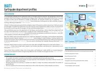
A 7.2 magnitude earthquake struck southwestern Haiti on 14 August at 8:30 am local time. The earthquake occurred 13km
southeast of Petit-Trou-de-Nippes, in the department of Nippes, about 125km west of the capital Port-au-Prince. It occurred
at a depth of 10km and was followed by a number of aftershocks, the strongest of which was 5.2 magnitude (CDEMA
14/08/2021; USGS 14/08/2021 a; Independent 17/08/2021). Tropical Depression Grace passed over Haiti on Monday 16 August,
resulting in flooding and landslides (CDEMA 18/08/2021).
At least 2.2 million people were exposed to the earthquake, about 2,100 people have died, and more than 12,000 were injured
as at 20 August. The death toll is expected to rise as the search for victims trapped under rubble continues. The Government
has declared a month-long state of emergency for the most affected departments (LCI 19/08/2021; USAID 18/08/2021 a).
The most affected areas are in the departments of Sud, Nippes, and Grand’Anse. Jérémie (Grand’Anse department) and
Les Cayes (Sud department) arrondissements recorded the most infrastructure damage (Le Temps 15/08/2021; Europe 1
15/08/2021; Government of Haiti 14/08/2021). At least 650,000 people need emergency humanitarian assistance – about 40%
of the population of the three affected departments (CDEMA 19/08/2021).
More than 50,000 houses were destroyed and over 70,000 were damaged in Sud, Nippes, and Grand’Anse departments,
leaving thousands of people homeless (CDEMA 19/08/2021) . Severe damage to public buildings, including hospitals and
schools, was reported. Those hospitals that are still functional are overwhelmed and likely to lack medicine and equipment
to treat all wounded patients (AP 15/08/2021). There are reports of buildings that collapsed following aftershocks (CDEMA
19/08/2021).
Emergency shelter remains a priority, as well as access to water after earthquake damage to the local water systems (USAID
18/08/2021 a). Priority items include water, tarpaulin, food, medical assistance, and sanitary kits. Assessments are still
taking place (CDEMA 19/08/2021).
Tropical Storm Grace resulted in heavy rains, strong winds, and flooding as it made landfall as a tropical depression,
destroying some makeshift shelters and generating additional risk of collapse for damaged structures (USAID 19/08/2021).
HAITI
Earthquake department profiles
Source: ECHO (18/08/2020), see full map on page 18.
Emergency Response Coordination Centre (ERCC) –DG ECHO Daily Map | 18/08/2021
Haiti | 7.2 M Earthquake and EU Response
HAITI
17 August 03:00 UTC
56 km/h sust. winds
D
< 63 km/h
(tropical depression)
Intensity
Main earthquake
Earthquake
Source: GDACS, USGS
1,941*
Fatalities
IMPACTOVERVIEW
As of 17 August
Source:Civil Protection Haiti
9,900
Injured people
Focal mechanism
HAITI
ATLANTIC OCEAN
Canal de La Gonâve
Gonâve Island
Grande
Cayemite
Ile a Vache
Caribbean
Sea
205
Fatalities
1,597
Fatalities
137
Fatalities
16 August 21:00 UTC
56 km/h sust. winds
Tropical Cyclone
Source: GDACS, NOAA
Past track
7.2 M
Depth: 7.2 km
14 Aug 2021
12:29 UTC (8:29 local)
Source: GDACS
GDACS Red Alert
©EuropeanUnion,2021.MapproducedbytheJRC.Theboundariesandthenamesshownonthismapdonotimply
officialendorsementoracceptancebytheEuropeanUnion.
*Including2fatalitiesinNord-OuestDepartment(situatedoutsidethemapcoverage)
09
Destroyed houses per
commune division
Source: Civil Protection Haiti
2,500 –3,500
600 –2,500
> 3,500
200 –600
1 -200
Civil Protection Emergency Center/
OSOCC Center location
Deployement location of
ERCC Laison Officers
Modified Mercalli
Intensity Scale (MMI)
VIII (Severe shaking)
IX (Violent shaking)
Reported flood
200-300
100-200
>30050-100
25-50
Rainfall accumulation
(mm)
11-17 August
Source: NASA-GPM
Department
division
Communes
division
HAITI
Port
Airport
EU RESPONSE
As of 18 August
•On14August,a7.2-magnitudeearthquakehitthesouth-western
partofHaiti.
•On16August,theERCCreceivedarequestforassistancefor
technicalexpertiseandin-kindassistance.
•TheEUisallocating€3millioninhumanitarianfundingtoaddress
urgentneeds.
•AnEUCivilProtectionTeam(EUCPT)of12expertswillbedeployed
from18Augusttill3September,consistingof:teamleader(FR),
deputyteamleader(CZ),2infomanagement experts(CZ,ES),2
healthexperts(IT,ES),operationalexpert(FR),logisticexpert(ES),
securityexpert(SE),2structuralengineers(ES)andaWASHexpert
(SE).Theexpertswillbeaccompaniedby2ERCCLiaisonofficersand
aTechnicalAssistanceandSupportTeam(TAST)of8experts(SE).
•Offersforin-kindassistance:waterpurificationmodule(FR),medical
equipmentandmedicines(ES),and200familytentsand15support
facilitytents(multiuselargetents)(SE).
•CopernicusEmergencyMappingServicewasactivatedon14August
andhasproduced6gradingmapssince. Source:DGECHO
Copernicus EMSR536
Activation date: 14 August
Area of Interest:
with planned
grading
with grading
INFORMATION GAPS
• There is very little information available on the extent or kind of sectoral needs, particularly in relation to WASH and food.
The available information is preliminary and should be completed by upcoming needs assessments.
• Population numbers (including the number of people exposed to the earthquake) vary between different sources, and
ACAPS has not been able to verify them.
• Damage assessments are underway, so numbers are subject to change and possibly underrepresent the number of
people affected.
• This also implies that for some sectoral needs there is still too little information to draw adequate conclusions.
TABLE OF CONTENTS
Cities and populations exposed to very strong and severe shaking ........3
Grand’Anse Department Profile ........................................................................4
Nippes Department Profile .................................................................................8
Sud Department Profile .....................................................................................13
Topographic map showing earthquake shake intensity ............................ 16
Hazard susceptibility map ................................................................................17
7.2m Earthquake and EU response .................................................................18
Thematic report | 20 August 2021 2
DEPARTMENT GRAND’ANSE NIPPES SUD
Department capital Jérémie Miragoâne Les Cayes
Population 383,500 (33% in Jérémie) (OCHA 17/08/2021) 346,498 (29% in Miragoâne) (OCHA 17/08/2021) 675,117 (20% in Les Cayes) (OCHA 17/08/2021)
Number of communes 12 11 18
Area 1,268km2 1,268km2 2,794km2
PiN, 2021 Haiti Humanitarian Needs
Overview (HNO)
187,000 (OCHA 04/03/2021) 136,000 (OCHA 04/03/2021) 309,000 (OCHA 04/03/2021)
Household size 4.3 people (national average) (UN DESA 2019) 4.3 people (national average) (UN DESA 2019) 4.3 (national average) (UN DESA 2019)
Poverty 70% (USAID 02/11/2020)
50% (Ministère de la Santé Publique et de la Population
07/2018)
50% (USAID 02/11/2020)
Stunting
IPC
21.6% (USAID 02/11/2020)
Phase 3 level
17% of children under 5 (Ministère de la Santé Publique
et de la Population 07/2018)
Phase 3 level
19% (USAID 2013)
Phase 3 level
Population exposed to earthquakes level
VII and stronger on the modified Mercalli
intensity scale (MMI)
45,304 people in Pestel commune (OCHA 17/08/2021) 97,000 (USGS 14/08/2021 b) 414,933 (ECHO 18/08/2021)
Number of confirmed deaths 218 (Le Nouvelliste 18/08/2021) 137 (Le Nouvelliste 18/08/2021) 1,832 (Le Nouvelliste 18/08/2021)
Number of injured 1,652 (Le Nouvelliste 18/08/2021) 1,458 (Le Nouvelliste 18/08/2021) 9,158 (Le Nouvelliste 18/08/2021
Destroyed buildings
13,800 (Donees EDAB Light 16/08/2021) /
8,483 (Le Nouvelliste 18/08/2021)
5,760 (Donees EDAB Light 16/08/2021) /
14,348 (Le Nouvelliste 18/08/2021)
17, 8 41 (Donees EDAB Light 16/08/2021) /
30,122 (Le Nouvelliste 18/08/2021)
Damaged buildings
27,9 25 (Donees EDAB Light 16/08/2021) /
19,371 (Le Nouvelliste 18/08/2021)
286 (Donees EDAB Light 16/08/2021) /
14,898 (Le Nouvelliste 18/08/2021)
18,74 4 (737 (Le Nouvelliste 18/08/2021) /
42,737 (Le Nouvelliste 18/08/2021)
Thematic report | 20 August 2021 3
CITIES AND POPULATIONS EXPOSED TO VERY STRONG AND SEVERE SHAKING
CITY DEPARTMENT LEVEL OF EXPOSURE (MMI) POPULATION EXPOSED TOTAL POPULATION OF ARRONDISSEMENT (2019)
Les Cayes Sud VIII 126,000 154,850
Aquin Sud VIII 5,000 106,382
Anse-à-Veau Nippes VIII 2,000 35,556
Petite-Rivière-de-Nippes Nippes VIII 2,000 29,331
Cavaillon Sud VIII 1,000 49,699
Miragoâne Nippes VII 89,0001 64,232
Fond-des-Blancs Sud VII 3,000 Part of Aquin arrondissement
Corail Grand’Anse VII 3,000 20,098
Torbeck Sud VII 2,000 7 7, 6 6 4
Saint-Louis-du-Sud Sud VII 2,000 66,274
Petit-Trou-de-Nippes Nippes VII 2,000 30,807
Chantal Sud VII 2,000 34,830
Baradères Nippes VII 2,000 42,103
Source: (USGS 14/08/2021 b; OCHA accessed 15/08/2021)
1
ACAPS was not able to verify the number of people exposed in Miragoâne against the current population numbers. Current data suggests that the number of people exposed exceeds 100% of the total population. Possible explanations include outdated population numbers
and administrative divisions used by different sources.
Thematic report | 20 August 2021 4
Grand’Anse Department Profile
CRISIS OVERVIEW
The department of Grand’Anse was exposed to moderate, strong, and very strong levels of
shaking (levels V, VI, and VII MMI) (MapAction 17/08/2021).
As at 18 August, 205 fatalities were
recorded in Grand’Anse overall
(European Commission 18/08/2021). At least 187,505 people in
four communes were exposed to strong shaking (level V MMI); these communes are Jérémie
(125,315 people), Corail (11,011 people), Roseaux (32,878 people), and Beaumont (18,301
people). 45,304 people in Pestel were exposed to very strong shaking (level VI MMI)
(OCHA
17/08/2021; MapAction 17/08/2021).
Prior to the earthquake, the 2021 Haiti HNO had identified 187,000 people in need in
Grand’Anse
(HNO 04/03/2021), and it is likely that the severity of their needs has increased
because of the direct and overall impact of the earthquake.
KEY CHARACTERISTICS
Grand’Anse is located in the southwest of Haiti. Along with the Sud and Ouest departments,
it constitutes the Tiburon Peninsula. Grand’Anse is prone to hurricanes, earthquakes, and
floods; these natural hazards are a major threat to the department
(ACAPS 21/10/2016).
CRISIS IMPACT AND PRE-CRISIS VULNERABILITY
Shelter
• Housing was significantly damaged in Grand’Anse.
• Approximately 35% of all the damaged houses in southwestern Haiti (26,516 out of 76,100)
and 22% of the destroyed houses (13,525 of 60,700) were in Grand’Anse department
(CBi,
OCHA 18/08/2021).
• These damages were particularly in the communes of Jérémie and Pestel (Donees EDAB
Light 16/08/2021).
• 1,000 people were in need of emergency shelter in Jérémie as at 17 August (USAID
18/08/2021 a).
Health
• Five healthcare facilities were affected by the earthquake (Pestel Health Center, Beaumont
Health Center, Carrefour Charles health centres, Saint Antoine Hospital, and St. Pierre de
Corail Health Center). Two of these facilities were destroyed, and three were structurally
damaged
(PAHO 18/08/2021).
• All five healthcare facilities in Jérémie are experiencing fuel, medical supply, and
personnel shortages
(USAID 18/08/2021 b).
• Displacement and the continuous rains combine to increase the risk of disease, including
cholera, acute respiratory infections, diarrhoeal diseases and malaria, and COVID-19 – all
of which are more difficult to manage in the context of disrupted health facilities
(OCHA
18/08/2021 a).
WASH
• The full extent of damage to water infrastructure caused by the earthquake is not known.
In Pestel commune, 1,810 water cisterns were damaged or destroyed, resulting in the
need for urgent support for safe drinking water and sanitation
(OCHA 18/08/2021 a).
• Prior to the earthquake, water, sanitation, and hygiene were identified as areas of serious
need in Haiti
(HNO 04/03/2021), as 65,2% of households in Grand’Anse did not have
access to clean water, soap, and hygiene products.
DEPARTMENT CAPITAL JÉRÉMIE
Population 383,500 (33% in Jérémie) (OCHA 17/08/2021)
Number of communes 12
Area 1,268km
2
PiN (2021 Haiti HNO) 187,000 (OCHA 04/03/2021)
Household size 4.3 people (national average) (UN DESA 2019)
Poverty 70% (USAID 02/11/2020)
Stunting
IPC
21.6% (USAID 02/11/2020)
Phase 3 level
Population exposed to earthquakes
(VII and stronger MMI)
45,304 people in Pestel commune (OCHA 17/08/2021)
Number of confirmed deaths 218 (Le Nouvelliste 18/08/2021)
Number of injured 1,652 (Le Nouvelliste 18/08/2021)
Destroyed buildings
13,800 (Donees EDAB Light 16/08/2021) /
8,483 (Le Nouvelliste 18/08/2021)
Damaged buildings
27,9 25 (Donees EDAB Light 16/08/2021) /
19,371 (Le Nouvelliste 18/08/2021)
GRAND’ANSE DEPARTMENT PROFILE
Thematic report | 20 August 2021 5
• During previous humanitarian emergencies, WASH has been one of the priorities because
of the lack of water connection networks in the regions
(Ministère de la Santé Publique et
de la Population 07/2018
; UNICEF 29/10/2016). During the earthquake emergency, drinking
water transport flows have been interrupted, so people may also be without access to
clean water
(USAID 18/08/2021 b).
Food
• Post-earthquake, food assistance is urgently needed, particularly in Jérémie (USAID
18/08/2021 b).
• 187,000 people in Grand’Anse were estimated in need of food assistance by the HNO
(HNO 04/03/2021).
• 77.9% of the population in Grand’Anse is food-insecure (USAID 02/11/2020).
• Food insecurity in Haiti is driven by the economic situation and the climate affecting
harvests, and it is aggravated by COVID-19 and natural disasters
(IPC 30/06/2021).
Nutrition
• 21.6% of the population of Grand’Anse is stunted (USAID 02/11/2020).
• Between 15% and 25% of the population in Grand’Anse reported never consuming vitamin
A
(USAID 02/11/2020).
Education
• Across Grand’Anse, 63 schools have been destroyed and 39 damaged.
• In Pestel commune alone, 32 schools were destroyed and 25 damaged
(Donees EDAB
Light 16/08/2021).
• Literacy rates in Grand’Anse are 73,8% for women and 77,1% for men (Ministère de la Santé
Publique et de la Population 07/2018).
Protection and vulnerable groups
• In general, the most vulnerable population groups in Haiti are women and girls, children,
the elderly, and people with disabilities, particularly if displaced, as well as people living
in remote or landlocked areas
(HNO 04/03/2021).
• These groups are more vulnerable to sexual and gender-based violence, discrimination,
and exclusion from assistance
(OCHA 18/08/2021 a).
HUMANITARIAN ACCESS
Security
• The main road between the capital Port-au-Prince and the southwestern peninsula
had been blocked by criminal groups for months prior to the earthquake. Following the
earthquake, access for relief convoys through the blockaded area has been negotiated by
UN and government representatives, allowing the passage of humanitarian aid for at least
a week. In spite of this, access remains uncertain because the affected communities
have blocked access, demanding that their needs are met
(OCHA 16/08/2021; OCHA
18/08/2021 b).
Earthquake impact
• Humanitarian access is a challenge because of the infrastructure damage caused by the
earthquake, the presence of criminal groups, and grievances of the affected communities.
• There are significant infrastructure damages in the remote areas surrounding Jérémie
commune
(USAID 18/08/2021 b). The impact on critical infrastructure is highest in
Pestel commune, as it was exposed to very strong shaking (level VI MMI) because of its
proximity to the epicentre of the earthquake
(MapAction 17/08/2021).
• An aerial assessment of earthquake impact on infrastructure in Pestel commune shows
that most roads are damaged; this is likely disrupting vehicle movement, services, and
humanitarian aid
(USAID 18/08/2021 b).
• Seaport, airport, and telecommunications infrastructure in the affected departments was
not critically damaged
(OCHA 18/08/2021 b).
Please also see the 2016 Department Profile.
Thematic report | 20 August 2021 6
Source: ACAPS (21/10/2016)
Thematic report | 20 August 2021 7
Source: MapAction (18/08/2021)
��
�$
�$
�$
�$
!
!
!
!
Anse d'Hainault
MoronDame Marie
Latibolière
GRANDE'ANSE
HT08
NIPPES
HT10
SOUTH
HT07
Jérémie
ABRICOTS
HT0812
ANSE
D'HAINAULT
HT0821
BARADERES
HT1031
BEAUMONT
HT0833
BONBON
HT0813
CAMP-PERRIN
HT0714
CAVAILLON
HT0733
CHAMBELLAN
HT0815
CHANTAL
HT0713
CHARDONNIERES
HT0751
CORAIL
HT0831
COTEAUX
HT0741
DAME
MARIE
HT0822
GRAND-BOUCAN
HT1032
JEREMIE
HT0811
LES ANGLAIS
HT0752
LES
CAYES
HT0711
LES IROIS
HT0823
MANICHE
HT0715
MORON
HT0814
PESTEL
HT0834
PORT-A-PIMENT
HT0742
ROSEAUX
HT0832
TIBURON
HT0753
TORBECK
HT0712
HAITI
´
CUBA
DOMINICAN
REPUBLIC
HAITI
JAMAICA
10
km
Topographic map showing earthquake shake intensity
Haiti
Topographic map of Grande'Anse
Département, with earthquake
shake intensity contours
Produced by MapAction
https://mapaction.org
haiti@mapaction.org
The depiction and use of boundaries, names and
associated data shown here do not imply
endorsement or acceptance by MapAction.
Supported by The German Federal Foreign Office
Created 18-Aug-2021 17:00 EDT
Proj
ection &
Datum
WGS 1984
GLIDE NumberEQ-2021-000116-HTI
MA005
Scan for
latest maps
UTC-05:00
Data Sources:
OSM - Topographic data
SRTM - DEM
USGS - Shake intensity
WorldPop 2020 - Populated areas
UN OCHA - Admin boundaries
Grande'Anse Département (HT08)
9
EQ Epicentre
IV (Light)
V (Moderate)
VI (Strong)
VII (Very Strong)
VIII (Severe)
CAPITAL
City
! Town
�$Seaport
��Airport
River
Lake
Roads
Primary
Secondary
Tertiary
Residential
Track
Path
ADMIN 1 - DÉPARTEMENT
ADMIN 2 - COMMUNE
Populated Areas
Elevation (m)
High : 2667
Low : -11
Thematic report | 20 August 2021 8
Nippes Department Profile
OVERVIEW
At least 97,000 people in five communes of Nippes were exposed to very strong or severe
shaking (level VII and above MMI). Anse-à-Veau and Petite-Rivière-de-Nippes were exposed to
severe shaking (level VIII MMI). Petit-Trou-de-Nippes, Miragoâne, and Baradères were exposed
to very strong shaking (level VII MMI)
(USGS 14/08/2021 b). Prior to the earthquake, there were
136,000 people in need of humanitarian aid in Nippes because of food insecurity and natural
disasters, out of the approximately 346,000 inhabitants of the department
(OCHA 04/03/2021).
KEY CHARACTERISTICS
Nippes is located in the southwest of Haiti. Along with the Sud, Grand’Anse, and Ouest
departments, it constitutes the Tiburon Peninsula. It covers 1,268km2. Until 2003, Nippes was
part of Grand’Anse department. Nippes has 11 communes, and its capital is Miragoâne. 50%
of households in Nippes are in the two lowest quintiles of economic wellbeing
(Ministère de la
Santé Publique et de la Population 07/2018).
Although the entire territory of Haiti is susceptible to
earthquakes, some of the communes in Nippes are more vulnerable because of their location
in places prone to other natural disasters, their constructions, and their socioeconomic
indicators. In Nippes, the communes of Anse-à-Veau and Petite-Rivière-de-Nippes and
some sectors of Miragoâne are situated in critical vulnerability (5 on a scale of 1 to 5)
(OCHA
20/02/2019).
Nippes is home to at least 346,498 people. About 29% of its population (99,183)
lives in Miragoâne. Four other communes account for 40% of the department’s population
(10% in each): Anse-à-Veau, Baradères, L’Asile, and Plaisance du Sud. Each of these communes
is home to 34,000–39,000 people
(OCHA 17/08/2021).
CRISIS IMPACT AND PRE-CRISIS VULNERABILITY
Shelter
• At the time of writing, there are no estimates of the number of displaced people. However,
the fact that at least 14,348 houses were completely destroyed and 14,898 were damaged
by the earthquake in Nippes suggests that there is a significant number of people in need
of shelter. The most affected communes were L’Asile (2,500 houses destroyed), Baradères
(2,515 houses destroyed), and Petit-Trou-des-Nippes (603 houses destroyed)
(Le Nouvelliste
18/08/2021; UNOSAT 16/08/2021; ACT Alliance 15/08/2021).
On average, a household in Haiti
is made up of 4.3 people, meaning that there are approximately 61,696 people displaced by
the destruction of their homes and another 64,061 with partially damaged homes who may
choose not to return in fear of aftershocks or risk of house collapse.
• In addition to houses, several churches and schools (which are normally used as temporary
shelters) have also been destroyed
(UNICEF 17/08/2021; The New York Times 17/08/2021).
In the absence of shelters, people are sleeping in the streets, with plastic sheets covering
their bodies
(The Wall Street Journal 17/08/2021). Recent rains in the aftermath of Tropical
Storm Grace in Haiti make it more urgent to provide shelter for those affected. The
storm is expected to move away from Haiti over the next few days
(Reuters 17/08/2021;
NDN 18/08/2021)
. As at 18 August, 33 makeshift shelters in Nippes have been registered
(gathering points on public spaces or empty land)
(OCHA 18/08/2021 b).
DEPARTMENT NIPPES
Department capital Miragoâne
Population 346,498 (29% in Miragoâne) (OCHA 17/08/2021)
Number of communes 11
Area 1,268km2
PiN (2021 HNO) 136,000 (OCHA 04/03/2021)
Household size 4.3 people (national average) (UN DESA 2019)
Poverty
50%
(Ministère de la Santé Publique et de la Population 07/2018)
Stunting
17% of children under 5
(Ministère de la Santé Publique et de la Population 07/2018)
IPC Phase 3 level
Population exposed to the earthquakes
(VII and stronger MMI)
97,000 (USGS 14/08/2021 b)
Number of confirmed deaths 137 (Le Nouvelliste 18/08/2021)
Number of injured 1,458 (Le Nouvelliste 18/08/2021)
Destroyed buildings 5,760 (Donees EDAB Light 16/08/2021) /
14,348 (Le Nouvelliste 18/08/2021)
Damaged buildings
286 (Donees EDAB Light 16/08/2021) /
14,898 (Le Nouvelliste 18/08/2021)
NIPPES DEPARTMENT PROFILE
Thematic report | 20 August 2021 9
Health
• As at 16 August, at least one hospital in Nippes has reported damage to its infrastructure.
The large number of patients seeking treatment from earthquake-related injuries has
resulted in the need for supplies and equipment to treat orthopaedic problems and
additional health personnel
(OCHA 16/08/2021; Radio-Canada 16/08/2021).
• In l’Asile, a hospital was damaged (Système national de gestion des risques de désastre
14/08/2021).
• Four hospitals in Nippes were exposed to shaking level VI and above MMI (PAHO 15/08/2021).
The Sainte Thérèse hospital in Miragoâne, the Paillant Hospital, l’Asile Hospital, and the
Baradères Health Centre were affected, although they continue to function
(Rezo Nòdwes
17/08/2021)
. As the damage assessment has not yet been finalised, these numbers are
likely to increase. As at 19 August, seven health facilities were reported damaged and two
destroyed.
• The conditions of hospitals in Petit-Trou-de-Nippes, the most severely affected
arrondissement, are still being assessed
(MSF 16/08/2021). A preliminary assessment in
Miragoâne revealed a lack of medical staff and equipment; in Baradères, hospitals are
overwhelmed and lacking medicines
(PAHO 15/08/2021).
• In addition to immediate treatment for injuries and medical needs, earthquake-affected
people may be in need of mental health support, given the human and material losses they
have experienced
(Action Against Hunger 17/08/2021).
• In 2019, Nippes department had a total of 34 hospitals (Ministère de la Santé Publique et de
la Population 11/2019).
The inpatient capacity of these hospitals is 135 people (based on
bed availability) – a ratio of 3.8 beds per 100,000 inhabitants, below the national average
of 6.7. In 2019, there were 240 medical staff members in Nippes: 67 doctors, 95 nurses, 76
auxiliary nurses, and two midwives, for a ratio of 6.8 medical staff members per 100,000
inhabitants, below the national average of 10.47
(Ministère de la Santé Publique et de la
Population 11/2019).
• Prior to the earthquake, health facilities in Haiti were already known to be short of essential
supplies, and emergency units were overwhelmed by a combination of COVID-19 and
violence-related casualties
(The New Humanitarian 05/07/2021).
WASH
• 25 water supply piped systems were damaged because of the earthquake in Haiti. People
are in need of safe drinking water and hygiene kits
(UNICEF 17/08/2021). In Nippes, around
10% of households reported by 2018 that one of their members had had cholera since 2010
(when an outbreak associated with the earthquake occurred)
(Ministère de la Santé Publique
et de la Population 07/2018).
Although this is a relatively low percentage compared to other
departments, the number of damaged sanitation facilities (in houses and public buildings)
may be conducive to a new outbreak. While no cholera cases have been officially diagnosed
in Haiti since February 2021, this does not mean that the vibrio cholerae bacterium (the
bacterium that causes cholera) is absent in the ground
(World Bank 07/04/2021).
• The earthquake may make it harder for people to observe key preventative hygiene practices
(such as handwashing with soap) and more prone to risky ones (such as drinking unsafe
water and open defecation), which could lead to a new outbreak. 64% of households in
Nippes do not have access to clean water, soap, and hygiene products. During previous
humanitarian emergencies, WASH has been one of the priorities because of the lack of
water connection networks in the regions
(Ministère de la Santé Publique et de la Population
07/2018; UNICEF 29/10/2016).
Food
• 58% of the inhabitants of Nippes are food-insecure (WFP 21/02/2017).
Nutrition
• 17% of children under 5 in Nippes are stunted as a result of insufficient nutrition. Nippes
has the lowest percentage of underweight children in Haiti
(Ministère de la Santé Publique
et de la Population 07/2018).
Education
• Seven schools were damaged and one destroyed. In l’Asile, a hospital was damaged
(Système national de gestion des risques de désastre 14/08/2021).
• Literacy rates in Nippes are 80.3% for women and 83.2% for men (Ministère de la Santé
Publique et de la Population 07/2018).
Protection
• People are at risk if they return to damaged or partly destroyed houses to retrieve
possessions or seek shelter from the rain. During the 2010 earthquake, several people died
after the event, either because they were injured and could not be found or because they
returned to their damaged houses, and smaller aftershocks (or even the damages alone)
caused them to collapse
(Reuters 17/08/2021). Given the large number of houses destroyed
or damaged, people in Nippes are still at risk of death. The number of missing individuals
is currently unknown.
• In Chalon (Miragoâne), gangs are present and have attacked people trying to transit to
other areas of Nippes. Gangs are also present in Anse-à-Veau
(Leader-Telegram 18/08/2021;
UN Security Council 25/09/2020; AyiboPost 02/12/2019).
Thematic report | 20 August 2021 10
HUMANITARIAN ACCESS
Security
• In the first days after the earthquake, gangs in Miragoâne attacked those entering from
Port-au-Prince with humanitarian aid
(Leader-Telegram 18/08/2021). Miragoâne is the
gateway from the capital to the Tiburon Peninsula, so the attacks restricted access to not
only Nippes but also other affected departments (Sud and Grand’Anse).
• On 18 August, the gangs announced a truce to allow the transport of humanitarian aid
from Port-au-Prince (where they have a major presence) to southern Haiti
(Notimérica
18/08/2021).
Earthquake impact
• In the north of the department, between the roads linking Petite-Rivière-de-Nippes,
Anse-à-Veau, and Baradères, there are no major access restrictions. A municipal road is
damaged near Saint-Marc, in Petite-Rivière-de-Nippes, and a landslide in Petit-Trou-de-
Nippes restricts access to certain areas
(Système national de gestion des risques de désastre
14/08/2021).
• In Rey Pond (located in Paillant, part of Miragoâne), several landslides and rockslides
impede mobility
(European Commission 15/08/2021). Paillant is the area with the most
access restrictions in Nippes. The roads connecting Miragoâne to Saint-Michel-du-Sud
present access restrictions.
• As at 17 August, telephone lines were not functioning in Petit-Trou-de-Nippes, which could
hamper damage assessments and communications between organisations operating in
the area
(The New York Times 17/08/2021).
Tropical Storm Grace
• Since 16 August 2021, Tropical Storm Grace has brought heavy rains in southern Haiti,
triggering mudslides and hampering relief efforts. The landslides in Petit-Trou-de-
Nippes and Paillant are the result of rainfall caused by this storm
(UNICEF 17/08/2021; The
Washington Post 17/08/2021).
Please also see the 2016 Department Profile.
Thematic report | 20 August 2021 11
Source: (ACAPS 2016)
Thematic report | 20 August 2021 12
Source:(MapAction 18/08/2021)
��
�$
�$
�$
�$
!
!
!
!
!
!
!
!
!
9
Saint-Louis-du-Sud
Aquin
Cavaillon
Grande Caille
Saint
Michel
du Sud
L'Asile
Chalon
L'Anse-à-Veau
GRANDE'ANSE
HT08
NIPPES
HT10
SOUTH
HT07
WEST
HT01
Les Cayes
Miragoâne
ANSE-A-VEAU
HT1021
AQUIN
HT0731
ARNAUD
HT1024
BARADERES
HT1031
CAVAILLON
HT0733
COTES
DE FER
HT0222
FONDS DES
NEGRES
HT1013
GRAND-BOUCAN
HT1032
L'ASILE
HT1023
LES CAYES
HT0711
MANICHE
HT0715
MIRAGOANE
HT1011
PAILLANT
HT1014
PESTEL
HT0834
PETIT-GOAVE
HT0122
PETIT TROU
DE NIPPES
HT1022 PETITE RIVIERE
DE NIPPES
HT1012
PLAISANCE
DU SUD
HT1025
SAINT LOUIS
DU SUD
HT0732
HAITI
´
CUBA
DOMINICAN
REPUBLIC
HAITI
JAMAICA
10
km
Topographic map showing earthquake shake intensity
Haiti
Topographic map of Nippes
Département, with earthquake
shake intensity contours
Produced by MapAction
https://mapaction.org
haiti@mapaction.org
The depiction and use of boundaries, names and
associated data shown here do not imply
endorsement or acceptance by MapAction.
Supported by The German Federal Foreign Office
Created 18-Aug-2021 17:00 EDT
Projectio
n &
Datum
WGS 1984
GLIDE NumberEQ-2021-000116-HTI
MA005
Scan for
latest maps
UTC-05:00
Data Sources:
OSM - Topographic data
SRTM - DEM
USGS - Shake intensity
WorldPop 2020 - Populated areas
UN OCHA - Admin boundaries
Nippes Département (HT10)
9
EQ Epicentre
IV (Light)
V (Moderate)
VI (Strong)
VII (Very Strong)
VIII (Severe)
CAPITAL
City
! Town
�$Seaport
��Airport
River
Lake
Roads
Primary
Secondary
Tertiary
Residential
Track
Path
ADMIN 1 - DÉPARTEMENT
ADMIN 2 - COMMUNE
Populated Areas
Elevation (m)
High : 2667
Low : -11
Thematic report | 20 August 2021 13
Sud Department Profile
OVERVIEW
Sud is the most affected department, with more than 1,800 people dead, over 9,000 injured,
and more than 72,000 houses destroyed or damaged
(Le Nouvelliste 18/08/2021).
In addition to the direct impact of the earthquake, the passage of Tropical Depression Grace
has caused flooding in the south, increasing safety risks for damaged homes and worsening
conditions for those homeless since the earthquake
(OCHA 18/08/2021 b).
The 2021 Haiti HNO estimates that 309,000 people in Sud were in need of humanitarian
assistance prior to the earthquake
(OCHA 04/03/2021). According to the first assessments,
emergency needs in Les Cayes are hygiene kits, plastic protection sheets, and drinkable water
(USAID 18/08/2021 a).
KEY CHARACTERISTICS
Located in the southwest of the Tiburon Peninsula, Sud has five districts divided into 18
municipalities. Its surface area is 2,654km2. Les Cayes is the capital of the department
(Haiti
Culture accessed 18/08/2021).
The communes of Aquin, Cavaillon, Les Anglais, Saint Louis du
Sud, and Tiburon have territories in critical geographic vulnerability to earthquake (5 on a scale
of 1 to 5)
(OCHA 20/02/2019). In Sud department, 53% of household walls are made of cement,
16% of bricks or rocks, and 13% of earthen material. 73% of the roofs are sheet metal, and 16%
are thatch or straw
(IHSI 03/2014).
CRISIS IMPACT AND PRE-CRISIS VULNERABILITY
Shelter
• Around 30,122 houses were destroyed and 42,737 damaged as at 17 August (Le Nouvelliste
18/08/2021).
• The provision of shelter supplies and building materials for the department is centred in
Les Cayes (PI 10/2016). With the city among the most affected locations, the supply chain
is likely to be disrupted, making access to shelter materials more difficult.
• In Les Cayes, thousands of people fled their homes in fear that they may collapse
(OCHA
15/08/2021).
Those who are homeless are taking refuge in assembly points – mainly public
squares and empty land. Five assembly points are reported in Sud department
(OCHA
18/08/2021 b).
More than 200 people started to build temporary shelters on a football
field, which quickly flooded as a result of persistent wind and rain
(Le Point International
18/08/2021).
Displaced people are staying in neighbouring communes and not moving
towards the capital
(Direct Relief 18/08/2021).
• Based on initial assessments, around 20% of the buildings in Les Cayes and in the
neighbouring commune of Camp-Perrin, which has been affected by mudslides, have been
destroyed or damaged
(USAID 18/08/2021 a).
• In Les Cayes, some homeowners are patching cracks caused by the earthquake to
reoccupy damaged homes before engineers’ assessment. This exposes them to the risk
of new collapses because of the frequent aftershocks in Sud department
(Le Nouvelliste
19/08/2021).
WASH
• In Les Cayes, drinking water is needed because water storage tanks were destroyed, and
water pipes exploded
(Americares 14/08/2021; France Info 18/08/2021).
• The impact on communal and household infrastructure will have implications on WASH
for people in the affected areas. The destruction or damage of more than 72,000 houses
creates a need for access to temporary toilets to prevent the public health implications
of open defecation and the associated protection risks
(OCHA 16/08/2021; Action Against
Hunger 17/08/2021; Le Nouvelliste 18/08/2021).
DEPARTMENT SUD
Department capital Les Cayes
Population 675,117 (20% in Les Cayes) (OCHA 17/08/2021)
Number of communes 18
Area 2,794km
2
Pin (2021 HNO) 309,000 (OCHA 04/03/2021 )
Household size 4.3 (national average) (UN DESA accessed 19/08/2021)
Poverty 50% (USAID 02/11/2020)
Stunting 19% (USAID 2013)
IPC Phase 3 level
Population exposed to the earthquakes (VII
and stronger MMI)
414,933 (European Commission 18/08/2021)
Number of confirmed deaths 1,832 (Le Nouvelliste 18/08/2021)
Number of injured 9,158 (Le Nouvelliste 18/08/2021)
Number of destroyed buildings
17, 8 41 (Donees EDAB Light 16/08/2021) /
30,122 (Le Nouvelliste 18/08/2021)
Damaged buildings 18,744 / 42,737 (Le Nouvelliste 18/08/2021)
SUD DEPARTMENT PROFILE
Thematic report | 20 August 2021 14
• In Sud department, WASH infrastructures were weakened by Isaias and Laura storms in
2020. Access to basic hygiene was particularly difficult, with affected people dependent on
the supply of water by truck and the distribution of hygiene kits
(OCHA 04/03/2021).
• Sanitation facilities often consist of a simple latrine dug at a distance from the house.
There is no tap water in some houses
(Encyclopaedia Britannica accessed 20/08/2021).
Food
• The lack of food reported prior to the earthquake raises concerns about the deterioration
in the nutritional status of children, who are already weakened by food insecurity due to the
lean season
(UNICEF 17/08/2021).
• COVID-19, reduced mobility caused road blockages, and increasing insecurity had already
affected access to food across Haiti, including in Sud
(FAO 31/08/2020).
• While Sud department is classified as Crisis (IPC Phase 3), the southern coastal areas are
of major severity, with 15% of the population in IPC Phase 4
(OCHA 04/03/2021).
• In Sud department, 65% of households use gas lamps (kerosene) for lighting. Only 8% of
households have an individual electricity meter. 68% of households use wood and straw as
an energy source for cooking, while 30% use charcoal
(IHSI 03/2014).
Nutrition
• 19% of children in Sud are stunted as a result of insufficient nutrition (USAID 2013).
Health
• Ten health facilities were reported damaged and 12 severely damaged (out of 79 health
facilities reported in 2018) according to an assessment carried out on 10 of the 18
communes in Sud
(PAHO 19/08/2021; Ministère de la Santé Publique et de la Population
11/2019).
• In Les Cayes, the three main hospitals for the region (especially HIC Cayes and Hôpital
OFATMA) are overwhelmed by the influx of injured people. There is a shortage of required
medicines and medical supplies
(Haiti Libre 17/08/2021; OCHA 16/08/2021). The hospitals
are also running on generators and with a limited stock of fuel
(USAID 18/08/2021 a). Two
out of the five operating rooms in Les Cayes are not usable due to earthquake damage
(USAID 18/08/2021 a).
• The infant mortality rate is 40 children per 1,000 births in Sud department. Haiti is ranked
190th out of 237 countries
(Population Data accessed 19/08/2021).
Education
• 94 schools (out of 225 schools in Sud department) were completely destroyed or suffered
partial damage as at 18 August, making it difficult to begin school as initially scheduled for
7 September
(UNICEF 18/08/2021).
• The primary school attendance rate was 79% in 2012 in Sud department. The literacy
rate was 85% in 2012 for 15–24 year-olds (85.9% for women and 84.2% for men). Younger
generations are better literate than older ones, whether they are women or men. Only 13%
of women aged 15–19 cannot read compared to 57% of those aged 45–49. Among men,
the rates are 17% and 41%, respectively
(UNICEF 06/07/2016).
HUMANITARIAN ACCESS
Insecurity
• The roadblocks along national road 2, which connects Port-au-Prince to the southern
peninsula of the country, are expected to continue to pose logistical and security problems
for humanitarian organisations
(OCHA 16/08/2021).
• An informal truce between gangs is allowing the passage of aid, and some humanitarian
organisations have started negotiating humanitarian corridors
(France Info 19/08/2021;
USAID 18/08/2021 a).
Other routes and alternative modes of transport for reaching affected
people, especially by sea are also being explored
(OCHA 16/08/2021).
• Insecurity along the land routes connecting Port-au-Prince to earthquake-affected areas
has prompted humanitarian actors to rely heavily on air and sea transport, thus limiting the
frequency and volume of aid deliveries
(USAID 18/08/2021 a).
• As at 17 August, some humanitarian convoys with food and emergency kits arrived at Les
Cayes with police escort
(USAID 18/08/2021 a).
Earthquake impact
• National road 7, which connects Les Cayes and Jérémie, has been cut off as a result of a
landslide; access by road to the affected areas is further limited
(OCHA 16/08/2021). The
national road that cut off again to traffic after the passage of Cyclone Grace, is reportedly
reopened towards Rivière Glace
(AlterPresse 17/08/2021).
Please also see the 2016 Department Profile.
Thematic report | 20 August 2021 15
Source: ACAPS (21/10/2016)
Thematic report | 20 August 2021 16
Source: MapAction (18/08/2021)
��
�$
�$
�$
�$
!
!
!
!
!
!
!
!
!
!
!
!
!
!!
!
9
Port Salut
Côtes-de-Fer
Port-à-Piment
Saint-Louis-du-Sud
Chardonnières Aquin
Cavaillon
Grande
Caille
Saint Michel
du Sud
L'Asile
Chalon
Anse
d'Hainault
L'Anse-à-Veau
Moron
Dame Marie
Latibolière
GRANDE'ANSE
HT08
NIPPES
HT10
SOUTH
HT07
WEST
HT01
Les Cayes
Miragoâne
ABRICOTS
HT0812
ANSE-A-VEAU
HT1021
ANSE
D'HAINAULT
HT0821
AQUIN
HT0731
ARNAUD
HT1024
ARNIQUET
HT0723
BARADERES
HT1031
BEAUMONT
HT0833
BONBON
HT0813
CAMP-PERRIN
HT0714
CAVAILLON
HT0733
CHAMBELLAN
HT0815
CHANTAL
HT0713
CHARDONNIERES
HT0751
CORAIL
HT0831
COTEAUX
HT0741
COTES
DE FER
HT0222
DAME
MARIE
HT0822
FONDS
DES NEGRES
HT1013
GRAND-BOUCAN
HT1032
ILE A VACHE
HT0716
JEREMIE
HT0811
L'ASILE
HT1023
LES ANGLAIS
HT0752
LES CAYES
HT0711
LES IROIS
HT0823
MANICHE
HT0715
MIRAGOANE
HT1011
MORON
HT0814
PAILLANT
HT1014
PESTEL
HT0834
PETIT-GOAVE
HT0122
PETIT TROU
DE NIPPES
HT1022
PETITE RIVIERE
DE NIPPES
HT1012
PLAISANCE
DU SUD
HT1025
PORT-A-PIMENT
HT0742
PORT-SALUT
HT0721
ROCHE A
BATEAU
HT0743
ROSEAUX
HT0832
SAINT JEAN
DU SUD
HT0722
SAINT LOUIS DU SUD
HT0732
TIBURON
HT0753
TORBECK
HT0712
HAITI
´
CUBA
DOMINICAN
REPUBLIC
HAITI
JAMAICA
10
km
Topographic map showing earthquake shake intensity
Haiti
Topographic map of South
Département, with earthquake
shake intensity contours
Produced by MapAction
https://mapaction.org
haiti@mapaction.org
The depiction and use of boundaries, names and
associated data shown here do not imply
endorsement or acceptance by MapAction.
Supported by The German Federal Foreign Office
Created 18-Aug-2021 17:00 EDT
Projection
&
Datum
WGS 1984
GLIDE NumberEQ-2021-000116-HTI
MA005
Scan for
latest maps
UTC-05:00
Data Sources:
OSM - Topographic data
SRTM - DEM
USGS - Shake intensity
WorldPop 2020 - Populated areas
UN OCHA - Admin boundaries
South Département (HT07)
9
EQ Epicentre
IV (Light)
V (Moderate)
VI (Strong)
VII (Very Strong)
VIII (Severe)
CAPITAL
City
! Town
�$Seaport
��Airport
River
Lake
Roads
Primary
Secondary
Tertiary
Residential
Track
Path
ADMIN 1 - DÉPARTEMENT
ADMIN 2 - COMMUNE
Populated Areas
Elevation (m)
High : 2667
Low : -11
Topographic map showing
earthquake shake intensity
Thematic report | 20 August 2021 17
Source: Map Action (19/08/2021)
9
Port Salut
Côtes-de-Fer
Port-à-Piment
Saint-Louis-du-Sud
Chardonnières
Aquin
Cavaillon
Grande Caille
Saint Michel
du Sud
L'Asile
Chalon
Anse
d'Hainault
L'Anse-à-Veau
MoronDame Marie
Latibolière
GRANDE'ANSE
HT08
NIPPES
HT10
SOUTH
HT07
SOUTH-EAST HT02
WEST HT01
2.
2
1.
1
Les Cayes
Miragoâne
Jérémie
ABRICOTS
HT0812
ANSE-A-VEAU
HT1021
ANSE D'HAINAULT
HT0821
AQUIN
HT0731
ARNAUD
HT1024
ARNIQUET
HT0723
BARADERES
HT1031
BEAUMONT
HT0833
BONBON
HT0813
CAMP-PERRIN
HT0714
CAVAILLON
HT0733
CHAMBELLAN
HT0815
CHANTAL
HT0713
CHARDONNIERES
HT0751
CORAIL
HT0831
COTEAUX
HT0741
COTES
DE FER
HT0222
DAME
MARIE
HT0822
FONDS DES
NEGRES
HT1013
GRAND-BOUCAN
HT1032
ILE A VACHE
HT0716
JEREMIE
HT0811
L'ASILE
HT1023LES
ANGLAIS
HT0752
LES CAYES
HT0711
LES IROIS
HT0823
MANICHE
HT0715
MIRAGOANE
HT1011
MORON
HT0814
PAILLANT
HT1014
PESTEL
HT0834
PETIT-GOAVE
HT0122
PETIT TROU
DE NIPPES
HT1022
PETITE RIVIERE
DE NIPPES
HT1012
PLAISANCE
DU SUD
HT1025
PORT-A-PIMENT
HT0742
PORT-SALUT
HT0721
ROCHE A
BATEAU
HT0743
ROSEAUX
HT0832
SAINT JEAN
DU SUD
HT0722
SAINT LOUIS DU SUD
HT0732
TIBURON
HT0753
TORBECK
HT0712
200mm
260mm
280mm
400mm
240mm
380mm
200mm
360mm
340mm
120mm
320mm
260mm
220mm
300mm
280mm
220mm
260mm
60mm
240mm 220mm
80mm
120mm
100mm
140mm
160mm
200mm
180mm
Stanley, T., and D. B. Kirschbaum (2017), A heuristic approach to global landslide susceptibility mapping, Nat. Hazards, 1–20, doi:10.1007/s11069-017-2757-y.
Link to article: http://link.springer.com/article/10.1007%2Fs11069-017-2757-y
´
CUBA
DOMINICAN
REPUBLIC
HAITI
JAMAICA
10
km
Hazard Susceptibility map
Haiti
Hazard susceptibility map, showing
flood zones and landslide
susceptibility mapping, together
with earthquake shake intensity
information and rainfall isohyets
from the last 7 days (including the
time period that Tropical Storm
Grace moved through the area)
Produced by MapAction
https://mapaction.org
haiti@mapaction.org
The depiction and use of boundaries, names and
associated da
ta shown here do not imply
endorsement or acceptance by MapAction.
Supported by The German Federal Foreign Office
Created 19-Aug-2021 11:00 EDT
Projection &
Datum
WGS 1984
GLIDE NumberEQ-2021-000116-HTI
MA004
Scan for
latest maps
UTC-05:00
Data Sources:
USGS - Shake intensity
NASA - Rainfall contours derived from
Global Precipitation Measurement data
NASA - Global Landslide Susceptibility Map
UN OCHA - Admin boundaries
World Bank - Flood Zones
OSM - Settlements, Rivers
9
Earthquake epicentre
USGS Shake Intensity (MMI)
IV (Light)
V (Moderate)
VI (Strong)
VII (Very Strong)
VIII (Severe)
Rainfall Isohyets (mm)
< 100
120 - 200
220 - 300
320 - 400
> 400
Landslide Susceptibility
Very Low
Low
Moderate
High
Very High
Flood zones
CAPITAL
City
! Town
River
Lake
ADMIN 1 - DÉPARTEMENT
ADMIN 2 - COMMUNE
Caution:Neither the Landslide Susceptibility data or the flood zones
data show situational data related to the current emergency.
They are included as a guide relating to general susceptibility only.
HAZARD SUSCEPTIBILITY MAP
Thematic report | 20 August 2021 18
Source: (ECHO 18/08/2020)
Emergency Response Coordination Centre (ERCC) –DG ECHO Daily Map | 18/08/2021
Haiti | 7.2 M Earthquake and EU Response
HAITI
17 August 03:00 UTC
56 km/h sust. winds
D
< 63 km/h
(tropical depression)
Intensity
Main earthquake
Earthquake
Source: GDACS, USGS
1,941*
Fatalities
IMPACTOVERVIEW
As of 17 August
Source:Civil Protection Haiti
9,900
Injured people
Focal mechanism
HAITI
ATLANTIC OCEAN
Canal de La Gonâve
Gonâve Island
Grande
Cayemite
Ile a Vache
Caribbean
Sea
205
Fatalities
1,597
Fatalities
137
Fatalities
16 August 21:00 UTC
56 km/h sust. winds
Tropical Cyclone
Source: GDACS
, NOAA
Past track
7.2 M
Depth: 7.2 km
14 Aug 2021
12:29 UTC (8:29 local)
Source: GDACS
GDACS Red Alert
©EuropeanUnion,2021.MapproducedbytheJRC.Theboundariesandthenamesshownonthismapdonotimply
officialendorsementoracceptancebytheEuropeanUnion.
*Including2fatalitiesinNord-OuestDepartment(situatedoutsidethemapcoverage)
09
Destroyed houses per
commune division
Source: Civil Protection Haiti
2,500 –3,500
600 –2,500
> 3,500
200 –600
1 -200
Civil Protection Emergency Center/
OSOCC Center location
Deployement location of
ERCC Laison Officers
Modified Mercalli
Intensity Scale (MMI)
VIII (Severe shaking)
IX (Violent shaking)
Reported flood
200-300
100-200
>30050-100
25-50
Rainfall accumulation
(mm)
11-17 August
Source: NASA-GPM
Department
division
Communes
division
HAITI
Port
Airport
EU RESPONSE
As of 18 August
•On14August,a7.2-magnitudeearthquakehitthesouth-western
partofHaiti.
•On16August,theERCCreceivedarequestforassistancefor
technicalexpertiseandin-kindassistance.
•TheEUisallocating€3millioninhumanitarianfundingtoaddress
urgentneeds.
•AnEUCivilProtectionTeam(EUCPT)of12expertswillbedeployed
from18Augusttill3September,consistingof:teamleader(FR),
deputyteamleader(CZ),2infomanagement experts(CZ,ES),2
healthexperts(IT,ES),operationalexpert(FR),logisticexpert(ES),
securityexpert(SE),2structuralengineers(ES)andaWASHexpert
(SE).Theexpertswillbeaccompaniedby2ERCCLiaisonofficersand
aTechnicalAssistanceandSupportTeam(TAST)of8experts(SE).
•Offersforin-kindassistance:waterpurificationmodule(FR),medical
equipmentandmedicines(ES),and200familytentsand15support
facilitytents(multiuselargetents)(SE).
•CopernicusEmergencyMappingServicewasactivatedon14August
andhasproduced6gradingmapssince.Source:DGECHO
Copernicus EMSR536
Activation date: 14 August
Area of Interest:
with planned
grading
with grading
7.2m Earthquake and EU re-
sponse