
Rekonesans Aprè Tranblemanntè 14 Out 2021 an Ayiti: Pèspektiv Jeni Jeoteknik ak Syans Sosyal/Politik
Rezime — Rapò sa a prezante rezilta preliminè yo nan yon efò rekonèsans apre tranblemanntè 14 Out 2021, Mw7.2 nan Nippes, Ayiti. Ekip entèdisiplinè a te mennen ankèt sou efè jeoteknik ak sosyal/politik, konsantre sou souke tè, glisman teren, likidasyon, domaj nan enfrastrikti, ak enpak plizyè kriz sou vilnerabilite.
Dekouve Enpotan
- Tranblemanntè Mw7.2 Nippes la te fèt sou zòn fay Enriquillo-Plantain Garden.
- Danje jeoteknik yo te obsève yo enkli echèk tè ansanm fay la, enstabilite pant sismik ak glisman teren, likidasyon ak ralantisman siklik, ak domaj nan enfrastrikti.
- Danje ak kriz similtane an Ayiti, tankou danje natirèl, pwoblèm gouvènans, ak pwoblèm sekirite, afekte vilnerabilite.
Deskripsyon Konple
Rapò sa a rezime rezilta preliminè yo nan yon efò kolaborasyon, entèdisiplinè pou mennen ankèt sou efè jeoteknik ak sosyal/politik tranblemanntè Nippes 14 Out 2021, M7.2, an Ayiti. Akòz pwoblèm sekirite, yon ekip GEER (Geotechnical Extreme Events Reconnaissance) te mobilize a distans soti nan peyi Etazini, epi pita te asosye ak akademik ak enjenyè lokal yo. Yo te kolekte done sou karakteristik souke tè, glisman teren ki te koze pa tranbleman tè, rupture fay sifas, efè likidasyon, domaj sismik nan enfrastrikti, kontèks sosyal/ekonomik/politik dezas la, ak enpak plizyè kriz sou vilnerabilite. Objektif la se rezime rezilta preliminè yo epi prepare teren an pou pwochen ankèt pi konplè sou tranblemanntè a ak lòt danje nan lavni an Ayiti.
Teks Konple Dokiman an
Teks ki soti nan dokiman orijinal la pou endeksasyon.
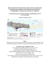
RECONNAISSANCE FOLLOWING THE AUGUST 14, 2021 HAITI EARTHQUAKE: PERSPECTIVES FROM GEOTECHNICAL ENGINEERING AND SOCIAL/POLITICAL SCIENCES Geotechnical Extreme Events Reconnaissance (GEER) Report No. 073 doi:10.18118/G60090 Version 1.0: February 3 , 2021 Editors: Shideh Dashti, Geotechnical Engineering Team Lead (University of Colorado Boulder, USA) Nazife Emel Ganapati, Social Science Team Lead (Florida International University, USA) Contributing Authors (alphabetical order): Nancy Ingabire Abayo (North Carolina State University, USA) Ashly Cabas (North Carolina State University, USA) Santina Contreras (University of Southern California, USA) Joseph Emmanuel Dessable (Geosciences at Faculte Des Sciences of UEH, Haiti) Estefan Garcia (University of Michigan, USA) Kelly Guerrier (Université d'Etat d'Haïti, Haiti) Yu-Wei Hwang (University of Colorado Boulder & University of Texas at Austin, USA) Tarah Jeannot (Civil Engineer at National Transport et Construction) Chunyang Ji (North Carolina State University, USA) Richard Lagesse (ARUP, UK) Marvens Logiste (la Faculté des sciences de UEH, Haiti) Cristina Lorenzo-Velazquez (North Carolina State University, USA) Louis Herns Marcelin (University of Miami, USA) Sary Nicolas (ARUP, USA) Jenny Ramirez (Geosyntec Consultants , USA) Christa Remington (University of South Florida, USA) Joanne Perodin (Florida International University, USA) Newdeskari Saint Fleur (Université d'Etat d'Haïti, Haiti) Michelle Shriro (ARUP, USA) Santiana Vissière (Geosciences at Faculte Des Sciences of UEH, Haiti) Michael Whitworth (AECOM and EEFIT, UK) CONTENTS ACKNOWLEDGEMENTS ................................................................................................................................ ................ 1 1. INTRODUCTION ................................................................................................................................ ......................... 1 2. TEAM STRUCTURE AND DATA COLLECTION APPROACH ................................ ......................... 2 3. REGIONAL TECTONICS ................................................................................................................................ ....... 4 3.1. Historical Seismicity ................................................................................................................................ ................. 6 4. GEOLOGIC SETTING ................................................................................................................................ .............. 9 4.1. Bedrock Geology ................................................................................................................................ ........................ 9 4.2. Surficial Geology ...................................................................................................................................................... 11 4.2.1 Local hydrogeologic and geomorphologic conditions .......................................................................... 17 5. SEISMOLOGICAL ASPECTS AND GROUND MOTION CHARACTERISTICS ..................... 20 5.1. Past Recorded Earthquakes ................................................................................................................................ 20 5.2. Main Event Characteristics and Aftershocks .............................................................................................. 24 5.3. Recorded Ground Motions from the 2021 Nippes Earthquake ........................................................... 27 6. SIMULTANEOUS HAZARDS AND CRISES IN HAITI AFFECTING VULNERABILITY .. 34 6.1. Natural Hazards ....................................................................................................................................................... 34 6.2. Governance Challenges ......................................................................................................................................... 35 6.3. Security Challenges ................................................................................................................................................. 37 6.4. Developmental Challenges ................................................................................................................................... 38 6.5. Mental Health Challenges .................................................................................................................................... 40 7. GEOTECHNICAL HAZARDS ................................................................................................................................. 42 7.1. Ground Failure along the Fault ......................................................................................................................... 43 7.2. Seismic Slope Stability and Landslides ........................................................................................................... 56 7.3. Liquefaction and Cyclic Softening .................................................................................................................... 86 7.4. Performance of Roads, Bridges, Retaining Structures, and other Infrastructure ....................... 96 7.5. Damage to Building Structures due to Geotechnical Effects ............................................................. 105 8 INTERSECTION OF SOCIAL AND ENGINEERING OBSERVATIONS ........................................ 107 8.1. Pre-Earthquake Conditions ............................................................................................................................. 107 8.2. Population Displacement following the Mw7.0, 2010 Earthquake .................................................. 108 8.3. The 2012 Hurricane Sandy ............................................................................................................................... 109 8.4. The 2016 Hurricane Matthew ......................................................................................................................... 110 8.5. The 2021 Mw7.2 Nippes Earthquake ........................................................................................................... 111 9. FUTURE RESEARCH AGENDA AND RECOMMENDATIONS ....................................................... 113 9.1. Engineering ............................................................................................................................................................. 113 9.2. Social Science .......................................................................................................................................................... 113 10. GUIDING PRINCIPLES FOR POST-DISASTER RESPONSE, RECOVERY, AND MITIGATION IN HAITI ............................................................................................................................................... 114 11. REFERENCES ............................................................................................................................................................ 116 LIST OF TABLES Table 3.1. Significant (>6.0 Mw) historical and recent earthquakes for the island of Hispaniola…………………………………………………………………………..……………..8 Table 4.1. Recording stations with available records from the 2021 Nippes mainshock…………......................................................................................................................13 Table 4.2. Proxy-based Vs30 and NEHRP (BSSC, 2003) site classification at locations of interest in Haiti based on proxy-based values of Vs30 from USGS. ............................................ 14 Table 5.1. Code, name, and location of the stations within the AY – Haitian Seismic Network operated by BME (FDSN; last accessed November 2021). .......................................................... 22 Table 5.2. Ground motion characteristics of the records corresponding to the 2021 Nippes earthquake. .................................................................................................................................... 28 Table 6.1. Haiti’s Economic Profile……………………………………..………………..……..39 Table 6.2. Largest Official Development Assistance Recipients in the Americas in 2019. ........ 39 LIST OF FIGURES Figure 3.1. Summary of tectonics in the Caribbean region and the epicenter location corresponding to the 2021 M7.2 Nippes, Haiti earthquake (modified after USGS, last accessed October 2021)….4 Figure 3.2. The complex tectonic regime characterizing the seismicity in Haiti. The Septentrional Fault in the north and the Enriquillo-Plantain Garden Fault are shown in the northern and southern parts, respectively. Historical seismicity in the region is also depicted (Modified after New York Times, January 26, 2010; credit Jonathan Corum). ................................................................ ........ 5 Figure 3.3. Crustal Faults are shown in red and green, while subduction zones are shown in blue. The black star shows the epicenter of the M7.0 12 January 2010 Haiti earthquake with respect to Port-au-Prince (denoted as “P”), while the red star depicts the epicenter of the M7.2 14 August 2021 Haiti earthquake (modified after Frankel et al 2011). ................................ ............................ 6 Figure 3.4. Estimated locations of historical events on or near the Enriquillo fault shown as orange stars. The location of the epicenter of the 12 January 2010 event is depicted as a white star (after Bakun et al 2012). ................................................................................................ ........................... 7 Figure 4.1. Geographic Provinces of Haiti showing the extent of the mountain range of La Hotte (Woodring et al. 1924.)...................................................................................................................10 Figure 4.2. Regional geological map highlighting the locations where ground failure or damage was observed [Modified after Bureau des mines et de l’énergie d'Haïti (1986)] ......................... 11 Figure 4.3. Location of stations that recorded ground motions from the 2021 Nippes earthquake overlaid on a map of the spatial distribution of proxy-based Vs30 values in Haiti. The cities of Nippes and Les Cayes, which experienced significant damage due to the 2021 Nippes earthquakes are shown, along with Haiti’s capital city, Port au Prince. ........................................................... 12 Figure 4.4. Regional map with the locations of interest overlaid on the proxy-based Vs30 distribution map of Haiti (from USGS). ....................................................................................... 15 Figure 4.5. Comparison of the approximated Vs30 proxy maps with the regional geologic maps within the regions of interest and the corresponding NEHRP (BSSC, 2003) soil classification.. 16 Figure 4.6. Surface water resources map [Modified after Knowles et al. 1999] ......................... 18 Figure 4.7. Groundwater Resources map [Modified after Knowles et al. 1999] ........................ 19 Figure 5.1. Locations of four Kinemetrics K2 seismographs (accelerometer) stations deployed by Eberhald et al (2013) during their reconnaissance mission after the 12 January 2010 Port-au-Prince earthquake. .................................................................................................................................... 20 Figure 5.2. Location of seismograph and strong-motion stations installed in Haiti (left) and their status (right) as of October 2017 (after Bent et al. 2018). EPGF refers to the Enriquillo Plantain Garden fault, NHF is the North Hispaniola fault, and SF refers to the Septentrional fault. ......... 21 Figure 5.3. Location of stations (red triangles) in the AY – Haitian Seismic Network operated by the Bureau of Mines and Energy of Haiti. (modified after FDSN; last accessed November 2021). ....................................................................................................................................................... 22 Figure 5.4. Locations of low-cost Raspberry Shake sensors in Haiti (modified after Witze 2021). The image on the right shows more detailed locations of the Raspberry sensors that are part of the Ayiti-Seismes, citizen science network (https://ayiti.unice.fr/ayiti-seismes/; last accessed November 2021) ........................................................................................................................... 23 Figure 5.5. Macroseismic Intensity Map in Haiti for the 2021 Nippes main event (USGS, last accessed October 2021). ............................................................................................................... 25 Figure 5.6. Peak ground acceleration ShakeMap in Haiti for the 2021 main event (USGS, last accessed October 2021). ............................................................................................................... 26 Figure 5.7. Magnitude and location of more than 400 aftershocks associated with the 2021 Nippes earthquake between August 14-23, 2021 (https://ayiti.unice.fr/ayiti-seismes/; last accessed November 2021). .......................................................................................................................... 26 Figure 5.8. Acceleration time series observed at station AM.R50D4 during the 2021 Nippes Earthquake. ................................................................................................................................... 29 Figure 5.9. Acceleration time series observed at station AY.NQUSE during the 2021 Nippes Earthquake. ................................................................................................................................... 30 Figure 5.10. Velocity time series observed at station AM.R50D4 during the 2021 Nippes Earthquake. ................................................................................................................................... 31 Figure 5.11. Comparison of the Fourier amplitude spectra in the two orthogonal horizontal directions observed at stations AM.R50D4 and AY.NQUSE. The AM.R50D4 may indicate potential directivity effects in the amplification of low-frequency motions in the north-south component. .................................................................................................................................... 32 Figure 5.12. Comparison of the acceleration response spectra (5%-damped) in the two orthogonal horizontal directions observed at stations AM.R50D4 and AY.NQUSE. The AM.R50D4 may indicate potential directivity effects in the amplification of long-period motions in the north-south component. .................................................................................................................................... 33 Figure 6.1. Percentage of Haitian population impacted by three or more events by department (region) between 2014-2016……………………………………………………………………..35 Figure 7.1. Route 1 taken by the October 9-10 GEER Team. Point A: Les Cayes. Point B: Pestle. Point C: Camp-Perrin………………………………………………………………………….…42 Figure 7.2. Route 2 taken by the October 9-10 GEER Team. Point A: Les Cayes. Point B: L’Asile. Point C: Balou. Point D: Cavaillon. .............................................................................................. 43 Figure 7.3. Locations of geotechnical observations nearest to the Enriquillo-Plaintain Garden Fault (courtesy of Google Earth). The Enriquillo-Plaintain Garden Fault is delineated in red by Saint Fleur et al. (2020). The pins correspond to the location of subsequent figures. .................. 44 Figure 7.4. Rockfall next to road RC-204 (Lat: 18.37306, Lon: -73.53889). .............................. 45 Figure 7.5. Possible surface fault rupture next to road RC-204 (Lat: 18.37306, Lon: -73.53889). ....................................................................................................................................................... 45 Figure 7.6. Slope failure near Balou (Lat: 18.37866, Lon: -73.51278). ...................................... 46 Figure 7.7. Possible earthquake-induced landslide near RC-204A between L’Asile and Balou (Lat: 18.37528, Lon: -73.46333). .......................................................................................................... 47 Figure 7.8. Upslope view of scarp associated with ground failure near L’Asile (Lat: 18.37444, Lon: -73.43278). For scale, person in (b) is 1.6 meters in height. ................................................ 48 Figure 7.9. Downslope views of ground failure near L’Asile (Lat: 18.37444, Lon: -73.43278). 49 Figure 7.10. Ground cracking associated with ground failure near L’Asile shown in Figs. 7.8 and 7.9 (Lat: 18.37444, Lon: -73.43278)............................................................................................. 50 Figure 7.11. Additional views of the ground failure shown in Figs. 7.8-7.10 (Lat: 18.37444, Lon: -73.43278). .................................................................................................................................... 51 Figure 7.12. Foundation damage associated with ground failure shown in Figs. 7.8-7.11 (Lat: 18.37444, Lon: -73.43278). .......................................................................................................... 52 Figure 7.13. Ground failure scarp near L’Asile (Lat: 18.3744, Lon: -73.4325). ......................... 52 Figure 7.14. Landslide adjacent to river in Saint Ange (Lat: 18.37333, Lon: -73.43278) .......... 53 Figure 7.15. Rockfall along RC-204a between L’Asile and Mornes (Lat: 18.36833, Lon: - 73.39417). ..................................................................................................................................... 54 Figure 7.16. Surface cracks with evidence of sand ejecta immediately adjacent to the cracks (Lat: 18.38574, Lon: -73.41023). Photos taken on August 25, 2021, courtesy of Dr. Newdeskarl Saint Fleur. ............................................................................................................................................. 55 Figure 7.17. Surface cracks with evidence of sand ejecta immediately adjacent to the cracks (Lat: 18.35, Lon: -73.70694). Photos taken on August 28, 2021, courtesy of Dr. Newdeskarl Saint Fleur. ....................................................................................................................................................... 55 Figure 7.18. Landslide susceptibility base map in Haiti (the sources are provided in the figure legend)........................................................................................................................................... 56 Figure 7.19. Satellite views of Pic Macaya National Park. (a) Imagery from August 10, 2021. (b) Imagery from August 29, 2021. Landslides are interpreted from the removed vegetation in the second image. Images courtesy of Planet Labs (planet.com). ...................................................... 57 Figure 7.20. Locations of slope instabilities identified by the remote GEER Team between October 9-10 (courtesy of Google Earth). Red pins are locations of rockfalls. Yellow pins are locations of landslides. Fault traces are delineated in red by Saint Fleur et al. (2020)................. 58 Figure 7.21. Landslide along RN2 between Saint Louis du Sud and Meyance (Lat: 18.25861, Lon: -73.52694). .................................................................................................................................... 59 Figure 7.22. Landslide near Champlois (Lat: 18.3718016, Lon: -73.8393673). ......................... 60 Figure 7.23. Satellite imagery of Landslide (roughly outlined in red) shown in Fig. 7. 22 (courtesy of Google Earth). .......................................................................................................................... 60 Figure 7.24. Landslide and rockfall adjacent to Saut-Mathurine (Lat: 18.3690876, Lon: - 73.8495348). ................................................................................................................................. 61 Figure 7.25. Google Earth imagery of Saut Mathurine (a) before the earthquake on February 26, 2021, and (b) after the earthquake on August 27, 2021. ............................................................... 61 Figure 7.26. Slope failure along RN7 with water tank at top of slope (Lat: 18.3652708, Lon: - 73.8791013). ................................................................................................................................. 62 Figure 7.27. Pre-event and post-event satellite imagery of landsliding along RN7 west of Champlois (courtesy of Planet Labs, planet.com): (a) February 26, 2021. (b) August 27, 2021. 62 Figure 7.28. Locations of landslides and rockfalls observed along RN7 east of Duchity and West of Champlois. Mapped fault strand shown in red from Saint Fleur et al. (2020). Imagery date October 9, 2021. ............................................................................................................................ 63 Figure 7.29. Slope failure along RN7 associated with 1.6 km stretch of landslide activity (Lat: 18.3688969905183, Lon: -73.8789592310786). .......................................................................... 64 Figure 7.30. Rockfall along RN7 associated with 1.6 km stretch of landslide activity (Lat: 18.369867, Lon: -73.8784972). Photo taken September 27, 2021. .............................................. 64 Figure 7.31. Slope failure along RN7 associated with 1.6 km stretch of landslide activity (Lat: 18.371743, Lon: -73.8773852). .................................................................................................... 65 Figure 7.32. Rockfall along RN7 (Lat: 18.3718874, Lon: -73.8773472). ................................... 65 Figure 7.33. Rockfall along RN7 (Lat: 18.3737682, Lon: -73.8769681). ................................... 66 Figure 7.34. Rockfall along RN7 (Lat: 18.37430287, Lon: -73.87626537). Photo taken September 28, 2021......................................................................................................................................... 66 Figure 7.35. Rockfall along RN7 (Lat: 18.3745397, Lon: -73.8762437). Photo taken September 28, 2021......................................................................................................................................... 67 Figure 7.36. Rockfall along RN7 (Lat: 18.374679, Lon: -73.8760854). ..................................... 67 Figure 7.37. Rockfall along RN7 (Lat: 18.3757585, Lon: -73.8739482). ................................... 67 Figure 7.38. Rockfall along RN7 (Lat: 18.376124, Lon: -73.8739723). Photo taken September 28, 2021............................................................................................................................................... 68 Figure 7.39. Rockfall along RN7 (Lat: 18.3771116, Lon: -73.8734214). ................................... 68 Figure 7.40. Rockfall along RN7 (Lat: 18.3777911, Lon: -73.8750105). ................................... 68 Figure 7.41. Landslide near RN7 with an average slope 47% over length of ~0.4 km as measured in Google Earth (Lat: 18.385256, Lon: -73.869594). (a) February 26, 2021. (b) August 27, 2021. ....................................................................................................................................................... 69 Figure 7.42. Locations of landslides (yellow pins) and rockfalls (red pins) observed along RN7 (courtesy of Google Earth). Imagery date October 9, 2021. ......................................................... 69 Figure 7.43. Rockfall along RN7 in Catiche (Lat: 18.4030031, Lon: -73.8747026). .................. 70 Figure 7.44. Rockfall along RN7 in Catiche (Lat: 18.4048258, Lon: -73.8767197). .................. 70 Figure 7.45. Landslide along RN7 (Lat: 18.4053372, Lon: -73.8777936). ................................. 71 Figure 7.46. Rockfall along RN7 (Lat: 18.407487, Lon: -73.8794692). ..................................... 71 Figure 7.47. Landslide with boulder debris along RN7 (Lat: 18.4072403, Lon: -73.8819915). . 72 Figure 7.48. Rockfall along RN7 (Lat: 18.4073275, Lon: -73.8825593). ................................... 72 Figure 7.49. Rockfall along RN7 (Lat: 18.4082712, Lon: -73.8832756). ................................... 72 Figure 7.50. Locations of landslides and rockfalls along RN7 (courtesy of Google Earth). Imagery date October 15, 2019. .................................................................................................................. 73 Figure 7.51. Slope failure along RN7 (Lat: 18.4166156, Lon: -73.9020873). ............................ 73 Figure 7.52. Slope failure along RN7 (Lat: 18.418817, Lon: -73.9027543). .............................. 74 Figure 7.53. Debris flow on RN7 (Lat: 18.4189306, Lon: -73.903528) ...................................... 74 Figure 7.54. Smaller rockfall along RN7 (Lat: 18.427099, Lon: -73.9020971). ......................... 75 Figure 7.55. Landslide above Riviere Glace (Lat: 18.4271578, Lon: -73.9020508). .................. 75 Figure 7.56. Landslide above Riviere Glace (Lat: 18.4277291, Lon: -73.9014994). .................. 75 Figure 7.57. Satellite imagery for landslide shown in Figs. 7.29 and 7.30 (courtesy of Planet Labs, planet.com). Marker shown is where the photos in Fig. 7.29 were taken. (a) August 10, 2021. (b) August 30, 2021. ........................................................................................................................... 76 Figure 7.58. Possible failure of rockface along RN7 (Lat: 18.429466, Lon: -73.8998361). ....... 76 Figure 7.59. Possible landslide with boulder debris that may have occurred sometime prior to the August 14 earthquake, judging based on satellite imagery (Lat: 18.429649, Lon: -73.899932).. 77 Figure 7.60. Locations of rockfalls observed along RN7 (courtesy of Google Earth). Imagery date October 15, 2019. .......................................................................................................................... 77 Figure 7.61. Rockslide along RN7 (Lat: 18.456184, Lon: -73.919748). ..................................... 78 Figure 7.62. Rockslide along RN7 (Lat: 18.4561665, Lon: -73.9199208). ................................. 78 Figure 7.63. Rockfall along RN7 (Lat: 18.46123, Lon: -73.919987). ......................................... 78 Figure 7.64. Northernmost locations of rockfalls documented by the GEER Team (courtesy of Google Earth). Imagery date October 15, 2019. ........................................................................... 79 Figure 7.65. Rockfall between Joly Guirbert and Nan Dance (Lat: 18.5009437, Lon: -73.7815141). ....................................................................................................................................................... 79 Figure 7.66. Rockfall along Highway 218 near Pestel (Lat: 18.5323424, Lon: -73.7988606) .. 80 Figure 7.67. Rockfall along Highway 218 near Pestel (Lat: 18.5326725, Lon: -73.7988475). .. 80 Figure 7.68. Rockfall along Highway 218 near Pestel (Lat: 18.5371693, Lon: -73.8009462). .. 80 Figure 7.69. Locations of slope failures observed in Nippes on September 23, 2021. Courtesy of Google Earth. ................................................................................................................................ 81 Figure 7.70. Toppling slope failure in Nippes. (a) Lat: 18.43791138, Lon: -73.49213398. (b) Lat: 18.437773, Lon: -73.4922458. Photos taken September 23, 2021. .............................................. 81 Figure 7.71. Slope failure in Nippes. (Lat: 18.39118189, Lon: -73.54879741). Photo taken September 23, 2021. ..................................................................................................................... 82 Figure 7.72. Slope failure in Nippes. (Lat: 18.3905122, Lon: -73.5280873). Photo taken September 23, 2021. ..................................................................................................................... 82 Figure 7.73. Locations of rockfalls observed along the northern coast of the southern peninsula of Haiti on September 29, 2021. Courtesy of Google Earth. ............................................................ 83 Figure 7.74. Rockfall along northern coast of southern peninsula of Haiti (Lat: 18.59722, Lon: - 73.94528). Photo taken September 29, 2021 courtesy of Dr. Newdeskarl Saint Fleur. ............... 83 Figure 7.75. Rockfall along northern coast of southern peninsula of Haiti (Lat: 18.59556, Lon: - 73.94944). Photo taken September 29, 2021, courtesy of Dr. Newdeskarl Saint Fleur. .............. 84 Figure 7.76. Rockfall along northern coast of southern peninsula of Haiti (Lat: 18.59583, Lon: - 73.94417). Photo taken September 29, 2021, courtesy of Dr. Newdeskarl Saint Fleur. .............. 84 Figure 7.77. Rockfall along northern coast of southern peninsula of Haiti (Lat: 18.5925, Lon: - 73.95222). Photo taken September 29, 2021, courtesy of Dr. Newdeskarl Saint Fleur. .............. 85 Figure 7.78. Rockfall along northern coast of southern peninsula of Haiti (Lat: 18.60111, Lon: - 73.96167). Photo taken September 29, 2021, courtesy of Dr. Newdeskarl Saint Fleur. .............. 85 Figure 7.79. Rockfall along northern coast of southern peninsula of Haiti (Lat: 18.62389, Lon: - 73.79583). Photo taken September 29, 2021, courtesy of Dr. Newdeskarl Saint Fleur. .............. 86 Figure 7.80. Liquefaction susceptibility base map. ..................................................................... 87 Figure 7.81. Locations of liquefaction observation by the in-ground GEER team. .................... 87 Figure 7.82. Reported observations of liquefaction during the August 14 th Nippes Earthquake (Lat: 18.5435502, Lon: -73.7921043). .................................................................................................. 88 Figure 7.83. Ground cracking near the coast in Pestel (Lat: 18.5422912, Lon: -73.7904188).... 89 Figure 7.84. Ground cracking near the coast in Pestel (Lat: 18.5423509, Lon: -73.7906552).... 89 Figure 7.85. Ground cracking near the coast in Pestel (Lat: 18.5424493, Lon: -73.7910169).... 89 Figure 7.86. Drone observations of liquefaction in Les Cayes (courtesy of Google Earth). ....... 90 Figure 7.87. Coast and slope damage near south Les Cayes: (a) before the earthquake; (b) after the earthquake. Coordinates: 18.181111, -73.758611. Images courtesy of OpenstreetMap (Pierre Béland, https://pierzen.dev.openstreetmap.org/). ........................................................................ 91 Figure 7.88. Coastal damage and possible evidence of liquefaction-induced lateral spreading in south Les Cayes. Coordinates: 18.189722, -73.748333. Images courtesy of OpenstreetMap (Pierre Béland, https://pierzen.dev.openstreetmap.org/). ......................................................................... 91 Figure 7.89. Coastal damage and possible evidence of liquefaction-induced lateral spreading in south Les Cayes. Coordinates: 18.188056, -73.750556. Images courtesy of OpenstreetMap (Pierre Béland, https://pierzen.dev.openstreetmap.org/). ......................................................................... 92 Figure 7.90. Possible lateral spreading in Les Cayes. Coordinates: 18.198611, -73.745833. Images courtesy of OpenstreetMap (Pierre Béland, https://pierzen.dev.openstreetmap.org/). .. 92 Figure 7.91. Damage and possible evidence of liquefaction-induced lateral spreading near river (Ravine du Sud) in Les Cayes. Coordinates: 18.195556, -73.759722. Images courtesy of OpenstreetMap (Pierre Béland, https://pierzen.dev.openstreetmap.org/). .................................... 93 Figure 7.92. Damage and possible lateral spreading near river (Ravine du Sud) in Les Cayes. Coordinates: 18.195 -73.760278. Images courtesy of OpenstreetMap (Pierre Béland, https://pierzen.dev.openstreetmap.org/). ....................................................................................... 93 Figure 7.93. Damage and possible lateral spreading near river (Ravine du Sud) in Les Cayes. Coordinates: 18.196389, -73.760833. Images courtesy of OpenstreetMap (Pierre Béland, https://pierzen.dev.openstreetmap.org/). ....................................................................................... 94 Figure 7.94. Damage and possible lateral spreading near river (Ravine du Sud) in Les Cayes. Coordinates: 18.361389 -73.770556. Images courtesy of OpenstreetMap (Pierre Béland, https://pierzen.dev.openstreetmap.org/). ....................................................................................... 94 Figure 7.95. Damage and possible lateral spreading near river (Madan Samdi) in Les Cayes. Coordinates: 18.218333, -73.759444. Images courtesy of OpenstreetMap (Pierre Béland, https://pierzen.dev.openstreetmap.org/). ....................................................................................... 95 Figure 7.96. Possible damage of water facility near river (Riviere L’lslet) in Les Cayes. Coordinates: 18.215278, -73.745833. Images courtesy of OpenstreetMap (Pierre Béland, https://pierzen.dev.openstreetmap.org/). ..................................................................................... 95 Figure 7.97. Damage and possible lateral spreading near river (Riviere de Cavaillon) in Cavaillon. Coordinates: 18.299167, -73.655833. Images courtesy of OpenstreetMap (Pierre Béland, https://pierzen.dev.openstreetmap.org/). ....................................................................................... 96 Figure 7.98. Locations of damage to roads and highways (red pins) and retaining structures (yellow pins). Courtesy of Google Earth. ..................................................................................... 97 Figure 7.99. Retaining wall damage along RN7 (Lat: 18.403283, Lon: -73.8750032). .............. 97 Figure 7.100. Retaining wall damage along RN7 (Lat: 18.4046922, Lon: -73.8766514). .......... 98 Figure 7.101. Retaining wall damage along RN7 (Lat: 18.4262836, Lon: -73.9027722). .......... 98 Figure 7.102. Retaining wall damage 2 km north of Enriquillo-Plaintain Garden Fault in Bonne Fin (Lat: 18.38944, Lon: -73.61028). ........................................................................................... 99 Figure 7.103. Pavement damage on RN7. (Lat: 18.3631332, Lon: -73.8753663). ................... 100 Figure 7.104. Pavement damage on RN7 (Lat: 18.3646397, Lon: -73.8785984). .................... 101 Figure 7.105. Pavement damage on RN7 (Lat: 18.39580833, Lon: -73.87810833). Photo taken September 29, 2021. ................................................................................................................... 102 Figure 7.106. Pavement damage on RN7 (Lat: 18.4039901, Lon: -73.8770421). .................... 102 Figure 7.107. Pavement damage on RN7 (Lat: 18.40532455, Lon: -73.87818961). Photo taken September 29, 2021. ................................................................................................................... 103 Figure 7.108. Pavement damage on RN7 (Lat: 18.4073805, Lon: -73.8794886). .................... 104 Figure 7.109. Road embankment damage on RN7 (Lat: 18.4073147, Lon: -73.8823895). ...... 104 Figure 7.110. Pavement damage on RN7 (Lat: 18.410061, Lon: -73.8873537). ...................... 105 Figure 7.111. Damaged building in Les Cayes (Lat: 18.1944, Lon: -73.7456). ........................ 106 Figure 7.112. Damaged building in Les Cayes (Lat: 18.1956, Lon: -73.7456). ........................ 106 Figure 8.1. Population density per commune in 2008 and 2021 in Haiti (source: Map Action, www.mapaction.org).................................................................................................................... 108 Figure 8.2. Social-political crises and natural disasters in Haiti since 2010, including the disaster new population displacements (sources noted in the legend). .................................................... 108 Figure 8.3. Map of population movements following the 2010 earthquake in Haiti (sources noted in the legend)............................................................................................................................... 109 Figure 8.4. Map of flooded areas during the 2012 Hurricane Sandy, including some landslide areas and locations of maximum human casualty (sources noted in the legend)................................. 110 Figure 8.5. Map of affected areas during the 2016 Hurricane Matthew and the lowest average annual income from 2015 in the study region (sources noted in the legend). ............................ 111 Figure 8.6. The USGS Liquefaction probability map and shaking intensity contours of the 2021 Nippes earthquake overlaid on the 2021 population map with the boundary of lowest average annual income within the study region in Haiti (sources noted in the legend). .......................... 112 Figure 8.7. The USGS Landslide probability map and shaking intensity contours of the 2021 Nippes earthquake overlaid on the 2021 population map with the boundary of lowest average annual income within the study region in Haiti (sources noted in the legend). .......................... 112 ACKNOWLEDGEMENTS The work of the GEER Association is based in part on work supported by the National Science Foundation through the Engineering for Civil Infrastructure Program under Grant No. CMMI1826118. Any opinions, findings, and conclusions or recommendations expressed in this material are those of the authors and do not necessarily reflect the views of the NSF. The authors would also like to express their gratitude to the USGS for providing access to hazard maps. In addition, the team benefited greatly from collaboration and coordination with members of StEER and GeoHazards International (GHI), who were collecting data on both structural and geotechnical hazards in Haiti immediately following the 2021 earthquake. StEER also provided access to the phone application Fulcrum, which greatly improved our ability to collect relevant perishable data on the ground. 1 1. INTRODUCTION Haiti is located in the western part of the island of Hispaniola, which is one of the Greater Antilles Islands between Puerto Rico and Cuba. The Mw7.2 Nippes, Haiti earthquake occurred at 8:29 am local time on August 14, 2021 in Haiti’s southwest peninsula. According to the USGS, the epicenter was located at 18.434°N 73.482°W, 10.6 km from the city of Petit Trou de Nippes, 38.6 km from Les Cayes, and 75 km west of the epicenter corresponding to the 2010 Mw 7.0 Port-au- Prince earthquake. The earthquake occurred in conjunction with significant social, economical, and political challenges and crises as well as other hazards (e.g., storm, tsunami, and a global pandemic) that made the population especially vulnerable to the aftermath of this earthquake. About 96% of Haiti’s population are vulnerable to natural hazards (World Bank, 2021). Besides earthquakes, with 1,100 miles of coastline in the hurricane belt, the country is subject to severe storms during the hurricane season (June 1 to November 30). According to EM-DAT (2021), between 2010 and 2021, 233,562 Haitians lost their lives to disasters. Of these, 96.4% and 3% were associated with earthquakes and hurricanes, respectively. The remaining losses were due to such events as biological and technological disasters, floods, and droughts. Due to the security challenges in Haiti at the time of the event, it was not possible to deploy an in-person reconnaissance team from the U.S. to Haiti. Instead, GEER (Geotechnical Extreme Events Reconnaissance) mobilized one interdisciplinary remote team from the U.S. to investigate the geotechnical and social/political effects of the August 14th, 2021 M7.2 Nippes event immediately following the event. The team was later able to partner with local academics and engineers who assisted in capturing additional higher quality data on the geotechnical hazards in affected regions. During this first phase of the reconnaissance, we collected data and observations on the following: - Ground shaking characteristics, site effects, and directivity effects; - Seismically induced landslides; - Absence or presence of surface fault ruptures; - Effects of liquefaction or cyclic softening on lateral spread, foundation failure, or damage to pipelines; - Seismic damage to infrastructure (e.g., retaining structures, bridges, highways, roads, and pipelines); - Social/economical/political context of this disaster and other crises in Haiti; - Impact of multiple crises and social/economical/political environment on vulnerability to geotechnical and seismological hazards. The results presented in this report are the outcome of a truly collaborative and interdisciplinary effort. This effort required the participation and collaboration of all remote and local team members as well as assistance from other organizations (detailed in Section 2). The goal of this first version of the GEER report is to summarize the preliminary findings of the team from the collaborative investigation and set the ground for future, more comprehensive investigations of the earthquake and other future hazards in Haiti. 2 2. TEAM STRUCTURE AND DATA COLLECTION APPROACH The remote GEER team consisted of experts in geotechnical earthquake engineering, engineering geology and seismology, engineering geomorphology, and social and political implications of disasters. This team was led by Shideh Dashti of the University of Colorado Boulder (CU) on the engineering side, and N. Emel Ganapati of the Florida International University (FIU) on the social science side. The engineering team consisted of Yu-Wei Hwang (University of Texas at Austin, UTA); Jenny Ramirez (Geosyntec Consultants ); Ashly Cabas, Nancy Ingabire Abayo, Cristina Lorenzo-Velazquez, and Chunyang Ji (North Carolina State University, NCSU); Estefan Garcia (University of Michigan, UM); Sary Nicolas, Michelle Shriro, and Richard Lagesse (ARUP), and Michael Whitworth at AECOM and EEFIT. The social science team consisted of Joanne Perodin (FIU); Santina Contreras (University of Southern California, USC); and Christa Remington (University of South Florida, USF). The GEER team members in Haiti consisted of Professors Kelly Guerrier and Newdeskari Saint Fleur (Université d'Etat d'Haïti, UEH), Santiana Vissière, Joseph Emmanuel Dessable (MS student in Geosciences at Faculte Des Sciences of UEH), Tarah Jeannot (Civil Engineer at National Transport et Construction), and Marvens Logiste (MS student at la Faculté des sciences de UEH). Because of the nature of this event and lack of immediate physical presence of the team (due to safety and security concerns), we initially collected perishable data and information from a variety of sources as quickly as possible. For example, the team employed reports provided by the USGS, USAID, CNIGS, CNSA, UN, and World Bank, plus satellite imagery and drone data collected by the World Bank. We obtained ground motion recordings from IRIS, Raspberry Shake Citizen Science Network/Ayiti-Seismes of Haiti, and Observatorio Sismológico Politécnico Loyola (in Dominican Republic). Evidence of geotechnical damage in affected areas was initially collected from social media (primarily twitter) and mainstream media as well as satellite imagery (primarily Google Earth) during reconnaissance planning. Subsequently, field reconnaissance was conducted with local GEER team members in affected areas, mainly using the Fulcrum phone application made available to us by StEER. In parallel, the team benefited greatly from collaboration and coordination with members of StEER and GeoHazards International (GHI), who were collecting data on both structural and geotechnical hazards in Haiti immediately following the 2021 earthquake. Hence, the preliminary results and insights presented in this report come from a large variety of sources, which leads to varying levels of quality and resolution in information. To create the intersectional maps, a simplified base map layer of the geographic extent of Haiti was first downloaded from the digital cartography collection of Porto Tapiquén (http://tapiquen- sig.jimdofree.com, last accessed October 20 th , 2021). Subsequently, several maps that include different engineering data or social/economical information were superimposed as multiple base map layers either manually or digitally. For instance, unreferenced images (e.g., USGS liquefaction or landslides probability map images) were overlaid on the main base map by manually assigning map coordinates to some points on the image. Alternatively, images with stored data were automatically imported digitally (e.g., Enrique-Plantain fault from Saint Fleur 3 2021). Finally, to account for a few distinctive Haiti map features, the geographic extent map was manually reshaped using the georeferenced maps from MapAction. Other map features included objects, data points, and contours to better visualize the available data. For example, some base map layers included a group of georeferenced objects that were manually traced (e.g., polygons that represent Haiti communes) with different attributes (e.g., total population per commune, flooded areas). Maps also consisted of layers with datapoints with coordinates such as the epicenter for both the 2021 Nippes earthquake and the 2010 Haiti earthquake. Some maps provided a visual representation of more qualitative as well as quantitative tabulated data (e.g., the disaster new population displacement map). When possible, the available data was processed for easier visual interpretation. For instance, earthquake intensity contours from the USGS (2021) were digitalized to more easily overlay them on the main base map layer. Social science data for this report is based on team members’ prior research in Haiti and a review of secondary sources. After the 2010 Haiti earthquake, our social science team members conducted research on a number of issues, including shelter recovery, social capital, public participation, and work-related challenges faced by those involved in disaster response and recovery (e.g., emotional challenges, cultural competencies). This research was funded by such agencies as the National Science Foundation (NSF) and the National Institutes of Health (NIH). The work was based on interviews, surveys, focus groups, and Town Hall meetings with various stakeholders (e.g., international aid agency representatives, and Haitian government officials, community leaders, and Port au Prince residents) (see Contreras 2019; Ganapati & Mukherji 2019; Ganapati & Rahill 2017; Kroll et al. 2021; Mukherji, Ganapati & Rahill 2014; Rahill et al. 2016, 2014; Remington & Ganapati 2017 for details on the methods). Secondary sources reviewed for this report, focusing on the effects of the 2021 Nippes Earthquake in Haiti, were mainly from: (1) Haitian government agencies (e.g., Ministry of Public Health [Ministère de la Santé Publique et de la Population]); (2) Haitian (e.g., Quisqueya University [Université Quisqueya]) and international universities, think-tanks, and research institutes (e.g., Pew Research Center); (3) Haitian (e.g., Le Nouvelliste) and international news sources (e.g., Reuters); (4) international aid agencies (e.g., the World Bank, the United Nations [UN] Development Programme, UN Office for Coordination of Humanitarian Assistance, UN International Organization for Migration, and UN Security Council); and, (5) disaster-focused databases (e.g., EM-DAT International Disaster Database). The team is in the process of receiving the Institutional Review Board (IRB) approval for conducting stakeholder interviews and a PhotoVoice project, both from U.S. and Haitian institutions. The plan is to conduct online or phone interviews with Haitian government officials, international aid agency representatives working in Haiti, community leaders in Haiti, and the Haitian diaspora in the U.S. The results of these data collection activities will be included in the follow-up report. 4 3. REGIONAL TECTONICS Haiti is geologically and tectonically relatively young and therefore quite dynamic and unstable. There is a complex tectonic regime that has developed in the last 12-15 million years. The North America, South America, Nazca and Cocos plates are located in the perimeter of the Caribbean Plate, and their relative motion characterizes complex and diverse tectonic regimes in the region (USGS, last accessed September 2021). Figure 3.1 shows a summary of the tectonics in the region, including the locations of earthquakes between 1900 and 2019. The red square highlights the location of Haiti, and the red star depicts the epicenter of the 2021 M7.2 Nippes, Haiti earthquake. Hispaniola is situated on a complex plate boundary wh