
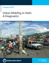
Urban Mobility in Haiti: A Diagnostic
Summary — This report analyzes urban mobility challenges in Haiti, focusing on Port-au-Prince and Cap-Haïtien. It identifies spatial fragmentation, low mobility, and limited accessibility as key issues hindering economic growth. The report recommends measures to improve public transport, enhance the pedestrian environment, and strengthen urban transport governance.
Key Findings
- Spatial fragmentation limits access to opportunities in Haitian cities.
- Urban transport is dominated by private paratransit services, particularly Tap Taps.
- Congestion significantly impacts Tap Tap operator profitability.
- Pedestrian conditions are substandard, affecting the urban poor and disabled.
- Improved governance and targeted interventions are needed to improve urban mobility.
Full Description
This diagnostic report examines urban mobility in Haiti, with a focus on Port-au-Prince and Cap-Haïtien. It highlights the spatial fragmentation of Haitian cities, particularly the barrier effect of the Port-au-Prince CBD, and the resulting low urban mobility. The report analyzes the urban public transport system, dominated by private paratransit services like Tap Taps, and identifies issues such as congestion, weak governance, and substandard pedestrian conditions. It recommends physical interventions, regulatory improvements, and governance reforms to reduce congestion, improve accessibility, and enhance the urban environment, ultimately aiming to unlock the economic potential of Haitian cities.
Full Document Text
Extracted text from the original document for search indexing.
URBAN MOBILITY IN HAITI: A DIAGNOSTIC 1 Urban Mobility in Haiti: A Diagnostic Transport & DD Technical Report MAY 2018 Public Disclosure Authorized Public Disclosure Authorized Public Disclosure Authorized Public Disclosure Authorized © 2017 International Bank for Reconstruction and Development / International Development Association or The World Bank 1818 H Street NW Washington DC 20433 Telephone: 202-473-1000 Internet: www.worldbank.org This work is a product of the external consultants with contributions by staff of The World Bank. The findings, interpretations, and conclusions expressed in this work do not necessarily reflect the views of The World Bank, its Board of Executive Directors, or the governments they represent. The World Bank does not guarantee the accuracy of the data included in this work. The boundaries, colors, denominations, and other information shown on any map in this work do not imply any judgment on the part of The World Bank concerning the legal status of any territory or the endorsement or acceptance of such boundaries. Nothing herein shall constitute or be considered to be a limitation upon or waiver of the privileges and immunities of The World Bank, all of which are specifically reserved. Rights and Permissions This work is available under the Creative Commons Attribution 3.0 IGO license (CC BY 3.0 IGO) http://creativecommons.org/ licenses/by/3.0/igo. Under the Creative Commons Attribution license, you are free to copy, distribute, transmit, and adapt this work, including for commercial purposes, under the following conditions: Attribution—Please cite the work as follows: The World Bank, 2017. “Climate Change and Asset Management.” World Bank, Washington, DC. License: Creative Commons Attribution CC BY 3.0 IGO Translations—If you create a translation of this work, please add the following disclaimer along with the attribution: This translation was not created by The World Bank and should not be considered an official World Bank translation. The World Bank shall not be liable for any content or error in this translation. Adaptations—If you create an adaptation of this work, please add the following disclaimer along with the attribution: This is an adaptation of an original work by The World Bank. Views and opinions expressed in the adaptation are the sole responsibility of the author or authors of the adaptation and are not endorsed by The World Bank. Third-party content—The World Bank does not necessarily own each component of the content contained within the work. The World Bank therefore does not warrant that the use of any third-party-owned individual component or part contained in the work will not infringe on the rights of those third parties. The risk of claims resulting from such infringement rests solely with you. If you wish to re-use a component of the work, it is your responsibility to determine whether permission is needed for that re-use and to obtain permission from the copyright owner. Examples of components can include, but are not limited to, tables, figures, or images. All queries on rights and licenses should be addressed to World Bank Publications, The World Bank Group, 1818 H Street NW, Washington, DC 20433, USA; fax: 202-522-2625; e-mail: pubrights@worldbank.org. Acknowledgements This report was developed by Kavita Sethi and Roger Gorham on the basis of a series of background papers, site surveys, and targeted interviews; the background papers include those on accessibility by He He, Malai - ka Becoulet and Pierre Xavier Bonneau, on transport and poverty by Emilie Perge, on public transport oper - ations by ITP Consultants, and fuel subsidies removal and characterization of transport providers by Franck Taillandier, Malaika Becoulet, Kavita Sethi and Pablo Salazar. The Report draws as well on the Urbanization Review prepared by Nancy Gracia et al. The authors gratefully acknowledge comments and data provided by Pierre Xavier Bonneau, Malaika Becoulet, Franck Taillandier, Raju Singh, Tatiana Peralta, and Shomik Mehndiratta, and assistance throughout the study and with production of the report by Licette Moncayo and Aracelly Woodall. The authors would also like to thank the following reviewers for their comments that have helped improve the document: Paolo Avner, Nancy Lozano-Gracia, Alejandro Hoyos Guerrero, and Nupur Gupta. Contents Acknowledgements 3 List of abbreviations 7 Executive summary 8 Chapter 1. Introduction 15 Chapter 2. Fragmentation and urban mobility challenges in Haitian cities 18 2.1 Introduction . . . . . . . . . . . . . . . . . . . . . . . . . . . . . . . . . . . . . . . . . . . . . . . . . . . . . . . . . . . . . . . . . . . . . 18 2.2 Spatial fragmentation and barriers to mobility created by the Port-au-Prince CBD . . . . . . . . . . . 19 2.3 Low urban mobility confirming spatial fragmentation . . . . . . . . . . . . . . . . . . . . . . . . . . . . . . . . . . . 24 2.4 Low accessibility, stemming from a limited mobility system, adds to fragmentation . . . . . . . . . . 29 Chapter 3. Analysis of urban public transport in Haiti 34 3.1 Introduction . . . . . . . . . . . . . . . . . . . . . . . . . . . . . . . . . . . . . . . . . . . . . . . . . . . . . . . . . . . . . . . . . . . . . 34 3.2 Overview of urban public transport services . . . . . . . . . . . . . . . . . . . . . . . . . . . . . . . . . . . . . . . . . . 35 3.3 Tap Tap services and operations . . . . . . . . . . . . . . . . . . . . . . . . . . . . . . . . . . . . . . . . . . . . . . . . . . . . . 39 3.4 Weak structure, monitoring and enforcement in the Tap Tap system . . . . . . . . . . . . . . . . . . . . . . 42 3.5 Easing congestion would enhance accessibility and lower operator unit costs . . . . . . . . . . . . . . . 43 3.6 Drivers of congestion . . . . . . . . . . . . . . . . . . . . . . . . . . . . . . . . . . . . . . . . . . . . . . . . . . . . . . . . . . . . . . 50 3.7 Analysis of strategic interventions to address congestion in Haitian cities . . . . . . . . . . . . . . . . . . . 52 3.8 Interventions for specific traffic situations in Port-au-Prince and Cap-Haïtien . . . . . . . . . . . . . . . . 54 Chapter 4. Walking as mode of transport for all citizens 60 4.1 Introduction . . . . . . . . . . . . . . . . . . . . . . . . . . . . . . . . . . . . . . . . . . . . . . . . . . . . . . . . . . . . . . . . . . . . . 60 4.2 Walking as a key mode of transport . . . . . . . . . . . . . . . . . . . . . . . . . . . . . . . . . . . . . . . . . . . . . . . . . . 60 4.3 Needs to improve the urban public space . . . . . . . . . . . . . . . . . . . . . . . . . . . . . . . . . . . . . . . . . . . . . 62 Substandard pedestrian conditions impact walking and last-mile access . . . . . . . . . . . . . . . . . . . . 63 Security challenges and lack of government oversight . . . . . . . . . . . . . . . . . . . . . . . . . . . . . . . . . . 67 4.4 Specific strategies to revitalize the public space and enhance walking in Haitian cities . . . . . . . . 67 Improving delivery of urban services other than transport . . . . . . . . . . . . . . . . . . . . . . . . . . . . . . . 69 Improving urban development planning and processes . . . . . . . . . . . . . . . . . . . . . . . . . . . . . . . . . 70 Implementing catalytic investments that demonstrate impact . . . . . . . . . . . . . . . . . . . . . . . . . . . . 72 Improving governance . . . . . . . . . . . . . . . . . . . . . . . . . . . . . . . . . . . . . . . . . . . . . . . . . . . . . . . . . . . . . 72 Chapter 5. Governance and institutional arrangements for urban transport 73 5.1 Overview of institutions involved with urban public transport . . . . . . . . . . . . . . . . . . . . . . . . . . . . 73 5.2 Steps to strengthen urban transport management . . . . . . . . . . . . . . . . . . . . . . . . . . . . . . . . . . . . . 77 5.3 Impact of government facility siting and land-use on urban transport . . . . . . . . . . . . . . . . . . . . . 79 Chapter 6. Conclusions and key recommendations 81 References . . . . . . . . . . . . . . . . . . . . . . . . . . . . . . . . . . . . . . . . . . . . . . . . . . . . . . . . . . . . . . . . . . . . . . . . . . 87 Annex 1: Identified locations for possible intersection interventions and other treatments 89 Annex 2: Specific interventions to improve traffic flow and urban public transport in Port-au-Prince and Cap-Haïtien 92 Annex 3: Public transport network in Port-au-Prince 95 Annex 4: Walking assessment methodology 98 Figures Figure 1. Market activity in the Port-au-Prince CBD spills over into the streets where it blocks pedestrians and other traffic . . . . . . . . . . . . . . . . . . . . . . . . . . . . . . . . . . . . . . . . . . . . . . . . . . . . . . . . . . . . . . . . . . . . . . . . . . . 8 Figure 2. Garbage on the streets blocks access in this typical street in the Port-au-Prince CBD . . . . . . . . 11 Figure 3. Market activity in the Port-au-Prince CBD spills over into the streets where it blocks pedestrians and other traffic . . . . . . . . . . . . . . . . . . . . . . . . . . . . . . . . . . . . . . . . . . . . . . . . . . . . . . . . . . . . . . . . . . . . . . . . . . 21 Figure 4. Competition for street space among modes of transport in PAP CBD . . . . . . . . . . . . . . . . . . . . . 22 Figure 5. Garbage on the streets blocks access in this typical street in the Port-au-Prince CBD . . . . . . . . 23 Figure 6. Streets in the CBD that could otherwise be used for through traffic are nearly impassable . . . 24 Figure 7. Population distribution in Port-au-Prince in daytime (left) and nighttime (right) . . . . . . . . . . . . 25 Figure 8. Distribution of commuters only during daytime (left) and nighttime (right) in Port-au-Prince . 26 Figure 9. Distribution of commuters during daytime (left) and evening (right) in Cap-Haïtien . . . . . . . . . 26 Figure 10. Cumulative population distribution from city center Port-au-Prince . . . . . . . . . . . . . . . . . . . . . 27 Figure 11. Cumulative population distribution from city center Cap-Haïtien . . . . . . . . . . . . . . . . . . . . . . . . 27 Figure 12. Areas with high daytime population densities . . . . . . . . . . . . . . . . . . . . . . . . . . . . . . . . . . . . . . . 31 Figure 13. Port-au-Prince public transportation network . . . . . . . . . . . . . . . . . . . . . . . . . . . . . . . . . . . . . . . 31 Figure 14. Spatial distribution of the population in relation to the transit routes . . . . . . . . . . . . . . . . . . . . 32 Figure 15. Baseline accessibility by public transport vehicles when traffic moves at 50 percent of the regulatory speed limits (current situation) . . . . . . . . . . . . . . . . . . . . . . . . . . . . . . . . . . . . . . . . . . . . . . . . . . . . 33 Figure 16. Map of the Port-au-Prince metropolitan area showing population density, the transit network, and an 800-meter catchment area . . . . . . . . . . . . . . . . . . . . . . . . . . . . . . . . . . . . . . . . . . . . . . . . . . . . . . . . . . 34 Figure 17. Tap Tap on a typical street in the Port-au-Prince CBD . . . . . . . . . . . . . . . . . . . . . . . . . . . . . . . . . 36 Figure 18. Breakdown of daily revenue intake for Tap Taps in entrepreneurial driver model. . . . . . . . . . . 41 Figure 19. Mechanism for speed increase to improve bottom line in public transport operations . . . . . . 47 Figure 20. Accessibility by public transport if traffic moved at the regulatory speed limit . . . . . . . . . . . . . 49 Figure 21. Public transport corridors assessed for speed improvements . . . . . . . . . . . . . . . . . . . . . . . . . . . 55 Figure 22. Population weighted average accessibility with increasing public transport speeds on selected corridors . . . . . . . . . . . . . . . . . . . . . . . . . . . . . . . . . . . . . . . . . . . . . . . . . . . . . . . . . . . . . . . . . . . . . . . . . . . . . . . . 56 Figure 23. Cumulative total employment pool growth at key employment centers with increasing public transport speeds on selected corridors . . . . . . . . . . . . . . . . . . . . . . . . . . . . . . . . . . . . . . . . . . . . . . . . . . . . . . . 56 Figure 24. Different Mass Transport Modes . . . . . . . . . . . . . . . . . . . . . . . . . . . . . . . . . . . . . . . . . . . . . . . . . . . 57 Figure 25. Mode shares in 34 selected cities (2011 – 2016 depending on city) . . . . . . . . . . . . . . . . . . . . . 61 Figure 26. Hierarchy of pedestrian needs . . . . . . . . . . . . . . . . . . . . . . . . . . . . . . . . . . . . . . . . . . . . . . . . . . . . 65 Figure 27. A mound of garbage creating an impassable obstruction on a dense area of pedestrian activity in the Port-au-Prince CBD . . . . . . . . . . . . . . . . . . . . . . . . . . . . . . . . . . . . . . . . . . . . . . . . . . . . . . . . . . . . . . . . . 66 Figure 28. Sample measures for developing inclusive social space in cities . . . . . . . . . . . . . . . . . . . . . . . . . 74 Figure 29. Functions to be performed in provision of urban transport services . . . . . . . . . . . . . . . . . . . . . 75 Tables Table 1. Recommendations to reduce congestion, improve the urban environment, and increase accessi - bility for Haitian cities (summary) . . . . . . . . . . . . . . . . . . . . . . . . . . . . . . . . . . . . . . . . . . . . . . . . . . . . . . . . . . . 13 Table 2. Size of the vehicle fleet in Haiti . . . . . . . . . . . . . . . . . . . . . . . . . . . . . . . . . . . . . . . . . . . . . . . . . . . . . . 37 Table 3. Calculated mode shares in Port-au-Prince metropolitan area . . . . . . . . . . . . . . . . . . . . . . . . . . . . . 38 Table 4. Tap Tap operating parameters . . . . . . . . . . . . . . . . . . . . . . . . . . . . . . . . . . . . . . . . . . . . . . . . . . . . . . 40 Table 5. Tap Tap operating parameters . . . . . . . . . . . . . . . . . . . . . . . . . . . . . . . . . . . . . . . . . . . . . . . . . . . . . . 40 Table 6. General overview of strategic interventions to reduce congestion . . . . . . . . . . . . . . . . . . . . . . . . 52 Table 7. Overview of key obstacles to pedestrian movements in Haitian cities . . . . . . . . . . . . . . . . . . . . . . 63 Table 8. Overall recommendations to reduce congestion, improve the urban environment, and increase accessibility for Haitian cities . . . . . . . . . . . . . . . . . . . . . . . . . . . . . . . . . . . . . . . . . . . . . . . . . . . . . . . . . . . . . . . 85 Table 9. Site-specific operational improvements for Port-au-Prince for further consideration . . . . . . . . . 92 Table 10. Site-specific operational improvements for Cap-Haïtien for further consideration. . . . . . . . . . . 94 Table 11. Pedestrian environment indicators . . . . . . . . . . . . . . . . . . . . . . . . . . . . . . . . . . . . . . . . . . . . . . . . . 99 Table 12. Weighting for scoring elements. . . . . . . . . . . . . . . . . . . . . . . . . . . . . . . . . . . . . . . . . . . . . . . . . . . 101 List of abbreviations Cap Cap-Haïtien CBD Central Business District CDR Call data records HTG Haitian gourdes (currency unit) MAST Ministry of Labor and Social Affairs (Ministère des Affaires Sociales et du Travail) MEF Ministry of Economy and Finance MCI Ministry of Commerce and Industry MTPTC Ministry of Public Works, Transport and Communication (Ministère des Travaux Publics, Transports et Communications) NMT Non-motorized transport PAP Port-au-Prince PPHPD Passengers per hour per direction PPP Purchasing Power Parity RSA Road Safety Audit URBAN MOBILITY IN HAITI: A DIAGNOSTIC 8 Executive summary 1. Cities can drive development through economies of scale, but recent ur- banization in Haiti has not been followed by economic growth. To fulfill their roles as engines of national economic development, cities—especially primary cities—must function as aggregators of labor markets and deliver on providing the economies of scale that can boost economic growth. In Haiti, Port-au-Prince is not playing this function particularly well. 2. Spatial fragmentation is limiting access to opportunities, a situation worsened by challenges in the urban transport systems in both Port-au-Prince and Cap-Haïtien. In particular, the Port-au-Prince CBD, which was greatly dam - aged in the 2010 earthquake, has become more a barrier than a connection, as shown in Figure 1, inhibiting linkages between parts of the city, metropolis, and even country. Figure 1. Market activity in the Port-au-Prince CBD spills over into the streets where it blocks pedestrians and other traffic Photo credit: World Bank URBAN MOBILITY IN HAITI: A DIAGNOSTIC 9 3. The spatial fragmentation is confirmed by very low urban mobility, with a large share of the population using walking as their main mode of transport. Motorized mobility is muted; only 42 percent of the working-age population in Port-au-Prince work beyond a 1-kilometer radius of their house, according to the call data records (CDR) reviewed in Chapter 2. Patterns of daytime and night - time population distributions across the Port-au-Prince metropolitan area also show little movement. Moreover, transport expenditures in Port-au-Prince are very low, suggesting large proportions of the population either predominantly or exclusively walk or do not travel at all. 4. An analysis of accessibility shows only low shares of the population can reach specific places in the city within 60 minutes—underscoring the spatial fragmentation and suggesting current limitations of the public transport system. Analysis showed that of four key centers (with important daytime pop - ulations as a proxy for employment centers) only three were accessible in less than 60 minutes to less than 10 percent of the metropolitan population; in other words: 90 percent of the population would need to travel more than an hour to access any of these sites. Moreover, only about half the population could get to central Port-au-Prince (CBD) in less than an hour. 5. Improving urban mobility can reduce fragmentation and help achieve agglomeration benefits. Urban transport is only one aspect of a city’s frag - mentation—with urban transport both being affected by that fragmentation, as well as adding to it. Improvements in urban transport, however, can be a practical way to reduce this fragmentation. This report then focuses specifically on studies of urban mobility and accessibility for Port-au-Prince and Cap-Haïtien. It is expected that findings for other urban areas will be similar. Urban public transport in Haiti 6. Urban transport is dominated by the private sector and in particular by paratransit services using mostly converted pickup trucks from North Amer- ica, known locally as “Tap Taps.” Haiti’s public transport supply is entirely in private hands, and, compared to the situation in other countries where active unions and associations create a coherent operating structure, little internal organization is in place. In addition, regulatory mechanisms are light. Several ownership/operations models are in place, in particular for the operation of Tap Taps. Among all modes of motorized transport in urban contexts, Tap Taps are the most widely available. 7. Tap Tap revenues vary substantially from one day to the next, depending on congestion conditions, which greatly impacts operator profitability. The analysis for this report shows that as a result of congestion, operators cannot This report focuses specifically on studies of urban mobility and accessibility URBAN MOBILITY IN HAITI: A DIAGNOSTIC 10 always make the same number of runs in a day. In addition, congestion exac - erbates the operators’ incentives to engage in court circuits (“short circuits”), which means operating only a portion of a route and then turning around to again fill the vehicle with new paying customers. This not only adds to a poor functioning transport system and reduced accessibility and increased travel times, but it also increases user costs and thus affects affordability. 8. Evidence suggests supply is not meeting demand because of conges- tion. While calculations indicate that on paper the ratio of total bus seats to population is not low by international bench marks, in practice, demand is not being met by supply because of very slow operating speeds associated with congestion. Interviewees for example reported long wait times and crowded Tap Tap vehicles. Analysis in this report suggests that congestion constrains the ability of the system to deliver the number of seat-kilometers that current demand levels appear to require. Addressing congestion will be important to increase traffic flow and public transport supply, and thus increase accessibility and reduce operator costs. 9. Congestion and risk likely prevent a market “correction” to better balance supply with demand. Normally, when demand outstrips supply, it is expected that this is followed by an increase in supply until the balance is restored; in Haiti, however, such a rebalancing doesn’t seem to occur, most likely because of congestion and risk. Individual operators can do nothing about congestion, and indeed any action they might take individually—provide more vehicles—would exacerbate congestion and therefore be a risky investment. Thus, the urban transport market remains in equilibrium, albeit one of very low quality and inadequate service; poor quality vehicles, Tap Taps mostly, offer no-frill services to a largely captive market, with little change in service quality over time. As is often the case with paratransit services, to keep costs low, operators rely on used vehicles with low capital requirements. Walking and the pedestrian environment 10. Large shares of the urban population predominantly use walking or ex- clusively walk as their means of getting around. While walking is important for all segments of the population, it is especially so for households in poor quintiles as they rely exclusively on walking. 11. Pedestrian conditions generally are sub-standard, which affects the ur- ban poor and disabled especially. The most common barriers to the walking en - vironment in the main two cities include the lack of adequate sidewalk space for the volume of pedestrians; sidewalk and roads blocked by garbage (see Figure 2); market activity on streets and sidewalk; poor drainage resulting in flooded Evidence suggests supply is not meeting demand because of congestion URBAN MOBILITY IN HAITI: A DIAGNOSTIC 11 streets; two-wheelers using and parking in pedestrian spaces; frequent sidewalk obstructions from poor object placement; frequent pedestrian/vehicle conflict points because of a lack of intersection control or poor street and intersection design and marking; and insecurity associated with gang violence. These factors contribute to a sense of fragmentation for pedestrians. Currently no one in the administrative structure of urban governance is tasked with looking after the needs of pedestrians. Figure 2. Garbage on the streets blocks access in this typical street in the Port-au-Prince CBD Photo credit: Roger Gorham Addressing fragmentation by reducing congestion and increasing accessibility 12. Analysis shows physical improvements are needed to address congestion and increase accessibility to economic and social opportunities. Improvements will also reduce operator costs (by allowing Tap Tap operators to do more runs) and improve the user experience by reducing their waiting times and improving their walking experience. An effective strategy would both target urban public transport—to improve flow, reduce costs, and improve accessibility—as well as strengthen the urban public space and increase walkability, thus addressing an important mode of transport for all residents and in particular the urban poor. URBAN MOBILITY IN HAITI: A DIAGNOSTIC 12 13. To improve urban public transport, measures can include physical in- terventions, an improved regulatory environment, and better governance. Addressing congestion systematically means prioritizing corridors where im - provement in travel speeds will have the most impact in creating accessibility for the largest number of people, thus facilitating the function of the city as aggregator of labor markets. In the Port-au-Prince metropolitan region, the analysis suggests that investments in the RN2 corridor through Carrefour would be the most effective in enhancing overall accessibility. A similar analysis for Cap-Haïtien could be carried out in the future. 14. Analysis suggests that well-targeted measures in specific corridors can have an impact on overall accessibility. While the precise package of measures would need more analysis, preliminary results indicate that well-targeted mea - sures can make a difference. Possible interventions would include intersection improvements; drainage improvements, including inspection and maintenance of drains; improved solid waste management, especially refuse collection; im - proved public transport facilities (including reconfiguration of public transport staging areas); traffic management and control interventions; improved regu - lation and control of street space (for example for parking and vendors); and improved non-motorized transport (NMT) facilities (as access points to public transport). All the above measures—both to improve public transport and en - hance the pedestrian experience—should be packaged in a coherent program of action over a four-year time frame, at least for a geographically specific area. 15. Improving the pedestrian experience relies on similar measures as those to improve urban public transport. Measures to improve the urban public space and the pedestrian environment do not depend on large investments, but rather on a re-orientation of priorities driving public policy decisions along with institutional and procedural mechanisms to ensure they are delivered. These measures—similar to those to improve urban public transport—include re-in - vigorated attention to urban service delivery, improved procedures to manage urban development processes, and select catalytic investments, combined with improved governance. Improving urban transport governance and establishing a lead authority 16. A key challenge to implementing the interventions and changes in the transport sector in Haiti is the lack of a cohesive governance structure with the mandate and capacity to improve urban public transport. A possible approach, for the longer term, would be to work toward the creation of a lead authority for urban transport, at least in the Port-au-Prince metropolitan area. This authority should eventually be autonomous from the national government, Measures to improve the urban public space and the pedes- trian envi- ronment do not depend on large investments URBAN MOBILITY IN HAITI: A DIAGNOSTIC 13 but multi-jurisdictional to avoid administrative fragmentation. The authority could bring together functions such as long-term planning and investment programming; public transport oversight and regulation; traffic management; public transport improvements; oversight and development of pedestrian facilities; and road safety. In the short run, and as an interim measure, at the very least essential but currently missing functions in urban transport planning, regulation, and operation need to be enumerated and responsibility for their fulfilment assigned, at least on a temporary basis. 17. Moving forward, breaking away from the current low-level equilibrium of services involves a combination of new strategies and actions. Overall, steps forward included working toward (1) improved governance of the sector and more regulatory control, (2) targeted interventions to improve traffic flow and the pedestrian environment, and (3) generally improved urban manage - ment and urban service delivery. An overview of possible measures is provided in Table 1, while the specific steps are outlined in Chapter 3 (public transport), Chapter 4 (walking environment), and Chapter 5 (governance and regulatory measures); an overall summary is provided in Chapter 6. Table 1. Recommendations to reduce congestion, improve the urban environment, and increase accessibility for Haitian cities (summary) Recommendations Short Term Actions Medium to Long Term Action Urban transport physical interventions Implement measures to improve traffic flow and urban environment Increase focus on the pedestrian environment • Introduce a Road Management Strategy for different types of vehicles along spe- cific arterial routes during peak periods • Redesign and manage primary inter- sections • Prioritize interventions in select corri- dors • Invest in select public transport facilities • Implement pedestrian safety and road safety audits (RSA); prioritize pedestrian safety investments • Require design review (with focus on pedestrian safety) for all new infrastruc- ture projects • Undertake methodological walkability assessments • Based on assessments, improve the NMT environment (with sidewalks, rehabilitation of existing NMT infra- structure, and provision of pedestrian crossing facilities) • Rehabilitate secondary access streets to improve accessibility to peripheral residential areas • Develop an effective high- way maintenance program • Restore design features that encourage and facili- tate walking in city CBDs • Develop design standards or guidelines for complete streets URBAN MOBILITY IN HAITI: A DIAGNOSTIC 14 Recommendations Short Term Actions Medium to Long Term Action Urban transport physical interventions Institutional strengthening Introduce and strengthen regulatory measures • Develop and enforce regulation for street vendors and motor vehicle op- erators • Clearly delineate between the highway, sidewalk, and area for commercial activ- ity, and enforce regulations • Increase presence of traffic police at pri- mary and secondary intersections • Regulate and control parking • Develop a plan to ratio- nalize the public transport routes along the main cor- ridors and consider a tran- sition to the use of larger, but fewer, vehicles Improve governance by working towards a cohesive governance structure with the mandate and capacity to address the broad range of challenges • National government take lead in iden- tifying and developing appropriate lead authorities for urban transport • Initiate additional technical work and public consultation to design strategy for urban transport governance devel- opment • Inventory capacity and resources at the local level; and increase capacity within MTPTC to act on strategic planning and regulatory functions in the short term • Ensure all relevant functions are as- signed to existing departments/units and capacity is expanded or strength- ened where needed • Establish lead transport agencies on a metropolitan level • Consider the creation of an umbrella agency to coor- dinate long-term planning and investment program- ming, public transport oversight, among others • Assign responsibility for enhancing and maintaining the walking environment in cities • Engage with operators to begin building a cohesive interlocutor Urban management Improve delivery of urban public services, specifically solid waste collection and drainage • Regularly inspect and maintain highway drainage, including periodic de-silting of drainage channels, specifically before and during the hurricane season • Improve garbage collection • Make siting decisions for government and other facilities with awareness of / attention to their potential impacts on urban transport outcomes • Consider transport-specific infrastructure investments to alleviate impact of floods • Develop an extensive watershed management investment strategy and policies. • Introduce a robust and deliverable solid waste management strategy URBAN MOBILITY IN HAITI: A DIAGNOSTIC 15 Chapter 1. Introduction 1. Haiti’s geography, people, and history provide it with many opportuni- ties. The third largest Caribbean nation by area and population (10.4 million), Haiti shares the island of Hispaniola with the Dominican Republic. Haiti benefits from proximity and access to major markets with favorable trade agreements, a young labor force, a dynamic diaspora, and substantial geographic, historical, and cultural assets. The country possesses untapped markets and untapped potential for the private sector to explore, including agribusiness, light manu - facturing, and tourism. 2. However, Haiti remains the poorest country in the Latin America and Caribbean (LAC) region and among the poorest in the world. Haiti’s growth over the past four decades has been very low, averaging about 1 percent per year, with gross domestic product (GDP) per capita falling by 0.7 percent a year on average between 1971 and 2013. As a result, the overall poverty headcount in 2012 included 58.5 percent of the population while 24.5 percent was living in extreme poverty, 1 meaning that almost 6.3 million Haitians could not meet their basic needs and among them 2.5 million could not even cover their food needs. Poverty is particularly pervasive in rural areas, with almost 75 percent of the rural population living below the poverty line and over 38 percent in extreme poverty. Furthermore, with a Gini coefficient of 0.6, Haiti has the highest income inequality in the region and ranks among the world’s most unequal countries (Antoine et al. 2017). 3. Access to the labor market and services is not evenly distributed, and evidence suggests this situation is not improving with urbanization. A 2006 social resilience and state fragility paper notes the strong correlation between poverty in Haiti and lack of access to labor markets, infrastructure and services, and educational opportunities. Access to these factors can improve opportuni - ties for income generation, but access is not evenly distributed, with substantial variation across and within regions and urban areas (Verner and Heinemann 2006). Moreover, while normally access is expected to improve with urbaniza - tion, evidence suggests that in Haiti it has not. 4. Haiti’s population is increasingly urbanized, with many people moving to the cities, especially after the 2010 earthquake. The recently completed Haiti Urbanization Review (Gracia et al. 2018 forthcoming ) shows that urbanization in 1 In this paper, “poverty” refers to the national definition, which considers a household poor when household consumption per capita is less than G 81 per day (US$ 2.42 PPP in 2005) and extremely poor when consumption is less than G 42 per day (US$) Haiti possesses untapped markets and untapped potential for the private sector to explore URBAN MOBILITY IN HAITI: A DIAGNOSTIC 16 Haiti has occurred more recently and more rapidly than in cities elsewhere in the Latin America and Caribbean region. In the first 15 years of the current century, Haiti’s urban population grew 3.6 percentage points above the Caribbean aver - age and doubled in size from about 3 to 6 million people. Moreover, when taking a more expansive definition of “urban” by considering population density within 10,000 square meter cells (instead of simply using the proportion of population living in jurisdictions identified as urban), the Urbanization Review shows that Haiti in 2015/2016 was the fourth most urbanized country in the region after Puerto Rico, Trinidad and Tobago, and Mexico. 5. Most of this urbanization is occurring in the two largest cities–the Port- au-Prince metropolitan area and Cap-Haïtien. The Port-au-Prince metropolitan area (sometimes referred to as PAP in this report) accounts for 2.5 million people or about 40 percent of the Haitian urban population. Both Port-au-Prince and Cap-Haïtien (abbreviated to Cap) are the subject of the present report. Other large cities include Gonaives, Port-de-Paix, Saint Marc, and Léogane. For the country in general, few people live where they were born. In particular after the 2010 earthquake people have moved to the urban areas to access jobs and other urban services. 6. Urbanization is usually positively correlated with economic growth and has been shown to be a causal factor. The Haiti Urbanization Review notes that historical data for over 180 countries between 1986 and 2015 show incomes ris - ing when the share of population living in urban areas increases. The explanato - ry factors are generally three-fold. First, density itself promotes productivity, by offering economies of “agglomeration,” that is, the ability of productive sectors to benefit from proximity to firms producing similar or related outputs. Second, cities are efficient aggregators of labor, facilitating access to more diverse labor markets more efficiently than would be feasible in rural areas. Finally, social and infrastructure services can be rendered to urban dwellers at a substantially lower cost (because of economies of scale) than would be possible in rural areas. For these reasons, urbanization is usually associated with GDP growth. 7. In Haiti, however, urbanization has not been followed by economic growth. As summarized in the urbanization review: GDP per capita remained stagnant and even dropped from US$ 757 in 1996 to US$ 727 in 2013 even when urban levels increased drastically from 33 to 58 percent. Unlike similar countries in Latin America and the Caribbean (LAC), Haiti has not cashed in on the dividend from urbanization. Widespread fragility and costly natural disasters may have undermined the benefits of the urbanization process. (Gracia et. al. 2018, Pg. 3) After the 2010 earthquake people have moved to the urban areas to access jobs and other urban services URBAN MOBILITY IN HAITI: A DIAGNOSTIC 17 One particularly notable figure is that, in Haiti, urban areas have higher rates of unemployment and underemployment than rural areas: in 2006, 49 and 37 percent of populations in metropolitan and other urban areas, respectively, were un- or under-employed, compared to 36 percent in rural areas (Verner and Heinemann 2006). Nationally, unemployment has declined since 2001, from 27 percent in 2001 to 12 percent in 2012, but rural areas, not cities, have contrib - uted the most to this fall in unemployment. In 2012, the probability of being employed was 20 percentage points higher in rural areas than in 2001, but over 4 percentage points lower in urban areas, which maintained an unemployment rate of around 40 percent. 8. Many factors including urban and metropolitan fragmentation contrib- ute to the lack of economic growth following urbanization in Haiti. The Haiti Urbanization Review explores in detail the many factors that contribute to this unexpected and counter-intuitive (though not unprecedented, as described in Lall et al. 2017) feature of Haitian urbanization. Contributing factors include Haiti’s inherent vulnerability to various and frequent natural disasters, weak land administration and regulatory enforcement, information gaps, weak governance at all levels and particular at the sub-national level, and ongoing challenges with sustainable financing. The urbanization review particularly identifies urban and metropolitan fragmentation, especially in the PAP metropolitan area, as a key factor contributing to the mismatch between urbanization and national eco - nomic growth performance in Haiti. 9. Urban mobility—the focus of this report—is one of many aspects that can add to, but also lessen—the fragmentation of Haitian cities. This report—a diagnostic of urban mobility in Haiti—in particular, looks at the extent to which urban transport performance is affected by, and contributes to, the metropoli - tan-level fragmentation identified by the urbanization review. Through an analy - sis of available information and based on interviews and site visits, the objective is to identify the key challenges and solutions for improving urban transport services (in Haiti in general and in Port-au-Prince and Cap-Haïtien specifically), and so help reduce the fragmentation and enable Haitian cities to become the engines that power the country’s economic growth. 10. In the next chapters, first an overview of the spatial fragmentation of cities in Haiti—and Port-au-Prince specifically—is presented in Chapter 2, to provide the context for analysis in later parts of the report. Chapter 3 and 4 then zoom in specifically on the provision of urban public transport services in Port-au-Prince and Cap-Haïtien (Chapter 3), as well as the condition of the pedestrian environment in both (Chapter 4). With both chapters identifying possible measures to improve urban public transport (including walking), Chapter 5 then looks at the identified challenges from a governance and regulation perspective. Final conclusions and an overview of key recommendations is provided in Chapter 6. In Haiti, urban areas have higher rates of un- employment and under- employment than rural areas URBAN MOBILITY IN HAITI: A DIAGNOSTIC 18 Chapter 2. Fragmentation and urban mobility challenges in Haitian cities 2.1 Introduction 11. Fragmentation in Haitian cities is impacting economic growth. As discussed in Chapter 1, Haiti’s cities are increasingly urbanized, but this urban - ization has not been matched by the economic growth that typically follows urbanization, the result of the economies of scale and the access to labor and opportunities that characterize most cities. 12. The fragmentation of Haitian cities can be seen as both a spatial frag- mentation as well as an institutional one. The spatial fragmentation in Haiti links to a reduced ability for its urban population to access goods, services, and social interactions. The country’s general urban fragmentation and that of Port-au-Prince specifically, has led to a situation in which the urban population, despite some local access to goods and services, has lost the kind of city-wide or metropolitan accessibility that enhances quality of life and brings the desired economies of scale so typical for the urban environment. Related, the institutional fragmentation refers to the lack of coherence in the allocation and integration of responsibilities for the planning and management of urban transport, including the fact that many of these responsibilities are not assigned or allocated at all. 13. Factors contributing to this fragmentation and accessibility loss can be seen across a range of parameters typically used to characterize urban transport in cities or metropolitan areas, including mobility patterns, gover- nance structures, the physical landscape of the city, and the transport options available. As a result of these factors, as will be shown later in this chapter, ac - cessibility in metropolitan Port-au-Prince is already highly constrained, while in Cap-Haïtien mobility is only functional because of the city’s extreme mono-cen - tricity and geographically limited urban area that has not yet overwhelmed the limited services available. 14. The remainder of this chapter looks at various dimensions of fragmen- tation—as related to urban transport—that impact the effective functioning of Haiti’s two main cities. Section 2.2 examines the peculiar fragmenting effect of the central business district (CBD) in Port-au-Prince, an area where walkability has collapsed in spite of the fact that many people there need to, and do, walk. Section 2.3 demonstrates the fragmentation of Port-au-Prince by showing a very low level of mobility. Finally, section 2.4 shows the results of an analysis of transport accessibility for Port-au-Prince. Haiti’s cities are increasingly urbanized, but this urbanization has not been matched by the economic growth that typically follows urbanization URBAN MOBILITY IN HAITI: A DIAGNOSTIC 19 2.2 Spatial fragmentation and barriers to mobility created by the Port-au-Prince CBD 15. By looking at the existing fragmentation and mobility in Haiti in general and in Port-au-Prince and Cap-Haïtien specifically, this chapter sets the context for a more detailed look at both the challenges and opportunities in the public transport sector (chapter 3) and the pedestrian environment (chapter 4), to improve the so important and desired urban accessibility to opportunities. 16. The CBD in Port-au-Prince continues to function as a center for liveli- hoods and trading, but has also become a bottleneck in the mobility of the city, particularly since the 2010 earthquake. The historic CBD, an area of around 200 hectares in a narrow and strategic area of the coastal plain between the port on Port-au-Prince Bay and the foothills of the Massif de la Selle range, sits at the center of metropolitan life in Port-au-Prince. Its location is strategic not only for the region, but for the country, as all road access between the South and Southwest and the rest of the country passes through this narrow plain. In the 2010 earthquake, however, the district was severely damaged, and a key factor in the city’s spatial fragmentation has been the challenge in bringing back a well-functioning CBD. While it remains well connected to the entire metropol - itan region, the district’s devastation is such that it isolates and fragments other parts of the region, functioning more as a barrier than a link between parts of the city and even the country. 17. Today, the CBD hardly functions as a business district at all. Once the center of Haitian government administration, many government buildings were destroyed in the 2010 earthquake and private businesses left in the immediate aftermath and did not return. Shops in the traditional sense have also left. What did remain, however—and perhaps today more than ever—are various thriving markets. These include the Croix-des-Bossales (the largest market in Haiti), the Marché en Fer, the Marché du Port, and the Marché Hyppolite. Surrounding and linking these markets is a tremendous amount of intense commercial activity along the streets. While elites have largely stayed away from the historic center since the earthquake, these markets still constitute the center of daily life for the urban poor. 2 Indeed, the Croix-des-Bossales market handles about two-thirds of the food and manufactures consumed in the capital and is a major destination for traveling rural traders, the “Madam Saras,” who make a profit by buying and 2 The markets also remain quite important for the lives of the metropolitan region’s wealthier inhabitants. Bazabas et al. found that these CBD markets provide goods for other markets around the metropolitan area, as well as for bars, restaurants, and street merchants operating in all zones of the city. The historic CBD location is strategic, as all road access between the South and Southwest and the rest of the country passes through this narrow plain URBAN MOBILITY IN HAITI: A DIAGNOSTIC 20 selling in different markets. Various studies have underscored that agricultural product prices on most Haitian markets correlate strongly with the prices at the Croix-des-Bossales market in Port-au-Prince. 3 18. The CBD shows a disconnect between population density and economic investments. Despite its thriving markets, little investment is made in the CBD. In this respect, the area demonstrates a phenomenon observed by Lall et al. (2017) for African cities, of a disconnect between population density and economic investment. A stark contrast emerges between patterns of downtown population den - sity — in which Africa largely resembles other regions — and of economic density (as reflected in patterns visible from above that indicate capital investment). Africa’s generally low levels of urban capital investment also appear in the assessed worth of building stock. For example, the total economic value of buildings in Dar es Salaam is estimated at around US$12 billion (Ishizawa and Gunasekera 2016), or just less than three times the city’s share of GDP. Even lower are the estimated values for Nairobi, Kenya ($9 billion) and Kigali, Rwanda ($2 billion). Compared with cities in Central America, African cities have low replacement values for their built-up area, built-floor area, and population. Thus, Nairobi has the highest replacement value per square kilometer among the four African cities studied, yet it is just 60 percent of the value of Tegucigalpa, which has the lowest among six Central American cities. (Lall, Henderson et al. 2017, page 19) It is likely that even before the earthquake Port-au-Prince shared this pattern of high density with lack of investment (or disinvestment, as the case may be), and this lack of investment in the CBD, set in the heart of Port-au-Prince, might even be a better example of those sub-Saharan African patterns of urbanization mentioned by Lall et al. The markets are there, the daytime densities are there, but the investment is not. 19. The transport challenges of the CBD market zone are enormous. The thriving markets and connected activities bring life to the CBD, but the sheer volume of activities and movements generates intense pedestrian flows that are in themselves a challenge to manage safely. Traders occupy what